Map of Louisiana, United States
Navigate Louisiana map, Louisiana country map, satellite images of Louisiana, Louisiana largest cities, towns maps, political map of Louisiana, driving directions, physical, atlas and traffic maps in United States.
MAP OF LOUISIANA
A Collection of Louisiana Maps and Louisiana Satellite Images
MAP OF LOUISIANA
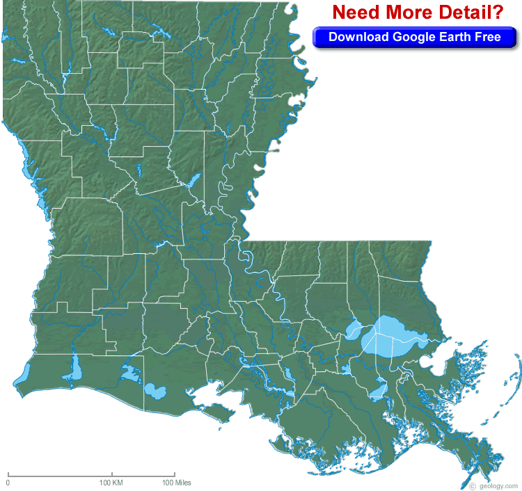
BLANK LOUISIANA PHYSICAL MAP
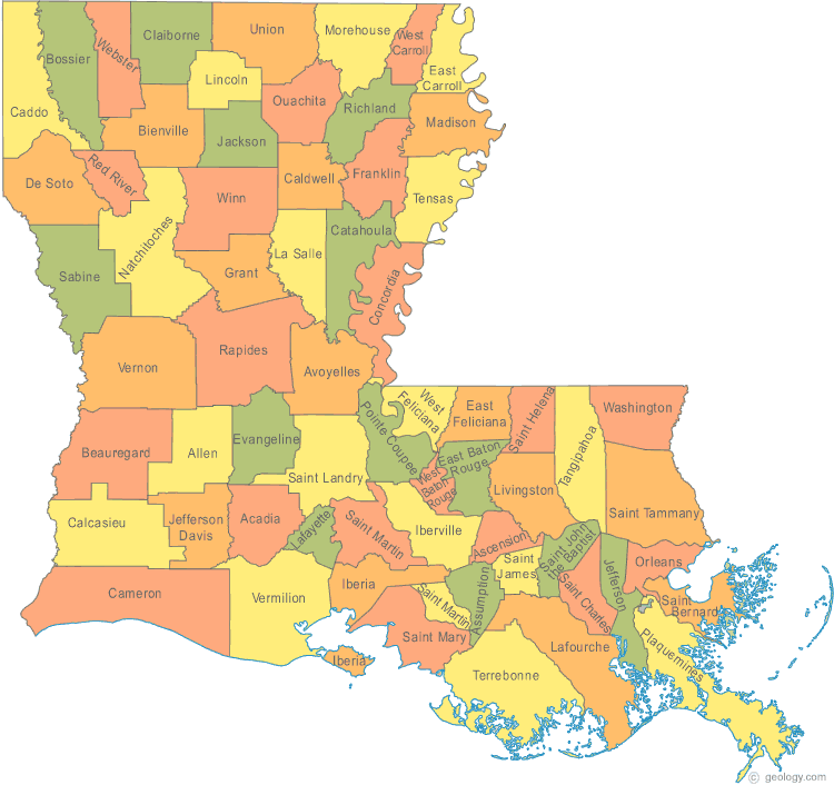
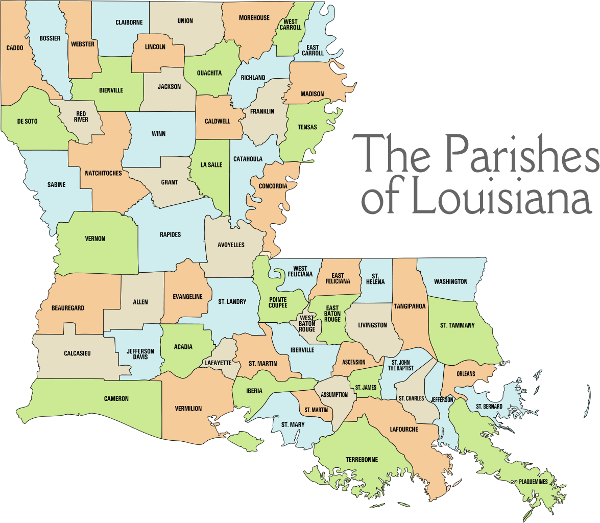
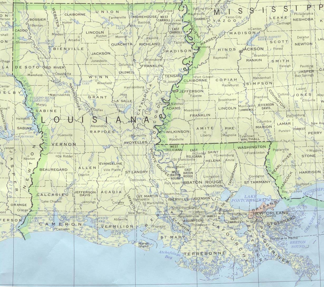
COUNTY MAP OF LOUISIANA
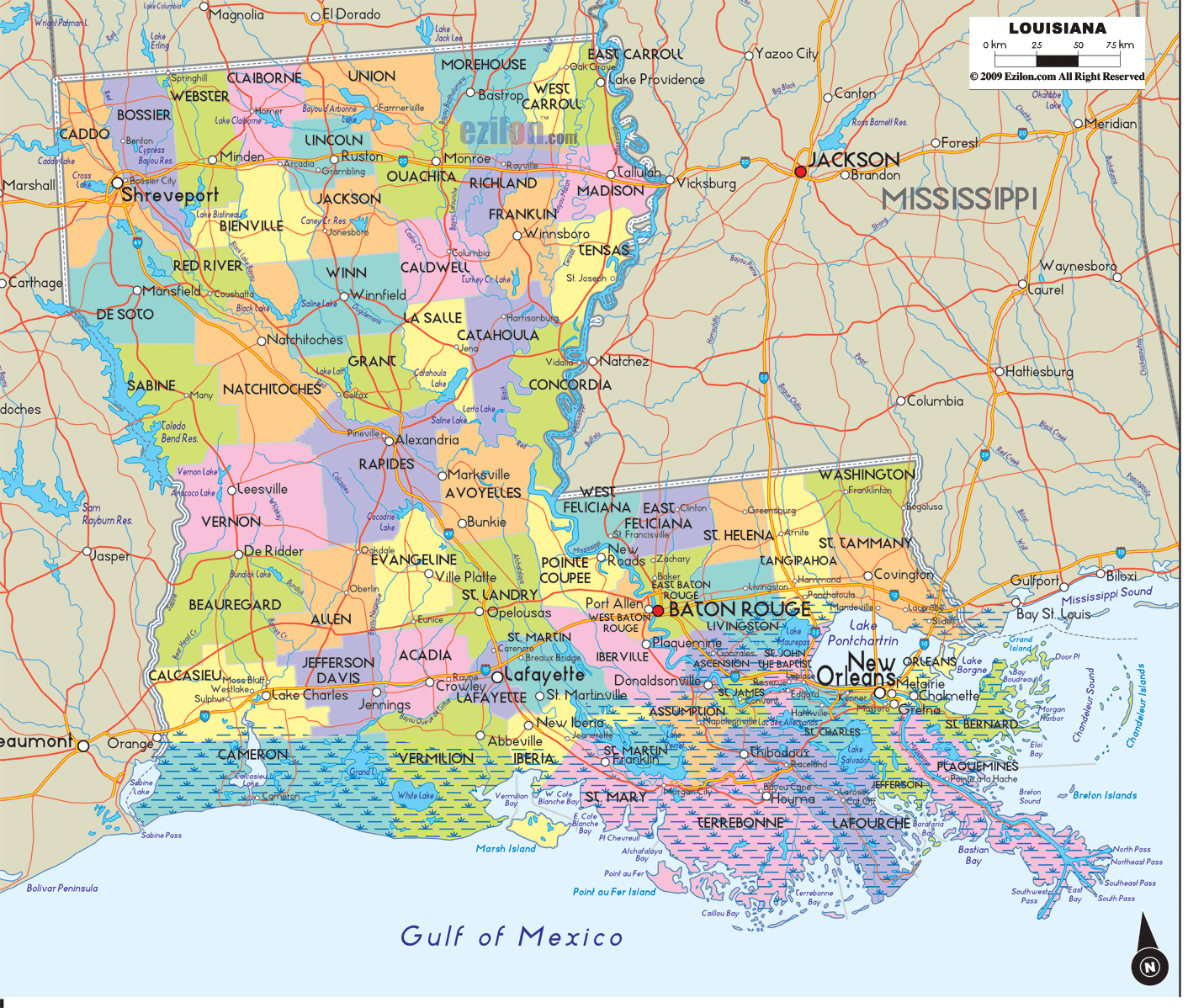
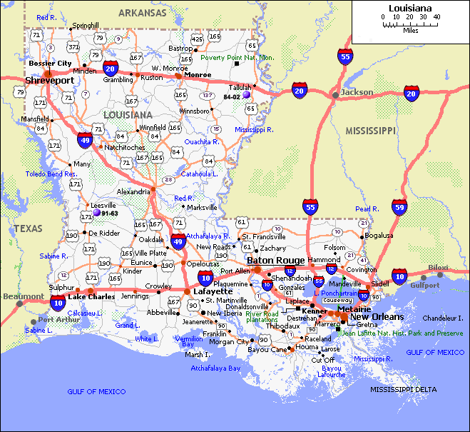
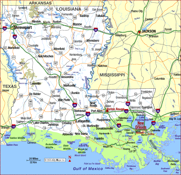
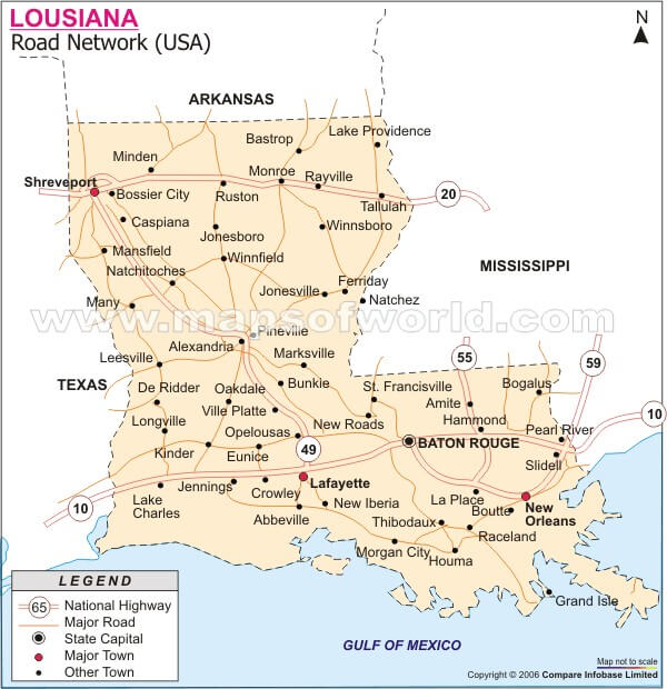
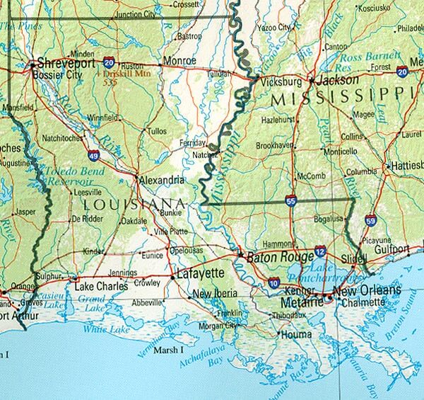
LOUISIANA ROAD MAPS

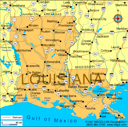
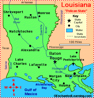
LOUISIANA STATE MAP
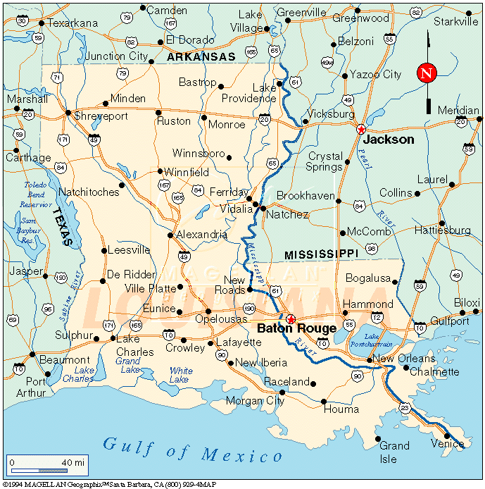
LOUISIANA REFERENCE MAP
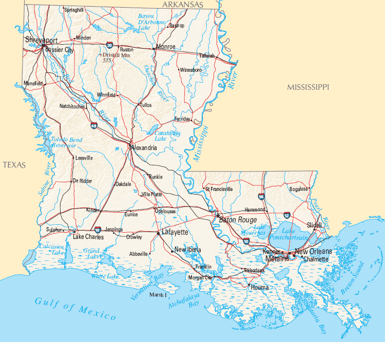
LOUISIANA ROAD MAP
LOUISIANA CITIES MAP
LOUISIANA COUNTY MAP
LOUISIANA HISTORICAL MAP
LOUISIANA MAIN CITIES MAP

LOUISIANA MAP
LOUISIANA MAP USA
LOUISIANA ROAD MAP
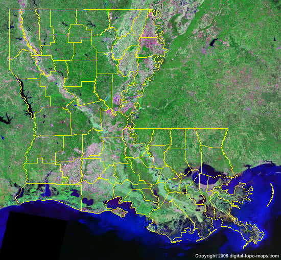
LOUISIANA SATELLITE IMAGE
PHYSICAL MAP OF LOUISIANA
STATE MAP OF LOUISIANA

Largest Cities Map of Louisiana and Population
New Orleans - 343,829 Baton Rouge - 229,493 Shreveport - 199,311 Metairie - 138,481 Lafayette - 120,623 Lake Charles - 71,993 Kenner - 66,702 Bossier City - 61,315 Monroe - 48,815 Alexandria - 47,723 Houma - 33,727 Marrero - 33,141 New Iberia - 30,617 Laplace - 29,872 Slidell - 27,068For All Louisiana Cities Map
See Also
Louisiana Google Map, Street Views, Maps Directions, Satellite Images
WorldMap1.com offers a collection of Louisiana map, google map, Louisiana atlas, political, physical, satellite view, country infos, cities map and more map of Louisiana.