Hawaii Map FQA
How many cities are in Hawaii ?
Hawaii has 5 counties. The largest by population are: Honolulu County; Hawaii County; Maui County; Kauai County; Kalawao County.
What are the major geographical features of Hawaii ?
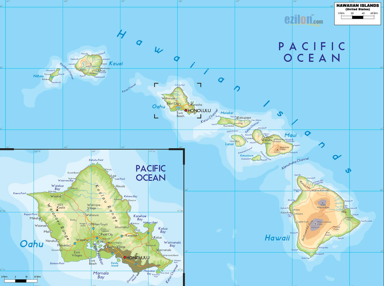
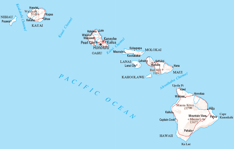
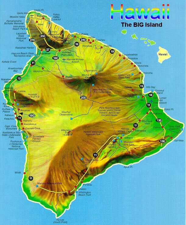
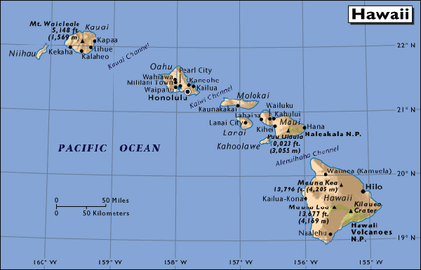
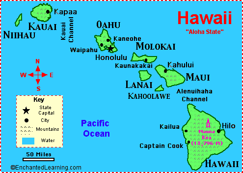
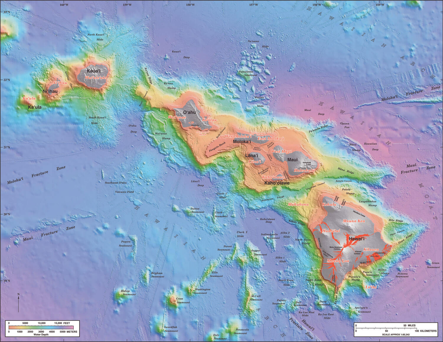
Hawaii is an isolated volcanic archipelago in the central Pacific Ocean. It is composed of eight main islands with mountainous landscapes formed by volcanic activity, including Mauna Kea and Mauna Loa on the Big Island. The islands feature lush tropical forests, waterfalls, and extensive coastlines with coral reefs.
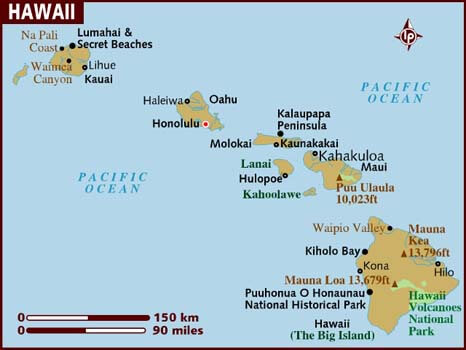
MAP OF HAWAII
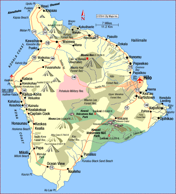
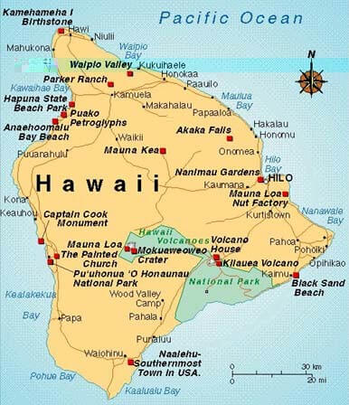
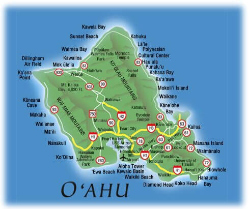
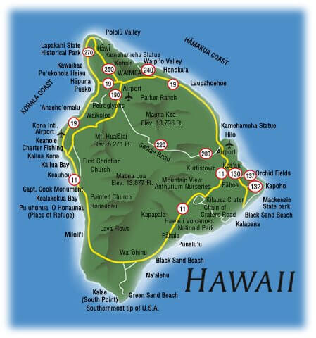
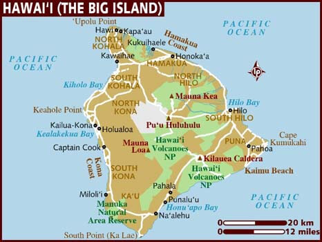
HAWAII BIG ISLAND MAP
Hawaii Map guide to exploring the beautiful islands of Hawaii! Hawaii is a state located in the Pacific Ocean, comprised of eight main islands with unique landscapes and attractions to explore. From the white sand beaches and turquoise waters to the lush tropical rainforests and active volcanoes, Hawaii is a true paradise on earth.
Our interactive map allows you to explore Hawaii and its many wonders from the comfort of your own home. Whether you're planning a vacation, researching for a school project, or simply satisfying your wanderlust, our Hawaii Map provides a wealth of information and visual representations of the islands. With our map, you can zoom in and out of different regions of Hawaii, view topographic and satellite images, and learn about the different attractions and landmarks.
Join us on a virtual tour of Hawaii and discover all that this tropical paradise has to offer. Let WorldMap1's Hawaii Map be your guide to exploring the beauty of the islands!
Hawaii Maps
Brief information about Hawaii, US
Hawaii is a state located in the Pacific Ocean and is part of the United States. It is the only U.S. state that is completely made up of islands, consisting of eight main islands and numerous smaller ones. The capital city is Honolulu, which is located on the island of Oahu. Hawaii has a unique and diverse culture, influenced by its Polynesian roots, as well as the various waves of migration and colonization that have occurred over the years.
The state is known for its stunning natural beauty, with white sand beaches, turquoise waters, and lush tropical rainforests, as well as its active volcanoes and unique geological formations. Hawaii is also a popular tourist destination, attracting millions of visitors each year to enjoy its warm climate, outdoor activities, and cultural attractions.
Here is some statistical information about Hawaii:
Area: Hawaii has a total land area of 10,931 square miles (28,311 square kilometers), making it the 43rd largest state in the United States.
Population: According to the latest estimates from the United States Census Bureau (2020), Hawaii has a population of approximately 1.4 million people, making it the 40th most populous state.
Demographics: Hawaii has a unique and diverse population, with a majority of residents identifying as Asian (37.7%), followed by White (25.5%), Native Hawaiian and Other Pacific Islander (21.1%), and Hispanic or Latino (10.8%). The state also has a significant population of people who identify as multiracial (23.8%). Hawaii has two official languages: English and Hawaiian, with Hawaiian being recognized as a co-official language.
History: The islands of Hawaii were first settled by Polynesians around 1,500 years ago. The islands were first visited by Europeans in 1778, when British explorer James Cook arrived in the area. Hawaii was an independent kingdom from 1810 until 1893, when a group of American businessmen overthrew the Hawaiian monarchy and established a provisional government. Hawaii was annexed by the United States in 1898 and became a U.S. territory in 1900. It became the 50th state in 1959.
Economy: Hawaii has a diverse economy, with tourism being the largest industry. Other important industries include defense, agriculture (primarily the cultivation of sugar cane and pineapples), and education. The state's gross domestic product (GDP) was $93.8 billion in 2020, with a per capita income of $60,101. Despite its small size and isolation, Hawaii has a high cost of living due to its reliance on imports for many goods and services.
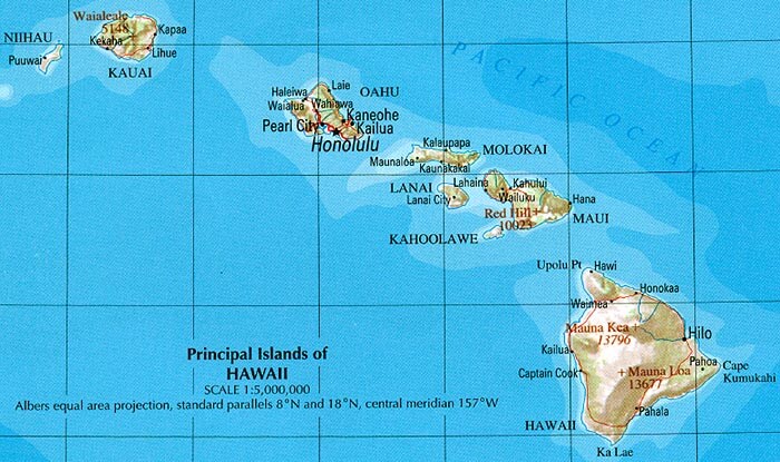
A Collection of Hawaii Maps and Hawaii Satellite Images
MAP OF HAWAII
HAWAII ISLANDS MAP

HAWAII MAP
HAWAII BIG ISLAND MAP
HAWAII CITIES MAP
HAWAII ISLANDS MAP
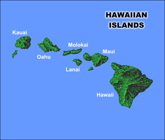
HAWAII ISLANDS MAP PASIFIC OCEAN
HAWAII MAP
HAWAII MAP ISLAND
HAWAII MAPS ISLANDS
HAWAII ROAD MAP
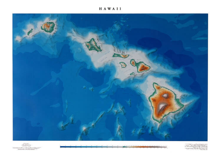
HAWAII TERRAIN MAP
MAP OF HAWAII

MAP OF HAWAII
MAP OF HAWAII BIG ISLAND
PRINCIPAL ISLANDS OF HAWAII MAP
THE ISLANDS OF HAWAII MAP
VOLCANO COTTAGE MAP OF HAWAII

Discovering the Magic of Honolulu Top 10 Must-Visit Spots
Please subscribe on "World Guide" channnel on Youtube at youtube.com/c/WorldGuide
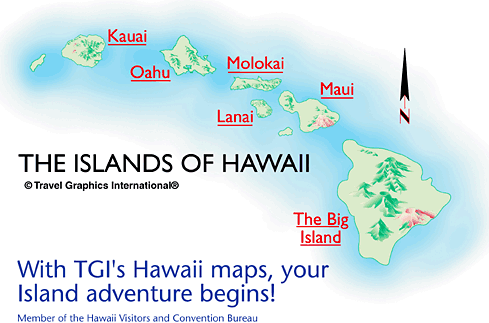
A collection of Hawaii Maps
Largest Cities Map of Hawaii and Population
- Honolulu Map - 387,170 - (21.307,-157.858)
- Pearl City Map - 47,698 - (21.397,-157.973)
- Hilo Map - 43,263 - (19.73,-155.09)
- Kailua Map - 38,635 - (21.402,-157.739)
- Waipahu Map - 38,216 - (21.387,-158.009)
- Kaneohe Map - 34,597 - (21.418,-157.804)
- Mililani Town Map - 27,629 - (21.45,-158.001)
- Kahului Map - 26,337 - (20.895,-156.47)
- Ewa Gentry Map - 22,690 - (21.344,-158.031)
- Mililani Mauka Map - 21,039 - (21.48231160000,-157.94640130000)
- Kihei Map - 20,881 - (20.785,-156.466)
- Makakilo Map - 18,248 - (21.346944, -158.085833)
- Wahiawa Map - 17,821 - (21.502778, -158.023611)
- Schofield Barracks Map - 16,370 - (21.489811, -158.050604)
- Wailuku Map - 15,313 - (20.891111, -156.504722)
Author: Arif Cagrici