Wales Map FQA
How many cities are in Wales ?
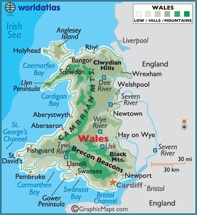
Wales has 6 official cities. The largest by population are: Cardiff; Swansea; Newport; Bangor; St Asaph; St Davids.
What are the major geographical features of Wales ?
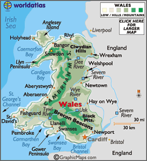
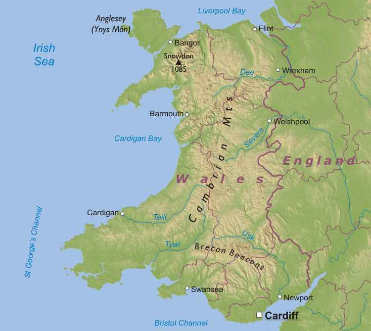
Wales is a mountainous region with ranges such as Snowdonia and the Brecon Beacons. It also has deep valleys, rivers, and a rugged coastline along the Irish Sea and Bristol Channel.
WALES MAP
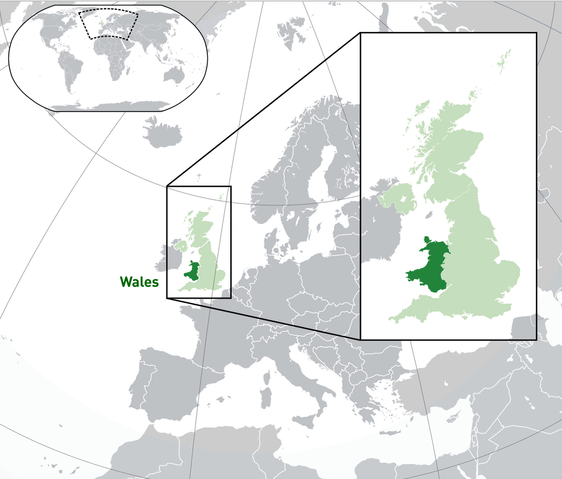
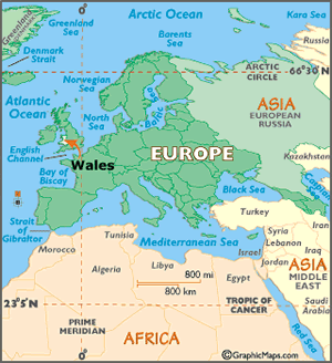
WHERE IS WALES IN THE WORLD
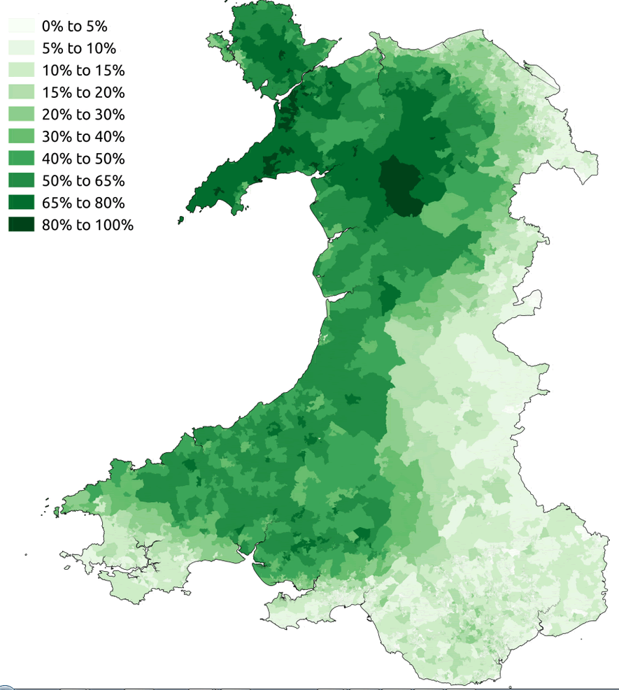
WELSH SPEAKERS 2011 CENSUS WALES
Can I download a high-resolution map of Wales ?
Yes. Download high-resolution political and physical maps of Wales for personal or educational use. Redistribution is subject to the terms of our license.
- Capital :
Cardiff
- Population :
3,063,500
- GDP :
N/A
- Per Capita :
N/A
- Calling Code :
+44
- Jobless Rate :
N/A
- Time Zone :
+0
With interactive Wales Map, view regional highways maps, road situations, transportation, lodging guide, geographical map, physical maps and more information. On Wales Map, you can view all states, regions, cities, towns, districts, avenues, streets and popular centers' satellite, sketch and terrain maps.
For more about Wales >>
A Collection of Wales Maps and Wales Satellite Images
WALES MAP
WHERE IS WALES IN THE WORLD
WELSH SPEAKERS 2011 CENSUS WALES
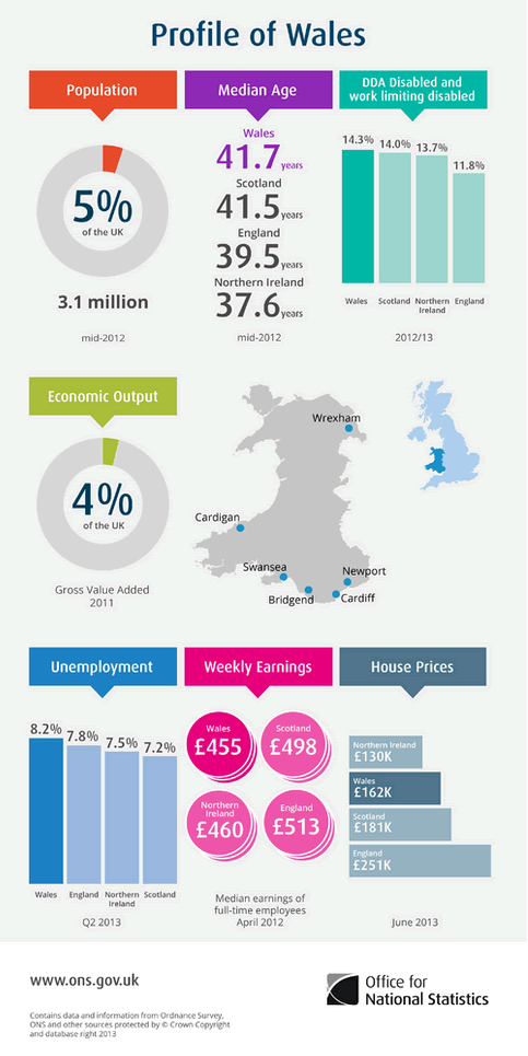
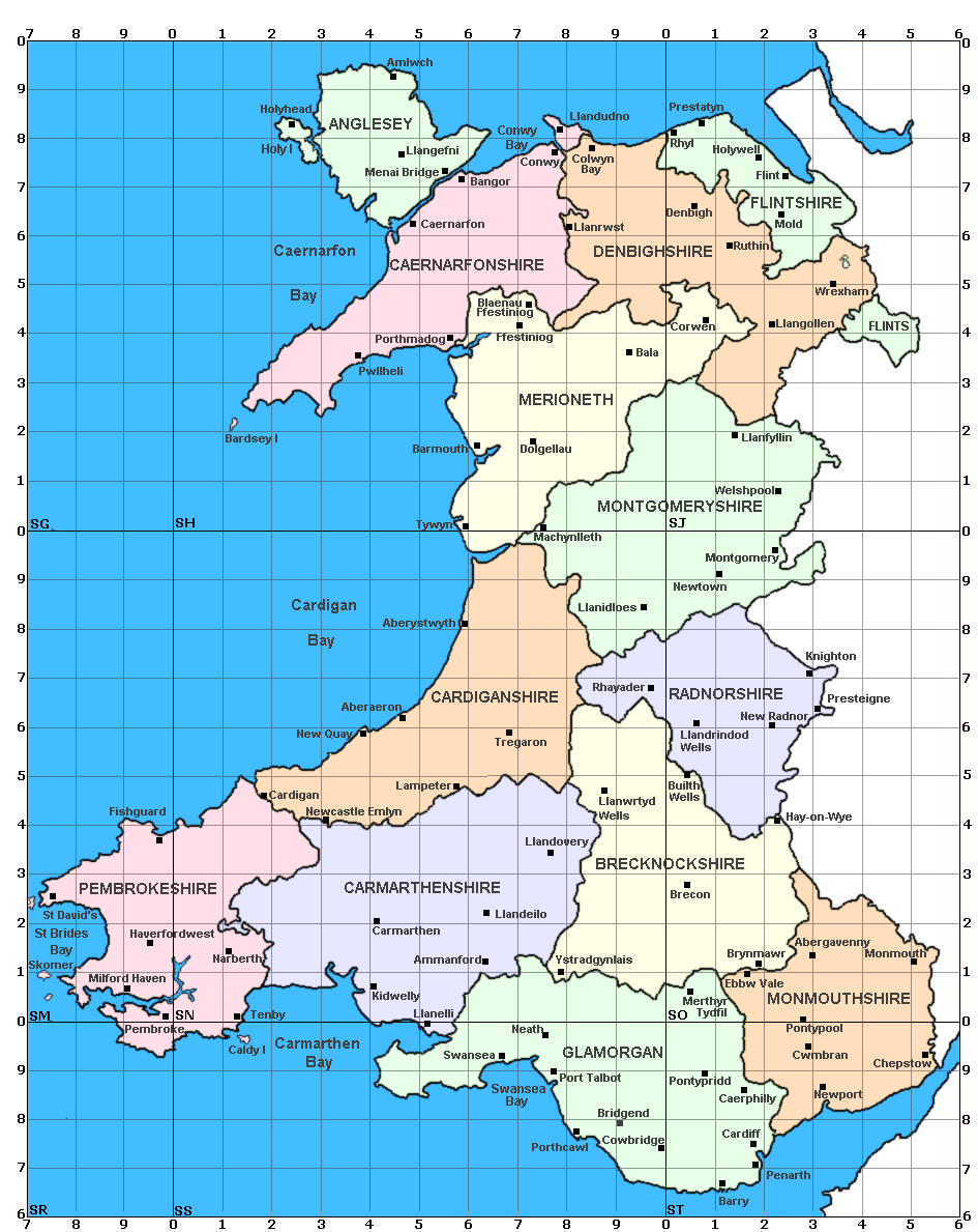
MAP OF PROFILE OF WALES
WALES
ROMAN WALES FORTS MAP 300

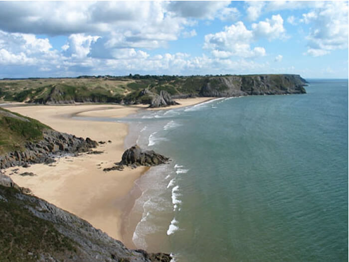
WALES THREE CLIFFS BAY
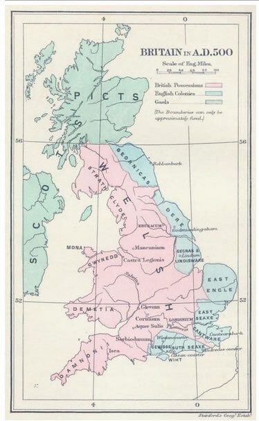
WALES BRITAIN 500
WALES EUROPE MAP
WALES MAP
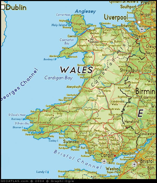
MAP OF WALES
WALES CITIES MAP
WALES PHYSICAL MAP
Author: Arif Cagrici
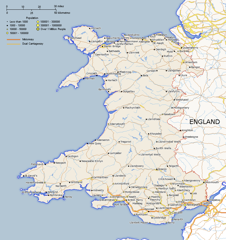
Largest Cities' Map of Wales
