Wallis and Futuna Map FQA
How many cities are in Wallis and Futuna ?
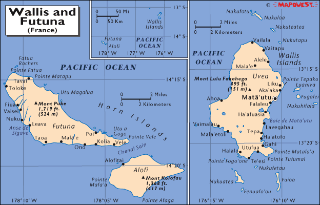
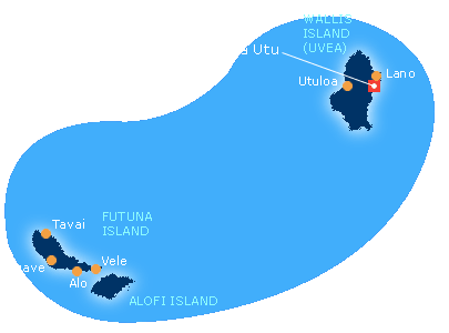
Wallis and Futuna has no official cities, only villages. The main settlements are: Mata-Utu (capital); Leava; Sigave.
What are the major geographical features of Wallis and Futuna ?
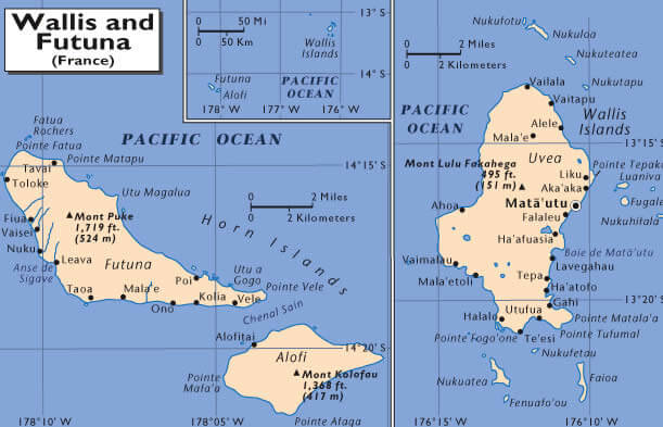
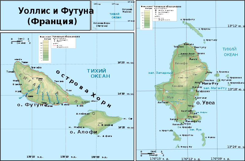
Wallis and Futuna, a French overseas collectivity in the South Pacific, consists of three main volcanic islands and smaller islets. It features rugged volcanic terrain, coastal plains, lagoons, and coral reefs.
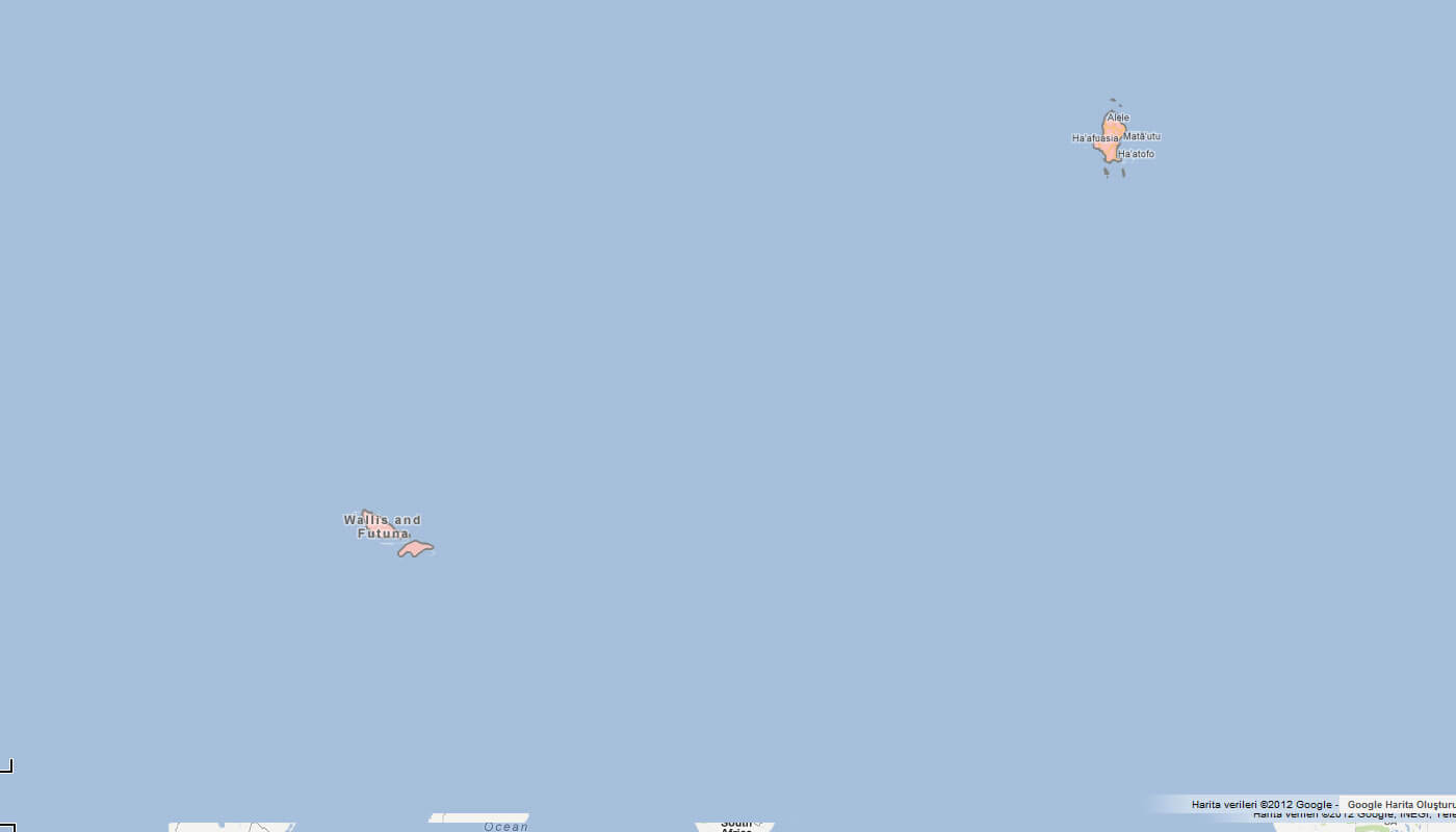
MAP OF WALLIS AND FUTUNA
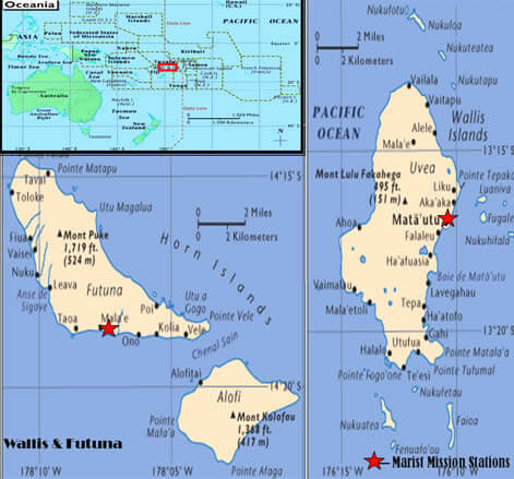
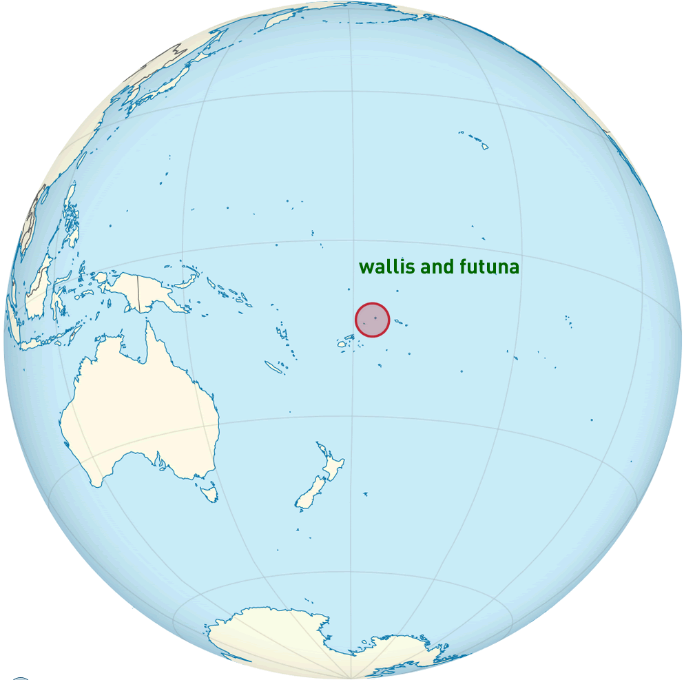
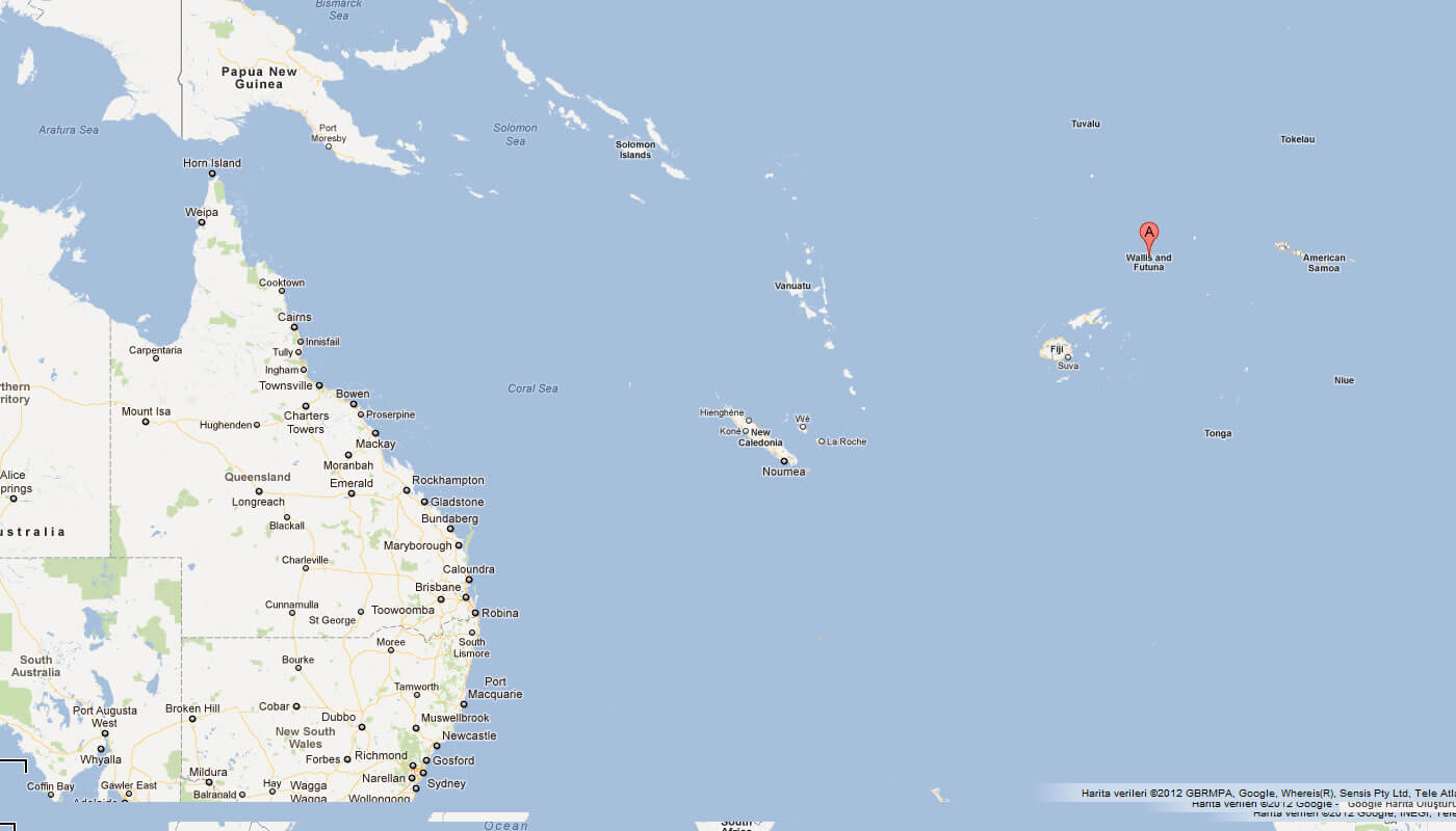
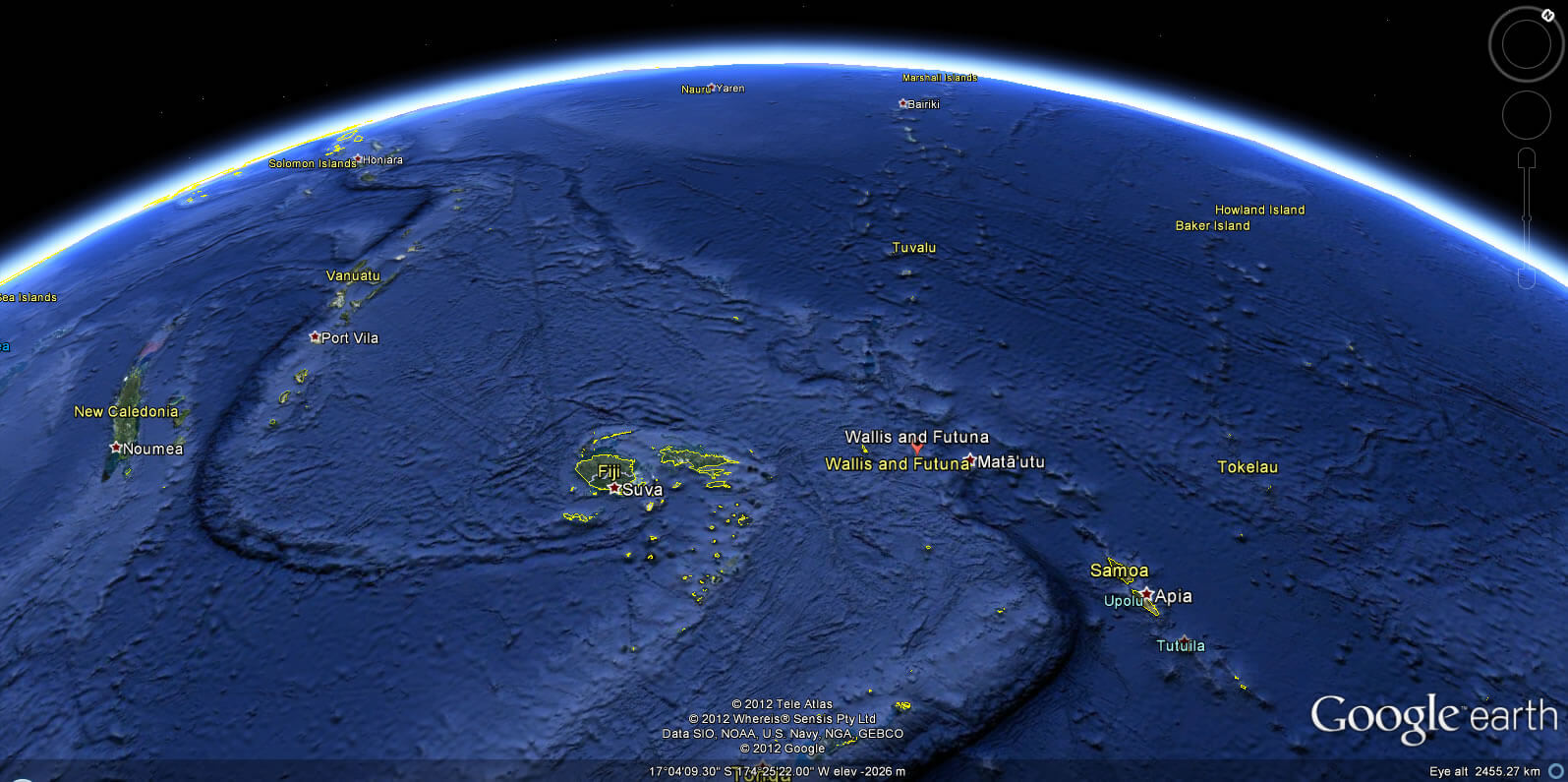
WALLIS AND FUTUNA LOCATION MAP
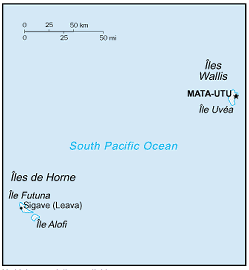
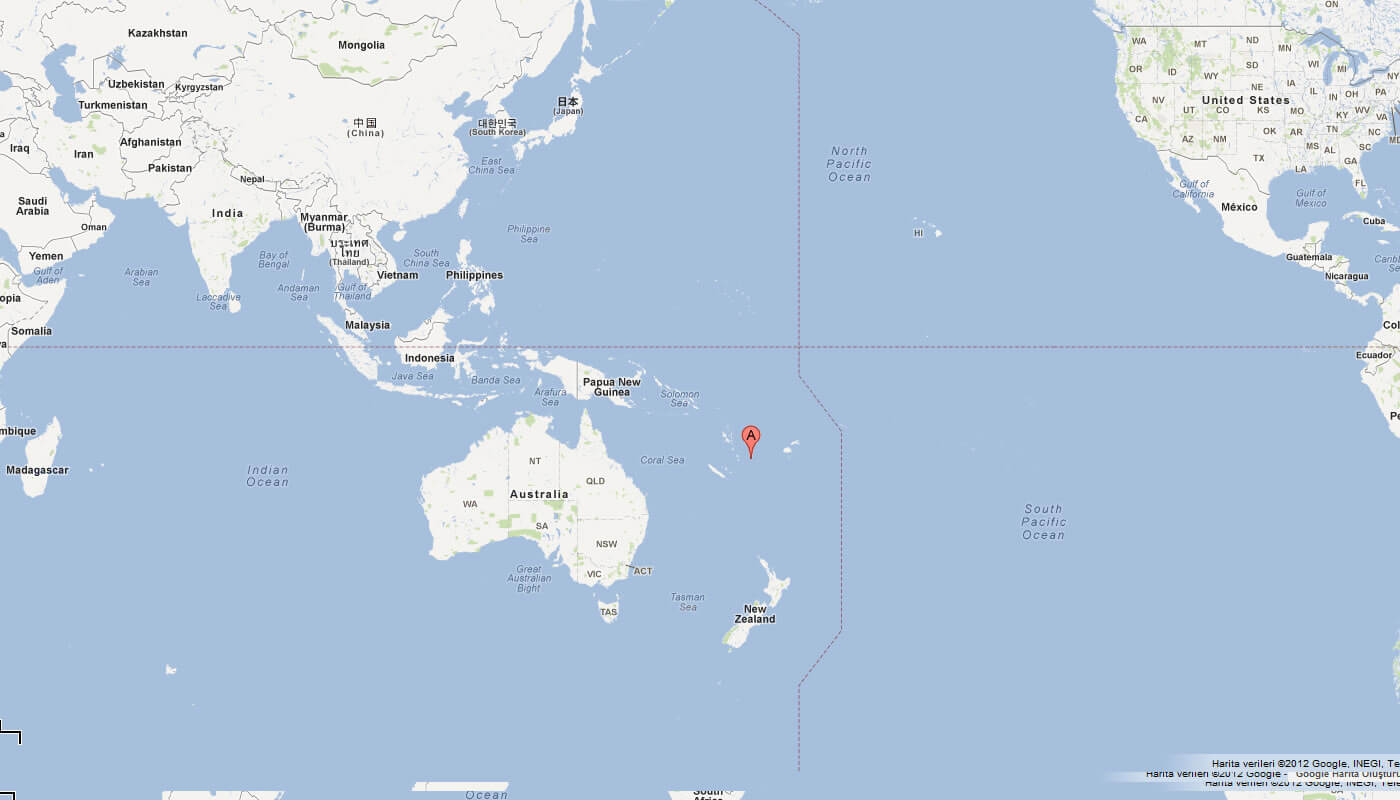
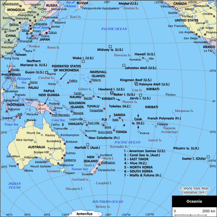
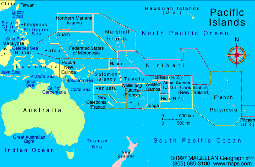
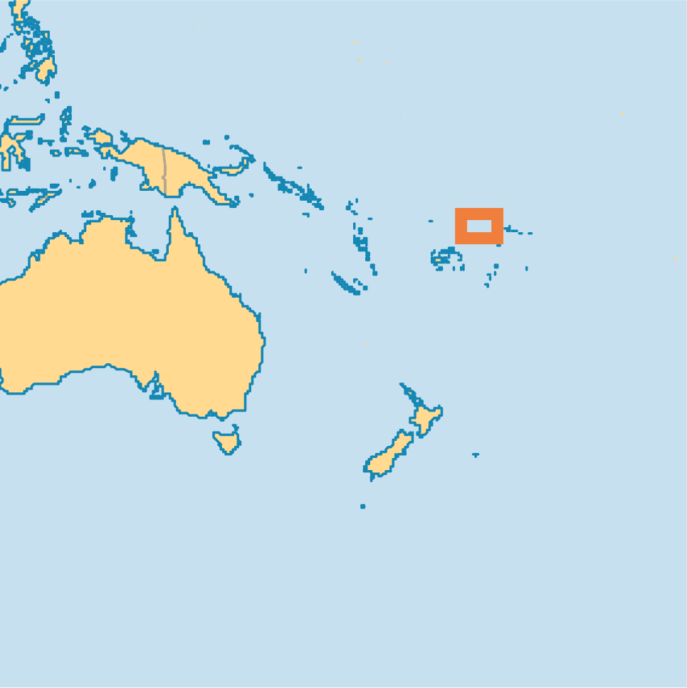
WHERE IS WALLIS AND FUTUNA IN THE WORLD
Can I download a high-resolution map of Wallis and Futuna ?
Yes. Download high-resolution political and physical maps of Wallis and Futuna for personal or educational use. Redistribution is subject to the terms of our license.
- Capital :
Mata-Utu
- Population :
15,289
- GDP :
$188 million
- Per Capita :
$12,640
- Calling Code :
+681
- Jobless Rate :
N/A
- Time Zone :
+12
With interactive Wallis and Futuna Map, view regional highways maps, road situations, transportation, lodging guide, geographical map, physical maps and more information. On Wallis and Futuna Map, you can view all states, regions, cities, towns, districts, avenues, streets and popular centers' satellite, sketch and terrain maps.
A Collection of Wallis and Futuna Maps and Wallis and Futuna Satellite Images
MAP OF WALLIS AND FUTUNA
WALLIS AND FUTUNA LOCATION MAP
WHERE IS WALLIS AND FUTUNA IN THE WORLD
MAP OF WALLIS AND FUTUNA OCEANIA
MAP OF WALLIS AND FUTUNA WORLD
MAP OF WALLIS AND FUTUNA
MAP WALLIS FUTUNA
WALLIS AND FUTUNA MAP FRANCE
WALLIS AND FUTUNA MAP OCEANIA
WALLIS FUTUNA MAP
WALLIS FUTUNA MAP AUSTRALIA
WALLIS AND FUTUNA MAP
WALLIS FUTUNA MAP
WALLIS AND FUTUNA EARTH MAP
Author: Arif Cagrici
Largest Cities' Map of Wallis and Futuna
