
Colombia Earthquake Map 2026
On August 10, 2026, a magnitude 7.4 earthquake struck western Colombia near San José del Palmar (Chocó department), about 240 km west of Bogotá. The powerful quake was felt widely across the country—triggering building evacuations and seismic alarms in the capital—and left at least 111 people dead and dozens injured. Use the Colombia Earthquake Map to view the epicenter, affected regions, depth, intensity, and latest updates.
M 7.4 San José del Palmar Earthquake Map
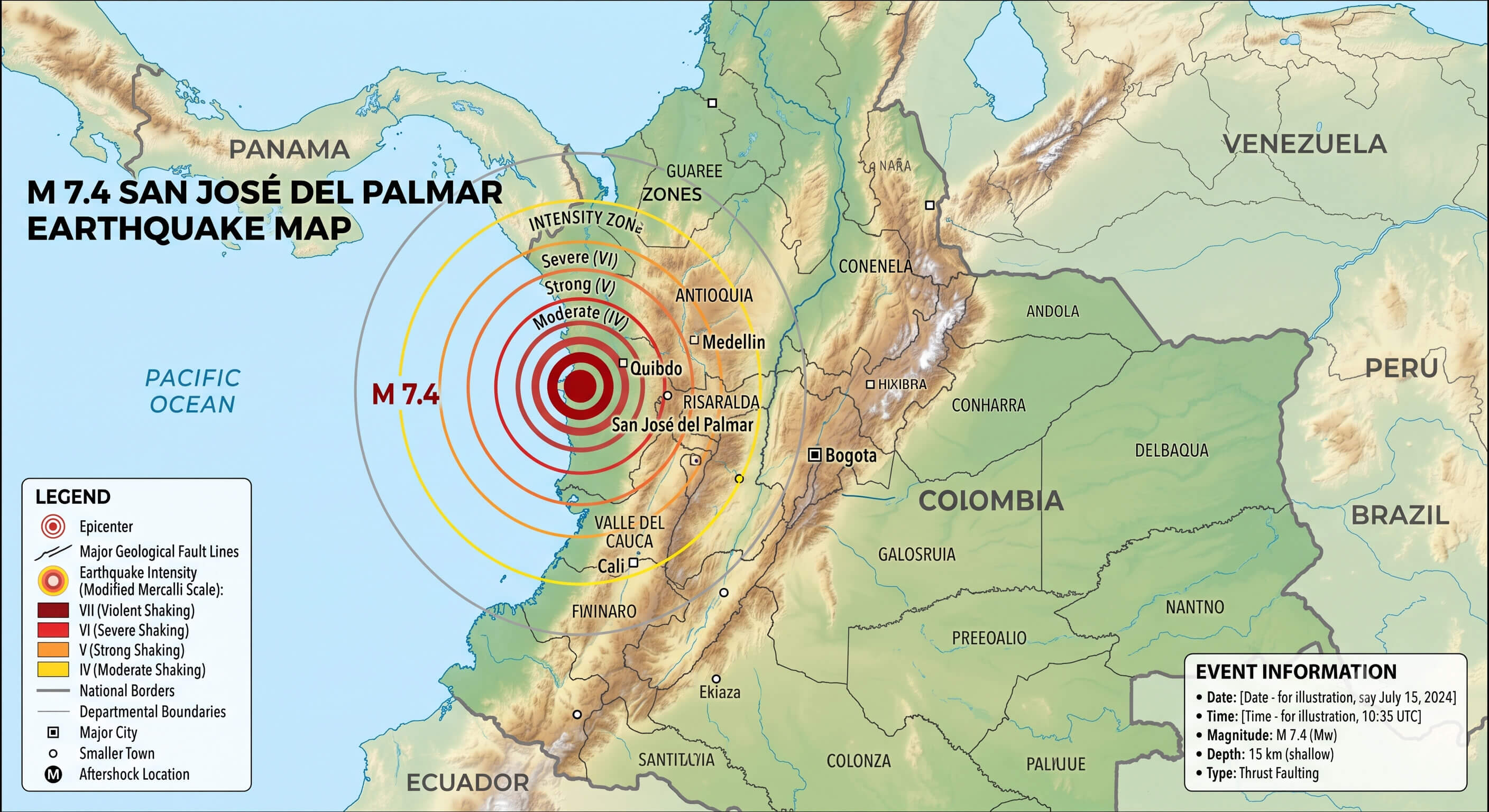
| Earthquake Information | Data |
|---|---|
| Magnitude | M 7.4 |
| Date | August 10, 2026 |
| Time | 12:34:28 UTC |
| Local Time | 7:34 AM COT |
| Epicenter | 5 km S of San José del Palmar, Colombia |
| Coordinates | 4.844°N, 76.242°W |
| Depth | 110.3 km |
| Country | Colombia |
| Region | Chocó / western Colombia |
Where Did the M 7.4 Colombia Earthquake Happen?
Terrain map of Colombia earthquake 7.4 magnitude
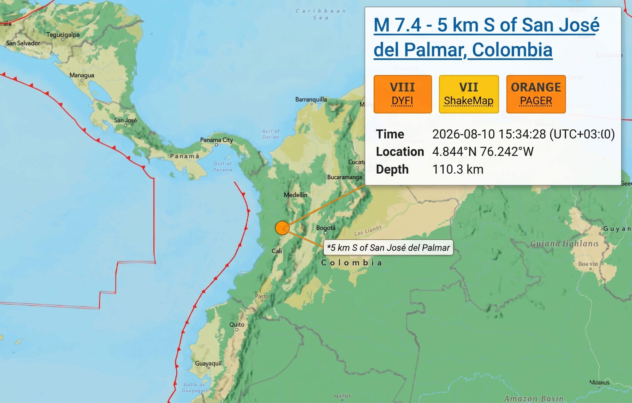
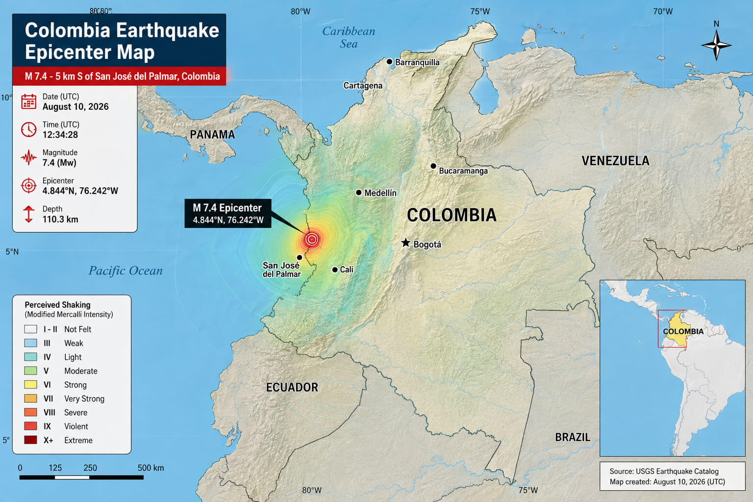
The M 7.4 Colombia earthquake struck western Colombia near San José del Palmar in the Chocó department on August 10, 2026. The epicenter was located at approximately 4.844°N, 76.242°W, about 5 km (3 miles) south of San José del Palmar and roughly 240 km (149 miles) west of Bogotá. The earthquake occurred in a seismically active region of western Colombia, where the interaction of major tectonic plates produces frequent and sometimes powerful earthquakes.
Colombia Earthquake Epicenter Map
How Strong Was the Colombia Earthquake?
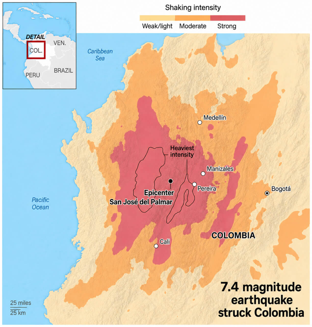
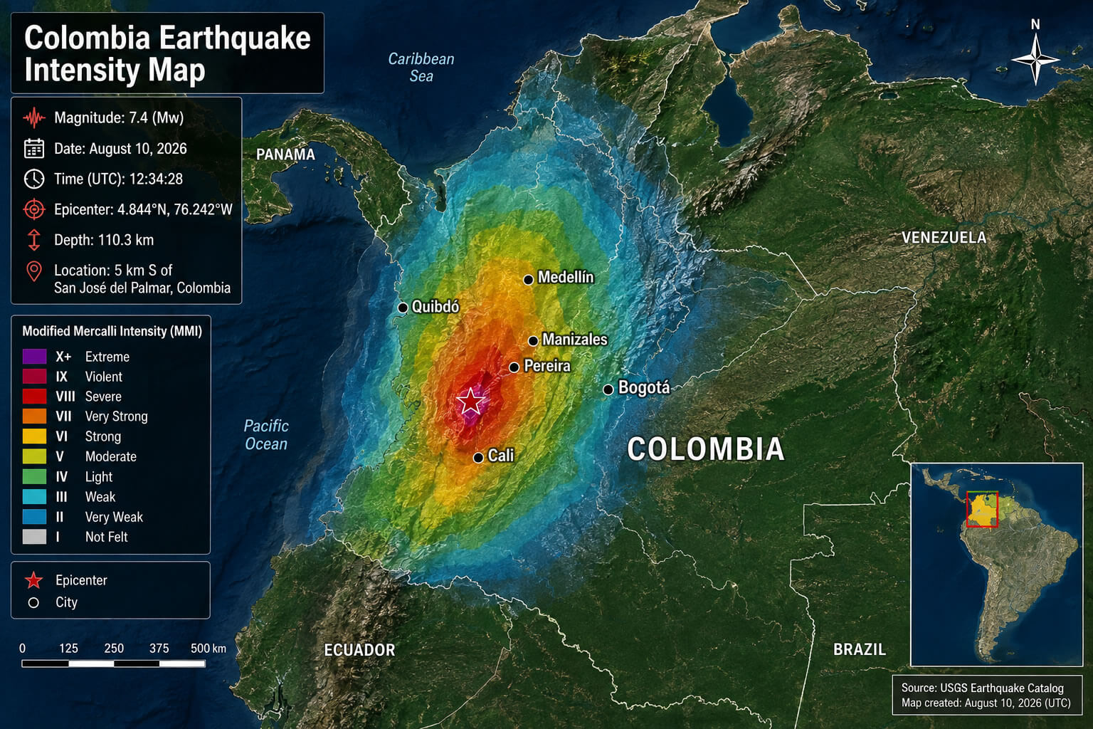
The earthquake reached a powerful magnitude of 7.4, making it a major seismic event capable of producing strong shaking across a large area. Although earthquake magnitude measures the energy released at the source, the intensity experienced at the surface can vary considerably depending on distance from the epicenter, local geology, building construction and earthquake depth. Strong shaking was reported across several parts of Colombia, including major cities far from the epicentral area.
How Deep Was the Colombia Earthquake?
The Colombia earthquake occurred at a depth of approximately 110.3 km (68.5 miles) below the Earth"s surface. This is considered an intermediate-depth earthquake, rather than a shallow earthquake. Because seismic waves from deeper earthquakes can travel over considerable distances, the August 10 earthquake was felt across a broad area of Colombia despite its relatively deep hypocenter. Depth is also an important factor when assessing the distribution and severity of shaking at the surface.
Where Was the Earthquake Felt?
Colombia Earthquake Felt Area Map
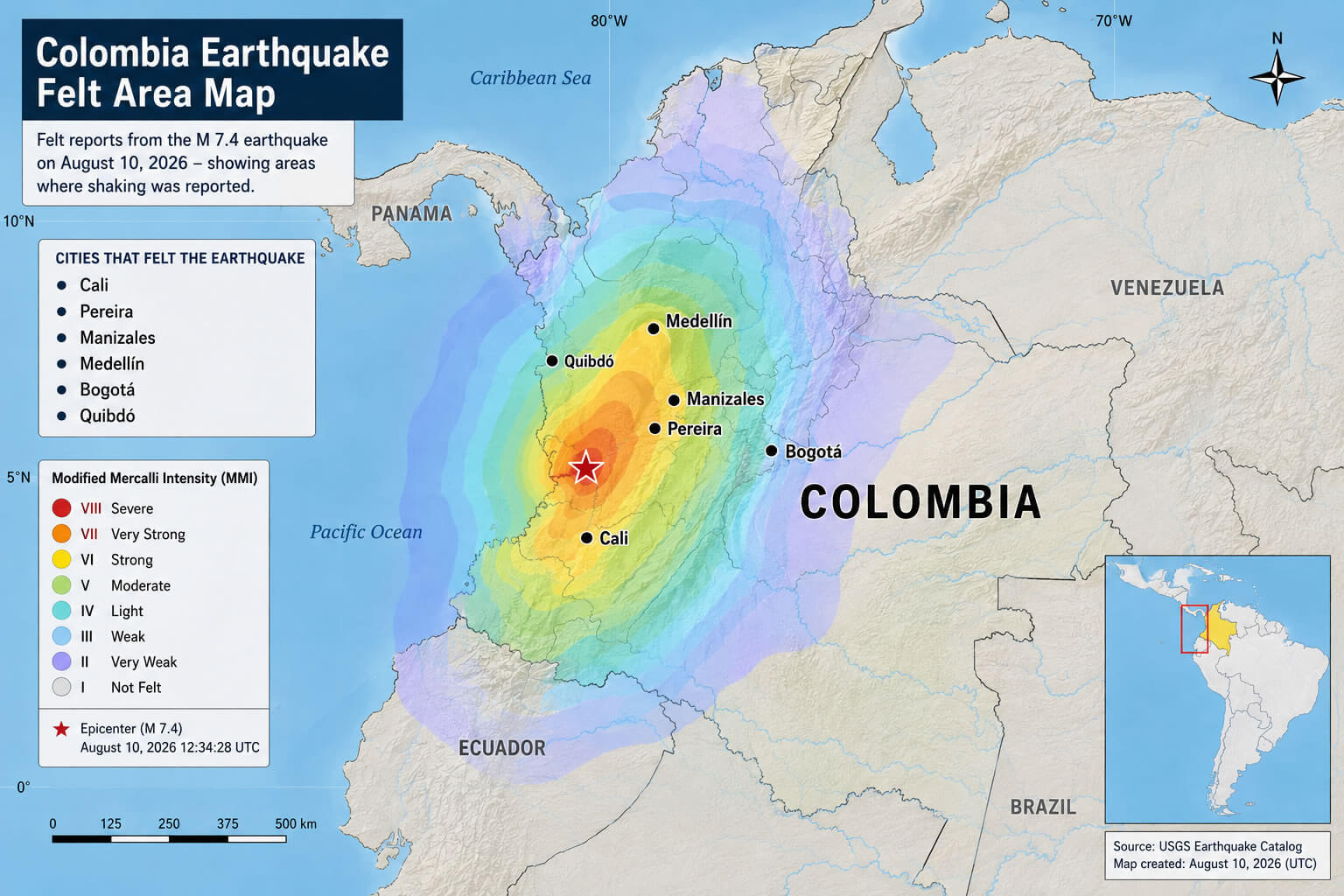
The M 7.4 earthquake was felt across a wide area of Colombia, including Bogotá and several cities in western and central parts of the country. Residents in the capital reported strong shaking, seismic alarms sounded and people evacuated buildings as a precaution. The earthquake was also felt in communities closer to the epicenter around San José del Palmar and throughout parts of Chocó and neighboring departments. The wide felt area was influenced by the earthquake"s large magnitude and its depth beneath western Colombia.
What time did the Colombia earthquake happen?
The M 7.4 San José del Palmar earthquake occurred on August 10, 2026, at 12:34:28 UTC. In Colombia, which observes Colombia Standard Time (COT, UTC-5) year-round, the earthquake occurred at approximately 7:34 a.m. local time on Monday morning. The event"s exact UTC timestamp is useful for comparing seismic records, aftershock activity and earthquake reports from monitoring stations around Colombia and neighboring regions.
Colombia Earthquake Intensity Map
Were there any deaths or injuries?
Collapsed building after an earthquake in Colombia 2026
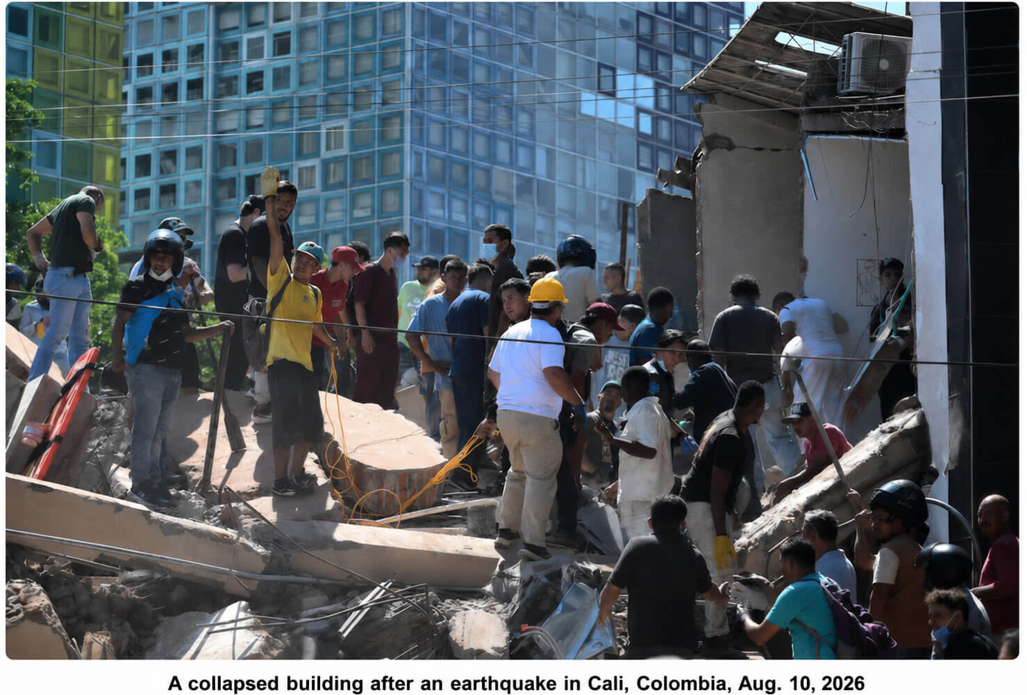
Yes. The M 7.4 Colombia earthquake caused significant loss of life and injuries across western Colombia. According to the latest reports, at least 111 people were killed and 87 others were injured following the August 10, 2026 earthquake. Rescue teams were deployed to the hardest-hit areas as authorities searched damaged and collapsed buildings for survivors. The number of casualties may change as search-and-rescue operations and damage assessments continue in affected communities.
Colombia Earthquake Cities Map
Colombia earthquake cities affected map
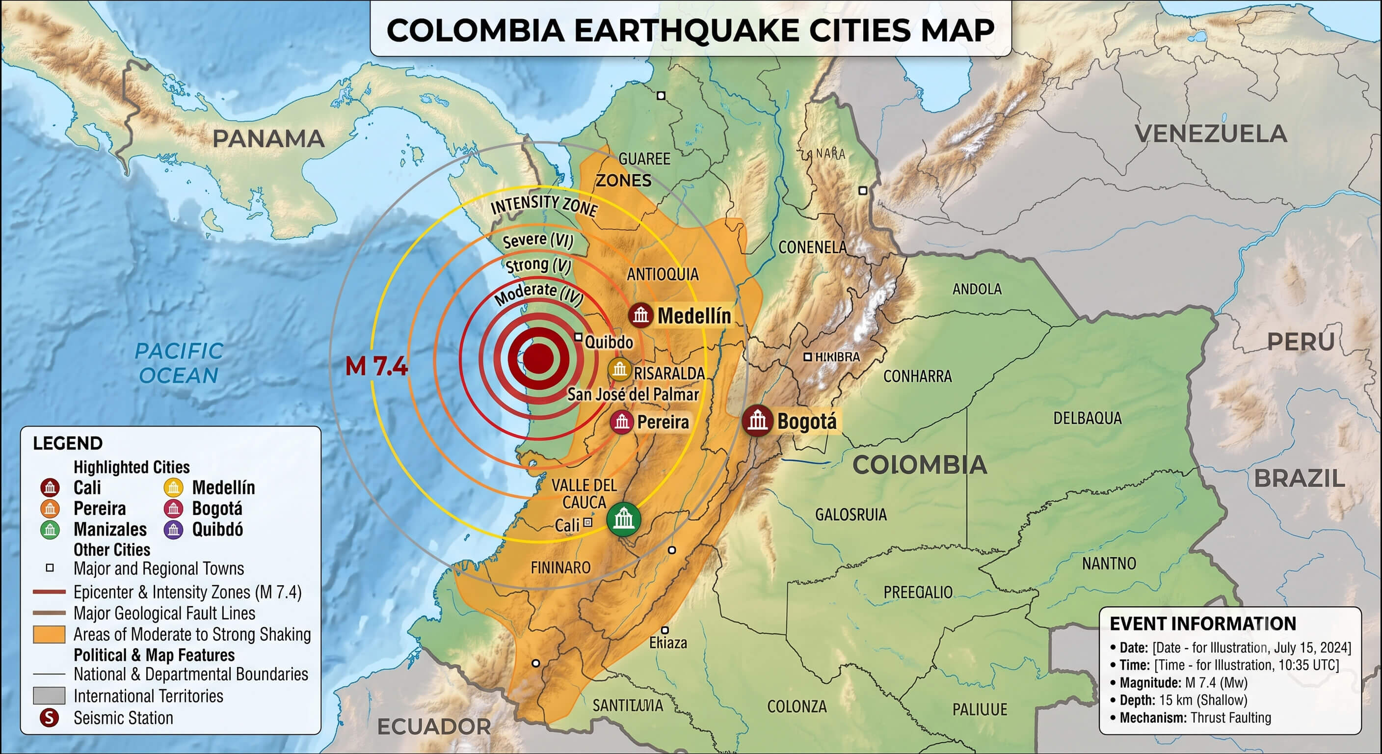
- Cali
- Pereira
- Manizales
- Medellín
- Bogotá
- Quibdó
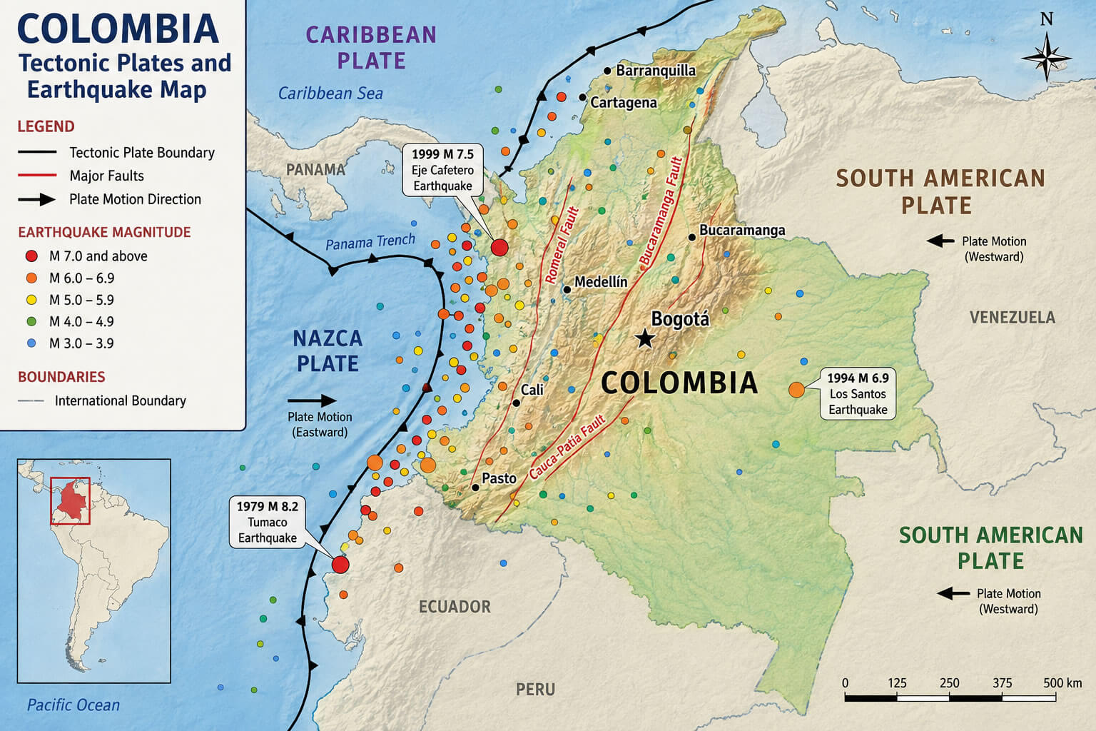
Colombia Tectonic Plates and Earthquake Map
Was There a Tsunami Warning?
No major tsunami warning was issued following the M 7.4 Colombia earthquake. Although the earthquake was powerful and occurred in western Colombia relatively close to the Pacific region, its epicenter was located inland near San José del Palmar and at a considerable depth below the surface. These characteristics significantly reduced the potential for the type of large seafloor displacement that can generate a destructive tsunami. Nevertheless, coastal residents should always follow official emergency information after a major earthquake.
Was the Colombia earthquake felt in Bogotá?
Yes, the M 7.4 Colombia earthquake was strongly felt in Bogotá, even though the capital is located hundreds of kilometers east of the epicenter. Residents reported noticeable shaking across the city, seismic alarms were activated and many people evacuated homes, offices and other buildings as a precaution. The earthquake"s large magnitude and intermediate depth allowed seismic waves to travel considerable distances, causing the tremor to be felt across much of Colombia and beyond the areas closest to San José del Palmar.
How far was the earthquake from Cali?
San Jose del Palmar Colombia earthquake map
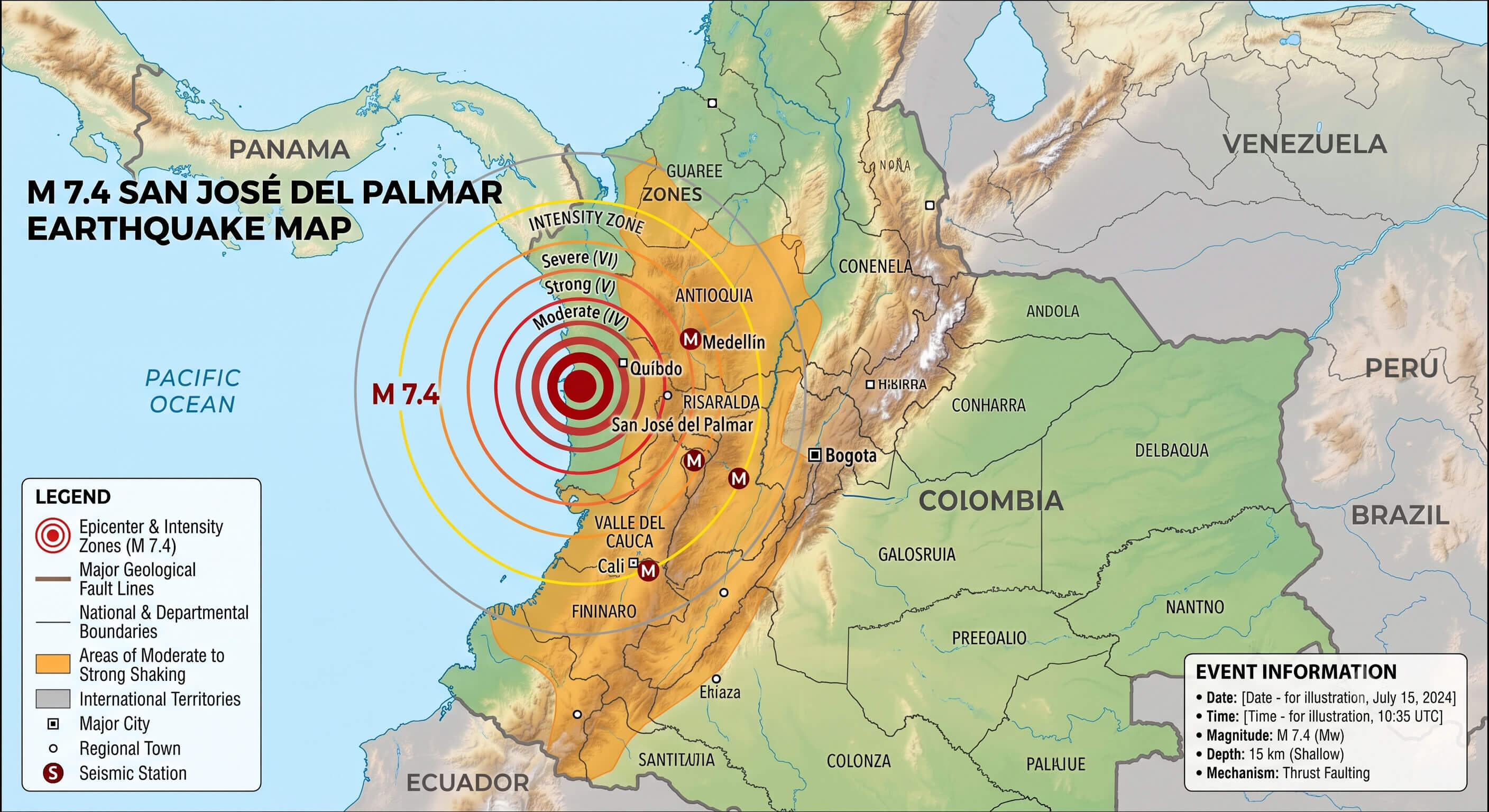
The epicenter of the M 7.4 Colombia earthquake was approximately 158 km (98 miles) from Cali in a straight-line geographic distance, based on the reported epicenter coordinates of 4.844°N, 76.242°W. Cali is one of the largest cities in western Colombia and lies relatively close to the earthquake zone compared with Bogotá. Strong shaking was reported in Cali and surrounding areas following the August 10 earthquake, and authorities assessed buildings and infrastructure for possible damage.
How far was the earthquake from Bogotá?
Satellite map of Colombia earthquake 7.4 magnitude
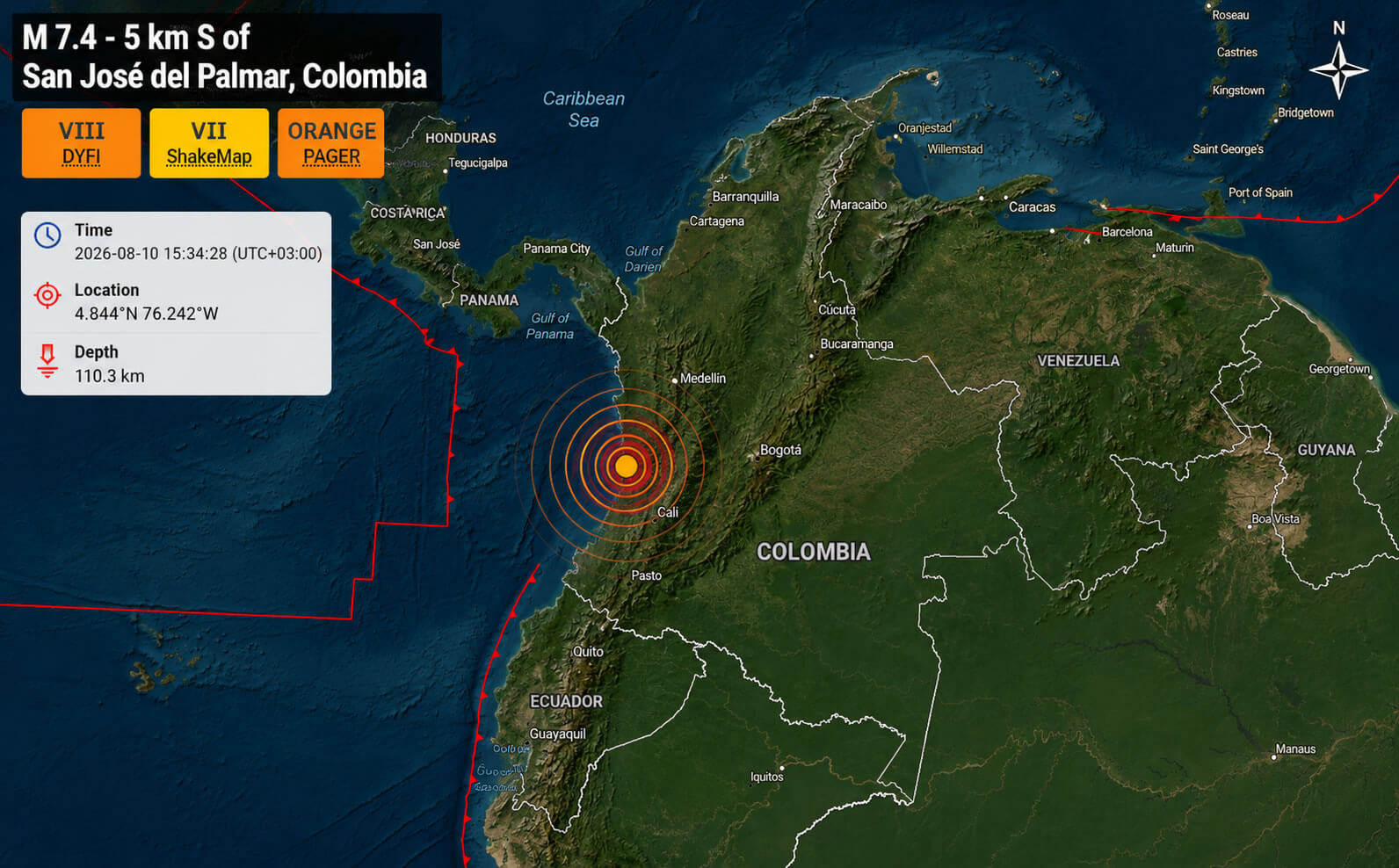
The Colombia earthquake epicenter was approximately 241 km (150 miles) west of Bogotá in a straight-line geographic distance, based on the reported epicenter coordinates. Despite this distance, the magnitude 7.4 earthquake was clearly felt throughout the Colombian capital. The combination of the earthquake"s high magnitude and its depth allowed seismic energy to travel across a broad area, producing noticeable shaking far from the epicenter near San José del Palmar.
What was the strongest earthquake in Colombia?
The 1906 Ecuador–Colombia earthquake is generally recognized as the strongest earthquake associated with Colombia in the modern seismic record. The massive magnitude 8.8 earthquake occurred on January 31, 1906, near the Pacific coast of Ecuador and Colombia. It generated a destructive tsunami that affected the coastline and caused widespread loss of life. With an estimated magnitude of 8.8, the 1906 event was considerably more powerful than the M 7.4 San José del Palmar earthquake of August 10, 2026, and it ranks among the largest earthquakes recorded worldwide since 1900.
Feel free to explore these pages as well:
- Head of Performance Marketing
- Head of SEO
- Linkedin Profile: linkedin.com/in/arifcagrici