Svalbard Map FQA
How many cities are in Svalbard ?
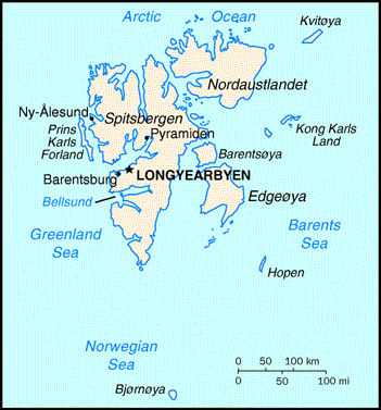
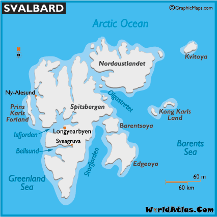
Svalbard has no cities, only research and mining settlements. The largest are: Longyearbyen; Barentsburg; Ny-Ålesund; Pyramiden (abandoned).
What are the major geographical features of Svalbard ?
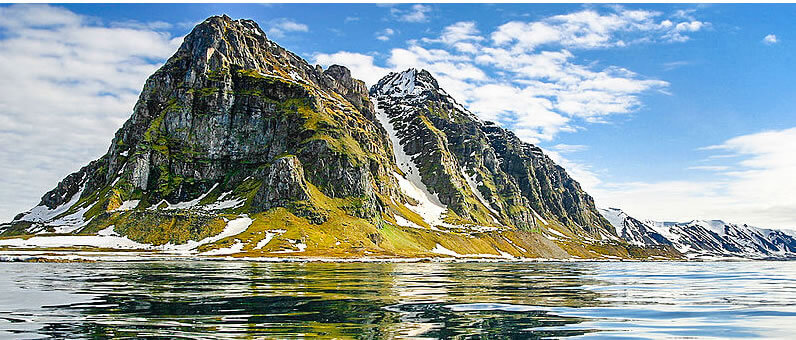
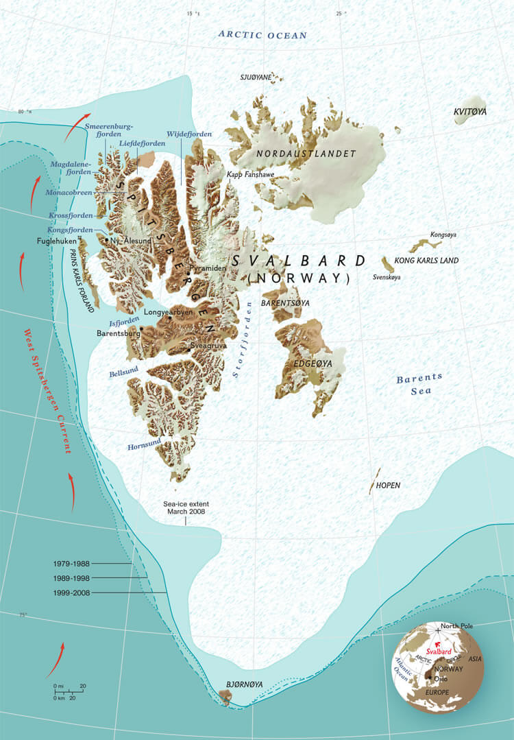
Svalbard, a Norwegian archipelago in the Arctic Ocean, features glaciers, fjords, and rugged mountains. Its geography is dominated by tundra landscapes, permafrost, and polar climate conditions.
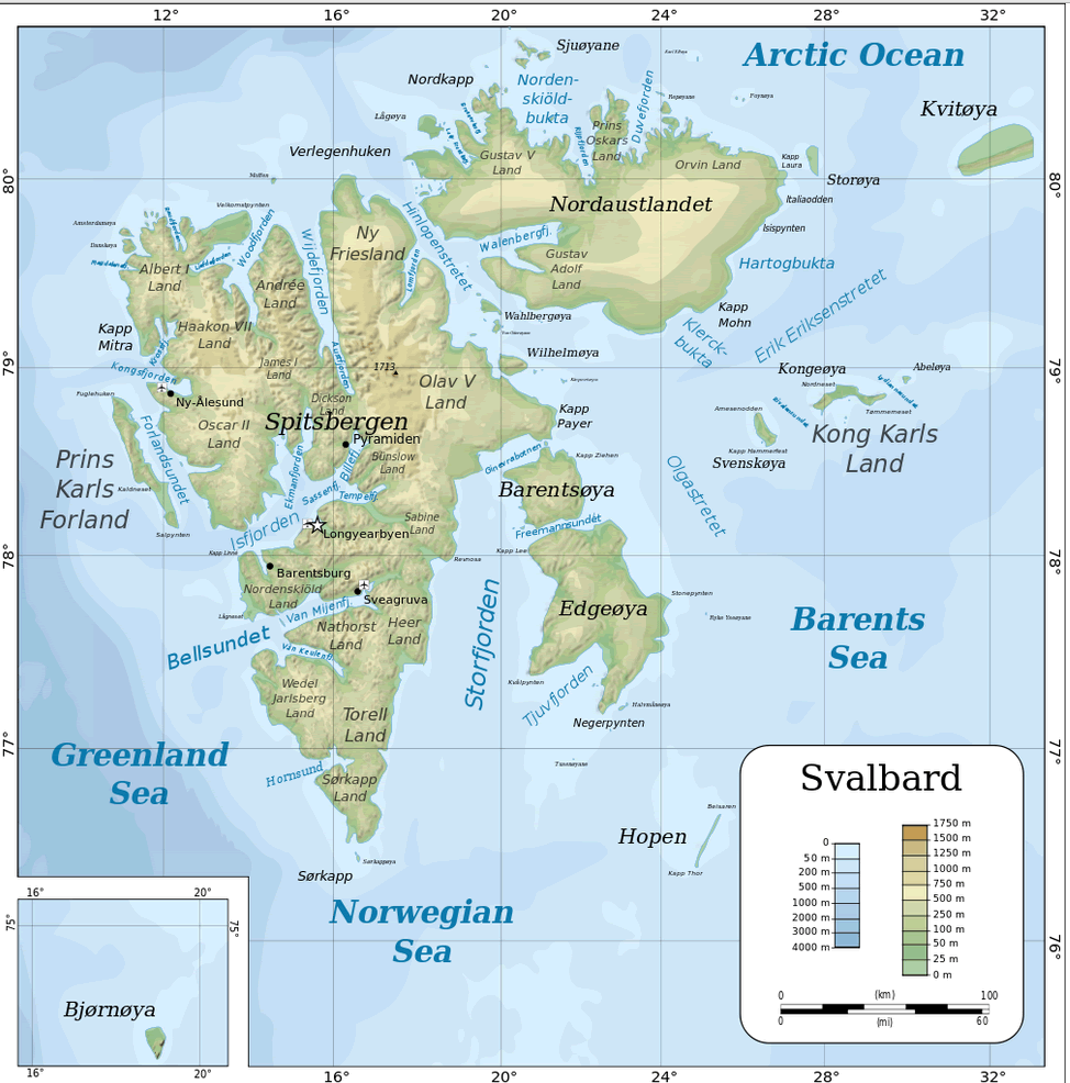
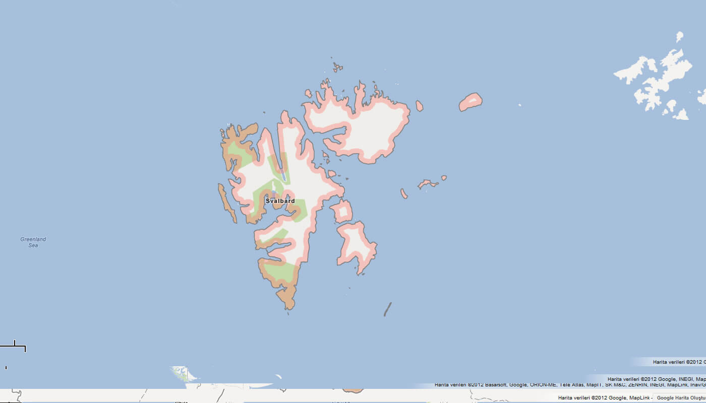
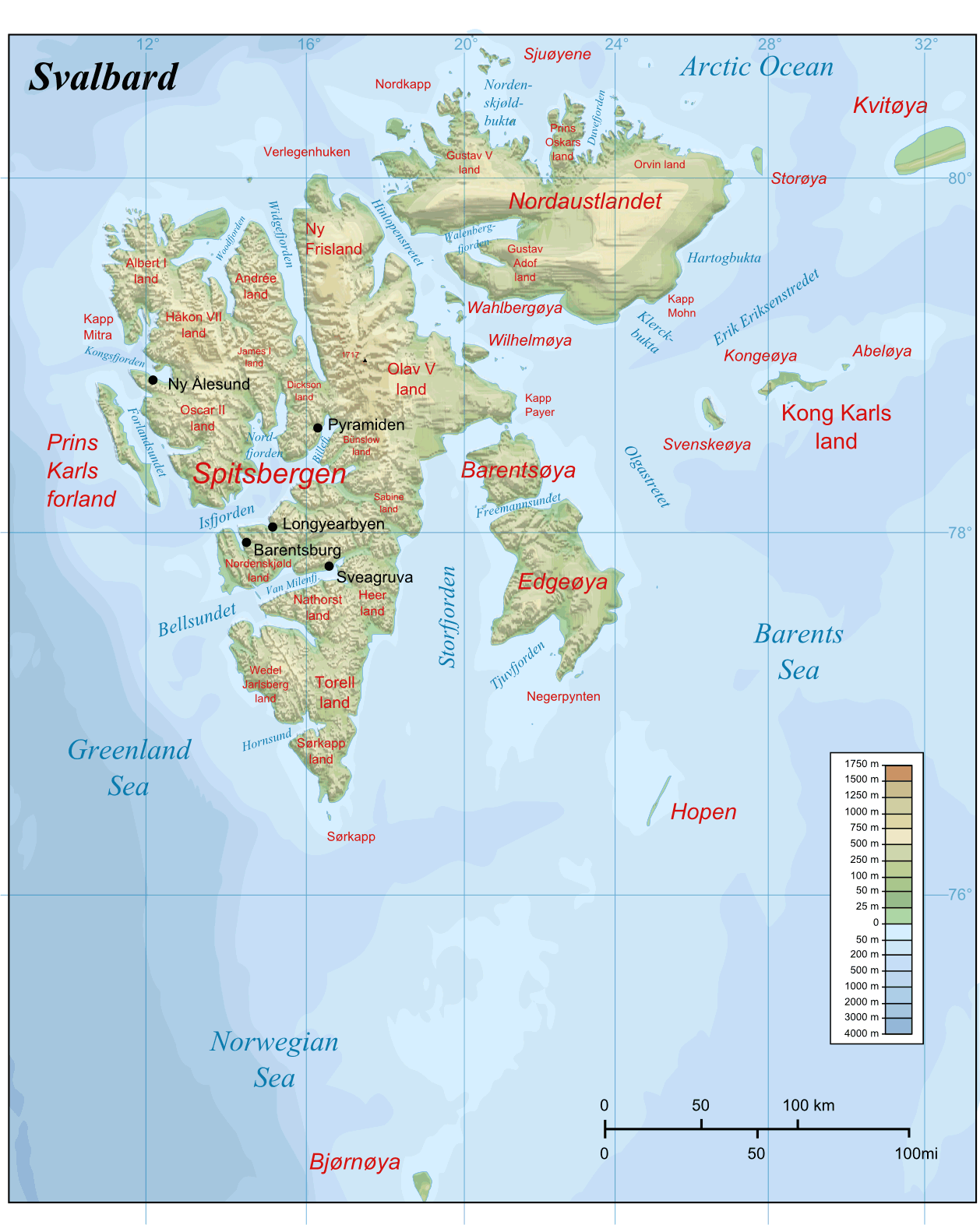
MAP OF SVALBARD

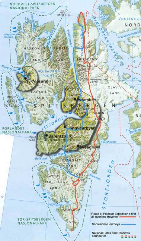
SVALBARD PRINS KARLS FORRLAND
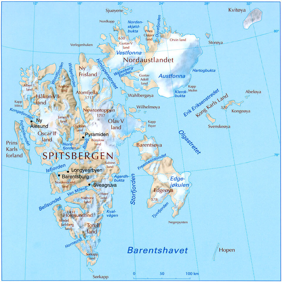
TOPOGRAPHIC MAP OF SVALBARD
Can I download a high-resolution map of Svalbard ?
Yes. Download high-resolution political and physical maps of Svalbard for personal or educational use. Redistribution is subject to the terms of our license.
- Capital :
Longyearbyen
- Population :
0
- GDP :
N/A
- Per Capita :
N/A
- Calling Code :
+47
- Jobless Rate :
N/A
- Time Zone :
+1
With interactive Svalbard Map, view regional highways maps, road situations, transportation, lodging guide, geographical map, physical maps and more information. On Svalbard Map, you can view all states, regions, cities, towns, districts, avenues, streets and popular centers' satellite, sketch and terrain maps.
For more about Svalbard >>
A Collection of Svalbard Maps and Svalbard Satellite Images
MAP OF SVALBARD
SVALBARD PRINS KARLS FORRLAND
TOPOGRAPHIC MAP OF SVALBARD
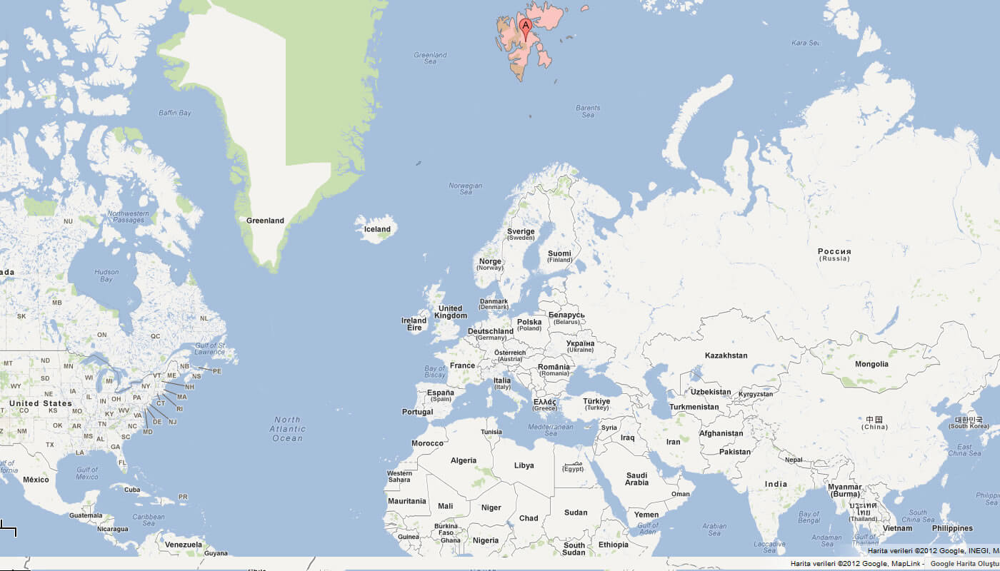
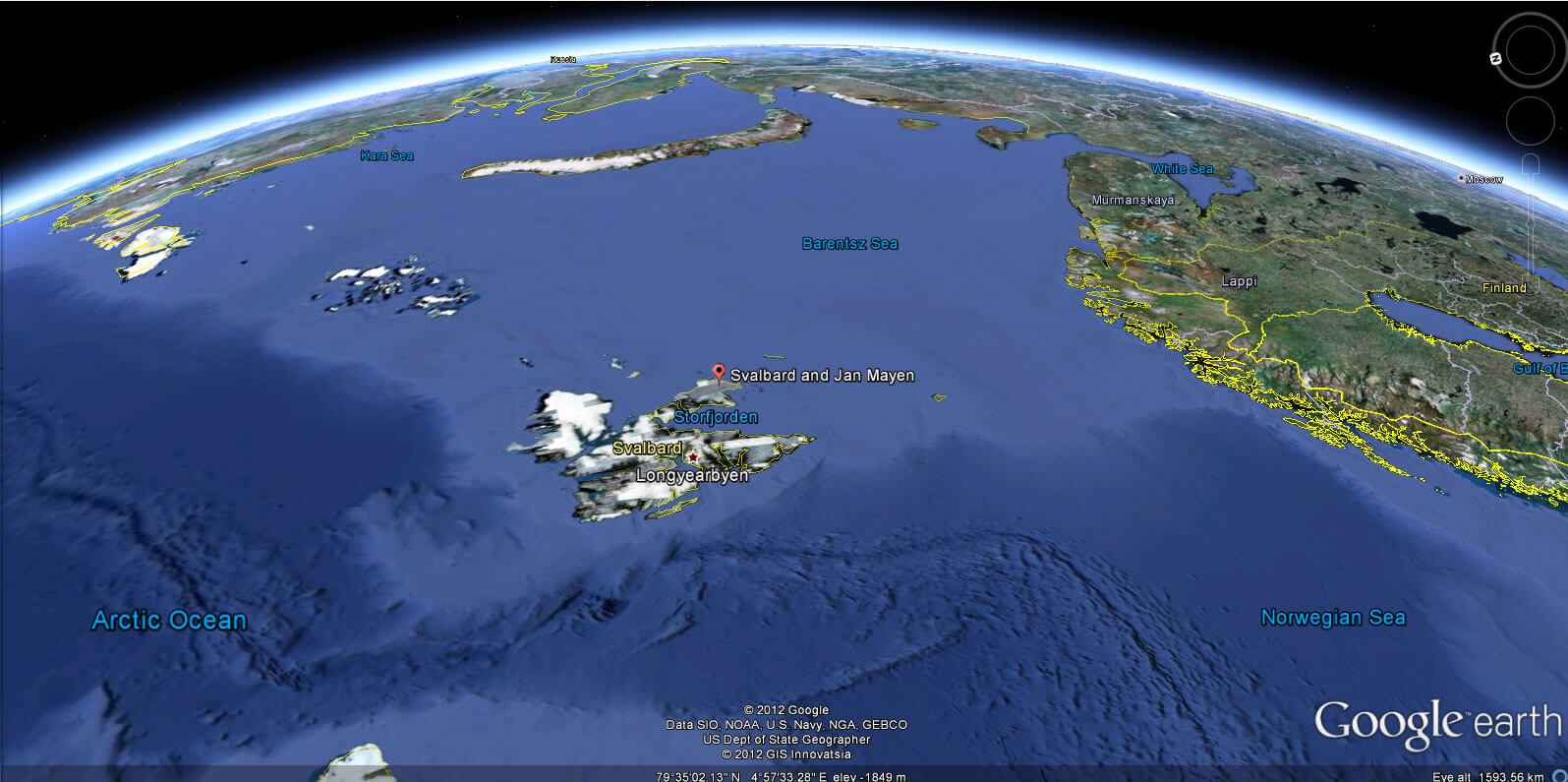
WHERE IS SVALBARD IN THE WORLD
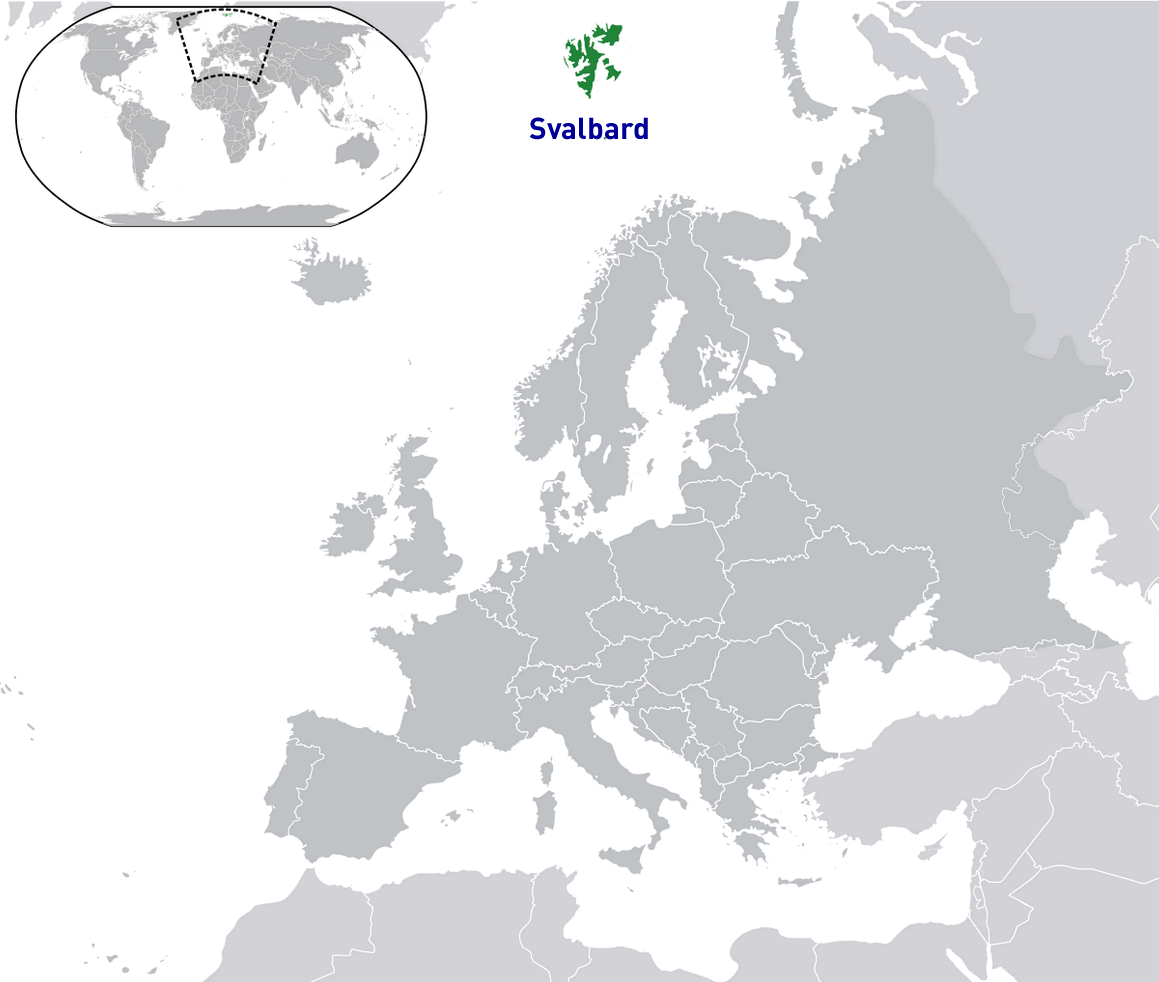
MAP OF SVALBARD WORLD
MAP OF SVALBARD
SVALBARD MAP
SVALBARD RELIEF MAP
SVALBARD MAP EUROPE

SVALBARD MAP
SVALBARD MAP
SVALBARD MAP NORWAY
SVALBARD PHYSICAL MAP
SVALBARD EARTH MAP
Author: Arif Cagrici
Largest Cities' Map of Svalbard
