Where Is Qatar on the World Map? Location, Borders and Geography Explained
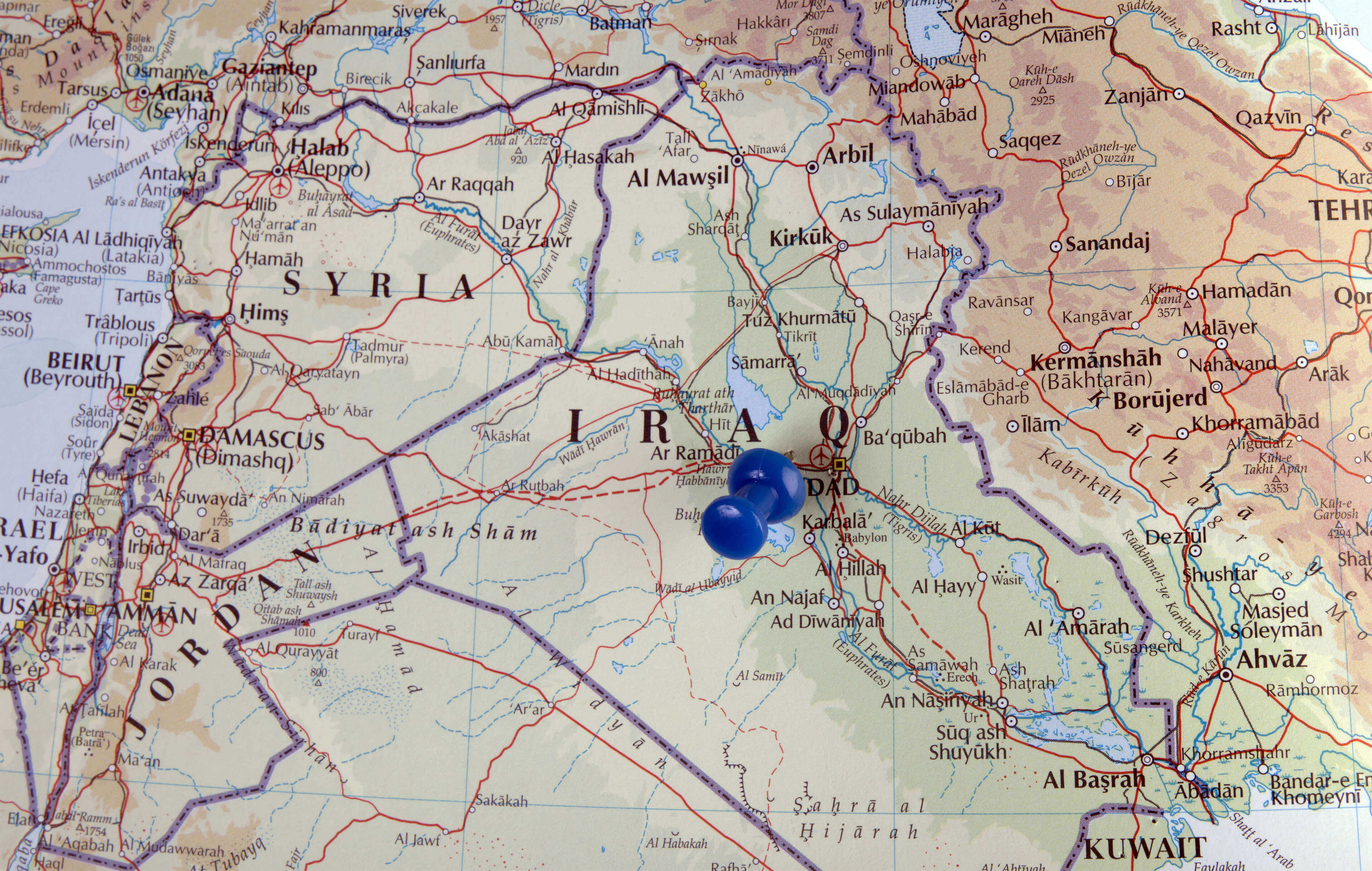
Iraq is a country located in Western Asia at the heart of the Middle East, positioned between several important regional powers. When asking "Where is Iraq located?", the country can be found between Turkey to the north, Iran to the east, Kuwait and Saudi Arabia to the south, and Jordan and Syria to the west, with a small coastline along the Persian Gulf. Iraq lies within the historic region of Mesopotamia, between the Tigris and Euphrates rivers, which played a major role in the development of early civilizations. Because of its central geographic location, Iraq has long been an important crossroads connecting the Middle East, Asia, and the Mediterranean region.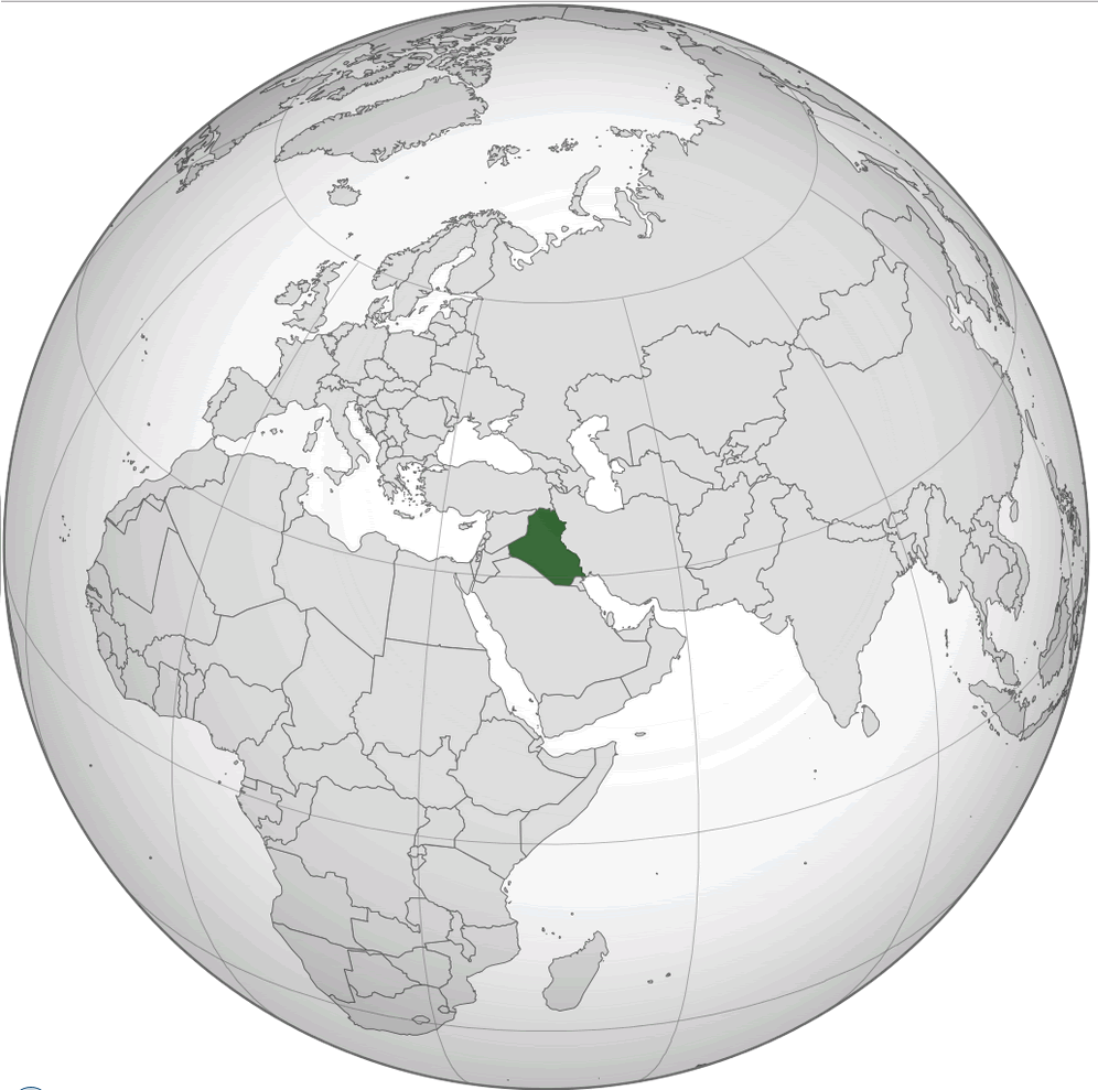
Where Is Iraq Located? (Complete Geographic Guide)
Where Is Iraq Located?
Iraq is situated in Western Asia at the center of the Middle East. The country lies between the Tigris and Euphrates rivers and shares borders with Turkey to the north, Iran to the east, Kuwait to the southeast, Saudi Arabia to the south, Jordan to the southwest, and Syria to the west. Iraq also has a short coastline along the northern Persian Gulf. Because of its location, Iraq has historically served as an important crossroads linking the Middle East, Asia, and the Mediterranean world.
Geographic Location of Iraq
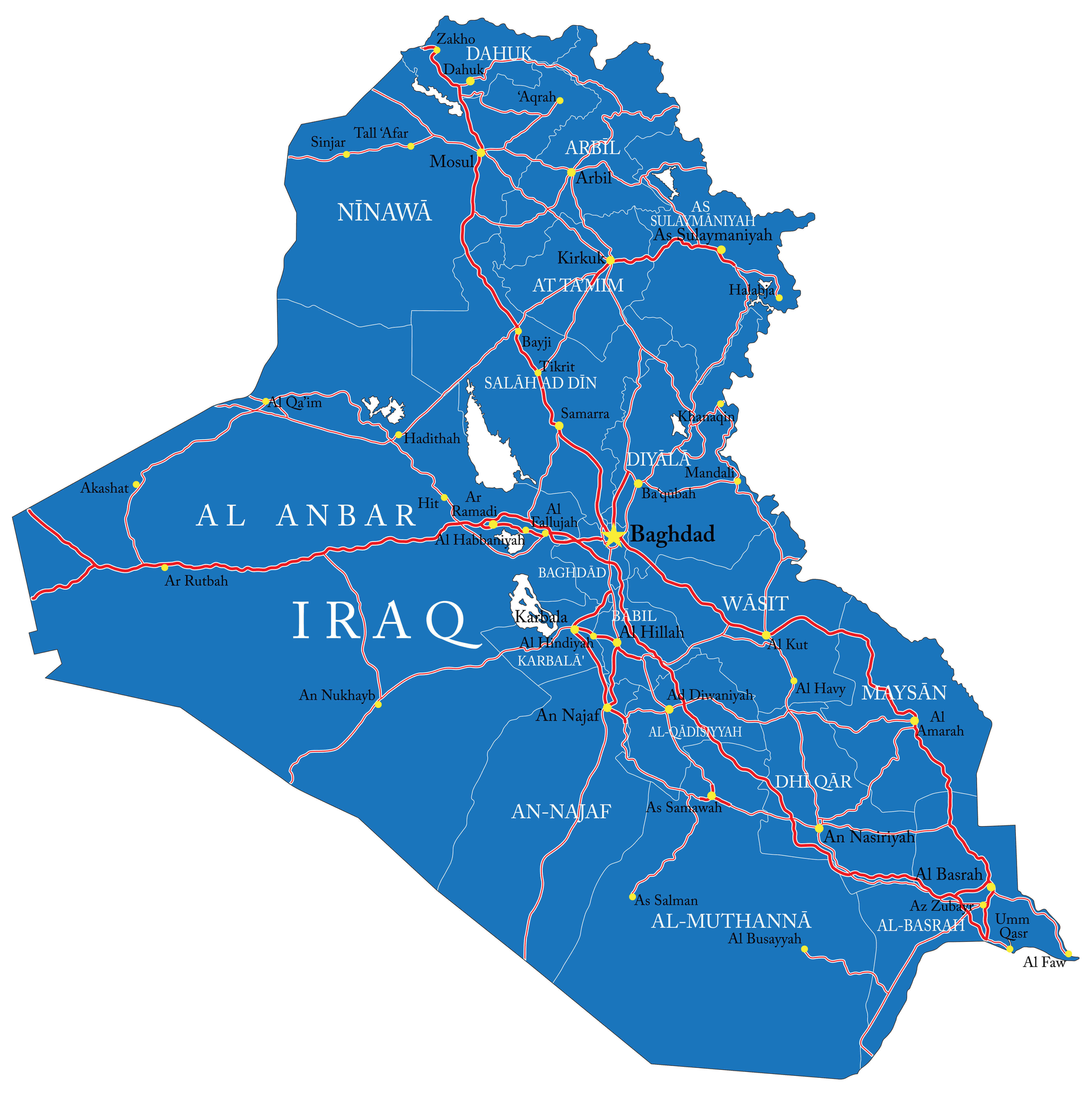
Iraq spans an area of about 438,317 square kilometers, making it one of the larger nations in the Middle East. Its landscape ranges from the fertile plains of central Iraq to vast desert areas in the west and mountainous terrain in the northeast along the borders with Turkey and Iran. The Tigris and Euphrates rivers are the country’s most significant geographic features, shaping the historic region of Mesopotamia, widely known as the “cradle of civilization.”
What Are the Main Regions of Iraq?
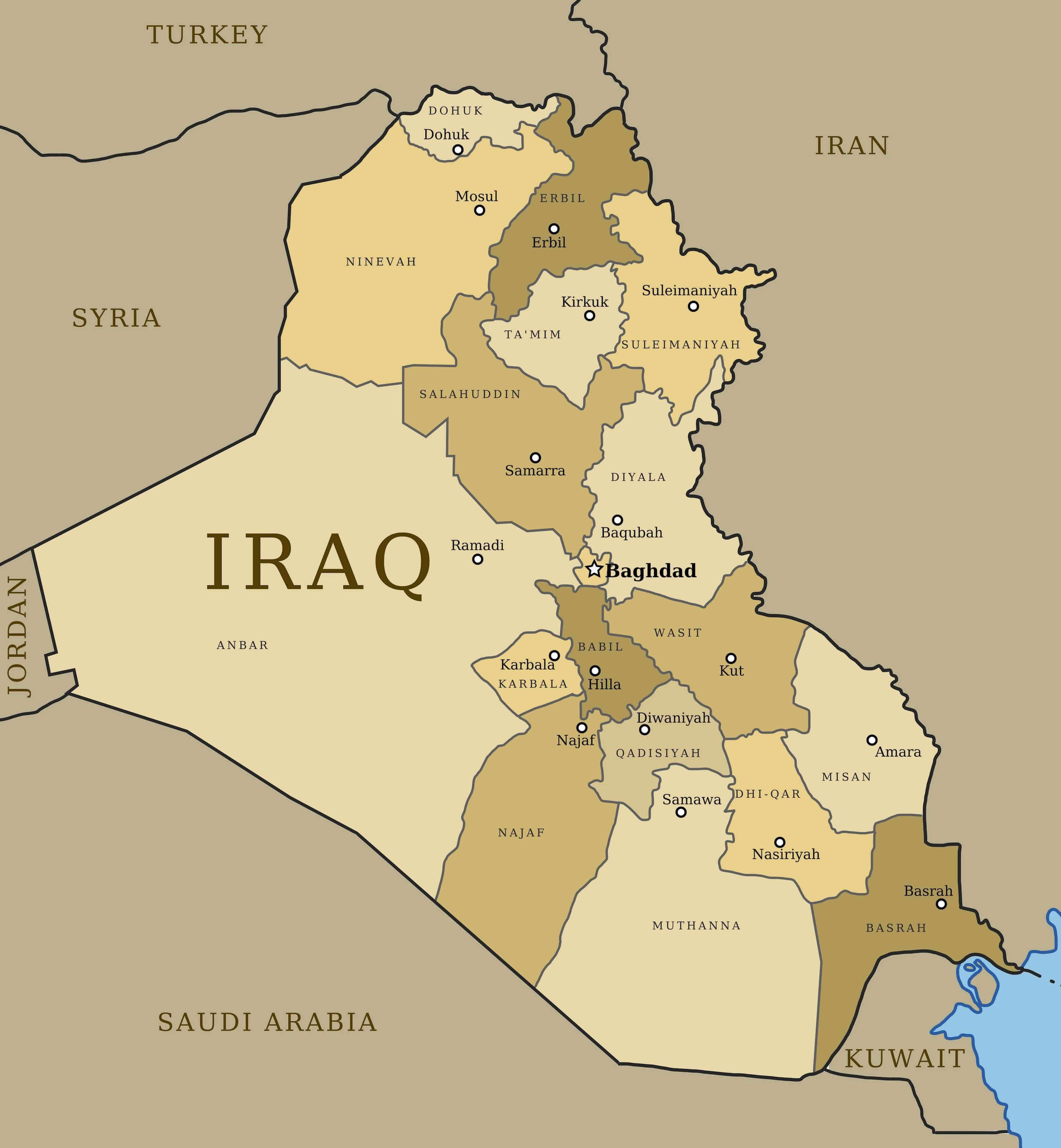
Iraq is administratively divided into 18 provinces (governorates). Some of the most important regions include:
- Baghdad Governorate – The capital region and the political, economic, and cultural center of Iraq.
- Basra Governorate – Located in southern Iraq near the Persian Gulf and known for its oil production and port facilities.
- Nineveh Governorate – A northern region whose largest city is Mosul, historically an important cultural and trade center.
- Anbar Governorate – The largest province in Iraq, located in the western desert region.
- Erbil Governorate – Part of the Kurdistan Region and one of the major economic centers in northern Iraq.
What Are the 5 Largest Cities in Iraq?
The five largest cities in Iraq by population are:
- Baghdad – The capital and largest city of Iraq, serving as the country’s political and economic center.
- Basra – Iraq’s main port city located in the south near the Persian Gulf.
- Mosul – A historic northern city located along the Tigris River.
- Erbil – The capital of the Kurdistan Region and one of the oldest continuously inhabited cities in the world.
- Kirkuk – An important city known for its oil resources and diverse population.
Quick Facts About Iraq
| Official Name: | Republic of Iraq |
|---|---|
| Area: | 438,317 km² |
| Capital: | Baghdad |
| Population: | Approximately 44 million |
| Currency: | Iraqi dinar (IQD) |
| GDP: | Approx. $260 billion (nominal) |
| Per capita: | $5,670 (nominal) |
| Time Zone: | Arabia Standard Time (AST, UTC+3) |
| Calling code: | +964 |
| Internet TLD: | .iq |
Why Iraq’s Location Is Important
Iraq occupies a strategically significant location in the Middle East because of its central position and abundant energy resources. Situated between major regional powers, the country serves as an important link between the Persian Gulf and the eastern Mediterranean. As one of the world’s leading oil producers, Iraq plays a crucial role in global energy supply, and its proximity to major trade routes and energy corridors gives it considerable influence in regional politics and international energy markets.
Frequently Asked Questions
Is Iraq part of the Middle East?
Yes. Iraq is situated in Western Asia and is widely recognized as one of the central countries of the Middle East region.
Which countries share borders with Iraq?
Iraq borders six countries: Turkey to the north, Iran to the east, Kuwait and Saudi Arabia to the south, Jordan to the southwest, and Syria to the west.
What city is the capital of Iraq?
Baghdad is the capital of Iraq and the country’s largest city, serving as its main political, economic, and cultural center.
Does Iraq have access to the sea?
Yes. Iraq has a short coastline along the northern Persian Gulf, located in the southern Basra region.
What geographic features is Iraq known for?
Iraq is famous for the Tigris and Euphrates rivers, the fertile plains of ancient Mesopotamia, vast desert landscapes in the west, and mountainous terrain in the northern regions.
Feel free to explore these pages as well:
- Head of Performance Marketing
- Head of SEO
- Linkedin Profile: linkedin.com/in/arifcagrici