Political Map of Europe in 1500
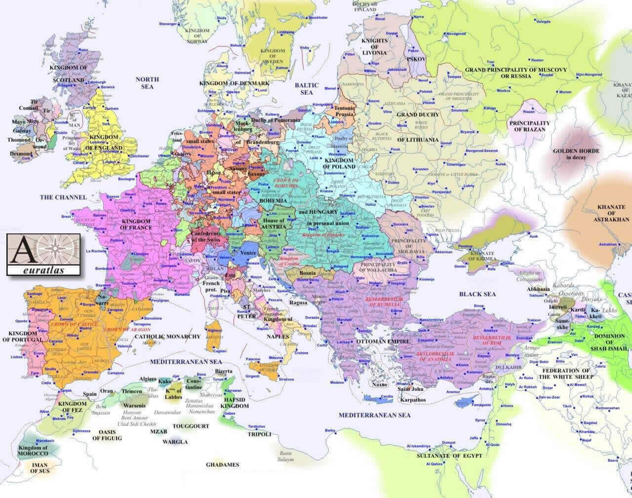 Europe political map in 1500 showing empires and kingdoms of the early modern era.
This historical map depicts the political landscape of Europe in the year 1500, showcasing the major empires, kingdoms, duchies, and territories of the early modern era. Key powers such as the Ottoman Empire, the Kingdom of France, the Holy Roman Empire, and the Grand Duchy of Lithuania are highlighted, providing valuable insight into Europe’s geopolitical divisions at the dawn of the 16th century.
Europe Historical Political Map in 1944
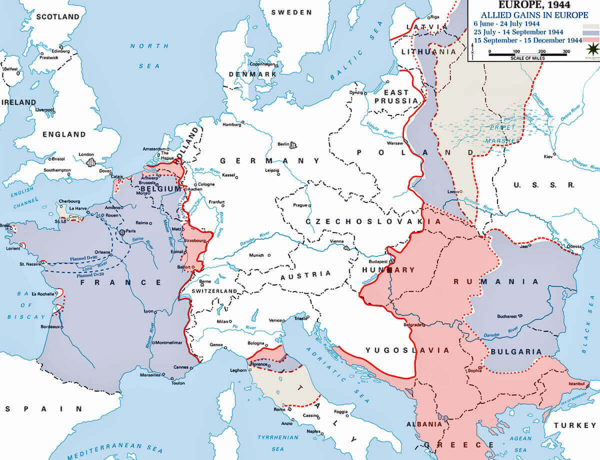 Europe 1944 political map with WWII frontlines and Allied advances in Europe.
This 1944 political map of Europe highlights the critical frontlines of World War II, tracking the Allies' advances from June to December. It outlines occupied territories, troop movements, and shifting borders during the war’s final stages, offering a clear visual representation of Europe’s military and geopolitical landscape at the time.
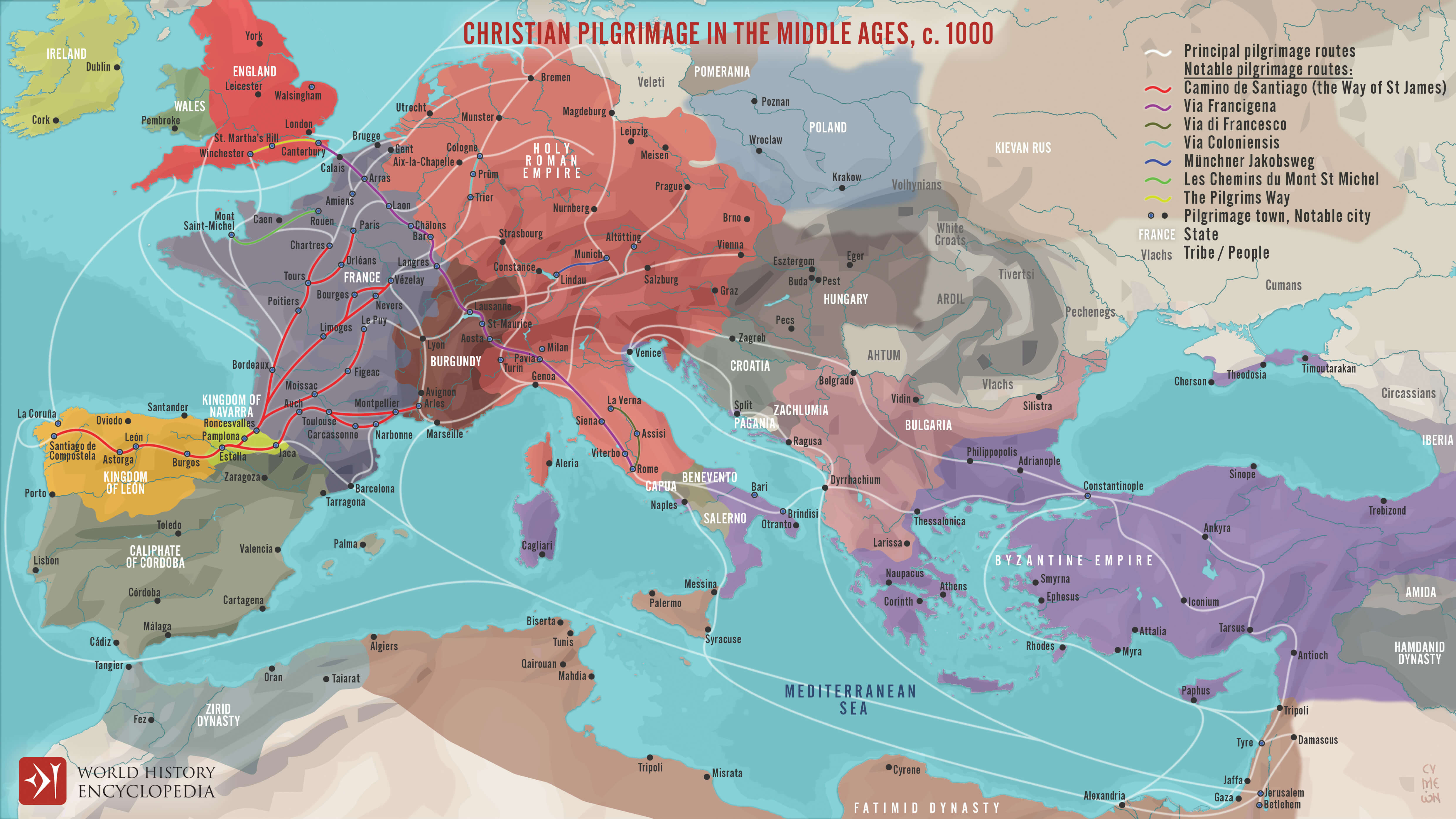
Europe Christian Pilgrimage map in the Middles 1000
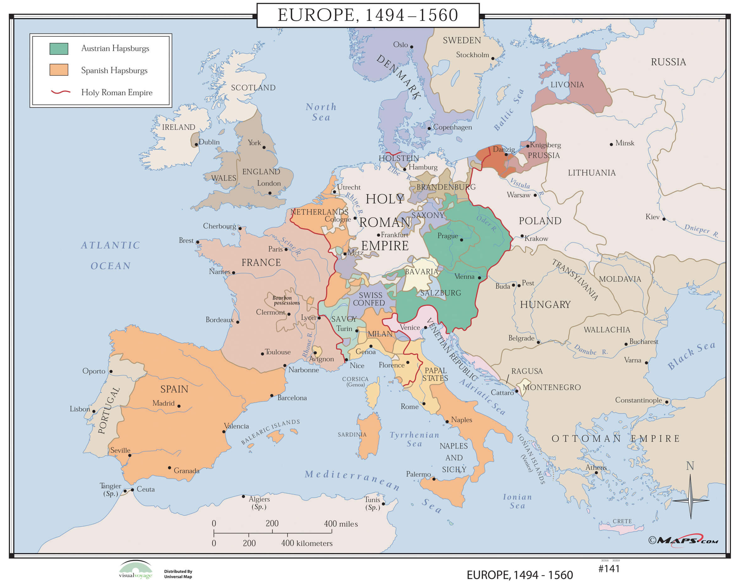
Europe Historical map 1494 1560
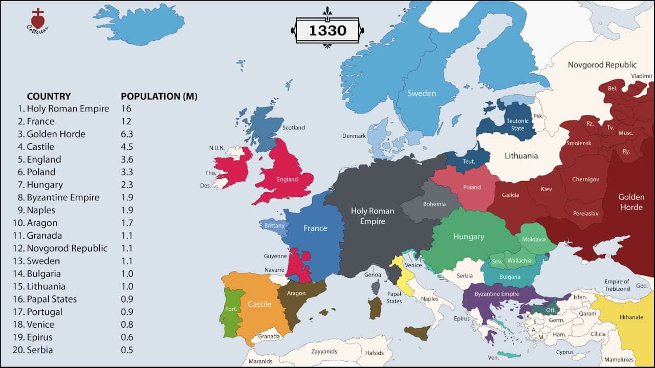
Europe Historical map in 1330
Europe History map 1730

Europe History map 1920

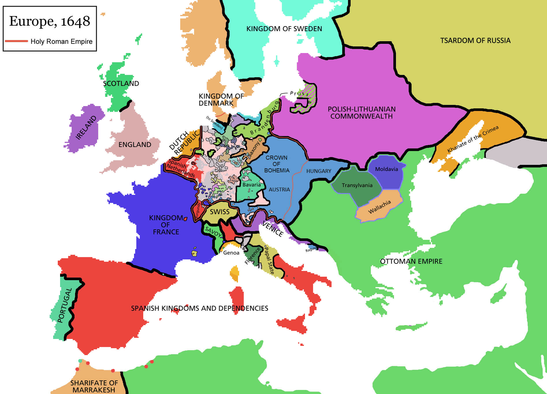
Europe History map in 1648
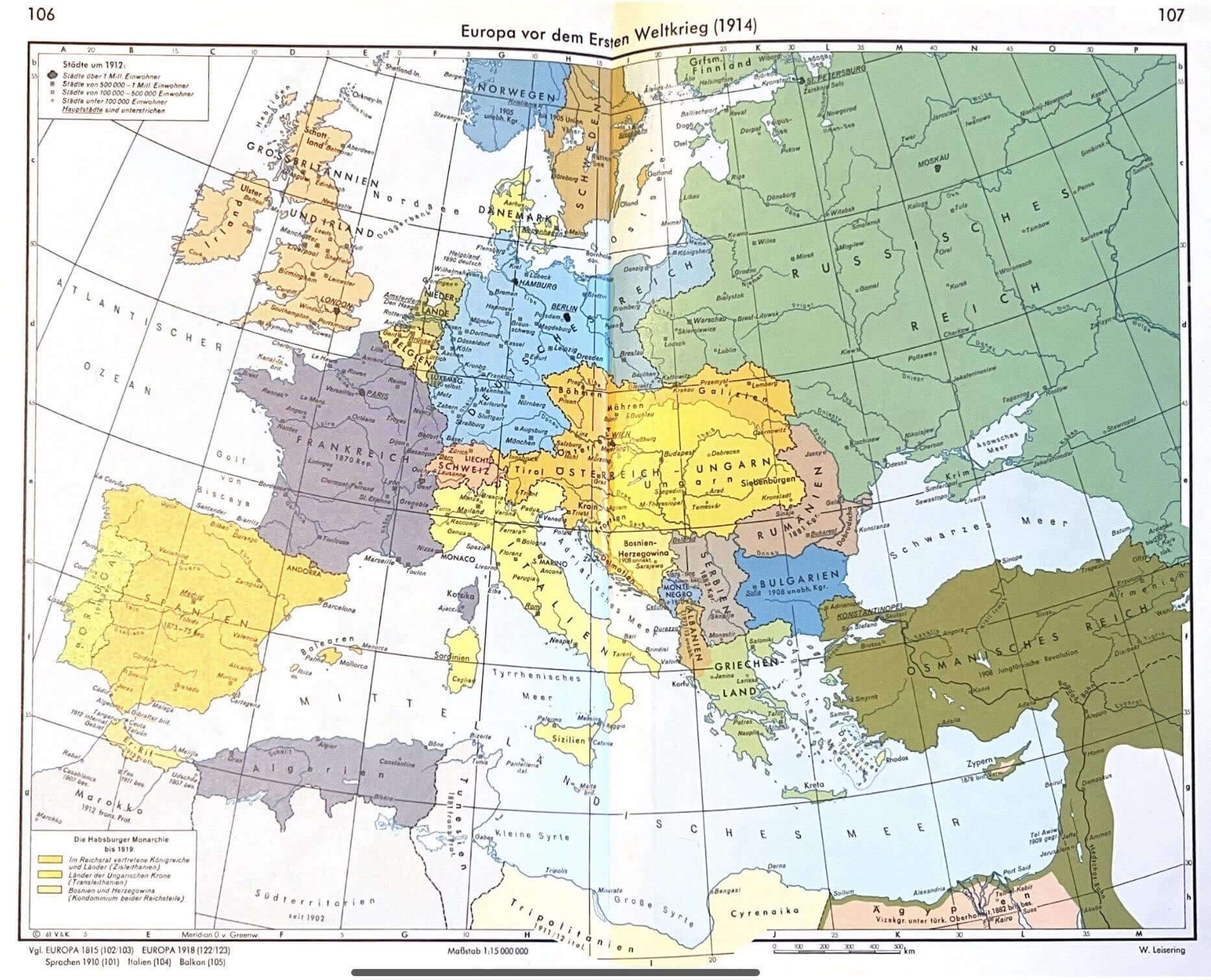
Europe map of the World war 1914
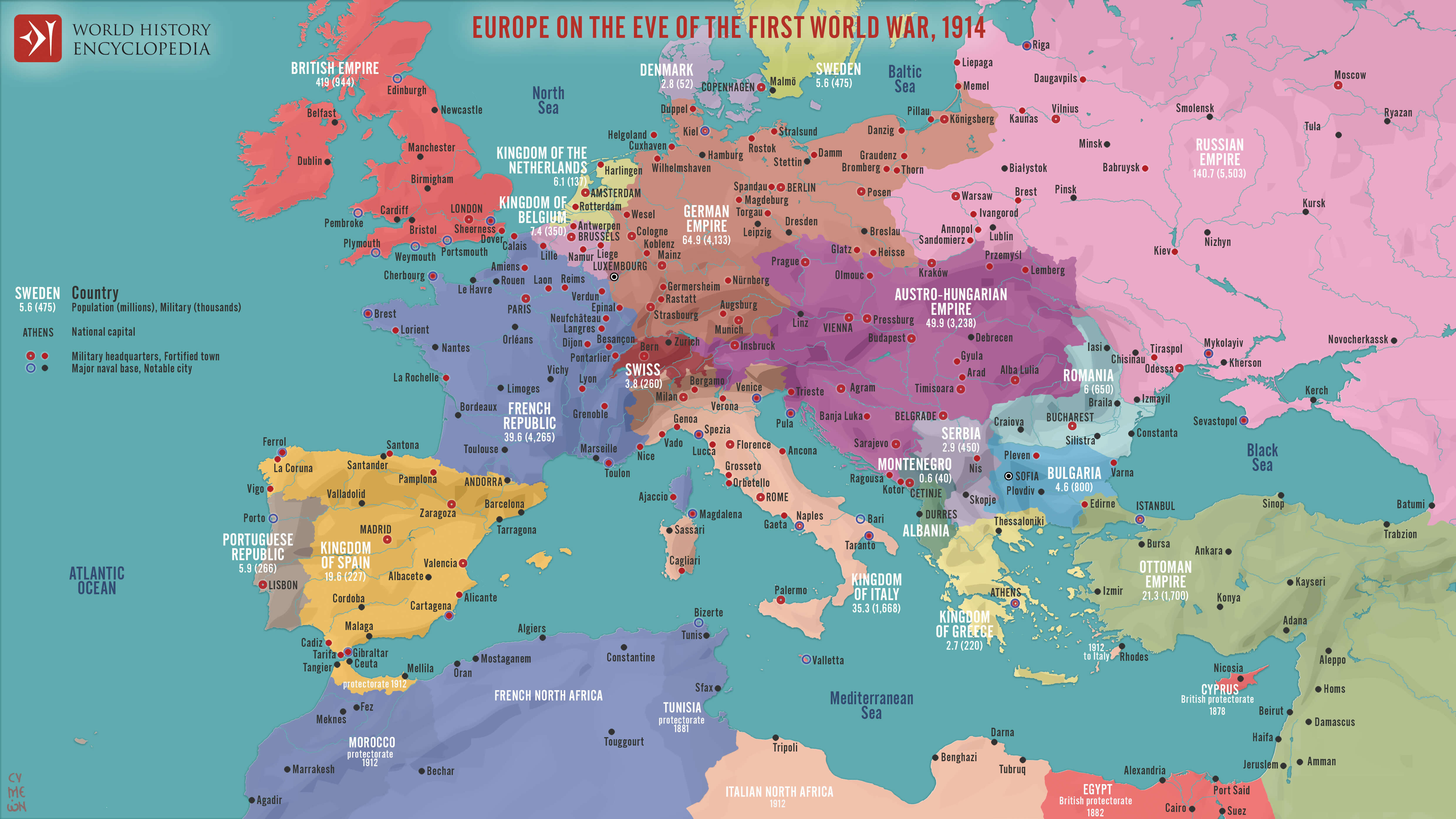
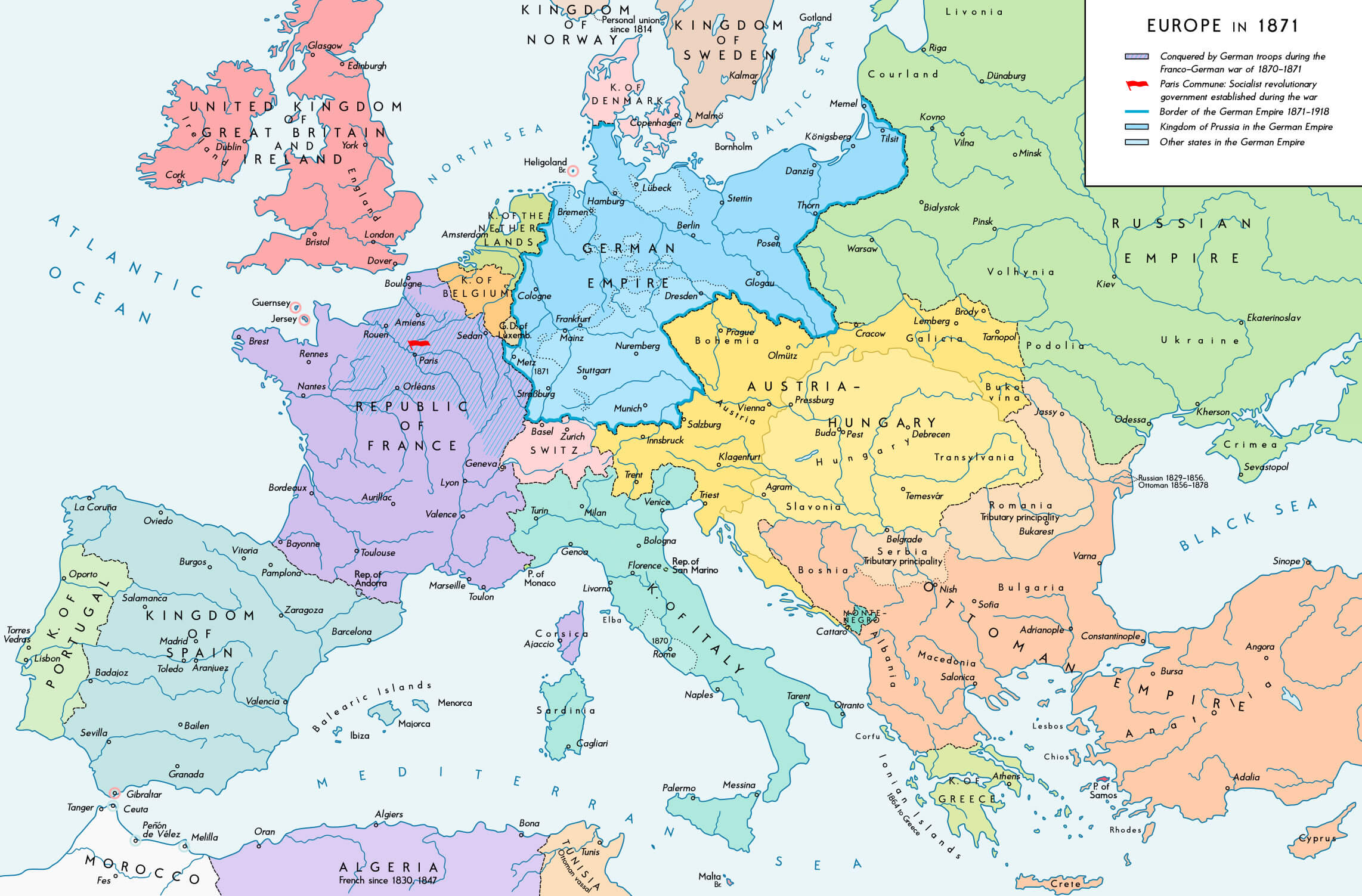
Europe political map 1871 1914

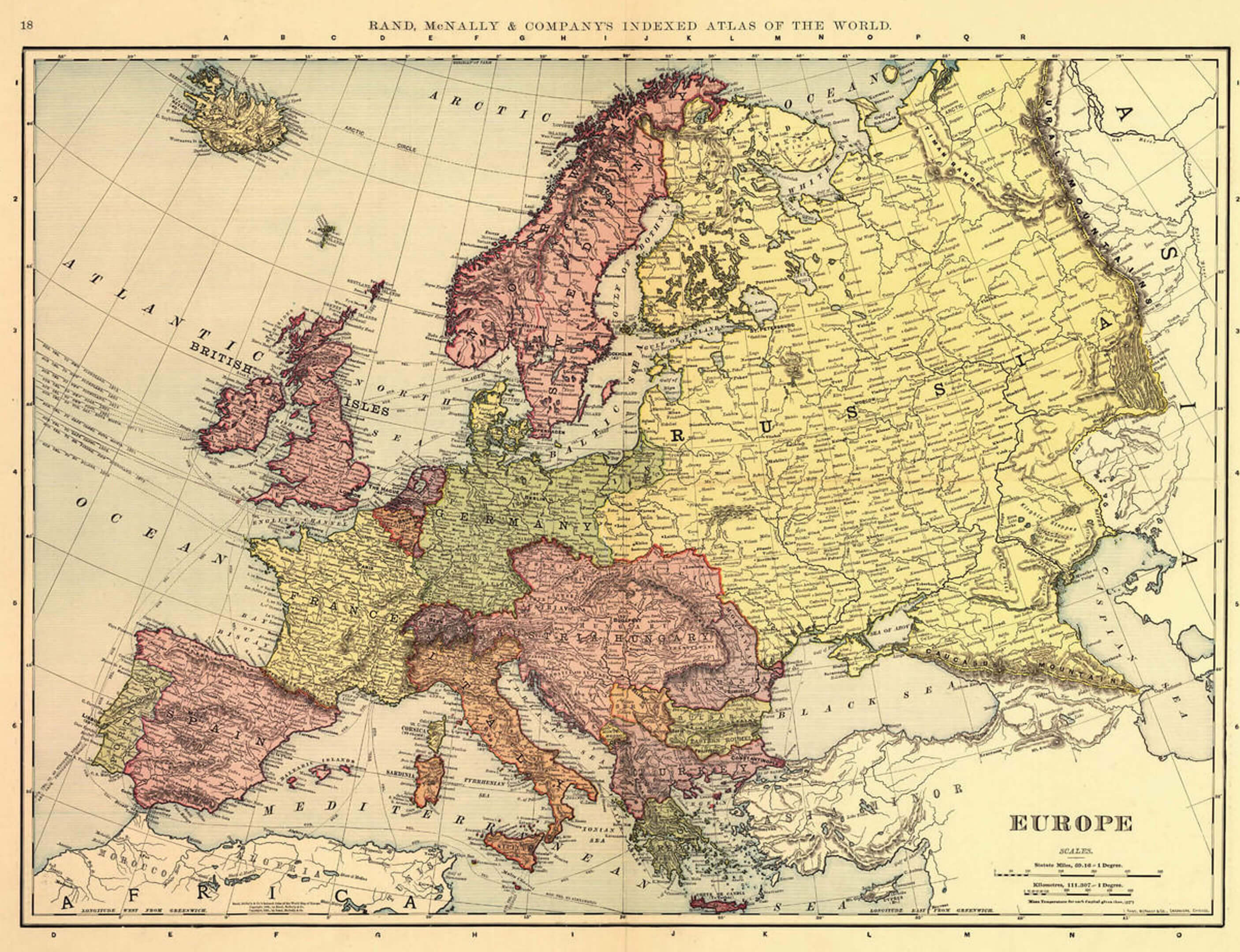
Historical atlas map of Europe
History map of Europe in 1871
History map of Europe in 1914
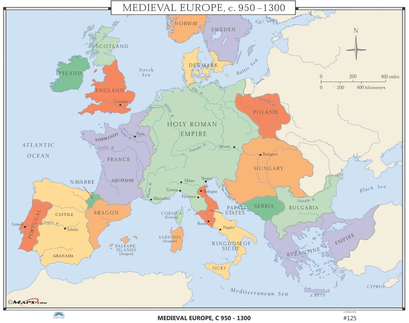
Medieval Europe map 950 1300
Medieval maps of Europe
