Florida Free Printable Map
Which are the largest cities in Florida? What is the population of Florida? Where to visit in Florida? List of counties of Florida.
Florida Major Cities Map, Florida Map with Georgia and Alabama, Florida Map with Gulf of Mexico, Florida Map with Miami and Tampa, Florida Map with South East States of US, Florida Map with The Bahamas, Florida Roads and Train Lines Map, Florida Satellite Map and more maps, photos, satellite images...What are the Largest Cities in the US and World by Population ?
US Largest Cities Map World Largest Cities Map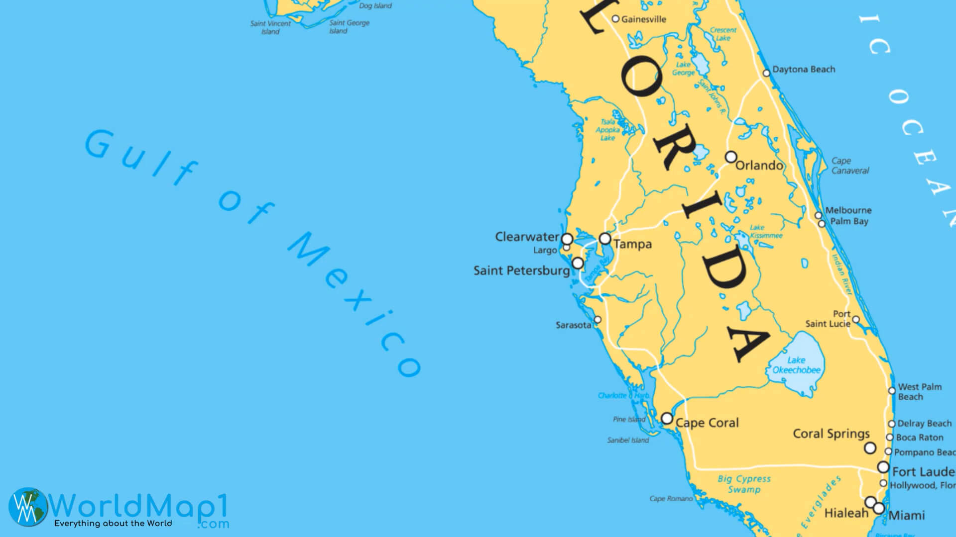
Where is Florida in the US and Cities Map of Florida
Please subscribe on "World Guide" channnel on Youtube at youtube.com/c/WorldGuide
Florida Major Cities Map
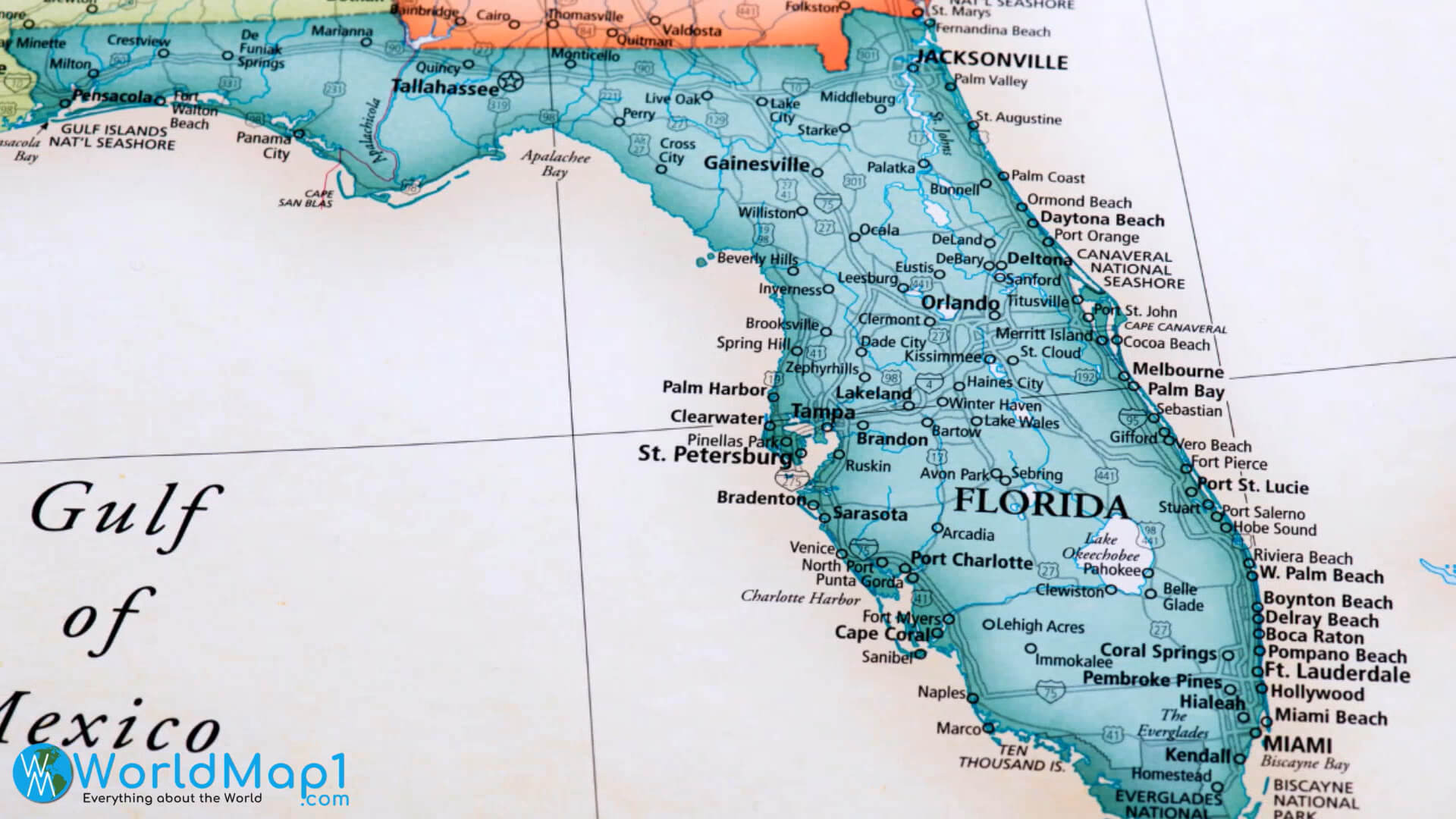
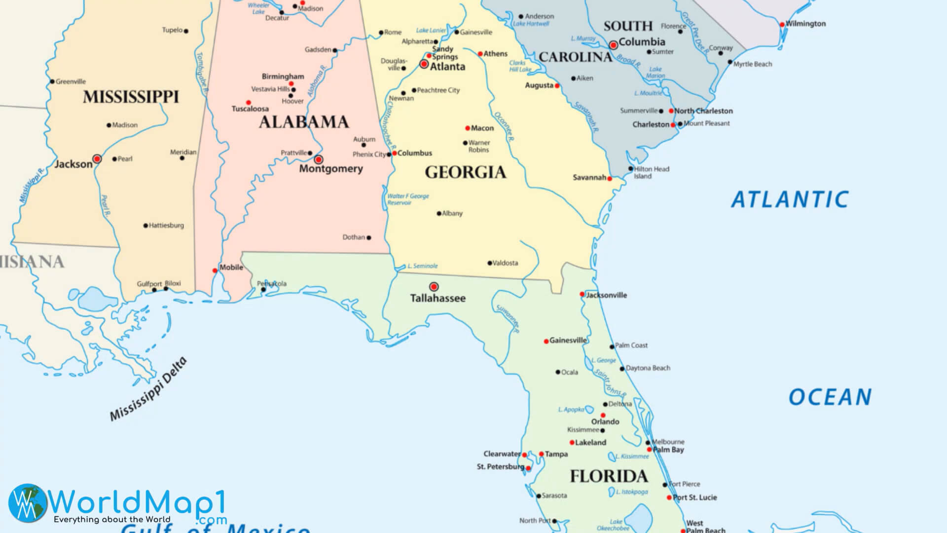
Florida Map with Georgia and Alabama
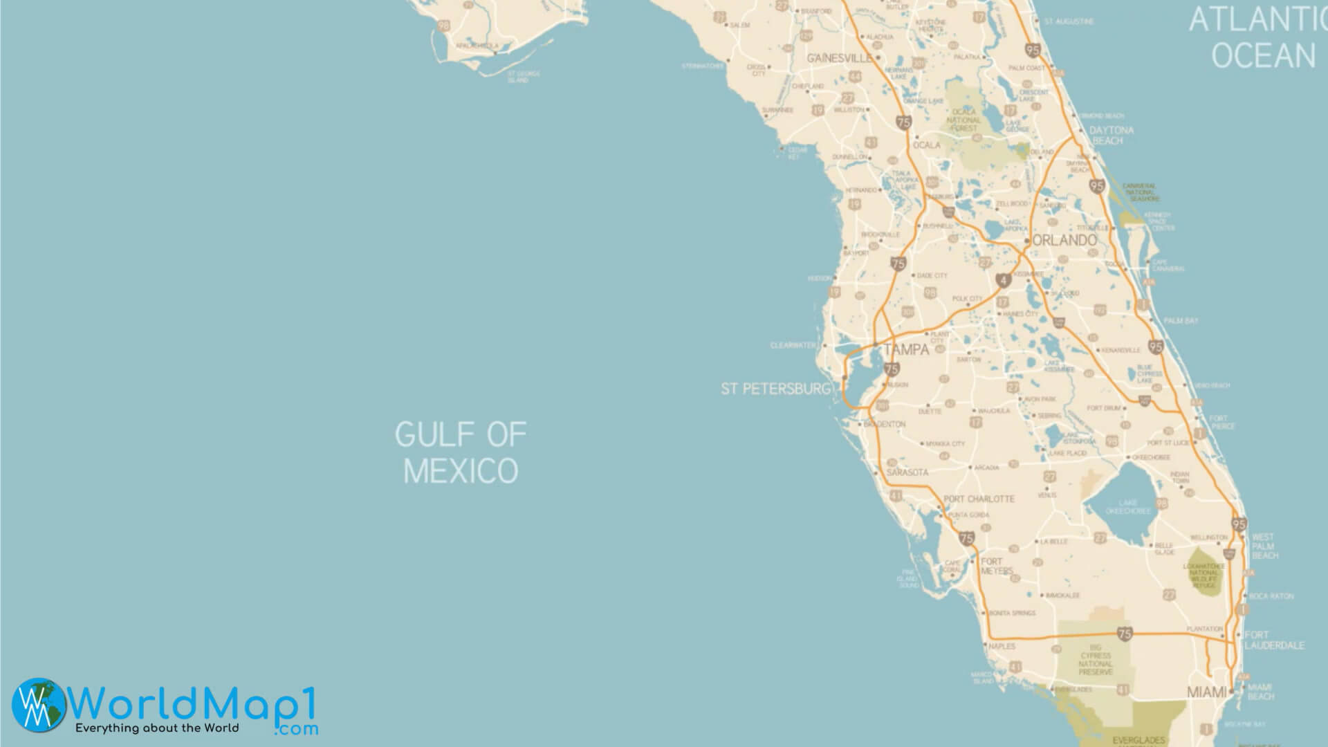
Florida Map with Gulf of Mexico
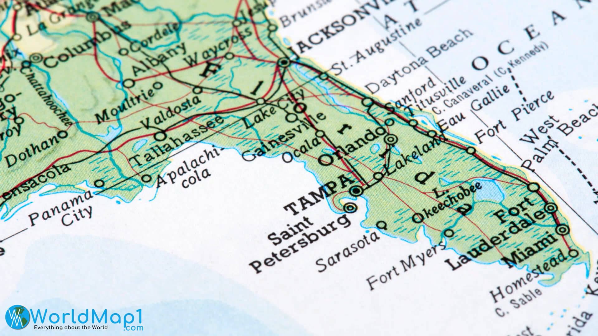
Florida Map with Miami and Tampa
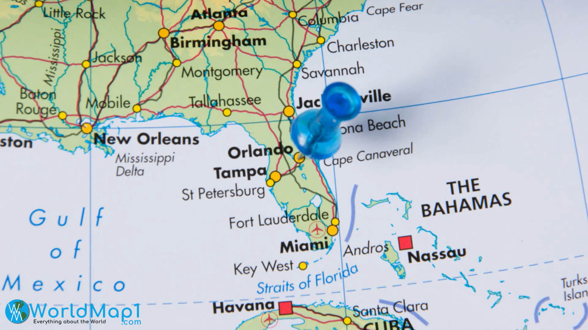
Florida Map with South East States of US
Please view more Florida Cities Aerial Views, Map and Photos
High Detailed Florida Map Florida Free Printable Map Where is Located Florida in the US and Cities Map of FloridaFlorida Map with The Bahamas
Florida Rivers Map with Auto Routes
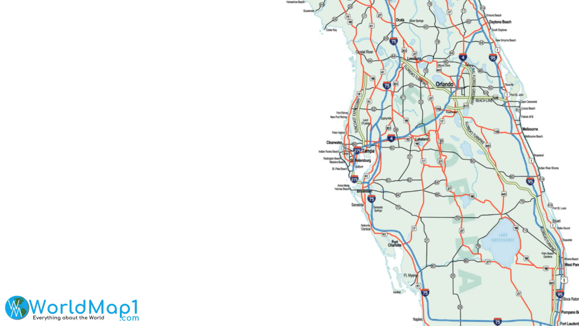
Florida Roads and Train Lines Map
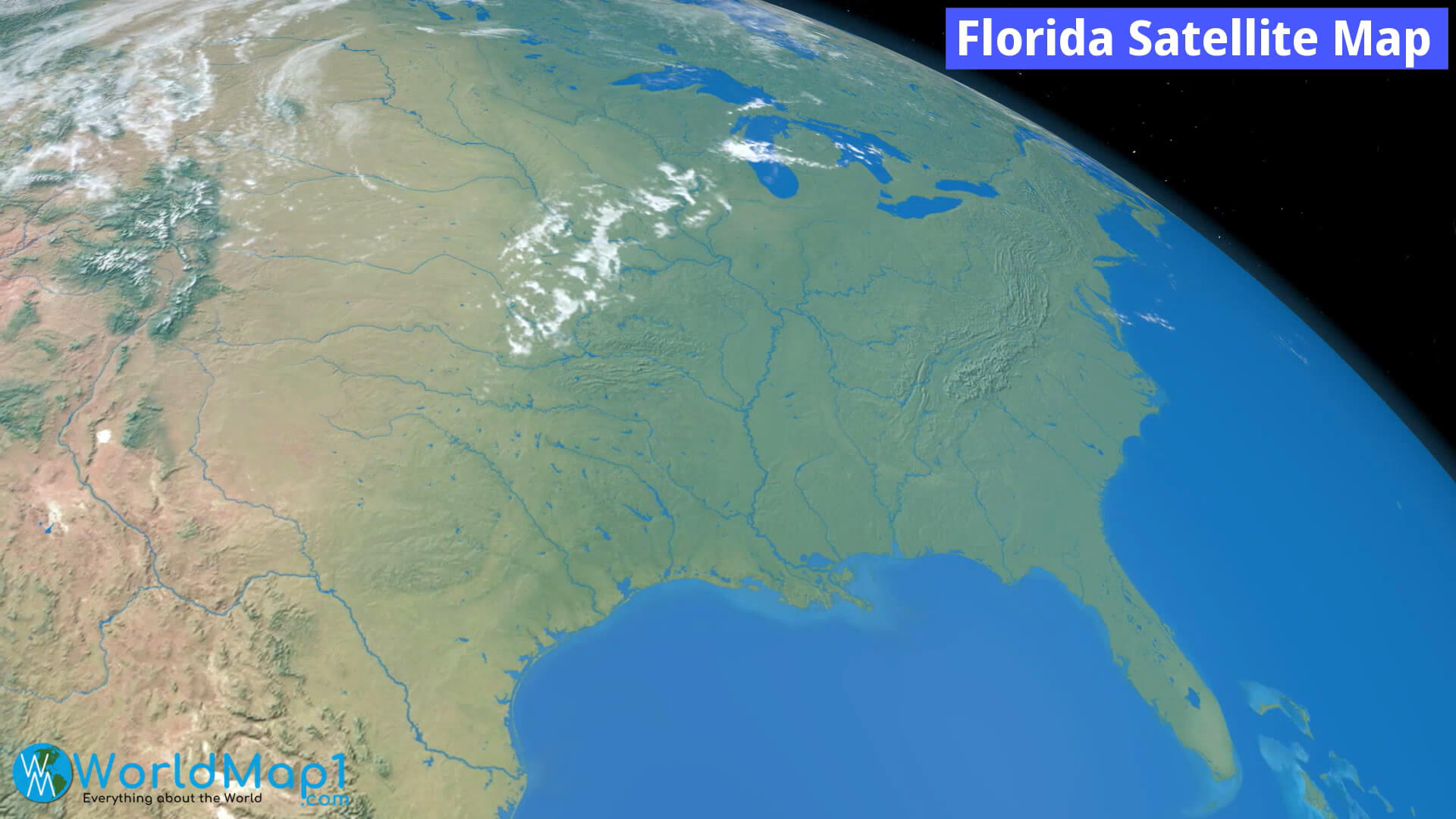
Florida Satellite Map
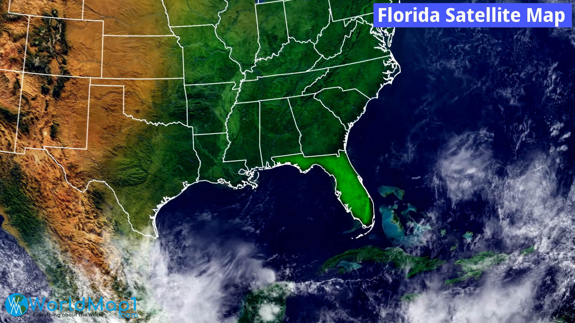
Florida Satellite View from Space
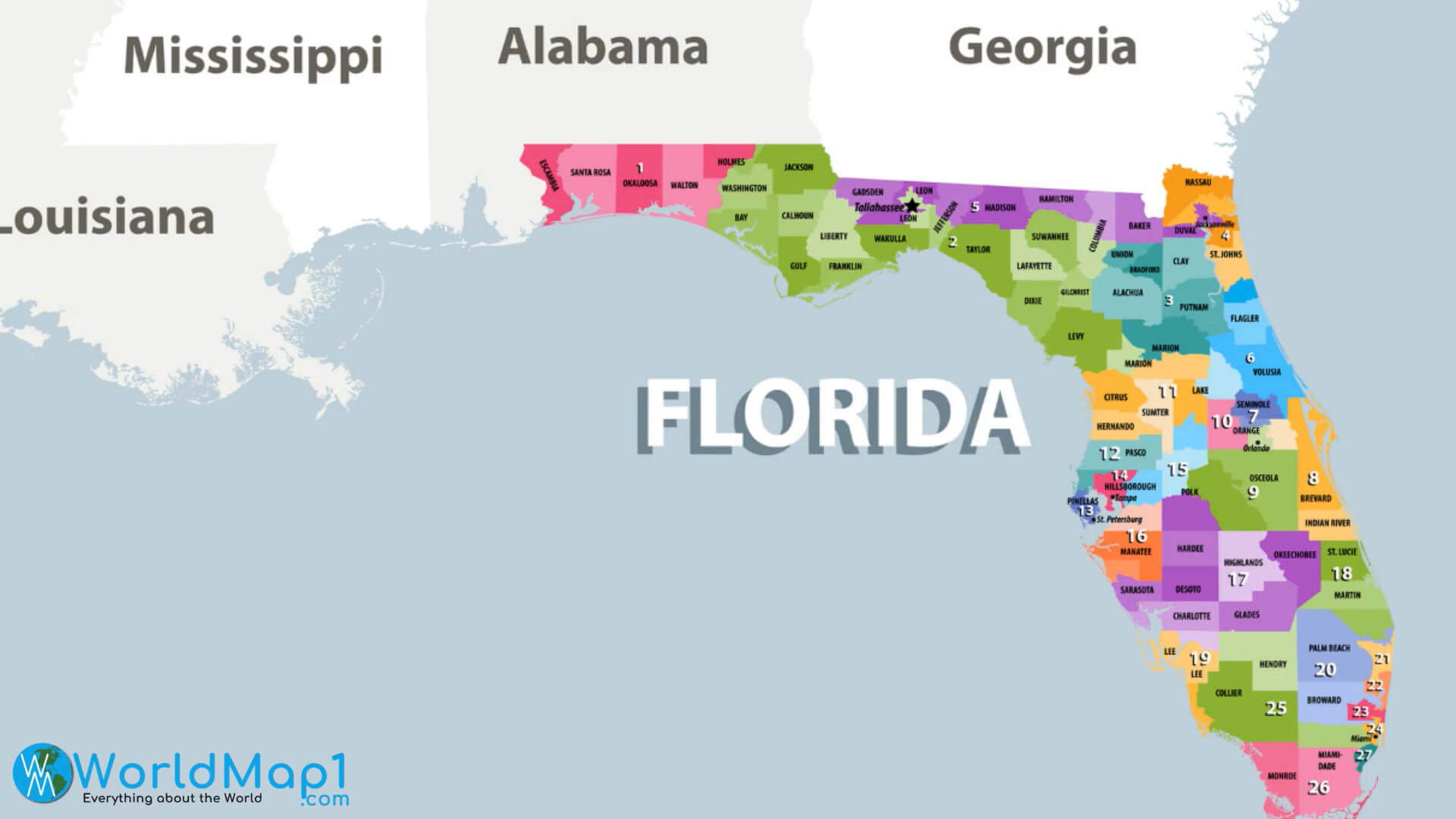
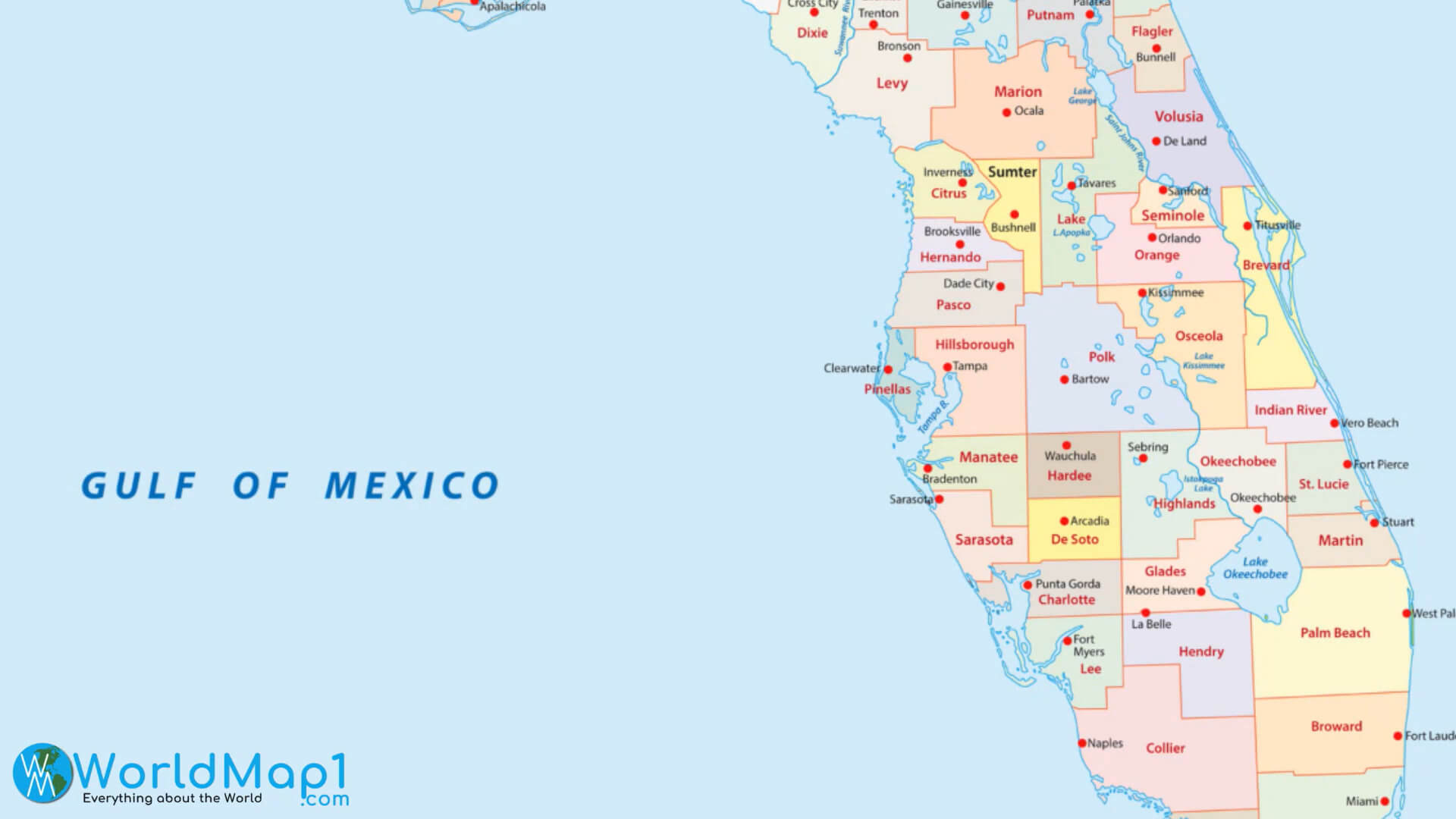
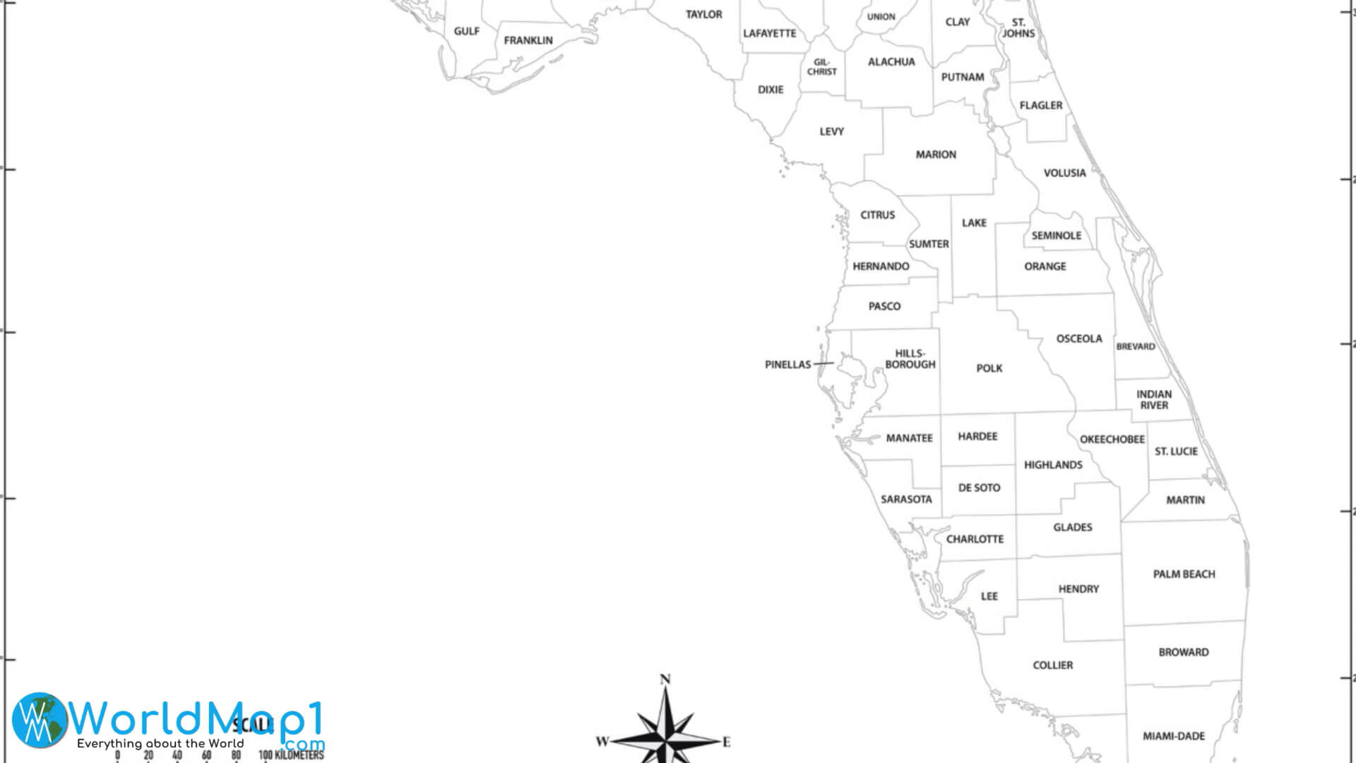
Florida State and Counties Maps
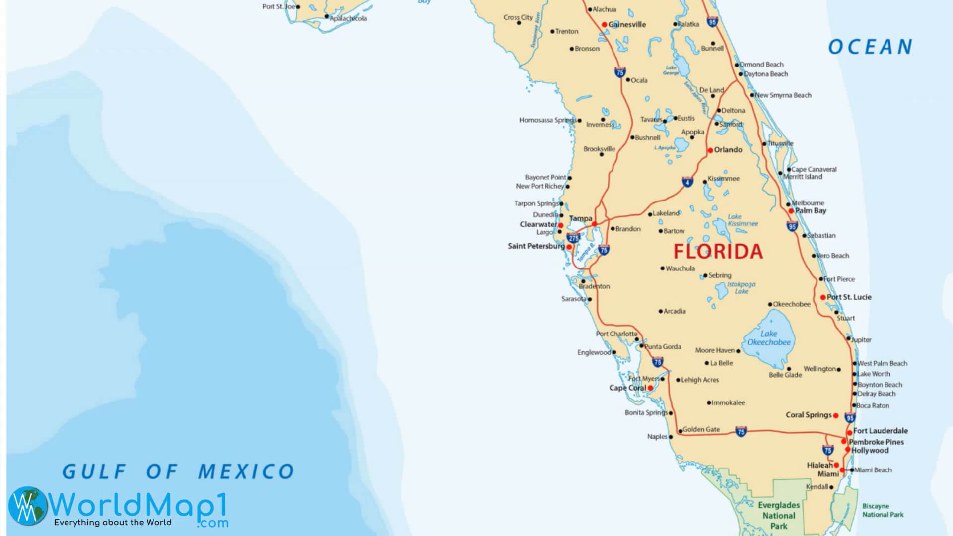
Florida State Map
Florida State Outline Map
For More Florida and United States Maps, Images
Where is Florida in the US and Cities Map of Florida
Please subscribe on "World Guide" channnel on Youtube at youtube.com/c/WorldGuide
Hurricane Ian Towards Florida and See What Looks Like From Space on WorldGuide Youtube Channel
Hurricane Ian Towards Florida with Strengthened into a Category 4 Storm
Hurricane Ian has strengthened into a Category 4 storm, just 2 mph shy of hitting 157 mph, a Category 5 storm. Hurricane Ian is expected to make landfall on Florida's west coast in the early afternoon on Wednesday September 28, 2022.Category 4 Hurricane Ian Hitting Florida Live
Author: Arif Cagrici
- Head of Performance Marketing
- Head of SEO
- Linkedin Profile: linkedin.com/in/arifcagrici