Map of Mexico, Mexico
Navigate Mexico map, Mexico country map, satellite images of Mexico, Mexico largest cities, towns maps, political map of Mexico, driving directions, physical, atlas and traffic maps in Mexico.
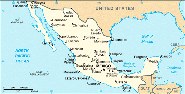
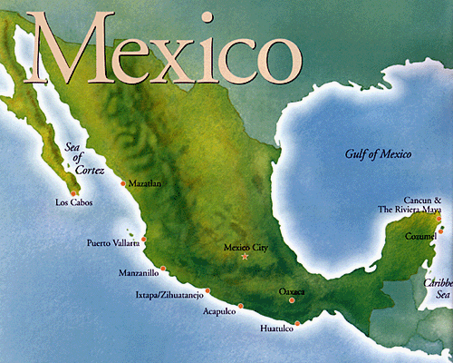
MAP OF MEXICO

Mexico City Maps
Acapulco Aguascalientes Cancun Mexico City Ciudad Juarez Cuernavaca Culiacan Durango Guadalajara Hermosillo Leon Matamoros Merida Monterrey Morelia Oaxaca Pachuca Puebla Queretaro Reynosa Saltillo San Luis Potosi Tampico Tijuana Toluca Torreon Tuxtla Gutierrez Veracruz Villahermosa JalapaA Collection of Mexico Maps and Mexico Satellite Images
MAP OF MEXICO
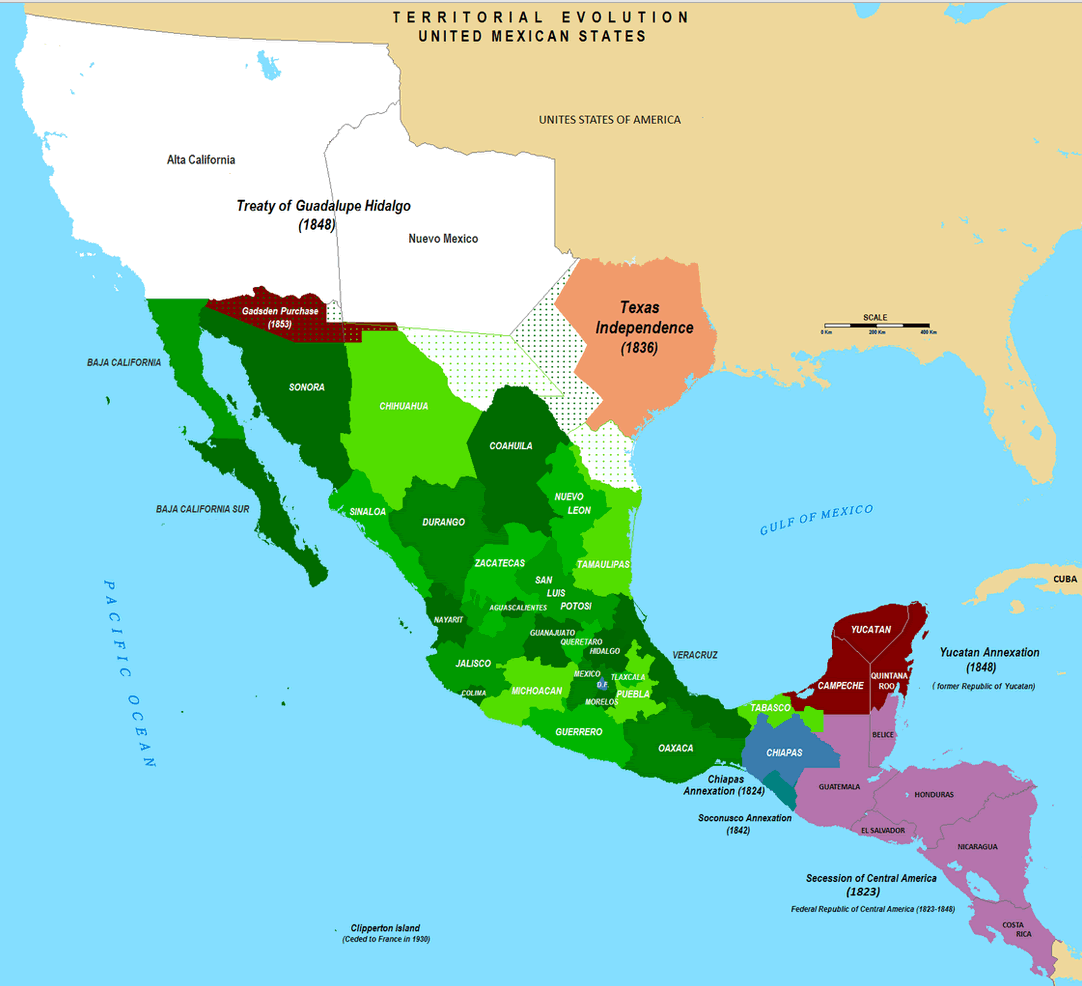
TERRITORIAL EVOLUTION MAP OF MEXICO
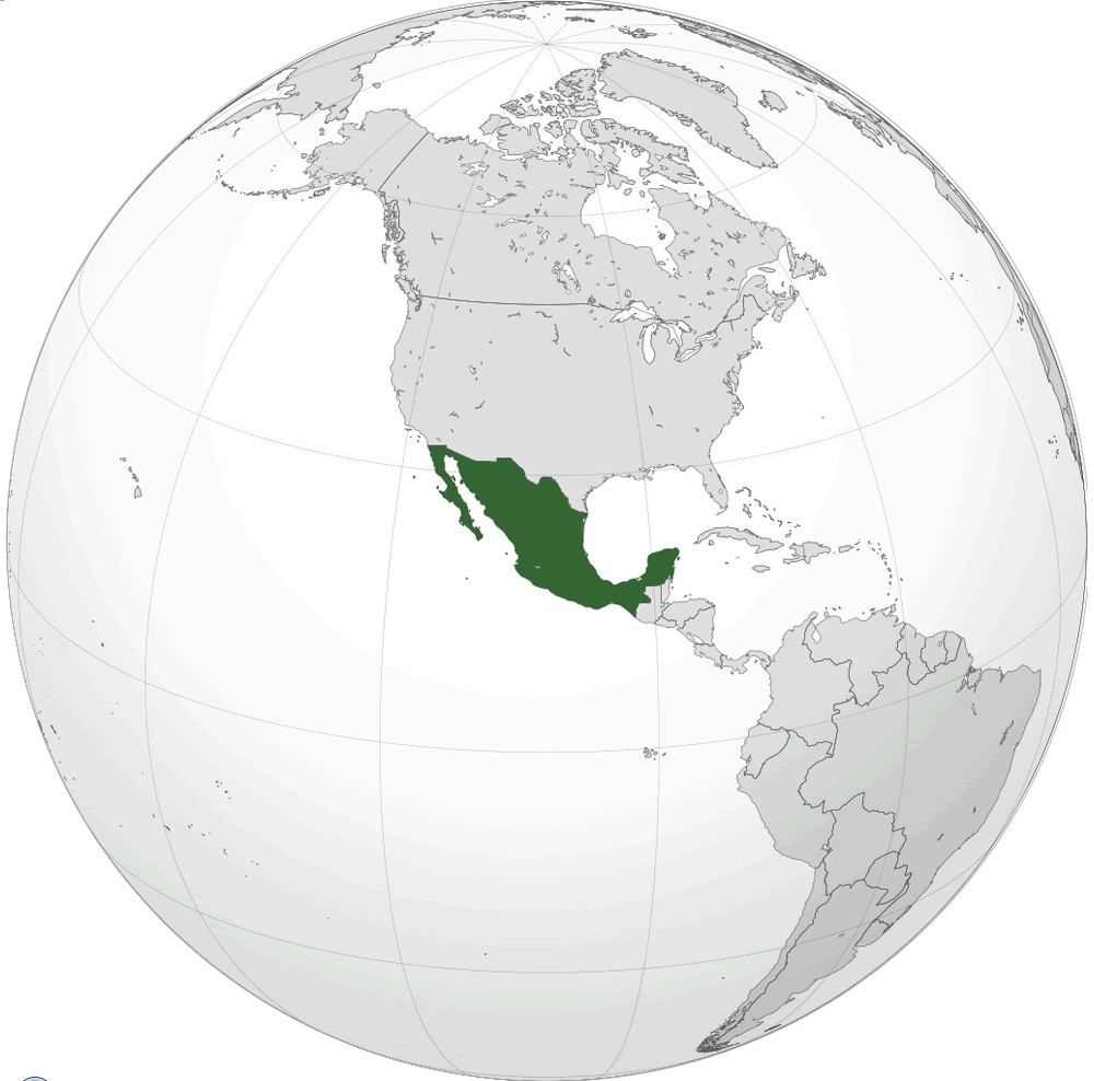
WHERE IS MEXICO IN THE WORLD
MAP OF MEXICO
MAP OF MEXICO
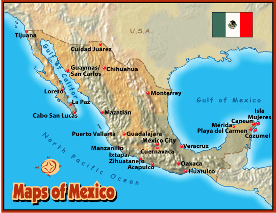
MAPS OF MEXICO
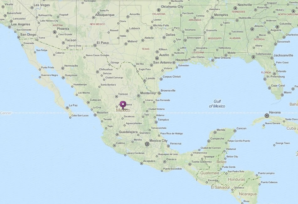
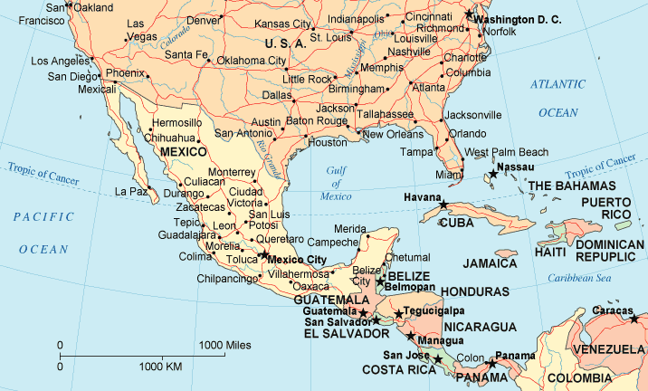
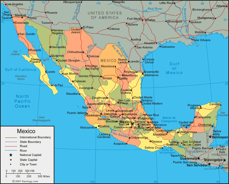
MEXICO MAP USA
MEXICO MAP

MEXICO MAP
MEXICO REGIONS MAPS
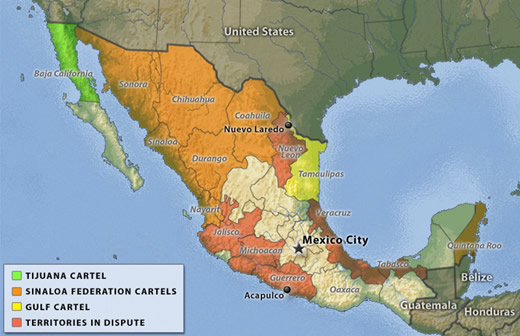
MEXICO CARTEL MAP
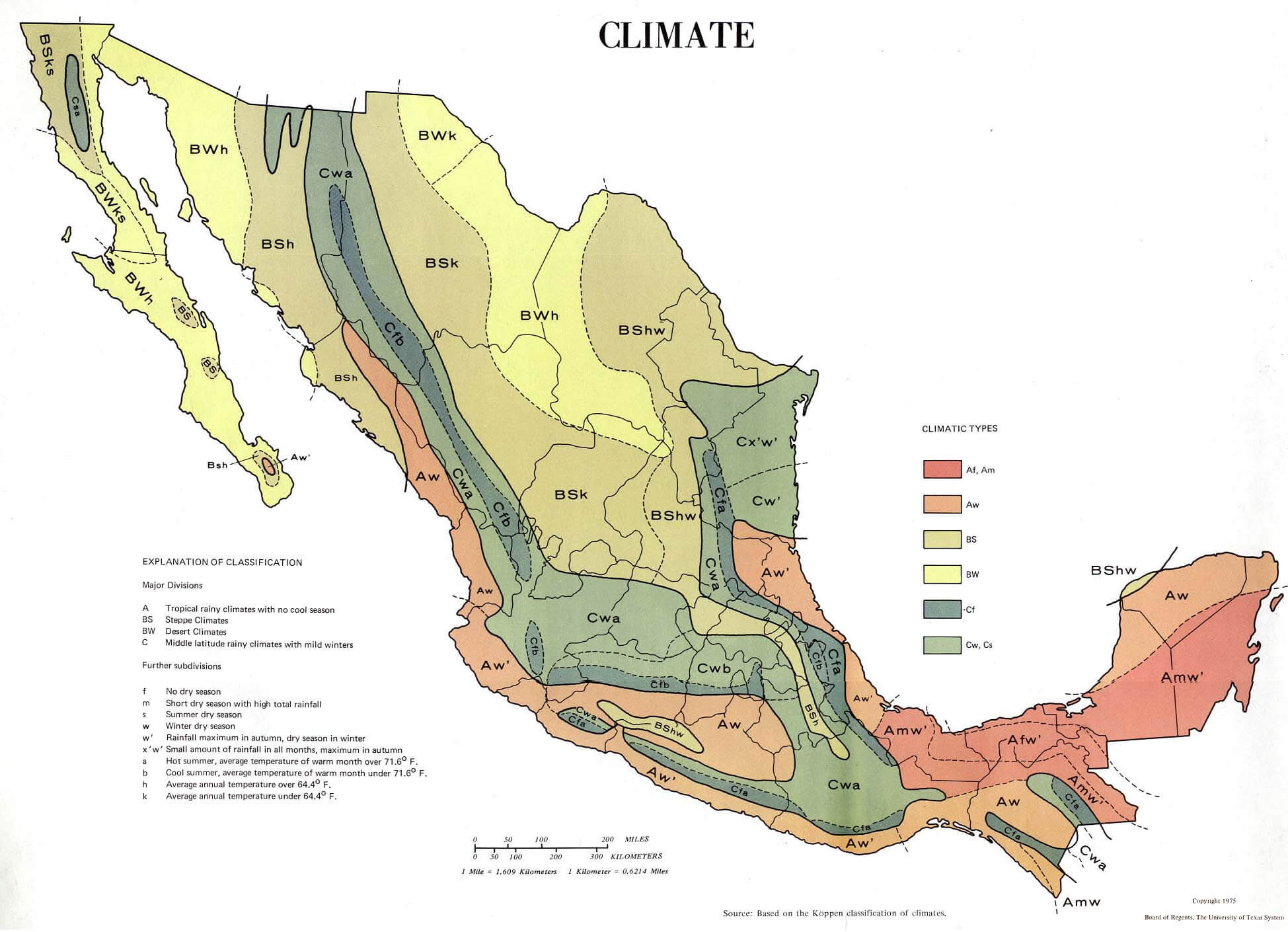
MEXICO CLIMATE MAP
MEXICO MAP
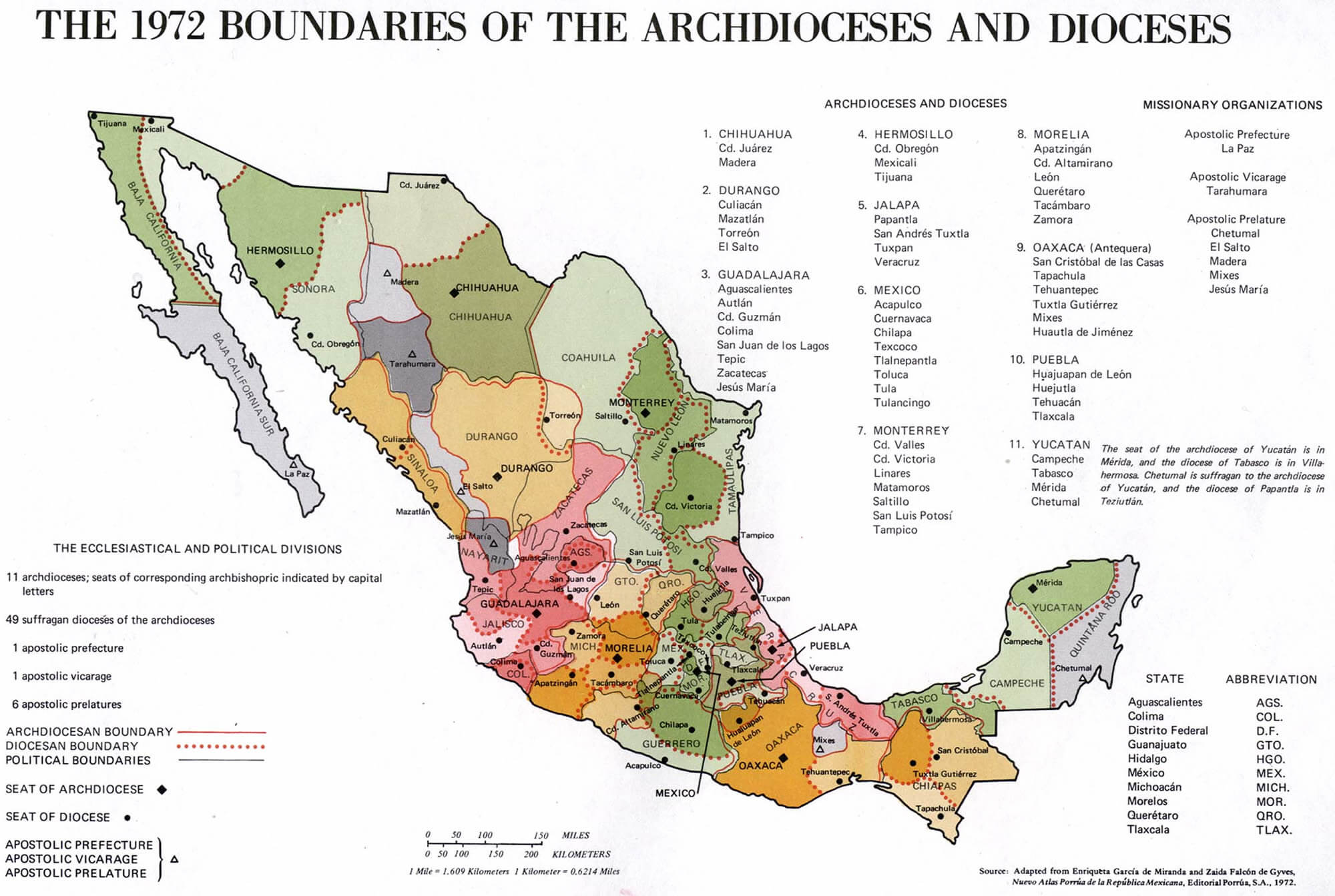
MEXICO MAP BOUNDARIES
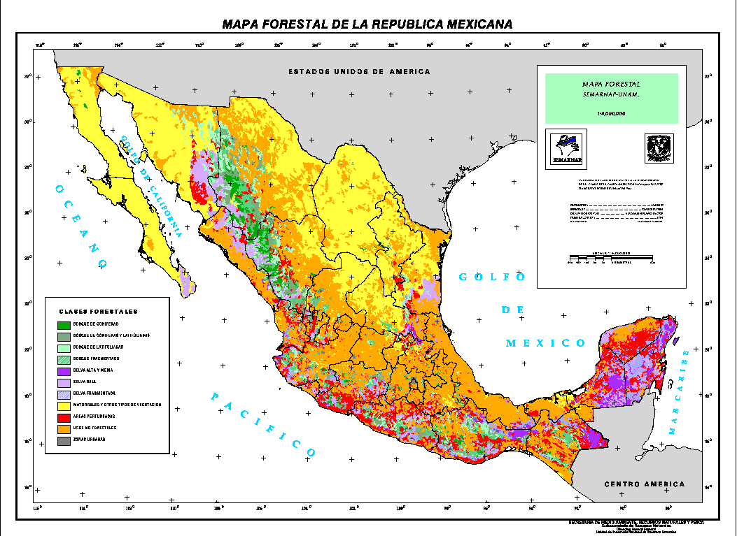
MEXICO MAP FOREST
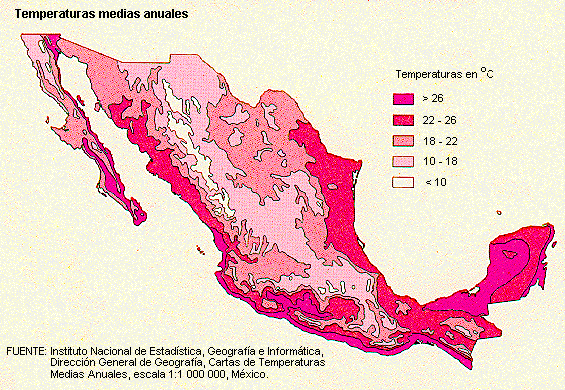
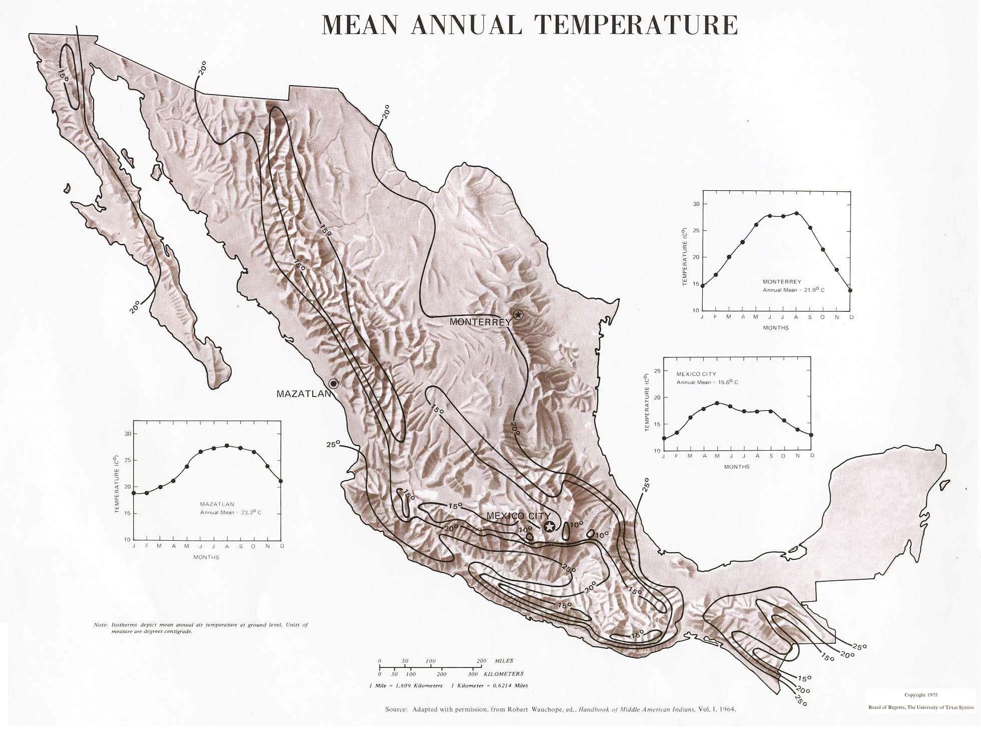
MEXICO MAP TEMPERATURES
MEXICO MAPS
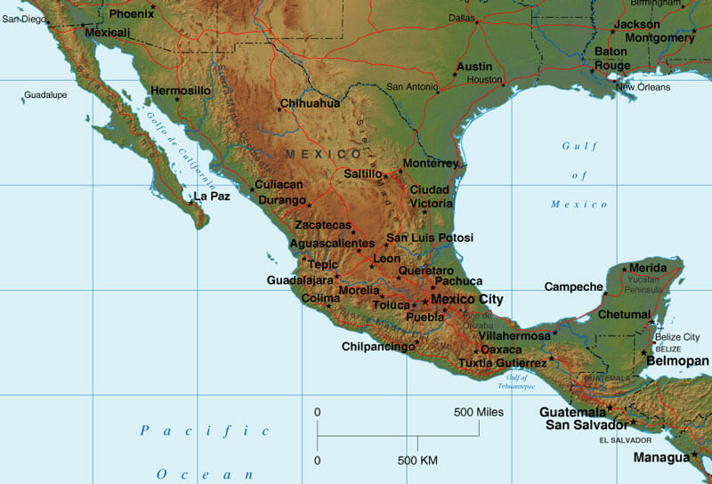
MEXICO PHYSICAL MAP
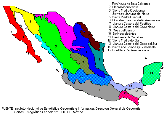
MEXICO PHYSIOGRAPHICAL MAP
MEXICO REGIONS MAP
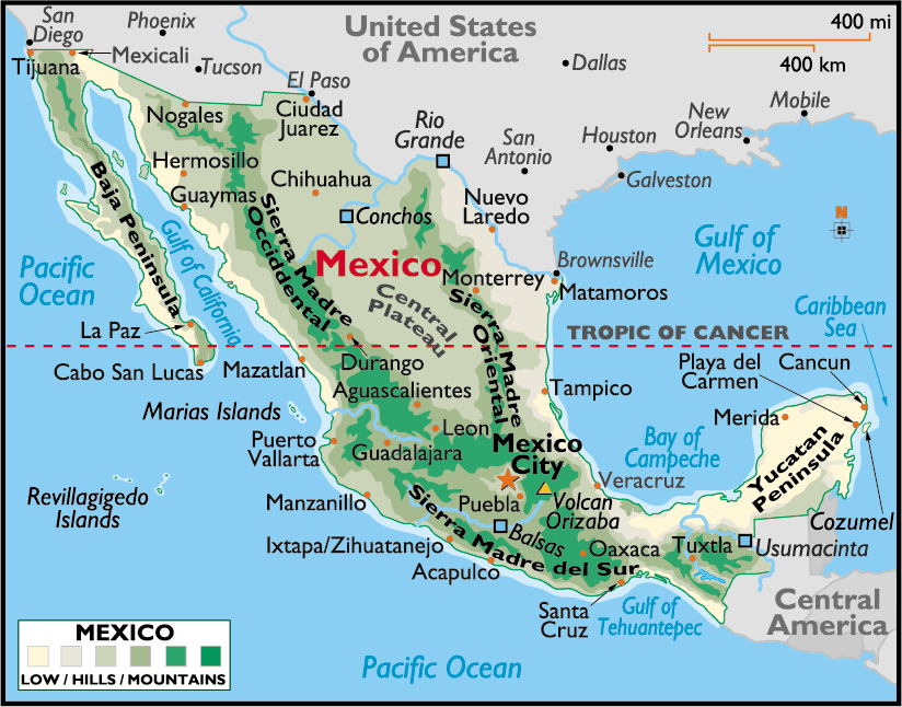
MEXICO RELIEF MAP
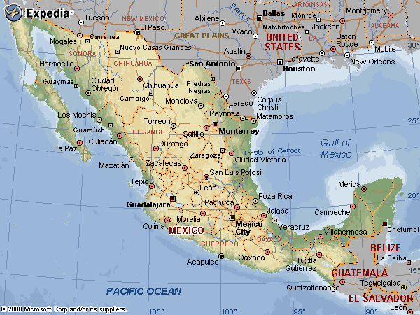
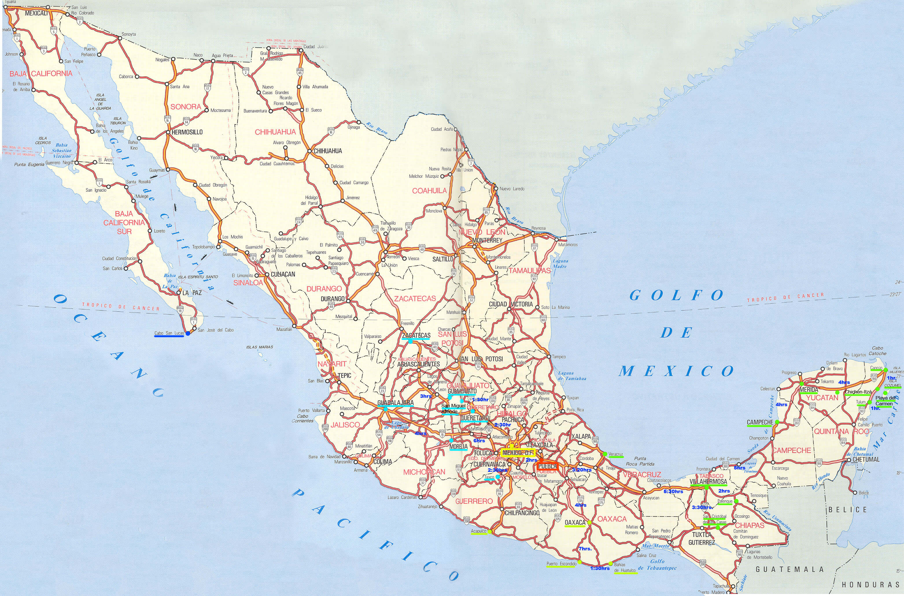
MEXICO ROAD MAP
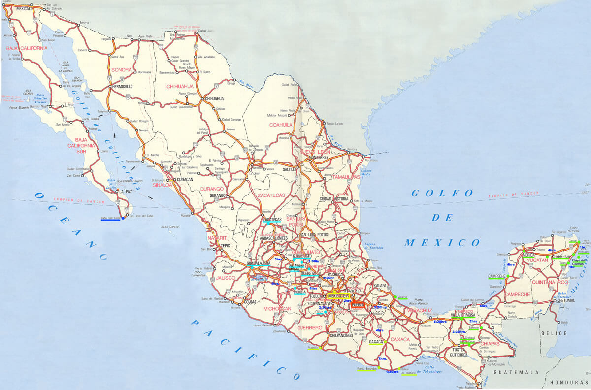
MEXICO ROAD MAP B
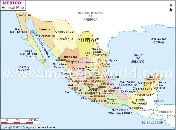
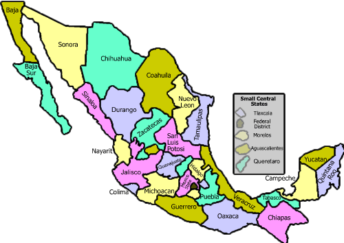
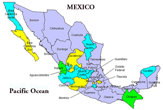
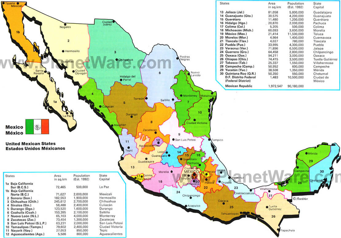
MEXICO STATES MAP
MEXICO TEMPERATURE MAP
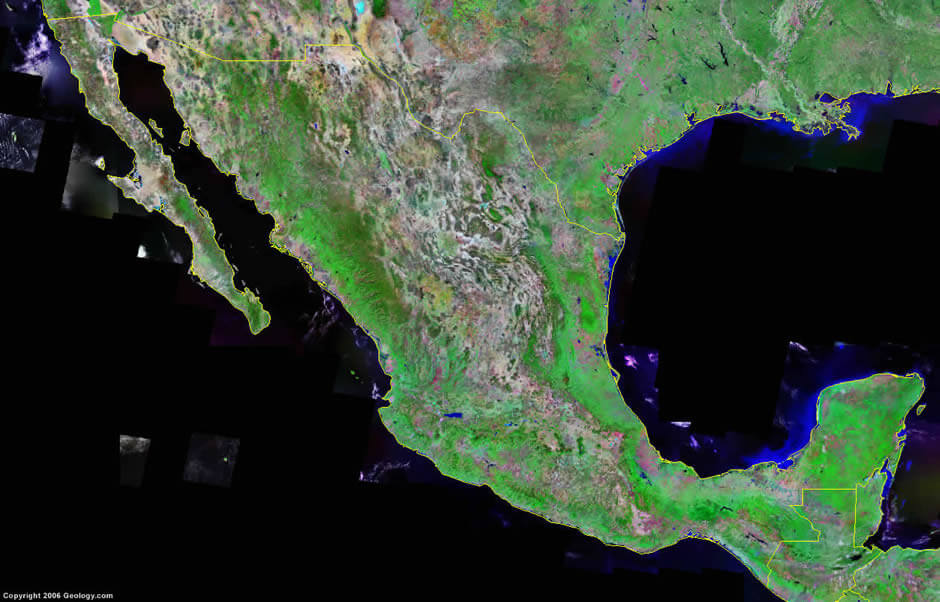
SATELLITE IMAGE OF MEXICO
SATELLITE MEXICO MAP
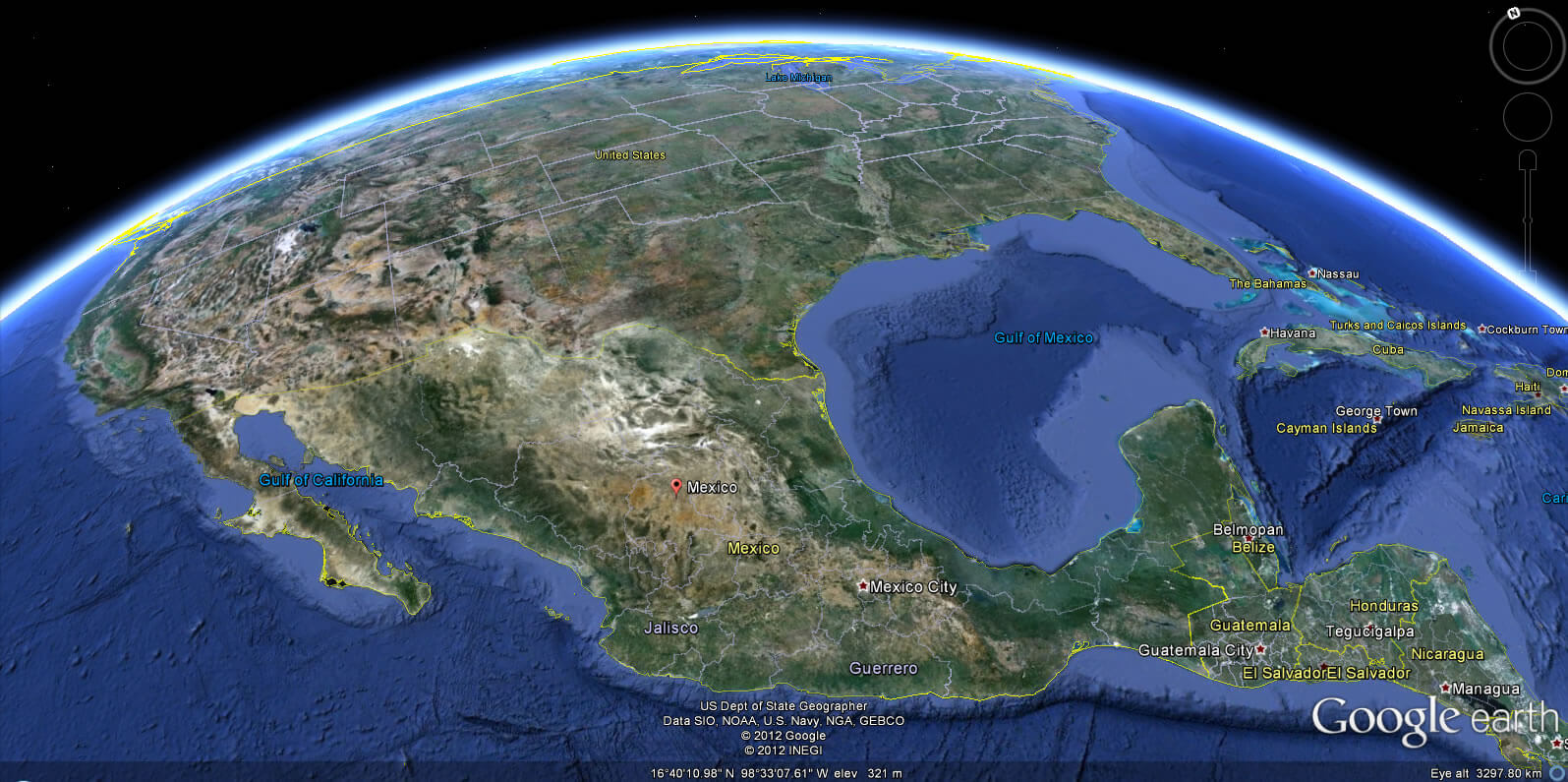
MEXICO EARTH MAP
10 Best Must-Visit Attractions in Mexico City
Please subscribe on "World Guide" channnel on Youtube at youtube.com/c/WorldGuide
Top 10 Favorite Things to Do in Cancún
10 Best Must-Visit Attractions in Mexico City
Please subscribe on "World Guide" channnel on Youtube at youtube.com/c/WorldGuide
Top 10 Favorite Things to Do in Cancún
See Also
Mexico Google Map, Street Views, Maps Directions, Satellite Images
WorldMap1.com offers a collection of Mexico map, google map, Mexico atlas, political, physical, satellite view, country infos, cities map and more map of Mexico.