Pennsylvania National Atlas USA
Map of Pennsylvania, showing major cities and roads. he Pennsylvania Department of Transportation, abbreviated as PennDOT, owns 39,861 miles (64,150 km) of the 121,770 miles (195,970 km) of roadway in the state, making it the fifth largest state highway system in the United States.
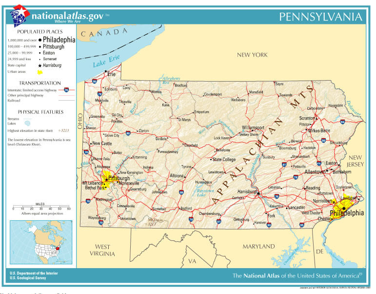
Largest Cities Map of Pennsylvania and Population
- Philadelphia Map - 1.526.006 - (39.952335, -75.163789)
- Pittsburgh Map - 305.704 - (40.441,-79.996)
- Allentown Map - 118.032 - (40.608,-75.49)
- Erie Map - 101.786 - (42.129,-80.085)
- Reading Map - 88.082 - (40.336,-75.927)
- Scranton Map - 76.089 - (41.409,-75.662)
- Bethlehem Map - 74.982 - (40.626,-75.37)
- Lancaster Map - 59.322 - (40.038,-76.306)
- Levittown Map - 52.983 - (40.155,-74.829)
- Harrisburg Map - 49.528 - (40.274,-76.884)
- Altoona Map - 46.320 - (40.518681, -78.394736)
- York Map - 43.718 - (39.962598, -76.727745)
- Penn Hills Township Map - 42.329 - (40.478781, -79.818468)
- State College Map - 42.034 - (40.793395, -77.860001)
- Wilkes Barre Map - 41.498 - (41.245915, -75.881308)
- Norristown Map - 34.324 - (40.121497, -75.339905)
- Chester Map - 33.972 - (39.849557, -75.355746)
- Mount Lebanon Township Map - 33.137 - (40.372771, -80.047904)
- Bethel Park Map - 32.313 - (40.327570, -80.039498)
- Radnor Township Map - 31.531 - (40.028344, -75.368307)
Where is Pennsylvania in the US and Cities Map of Pennsylvania
Please subscribe on "World Guide" channnel on Youtube at youtube.com/c/WorldGuide
Author: Arif Cagrici- Head of Performance Marketing
- Head of SEO
- Linkedin Profile: linkedin.com/in/arifcagrici
- Head of Performance Marketing
- Head of SEO
- Linkedin Profile: linkedin.com/in/arifcagrici
Google Map, Street Views, Maps Directions, Satellite Images
WorldMap1.com offers a collection of map, google map, atlas, political, physical, satellite view, country infos, cities map and more map of .