Texas County Map with County Population, Roads, Seats, Cities, and Interstate Highways

Explore comprehensive Texas county maps featuring GDP, population, ethnic composition, cities and urban areas, income, and interstate highways. See Texas at a glance—with Indian Territory, the Mexico border, and every county seat—all in one place. < Texas districts and counties wall map

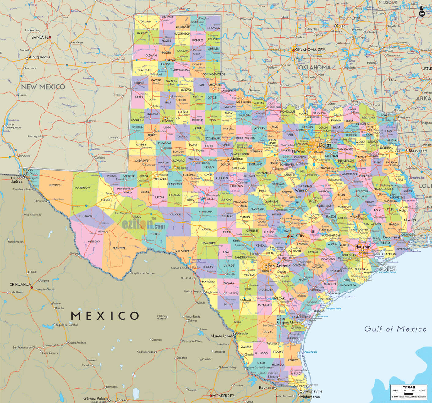
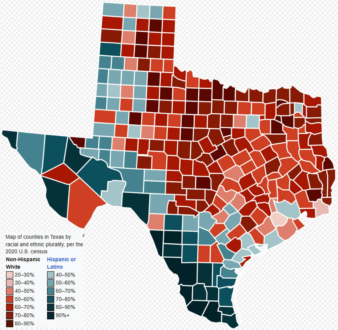
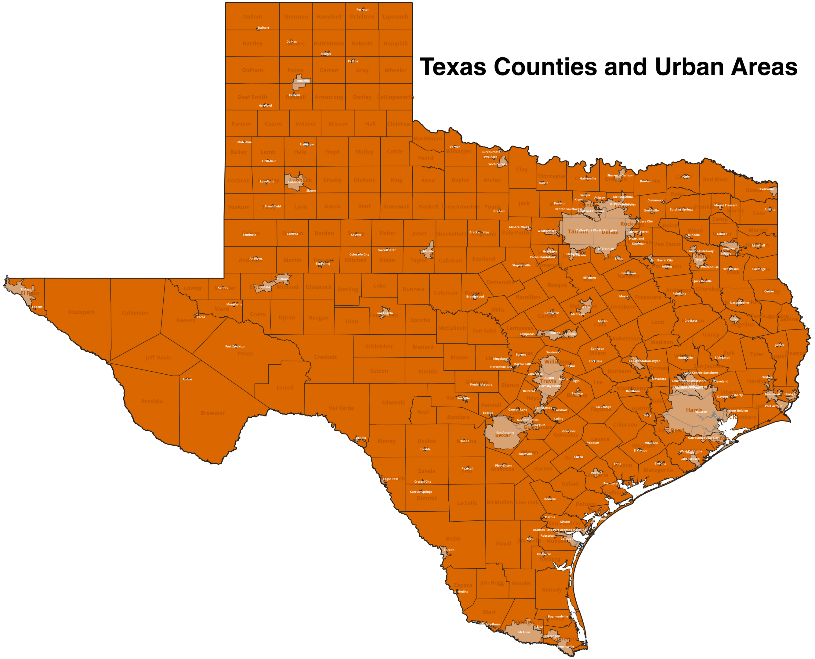
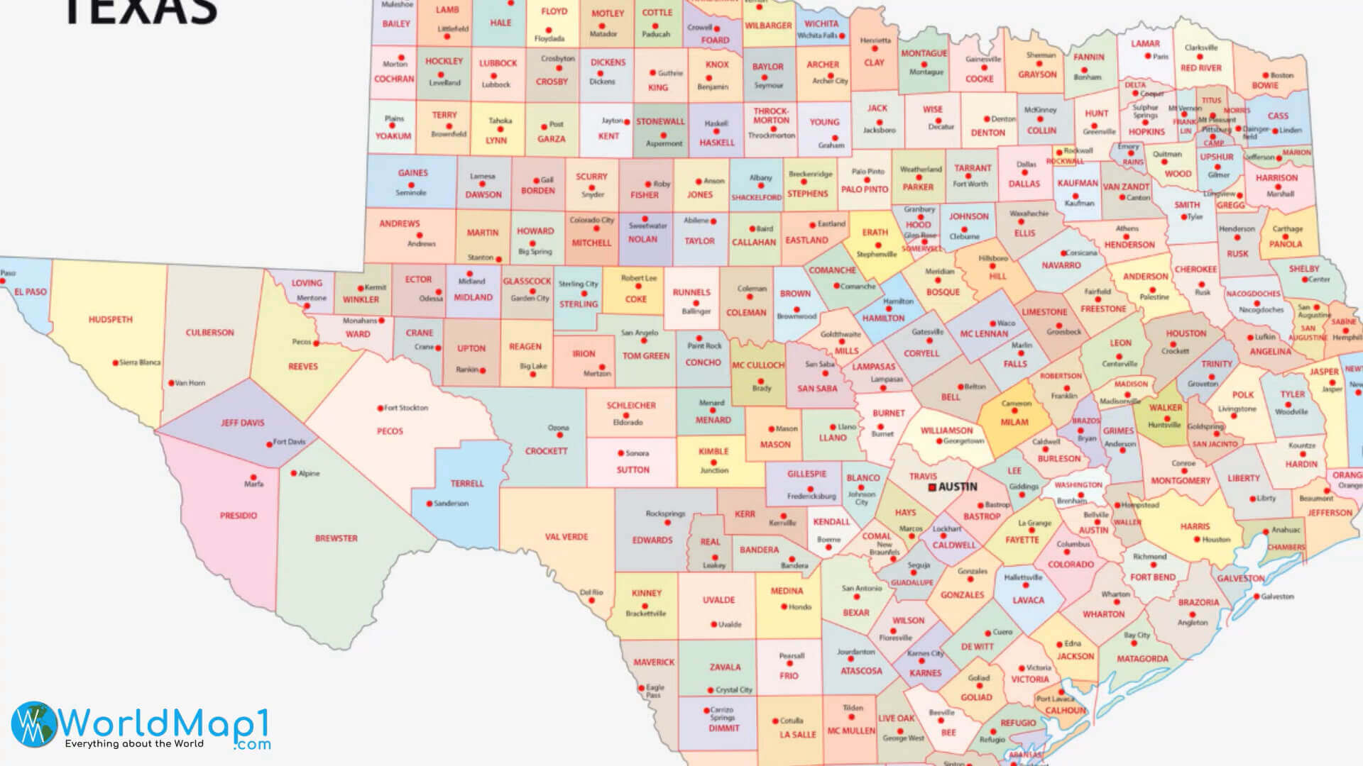
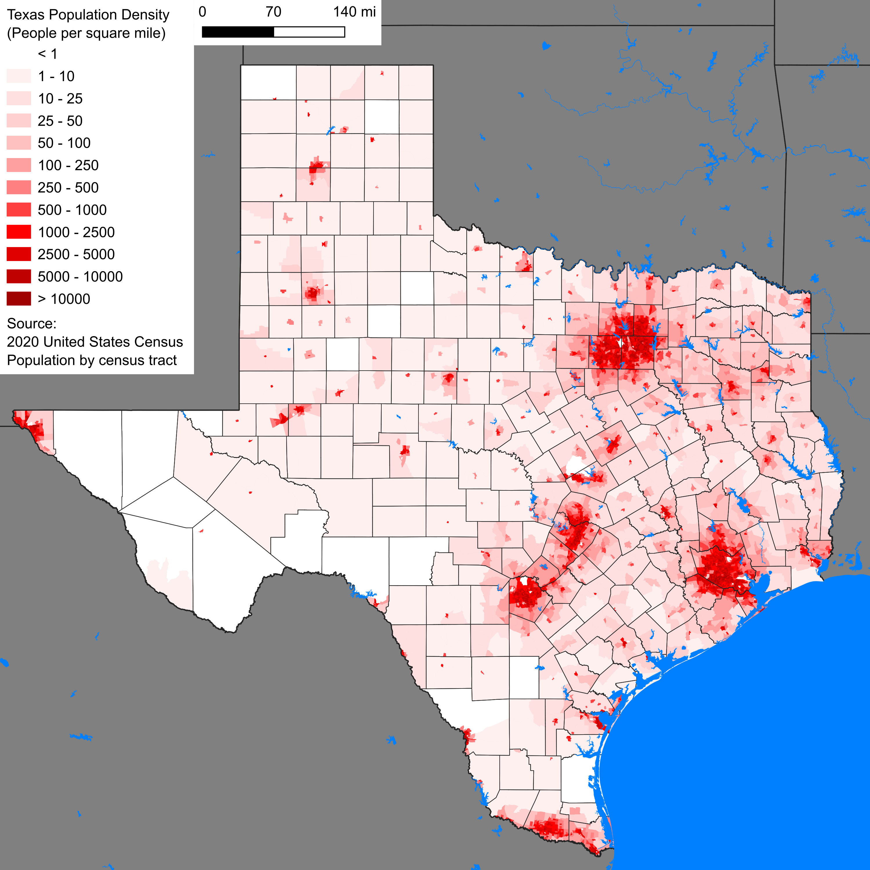
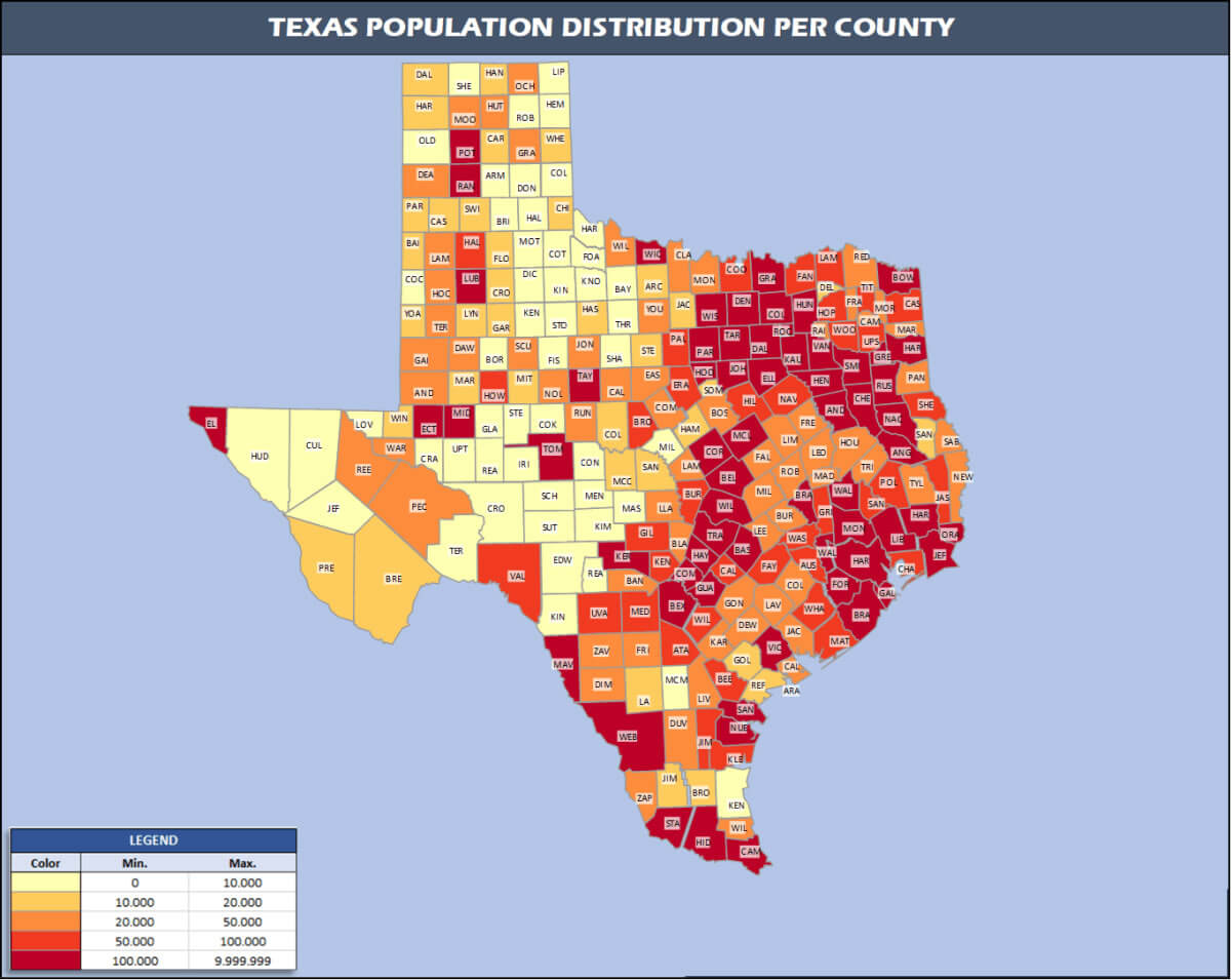
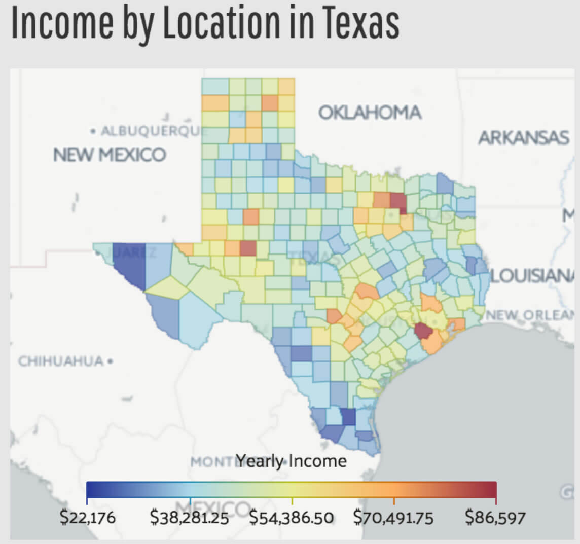
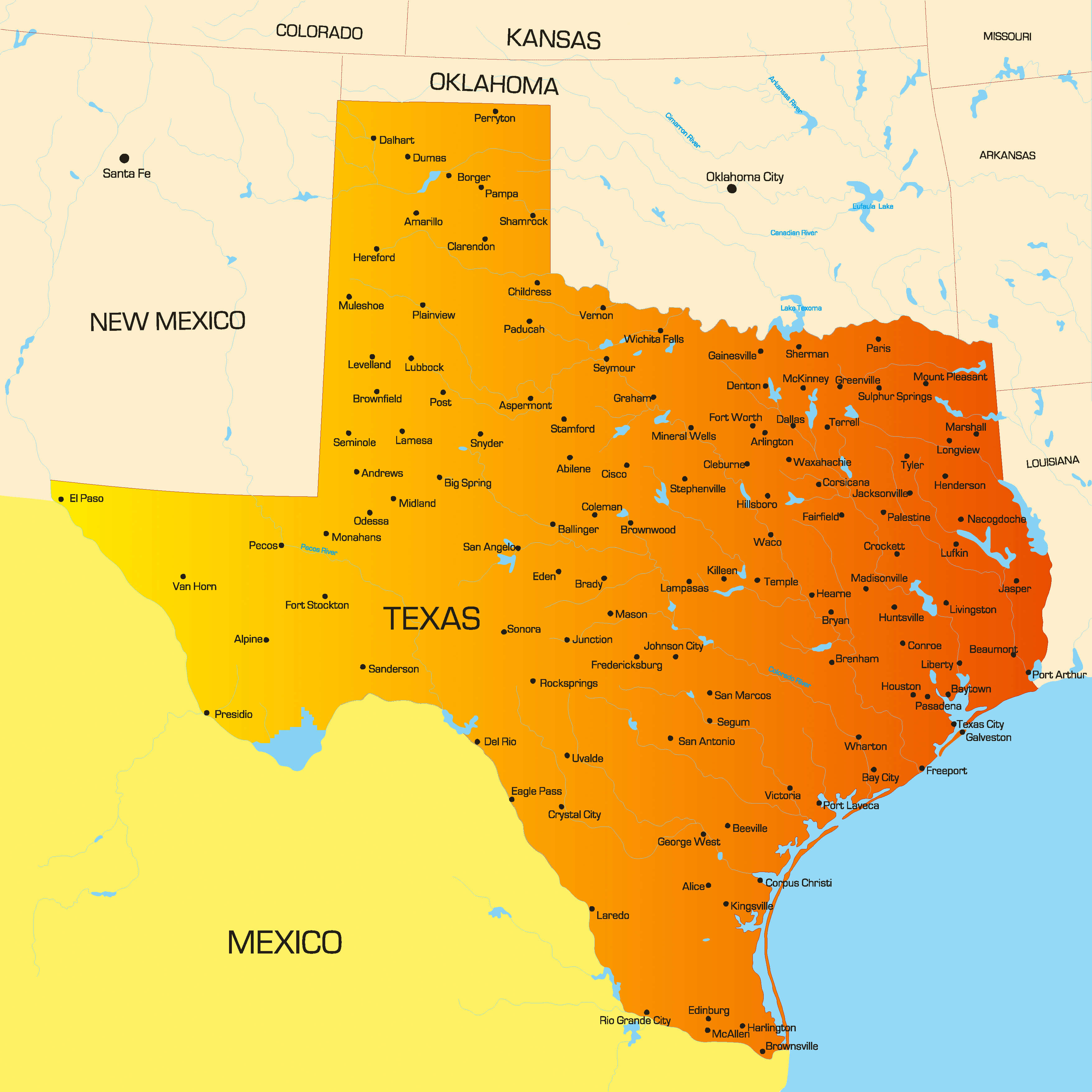
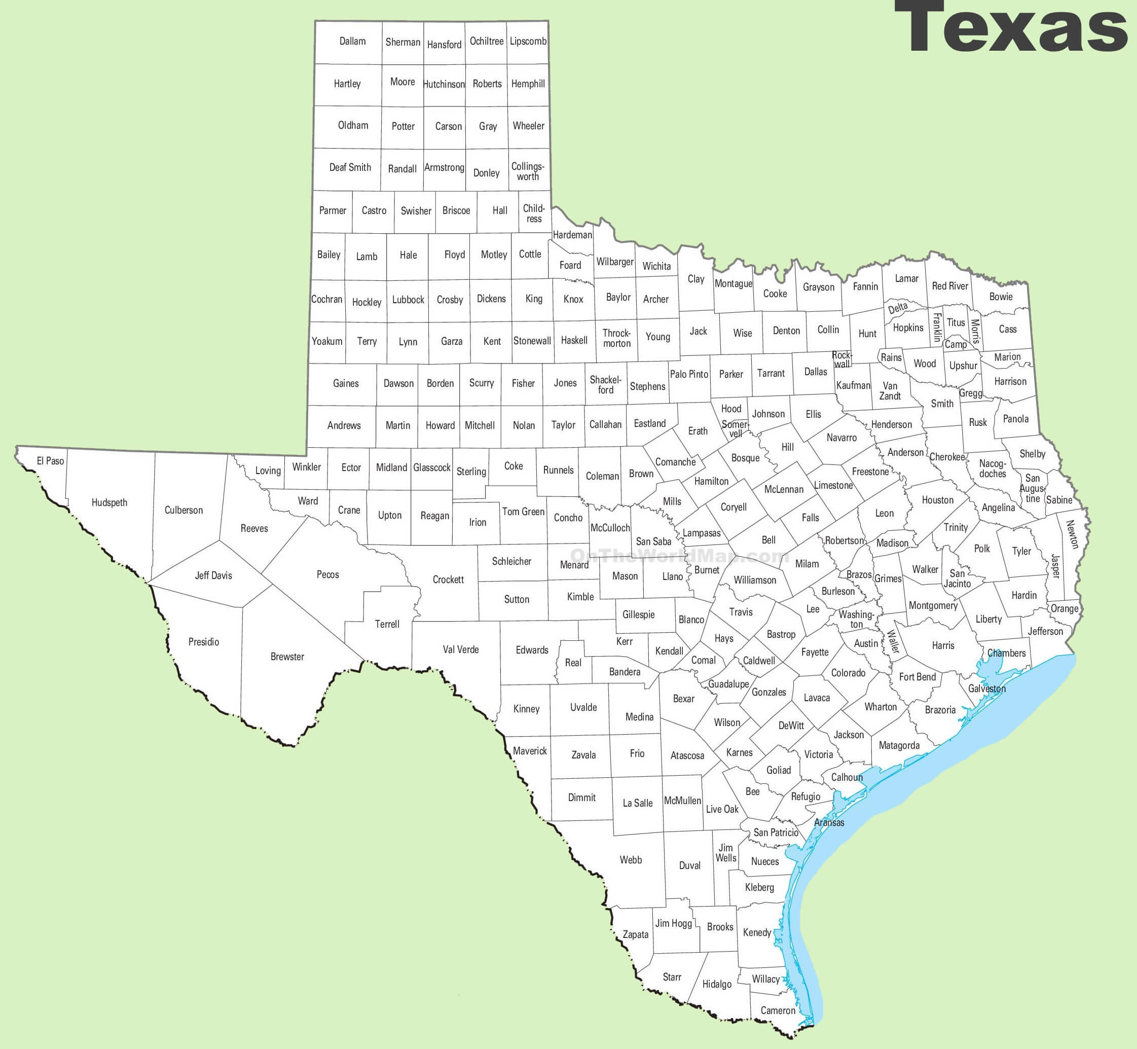
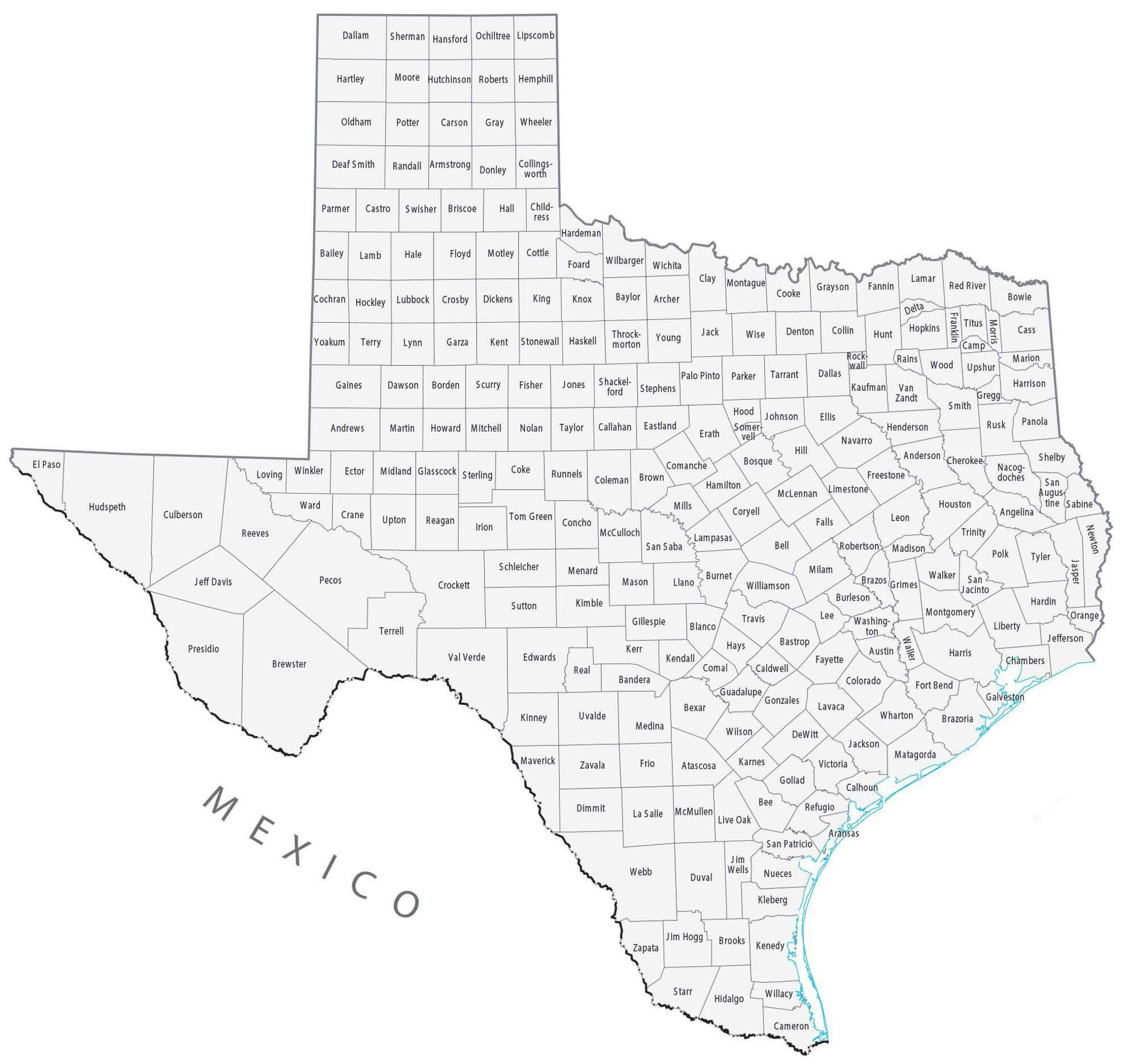
Texas County Map with Names and Borders

Texas county map
Texas county map with names borders and neighboring states marked.

This detailed Texas county map displays all 254 counties with clear boundaries and names. It includes surrounding states such as New Mexico, Oklahoma, Arkansas, and Louisiana, as well as Mexico to the southwest. Major cities like Austin, Houston, and Dallas are marked, making it ideal for geographic reference or education.

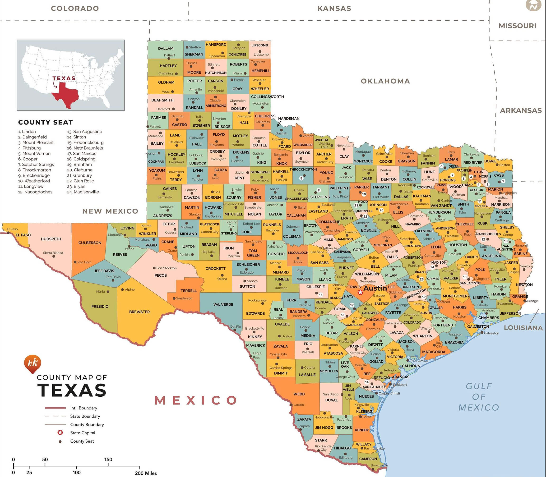
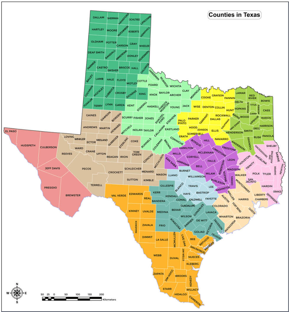
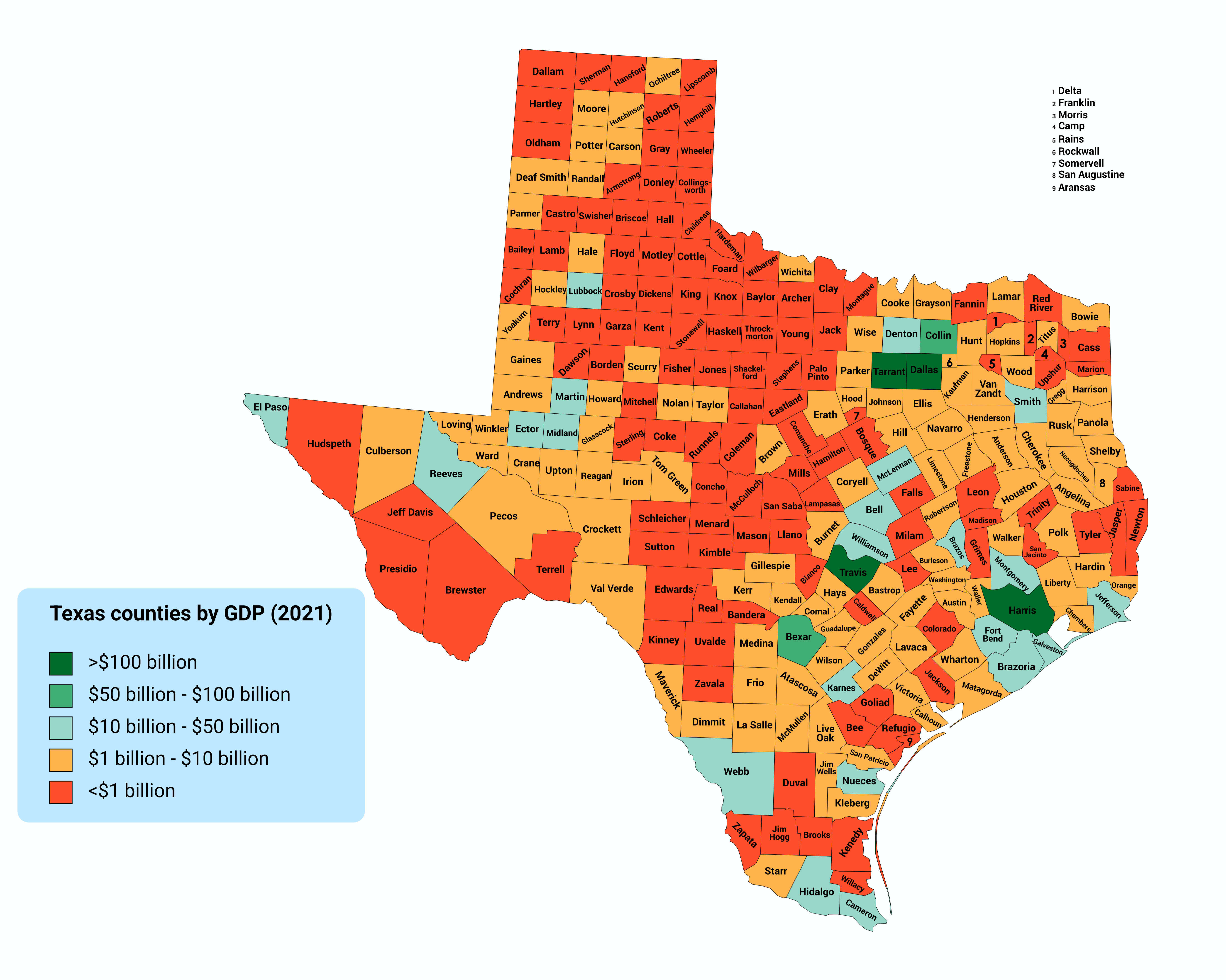
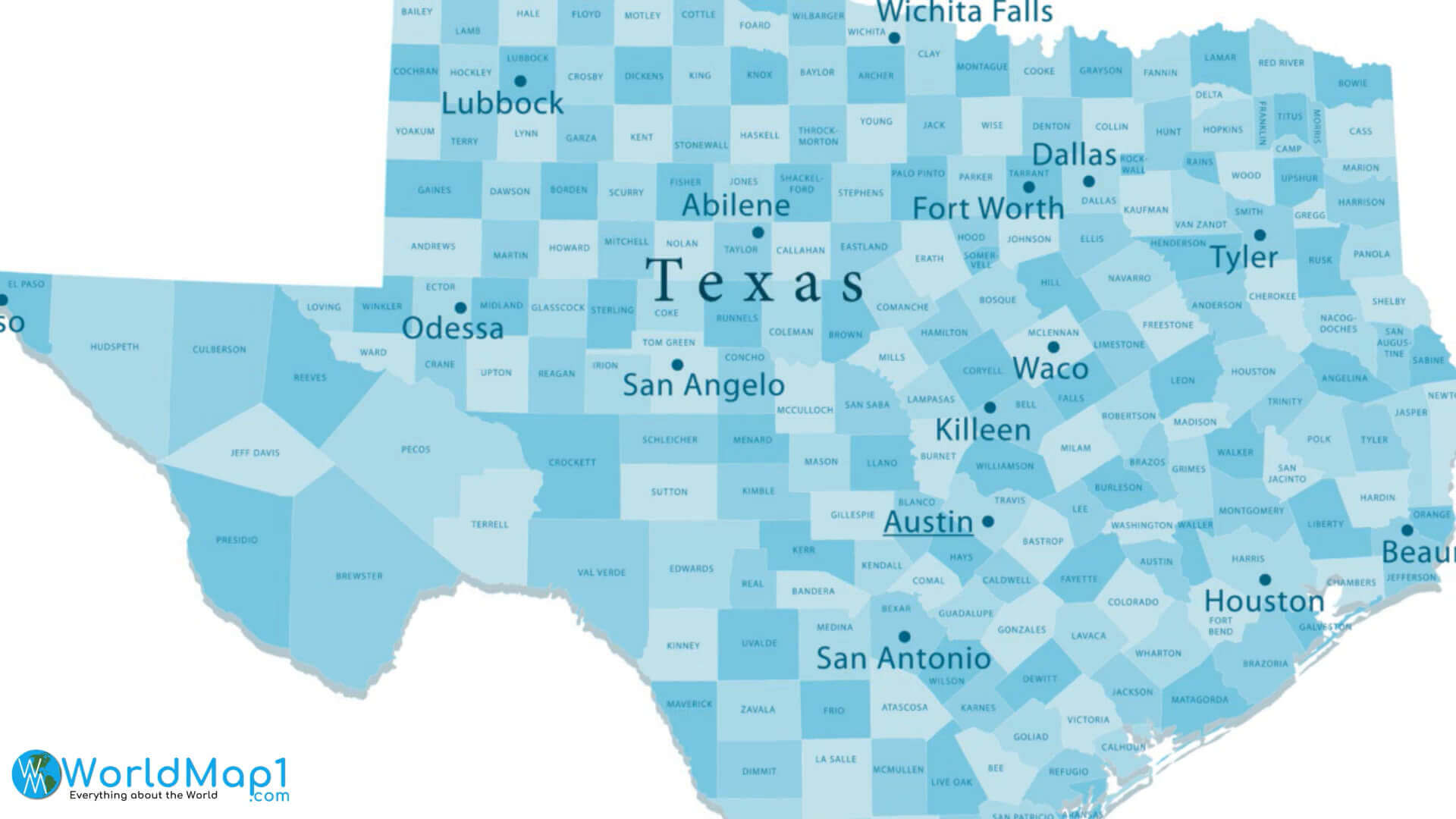
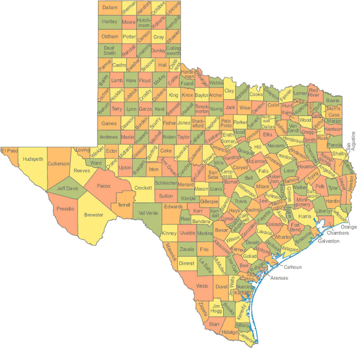
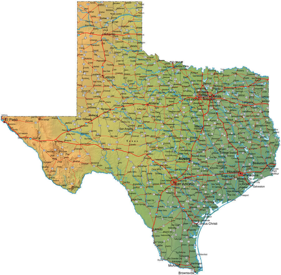
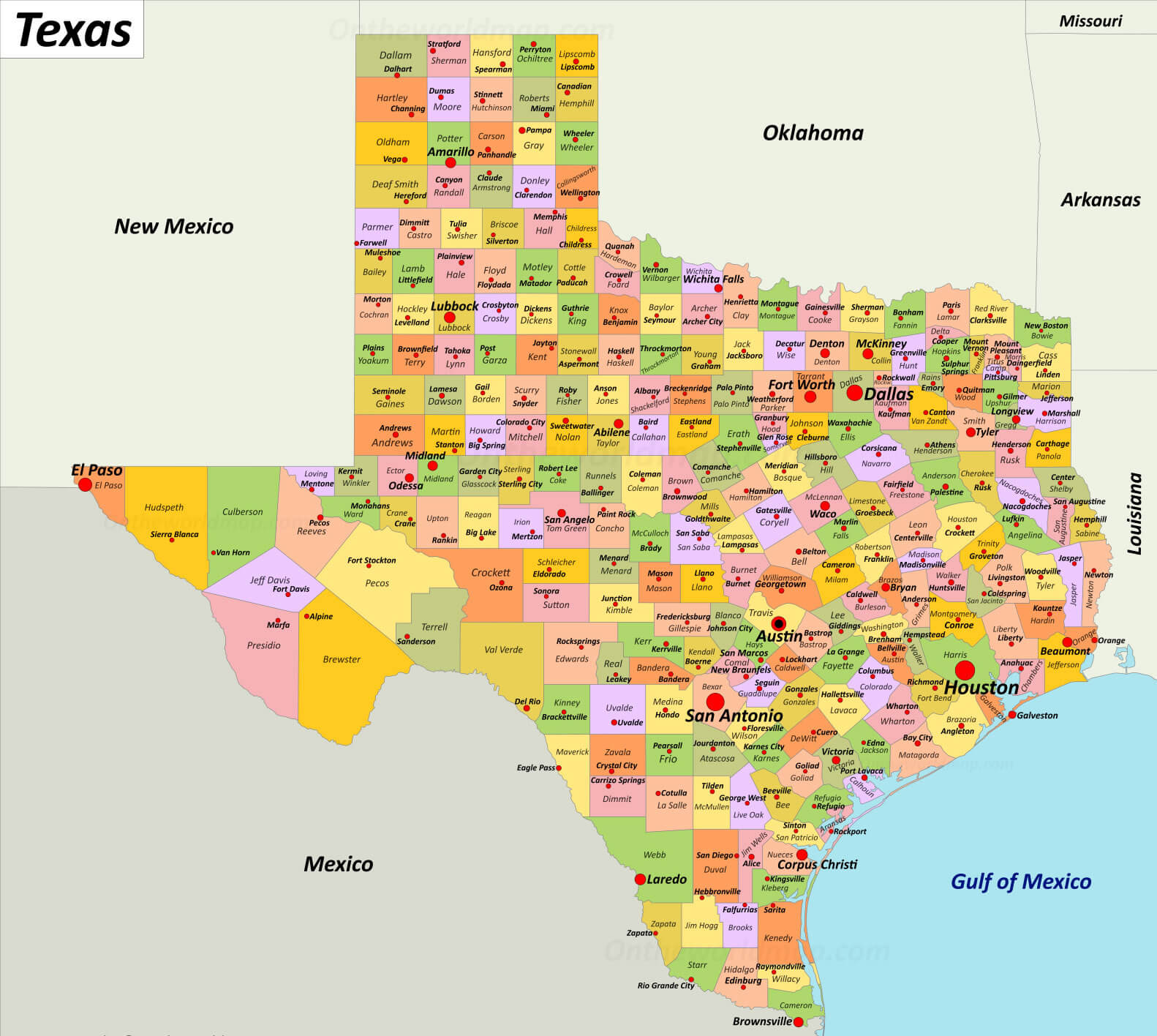
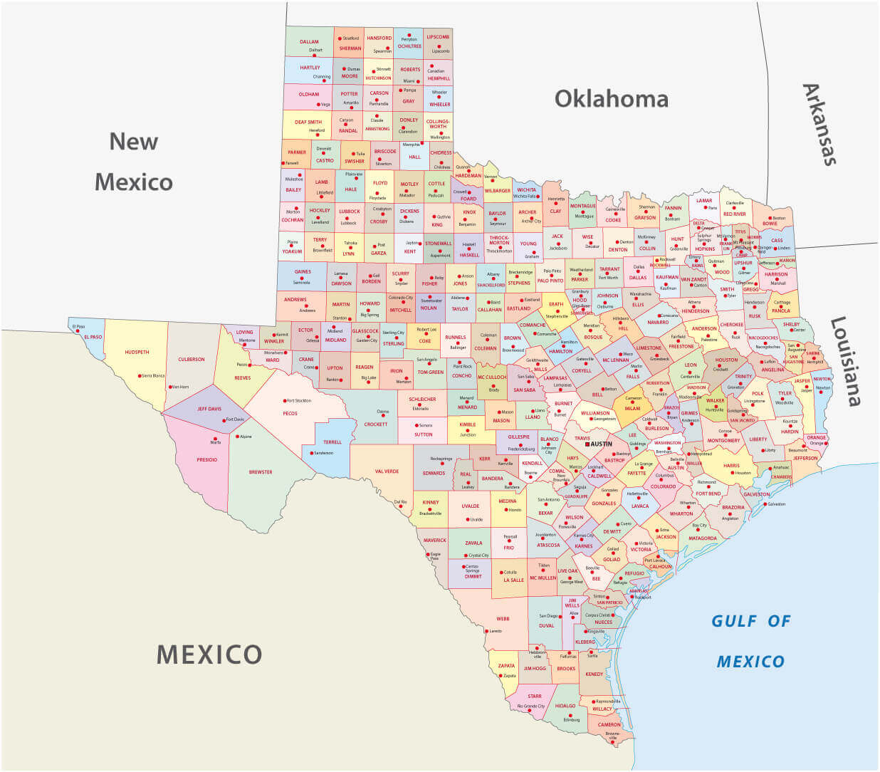
Texas Counties Map in the United States with Regional Highlights

Texas counties map in the United States
Color-coded Texas counties map with names and US location inset.

This visually enhanced Texas counties map highlights all 254 counties with distinct colors, making each region easy to identify. It includes a small inset of the United States for geographic context, showing Texas's location. Ideal for travelers, students, or educators exploring administrative divisions of the state.

Texas districts and counties wall map

Texas districts and counties wall map

Texas county map with Mexico and New Mexico border

Texas county map with Mexico and New Mexico border

Counties map of Texas

Counties map of Texas

County map of Texas

County map of Texas

Map of counties in Texas by racial and ethnic plurality

Map of counties in Texas by racial and ethnic plurality

Map of county with Texas cities

Map of county with Texas cities

County map of Texas with indian territory

County map of Texas with indian territory

Texas blank map with counties

Texas blank map with counties

Texas counties and urban areas map

Texas counties and urban areas map

Texas counties map by GDP

Texas counties map by GDP

Texas counties map in the US

Texas counties map in the US

Texas counties map with largest cities

Texas counties map with largest cities

Texas counties population density map

Texas counties population density map

Texas counties population map

Texas counties population map

Texas county income map by locations

Texas county income map by locations

Texas county map in the US

Texas county map in the US

Texas county map with cities

Texas county map with cities

Texas county map with interstate roads

Texas county map with interstate roads

Texas county outline map

Texas county outline map

Texas county seats map

Texas county seats map

Texas outlined map with counties

Texas outlined map with counties

Feel free to explore these pages as well:

Author: Arif Cagrici