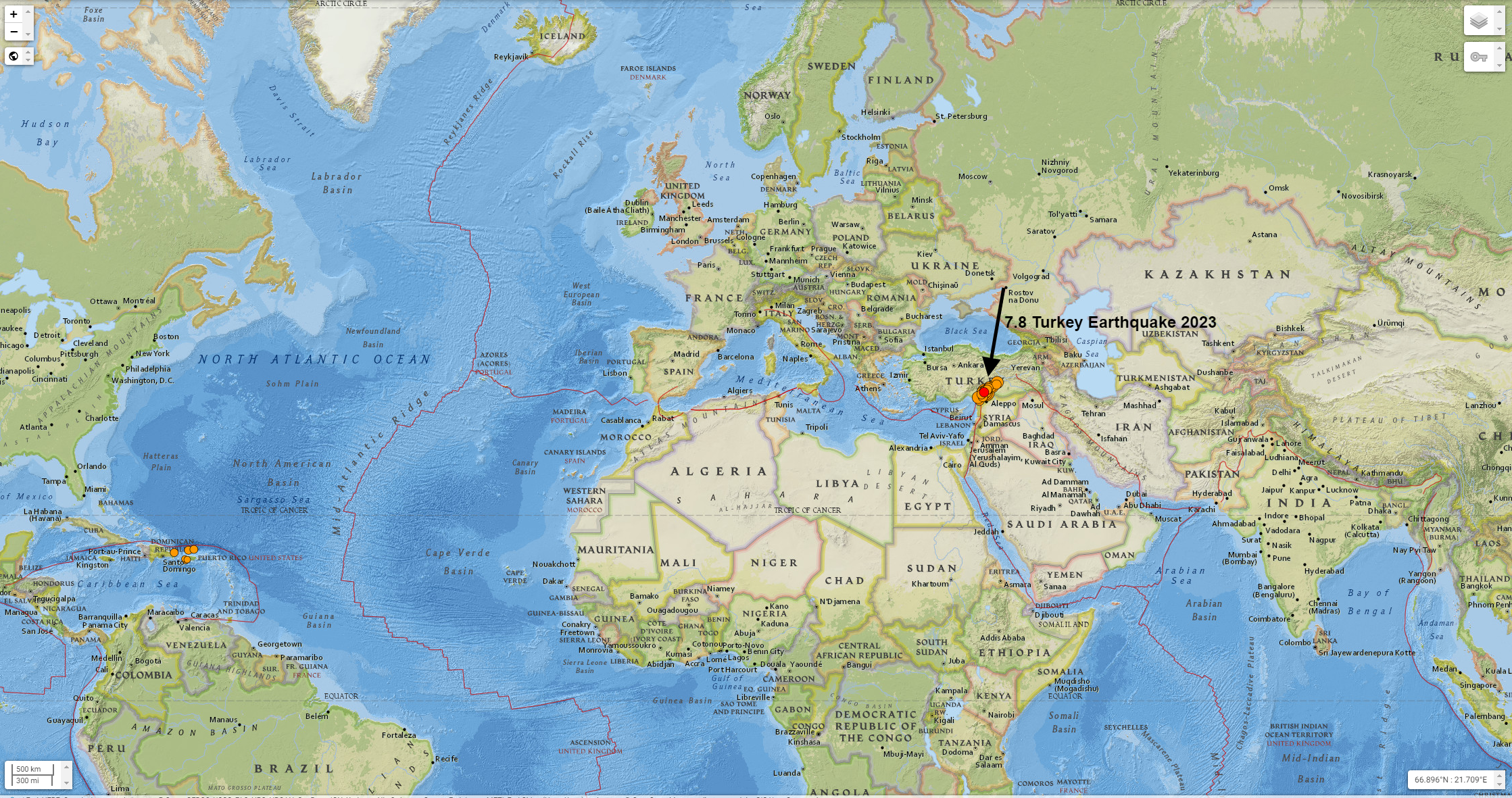
Hundreds of buildings collapsed, and millions of people in Turkey, Syria, Lebanon and Israel felt the earth shake. Hundreds of deaths were reported in Turkey and Syria, and the toll was expected to rise.
The quake struck 23 kilometers (14.2 miles) east of Nurdagi in Turkey's Gaziantep province, at a depth of 24.1 kilometers (14.9 miles), and is one of the strongest to hit the region in more than 100 years, the US Geological Survey (USGS) said.
For more about Turkey
Turkey Earthquake 2023

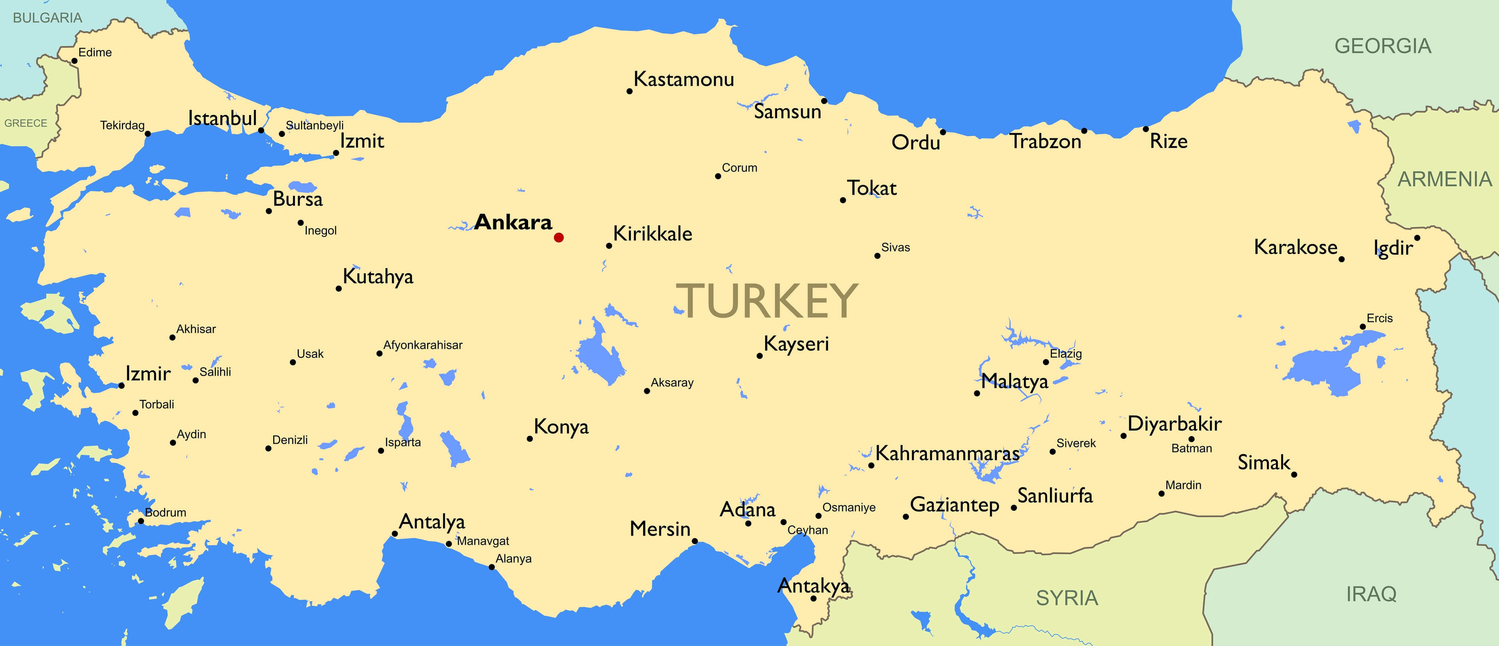
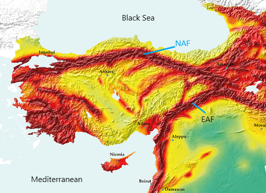
Turkey is located in a seismically active region, with several fault lines crossing the country. The North Anatolian Fault, the East Anatolian Fault, and the Aegean Sea Fault are among the most active fault lines in Turkey, and are responsible for frequent earthquakes in the region. These earthquakes can range from small, barely noticeable tremors to large, devastating events. The Turkish government and international organizations have implemented several measures to minimize the damage caused by earthquakes, such as building codes and emergency response plans.
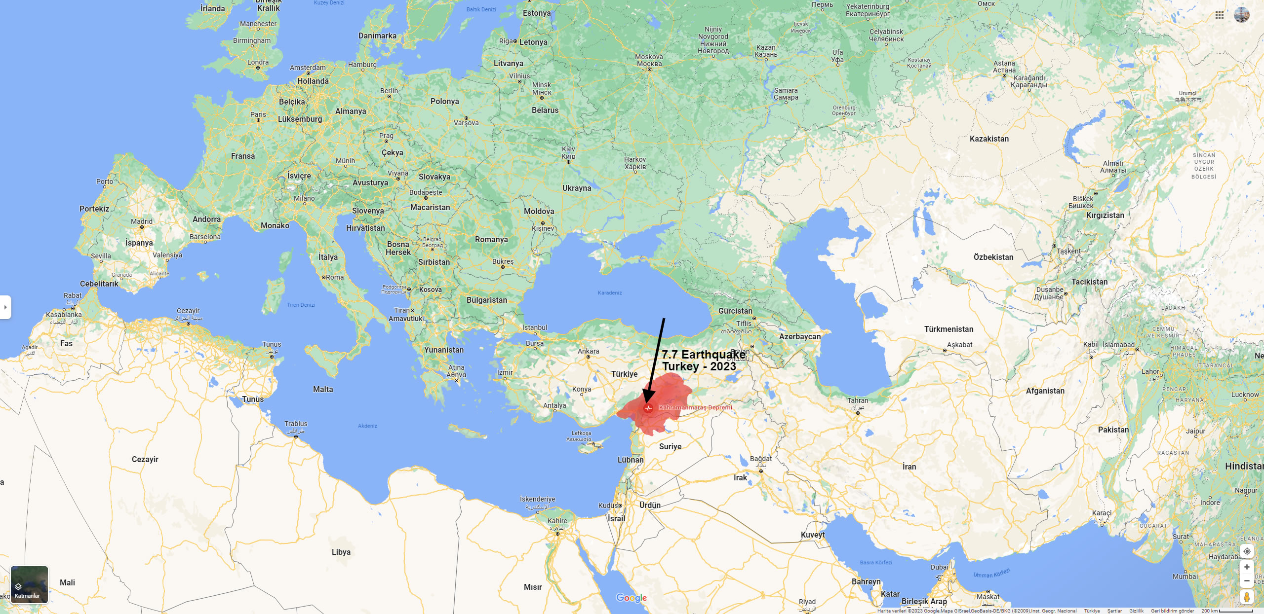
Turkey 7.7 Earthquake 2023 Map
Please subscribe on "World Guide" channnel on Youtube at youtube.com/c/WorldGuide
Here are the 10 largest earthquakes that occurred in Turkey along with their date and estimated loss information:
- August 17, 1999 - Izmit, 7.6 magnitude, approximately 17,000 people killed, 50,000 injured, and hundreds of thousands left homeless.
- November 12, 2020 - Eastern Turkey, 6.8 magnitude, at least 51 people killed, over 1,000 injured.
- March 23, 2010 - Western Turkey, 6.0 magnitude, at least 51 people killed, over 1,000 injured.
- March 3, 1992 - Erzincan, 6.8 magnitude, at least 500 people killed and thousands injured.
- December 27, 1939 - Erzurum, 7.8 magnitude, approximately 30,000 people killed.
- November 1, 1983 - Eastern Turkey, 6.9 magnitude, approximately 1,000 people killed, over 3,000 injured.
- October 20, 2011 - Eastern Turkey, 7.2 magnitude, over 600 people killed, thousands injured.
- August 7, 1999 - Gölcük, 7.4 magnitude, approximately 17,000 people killed and 50,000 injured.
- June 13, 2011 - Van, 7.2 magnitude, over 600 people killed, thousands injured.
- February 5, 1997 - Bolu, 6.3 magnitude, approximately 75 people killed, hundreds injured.
Please note that these are rough estimates and the actual number of casualties and loss may vary.
Kahramanmaras, Turkey Earthquake 2023
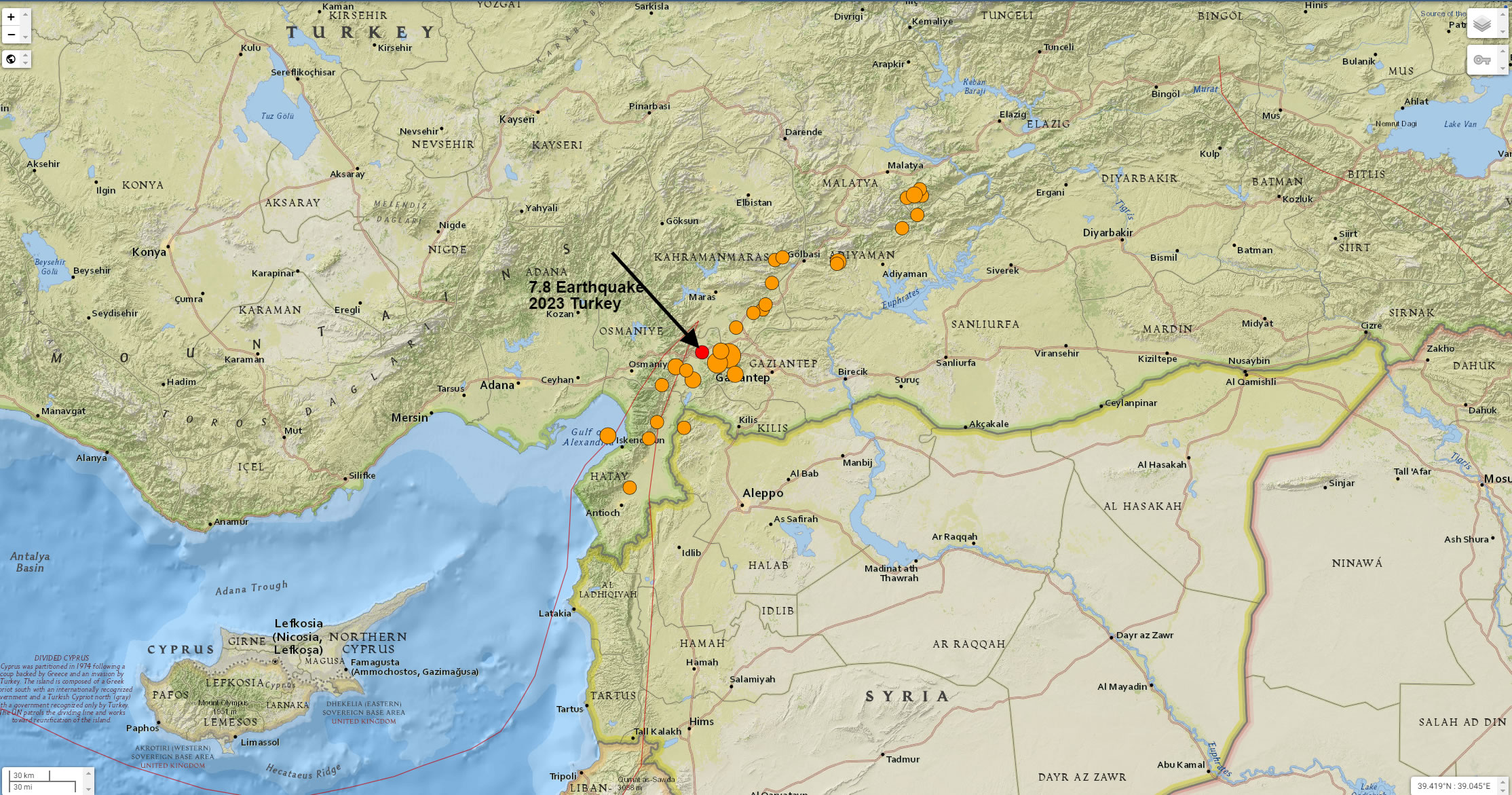
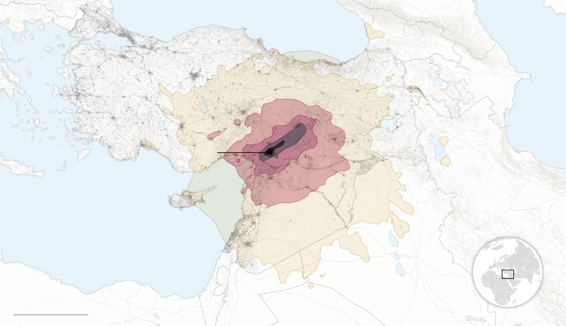
Turkey Earthquake 2023 Effected Areas
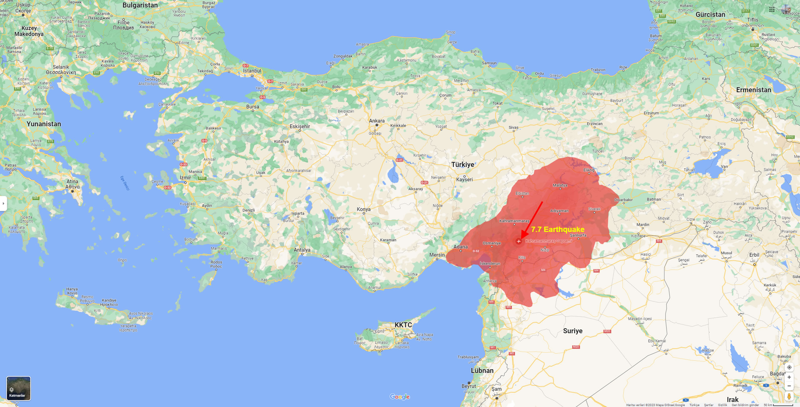
Turkey Earthquake 2023 Map
Turkey earthquake fault line map
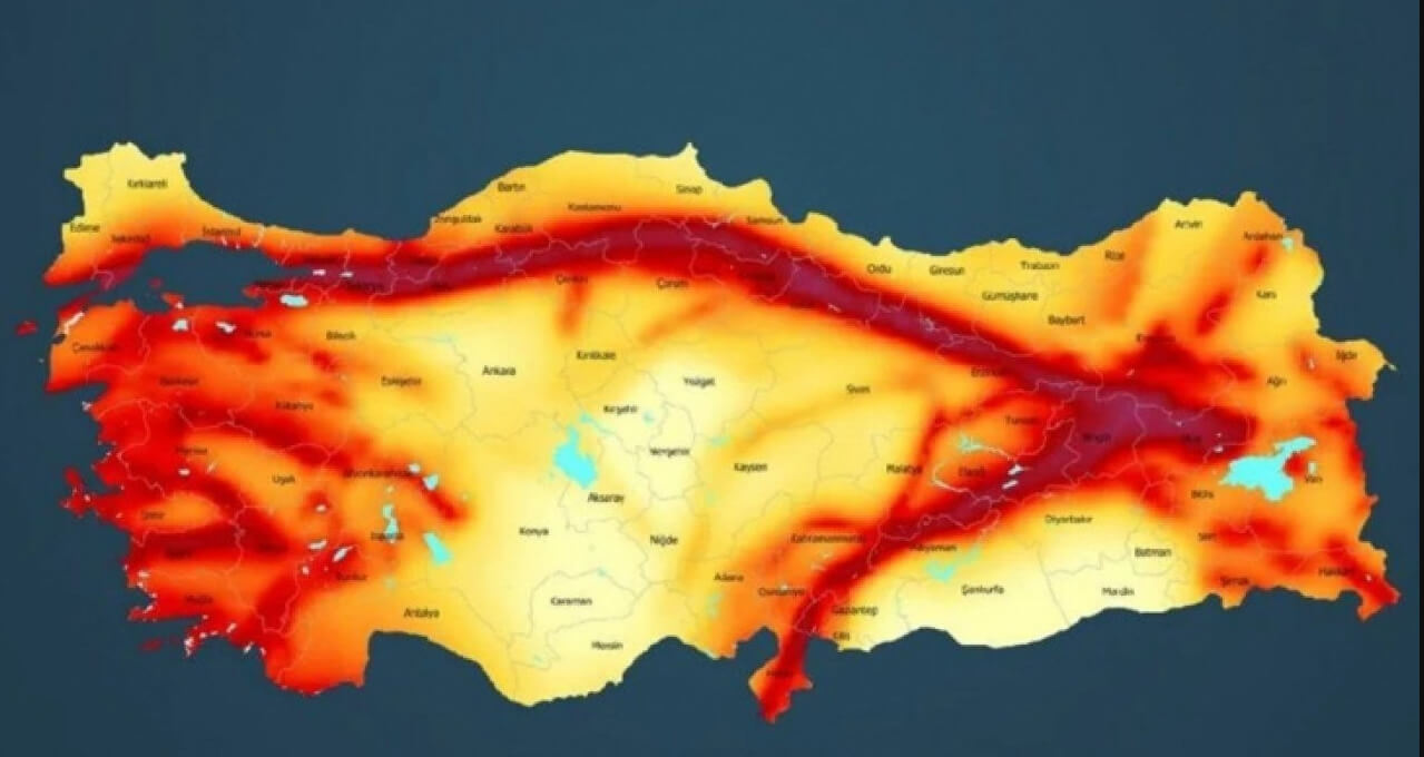
Turkey fault line map
7.8 Magnitude Turkey Earthquake Efectes Areas Map