Where Is Iran Located on the Map? Location, Borders, and Geography Explained
Where is Iran located? Explore Iran's position in Western Asia, its borders with neighbors, and its coastline along the Persian Gulf and Caspian Sea. Find out where Iran is located on the map, its neighboring countries, seas, and key geographic features that shape its role in the Middle East and Asia.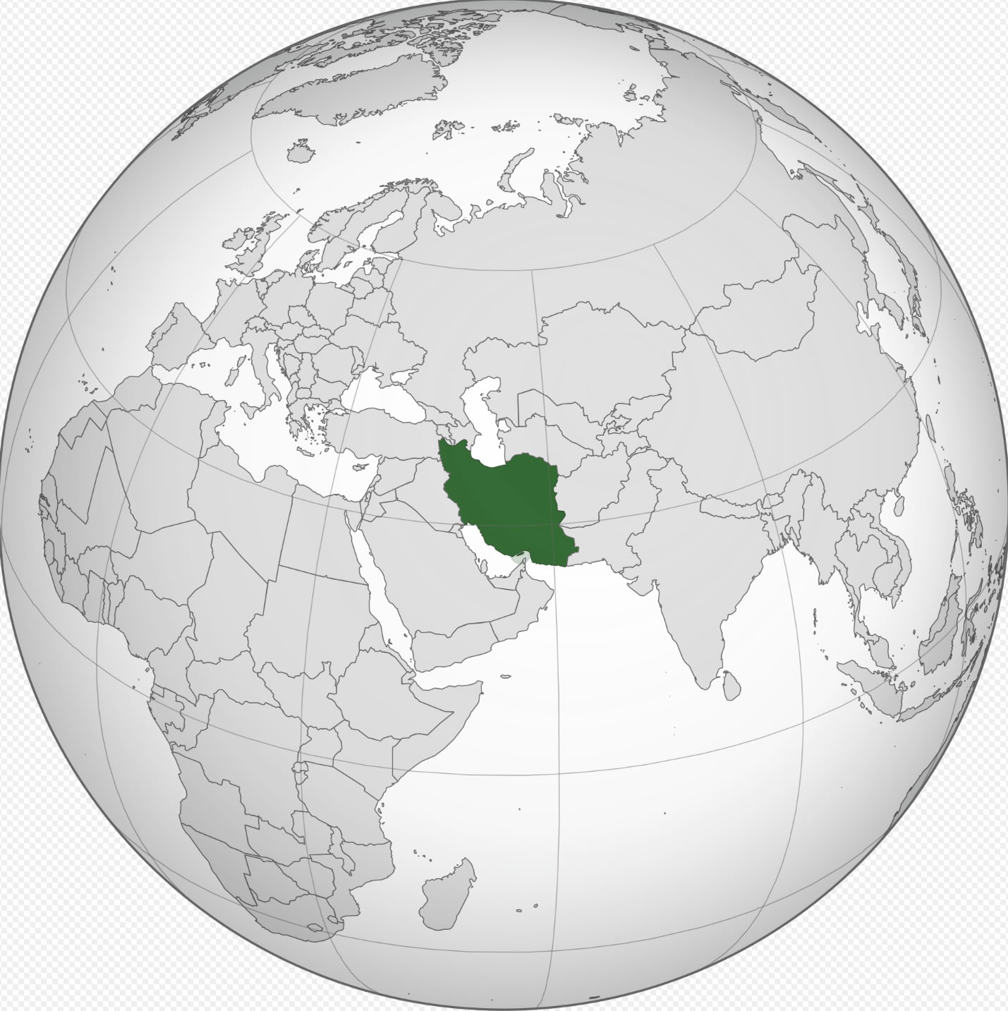
Where Is Iran Located? (Complete Geographic Guide)
Where Is Iran Located?
Iran is situated in Western Asia, where the Middle East, Central Asia, and South Asia meet. It borders Turkey and Iraq to the west, Armenia and Azerbaijan to the northwest, Turkmenistan to the northeast, and Afghanistan and Pakistan to the east. The country also has important coastlines along the Persian Gulf and the Gulf of Oman in the south, while the Caspian Sea lies to the north. Due to its central geographic position connecting several major regions of Asia, Iran has long served as a key link for trade, culture, and movement between the East and the West.
Geographic Location of Iran
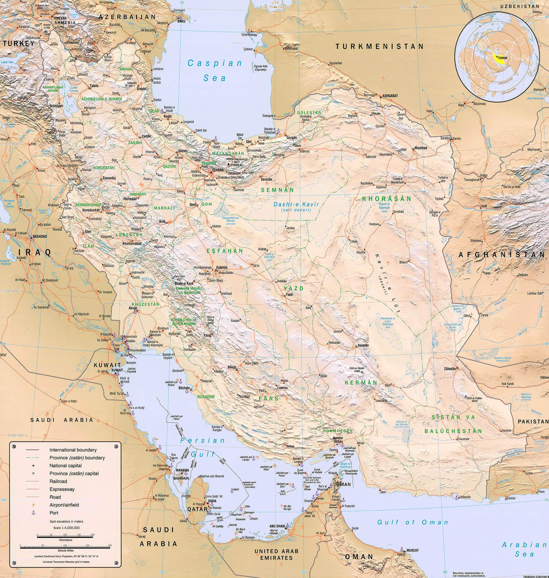
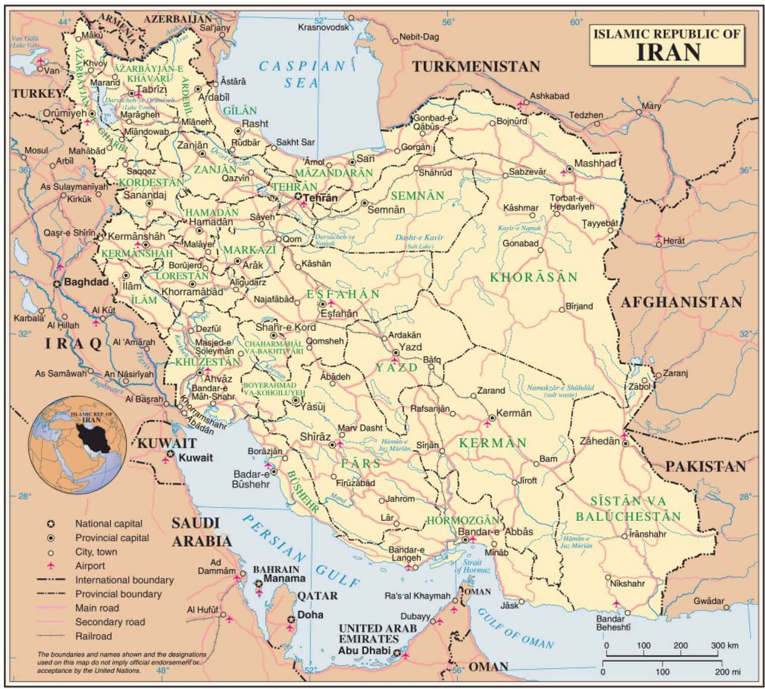
Iran spans an area of about 1,648,195 square kilometers, making it one of the largest countries in the Middle East. The country's terrain is largely shaped by major mountain systems, including the Zagros Mountains in the west and the Alborz Mountains in the north. Iran is also home to extensive desert regions such as the Dasht-e Kavir and the Dasht-e Lut, two of the largest deserts in the region. Important rivers like the Karun and Karkheh run through parts of the country, while its diverse landscape features high plateaus, fertile plains, and coastlines along both the Persian Gulf and the Caspian Sea.
What Are the Main Regions of Iran?
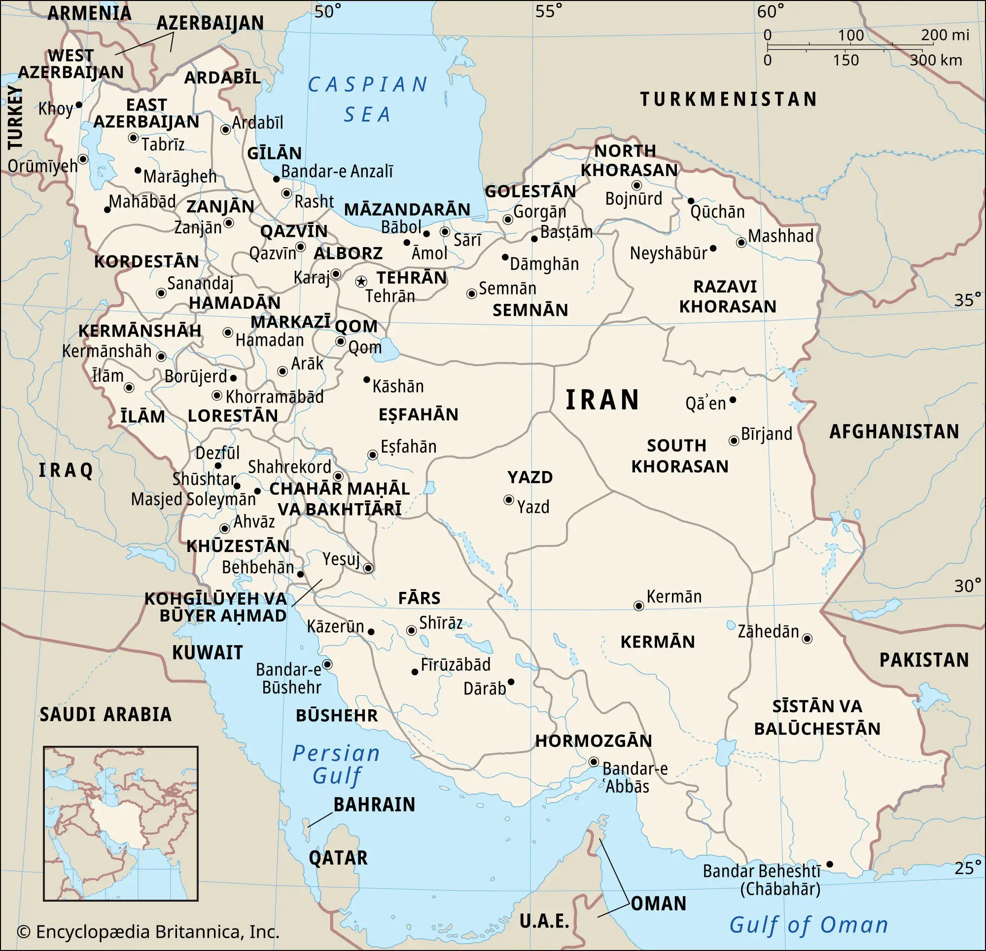
Iran is administratively divided into 31 provinces. Some of the most important geographic and cultural regions include:
- Tehran Province – The political and economic center of the country, home to the capital city Tehran.
- Isfahan Province – Known for its historical architecture, cultural heritage, and central location in Iran.
- Fars Province – The historic heartland of Persian civilization, including cities such as Shiraz and the ancient ruins of Persepolis.
- East Azerbaijan Province – A major cultural and commercial region in northwestern Iran, centered around the city of Tabriz.
- Khuzestan Province – A key oil-producing region in southwestern Iran with important industrial and energy infrastructure.
What Are the 5 Largest Cities in Iran?
The five largest cities in Iran by population are:
- Tehran – The capital and largest city, serving as Iran's political, economic, and cultural center.
- Mashhad – A major religious center and the second-largest city, known for the Imam Reza Shrine.
- Isfahan – Famous for its historic Persian architecture and cultural landmarks.
- Karaj – An important industrial city located near Tehran and part of the Greater Tehran metropolitan area.
- Shiraz – Known for its historical significance, gardens, poetry, and proximity to the ancient city of Persepolis.
Quick Facts About Iran
| Official Name: | Islamic Republic of Iran |
|---|---|
| Area: | 1,648,195 km² |
| Capital: | Tehran |
| Population: | Approximately 89 million |
| Currency: | Iranian rial (IRR) |
| GDP: | Approx. $400–500 billion (nominal) |
| Per Capita: | Approx. $4,000–6,000 (nominal) |
| Time Zone: | Iran Standard Time (IRST, UTC+3:30) |
| Calling code: | +98 |
| Internet TLD: | .ir |
Why Iran's Location Is Important
Iran occupies a strategically significant position in Western Asia, linking several major regions including the Middle East, Central Asia, South Asia, and the Caucasus. Throughout history, its location has made it an important crossroads for trade routes, cultural exchange, and political interaction. Iran shares borders with several influential regional states and has coastlines along the Persian Gulf, the Gulf of Oman, and the Caspian Sea, providing access to vital maritime corridors. Because of this geographic position, Iran played a key role in historic trade networks such as the Silk Road, and it continues to influence regional energy transport, geopolitics, and economic connections between Asia and Europe.
Frequently Asked Questions
Is Iran in the Middle East?
Yes. Iran is located in Western Asia and is widely considered part of the Middle East, while also serving as a bridge to Central and South Asia.
Which countries border Iran?
Iran shares land borders with Iraq and Turkey to the west, Armenia and Azerbaijan to the northwest, Turkmenistan to the northeast, Afghanistan and Pakistan to the east, and it also has coastlines along the Persian Gulf, the Gulf of Oman, and the Caspian Sea.
Is Persia the same as Iran?
Persia is the historical name often used for Iran, especially in Western sources. In 1935, the country asked the international community to use "Iran," which is the name long used locally.
What is the capital of Iran?
The capital of Iran is Tehran, the country's largest city and its main center for government, business, and culture.
What is Iran known for geographically?
Iran is known for its varied landscapes, including the Zagros and Alborz mountain ranges, vast deserts like the Dasht-e Kavir and Dasht-e Lut, and major waters such as the Caspian Sea and the Persian Gulf.
Feel free to explore these pages as well:
- Iran Map
- USA and Israel Strikes Maps on Iran
- High-resolution Map of Iran
- Political Map of Iran
- Physical Map of Iran
- Population Map of Iran
- Cities Map of Iran
- Regions Map of Iran
- Blank Map of Iran
- Historical Map of Iran
- Iraq Map
- High-resolution Map of Israel
- High-resolution Map of Iraq
- 12 Days Iran Israel War Map
- Syria Map
- Israel Map
- Saudi Arabia Map
- Where is Located Qatar in the World?
- United States Map
- Türkiye Map
- Head of Performance Marketing
- Head of SEO
- Linkedin Profile: linkedin.com/in/arifcagrici