High-Resolution Iraq Map with Cities, Borders and Terrain
Explore the Iraq High-Resolution Map collection featuring detailed political, provincial, regional, and administrative maps. Includes physical, terrain, elevation, relief, climate, and soil maps, along with rivers and lakes. Discover roads maps, satellite views of the Middle East, major cities maps, Arabic-language maps, and large blank province maps for reference. 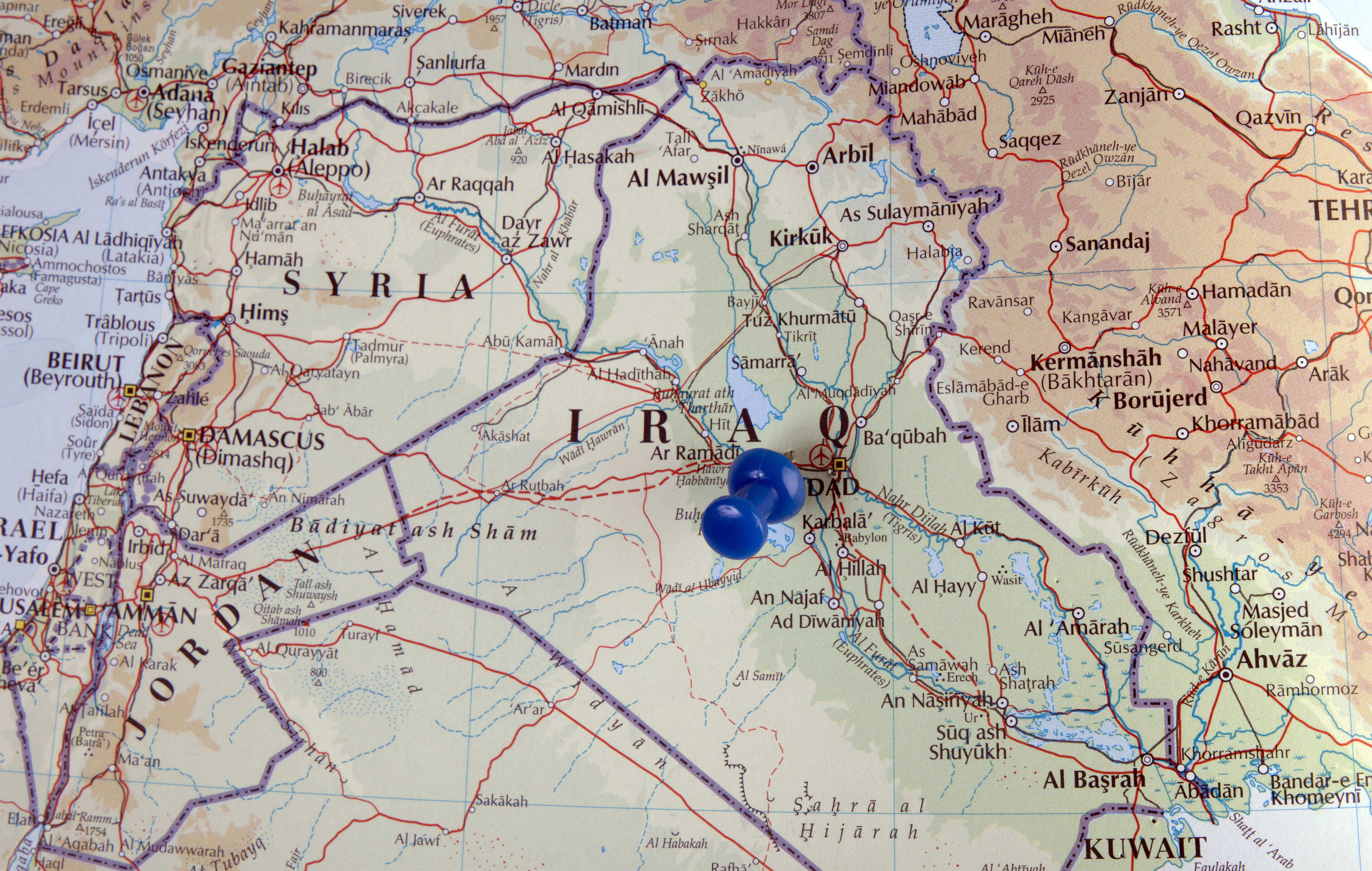
High-Resolution Iraq Political Map
Iraq map high resolution
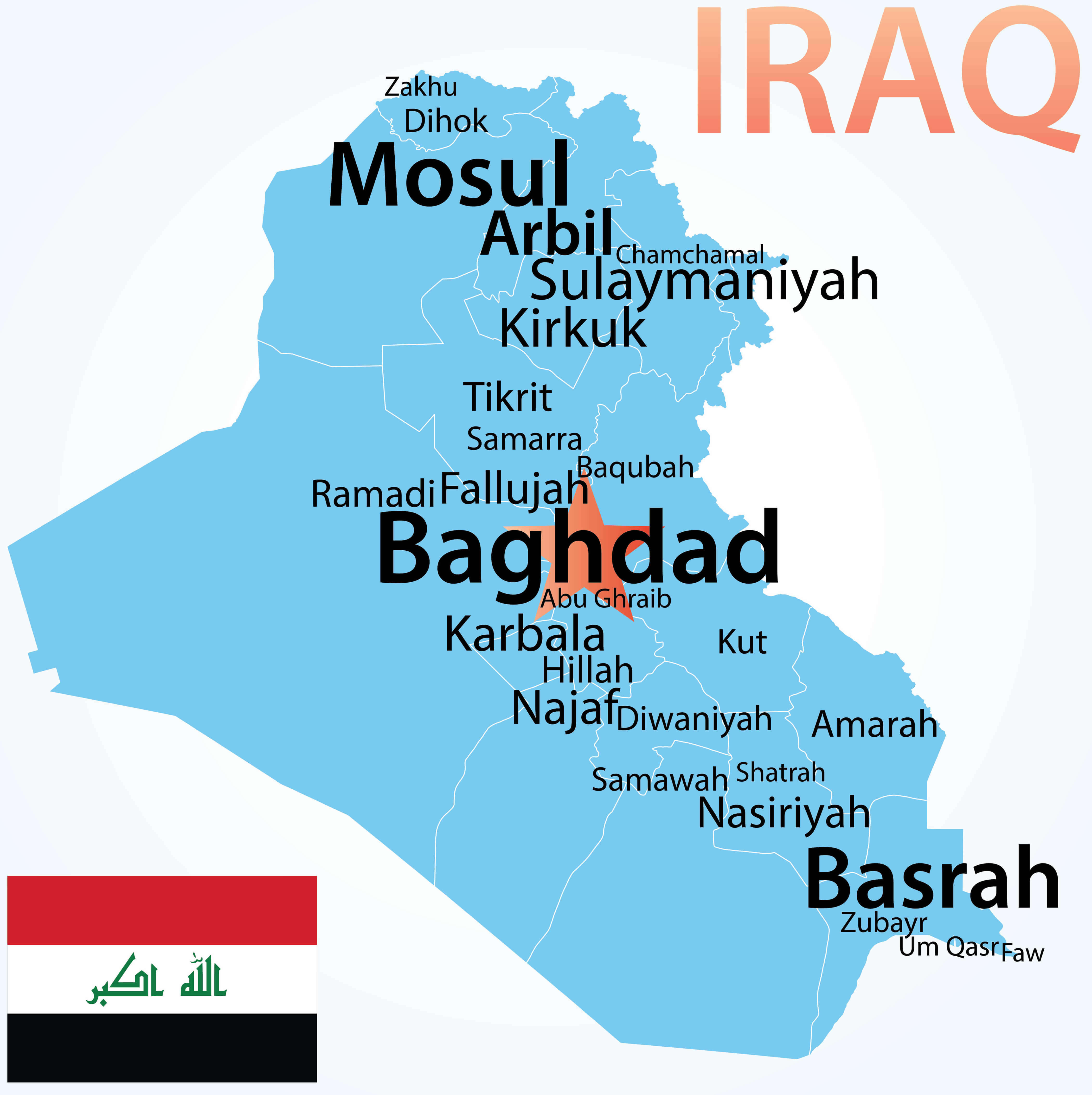
Iraq map with largest cities
High-resolution Map of Iraq
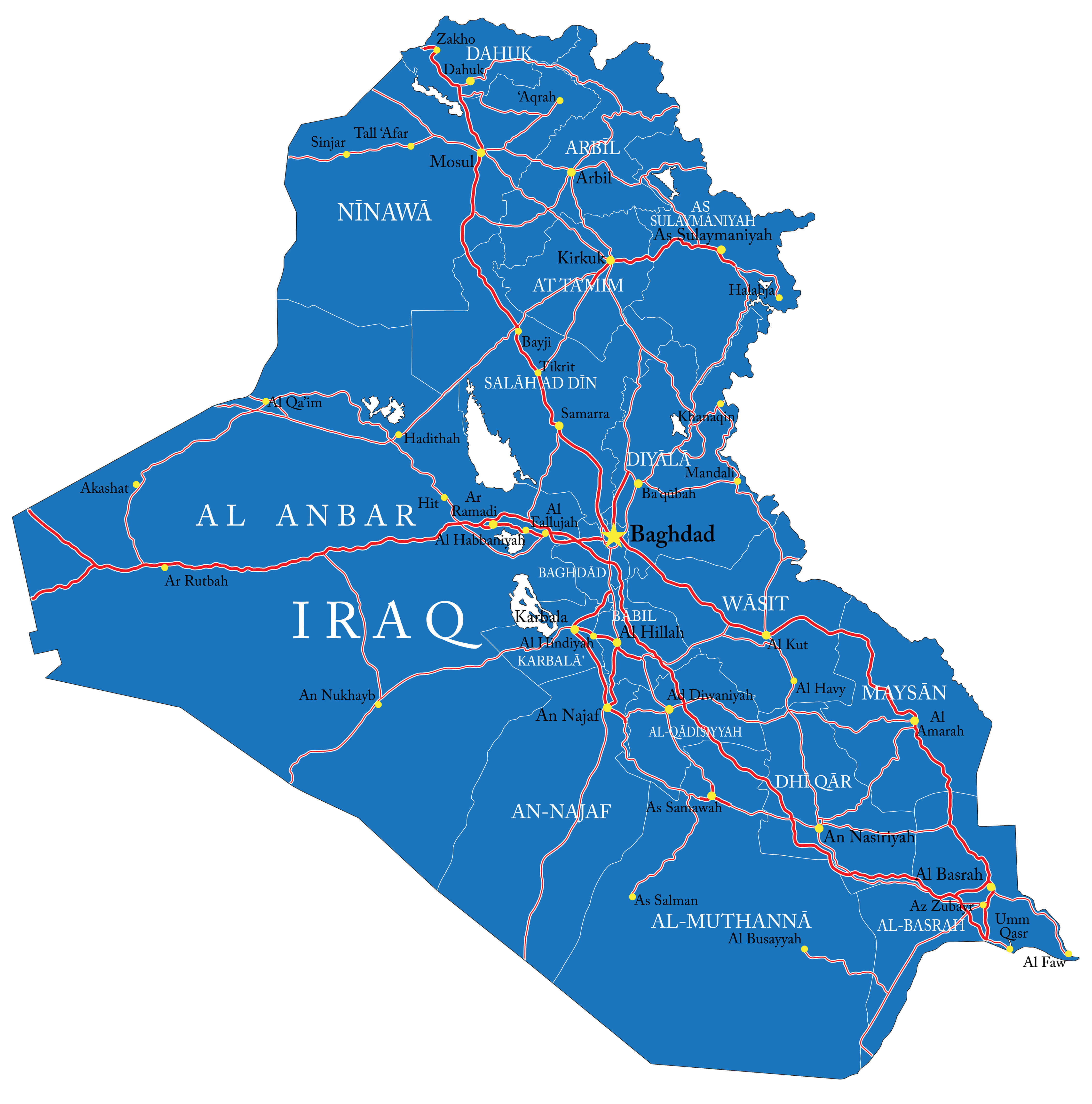
High-resolution Iraq roads map
Iraq high resolution physical map
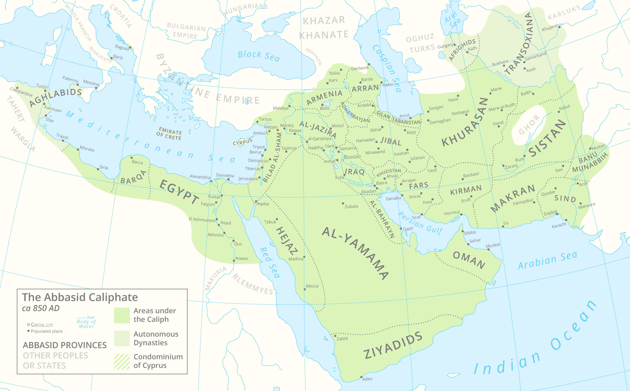
Abbasid caliphate map 850 AD with Iraq
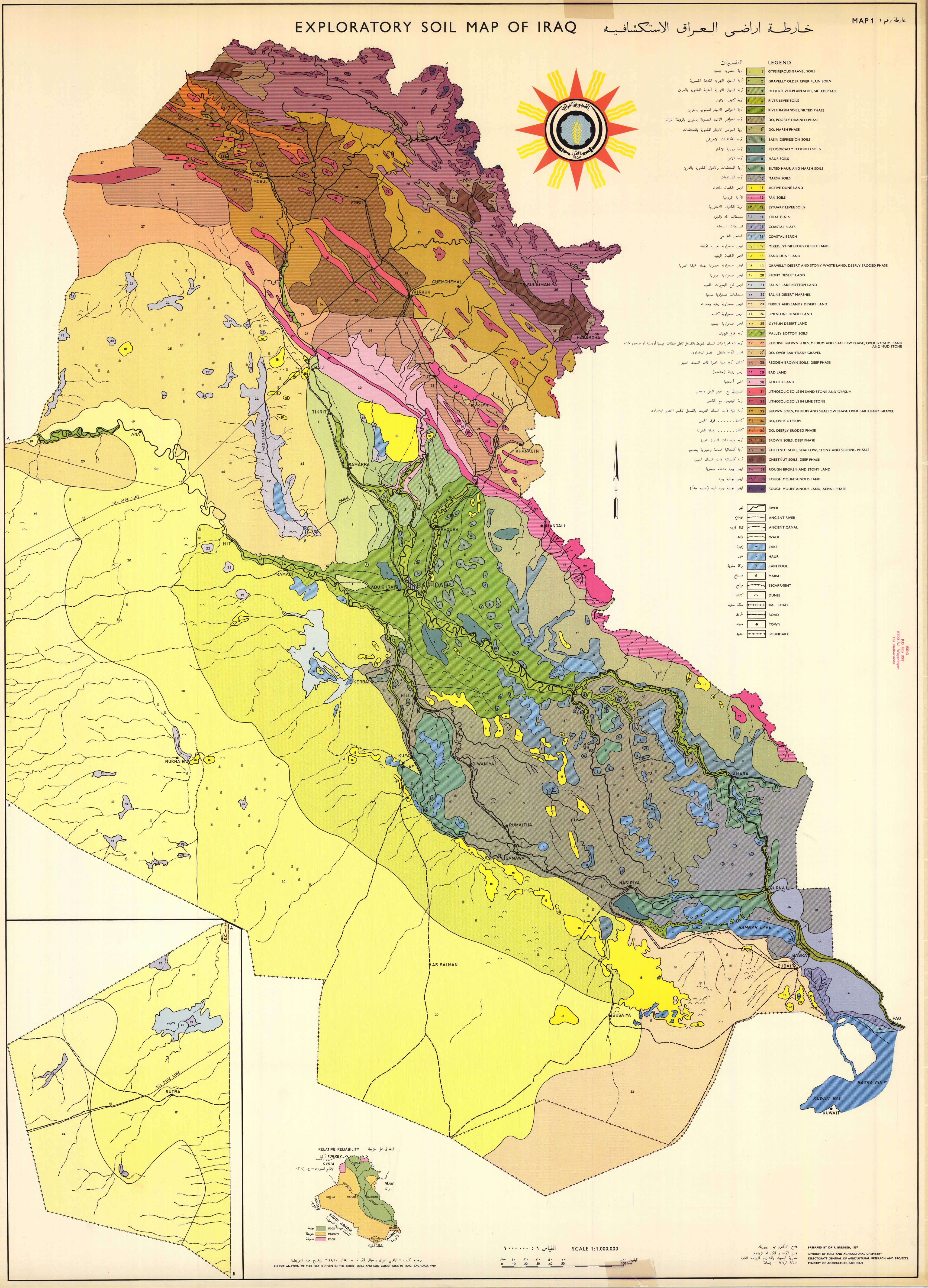
Detailed exploratory soil map of Iraq
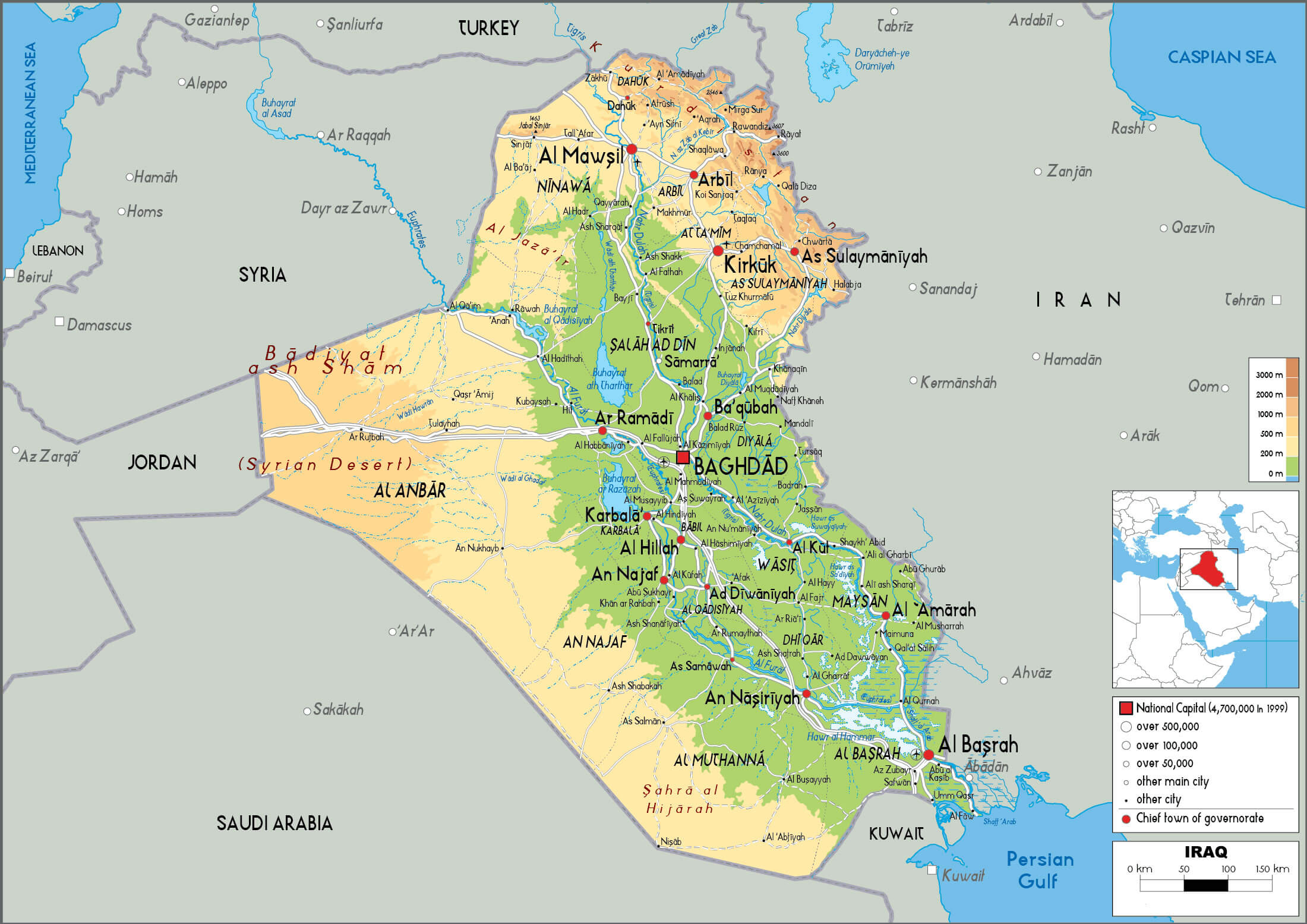
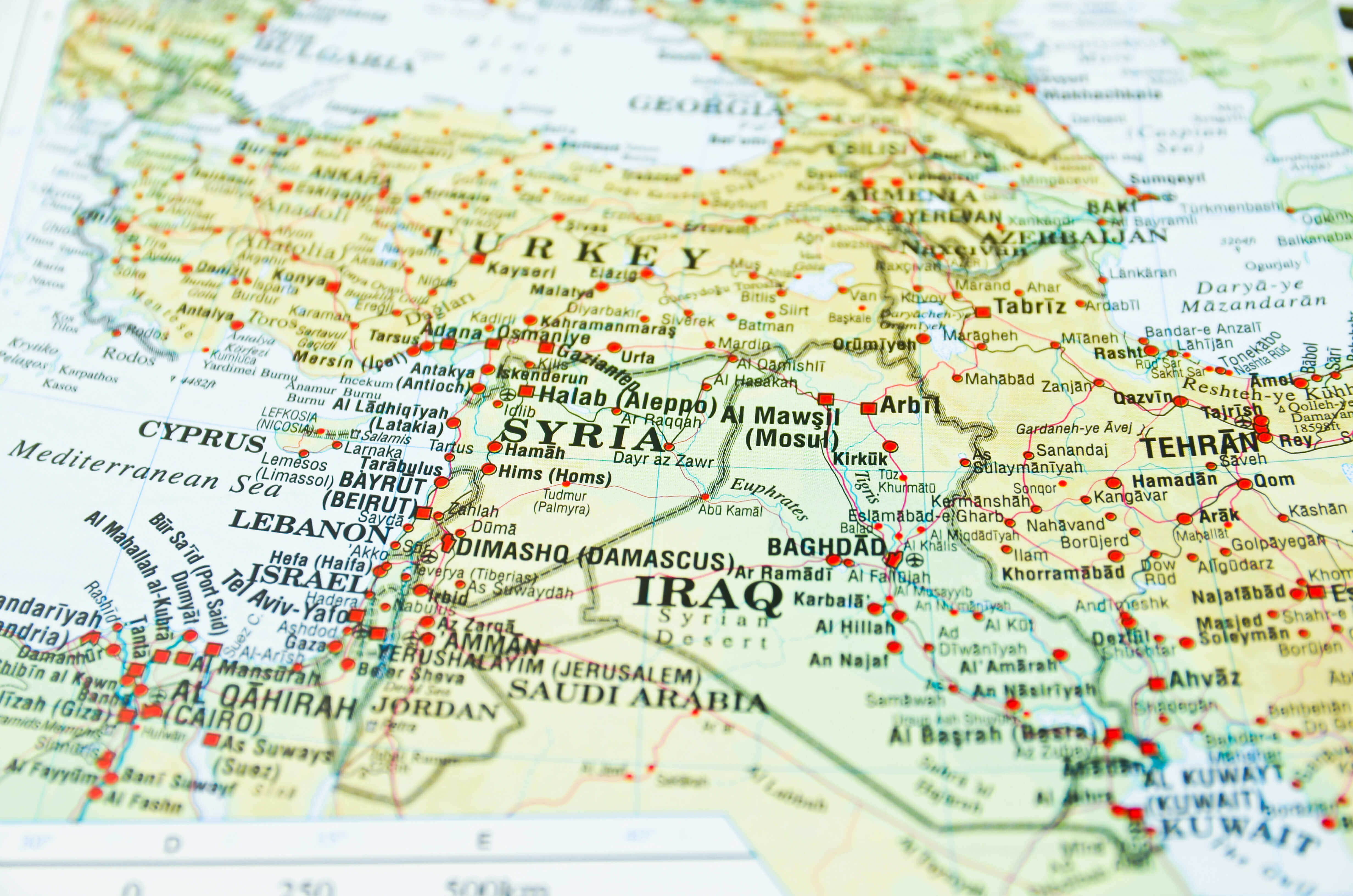
Detailed Iraq map with middle east
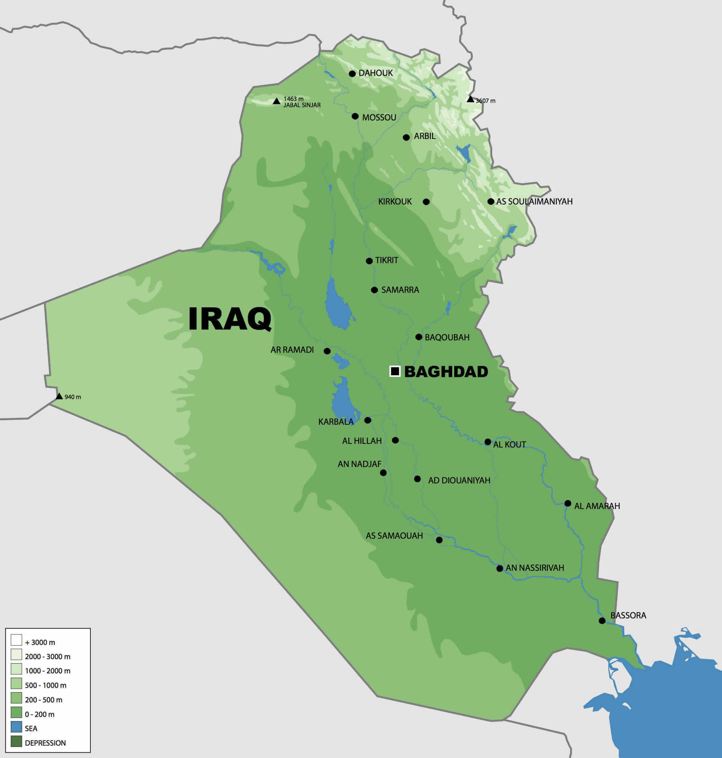
Elevation map of Iraq with major cities
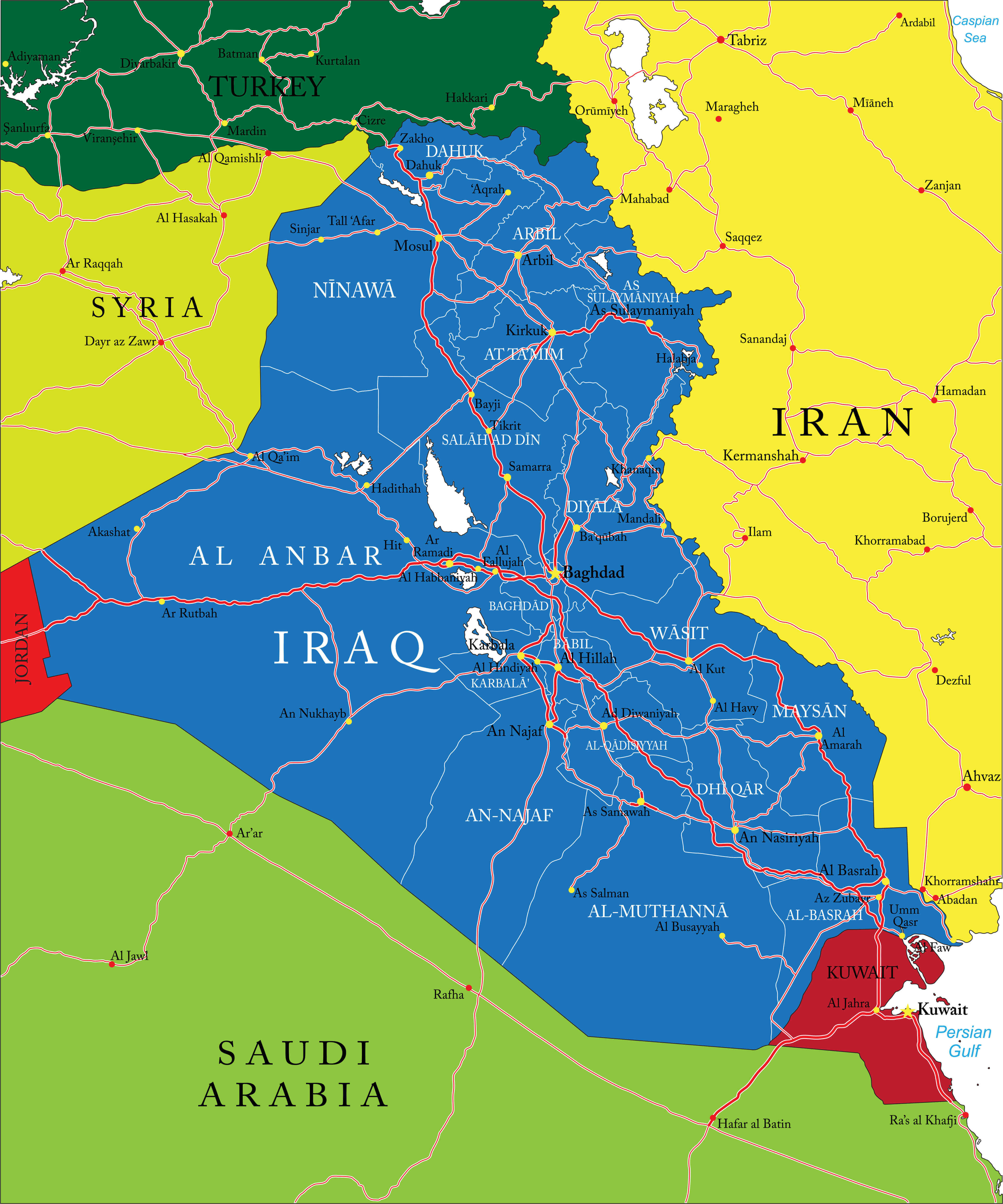
High-resolution Iraq provinces map
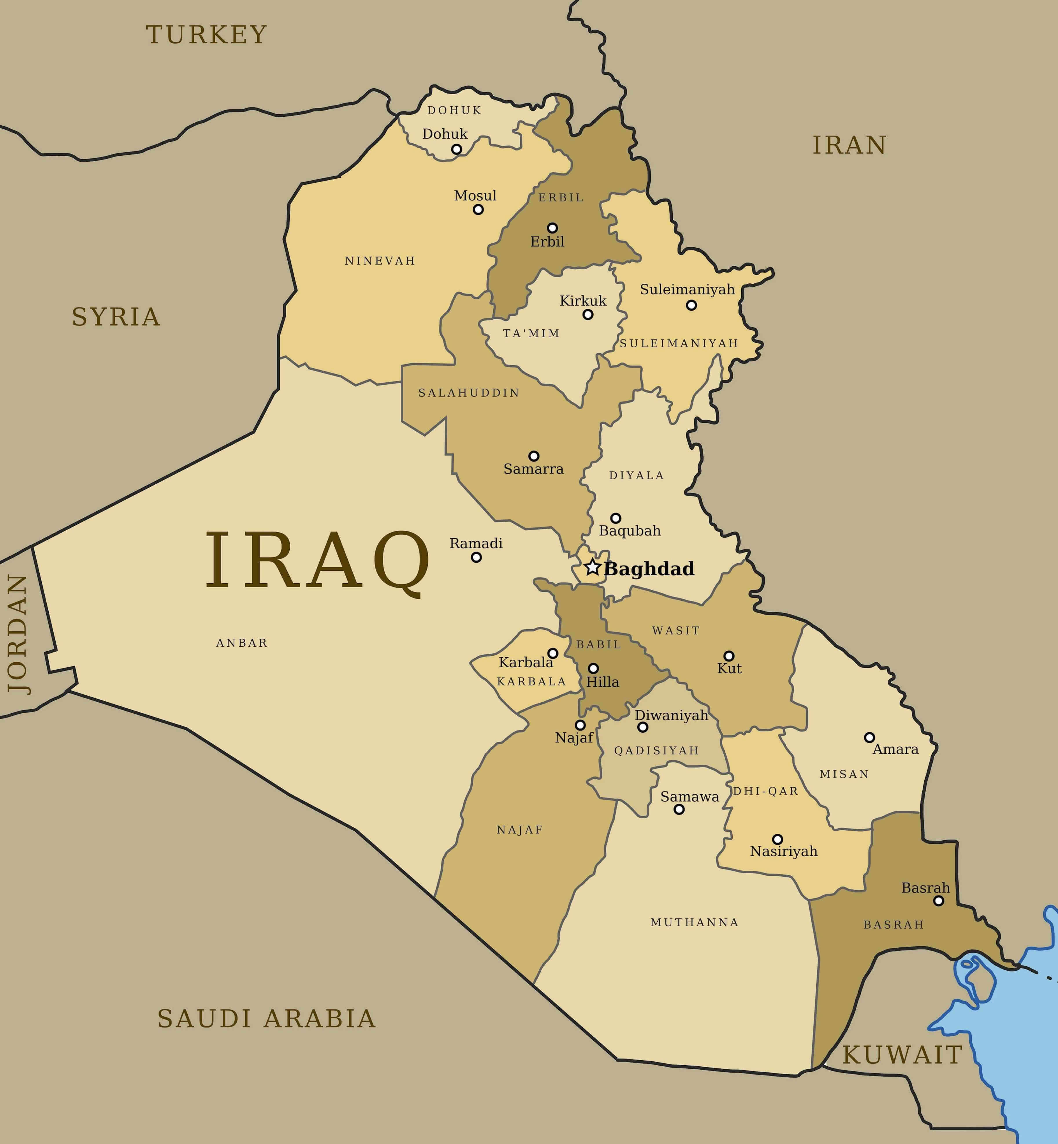
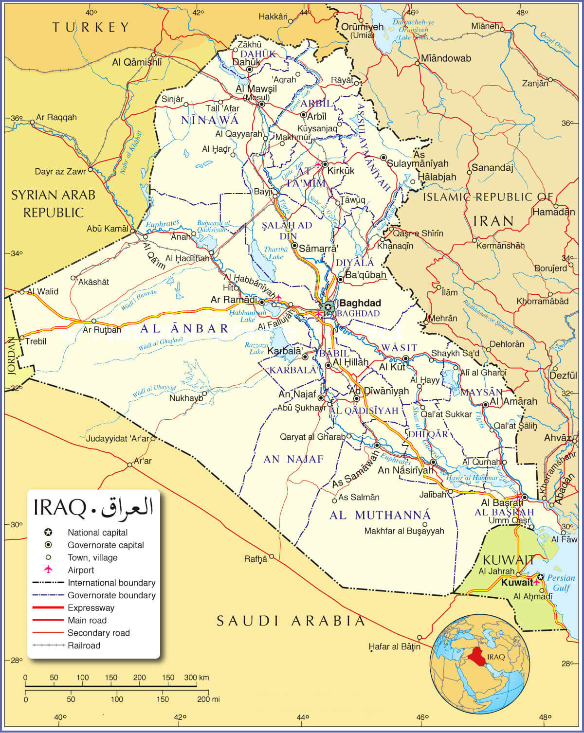
Iraq administrative map

Iraq climate map

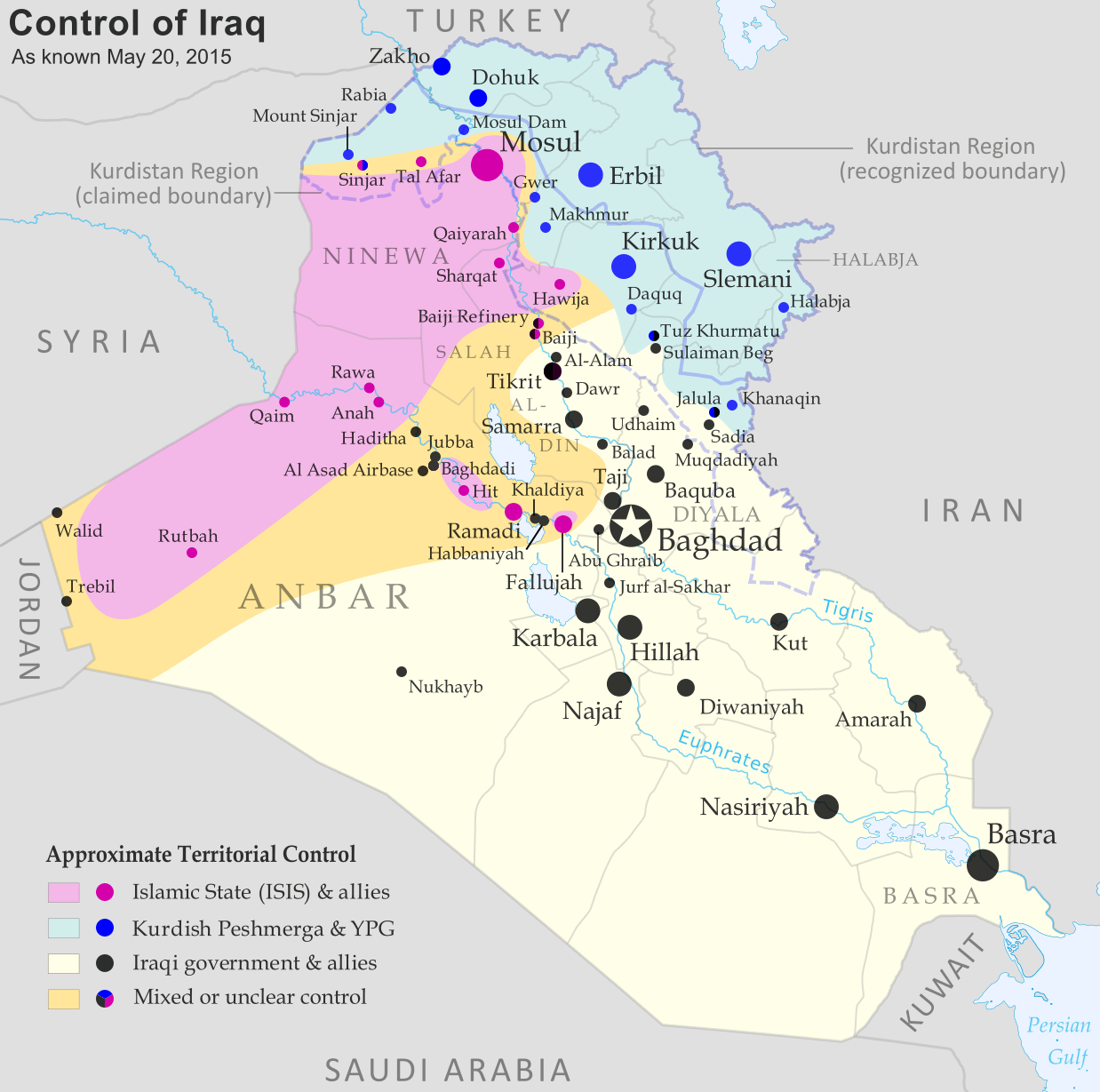
Iraq control map Islamic State with Kurdish Peshmergha
Iraq high resolution regions map
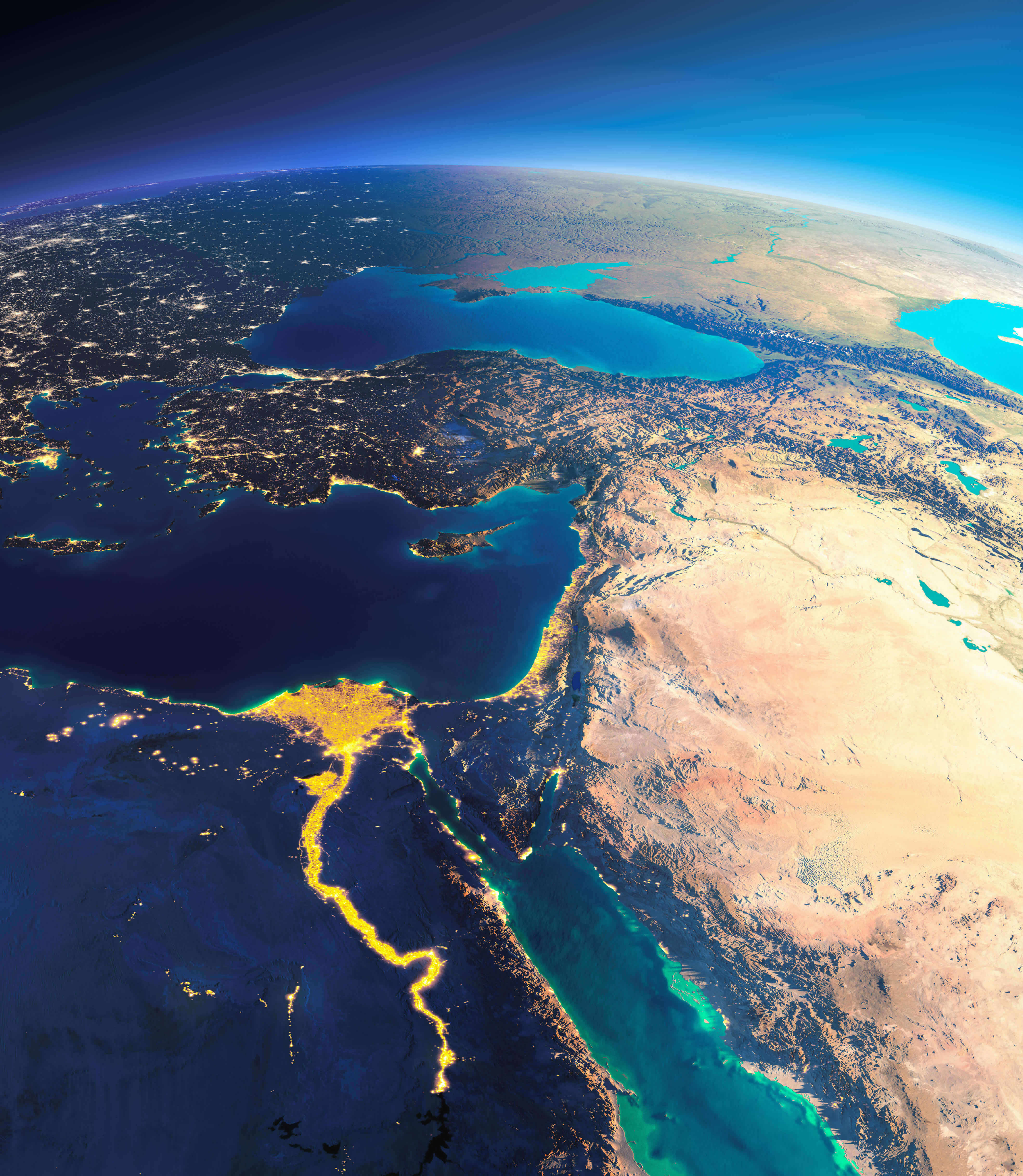
Iraq high resolution satellite map with Middle East
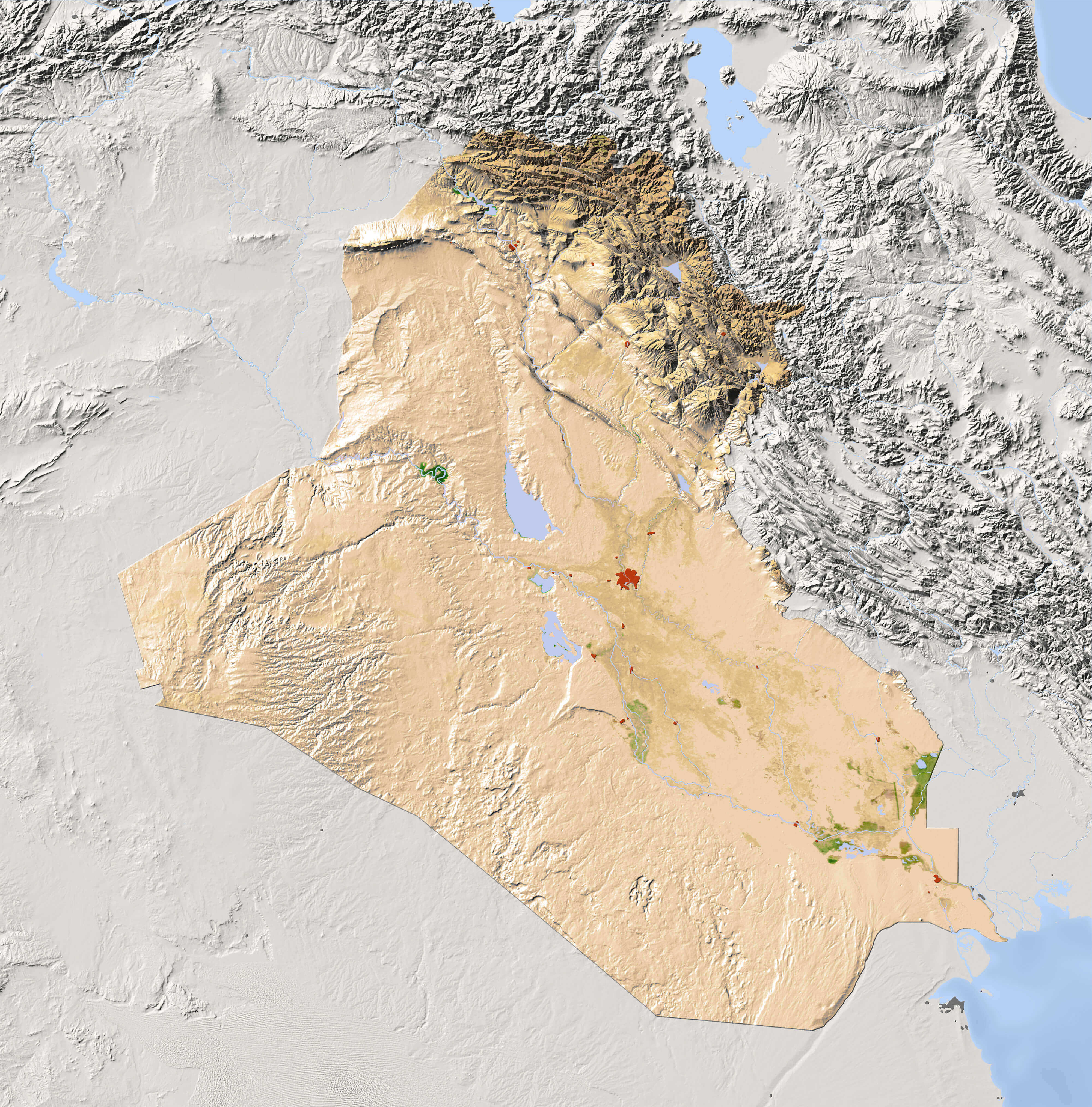
Iraq high resolution terrain map
Iraq large political map with cities
Iraq main cities map
Iraq major cities map
Iraq map in arabic
Large Iraq blank map with provinces
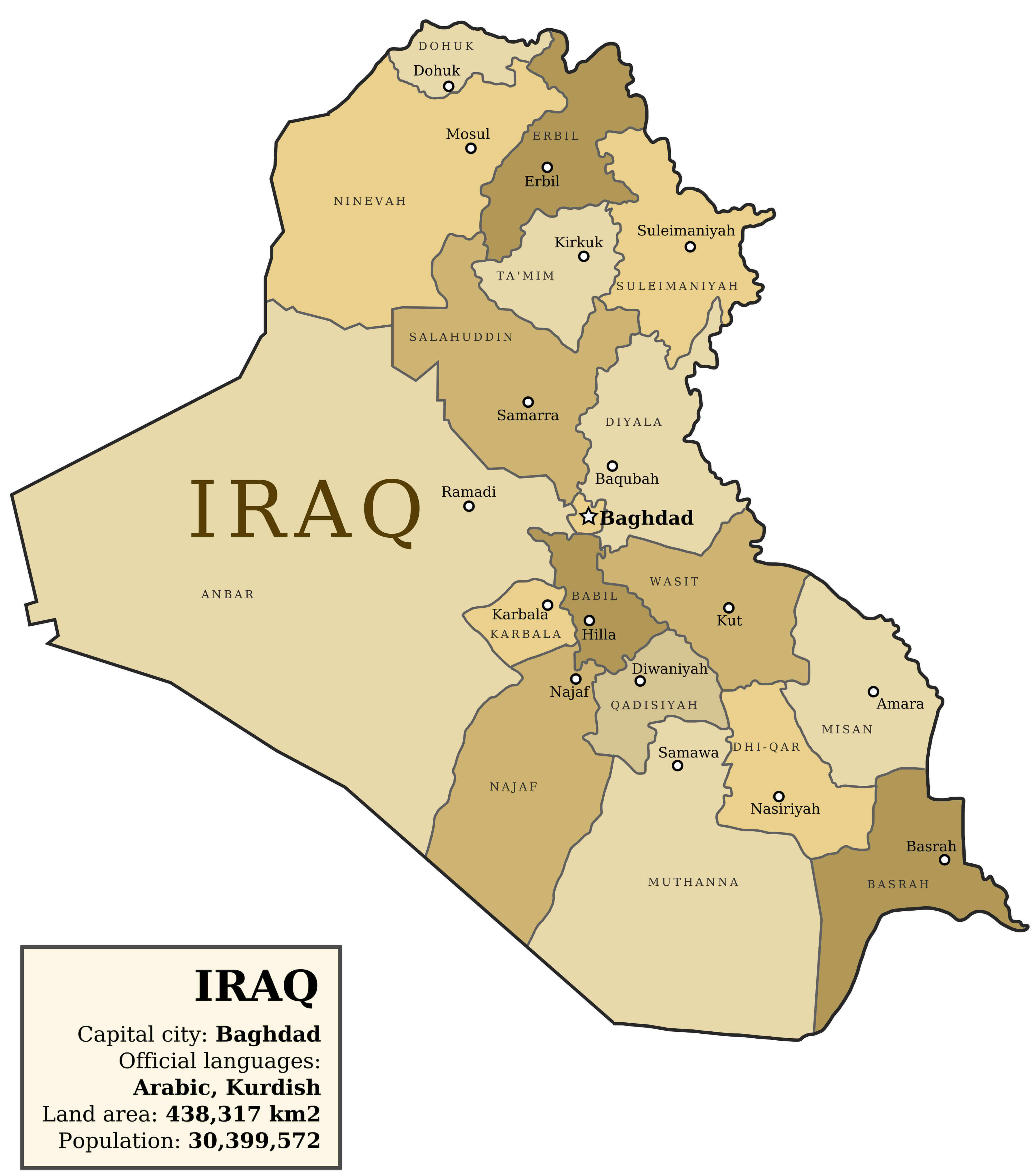
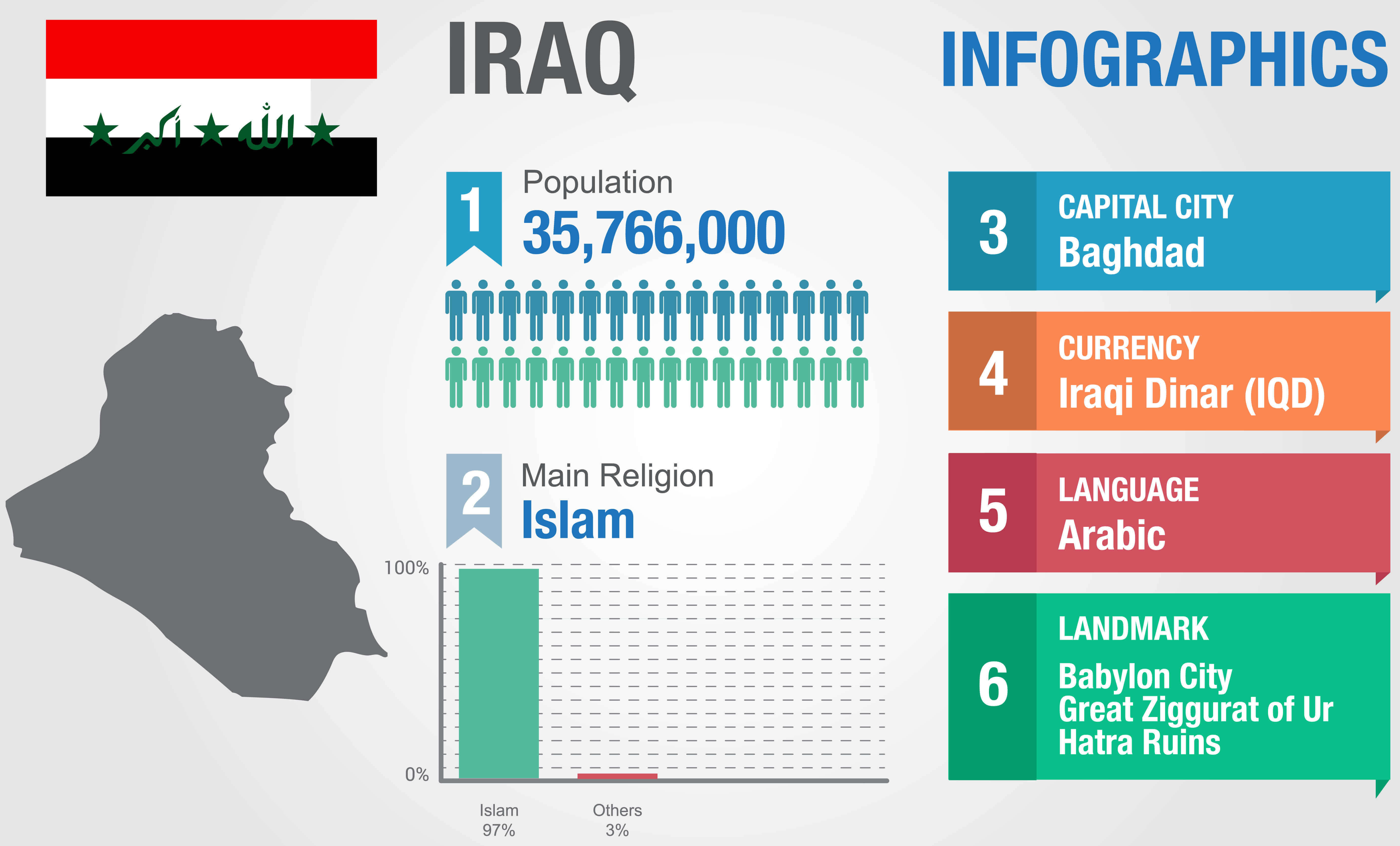
Large Iraq info map
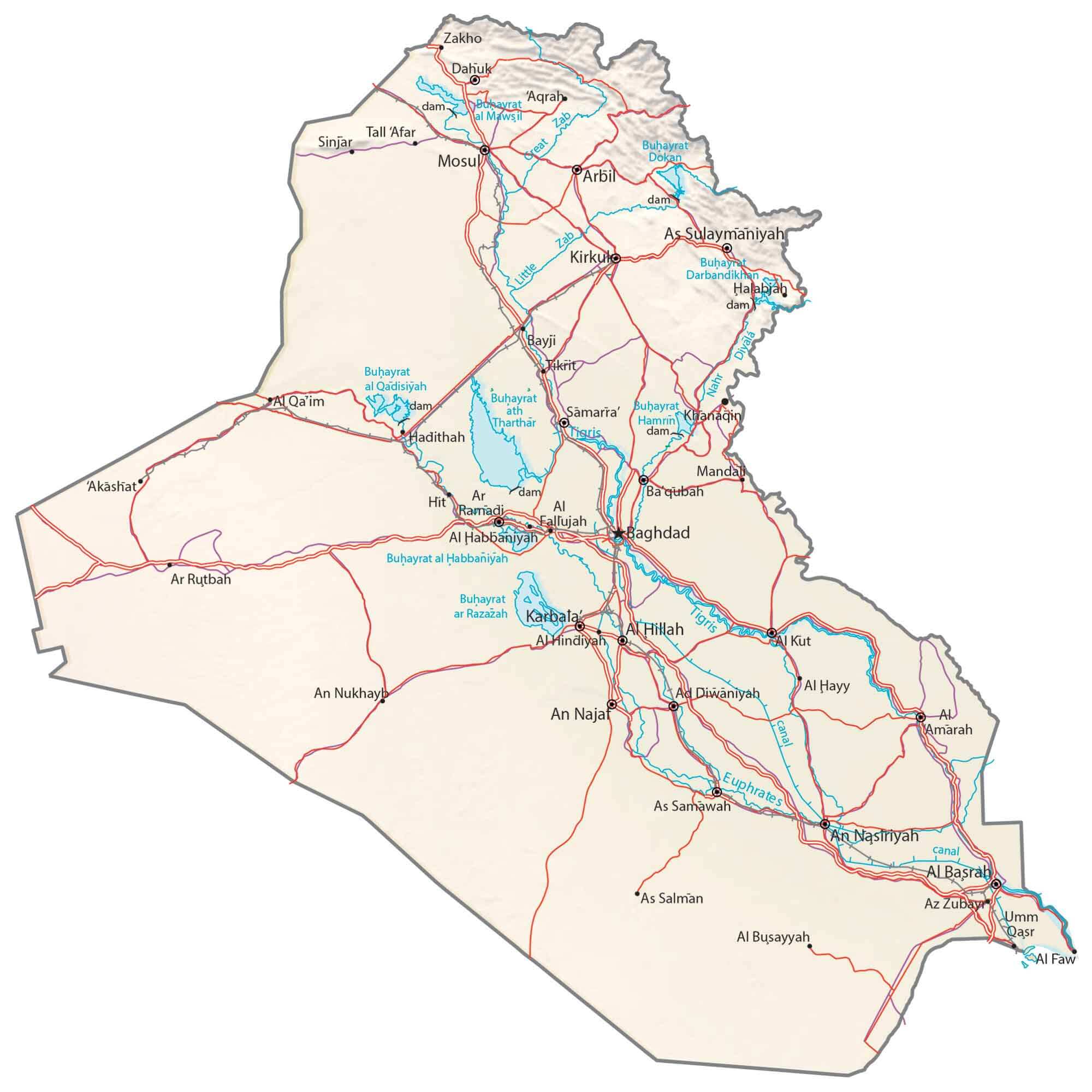
Large Iraq map with roads and rivers
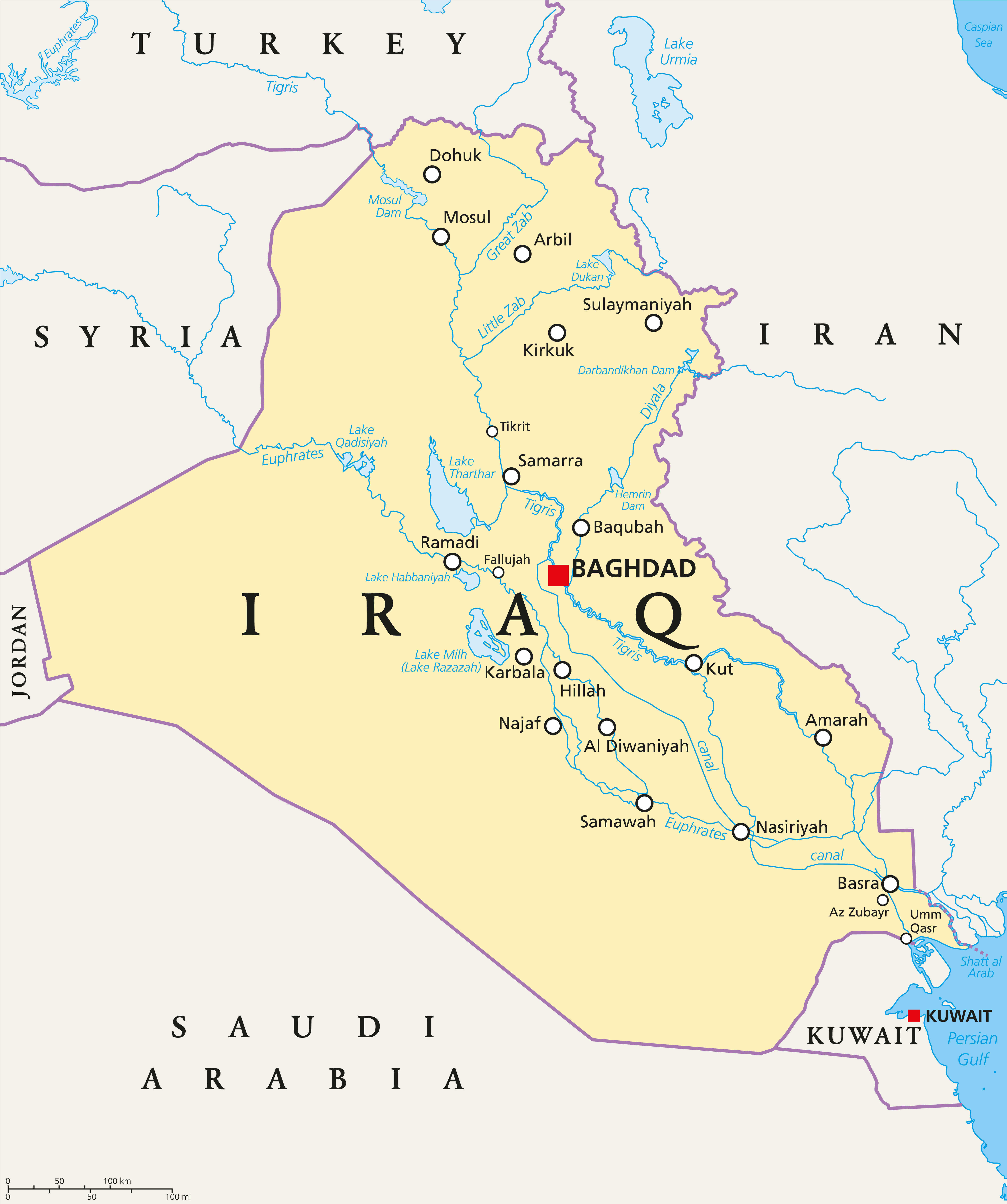
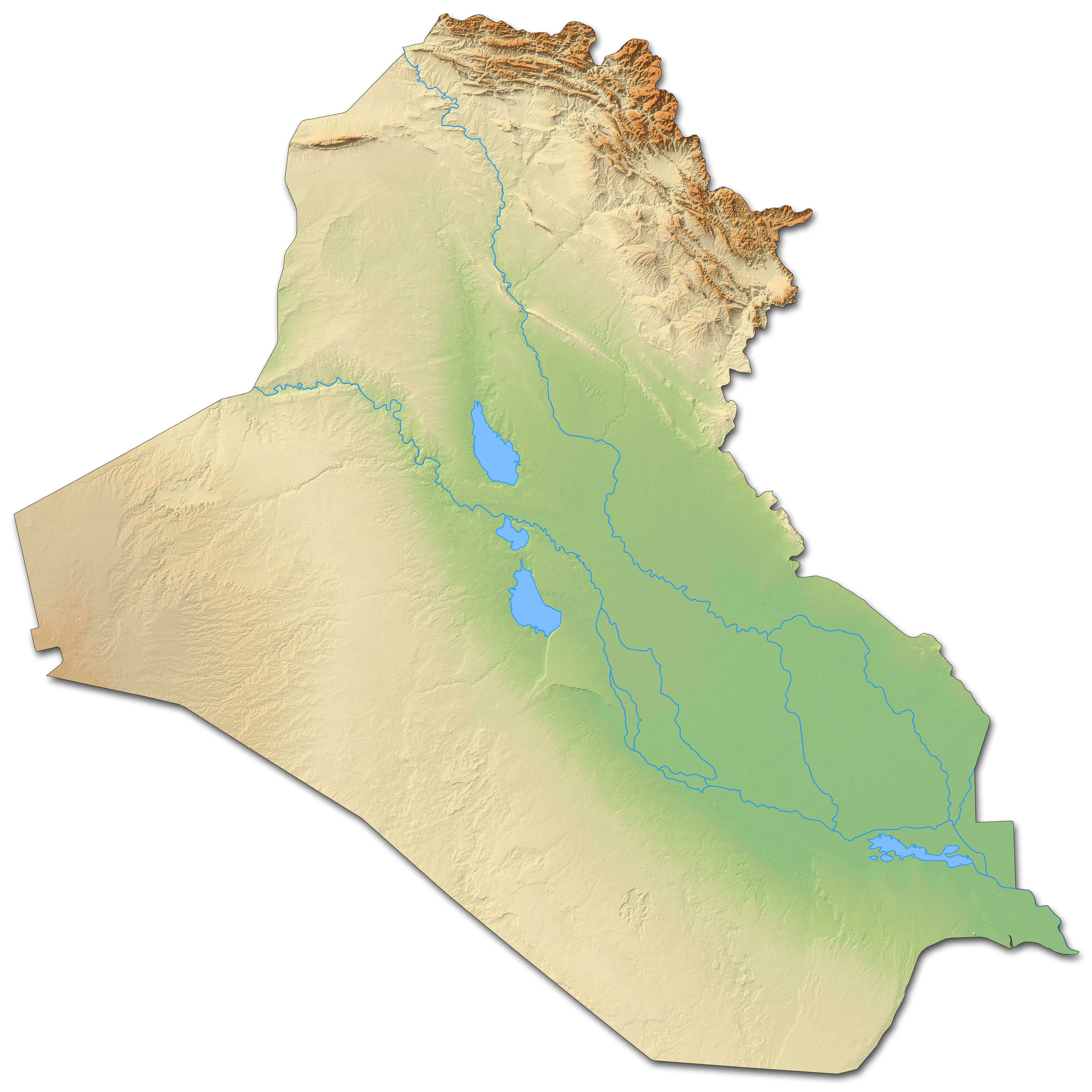
Large Iraq physical map with rivers lakes
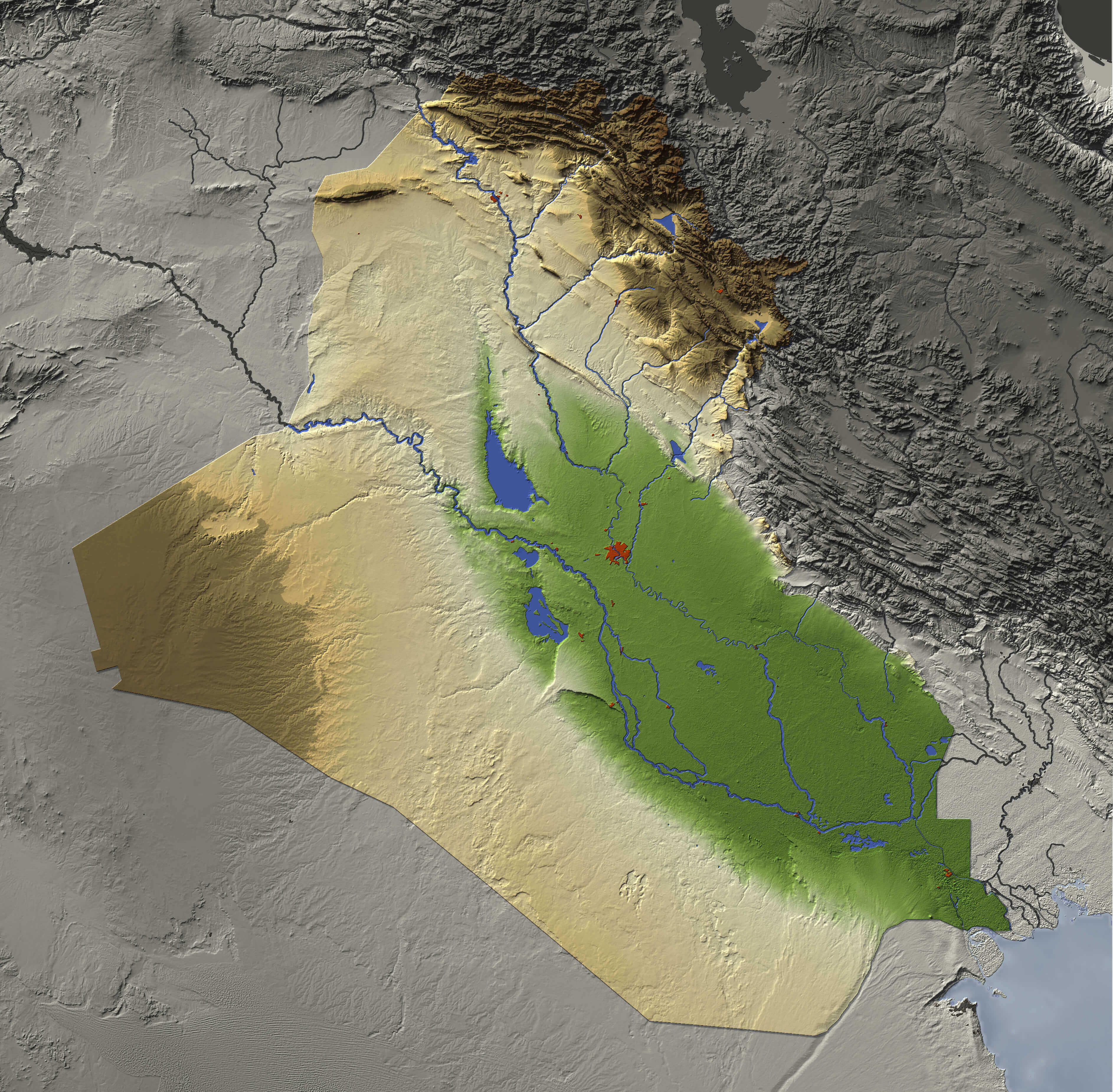
Large relief map of Iraq
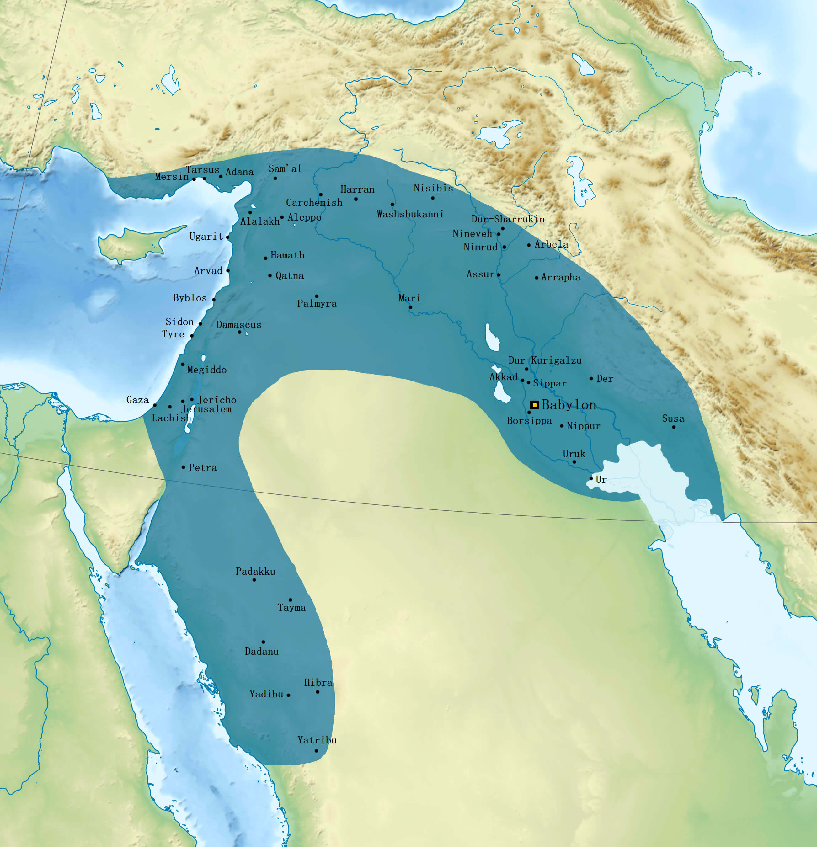
Neo Babylonian Empire map under Nabonidus 556 539 BC
Feel free to explore these pages as well:
Author: Arif Cagrici