The Netherlands on the Map: Location, Borders & Geography Explained
The Netherlands is located in Northwestern Europe, along the North Sea coast, between Germany to the east and Belgium to the south. As part of the Low Countries, the Netherlands is known for its low-lying landscape, extensive canal systems, and advanced water management infrastructure. Positioned at the delta of major European rivers such as the Rhine, Meuse, and Scheldt, the country has historically served as a key hub for trade and transportation. Its strategic geographic location within Europe makes the Netherlands one of the continent's most important economic and logistical centers.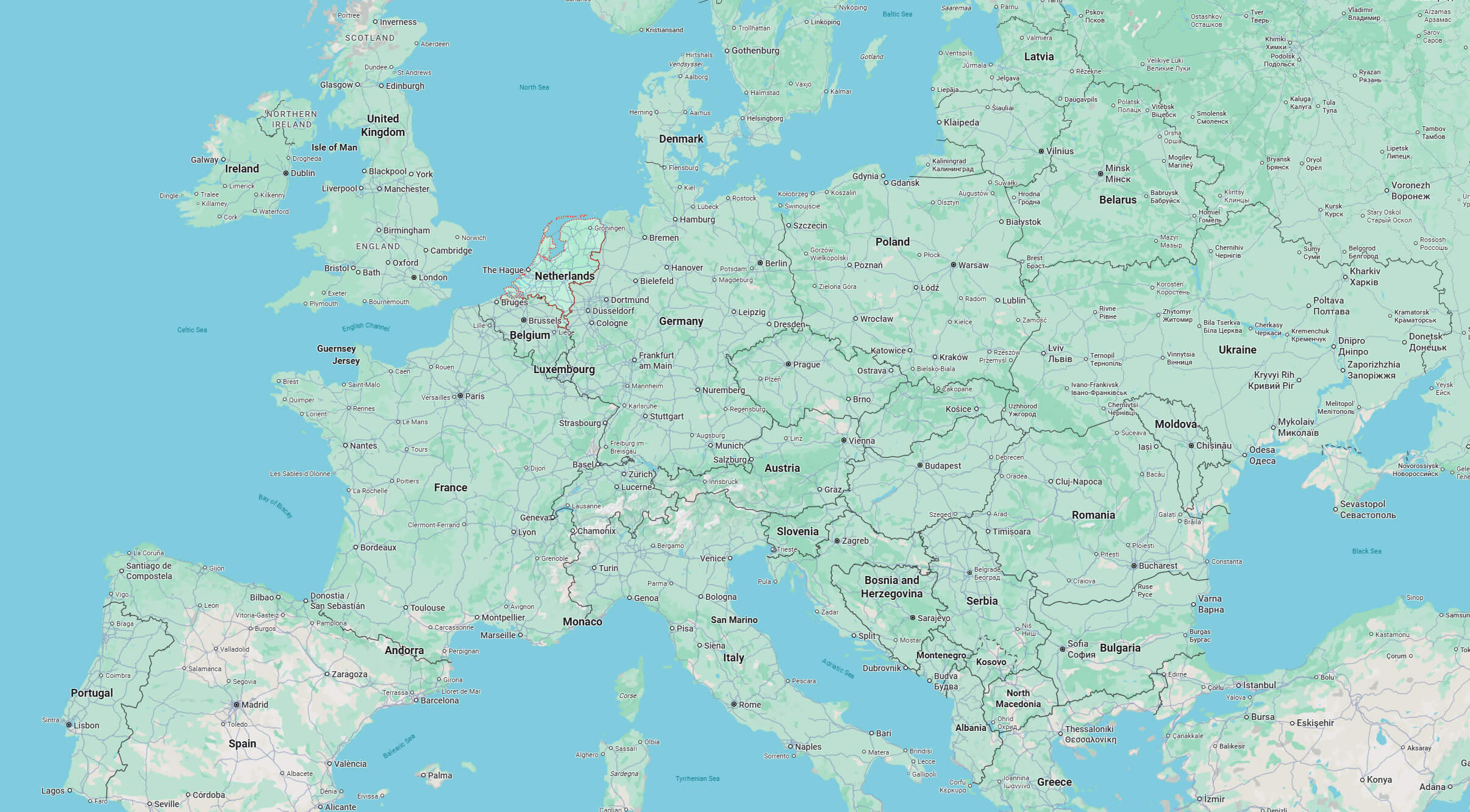
Where Is the Netherlands Located? (Complete Geographic Guide)
Where Is the Netherlands Located?
The Netherlands is a country in Northwestern Europe, located along the coast of the North Sea. It borders Germany to the east and Belgium to the south, and it sits within the wider region often called the Low Countries.
Geographic Location of the Netherlands
Geographically, the Netherlands lies on the delta of several major European rivers—most notably the Rhine, Meuse, and Scheldt—giving it a long history of trade, ports, and water management. A significant part of the country is low-lying, with some areas below sea level and protected by dikes and advanced flood-control systems.
What Are the Main Regions of the Netherlands?
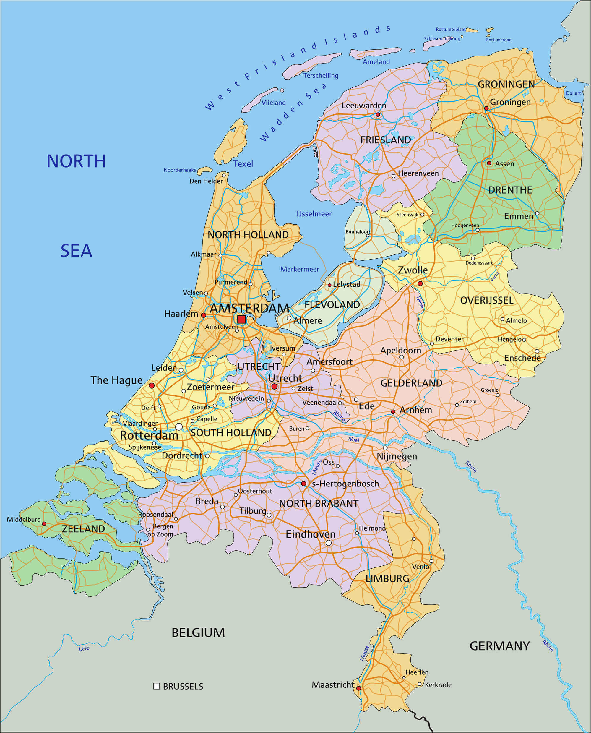
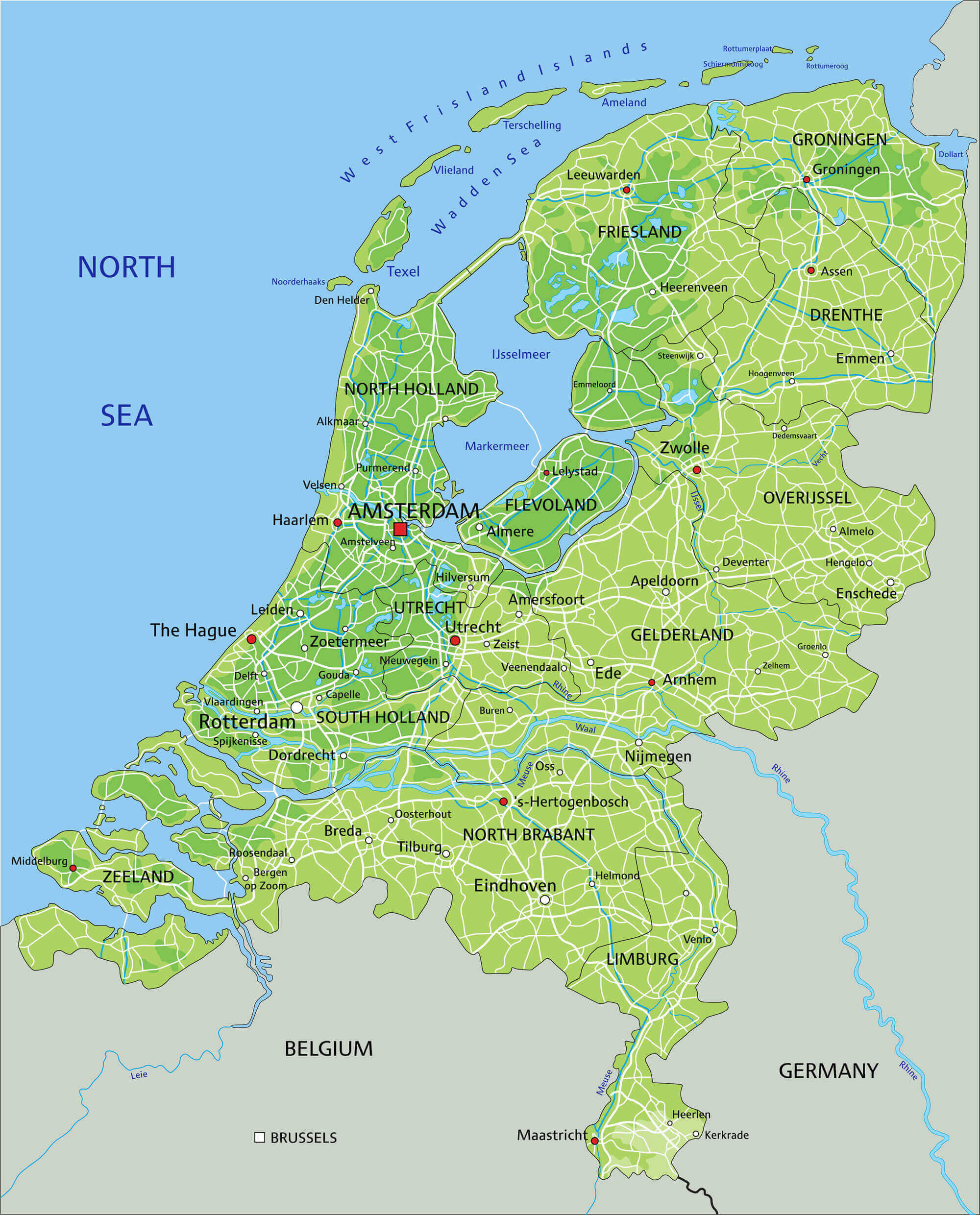
The Netherlands is divided into 12 provinces, often grouped informally into regions such as the Randstad (the major urban and economic ring), the northern provinces, the eastern inland areas, and the southern provinces. Each province has its own capital and local administration.
What Are the 5 Largest Cities in the Netherlands?
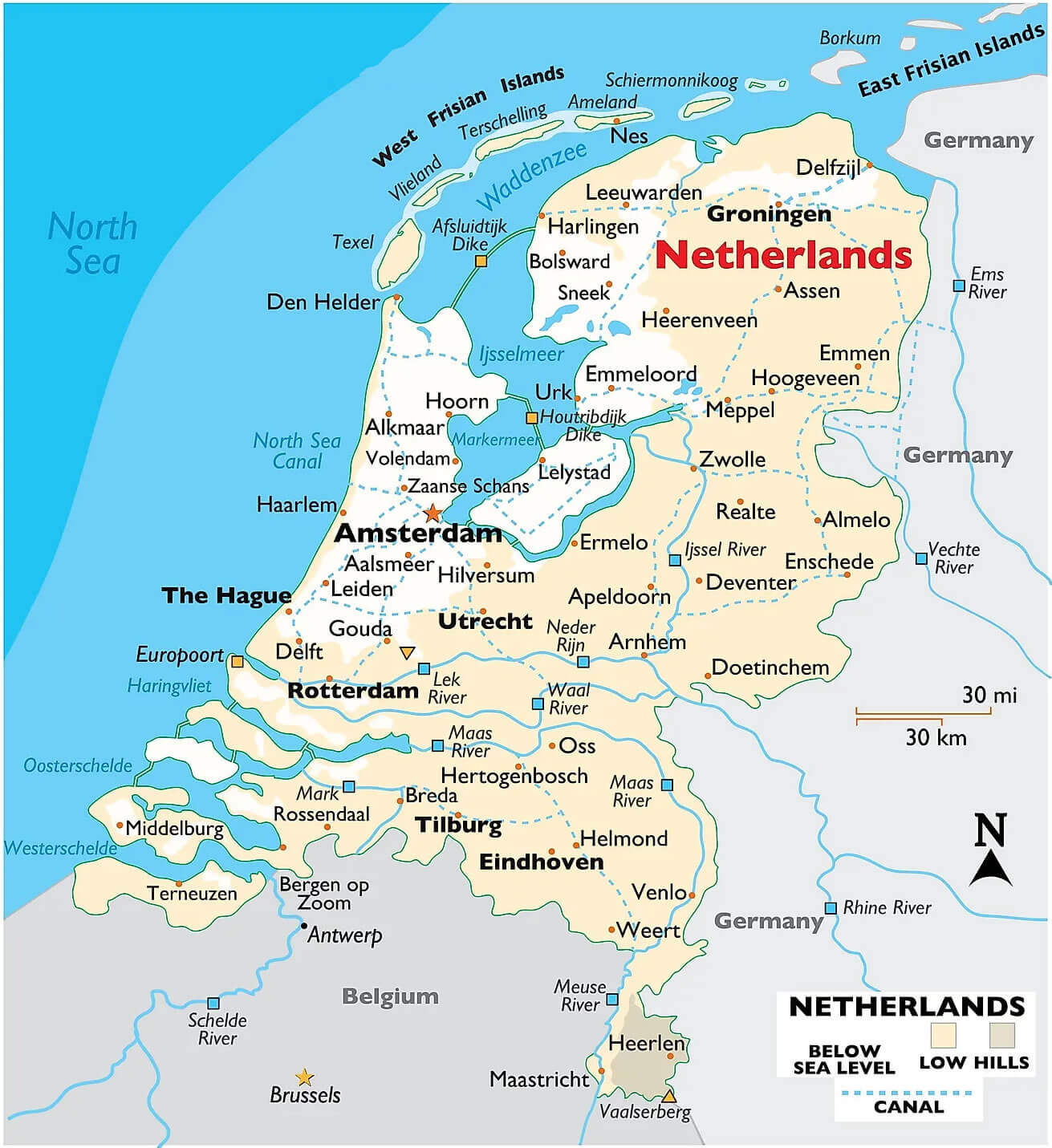
The largest cities in the Netherlands are typically led by Amsterdam, Rotterdam, The Hague, Utrecht, and Eindhoven. Together, many of these cities form the Randstad—one of Europe's most densely populated and economically important metropolitan areas.
Quick Facts About the Netherlands
| Official Name: | Kingdom of the Netherlands |
|---|---|
| Area: | ~41,500 km² |
| Capital: | Amsterdam |
| Population: | ~17.9 million (approx.) |
| Currency: | Euro (EUR) |
| GDP: | High-income economy (varies by year) |
| Per Capita: | High (varies by year) |
| Time Zone: | CET (UTC+1); CEST (UTC+2 in summer) |
| Calling code: | +31 |
| Internet TLD: | .nl |
Why the Netherlands's Location Is Important
The Netherlands' location at the heart of Western Europe—between major markets in Germany, Belgium, and the United Kingdom—makes it a key hub for trade and logistics. Its North Sea coastline and river deltas support world-class ports (including Rotterdam), while its low-lying geography has shaped a global reputation for innovative water management and flood protection.
Frequently Asked Questions
Is the Netherlands in Europe?
Yes. The Netherlands is in Northwestern Europe, on the North Sea coast.
What countries border the Netherlands?
The Netherlands shares land borders with Germany (east) and Belgium (south).
Is Amsterdam the capital of the Netherlands?
Yes—Amsterdam is the constitutional capital. The Hague is the seat of government.
Why is the Netherlands called a "Low Country"?
Because large parts of the country are low-lying, and some areas are below sea level.
How many provinces does the Netherlands have?
The Netherlands is divided into 12 provinces, each with its own regional administration.
Feel free to explore these pages as well:
- Head of Performance Marketing
- Head of SEO
- Linkedin Profile: linkedin.com/in/arifcagrici