Where Is Belgium Located? (Complete Geographic Guide)
Belgium is a premier Western European destination strategically situated at the crossroads of the continent's major powers. Bordered by France, Germany, the Netherlands, and Luxembourg, this influential nation serves as the headquarters for both the European Union and NATO, earning its reputation as the "heart of Europe." Whether you are exploring its scenic North Sea coastline in the northwest or the rugged, forested terrain of the Ardennes mountains in the southeast, understanding where Belgium is located is the first step to discovering its unique blend of Germanic and Latin cultures.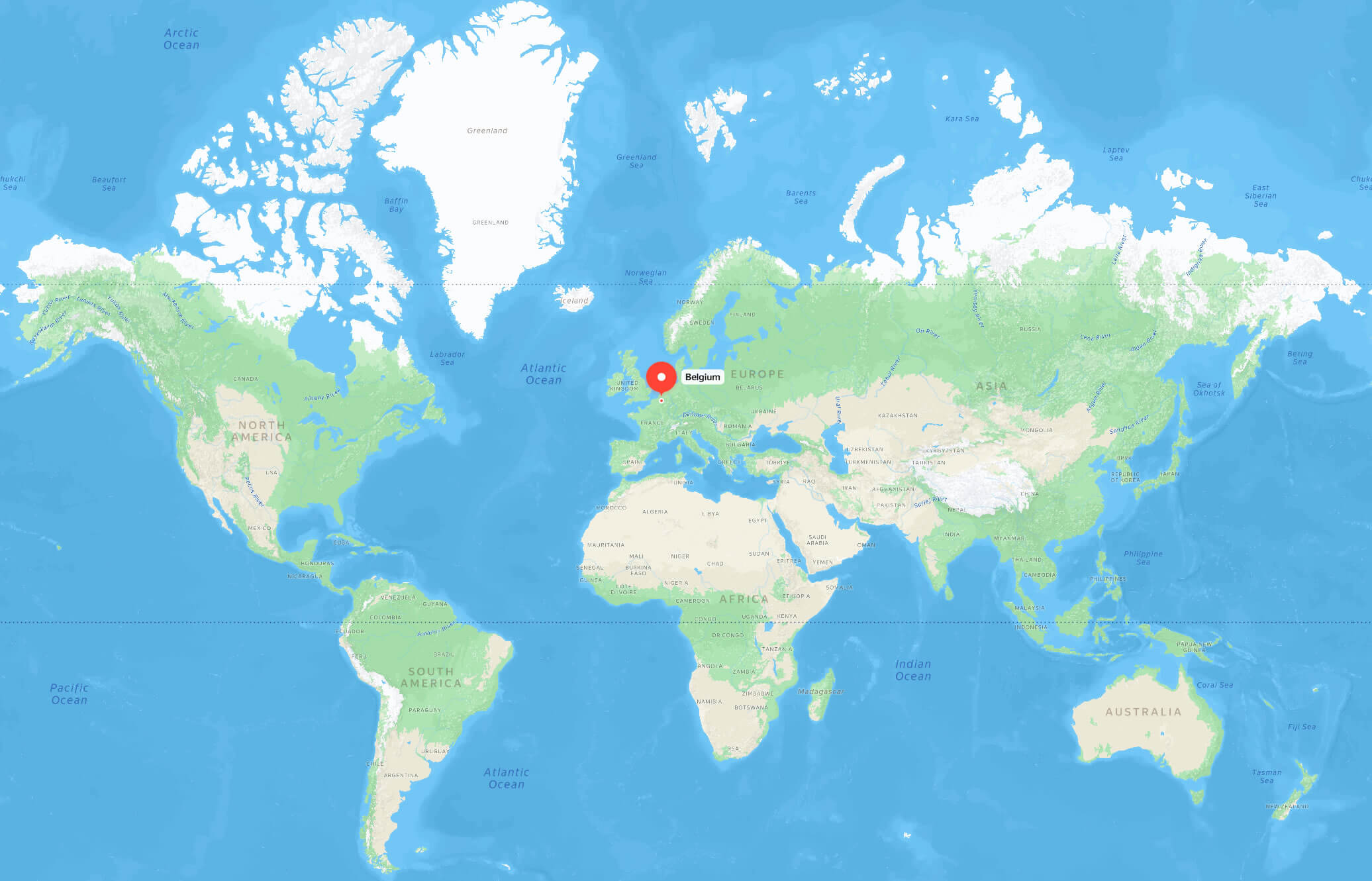
Discovering Belgium's Location

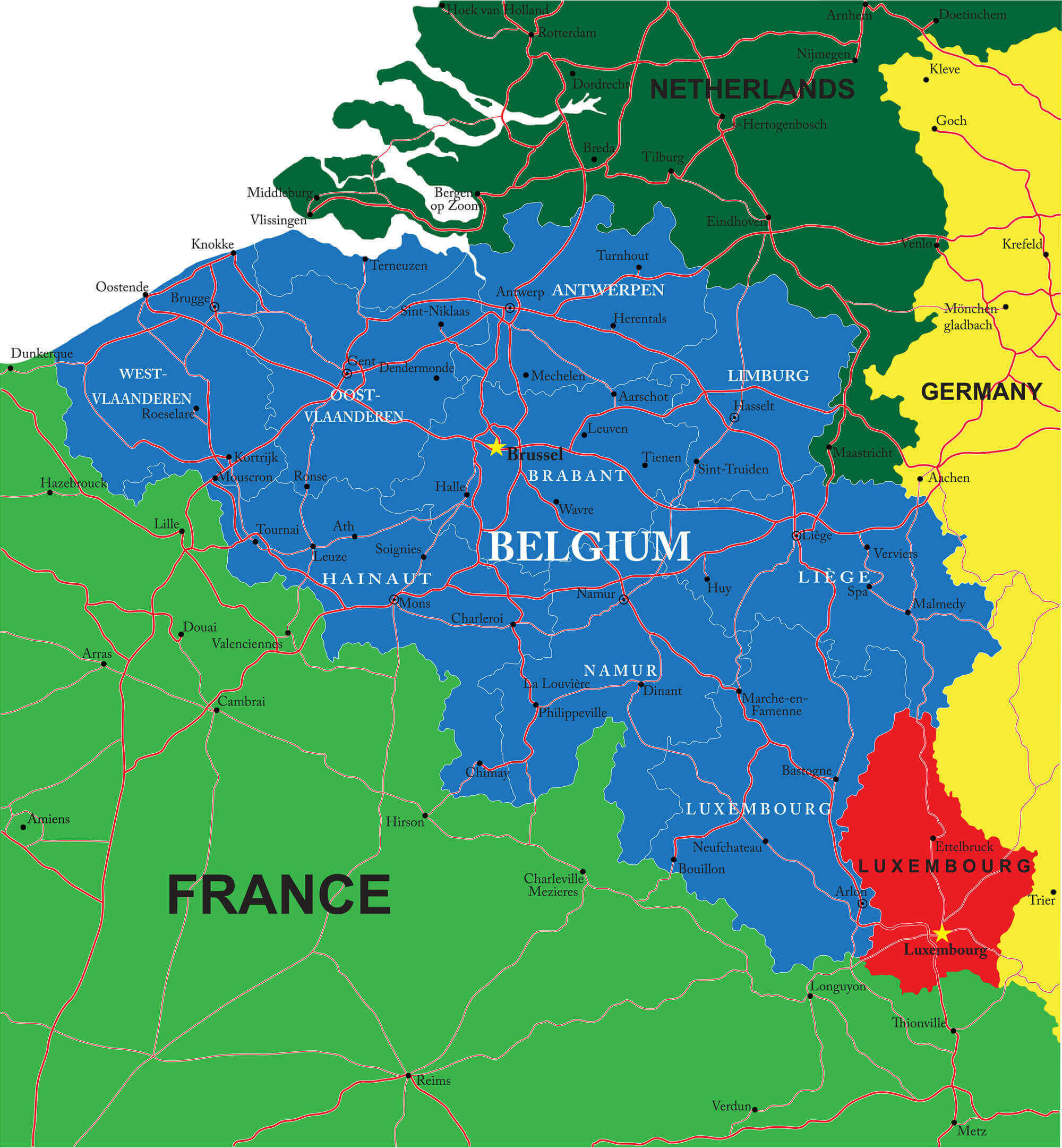
Belgium is a sovereign state situated in Western Europe, bordered by France, Germany, the Netherlands, and Luxembourg. Facing the North Sea, it is a key member of the historic Low Countries, a region characterized by its coastal geography and economic significance.
At a glance: Belgium serves as a vital bridge in Western Europe, nestled at the intersection of the continent's major cultural and political powers.
Geographic Coordinates and Borders
Positioned in northwestern Europe between latitudes 49° and 51° N, Belgium occupies a territory that has long been considered the "heart of Europe." This central placement makes it a strategic hub for trade and international relations.
The country shares its borders with four nations:
- France (to the south and southwest)
- Germany (to the east)
- The Netherlands (to the north)
- Luxembourg (to the southeast)
To the northwest, Belgium opens up to the North Sea, providing essential maritime access.
This geographic "crossroads" status is exactly why Belgium holds such immense political and economic influence within the modern world.
Western vs. Central Europe: Where Does It Fit?
Geopolitically, Belgium is firmly classified as a Western European country. While some refer to it as being in "Central Europe" due to its role as the functional center of the European Union, its cultural, historical, and UN-based classifications remain Western European.
In all official EU frameworks, Belgium is recognized as a core member of Western Europe.
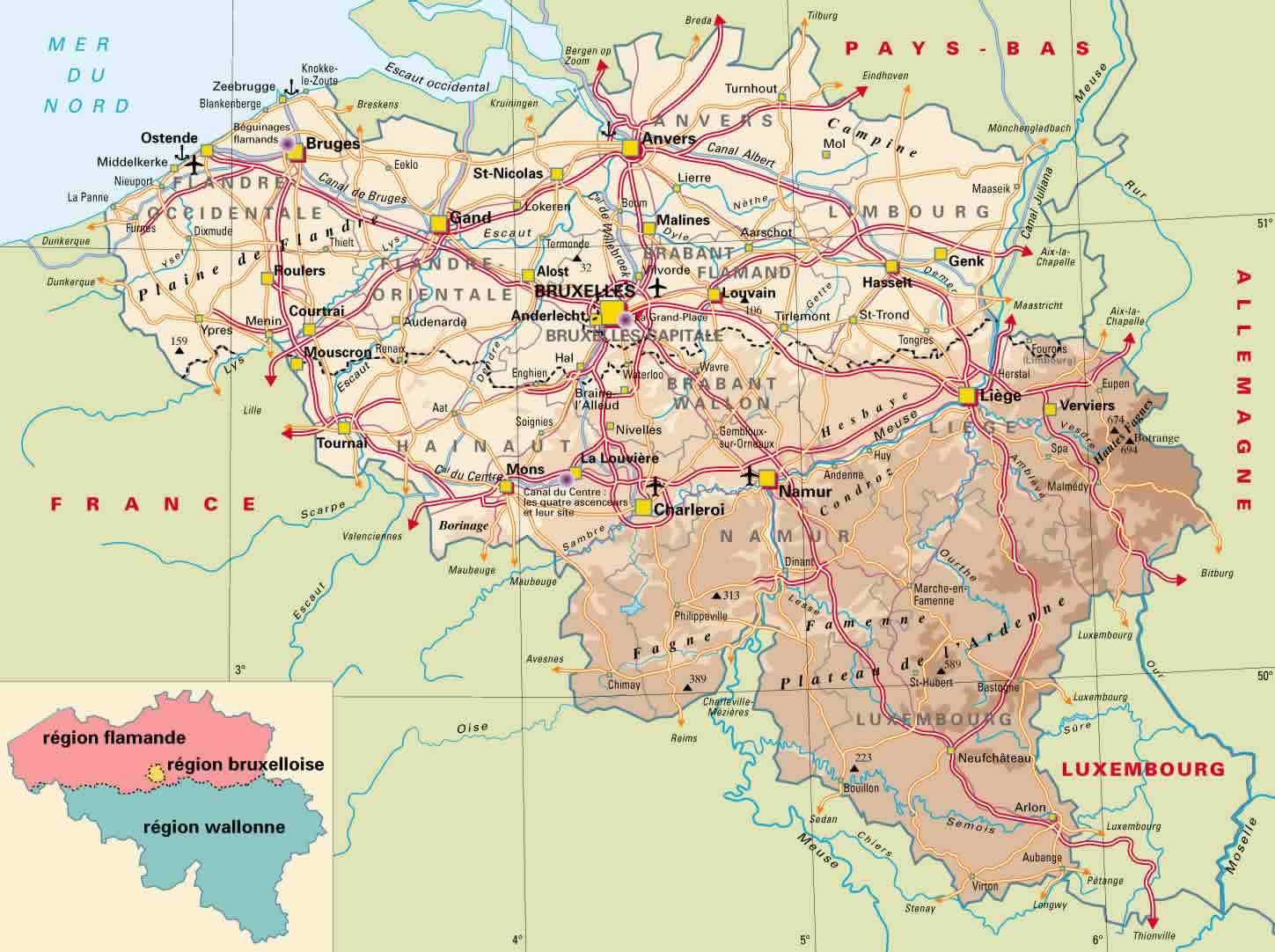
What Are the Main Regions of Belgium?
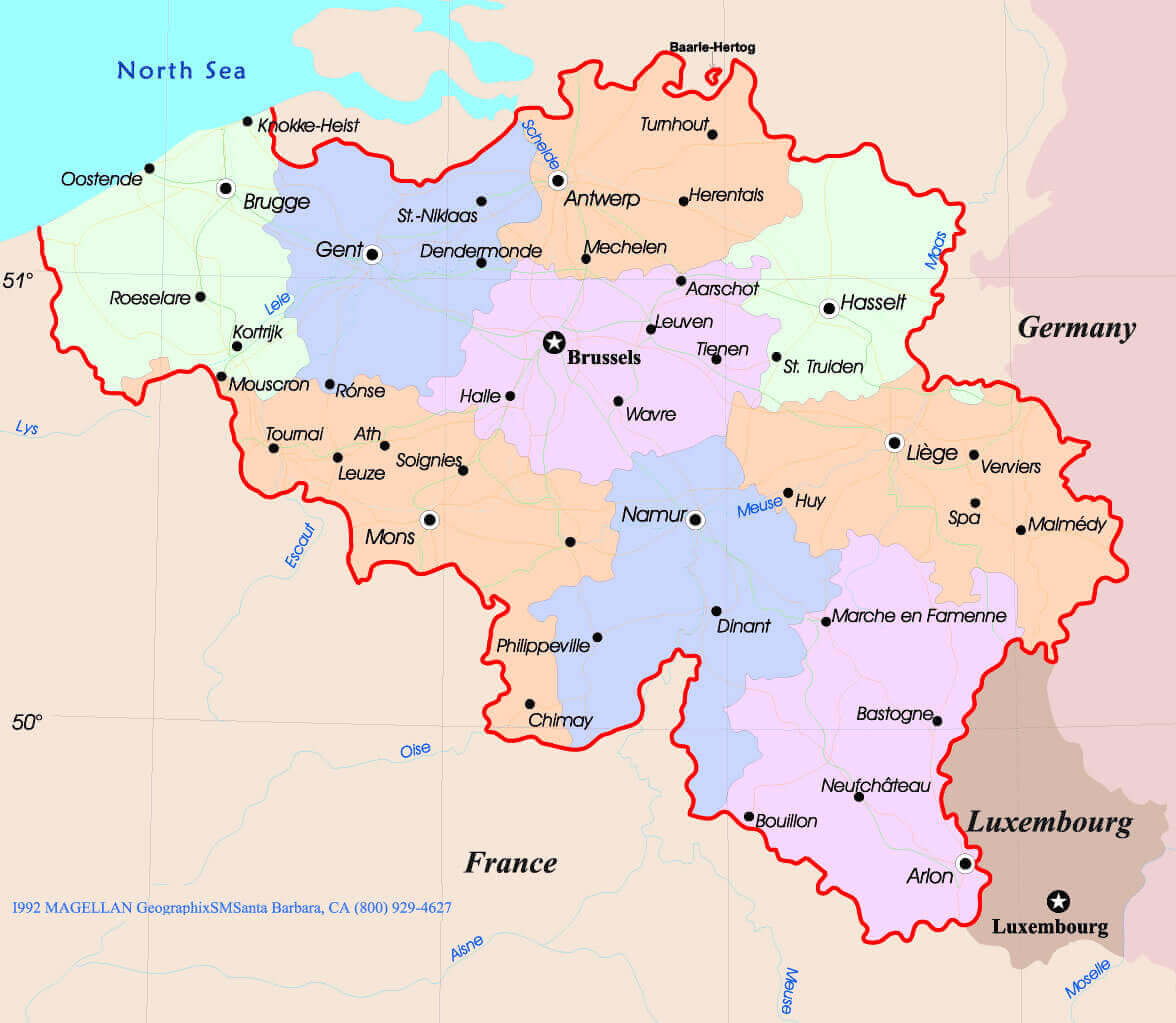
Belgium is organized into three distinct, highly autonomous regions:
1. Flanders (The Flemish Region)
The Dutch-speaking northern half of the country, known for its historic cities and flat plains.
2. Wallonia (The Walloon Region)
The predominantly French-speaking southern portion, featuring rolling hills and forests.
3. Brussels-Capital Region
A bilingual urban enclave located within Flanders, serving as the seat of the national government.
The nation's diverse terrain transitions from the low-lying sandy beaches of the coast to the rugged, forested terrain of the Ardennes mountains in the southeast.
The Importance of Brussels
The capital of Belgium is Brussels.
Brussels is far more than a national capital; it is often called the "Capital of Europe" because it hosts:
- The primary headquarters of the European Union (EU)
- The supreme political headquarters of NATO
- A massive concentration of international lobbyists and diplomats
This unique concentration of power makes Belgium a heavyweight in global decision-making.
Top 5 Largest Cities in Belgium
Major Urban Centers
- Brussels – The administrative heart of the European Union.
- Antwerp – A world-class port city and the global capital of the diamond trade.
- Ghent – A stunning medieval city with a vibrant university culture.
- Charleroi – A major industrial and transportation hub in the Walloon region.
- Liège – The principal cultural and commercial center of eastern Belgium.
Belgium: Quick Reference Facts
| Official Name | Kingdom of Belgium |
|---|---|
| Region | Western Europe |
| Capital | Brussels |
| Population | Approx. 11.7 million |
| Currency | Euro (€) |
| EU Member | Founding Member |
| NATO HQ | Brussels, Belgium |
| Water Border | North Sea Coast |
Why Belgium’s Geography Matters
Historically and modernly, Belgium's location has established it as:
- A primary hub for European trade and logistics.
- A strategic territory for military defense and cooperation.
- The epicenter of European political integration.
Wedged between giants like France and Germany, Belgium has masterfully used its location to become a neutral ground for international diplomacy.
Frequently Asked Questions
Is Belgium considered Western Europe?
Yes, Belgium is geographically and politically classified as part of Western Europe.
Which countries share a border with Belgium?
Belgium is bordered by the Netherlands, Germany, Luxembourg, and France.
Does Belgium have access to the ocean?
Yes. While small, Belgium has a 66-kilometer coastline along the North Sea.
Why is Brussels considered so important?
Brussels is the de facto capital of the EU and the headquarters of NATO, making it a global political hub.
What are the cultural regions of Belgium?
The country is divided into Dutch-speaking Flanders, French-speaking Wallonia, and the bilingual Brussels-Capital Region.
Feel free to explore these pages as well:
- Head of Performance Marketing
- Head of SEO
- Linkedin Profile: linkedin.com/in/arifcagrici