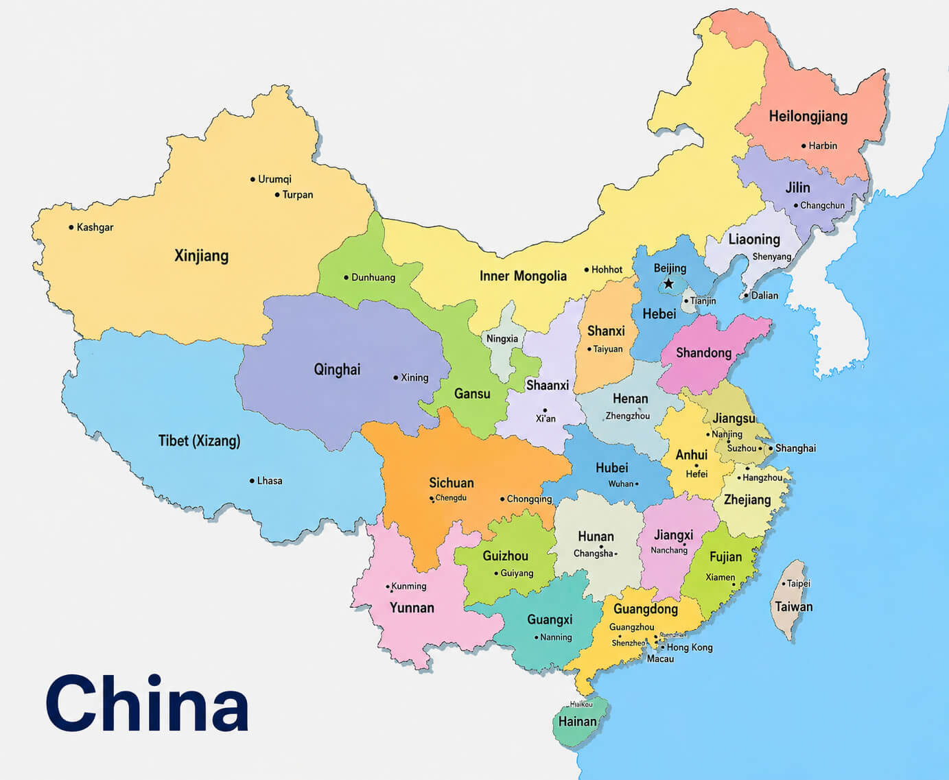
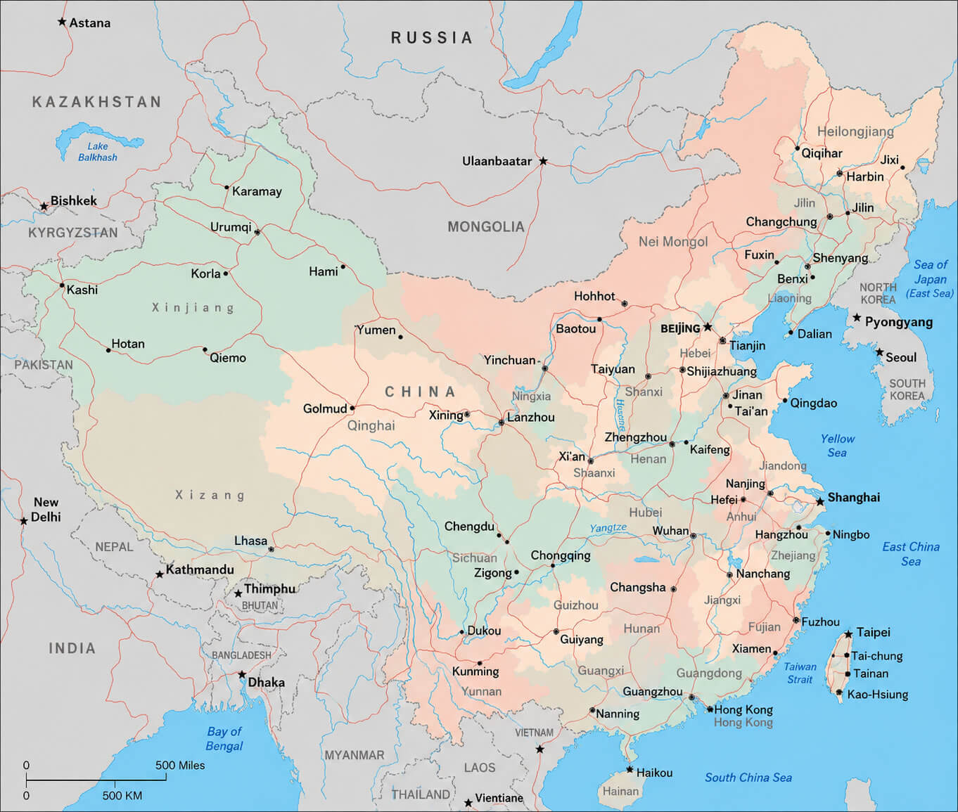
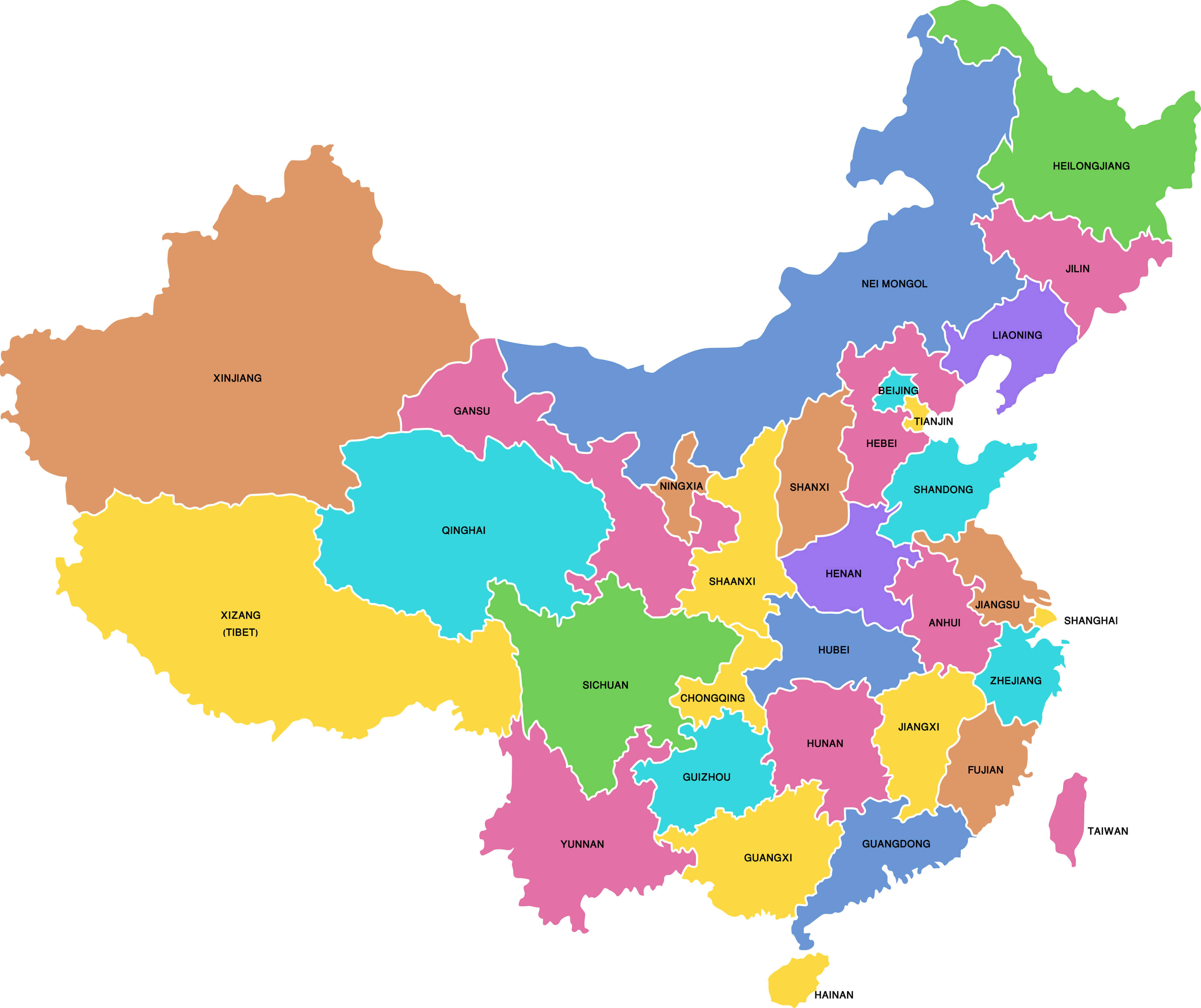
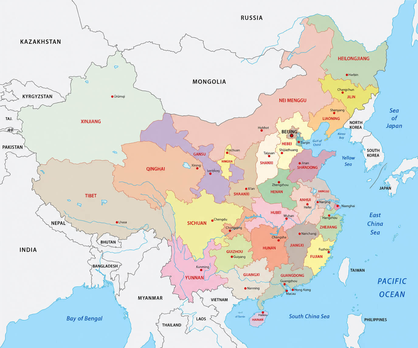
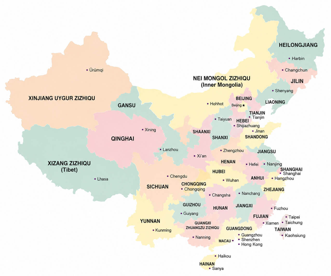
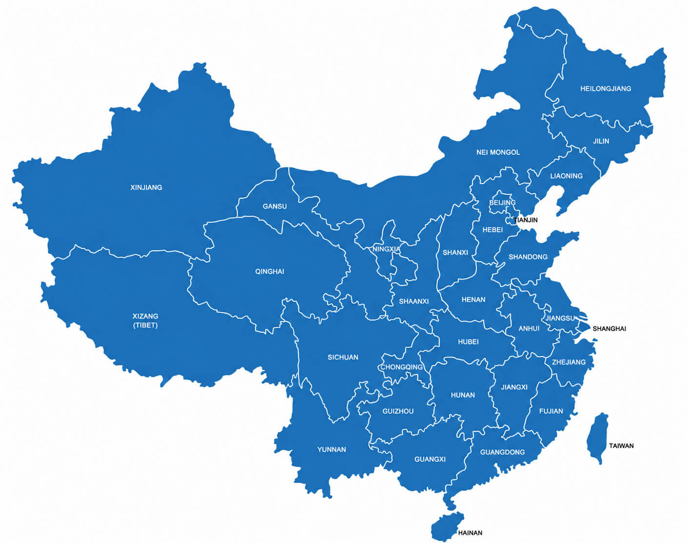
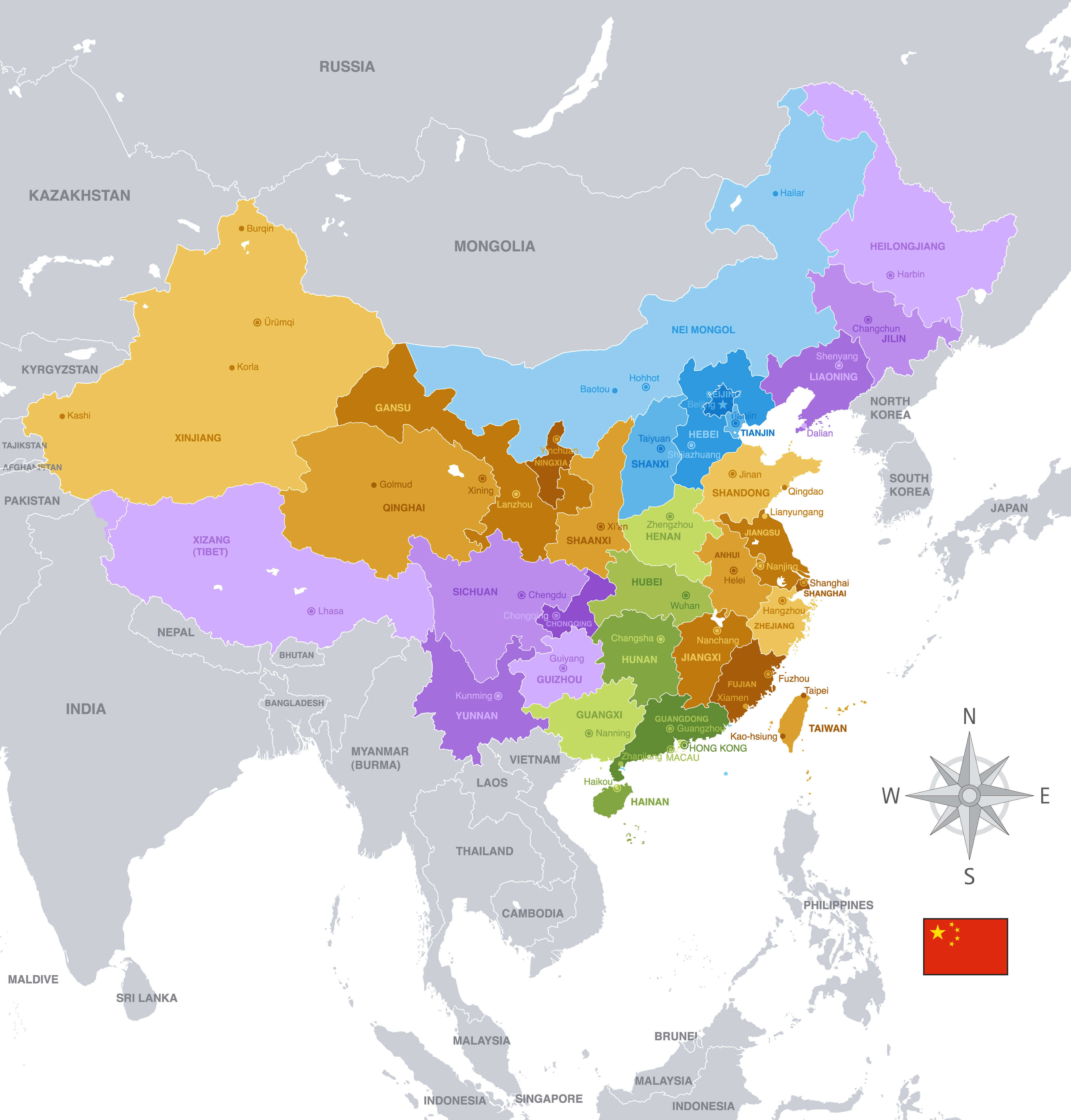
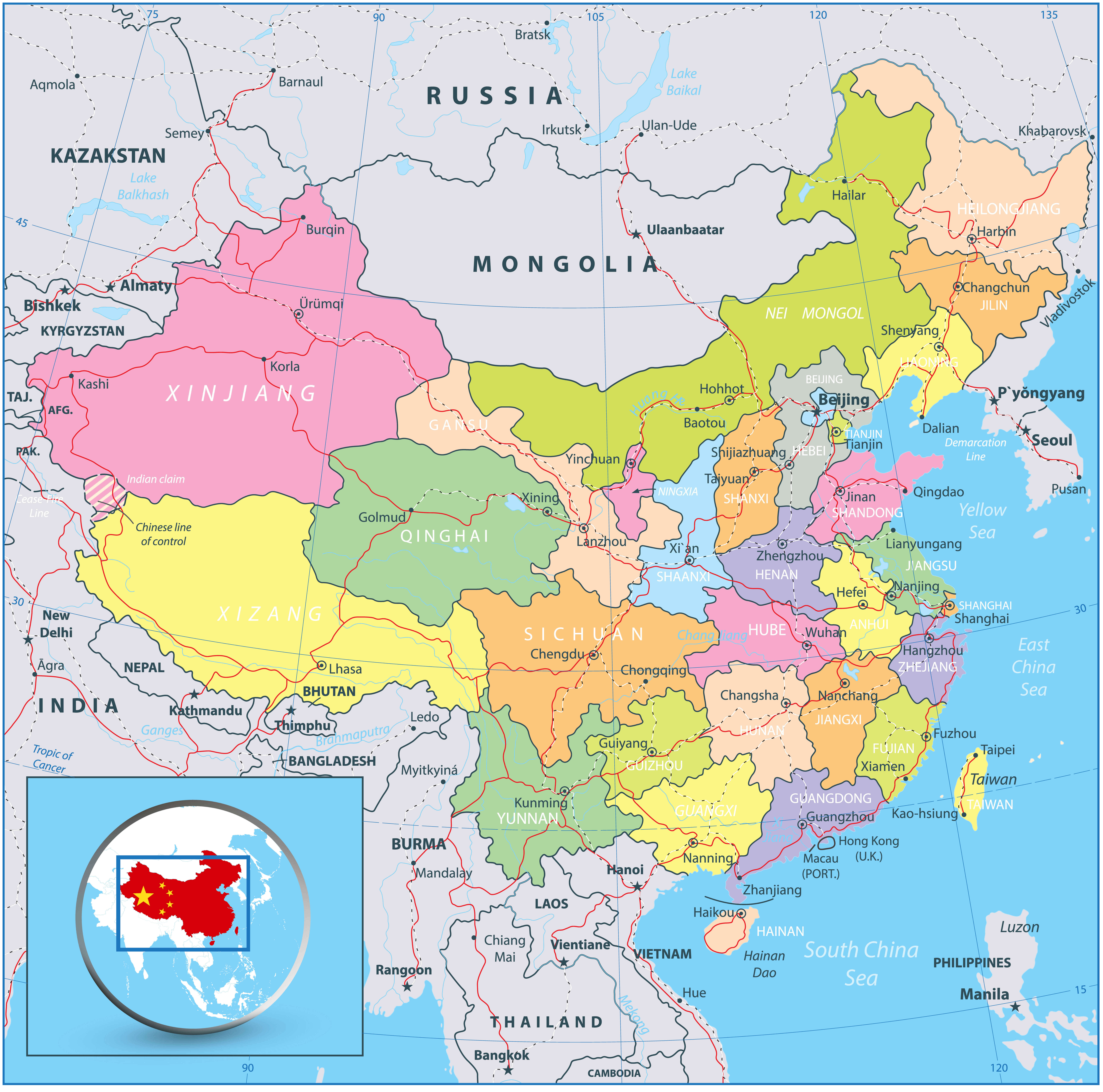
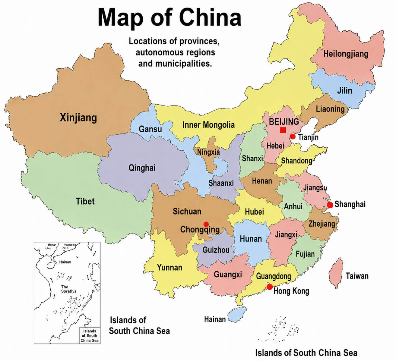
Explore the China Regions Map collection to understand the country’s administrative divisions, provinces, autonomous regions, municipalities, and major geographic areas. These detailed maps show the locations and boundaries of China’s provinces and regions, including Xinjiang, Tibet, Inner Mongolia, Sichuan, Yunnan, Guangdong, Shandong, Heilongjiang, and other important administrative areas, alongside major cities and neighboring countries. From a China administrative map and China provinces map to colorful regional maps, blank maps with boundaries, and high-resolution political maps, this collection provides a clear visual reference for exploring China’s regional geography, provincial boundaries, administrative structure, and major cities.