
Where is China on the Map

Explore the China Physical Map collection to understand China’s geographic location in Asia and the world, as well as its position in relation to neighboring countries, oceans, and major landforms. These maps show where China is on the map, highlighting its location in East Asia alongside countries such as Russia, Mongolia, India, Nepal, Myanmar, Vietnam, and North Korea, with the Pacific Ocean to the east. Featuring China location maps, world globe maps, Asia maps, physical location maps, and geography maps of China, this collection provides a clear visual guide to China’s physical geography, global position, regional setting, and location on the world map.
Where Is China?
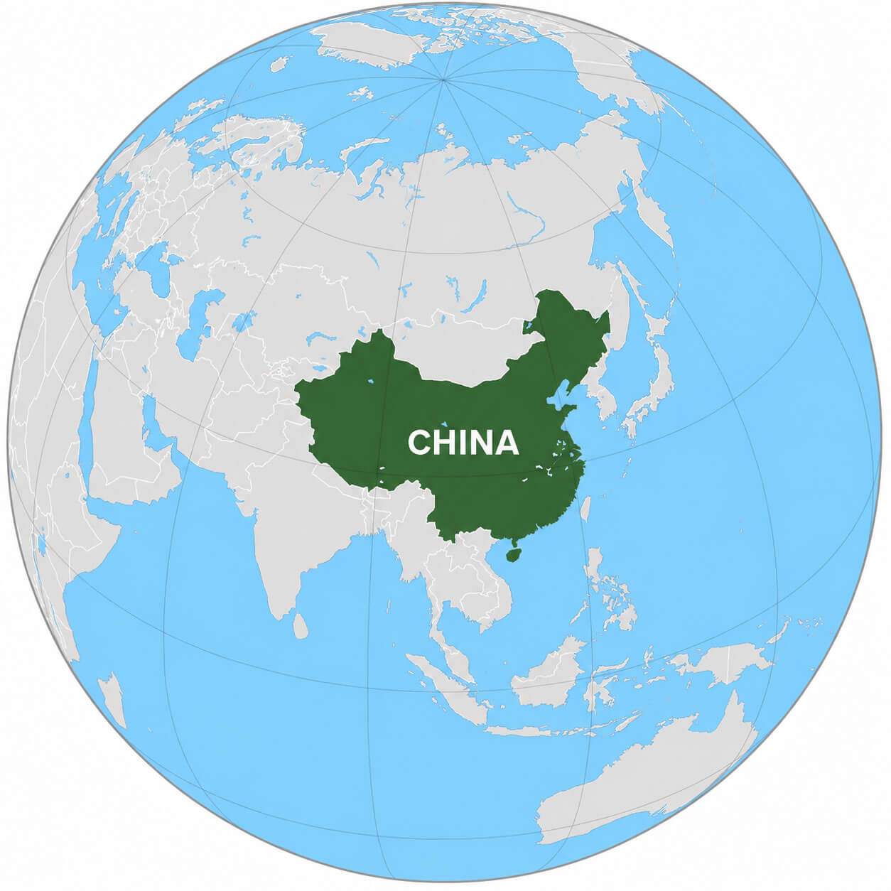
China is located in East Asia, along the western coast of the Pacific Ocean. It is one of the largest countries in the world by land area and stretches from the high mountains and plateaus of western China to the densely populated plains and coastal regions in the east. Its capital is Beijing, while Shanghai is the country's largest and most internationally connected city.
Where is China located in the World?
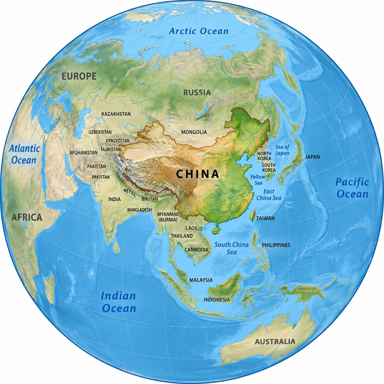
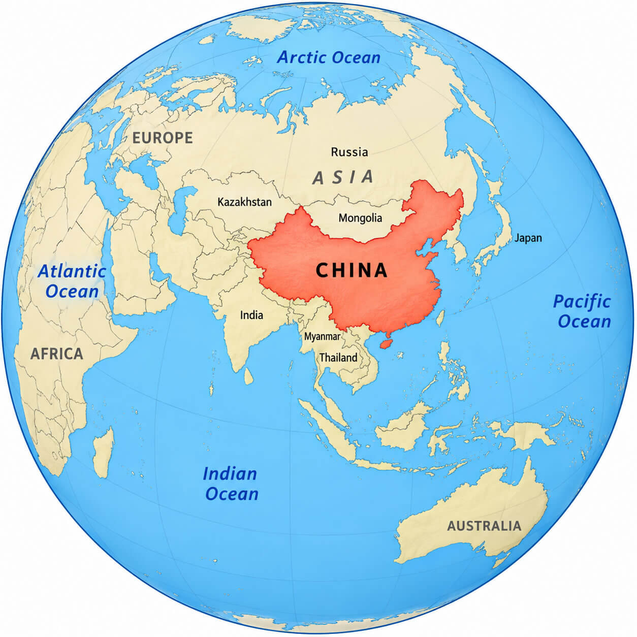
China is located in East Asia, primarily in the Northern and Eastern Hemispheres. It occupies a large part of the eastern Asian continent and faces the Pacific Ocean to the east. China lies south of Mongolia and Russia, east of Central Asia, north of Southeast Asia, and northeast of the Indian subcontinent, giving it a major geographic position within Asia.
Where Is China on the World Map?
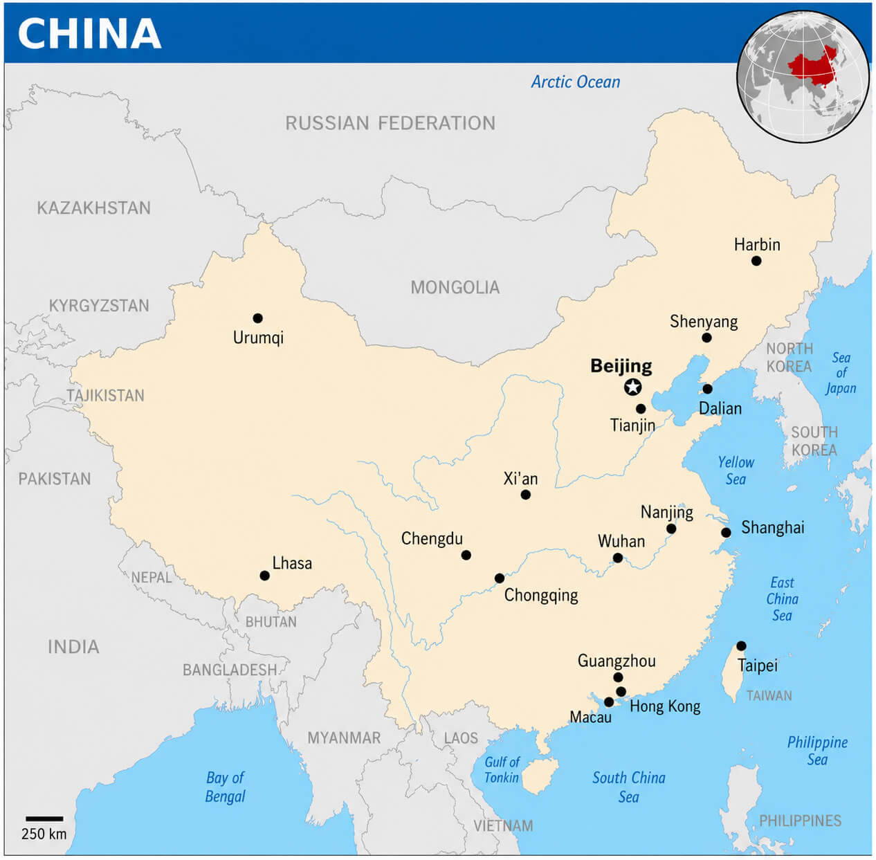
On the world map, China is situated in East Asia at approximately 35° N latitude and 105° E longitude. The country extends across a vast area between Central Asia and the Pacific Ocean. China can easily be identified by its large territory, long eastern coastline, and borders with numerous countries including Russia, Mongolia, India, Kazakhstan, Pakistan, Nepal, Vietnam, and North Korea.
Where Is China in Asia?
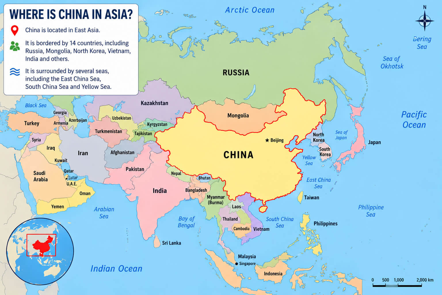
China is situated in East Asia, occupying a large portion of the eastern Asian continent. It stretches from the Pacific Ocean in the east to the mountains, deserts, and plateaus of Central Asia in the west. China's location connects East Asia with Central, South, and Southeast Asia and makes the country an important geographic, economic, and transportation hub within the continent.
What Countries Border China?
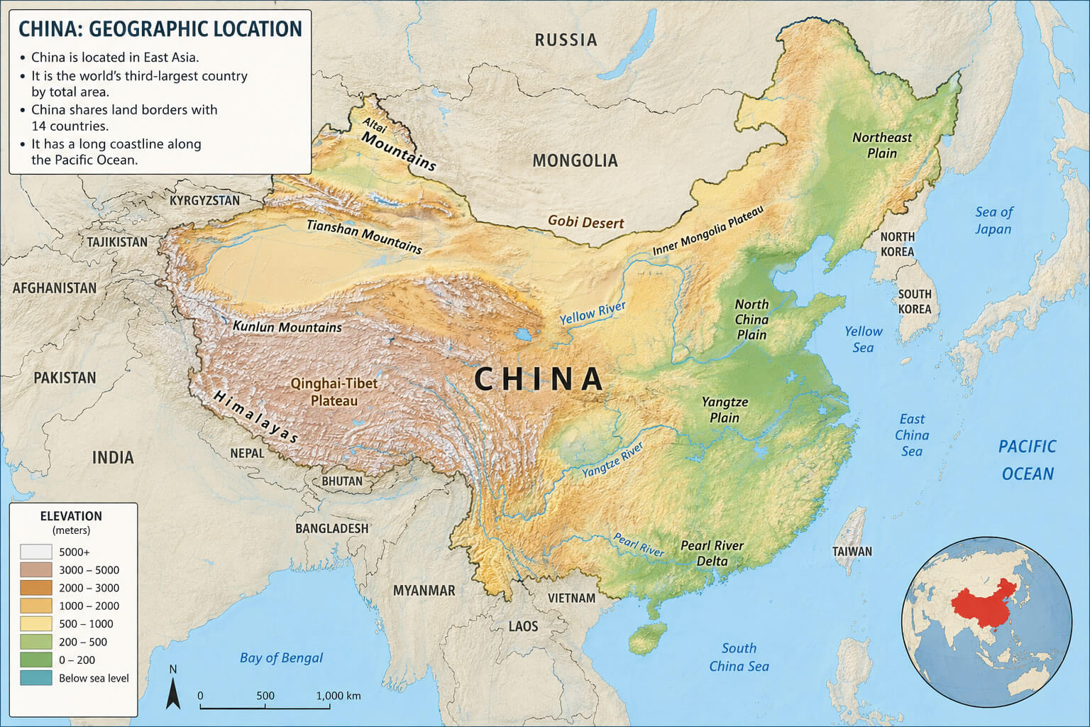
China shares land borders with 14 countries: Afghanistan, Bhutan, India, Kazakhstan, Kyrgyzstan, Laos, Mongolia, Myanmar, Nepal, North Korea, Pakistan, Russia, Tajikistan, and Vietnam. Its eastern and southeastern coastline faces the Yellow Sea, East China Sea, and South China Sea. These extensive land and maritime boundaries make China one of the most geographically connected countries in Asia.
Regions of China
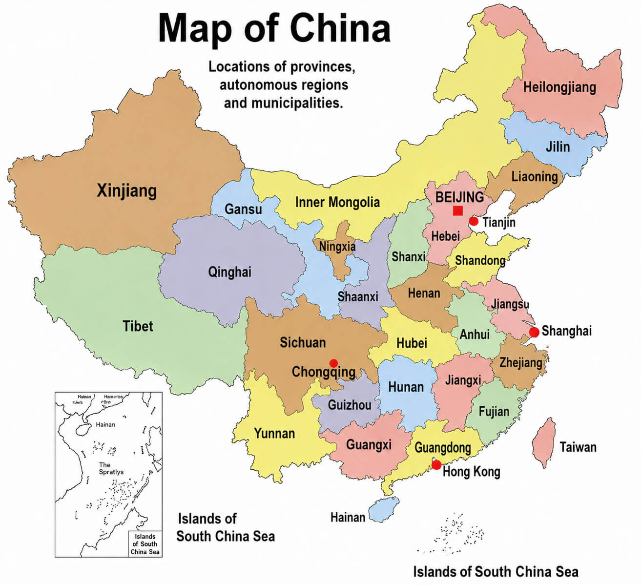
China is divided into provinces, autonomous regions, municipalities, and special administrative regions. Major provincial-level divisions include Guangdong, Sichuan, Shandong, Henan, Jiangsu, Zhejiang, Yunnan, Hubei, Xinjiang, Tibet, Inner Mongolia, Beijing, Shanghai, Chongqing, and Tianjin. From the Tibetan Plateau and deserts of western China to the densely populated river valleys and coastal regions in the east, China's administrative regions reflect the country's remarkable geographic and cultural diversity.
China location on- World globe map
Major Cities in China

China's Top 10 Largest Cities
Explore the largest cities in China by population and urban importance, from Shanghai and Beijing to Shenzhen, Guangzhou, Chengdu and other major metropolitan centers across the country.
1. Shanghai
Shanghai is China's largest city and one of the world's leading financial, commercial and transportation centers. Located at the mouth of the Yangtze River on the East China Sea, Shanghai is famous for the Bund, Pudong skyline, Lujiazui financial district and one of the world's busiest container ports.
2. Beijing
Beijing is the capital of China and the country's political, cultural and educational center. Major landmarks include the Forbidden City, Tiananmen Square, Temple of Heaven and nearby sections of the Great Wall of China. Beijing is also home to major universities, technology companies and national institutions.
3. Chongqing
Chongqing is a major municipality in southwestern China located along the upper reaches of the Yangtze River. Known for its dramatic mountainous landscape, dense urban skyline, bridges and spicy cuisine, Chongqing is an important manufacturing, logistics and transportation center connecting western and central China.
4. Shenzhen
Shenzhen is a major technology and manufacturing center in Guangdong Province, directly north of Hong Kong. Once a small border town, Shenzhen developed rapidly into one of China's most important economic cities and is now known for technology companies, modern architecture, electronics manufacturing and international trade.
5. Guangzhou, Guangdong
Guangzhou is the capital of Guangdong Province and one of southern China's largest commercial and transportation centers. Located on the Pearl River, the city is known for the Canton Fair, Cantonese culture and cuisine, international trade, manufacturing and its close economic connections with Shenzhen, Hong Kong and Macau.
6. Chengdu, Sichuan
Chengdu is the capital of Sichuan Province and one of the largest economic and cultural centers in western China. Famous for giant pandas, Sichuan cuisine, teahouse culture and historic sites, Chengdu is also a major hub for technology, aviation, manufacturing, education and transportation.
7. Tianjin
Tianjin is a major municipality and port city in northern China, located southeast of Beijing near the Bohai Sea. It is an important center for shipping, manufacturing, aerospace, finance and international trade, while its historic districts reflect a distinctive mixture of Chinese and European architectural influences.
8. Wuhan, Hubei
Wuhan is the capital of Hubei Province and a major transportation, education and industrial center in central China. Located where the Yangtze and Han rivers meet, Wuhan has long served as a strategic crossroads connecting northern, southern, eastern and western China by rail, road and river transport.
9. Xi'an, Shaanxi
Xi'an is the capital of Shaanxi Province and one of China's most historically important cities. Once the eastern starting point of the ancient Silk Road and the capital of several Chinese dynasties, Xi'an is famous for the Terracotta Army, ancient city walls and its role as a major modern education and technology center.
10. Hangzhou, Zhejiang
Hangzhou is the capital of Zhejiang Province and a major technology, tourism and business center in eastern China. The city is internationally known for West Lake, traditional gardens and historic temples, while its modern economy is strongly associated with e-commerce, digital technology, finance and entrepreneurship.
Feel free to explore these pages as well:
- China at a Glance: Facts, Geography, Cities, History, Economy & Culture
- China Map
- Map of China
- China Cities Map
- Where is China on the Map
- China Physical Map
- China Political Map
- China Regions Map
- China High Resolution Map
- China Time Zone Map