Explore Hawaii Time Zone Map & Details with Current Local Time
A Hawaii Time Zone Map is a clear and user-friendly guide to the time zone observed across the state of Hawaii, making it an essential resource for travelers, residents, and businesses. Hawaii operates ??????? within the Hawaii–Aleutian Standard Time (HST, UTC-10) zone and does not observe Daylight Saving Time, maintaining the same time throughout the year. This map highlights Hawaii's remote location in the Pacific Ocean and its significant time difference from the U.S. mainland, helping users easily understand scheduling and coordination across regions. Whether you're planning travel, managing international business, or checking the current local time, a Hawaii time zone map provides a reliable and practical tool for accurate time management.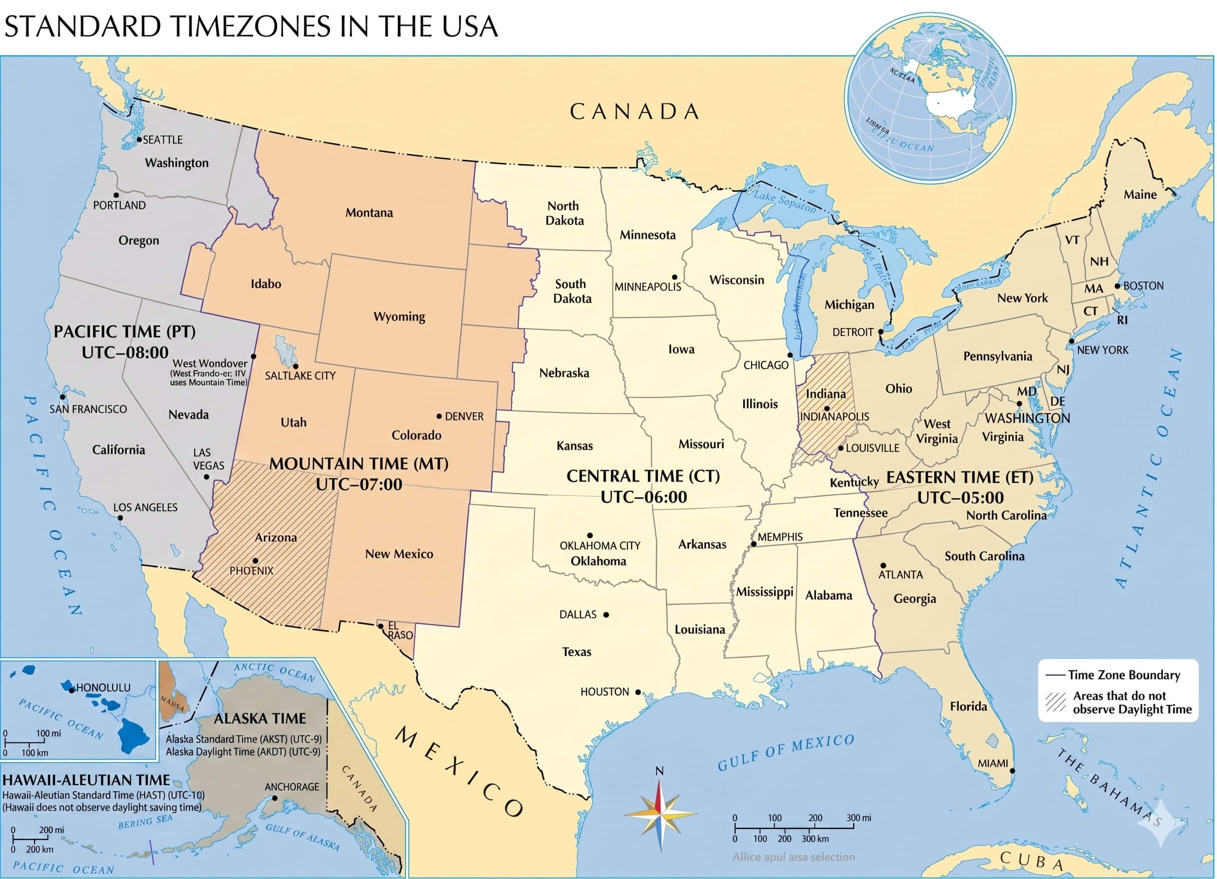
What Time Zone Does Hawaii Use?
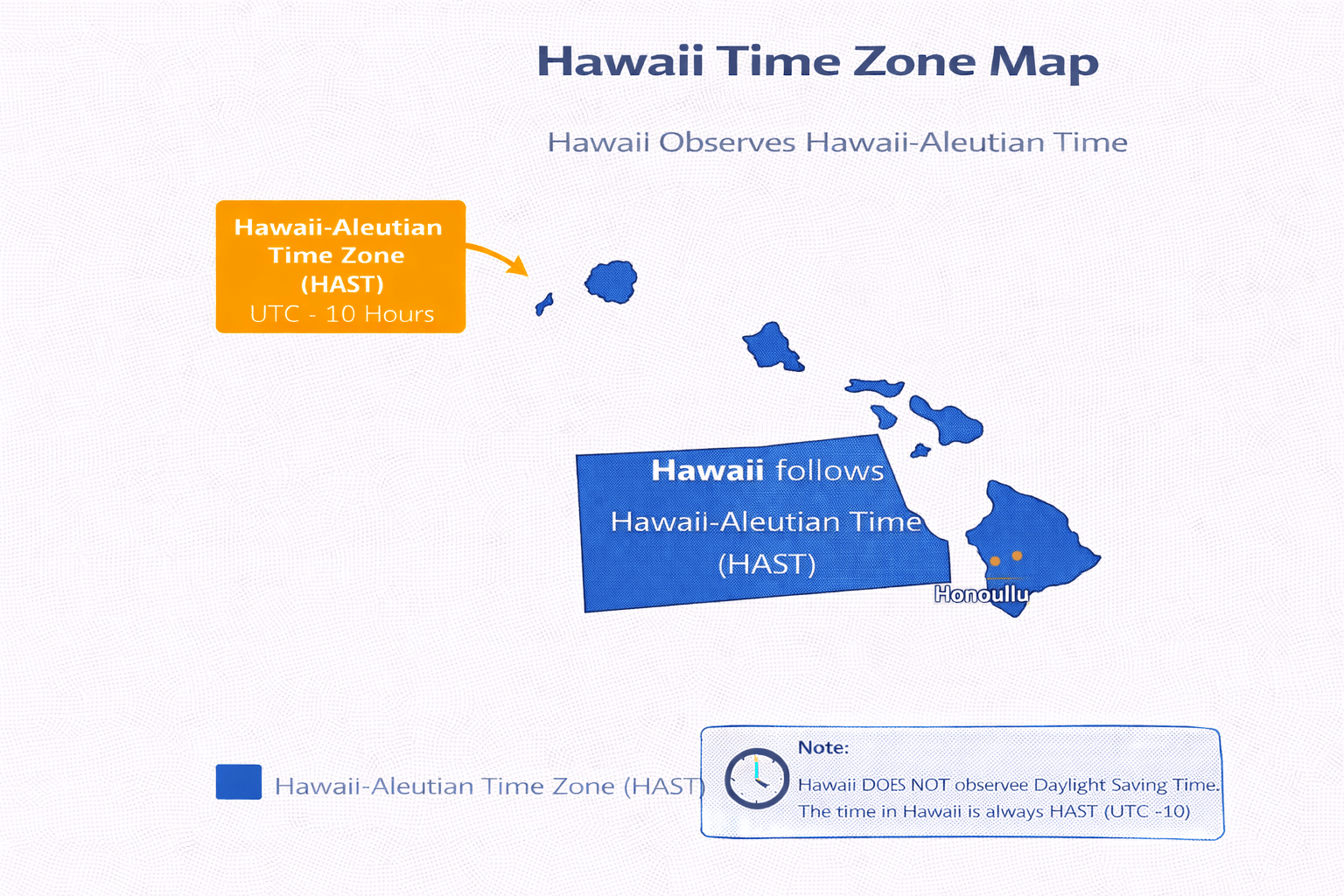
Hawaii follows the Hawaii-Aleutian Time Zone (HAT), which corresponds to Hawaii-Aleutian Standard Time (HST) or UTC-10 throughout the year. Located in the central Pacific Ocean, Hawaii is one of the westernmost U.S. states and operates on a unique time zone different from the mainland United States. This time zone plays an important role in tourism, aviation, and communication between the Pacific region and North America.
Hawaii Time Zone Map Infographic
Does Hawaii Use Daylight Saving Time?
No. Hawaii does not observe Daylight Saving Time. The state remains on Hawaii-Aleutian Standard Time (HST, UTC-10) all year round. This makes Hawaii one of the few regions in the United States that does not adjust clocks seasonally.
Hawaii Time Zone Map
What Time Is It in Hawaii Right Now?
Hawaii Time Zone
Hawaii Major cities in this time zone:
- Honolulu
- Hilo
- Kailua
- Kapolei
- Kaneohe
- Pearl City
Time Difference Between Hawaii and Major Cities
| City | Time Difference |
|---|---|
| New York | 5 hours ahead (ET) |
| Washington, D.C. | 5 hours ahead (ET) |
| Dallas | 4 hours ahead (CT) |
| Denver | 3 hours ahead (MT) |
| Los Angeles | 2 hours ahead (PT) |
| London | 10 hours ahead |
| Paris | 11 hours ahead |
| Istanbul | 12 hours ahead |
| Tokyo | 19 hours ahead |
How Far Is Honolulu from New York? Distance in KM and Miles
The distance between Honolulu and New York is approximately 8,000 kilometers (about 4,970 miles) when measured in a straight line. This route connects the Pacific islands of Hawaii to the East Coast of the United States and represents one of the longest domestic travel distances in the country. Actual travel distance may vary depending on the route and mode of transportation.
How Long Is the Flight Between Honolulu and New York?
A direct flight between Honolulu and New York typically takes about 10 to 11 hours, depending on weather conditions, air traffic, and the exact route. Flights usually depart from Daniel K. Inouye International Airport (HNL) and arrive at John F. Kennedy International Airport (JFK). Major airlines offering direct flights include Hawaiian Airlines, Delta Air Lines, American Airlines, and United Airlines.
Feel free to explore these pages as well:
- California Time Zone Map ↗️
- California Time Zone Map ↗️
- Texas Time Zone Map ↗️
- Florida Time Zone Map ↗️
- New York Time Zone Map ↗️
- Pennsylvania Time Zone Map ↗️
- Illinois Time Zone Map ↗️
- Ohio Time Zone Map ↗️
- Georgia Time Zone Map ↗️
- North Carolina Time Zone Map ↗️
- Michigan Time Zone Map ↗️
- New Jersey Time Zone Map ↗️
- Virginia Time Zone Map ↗️
- Washington Time Zone Map ↗️
- Arizona Time Zone Map ↗️
- Tennessee Time Zone Map ↗️
- Massachusetts Time Zone Map ↗️
- Indiana Time Zone Map ↗️
- Missouri Time Zone Map ↗️
- Maryland Time Zone Map ↗️
- Colorado Time Zone Map ↗️
- Wisconsin Time Zone Map ↗️
- Minnesota Time Zone Map ↗️
- South Carolina Time Zone Map ↗️
- Alabama Time Zone Map ↗️
- Head of Performance Marketing
- Head of SEO
- Linkedin Profile: linkedin.com/in/arifcagrici