Explore Arizona Time Zone Map & Details with Current Local Time
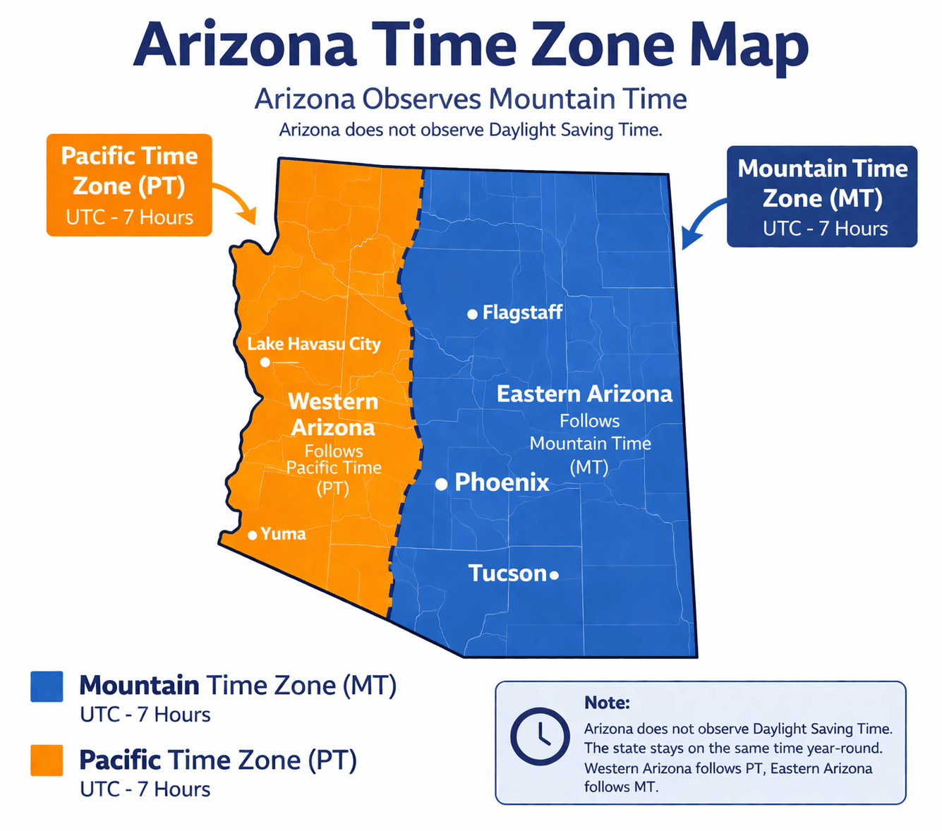
An Arizona Time Zone Map is a clear and practical guide to the time system used across the state of Arizona, making it an essential resource for residents, travelers, and businesses. Unlike most U.S. states, Arizona follows Mountain Standard Time (MST, UTC-7) year-round and does not observe Daylight Saving Time, creating a unique time pattern. However, the Navajo Nation in northeastern Arizona does observe daylight saving time, leading to regional variations. This map highlights these distinctions and shows Arizona's time alignment with neighboring states such as Colorado and New Mexico during different seasons. Whether you're planning travel, coordinating schedules, or checking the current local time, an Arizona time zone map provides a reliable and user-friendly tool for accurate time management.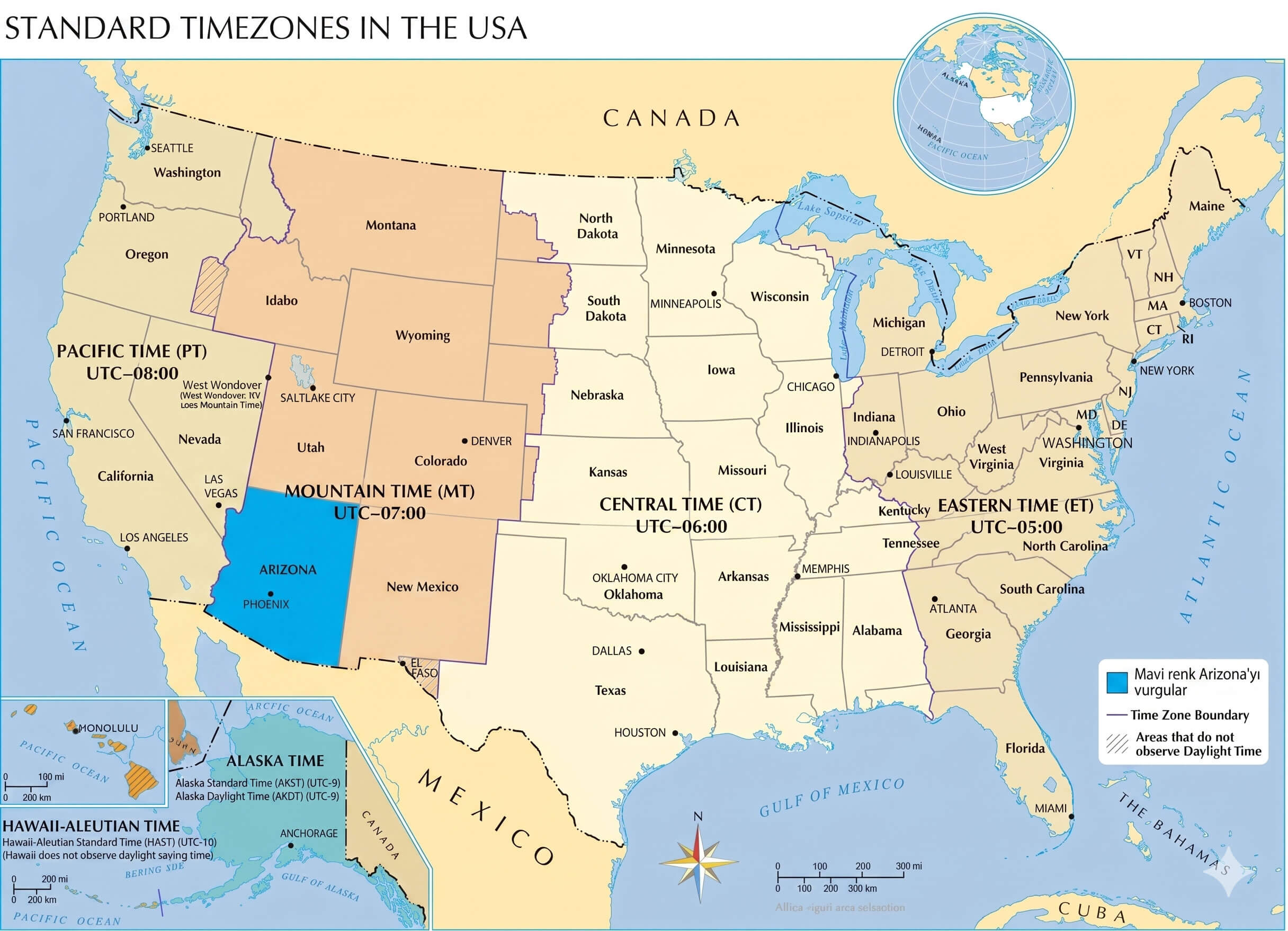
What Time Zone Does Arizona Use?
Arizona follows the Mountain Time Zone (MT), which corresponds to Mountain Standard Time (MST) or UTC-7 throughout most of the year. Located in the southwestern United States, Arizona shares its time zone with parts of states such as Colorado and New Mexico. However, Arizona is unique because it does not observe daylight saving time (with the exception of the Navajo Nation). This time zone plays an important role in transportation, tourism, and communication across the region.
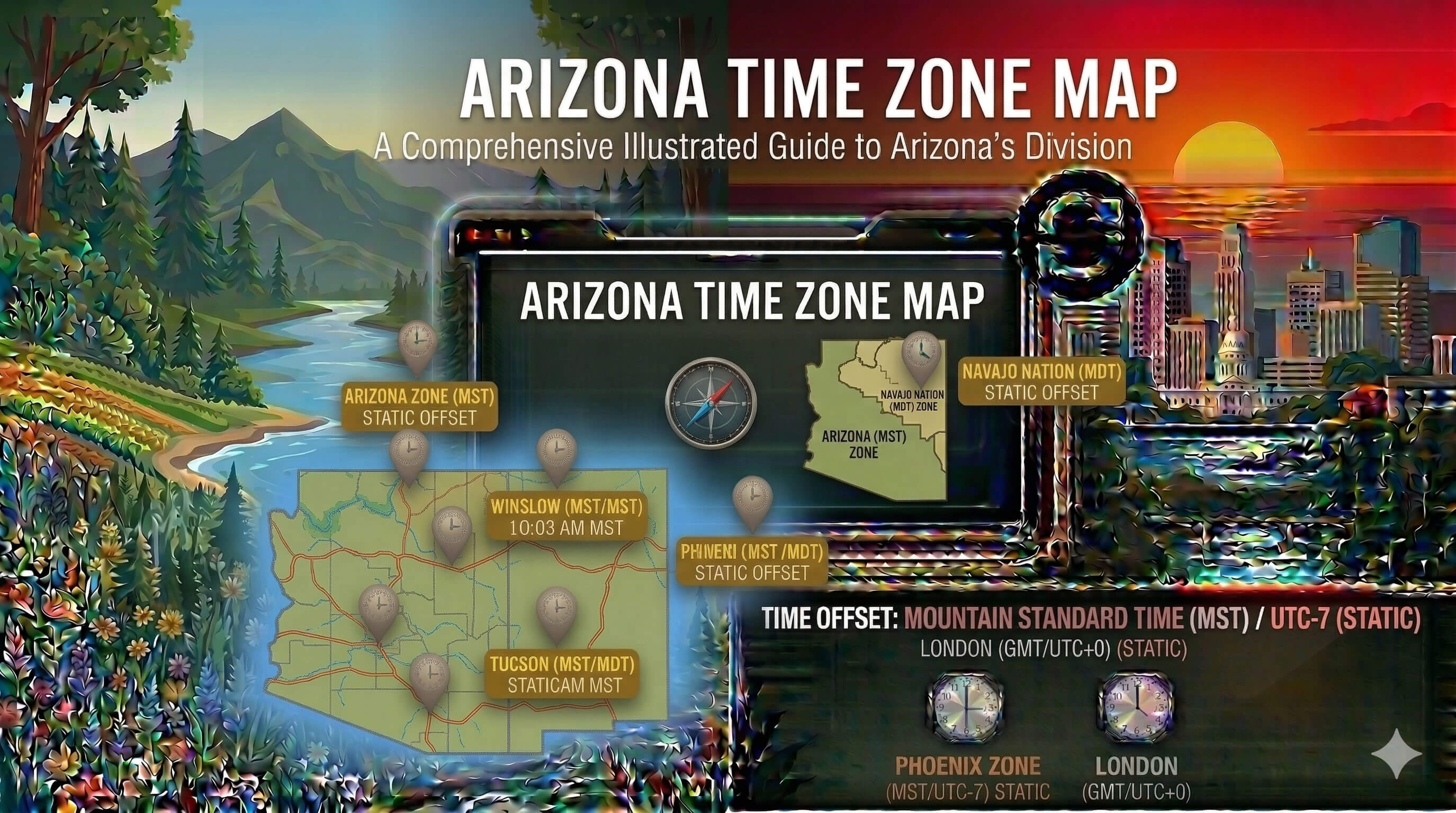
Arizona Time Zone Map Infographic
Does Arizona Use Daylight Saving Time?
No. Most of Arizona does not observe Daylight Saving Time. The state remains on Mountain Standard Time (MST, UTC-7) all year round. This means that while many U.S. states change their clocks in March and November, Arizona keeps the same time, making it unique among most states.
Arizona Time Zone Map
What Time Is It in Arizona Right Now?
Arizona Time Zone
Arizona Major cities in this time zone:
- Phoenix
- Tucson
- Mesa
- Chandler
- Scottsdale
- Glendale
Time Difference Between Arizona and Major Cities
| City | Time Difference |
|---|---|
| New York | 3 hours ahead (ET) |
| Washington, D.C. | 3 hours ahead (ET) |
| Chicago | 2 hours ahead (CT) |
| Denver | 1 hour ahead (MT) |
| Los Angeles | Same time (PT during DST) |
| London | 7 hours ahead |
| Paris | 8 hours ahead |
| Istanbul | 9 hours ahead |
| Tokyo | 15 hours ahead |
How Far Is Phoenix from New York? Distance in KM and Miles
The distance between Phoenix and New York is approximately 3,450 kilometers (about 2,145 miles) when measured in a straight line. This route connects the southwestern United States to the East Coast and is a major domestic travel corridor. Actual travel distance may vary depending on the route and mode of transportation.
How Long Is the Flight Between Phoenix and New York?
A direct flight between Phoenix and New York typically takes about 4.5 to 5 hours, depending on weather conditions, air traffic, and the exact route. Flights usually depart from Phoenix Sky Harbor International Airport (PHX) and arrive at John F. Kennedy International Airport (JFK) or LaGuardia Airport (LGA). Major airlines offering direct flights include American Airlines, Delta Air Lines, and JetBlue.
Feel free to explore these pages as well:
- California Time Zone Map ↗️
- California Time Zone Map ↗️
- Texas Time Zone Map ↗️
- Florida Time Zone Map ↗️
- New York Time Zone Map ↗️
- Pennsylvania Time Zone Map ↗️
- Illinois Time Zone Map ↗️
- Ohio Time Zone Map ↗️
- Georgia Time Zone Map ↗️
- North Carolina Time Zone Map ↗️
- Michigan Time Zone Map ↗️
- New Jersey Time Zone Map ↗️
- Virginia Time Zone Map ↗️
- Washington Time Zone Map ↗️
- Arizona Time Zone Map ↗️
- Tennessee Time Zone Map ↗️
- Massachusetts Time Zone Map ↗️
- Indiana Time Zone Map ↗️
- Missouri Time Zone Map ↗️
- Maryland Time Zone Map ↗️
- Colorado Time Zone Map ↗️
- Wisconsin Time Zone Map ↗️
- Minnesota Time Zone Map ↗️
- South Carolina Time Zone Map ↗️
- Alabama Time Zone Map ↗️
- Head of Performance Marketing
- Head of SEO
- Linkedin Profile: linkedin.com/in/arifcagrici