Maps of Europe: Political, Historical and Physical Maps Collection
Explore an extensive collection of Maps of Europe featuring political, historical, economic, demographic, and physical perspectives of the continent. From Europe GDP per capita maps and Europe population density maps to Europe topographic relief maps and Europe vegetation zones maps, these detailed resources help users better understand Europe’s geography, natural landscapes, economies, and regional characteristics. The collection is ideal for students, travelers, researchers, and anyone interested in European geography and history.
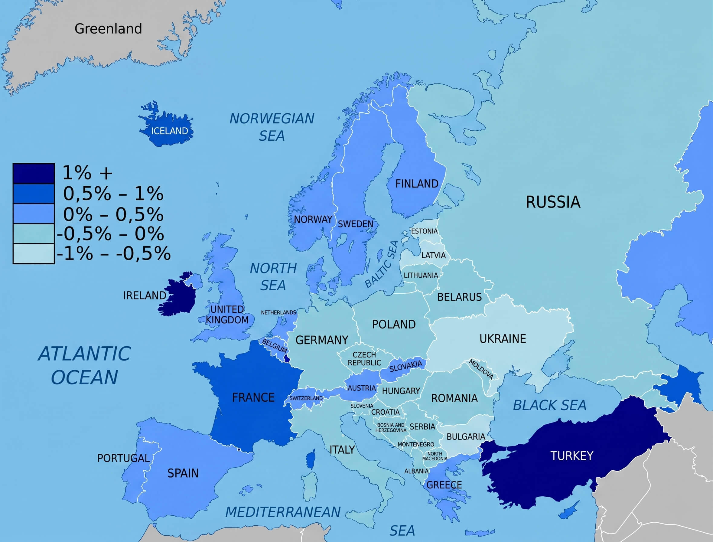
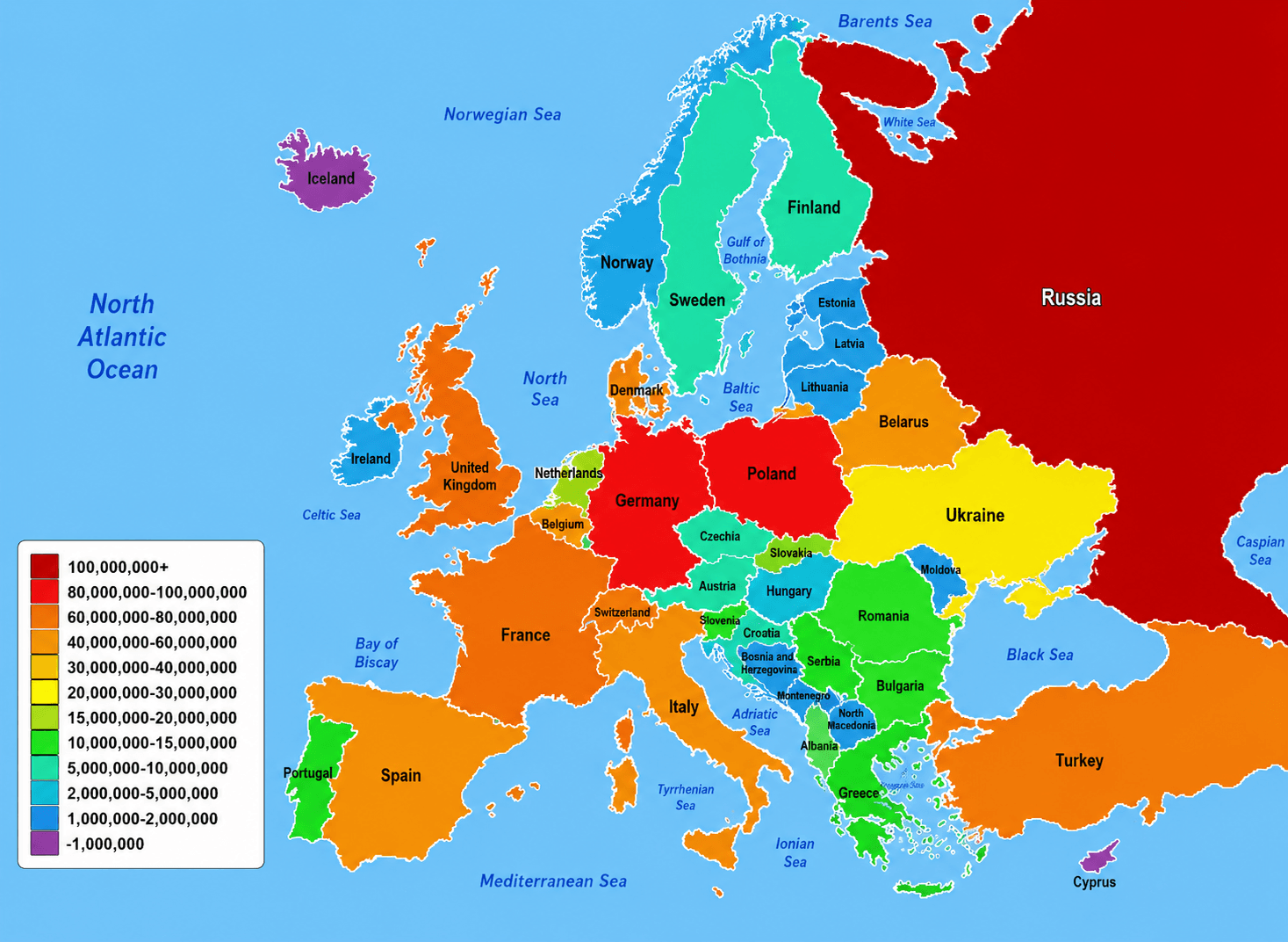
Europe population density map
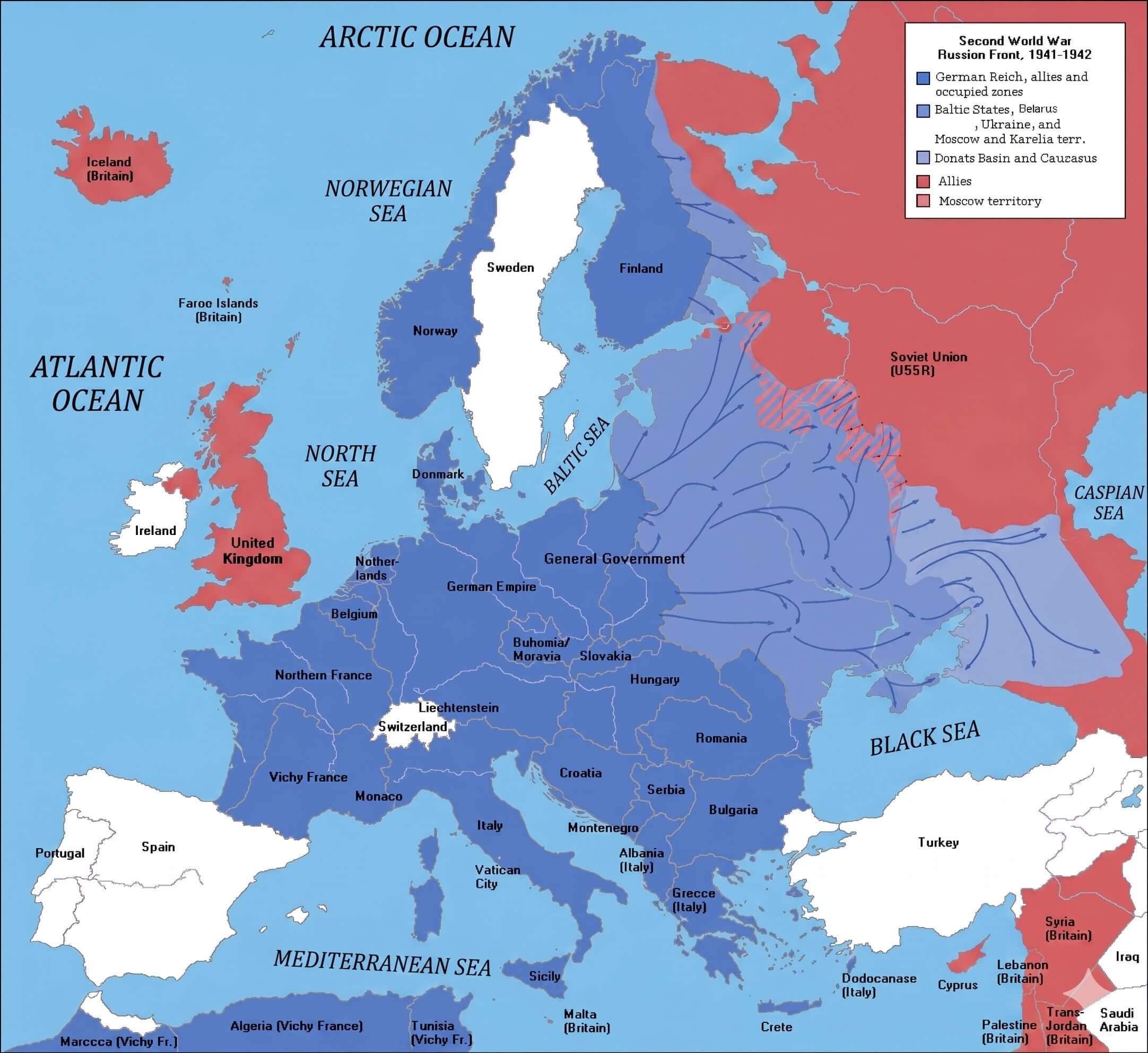
Europe map World war two 1941 1942
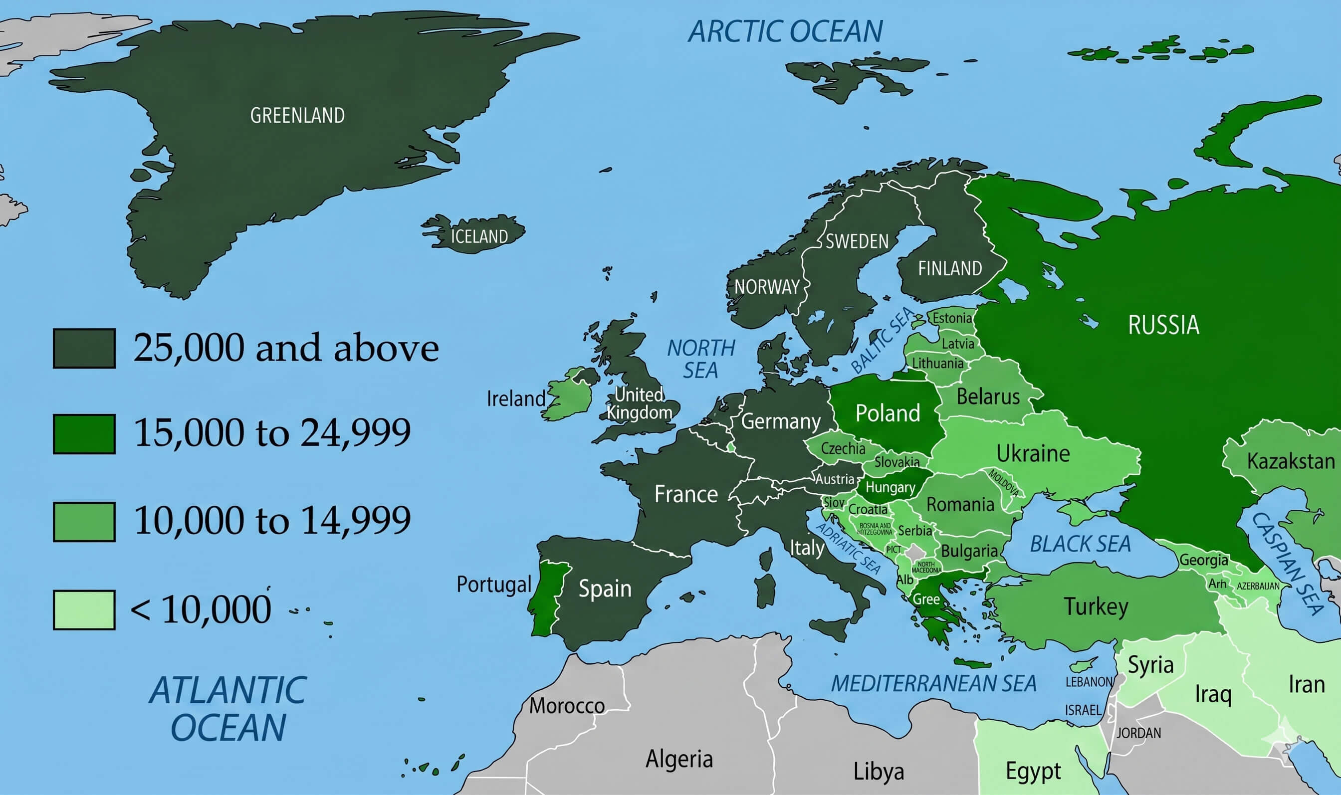
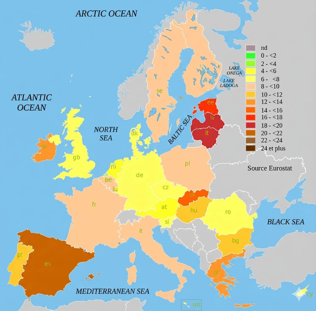
Europe GDP per capita map
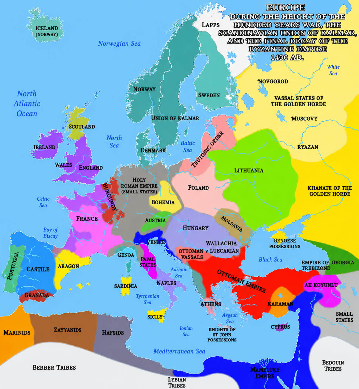
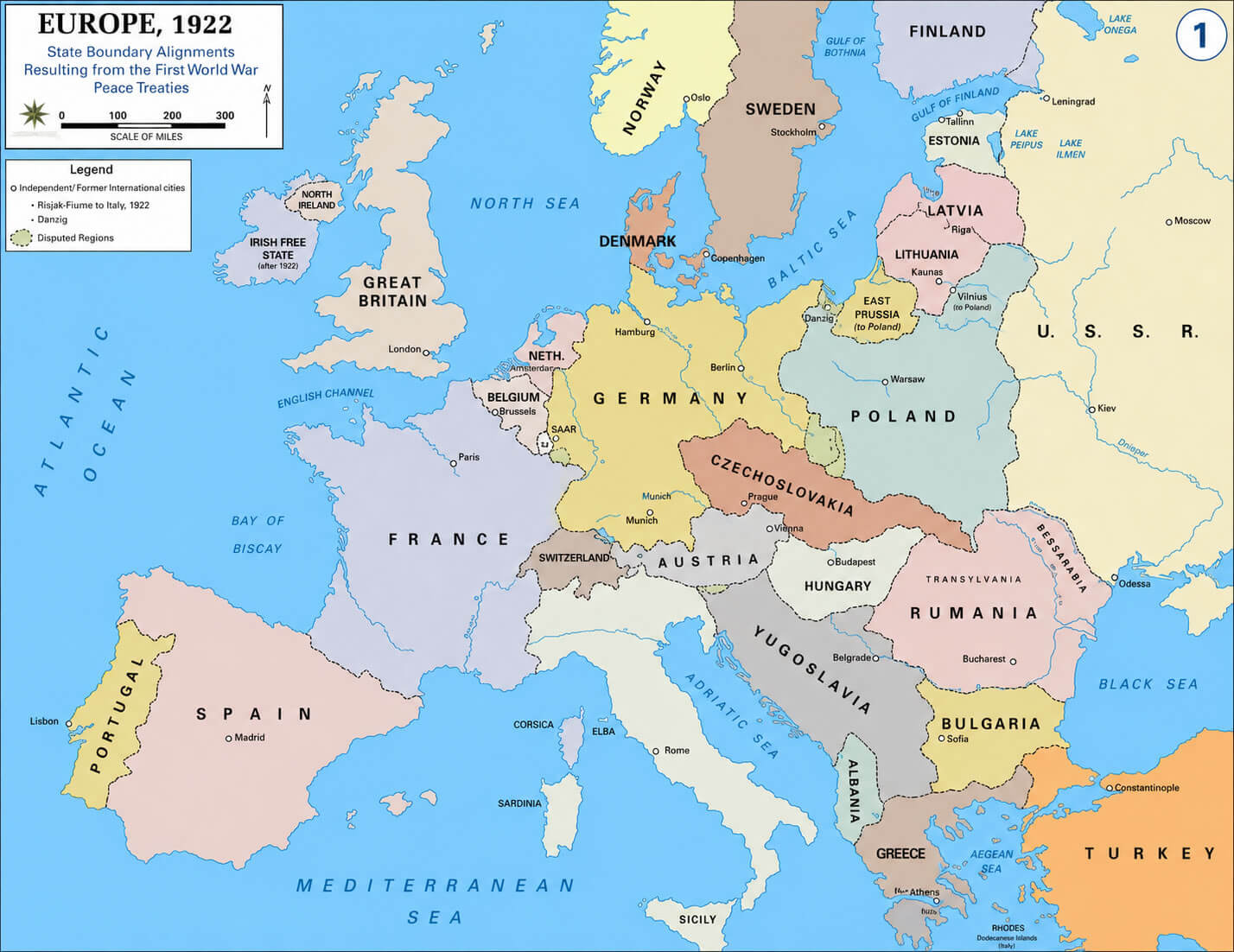
You can also browse a variety of historical Europe maps, including the Europe map 1430 medieval period, Europe map after World War One, and Europe map World War Two 1941–1942. These maps provide a clearer view of how European borders, kingdoms, alliances, and political systems evolved over time. Combined with modern Europe national borders maps and thematic visuals, this collection offers valuable insights for education, travel planning, and historical research.
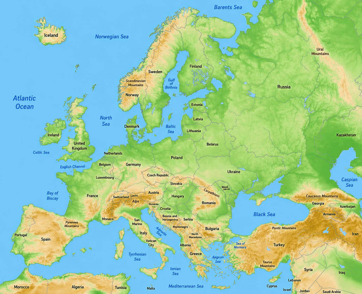
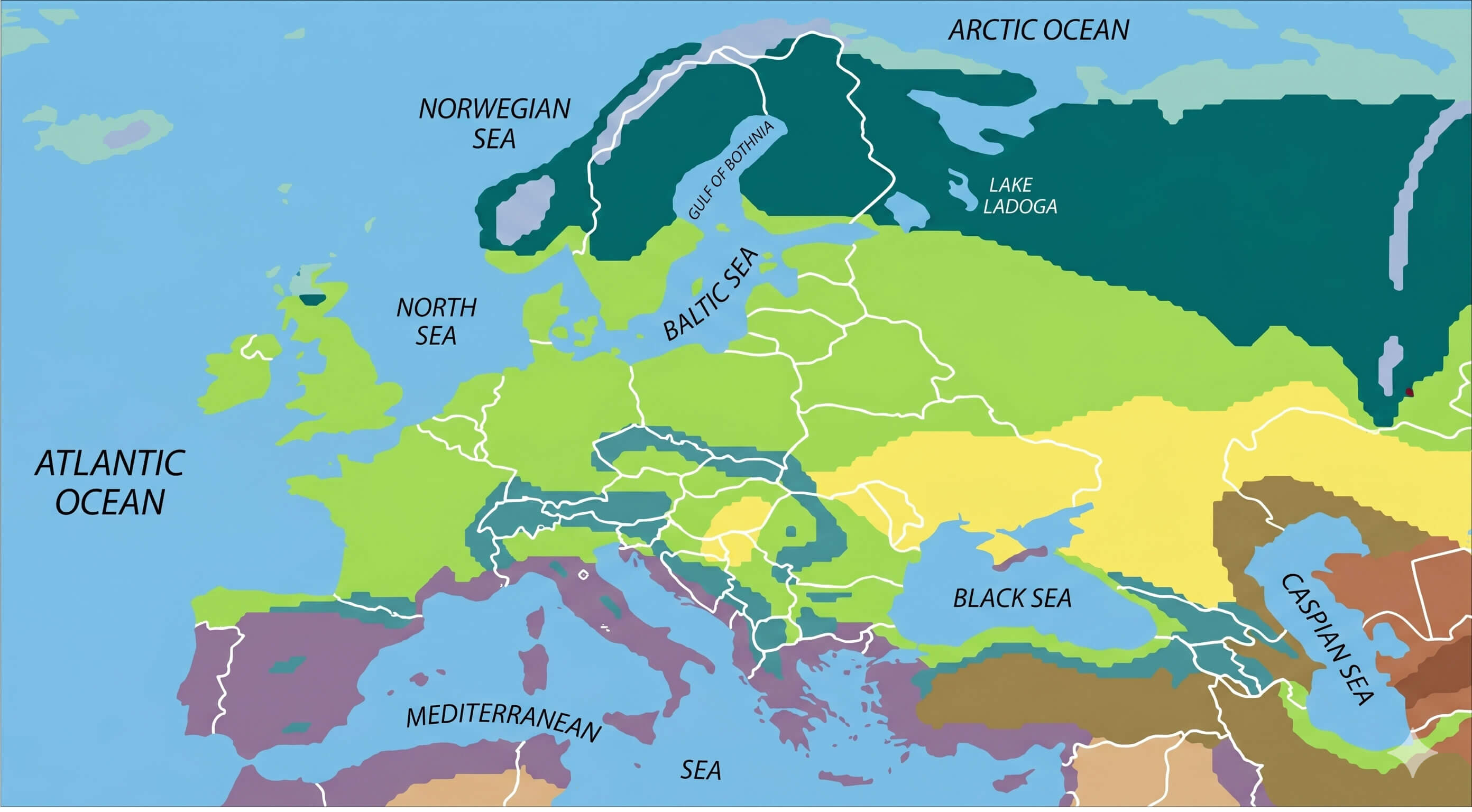
Europe topographic relief map
Europe national borders map
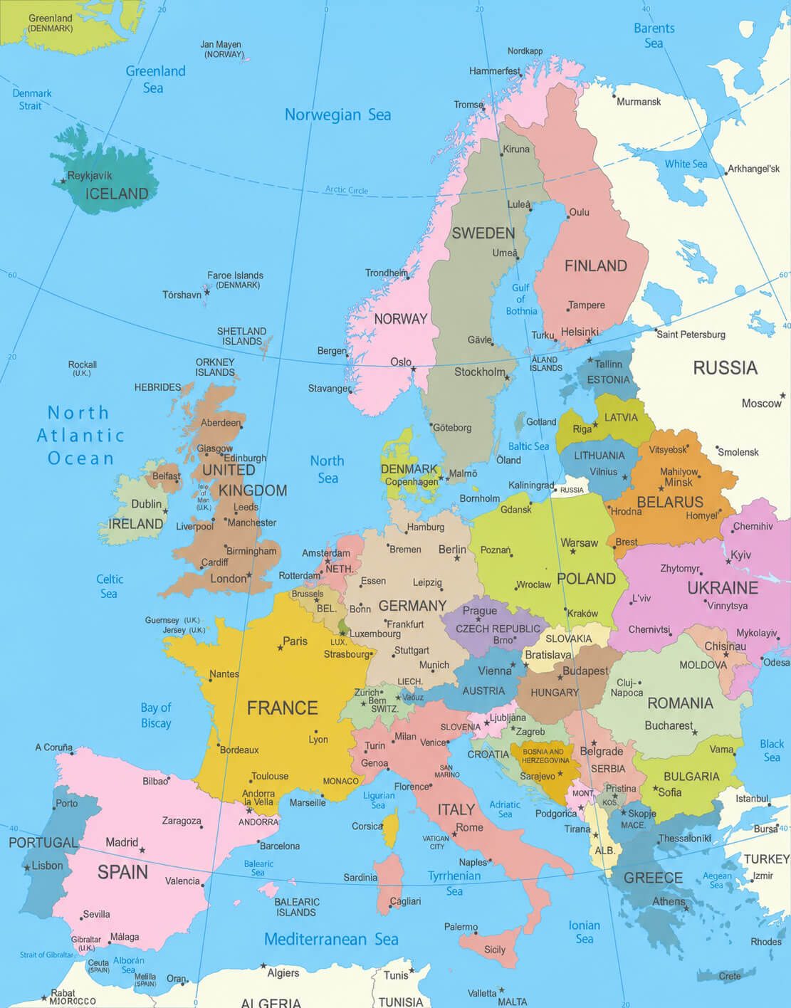
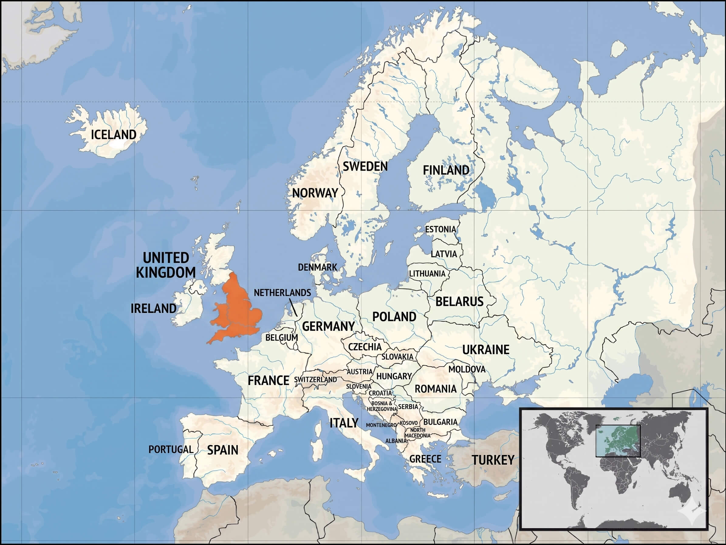
This Europe maps archive also includes practical and educational resources such as the Europe national borders map, Europe map with Wales highlighted, and Europe location on World globe map. Researchers, students, travelers, and educators can use these high-quality maps for presentations, school projects, travel planning, and geographic analysis. The collection further features thematic visuals like the Europe unemployment rate map 2010 and Europe population density map 2006, making it easier to compare social and economic conditions across European countries and regions.
Europe map 1430 medieval period
Europe map with wales highlighted
Europe map after World war one
Europe population density map 2006.png
Europe unemployment rate map 2010
Europe vegetation zones map
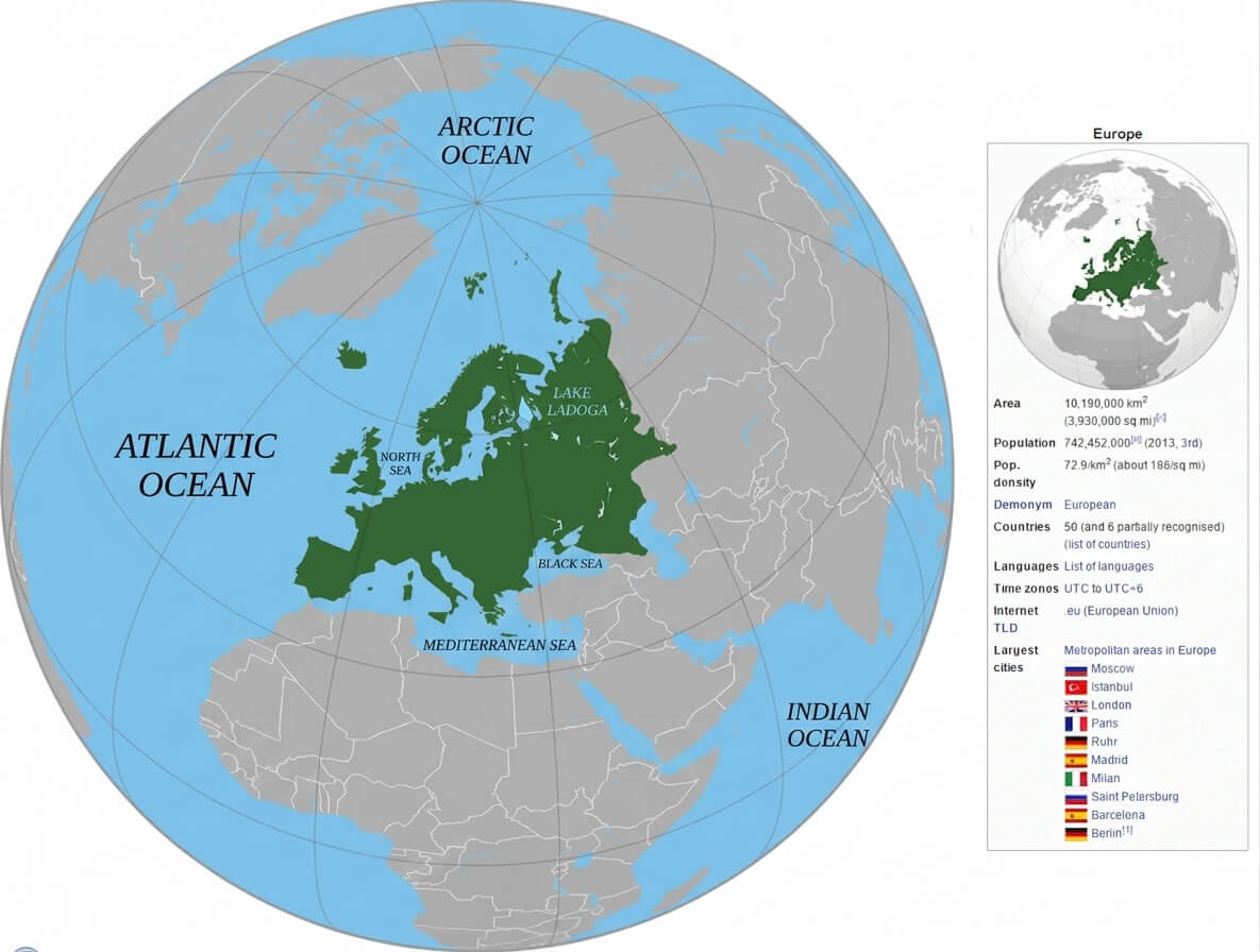
Europe location on World globe map
Feel free to explore these pages as well:
- Head of Performance Marketing
- Head of SEO
- Linkedin Profile: linkedin.com/in/arifcagrici