A Collection of Europe Maps: Political, Historical and Physical Maps
A Collection of Europe Maps features a diverse range of political, historical, economic, demographic, and physical maps created for students, travelers, educators, and geography enthusiasts. The collection includes valuable resources such as Europe GDP per capita maps, Europe population density maps, Europe topographic relief maps, and Europe vegetation zones maps, helping users explore the continent’s landscapes, economies, climate regions, and population distribution in greater detail. Visitors can also browse historical Europe maps, including the Europe map 1430 medieval period, Europe map after World War One, and Europe map World War Two 1941–1942, to better understand how European borders, kingdoms, and political structures changed throughout history.
Linguistic map of Europe
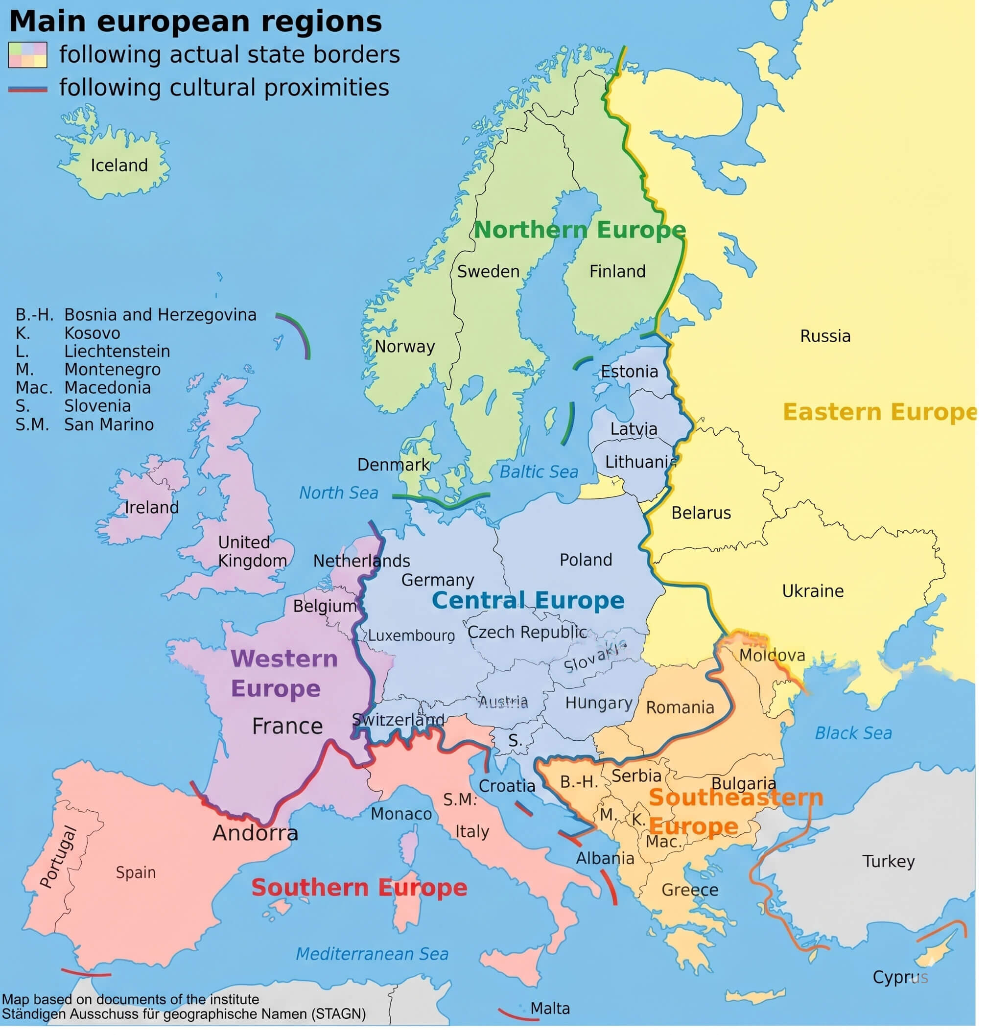
Major regions of Europe map
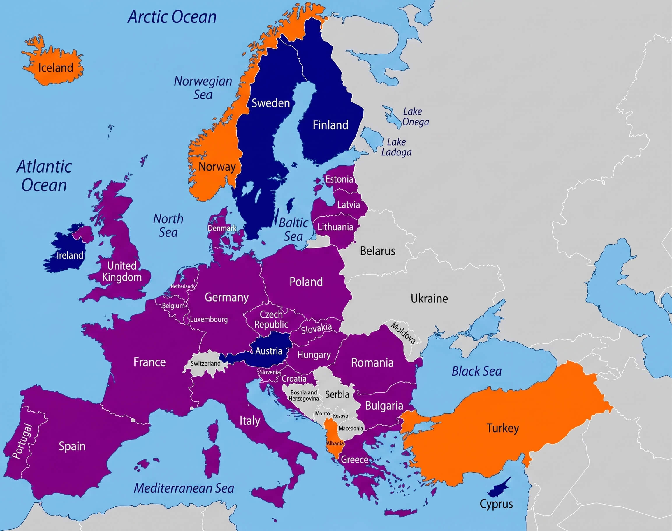
Europe eu and nato members map
In addition to historical and thematic content, this Europe map collection features educational and practical resources like the Europe national borders map, Europe location on World globe map, and Europe map with Wales highlighted. These high-quality Europe maps are ideal for academic research, classroom use, travel planning, genealogy studies, and business presentations. The archive also contains valuable socioeconomic visuals such as the Europe unemployment rate map 2010 and Europe population density map 2006, allowing users to compare regional trends, urban development, and economic conditions across Europe in a visually engaging way.
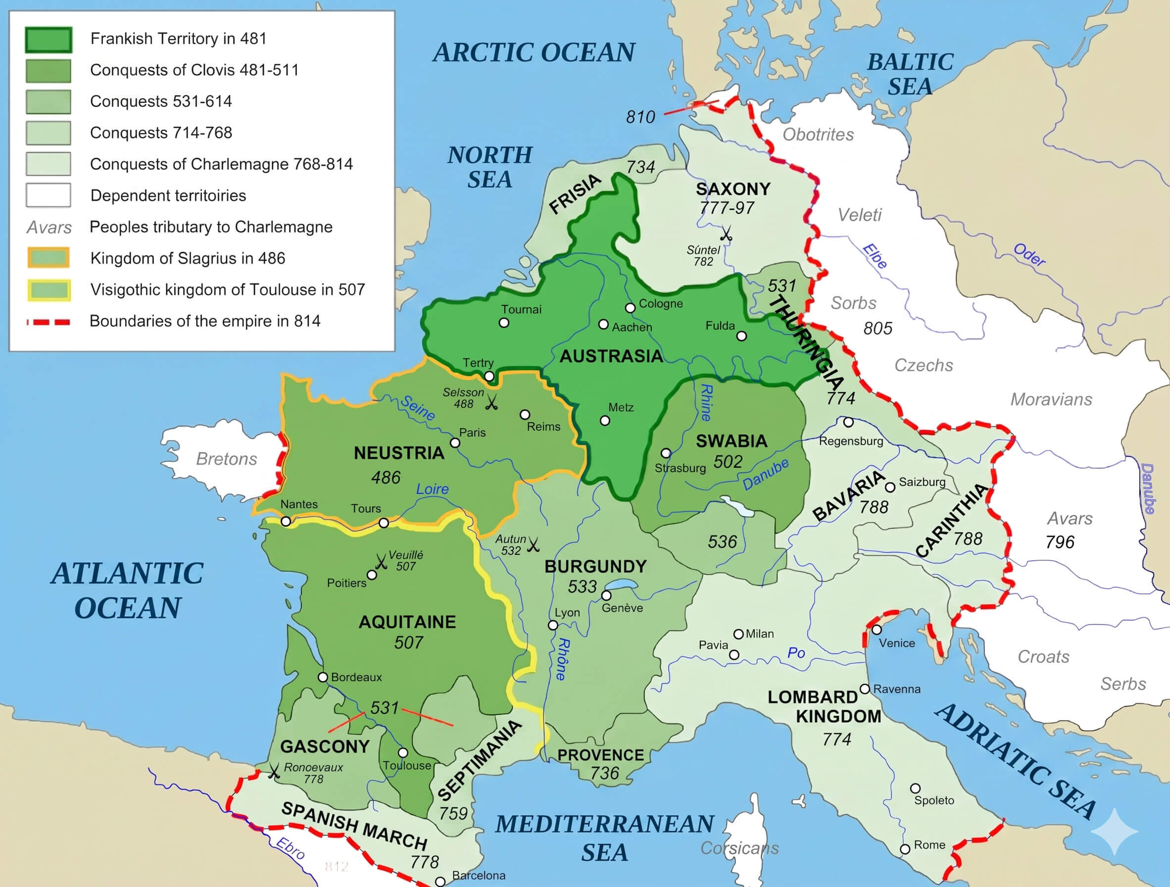
Frankish empire map 481 814
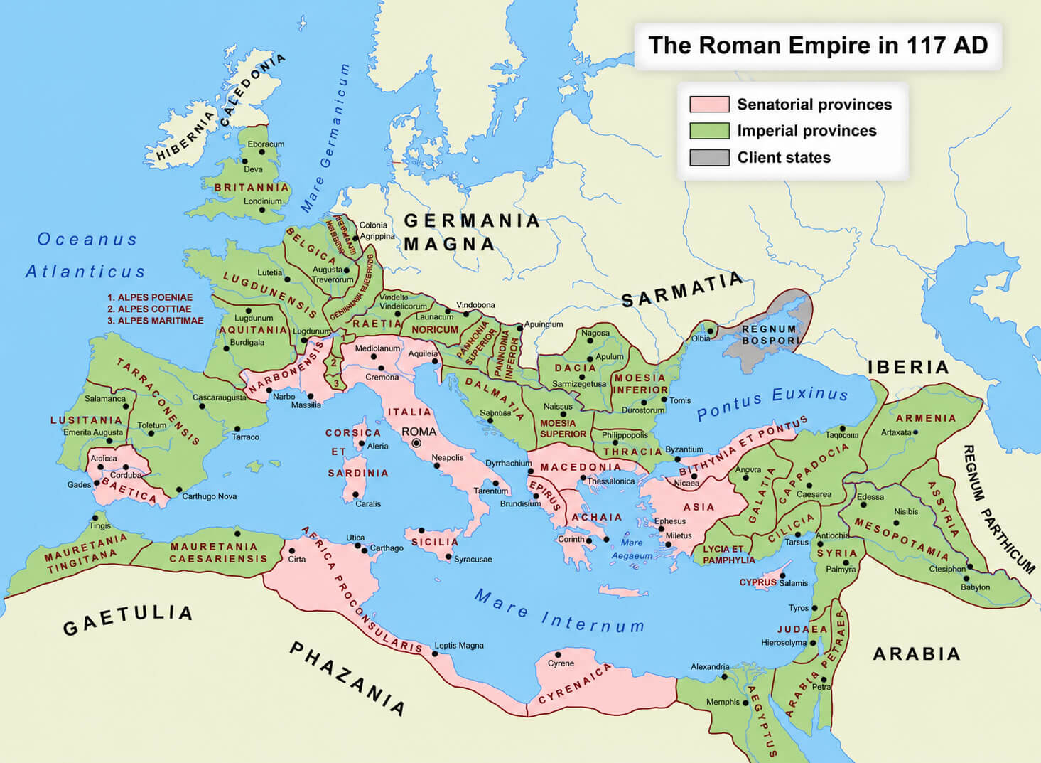
Roman Empire map 117 ad
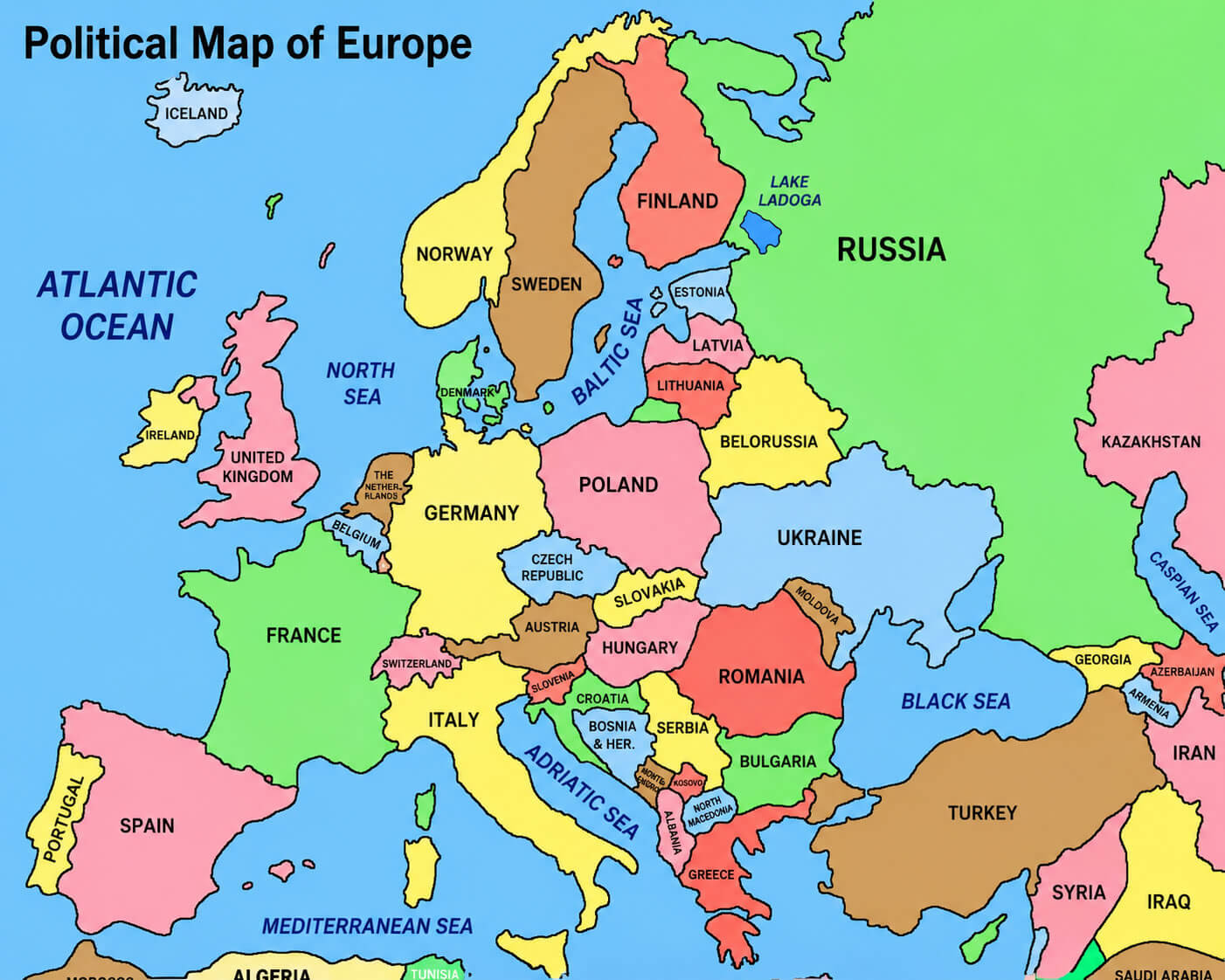
Political boundaries map of Europe
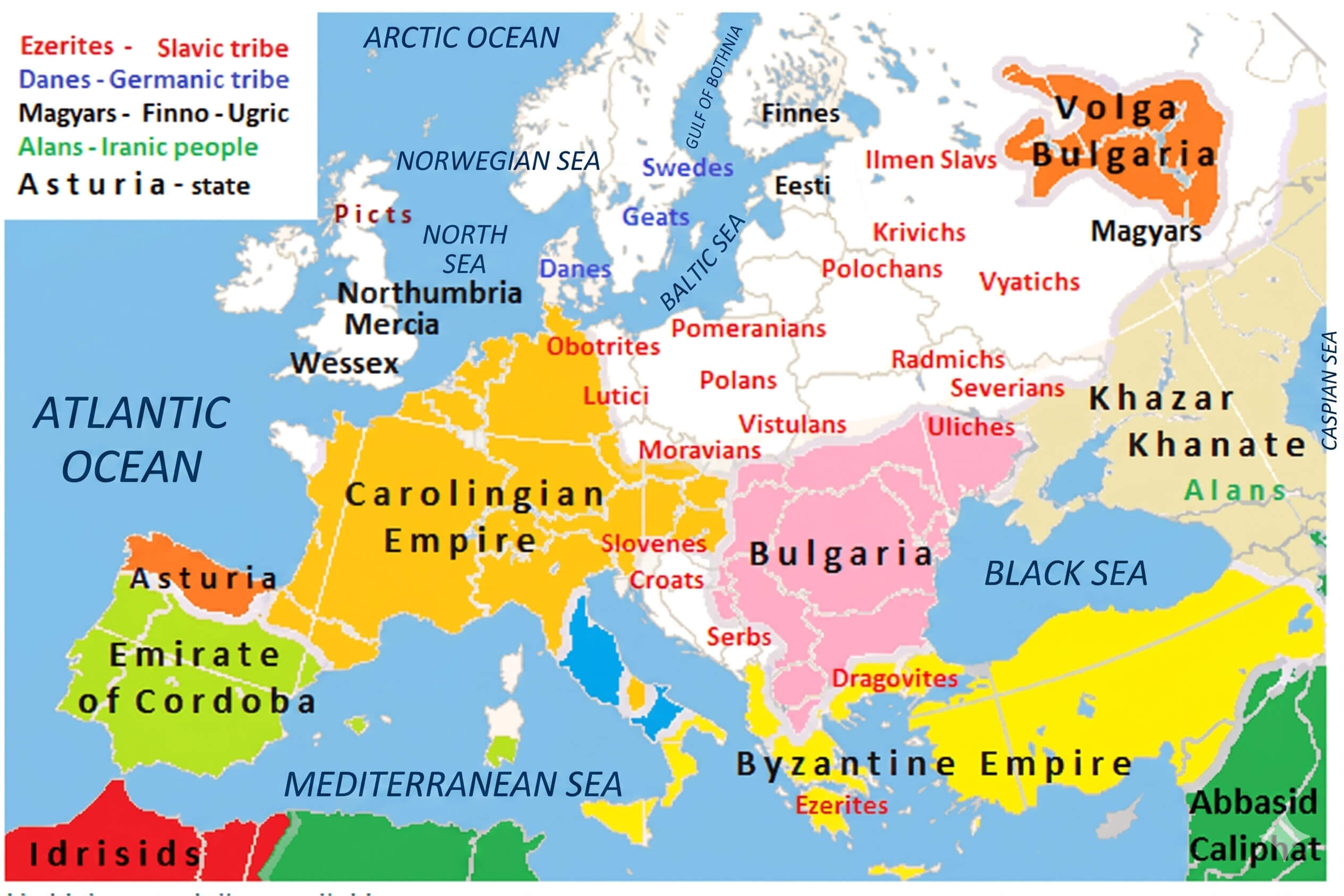
Medieval Europe map 814
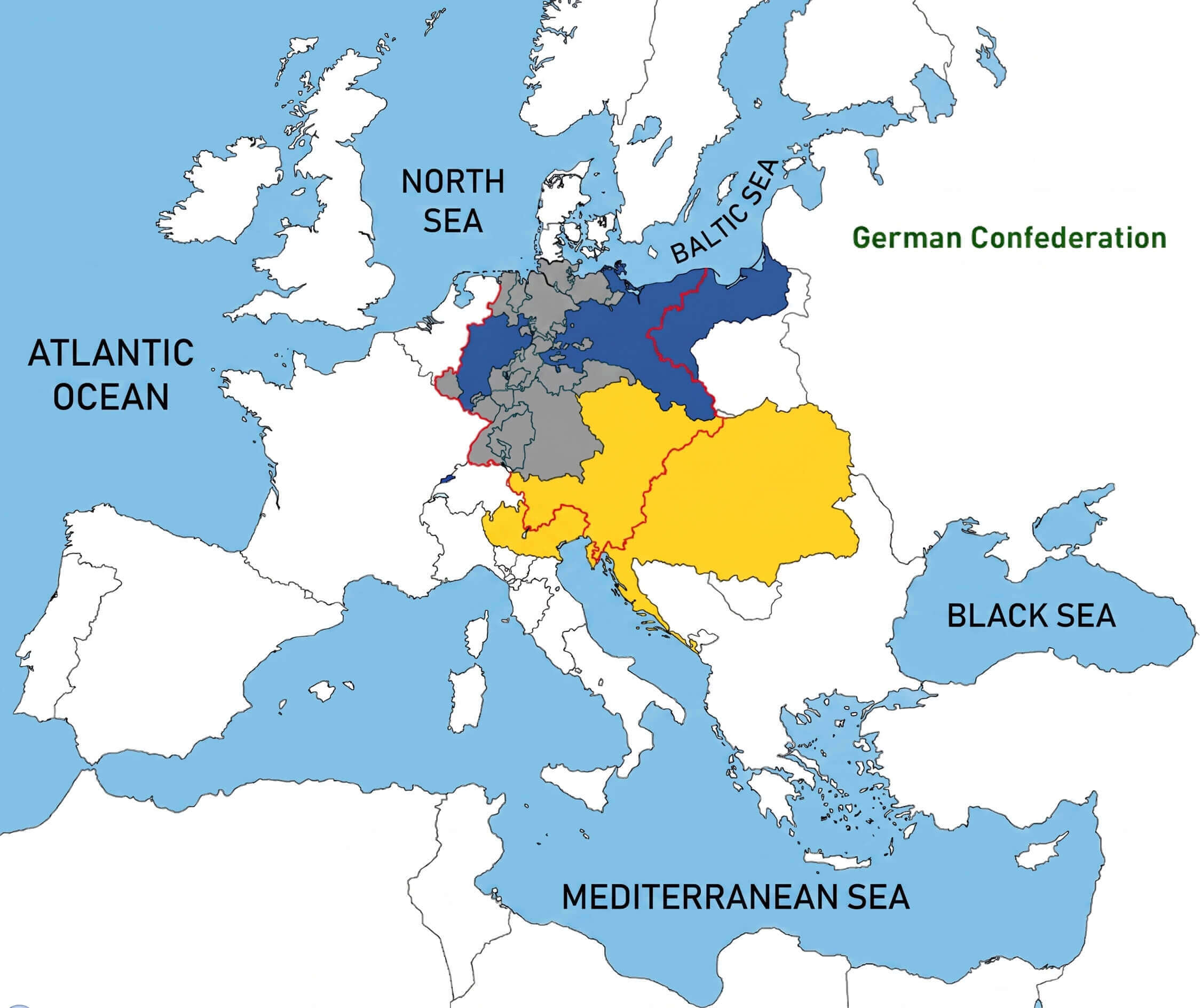
German Confederation map Europe
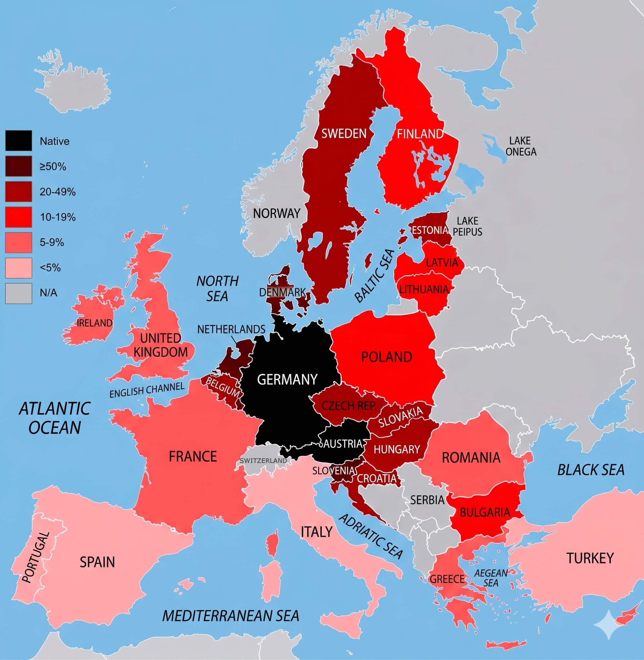
German language knowledge map Europe
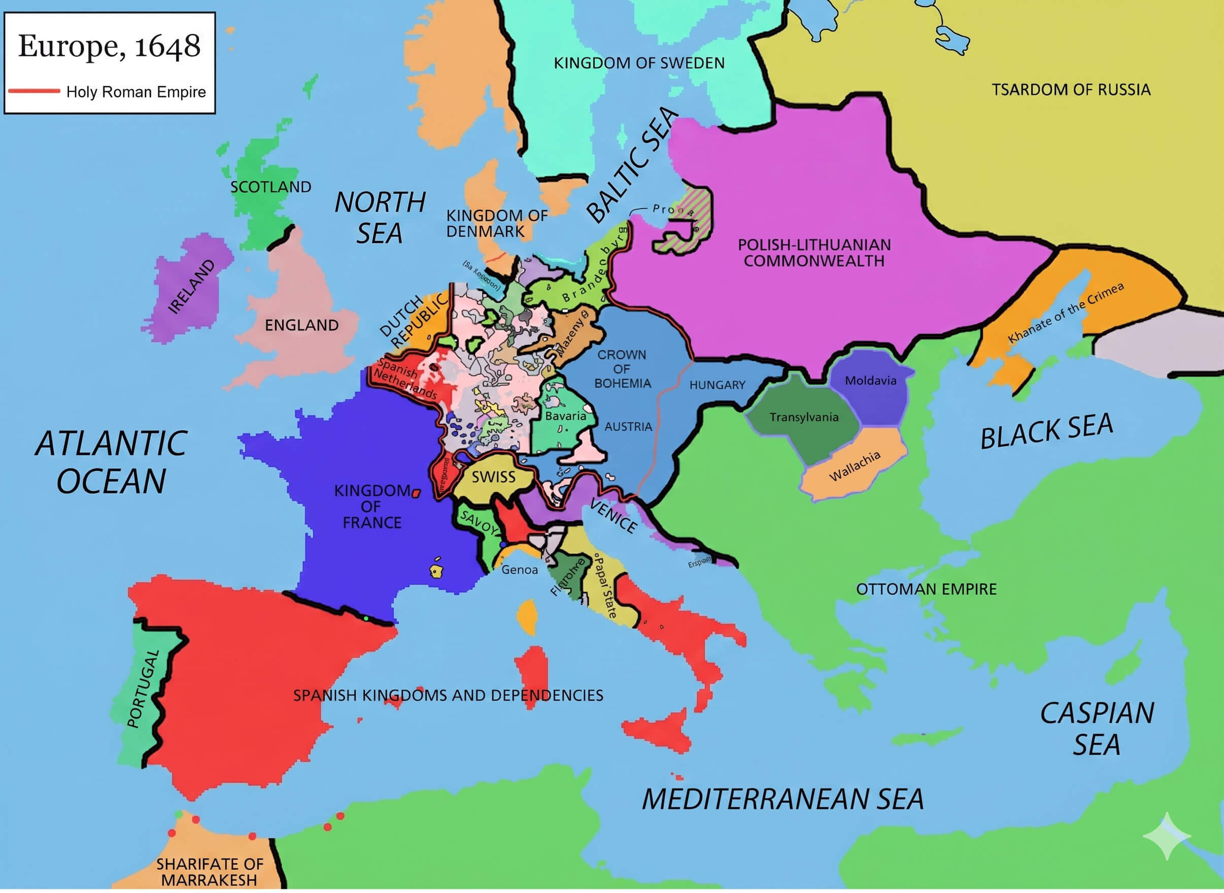
Holy Roman Empire map 1648
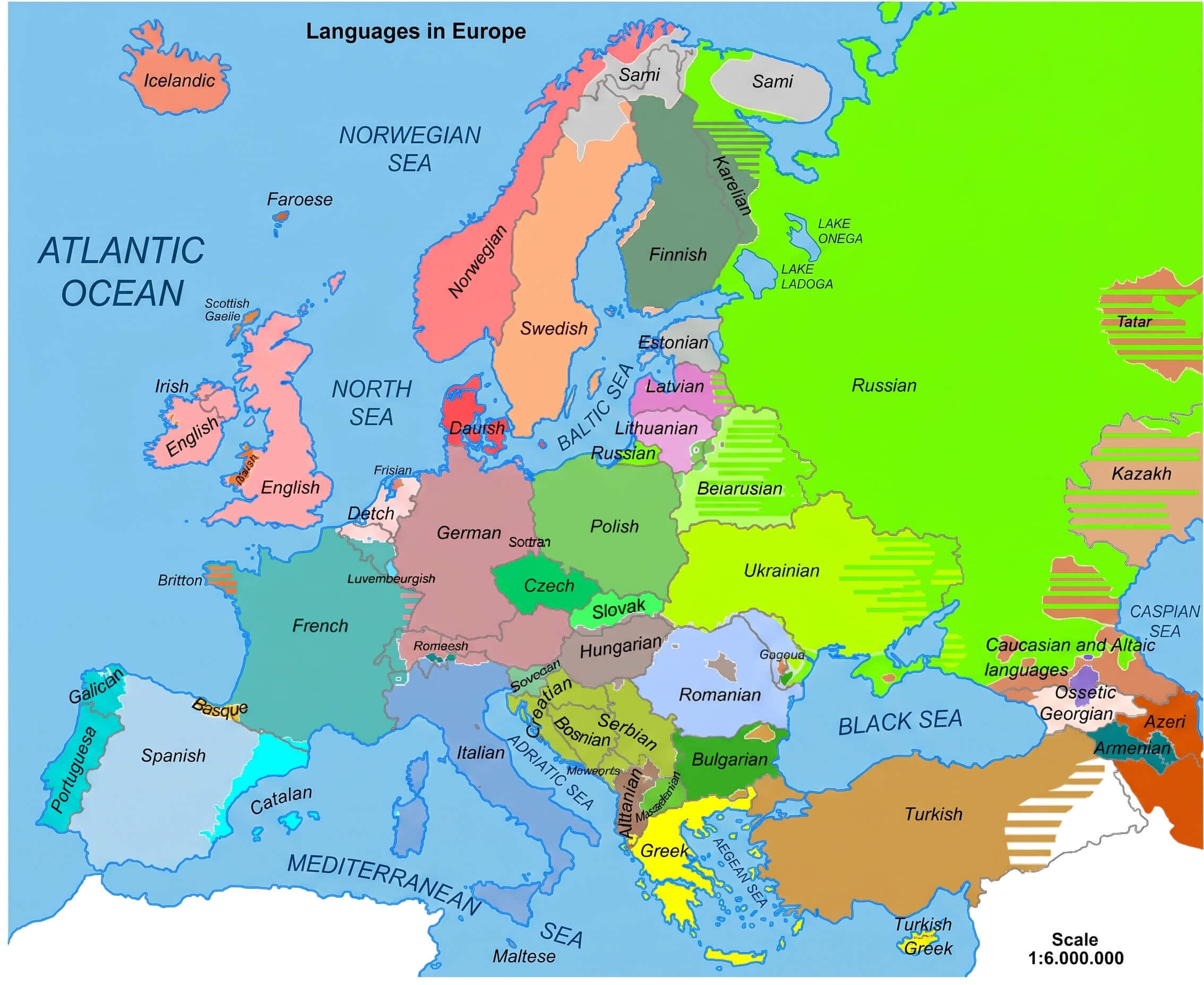
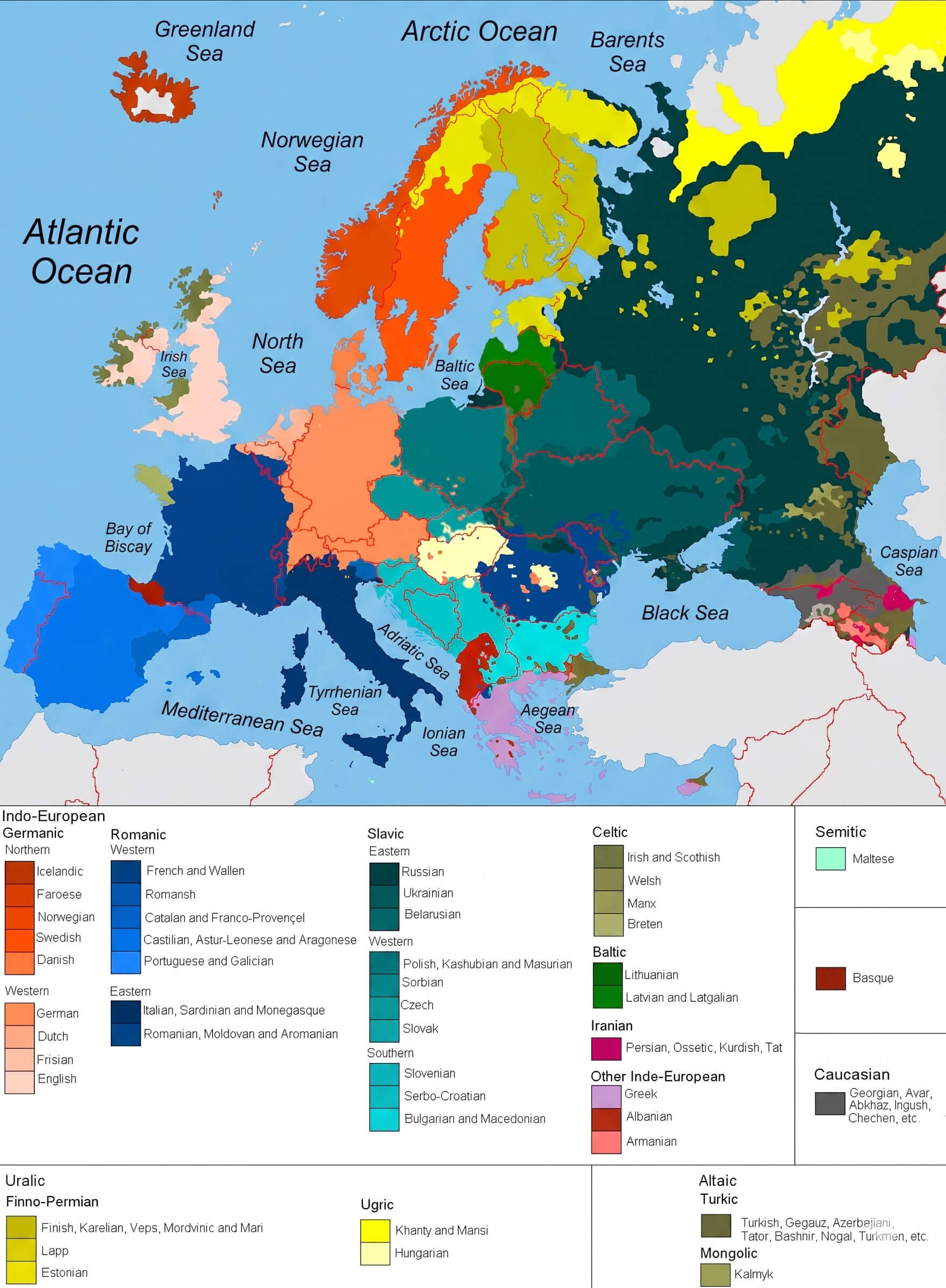
Languages spoken in Europe map
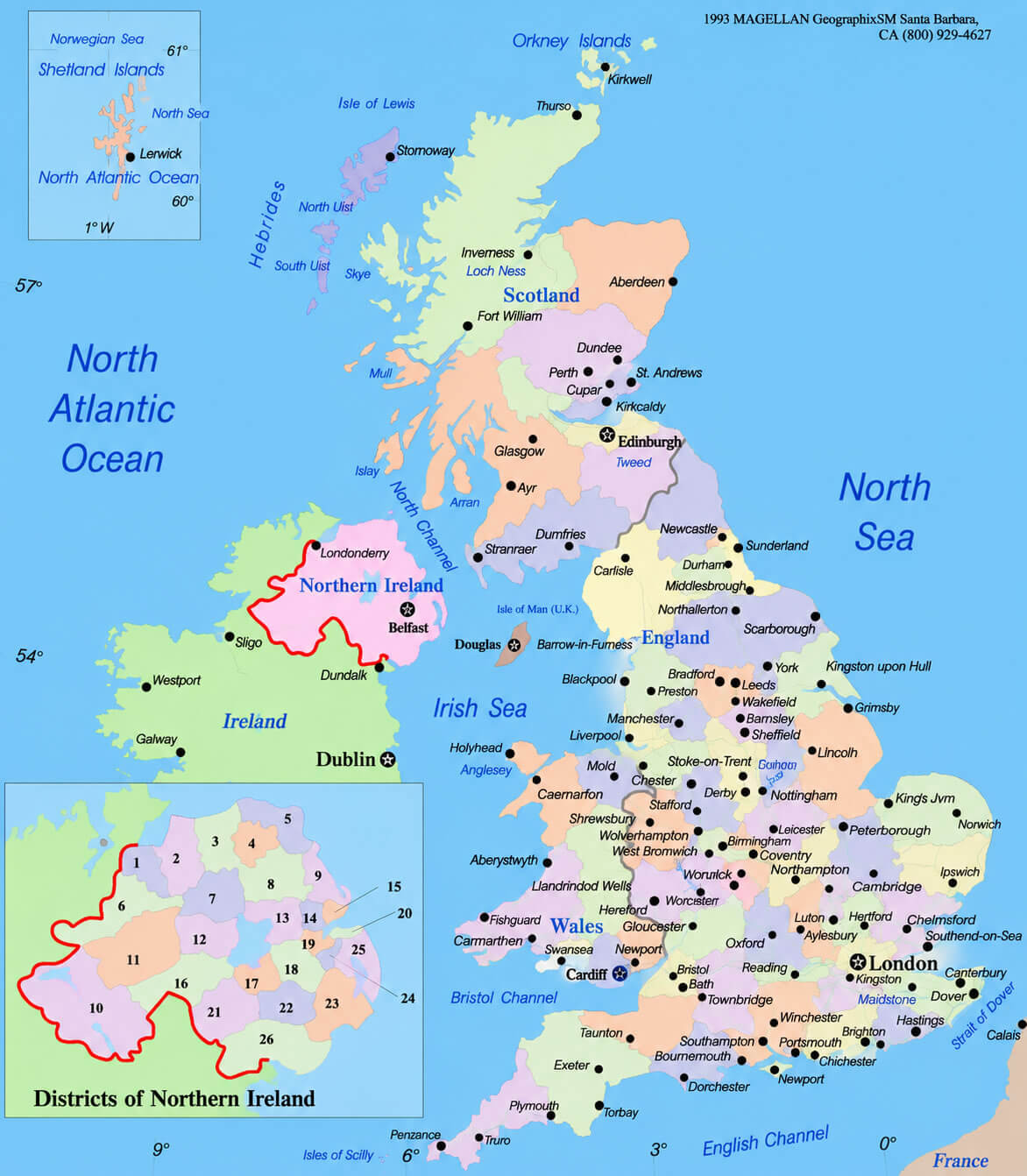
United Kingdom political map
Feel free to explore these pages as well:
- Head of Performance Marketing
- Head of SEO
- Linkedin Profile: linkedin.com/in/arifcagrici