Maps of the US: Detailed State, Political & Physical Maps
The United States features a diverse range of maps designed to help students, travelers, researchers, and geography enthusiasts explore the nation's landscapes, demographics, culture, and infrastructure. From French and German language maps of the US to detailed ancestry and ethnic groups maps, these visual resources provide valuable insights into the rich diversity and regional characteristics that define America today.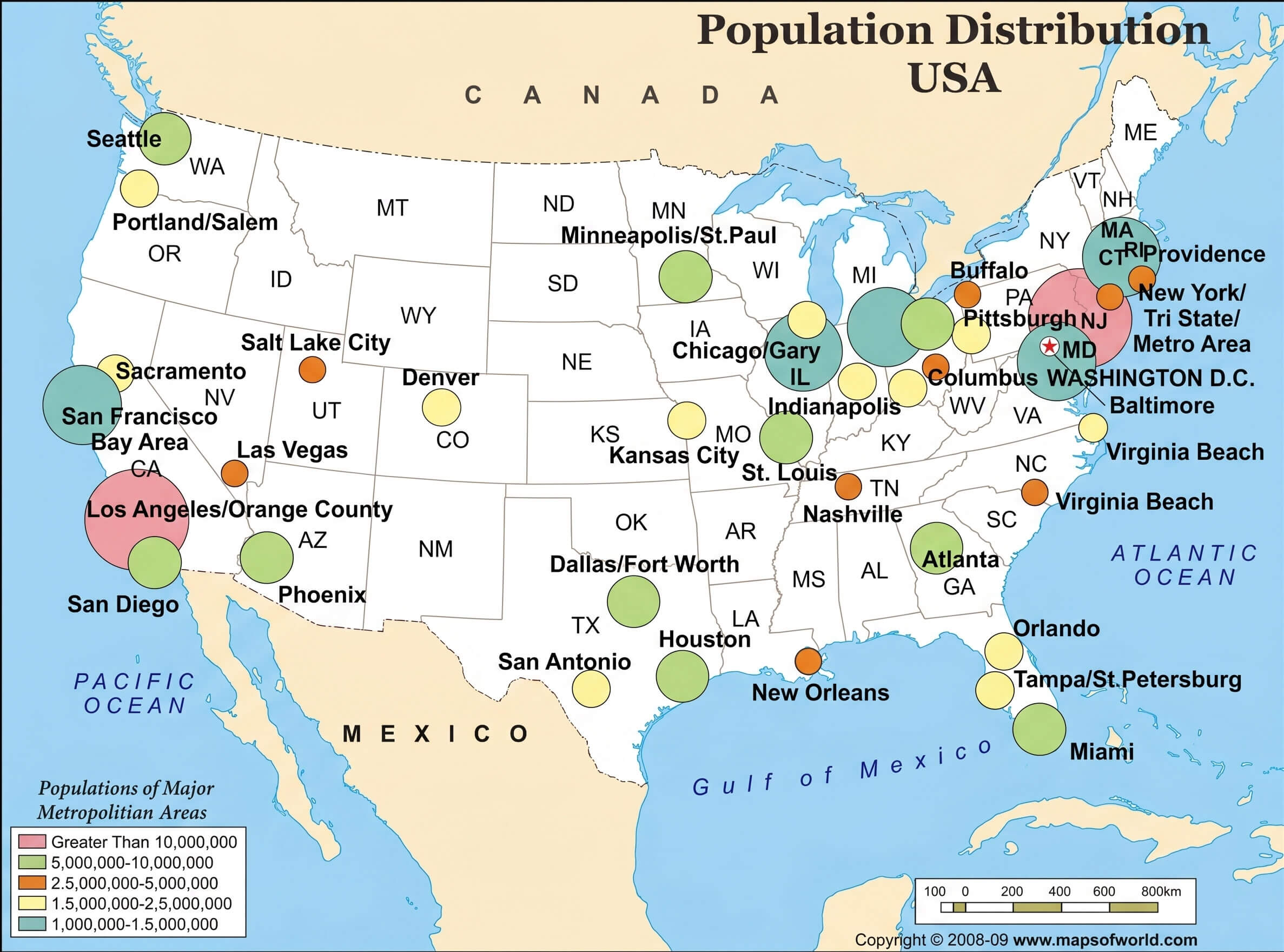
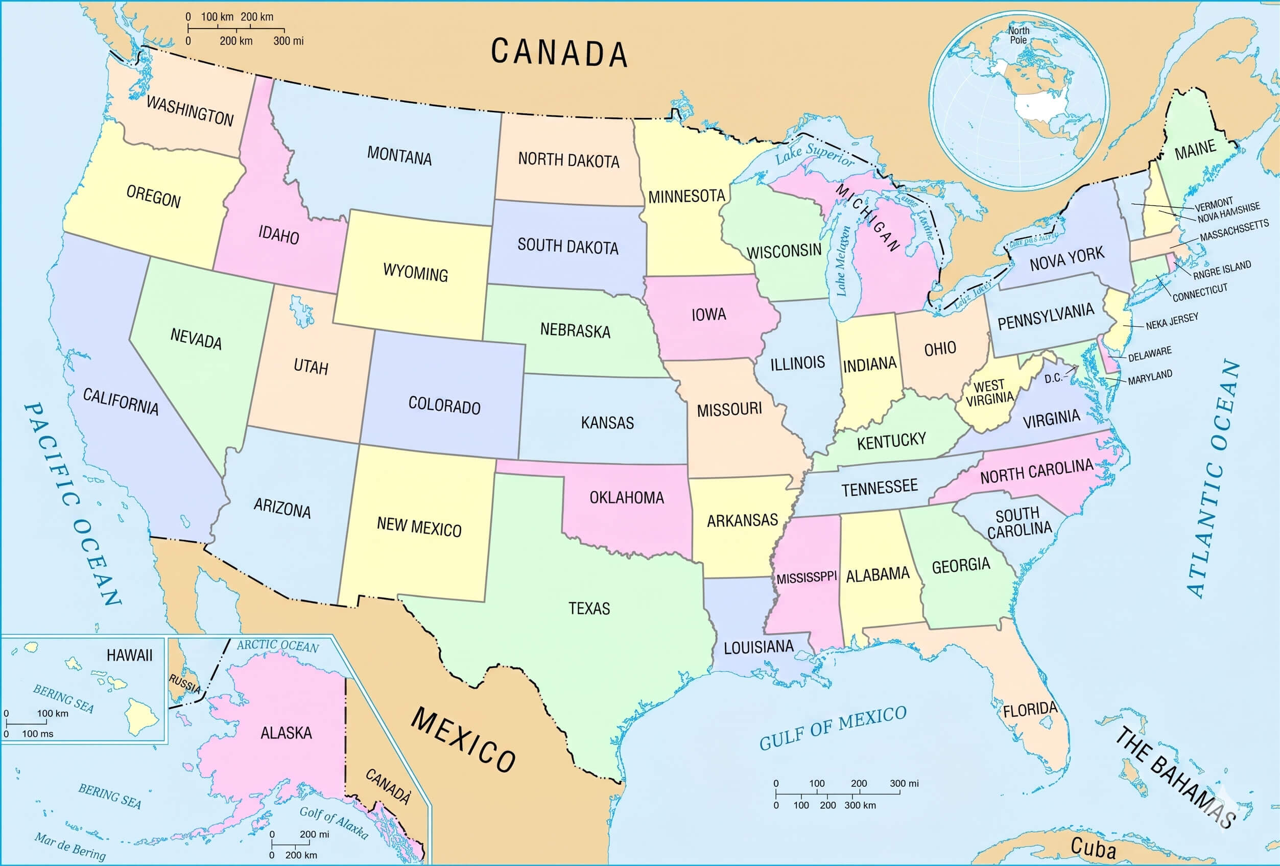
States map of the US
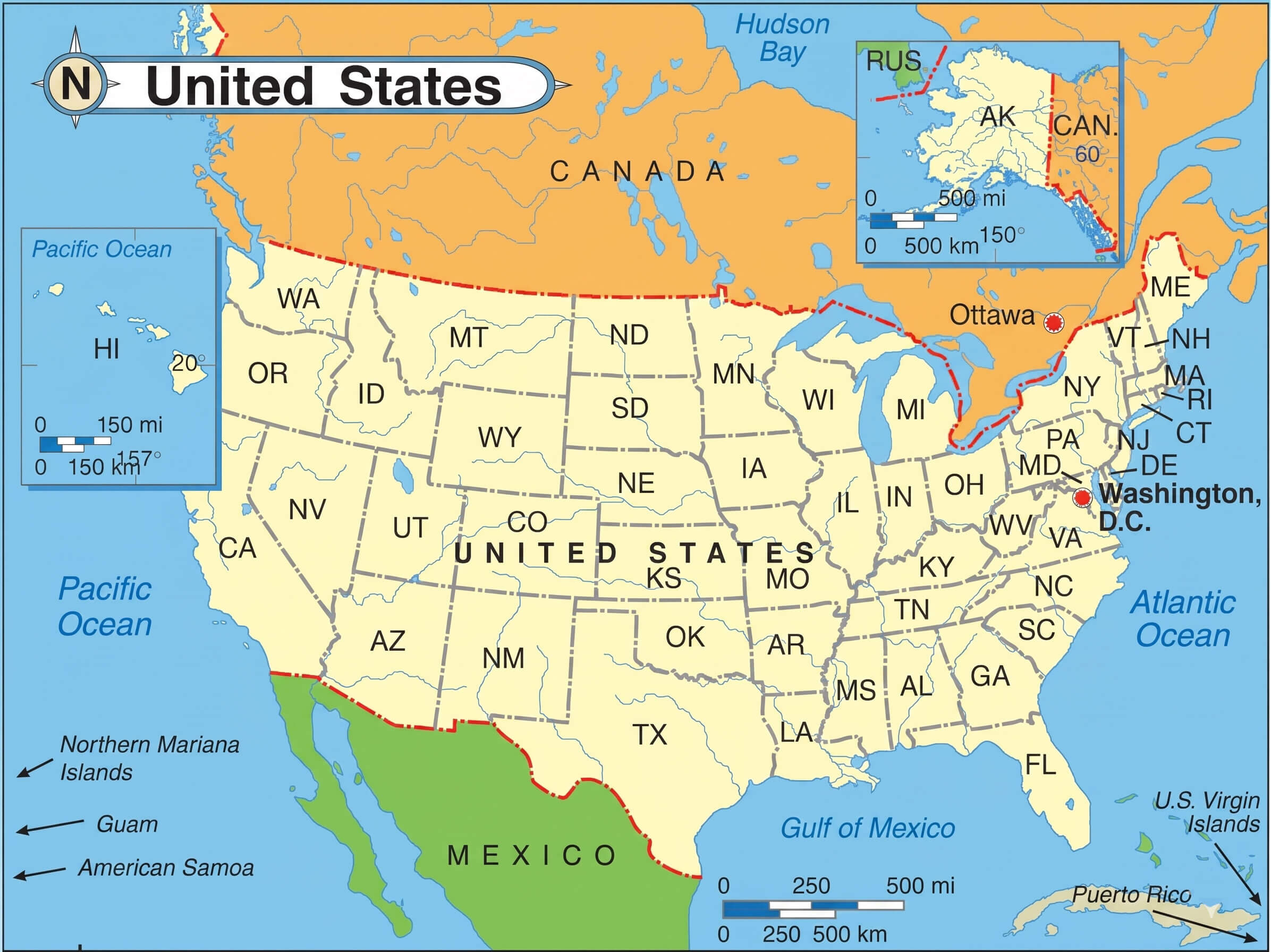
US states map with Alaska and Hawaii
US major cities population map
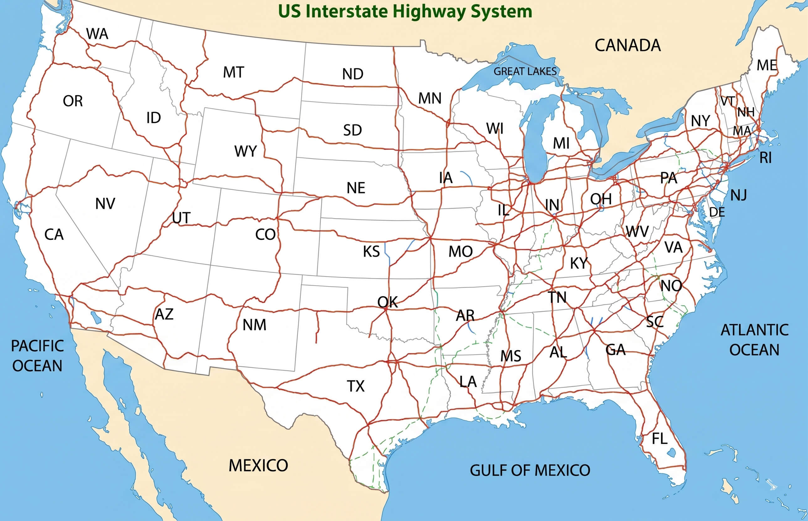
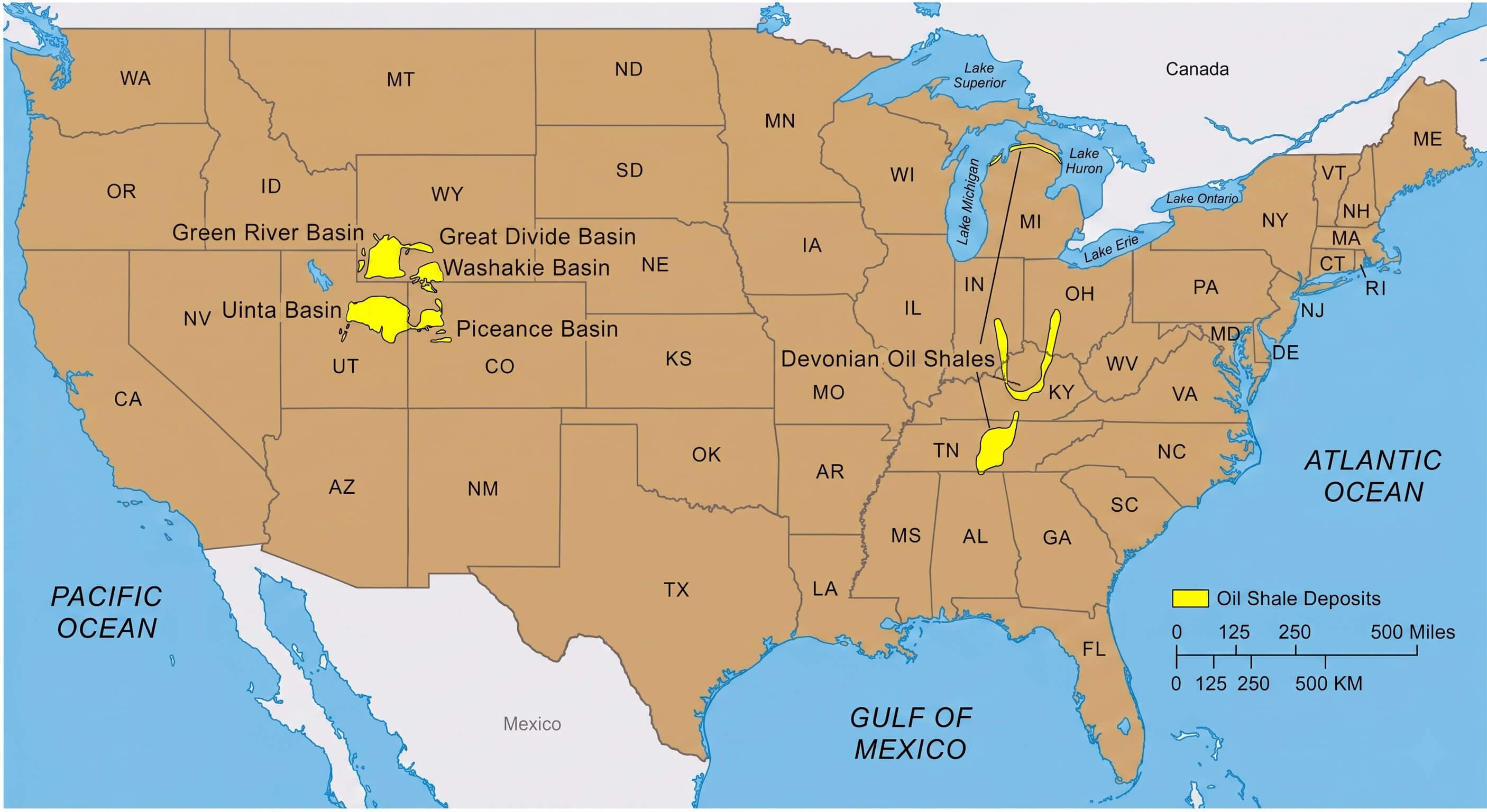
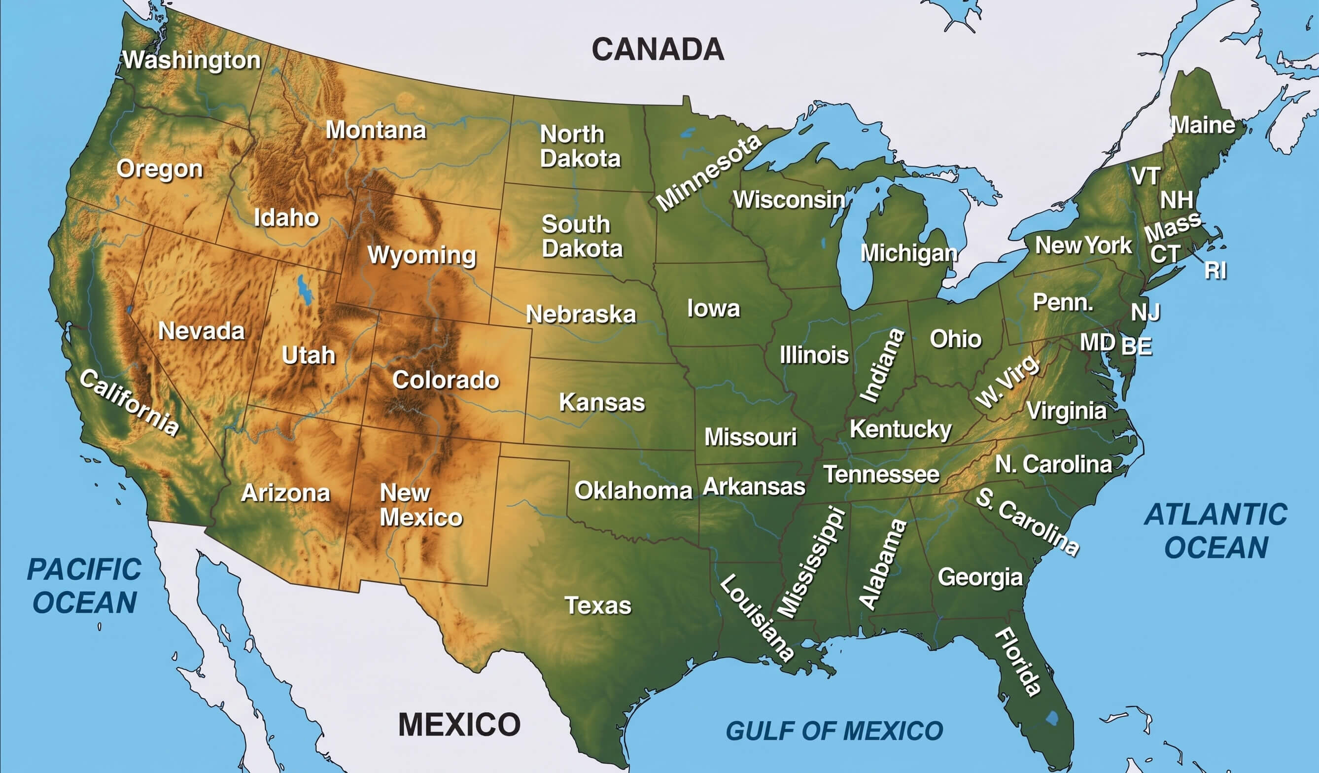
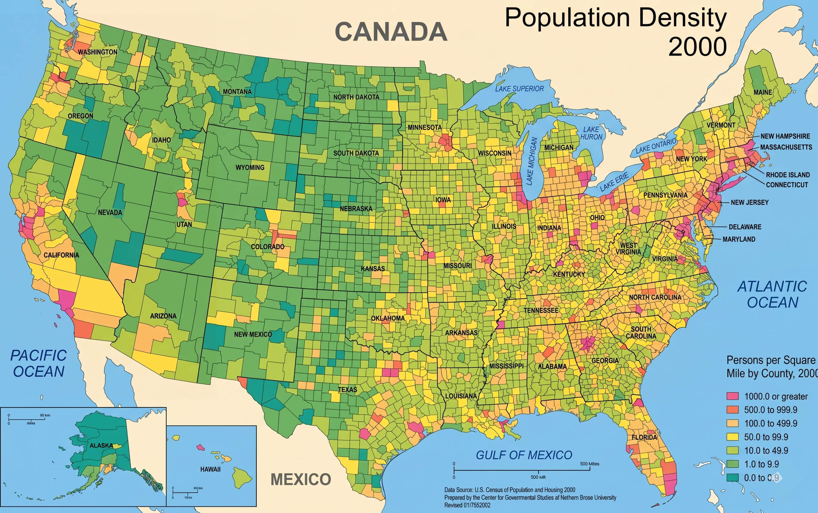
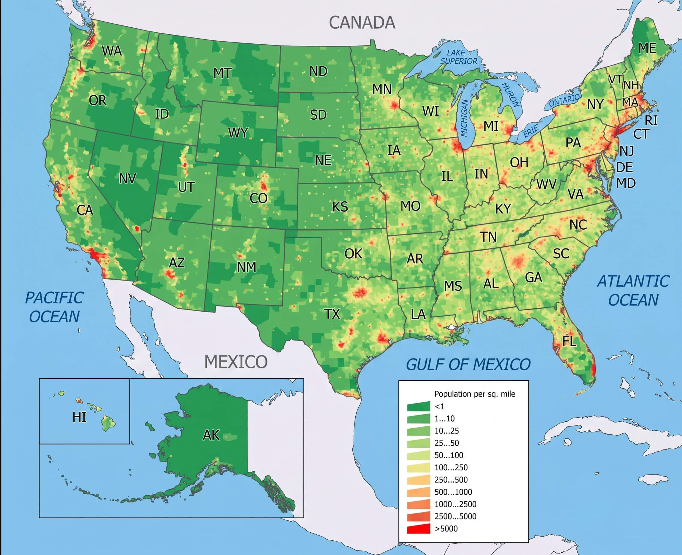
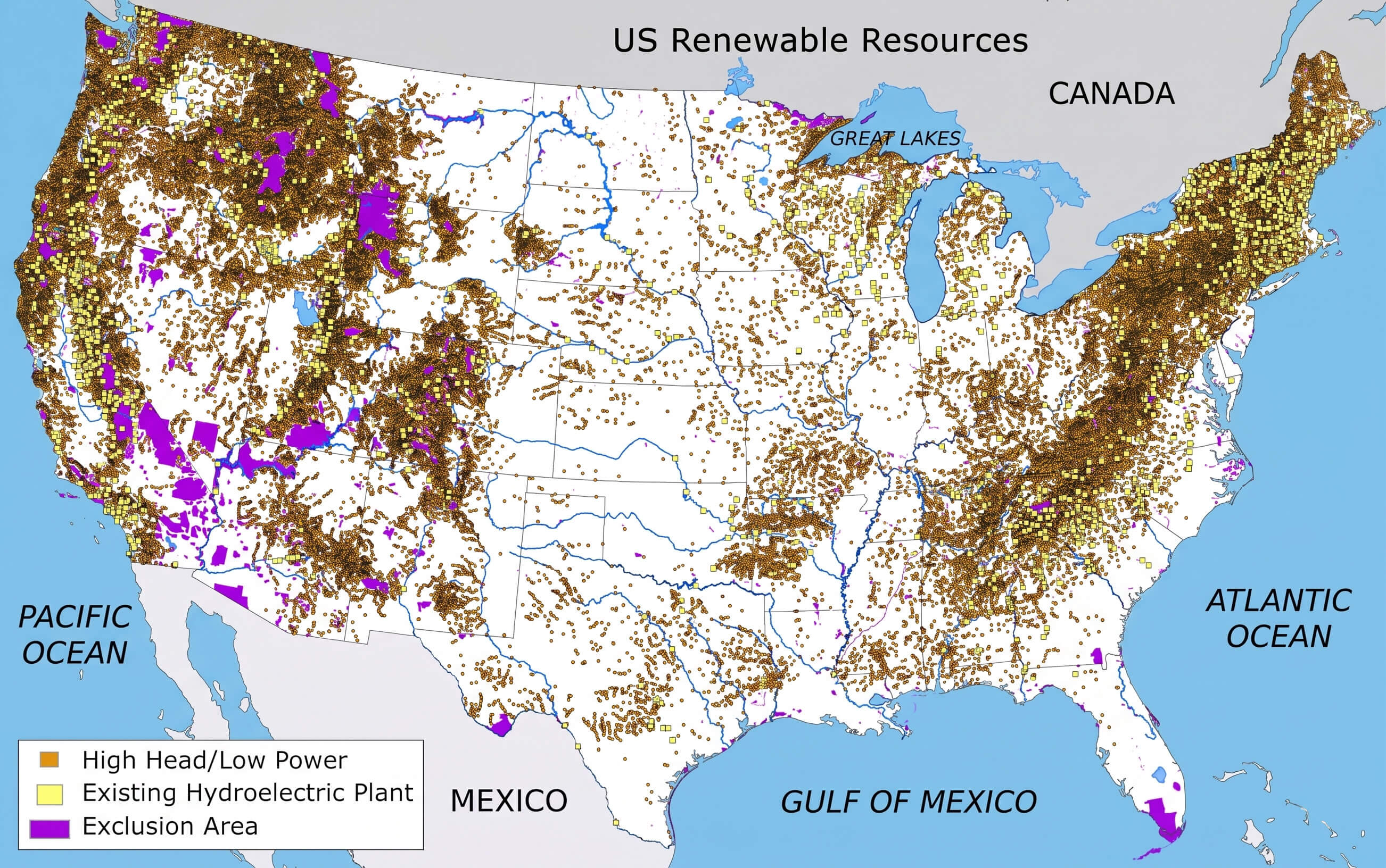
You can also explore practical and educational maps such as the US major interstate roads map, US major cities population map, US physical geography map, and US states map with Alaska and Hawaii for a clearer view of the nation’s geography and infrastructure. In addition, specialized maps including the US H1N1 map, US oil shale resources map, US renewable energy resources map, and both the US population density 2000 map and current US population density map provide valuable insights into historical trends, energy resources, and population distribution across the country.
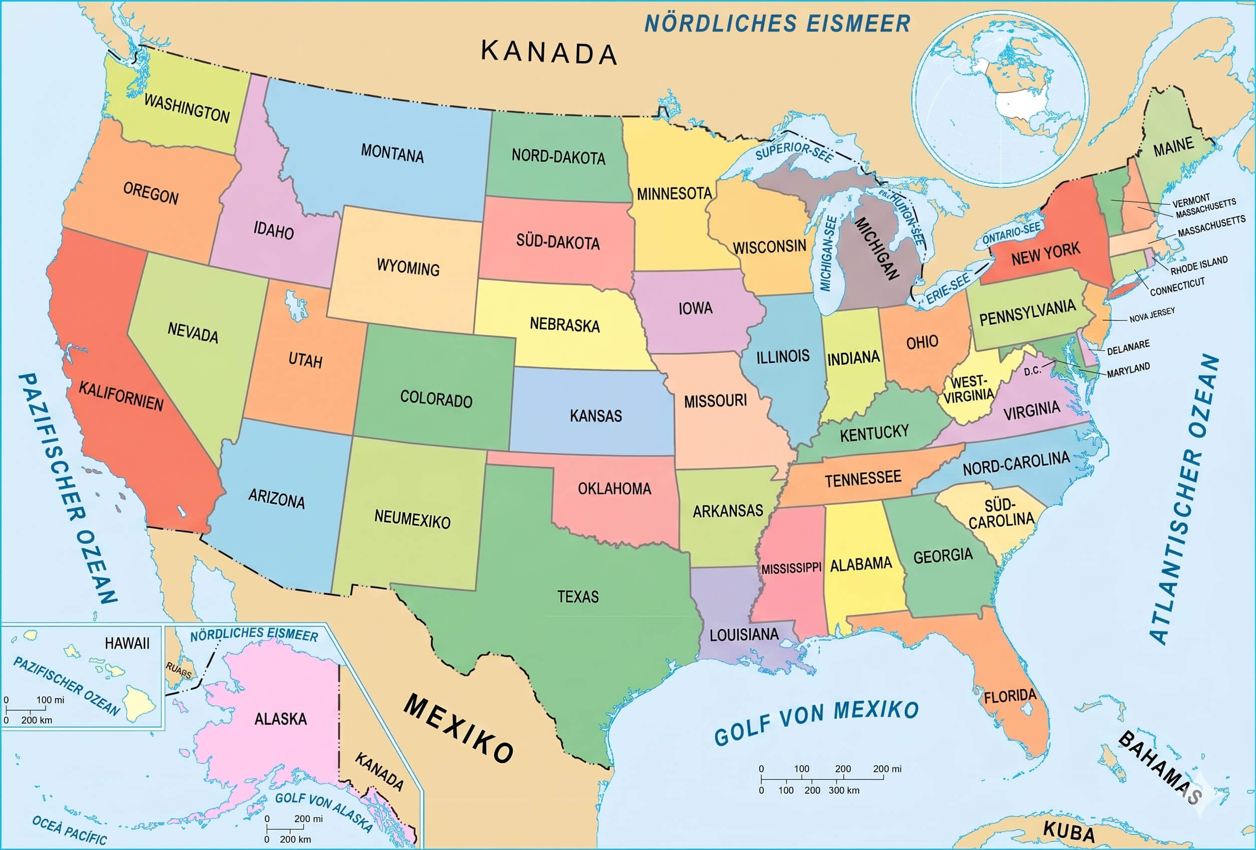
German language map of the US
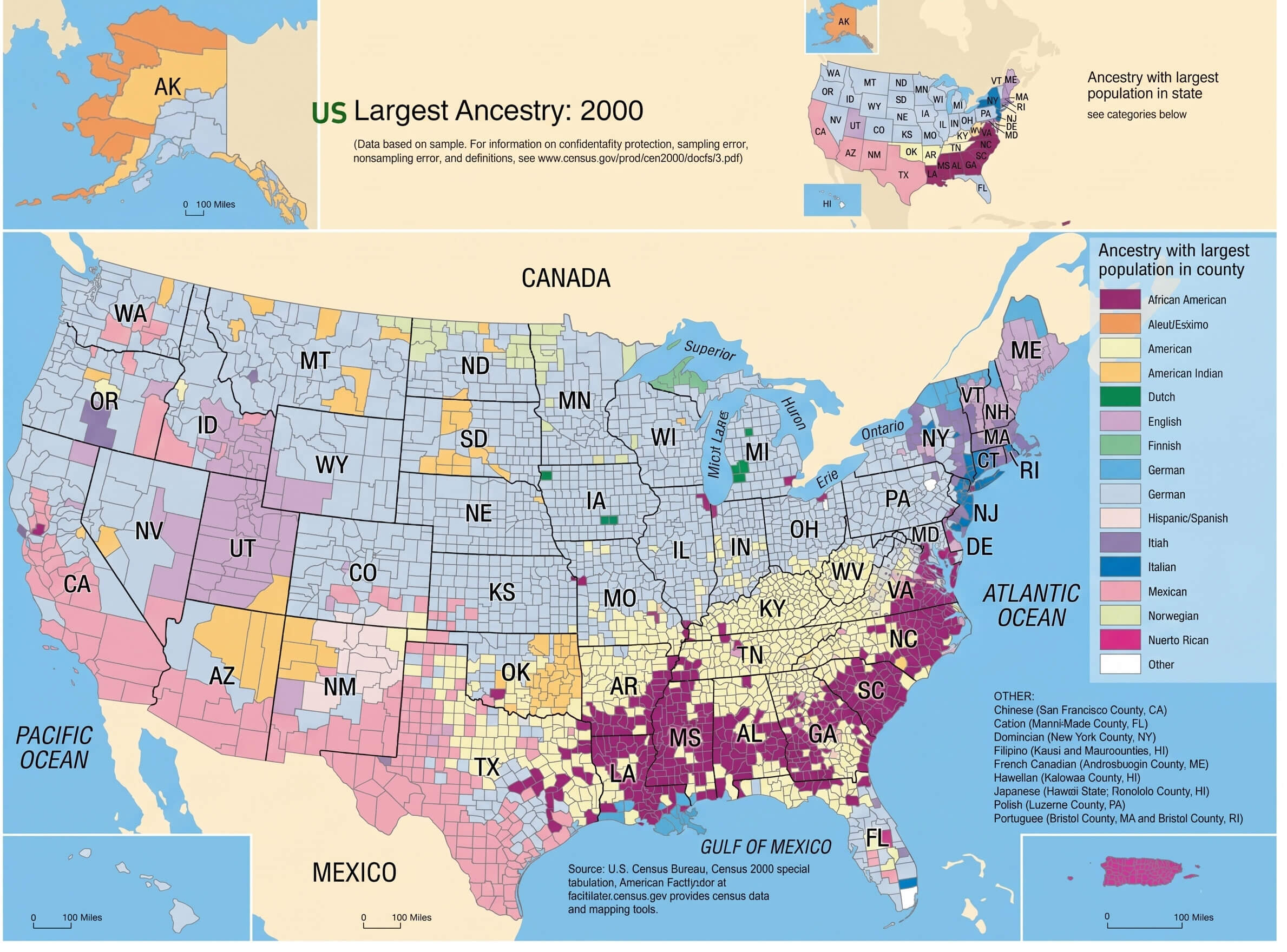
US ancestry and ethnic groups map
US H1N1 map
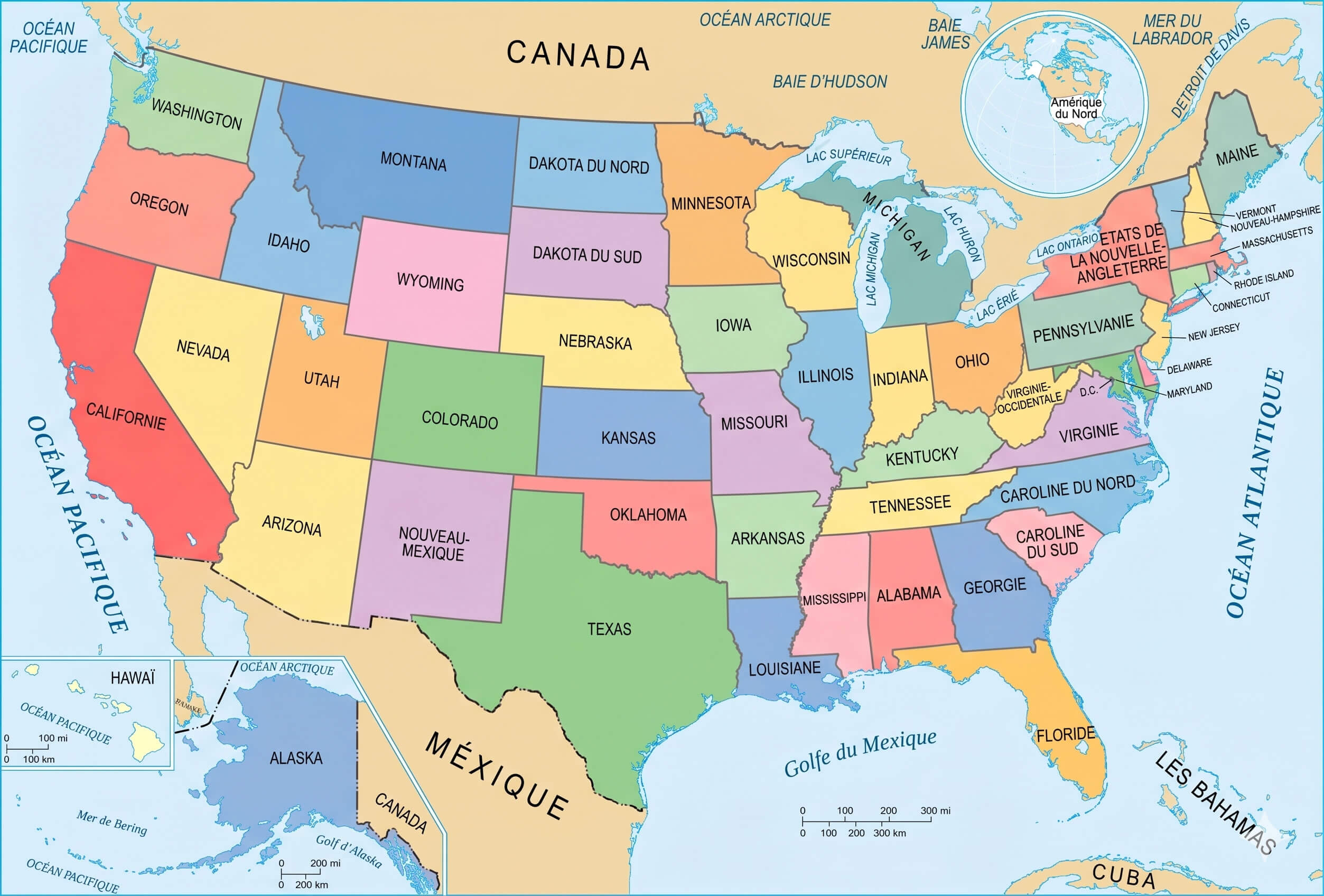
French language map of the US
US major interstate roads map
US oil shale resources map
US physical geography map
US population density 2000 map
US population density map
US renewable energy resources map
Feel free to explore these pages as well:
- Head of Performance Marketing
- Head of SEO
- Linkedin Profile: linkedin.com/in/arifcagrici