Maps of the USA: Detailed Political, Physical & State Maps
Explore an extensive collection of maps of the United States created for students, travelers, researchers, and map enthusiasts alike. This page includes a wide range of resources, from blank colorful US states maps and colorful political maps of the United States with states to highly detailed USA states maps and complete maps of all 50 US states. Visitors can also discover informative geographic and environmental maps such as the physical map of the United States, USA major rivers and lakes map, and USA population density map, offering valuable insights into the nation’s landscapes, waterways, and population distribution.
Pastel United States country map
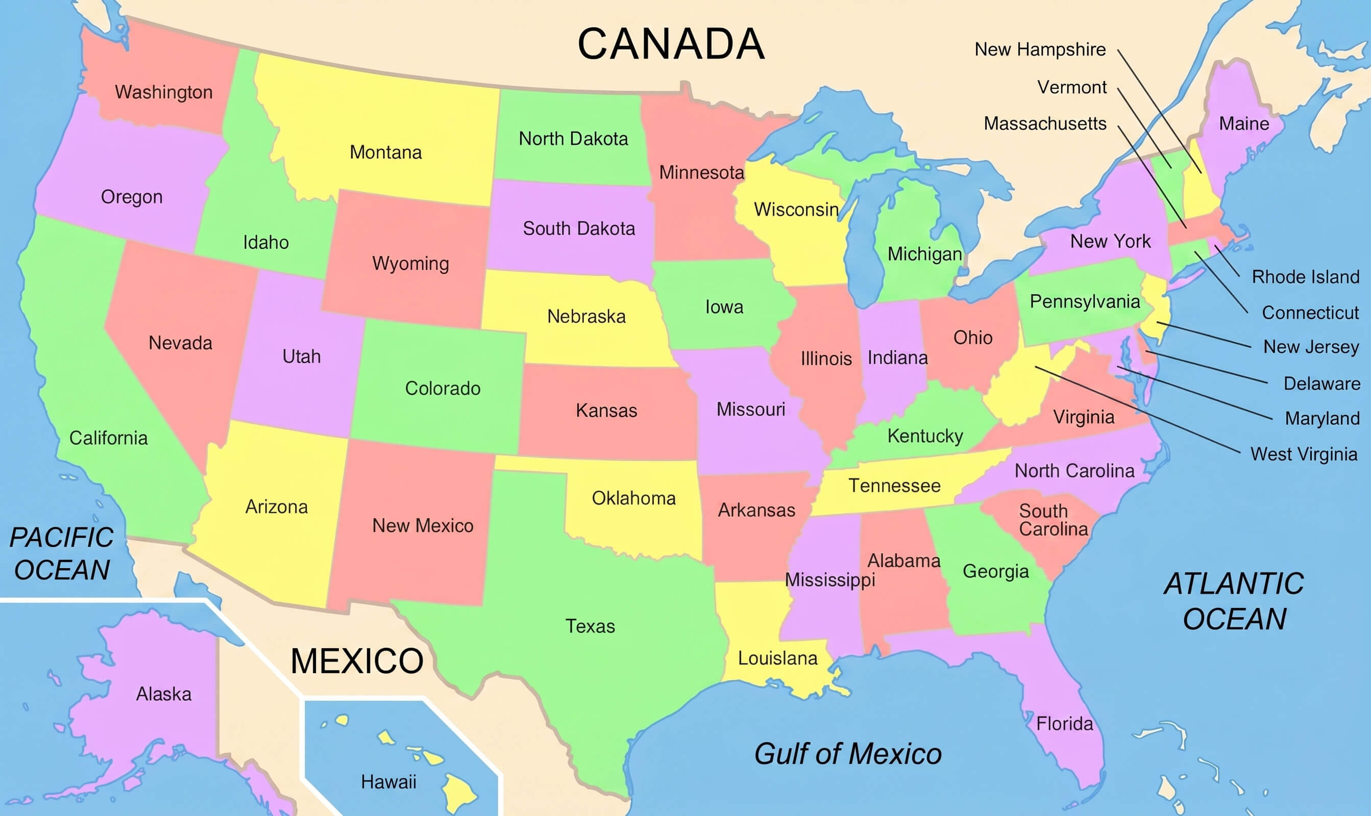
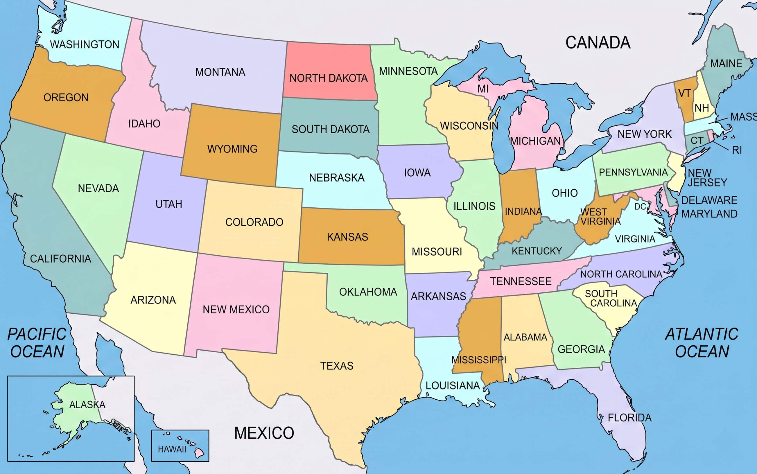
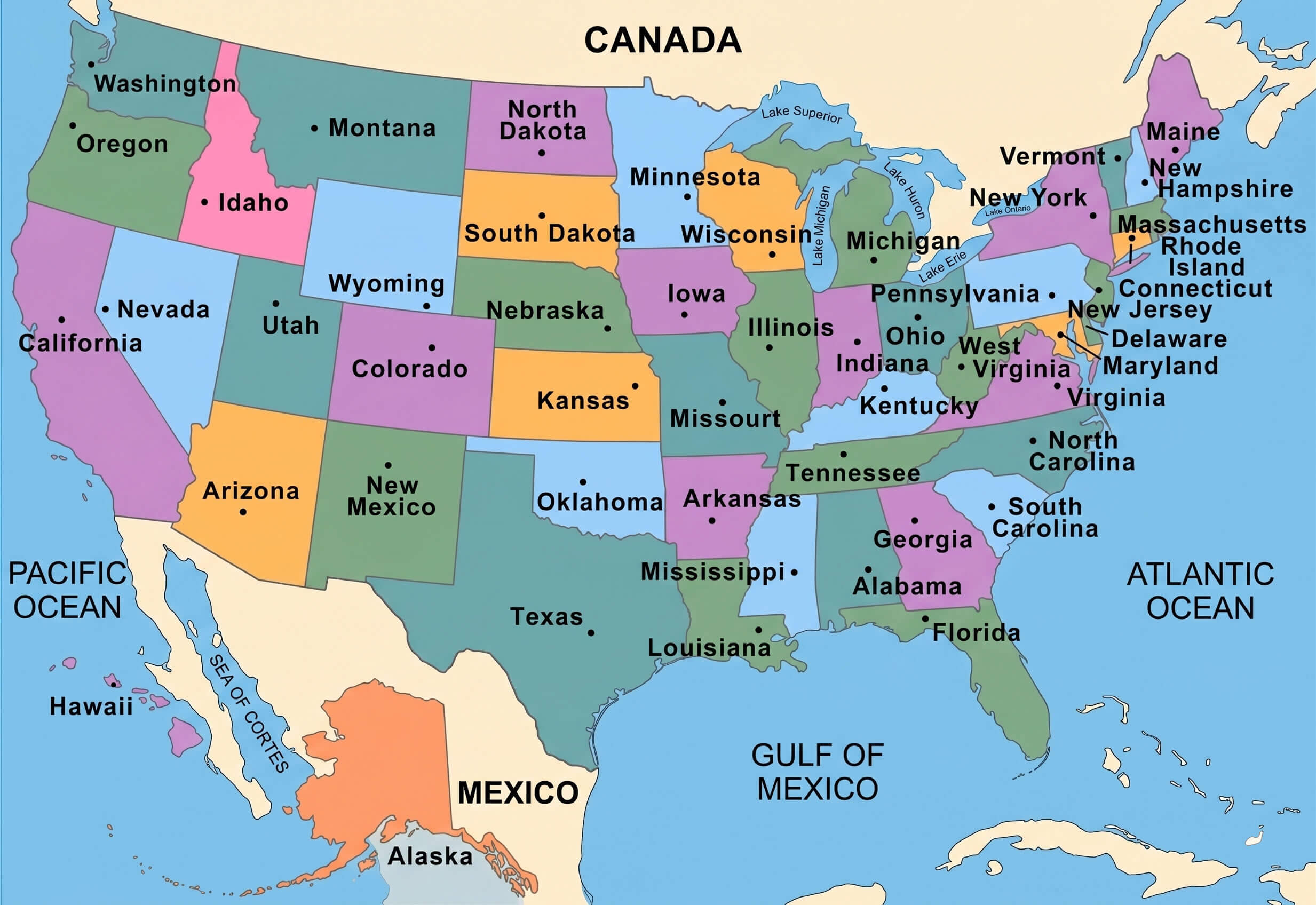
Colorful United States political map with us states
For broader geographic context, the collection also includes the location of the United States in the world map, a North America and US location map, and a USA states and regions map with regional division legends. Whether you are searching for a pastel United States country map, a political map of the United States of America, or educational maps for school and research purposes, these detailed USA maps provide valuable insights into the country’s regions, geography, and political structure.
Location of the United States in the World map
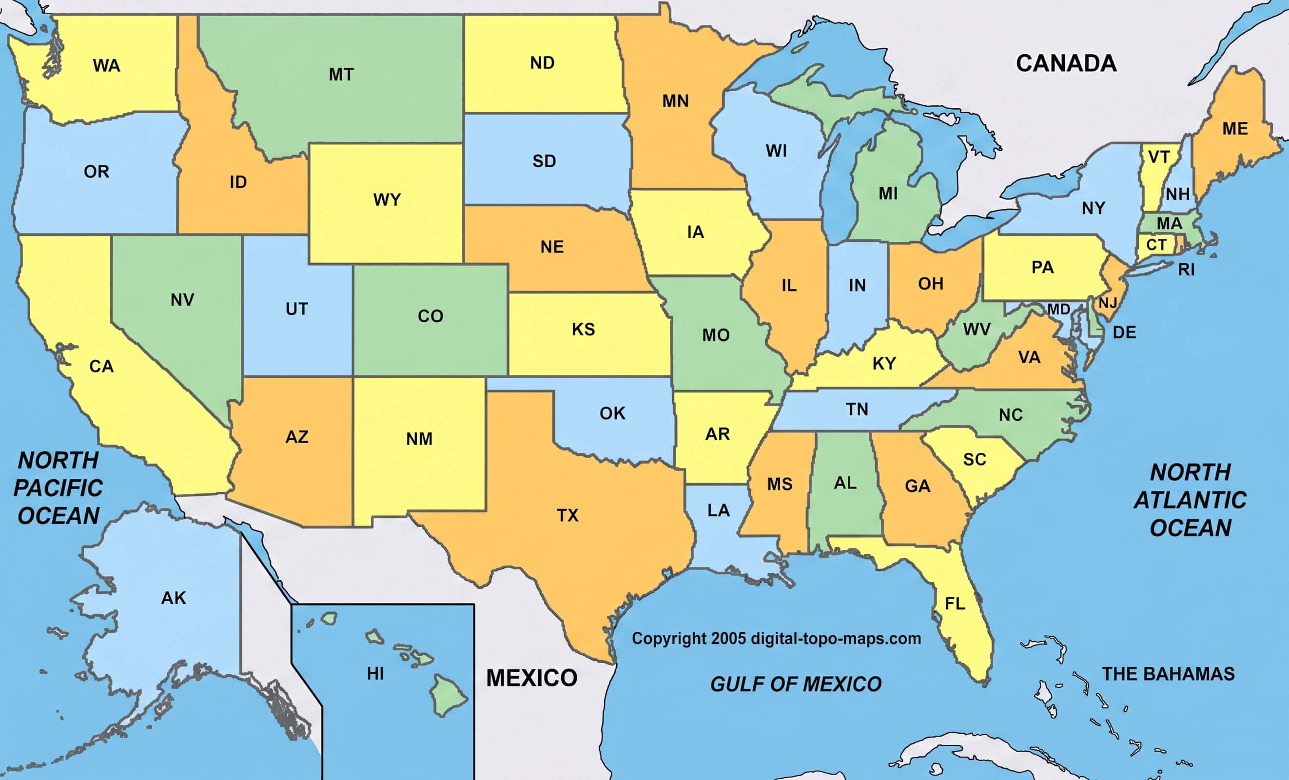
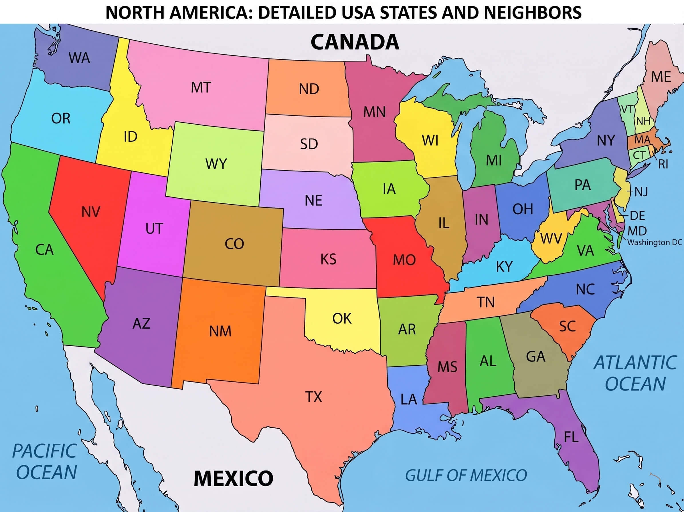
Detailed USA states map
Blank colorful us states map
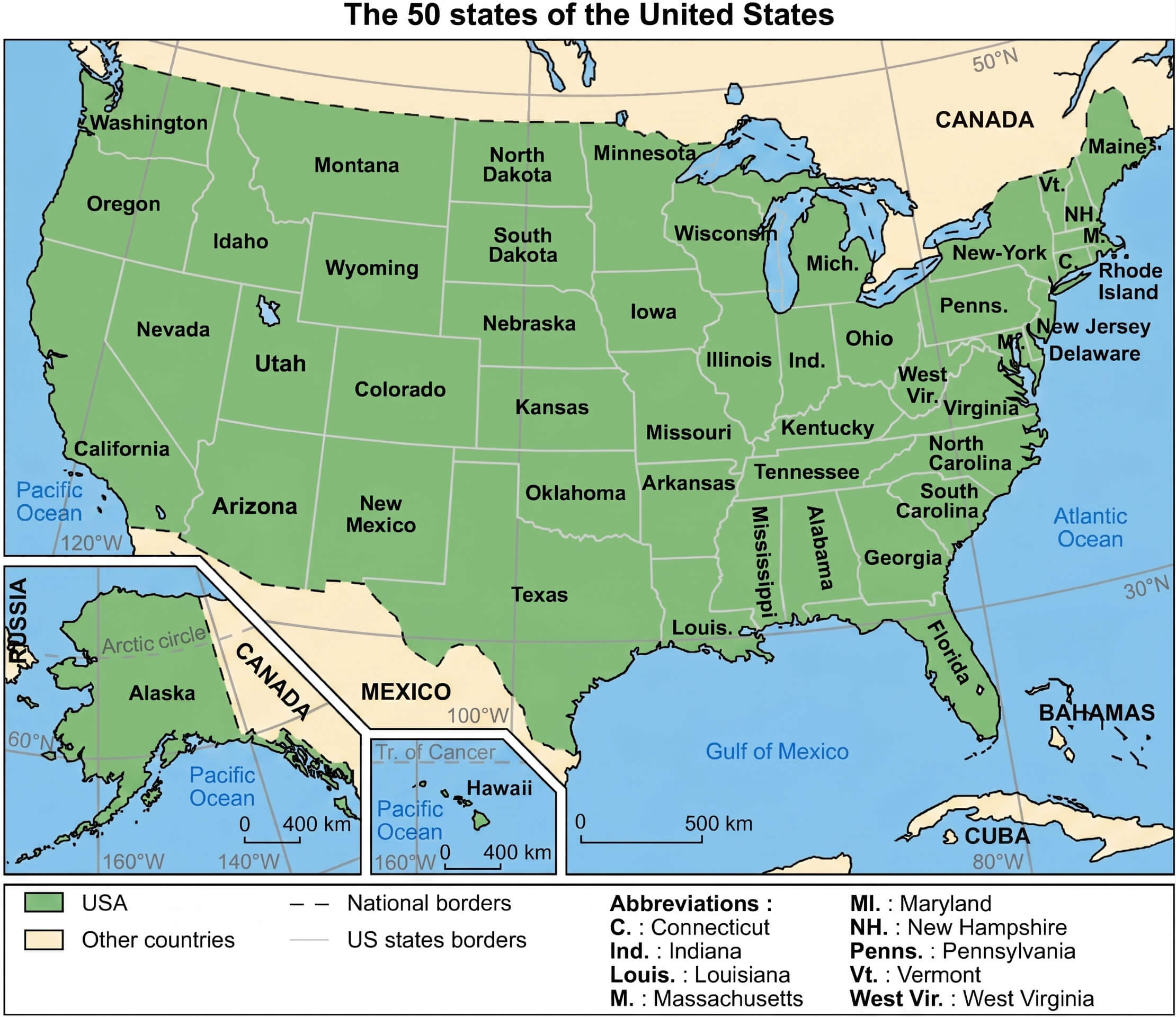
Map of the 50 us states
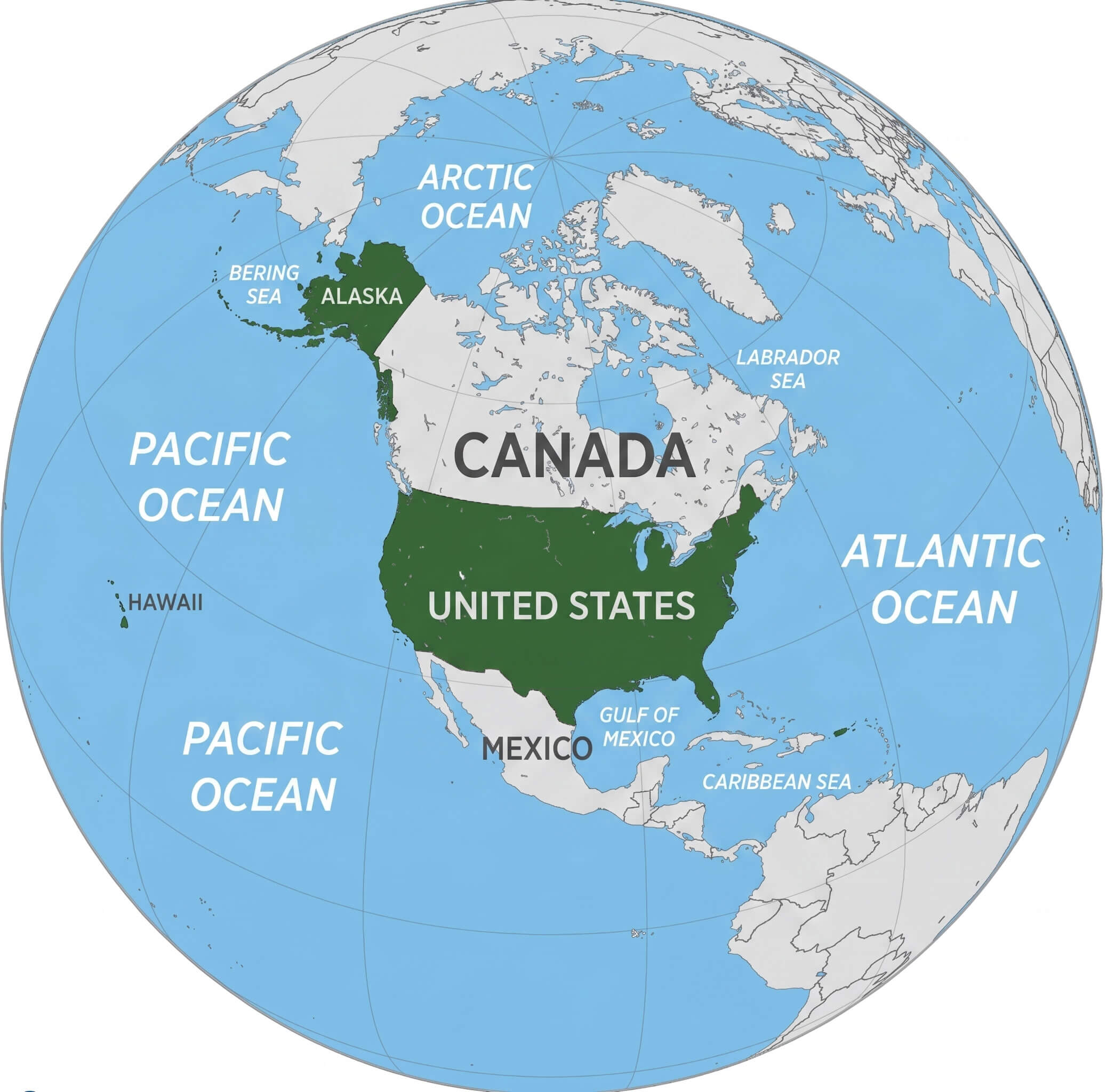
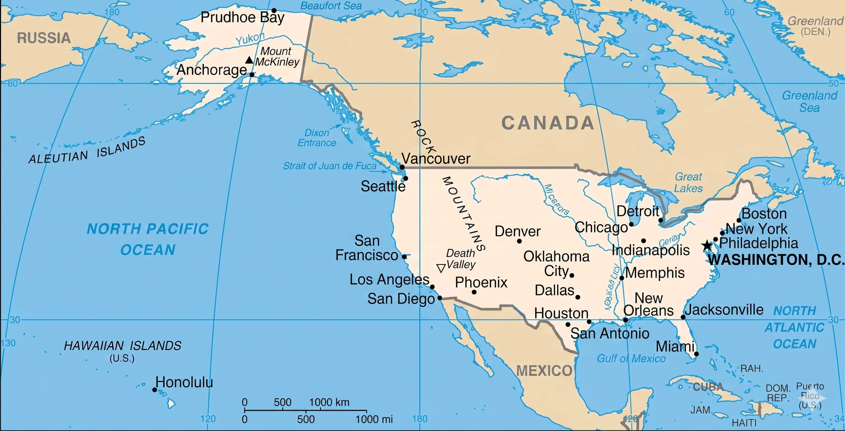
North America and us location map
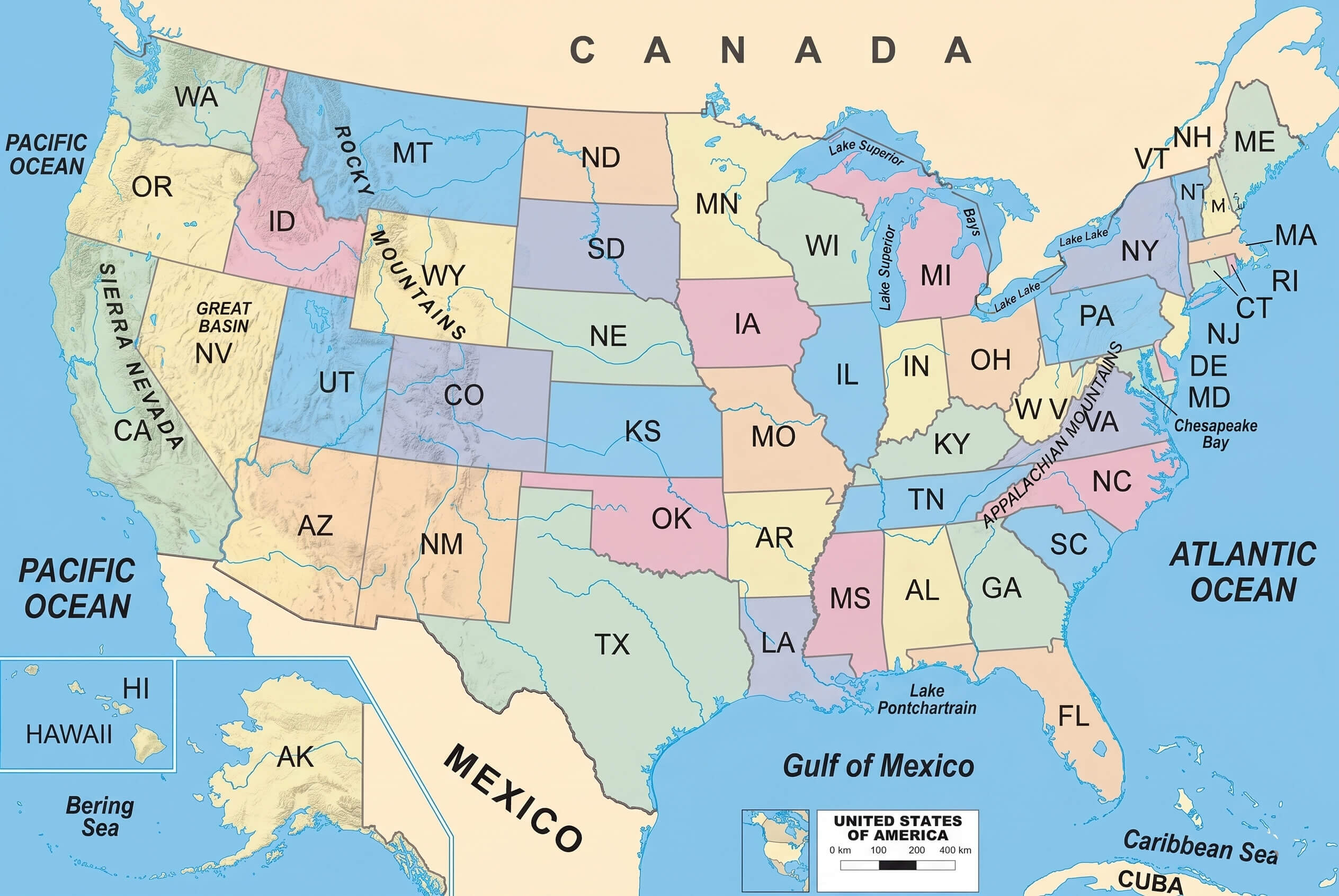
physical map of the United States
political map of the United States of America
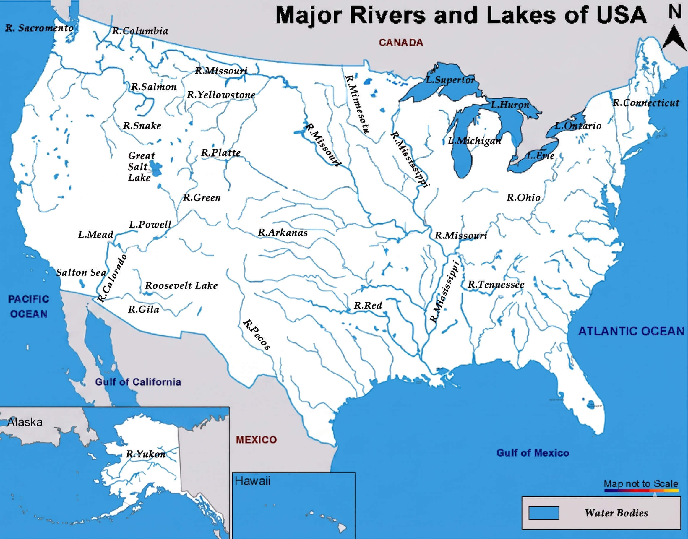
USA major rivers and lakes map
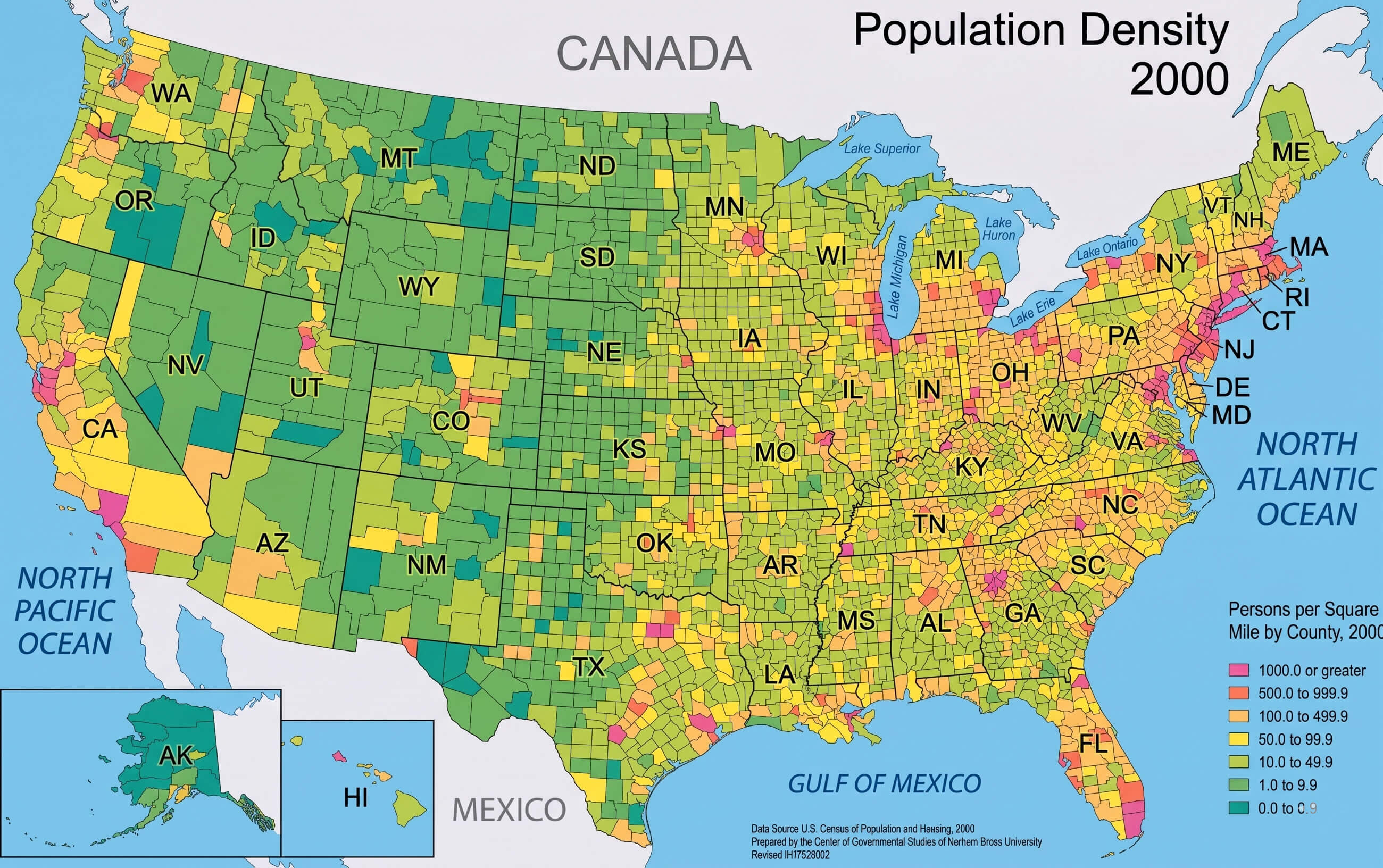
USA population density map
USA regional division legend map
USA states and regions map
Feel free to explore these pages as well:
- Head of Performance Marketing
- Head of SEO
- Linkedin Profile: linkedin.com/in/arifcagrici