Maps of the United States: Political, Physical & Population Maps
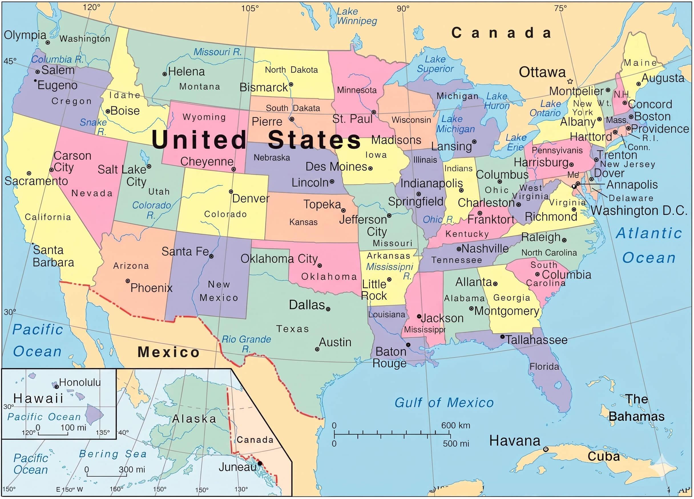
Discover a comprehensive selection of maps of the United States covering the nation’s geography, population, climate, transportation networks, and political divisions. This collection features everything from detailed maps of the United States and political boundaries maps with states to insightful thematic visuals such as United States population density maps, income distribution maps, and religious distribution maps. Whether you are researching demographics, studying geography, or planning travel routes, these detailed USA maps provide valuable information about the country’s diverse regions and landscapes.
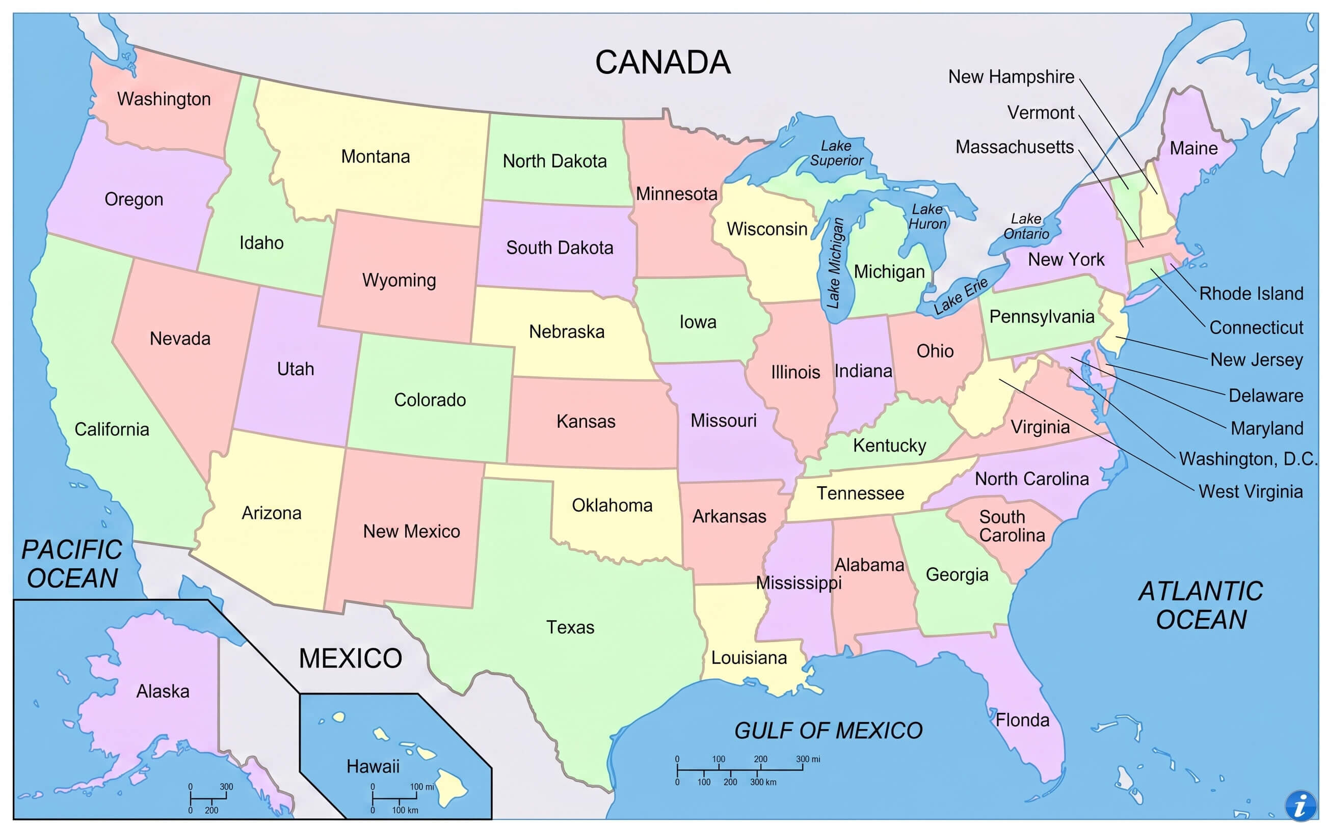
United States political boundaries map with states
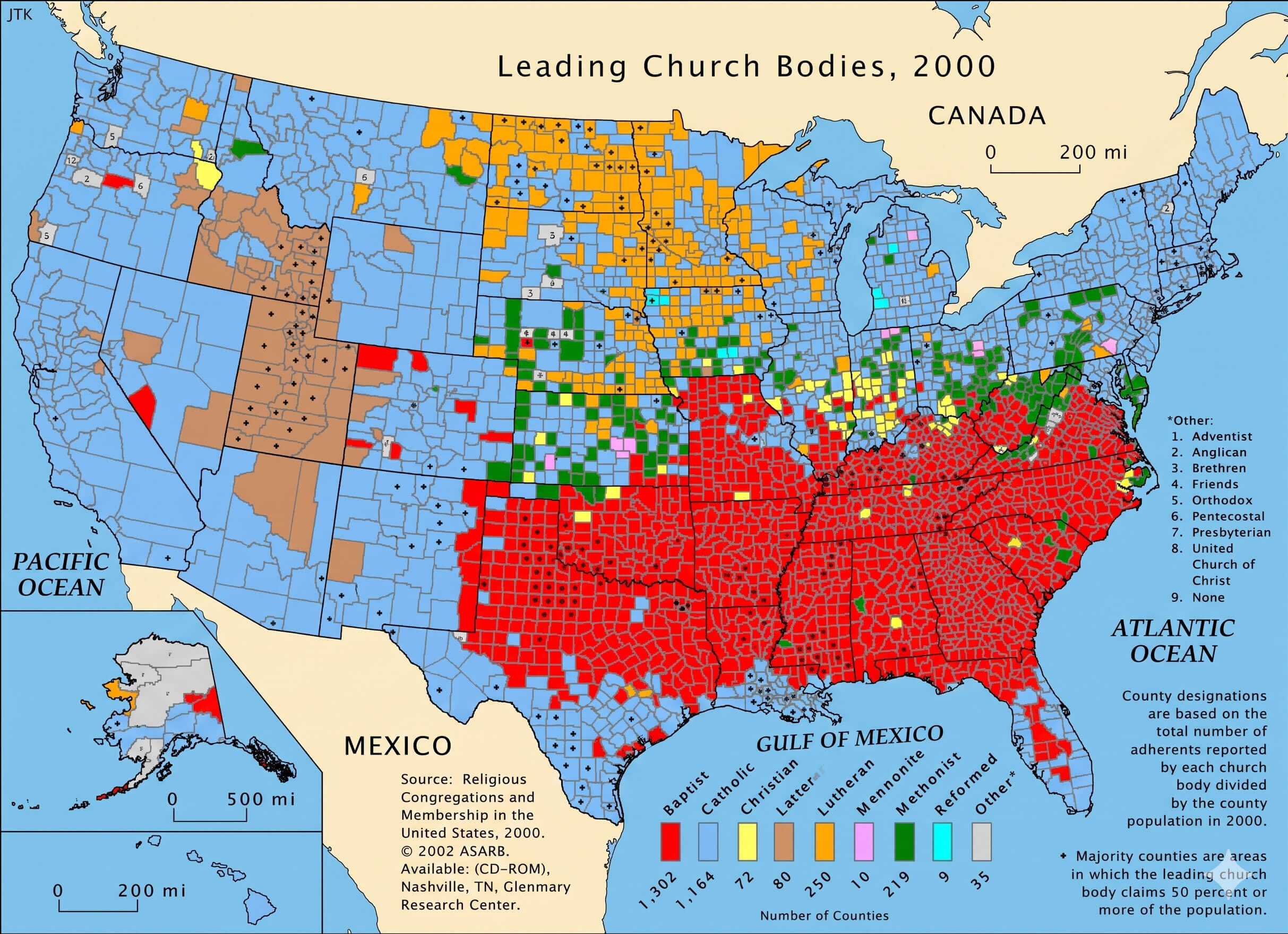
United States religious distribution map
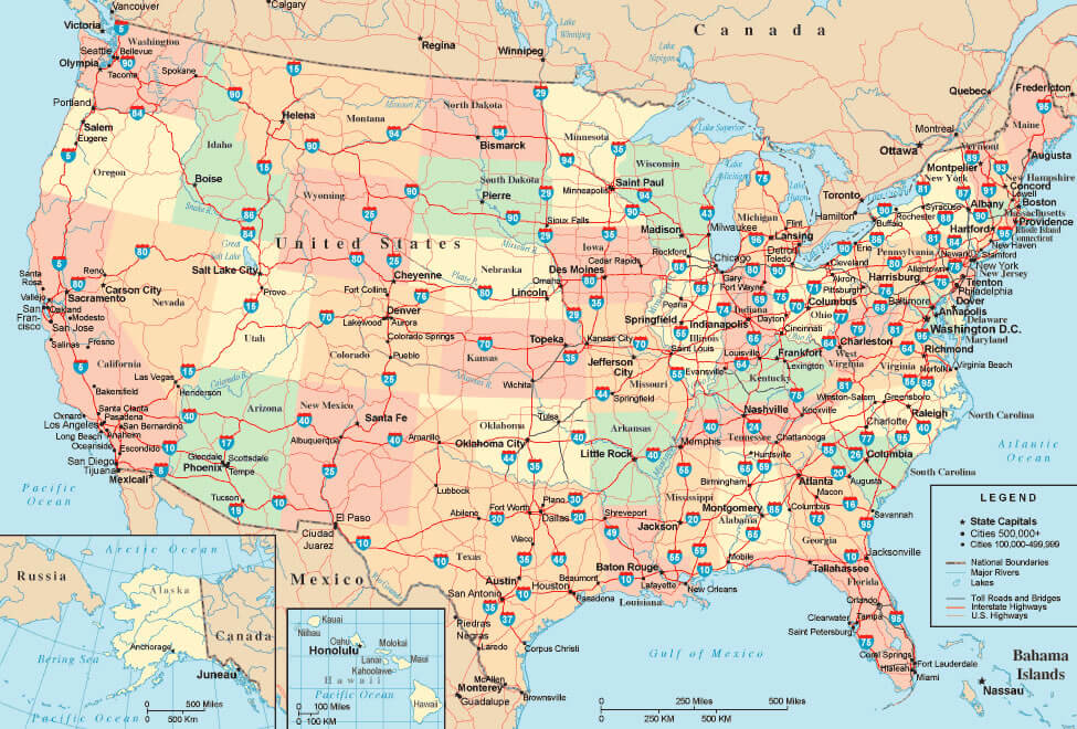
United States road and highway map
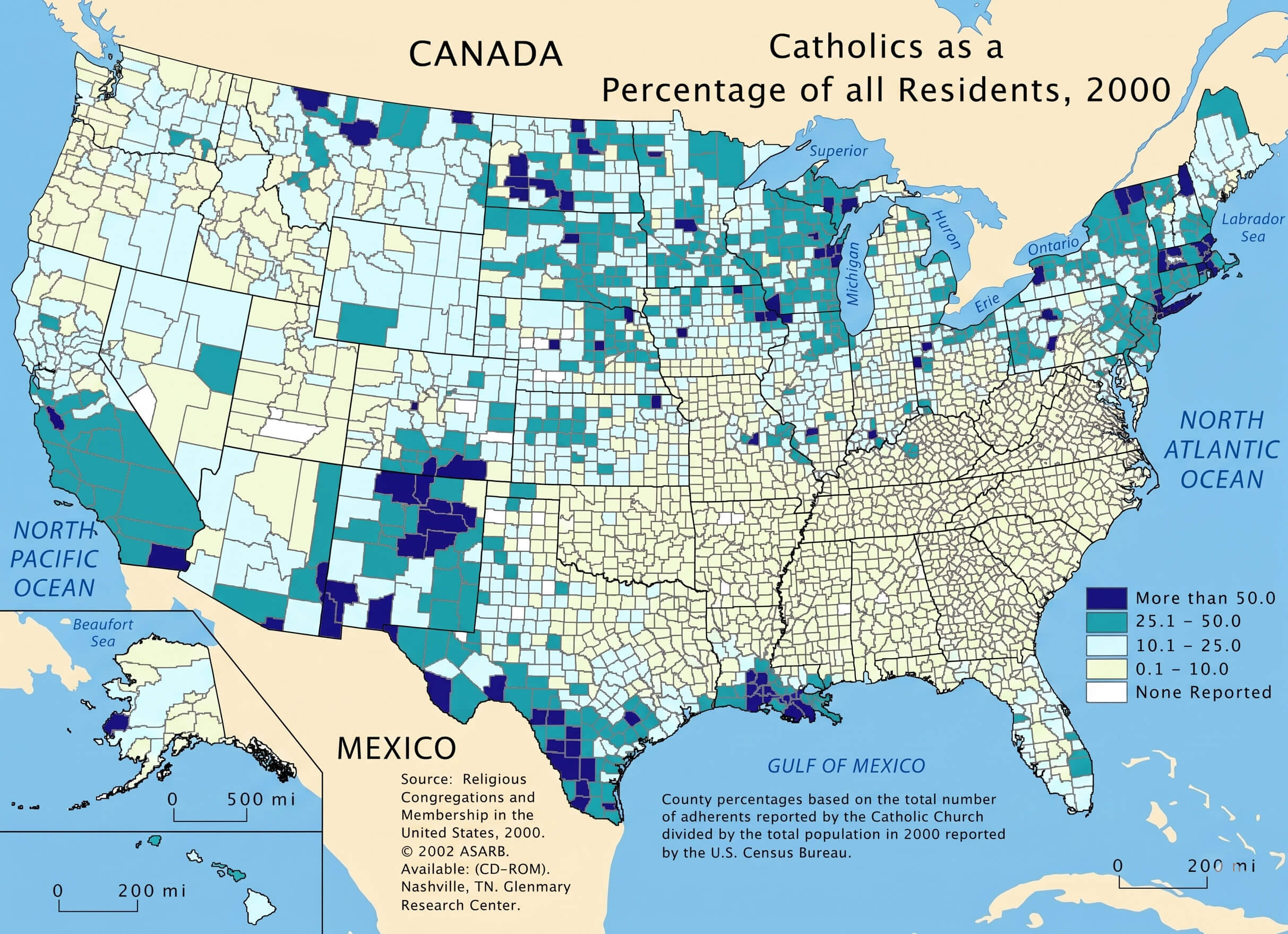
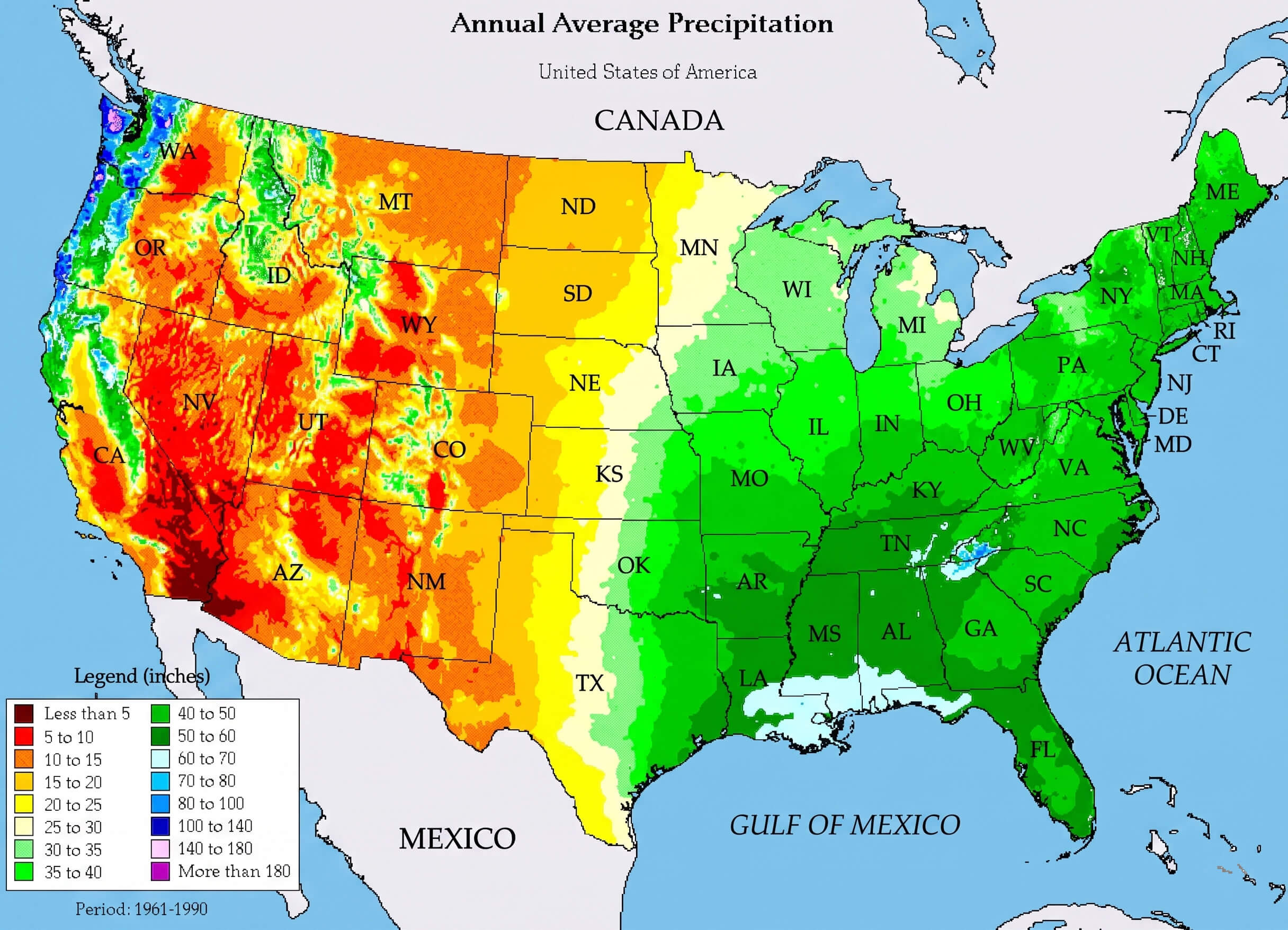
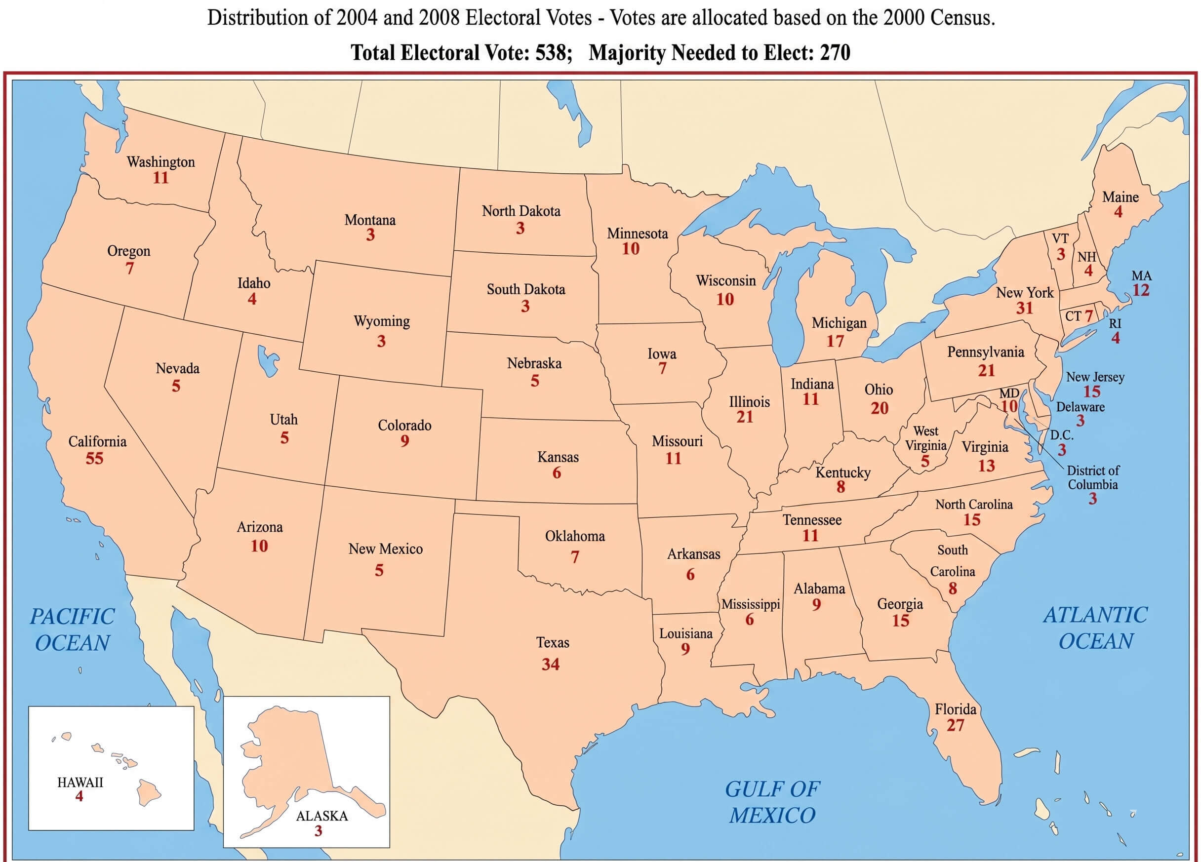
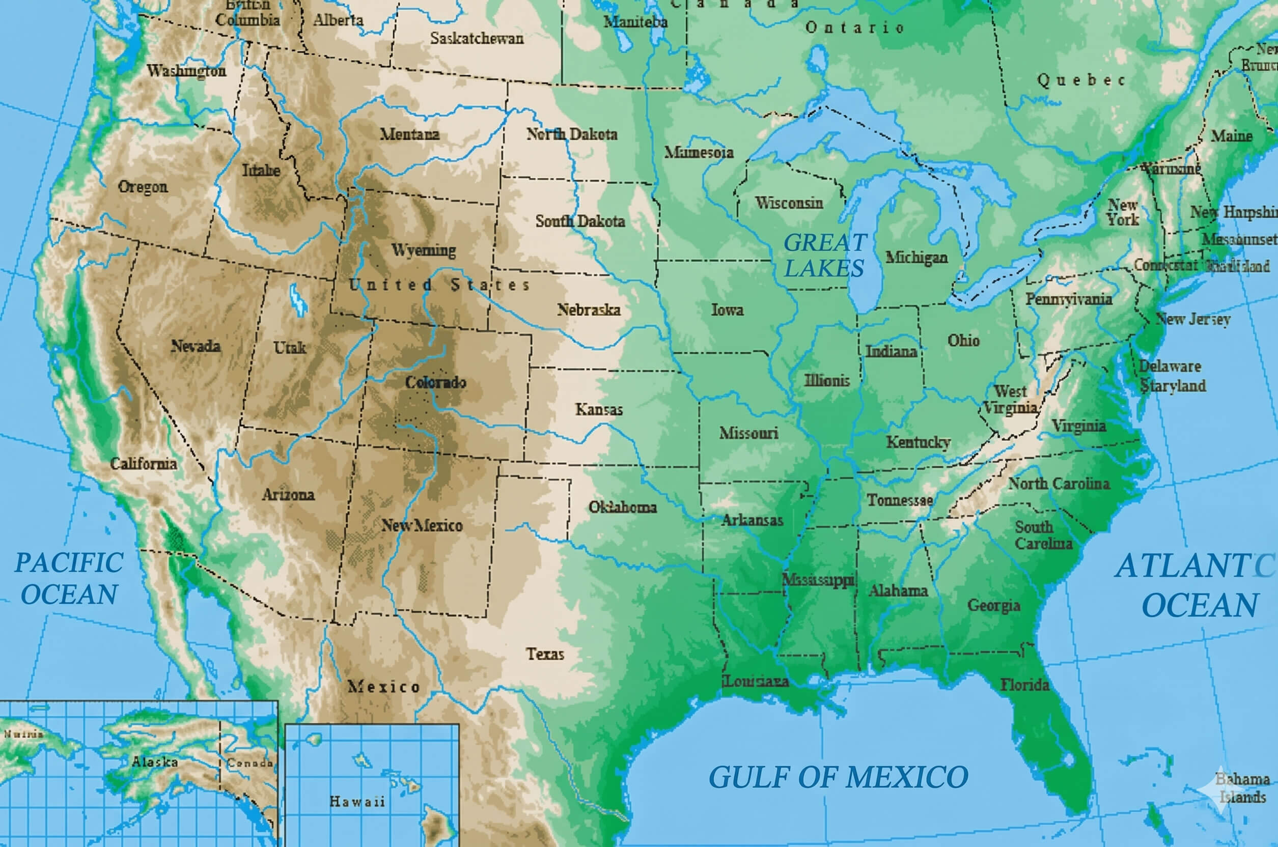
Visitors can also discover environmental and geographic resources including the United States annual precipitation map, United States average wind power map, United States terrain relief map, and United States map physical for a deeper understanding of America’s natural landscape. In addition, practical maps like the United States road and highway map, United States electoral votes map, United States catholic population map, and United States insular territories map provide valuable insights for travelers, researchers, students, and anyone interested in learning more about the diverse regions of the country.
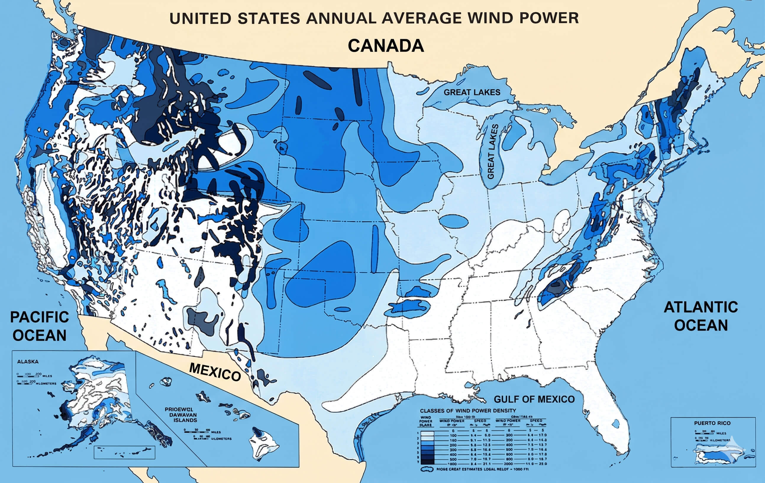
United States average wind power map
United States catholic population map
Detailed map of the United States
United States annual precipitation map
United States electoral votes map
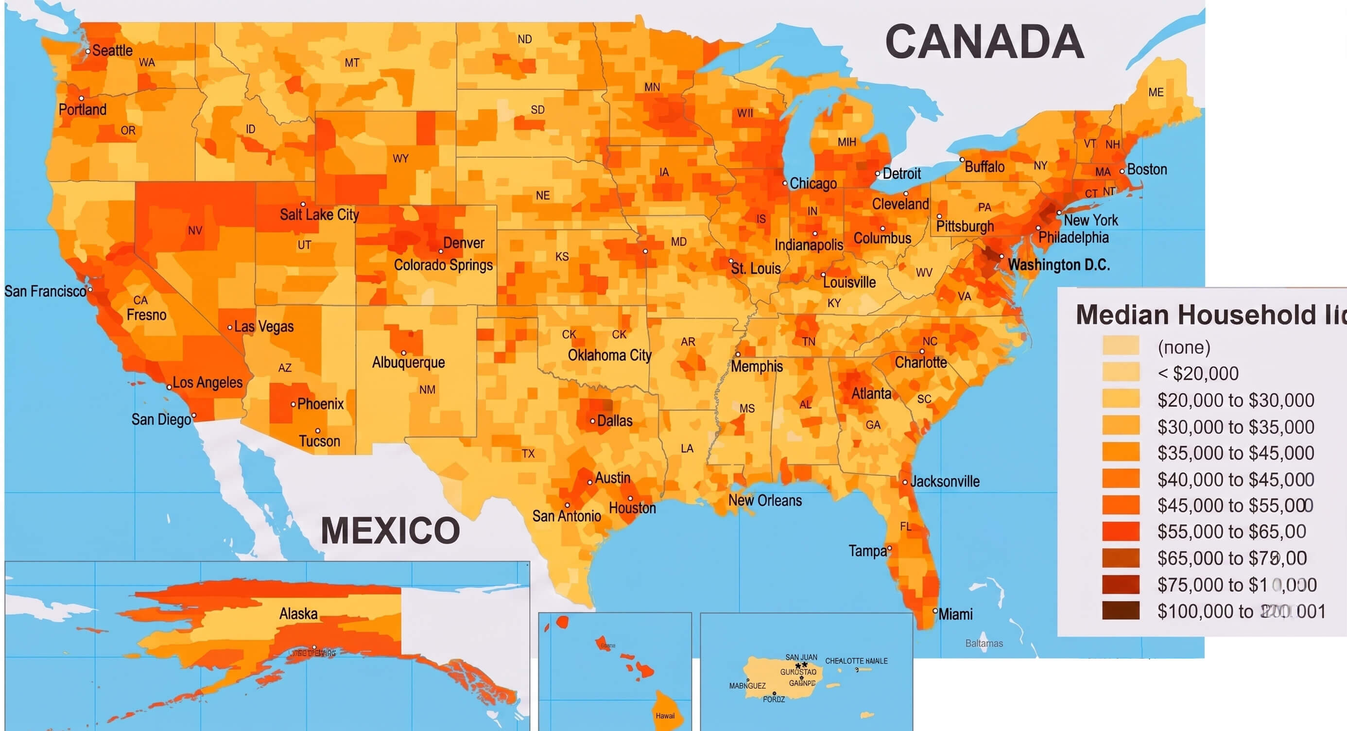
United States income distribution map
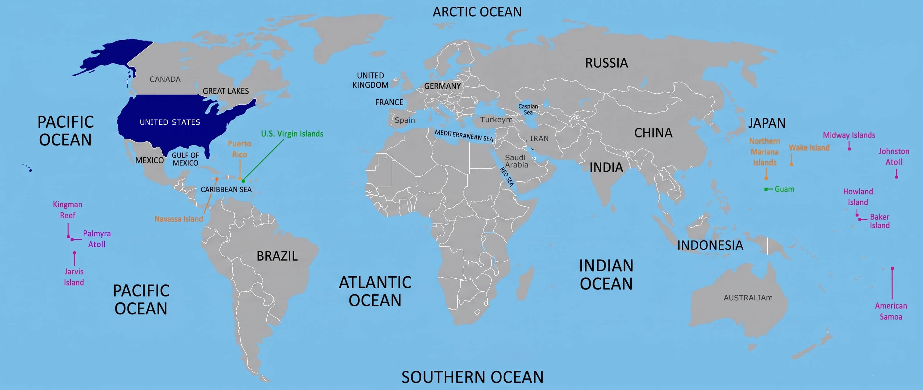
United States insular territories map
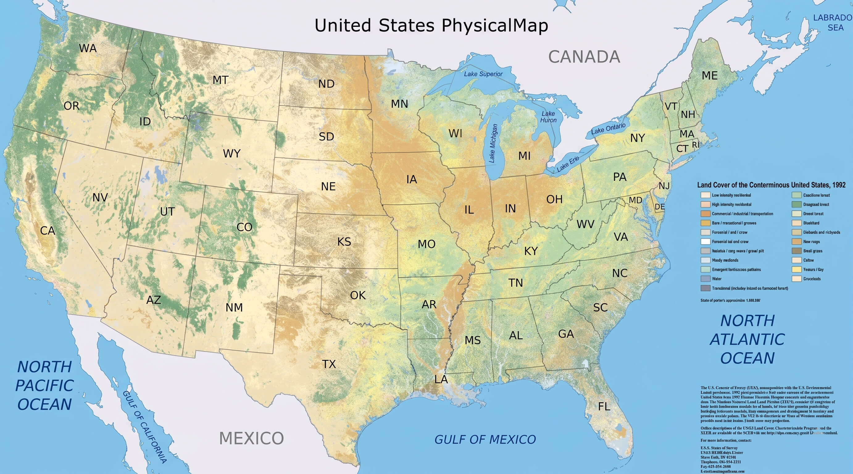
United States map physical
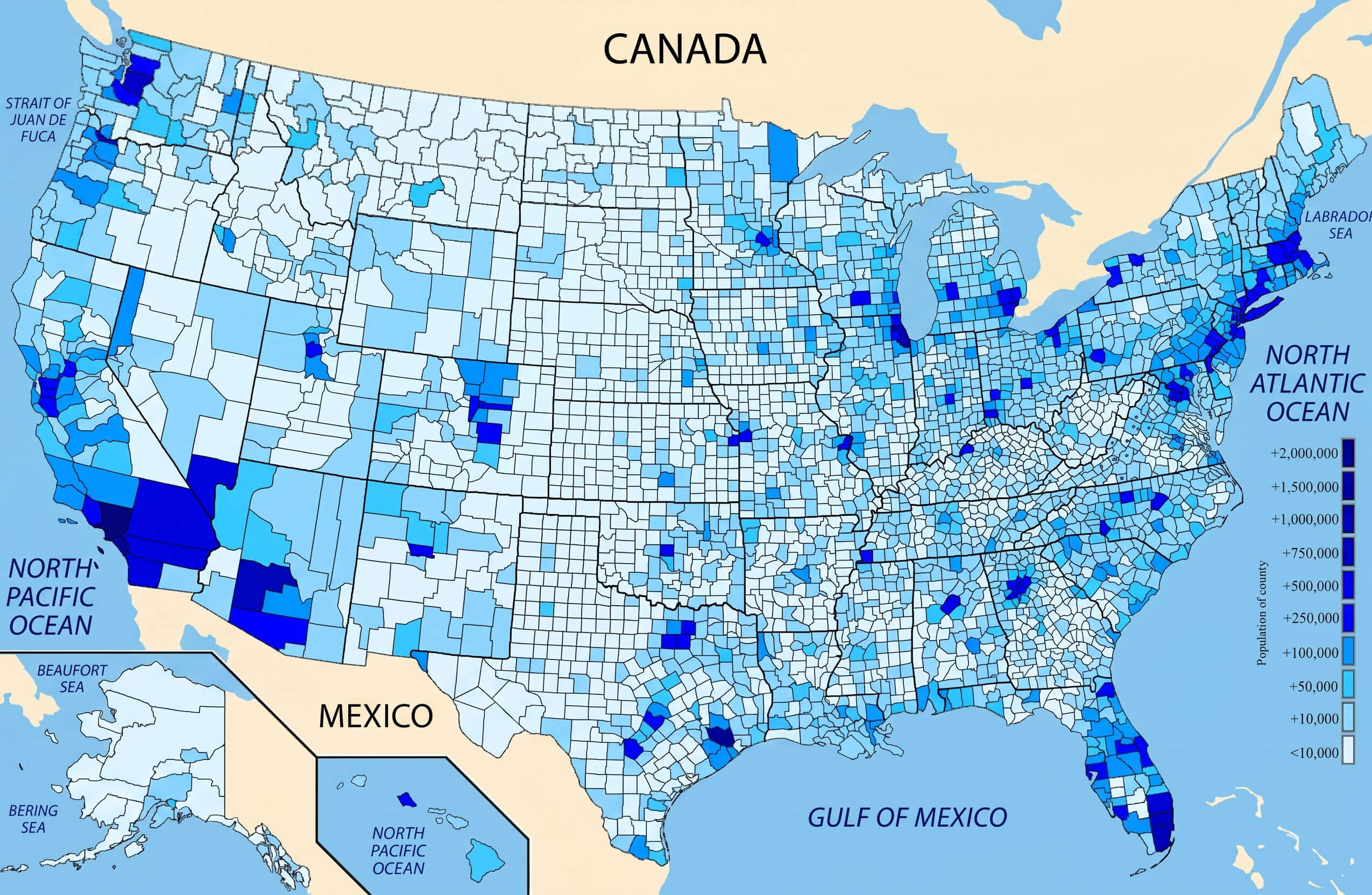
United States population density map
United States terrain relief map
Feel free to explore these pages as well:
- Head of Performance Marketing
- Head of SEO
- Linkedin Profile: linkedin.com/in/arifcagrici