Geography of Iran: Detailed Physical and Relief Map
Explore a comprehensive Iran Physical Map collection featuring geological, relief, and topography maps for detailed terrain analysis. Includes physical maps with elevation, roads, major cities, national boundaries, satellite views, Google terrain maps, regional Africa–Middle East satellite maps, and night space imagery for complete geographic insight. 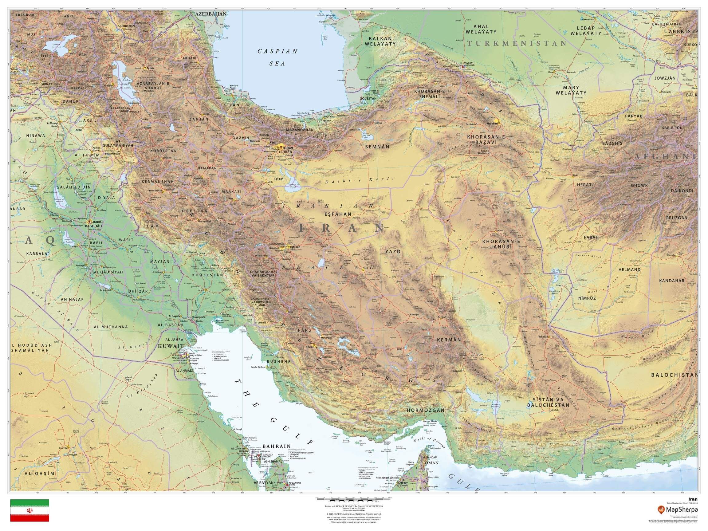
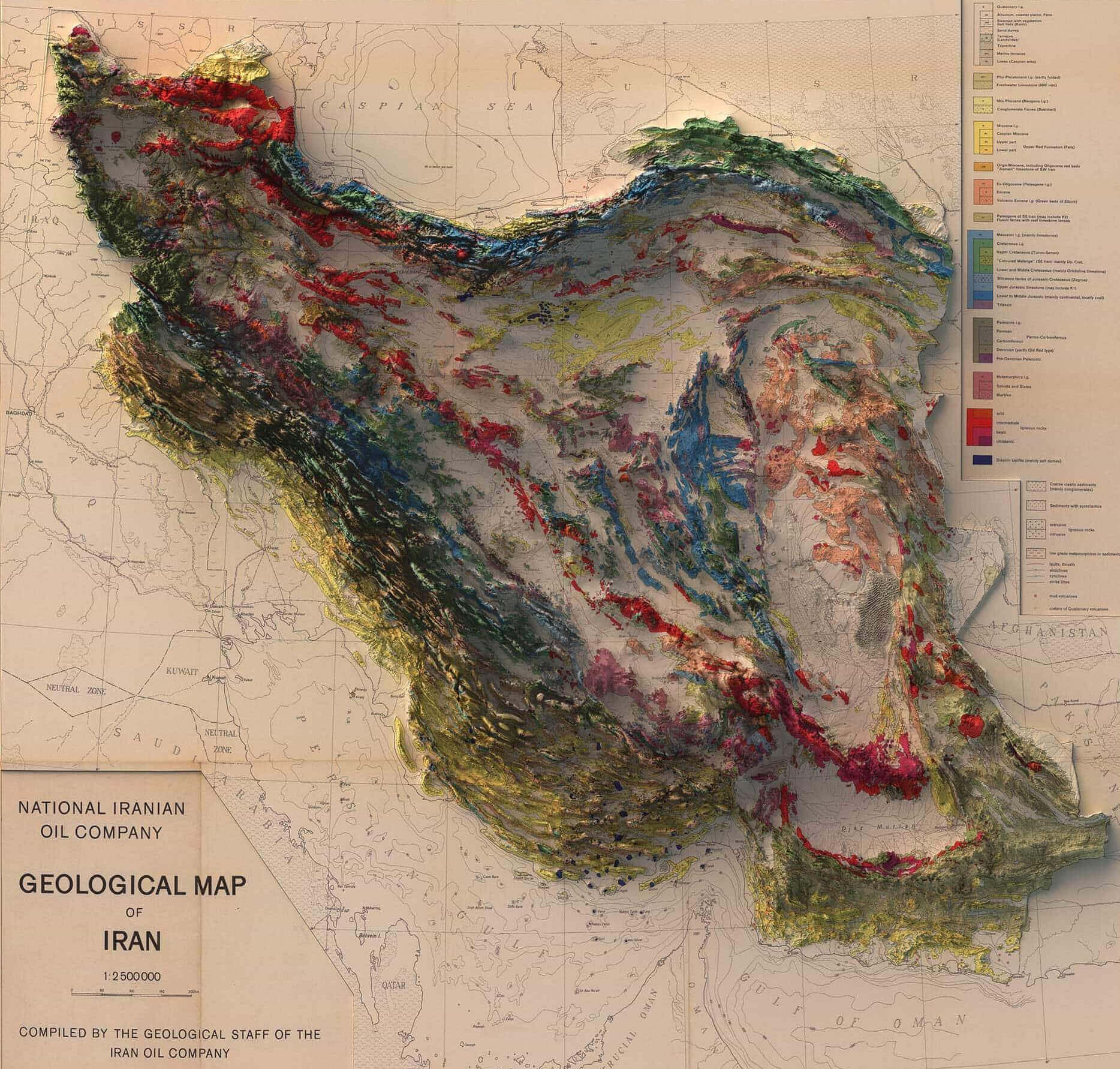
Geological map of Iran
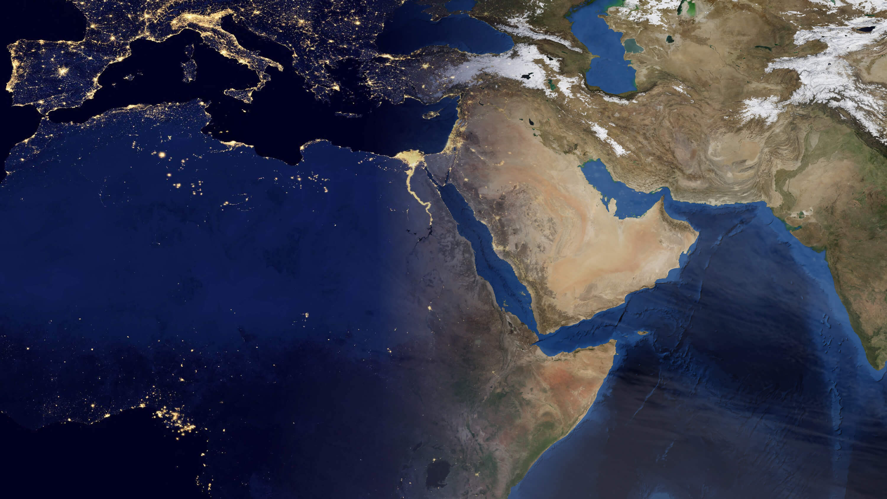
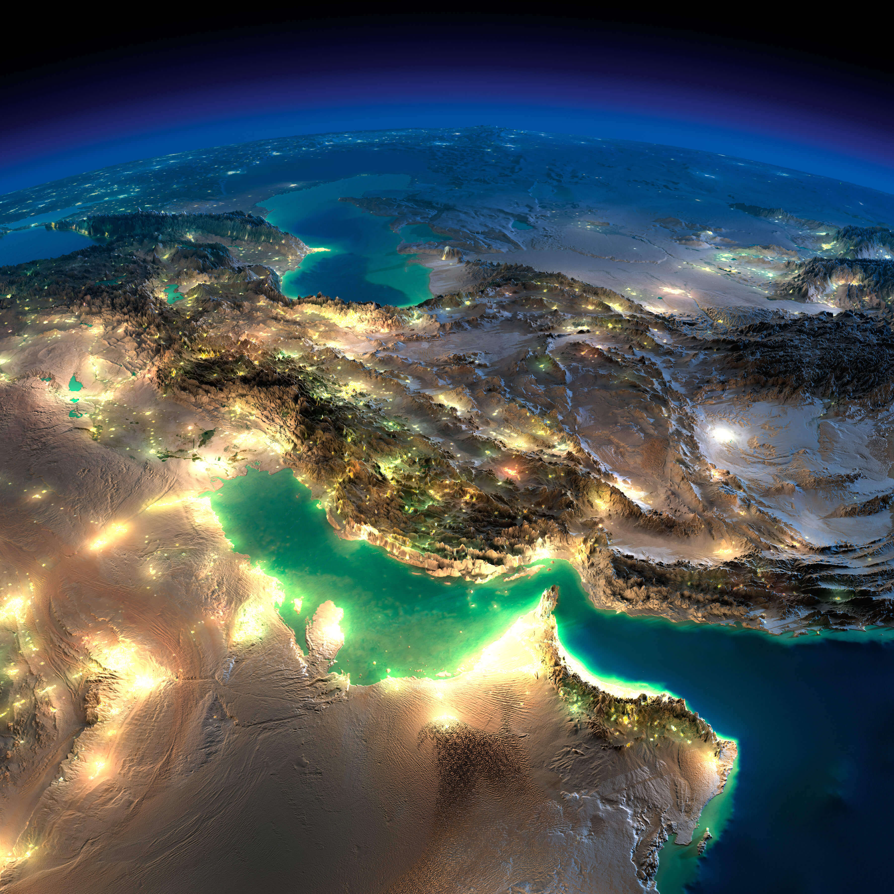
Iran Africa Middle East satellite map
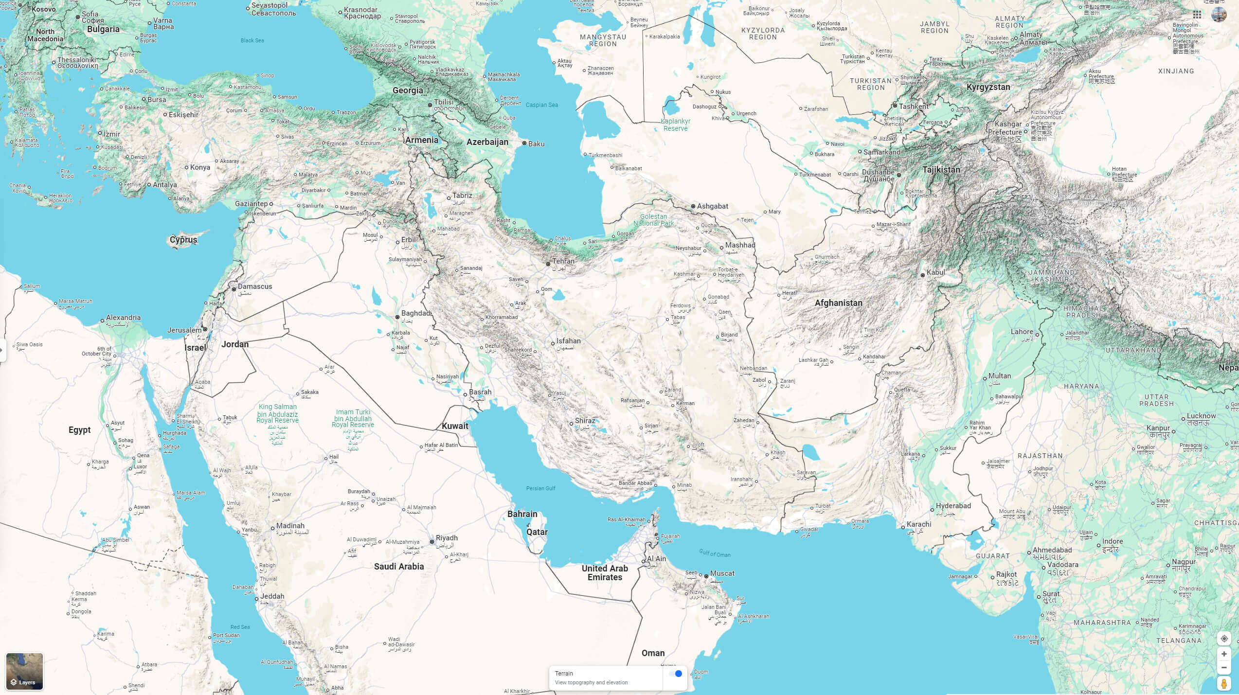
Iran Google terrain map
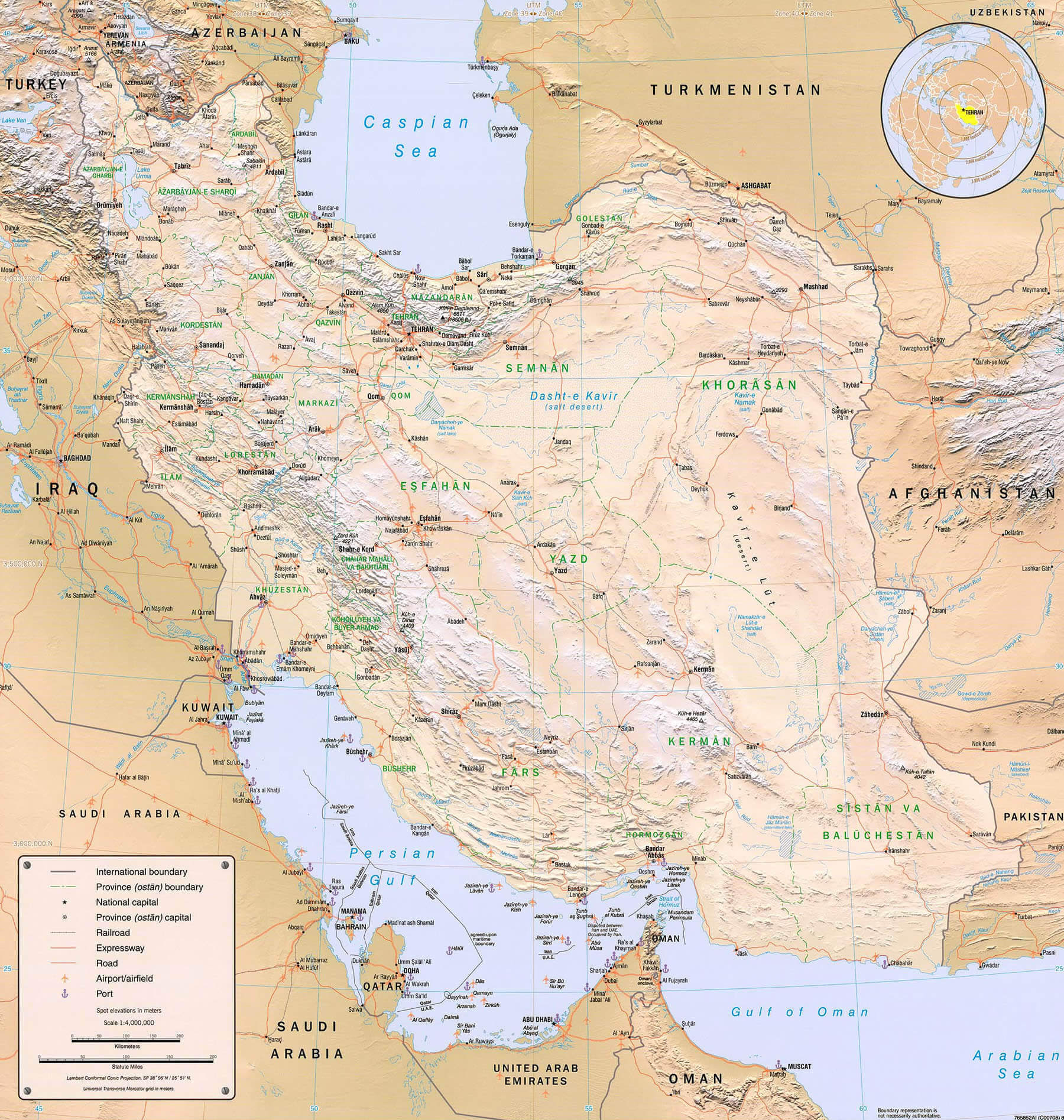
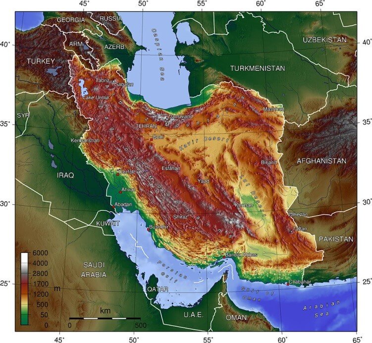
Iran Physical Map with Elevation, Mountains and Major Cities
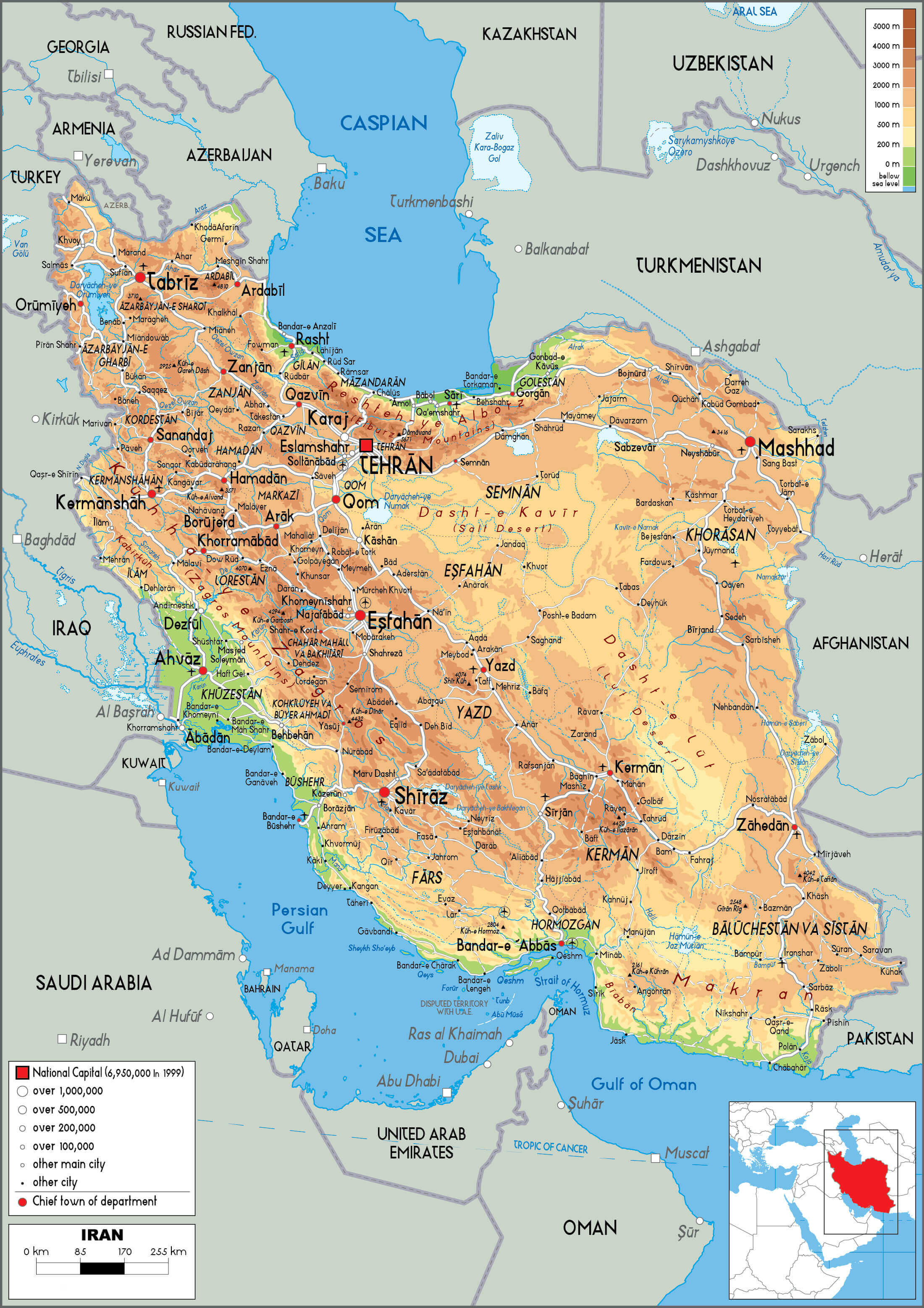
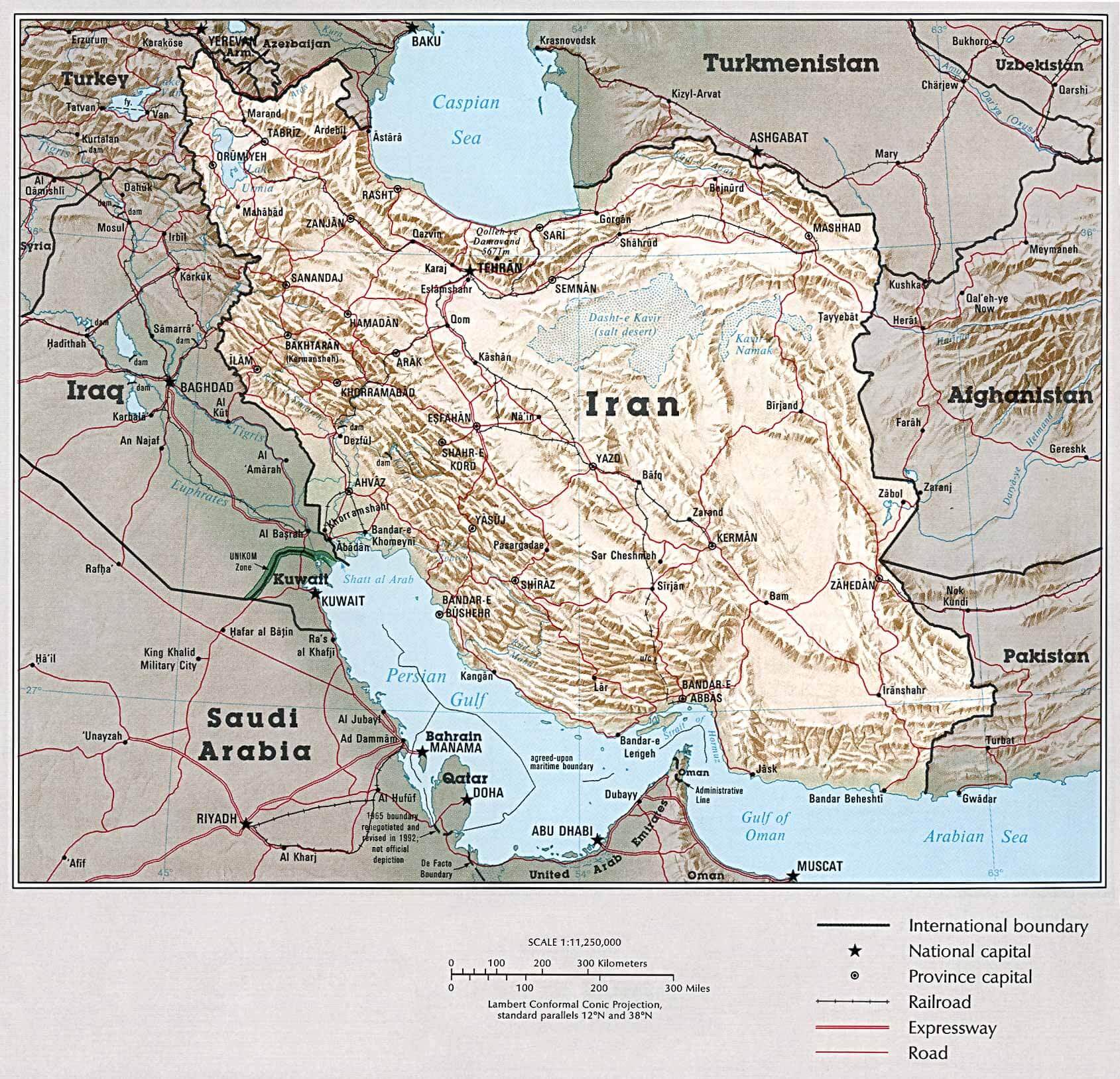
Physical Map of Iran
Physical map of Iran with elevation
Iran physical map with major cities
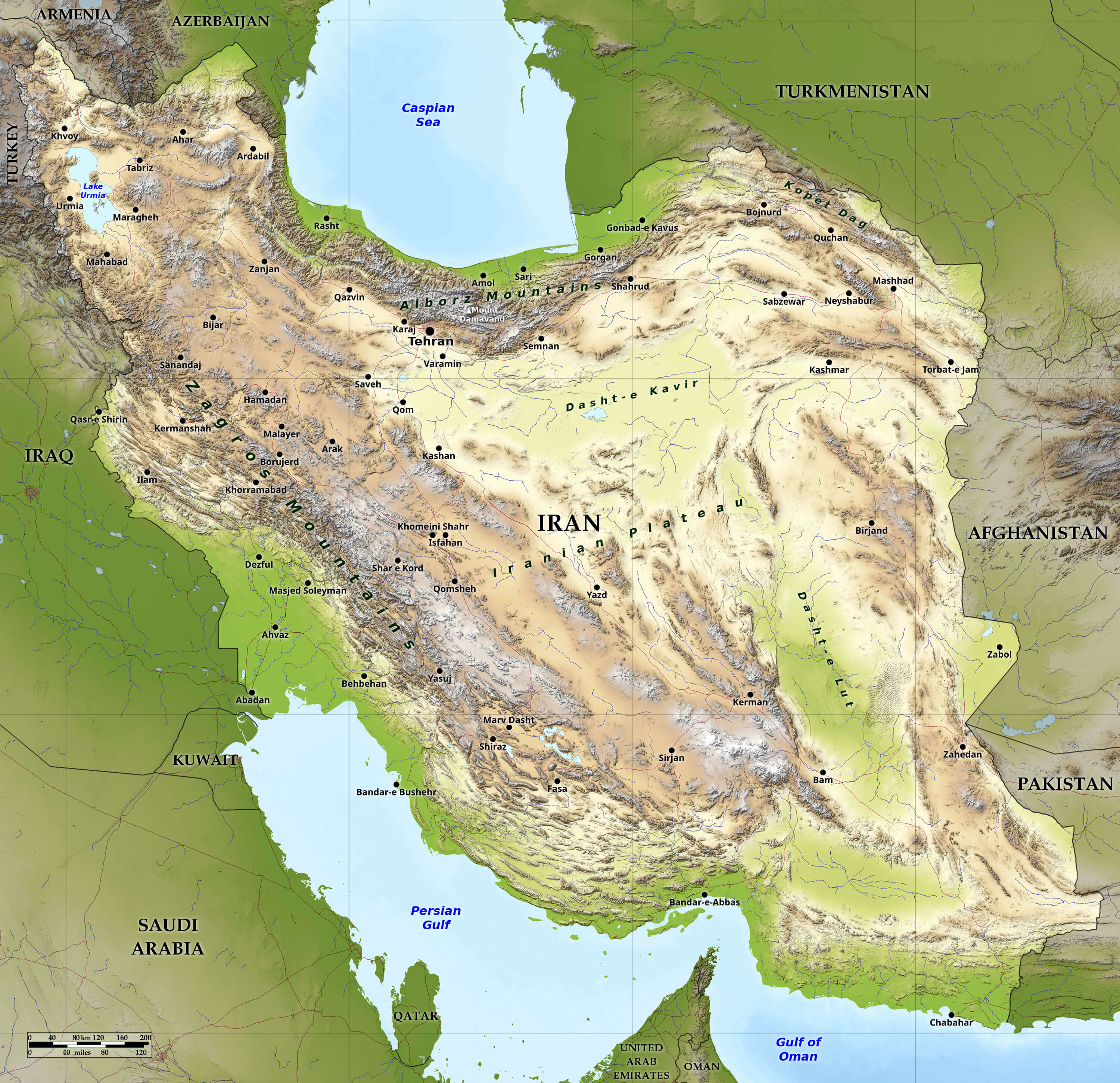
Relief map of Iran
Physical map of Iran with roads
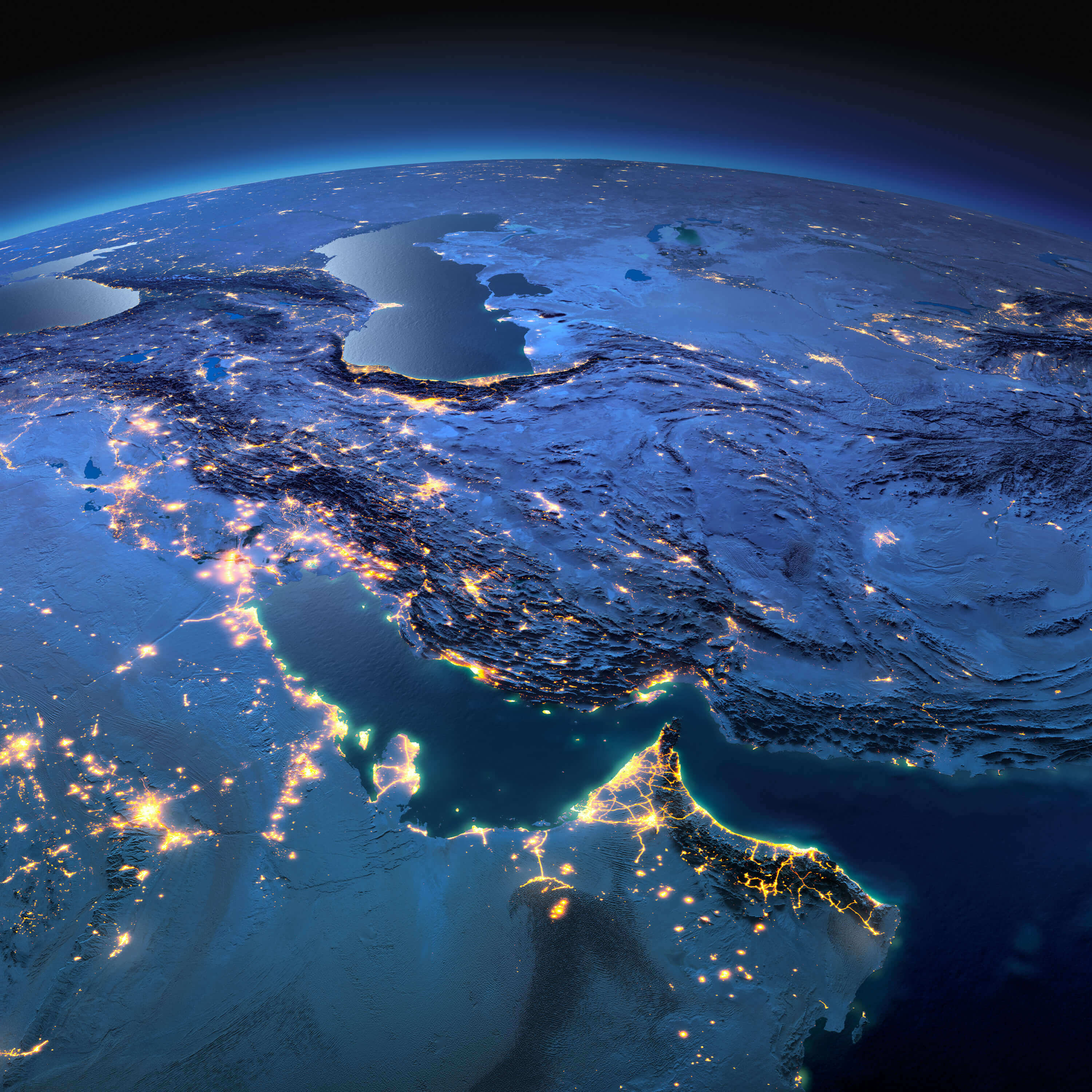
Iran map from space in the night
Iran national boundary physical map
Iran satellite map
Iran topographical map
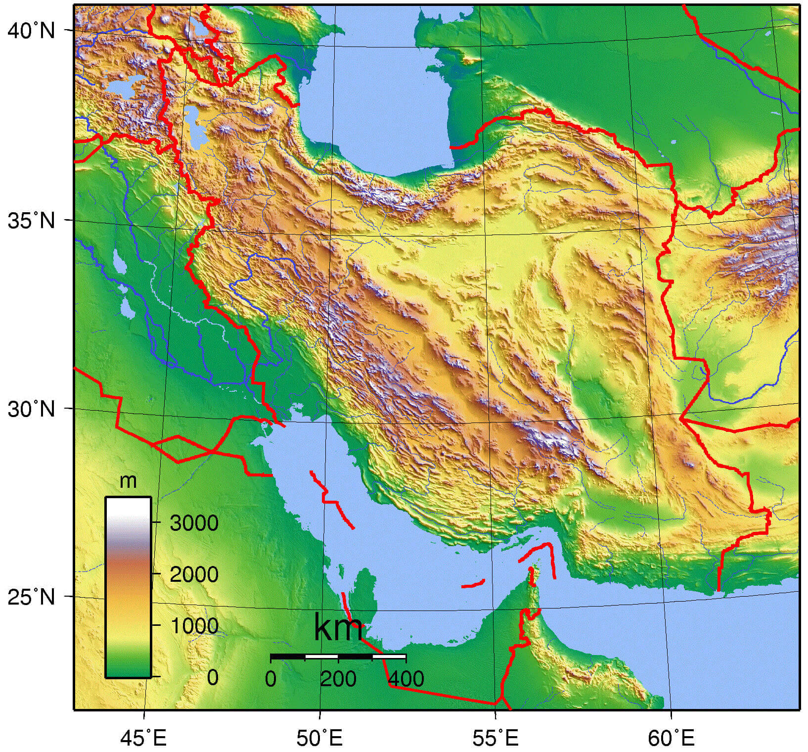
Topography map of Iran
Feel free to explore these pages as well:
Author: Arif Cagrici