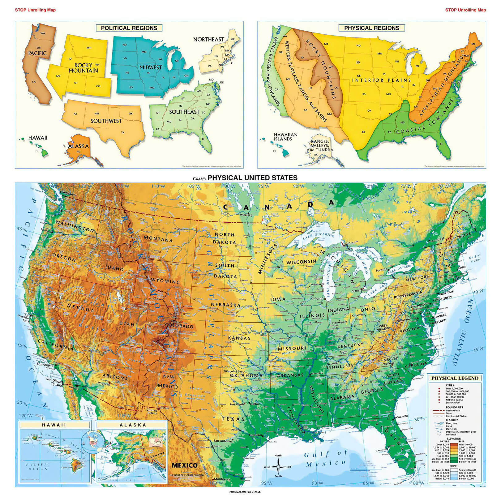
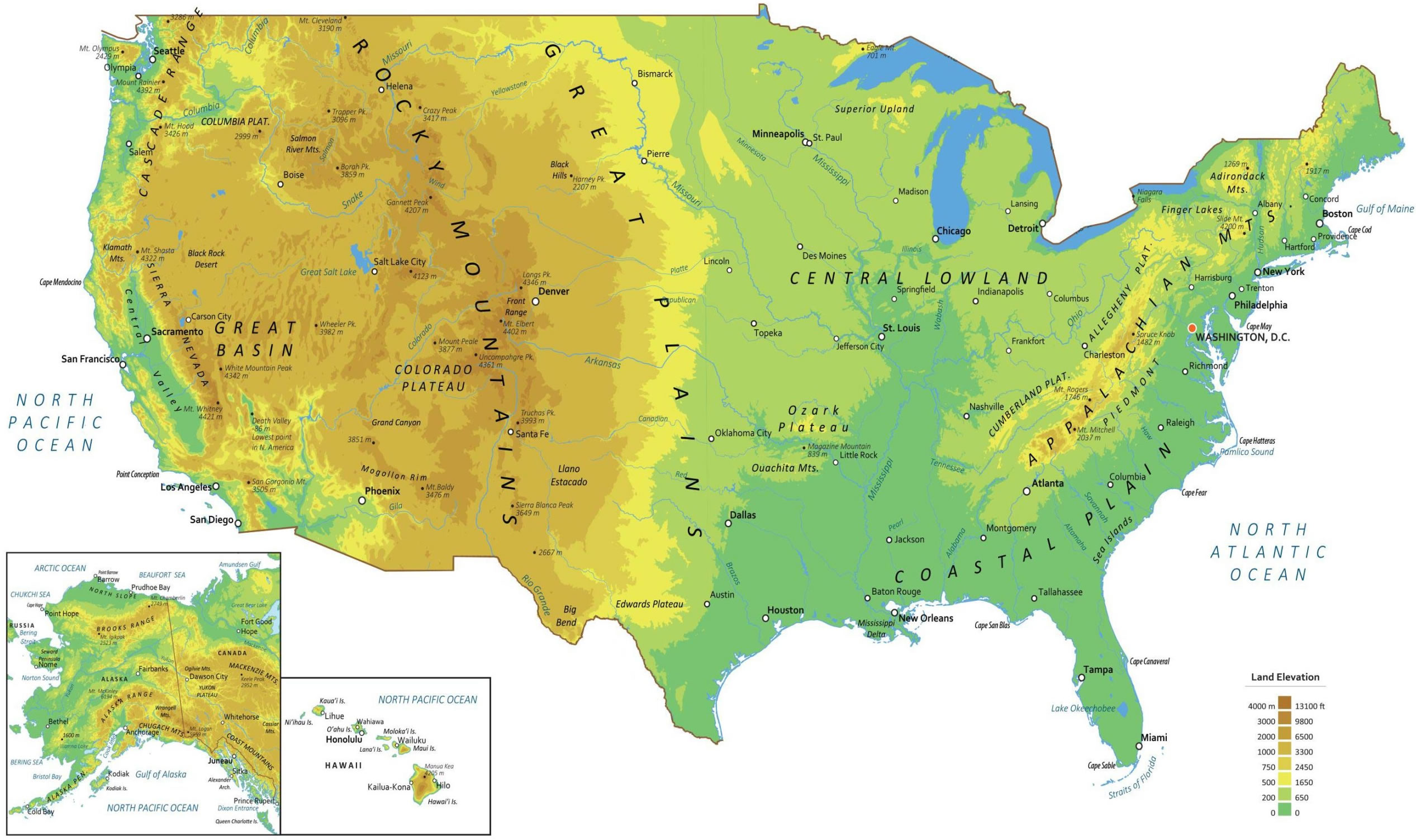
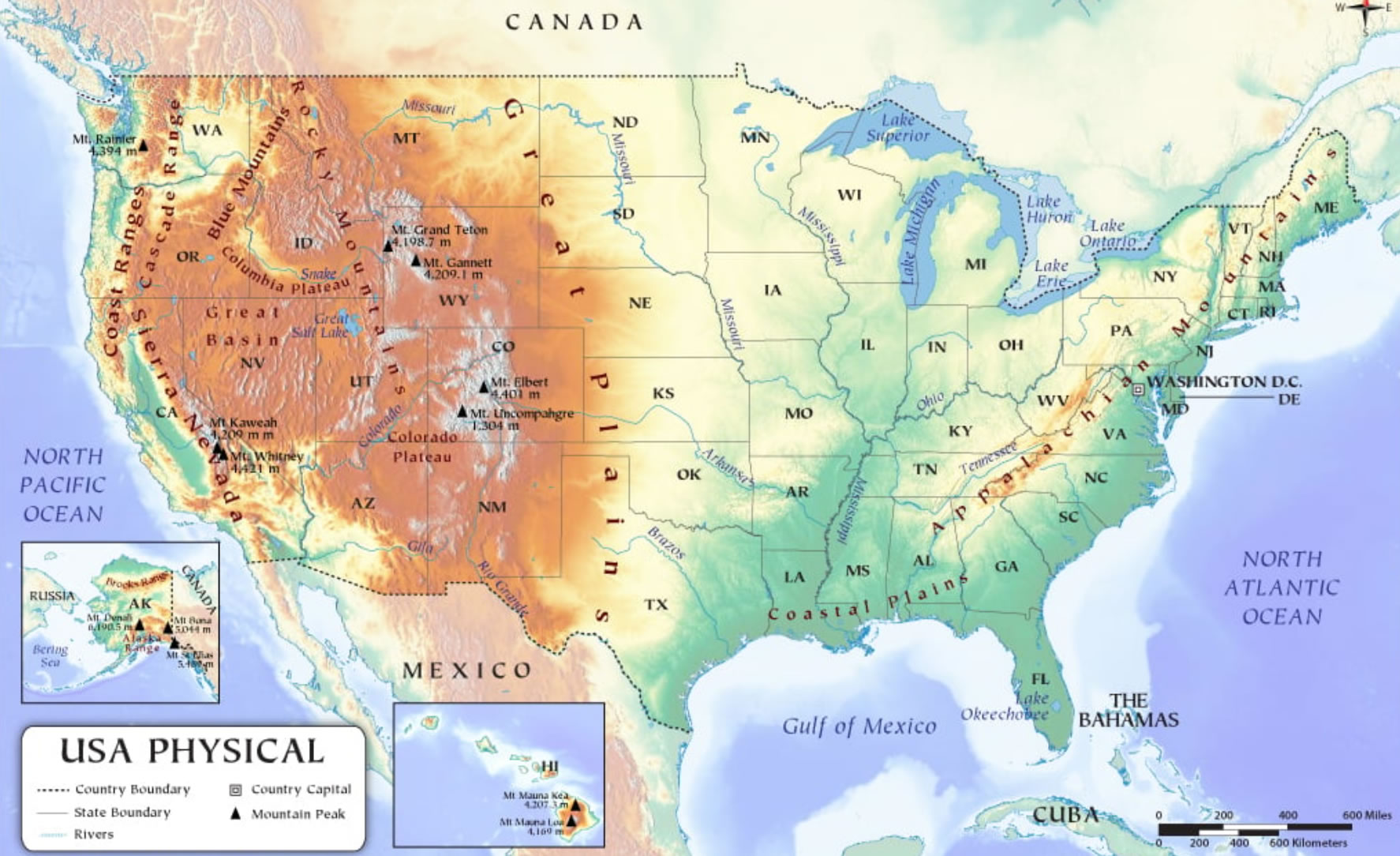
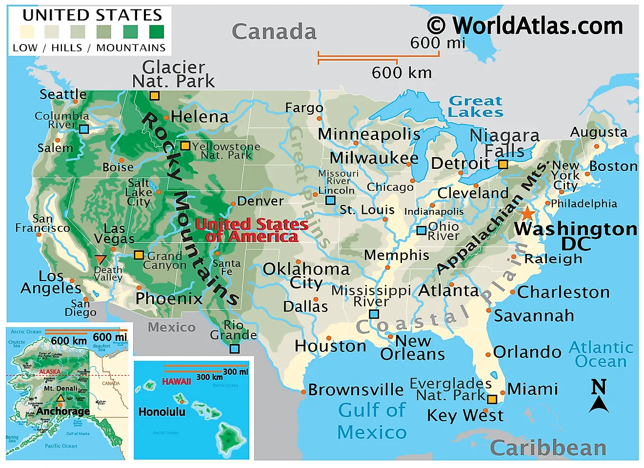
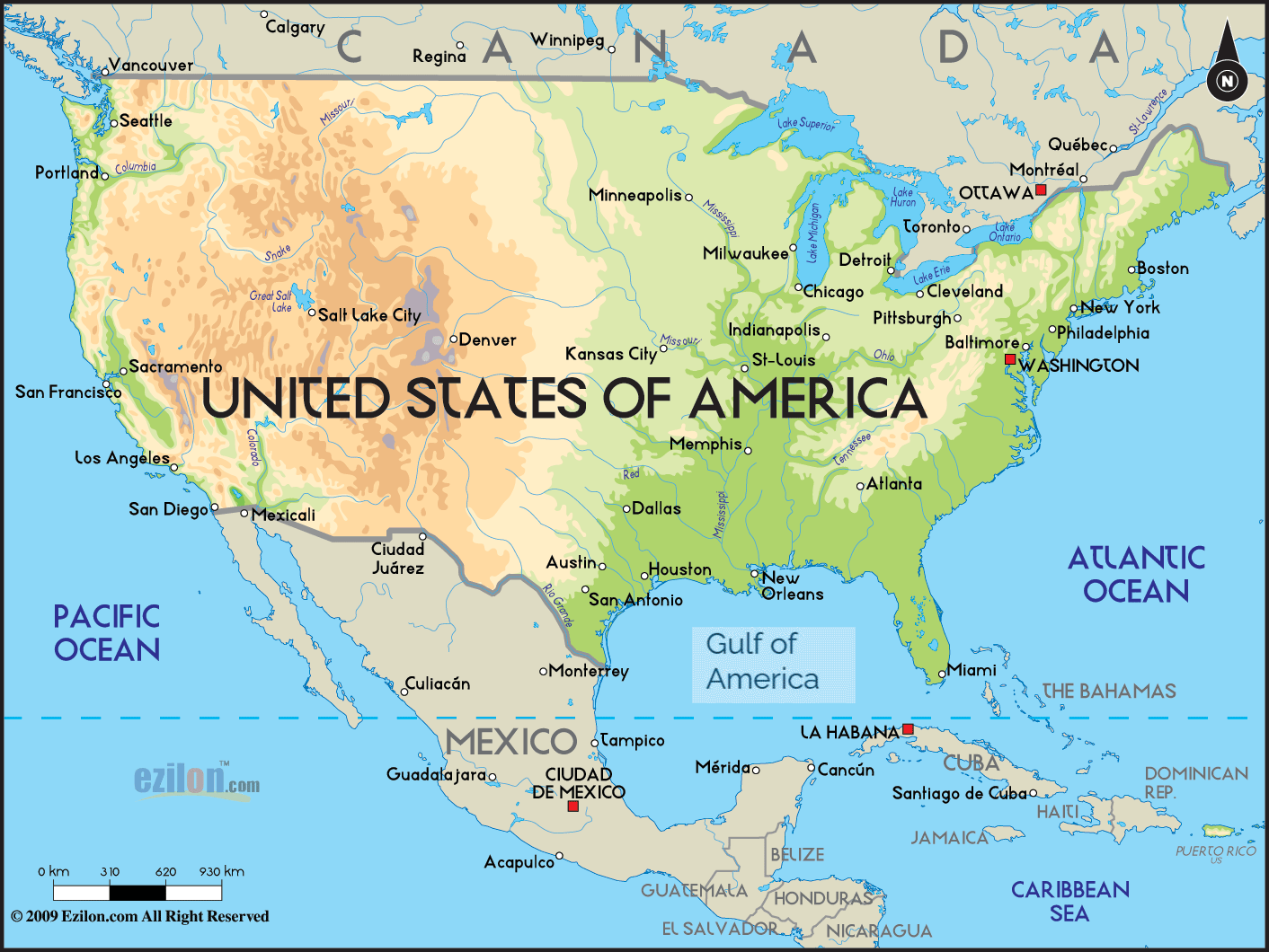
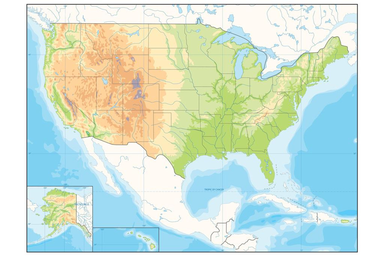
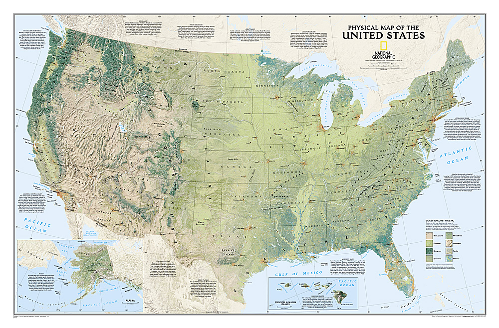
United States physical map with federal and state capitals
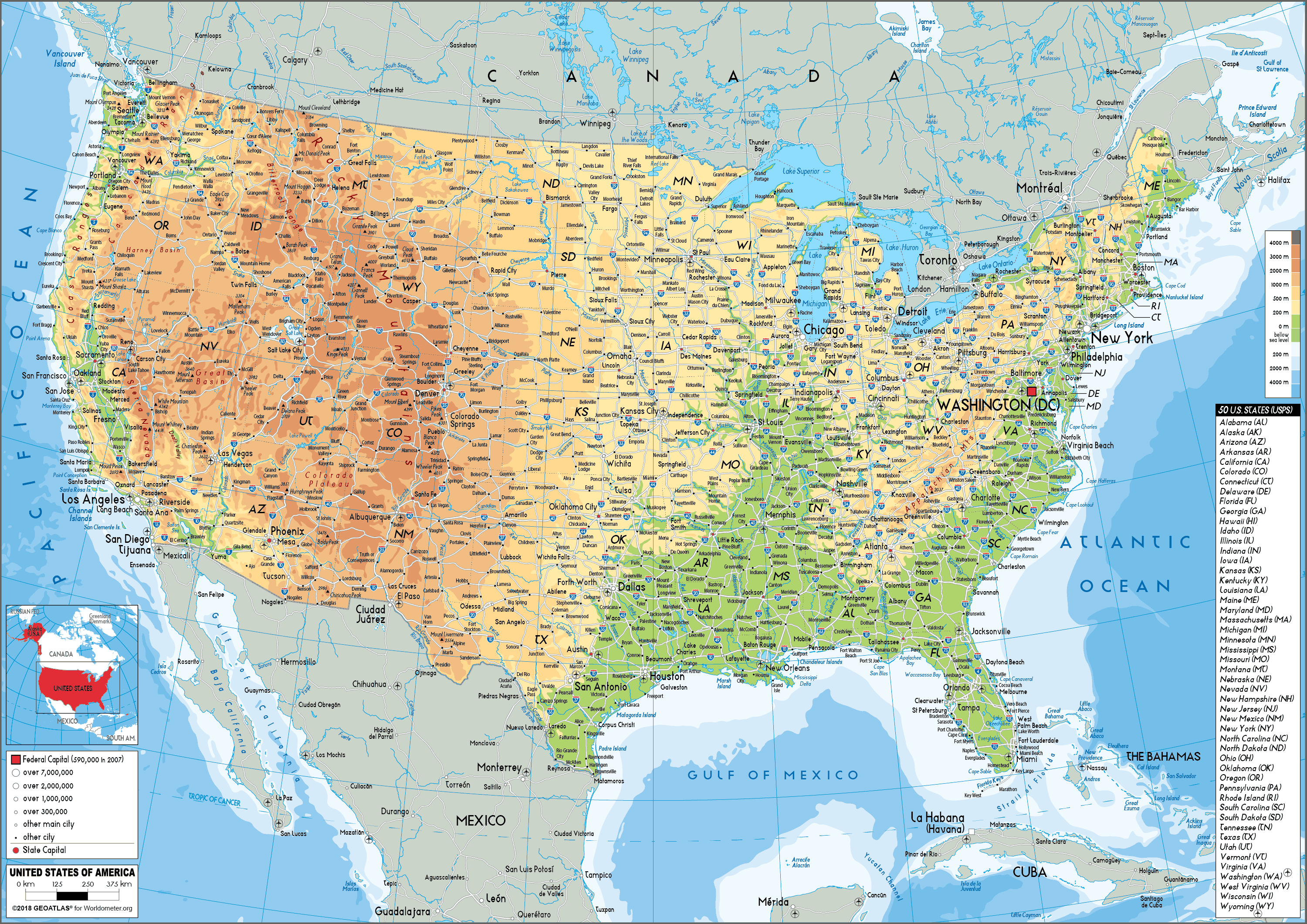 USA physical map showing topography, major cities and federal/state capitals.
Detailed physical map of the United States showing elevation (mountains, plains, rivers), major cities, highways and state borders. It marks the federal capital (Washington, D.C.) alongside each state capital for easy geographic reference and navigation.
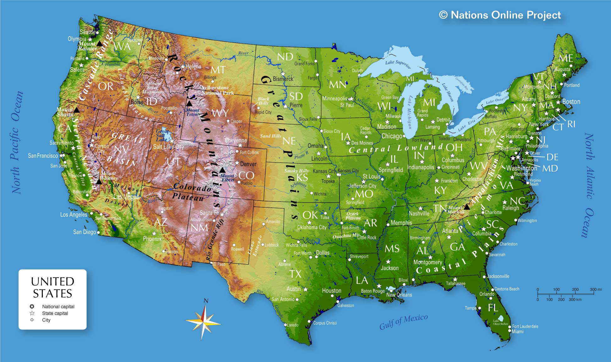
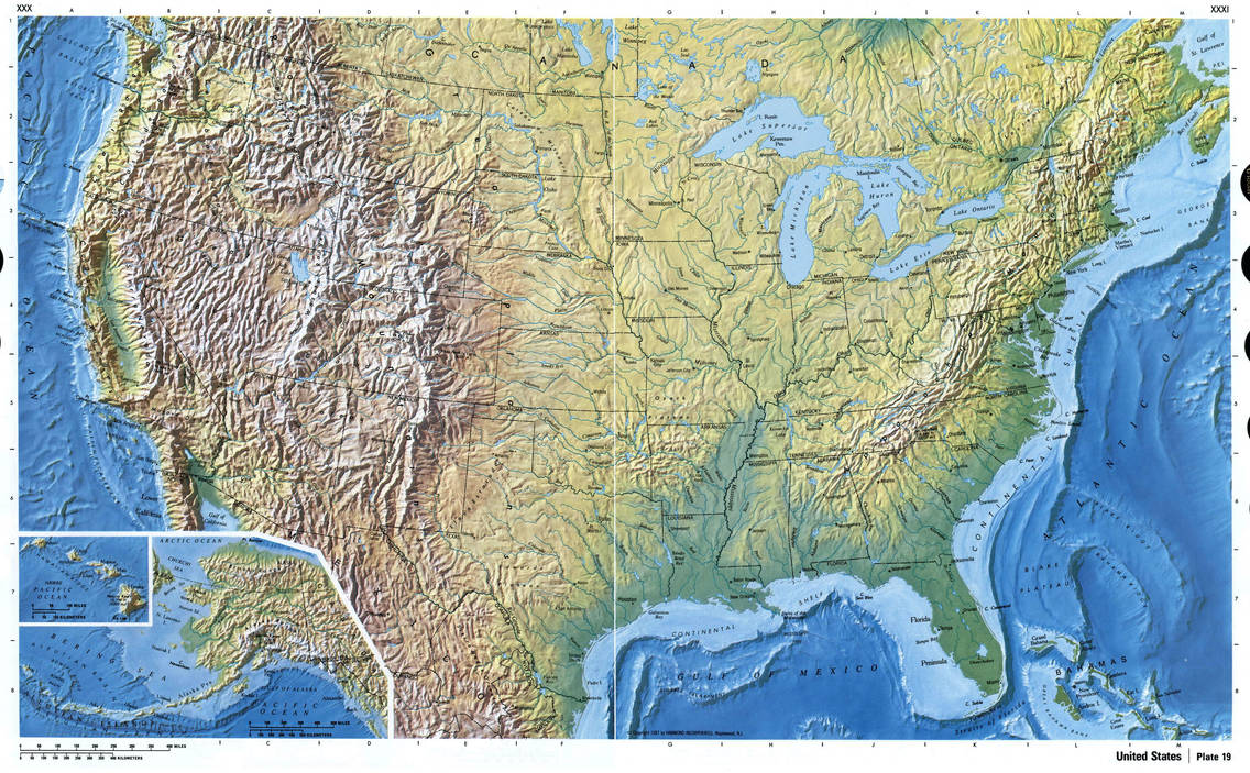
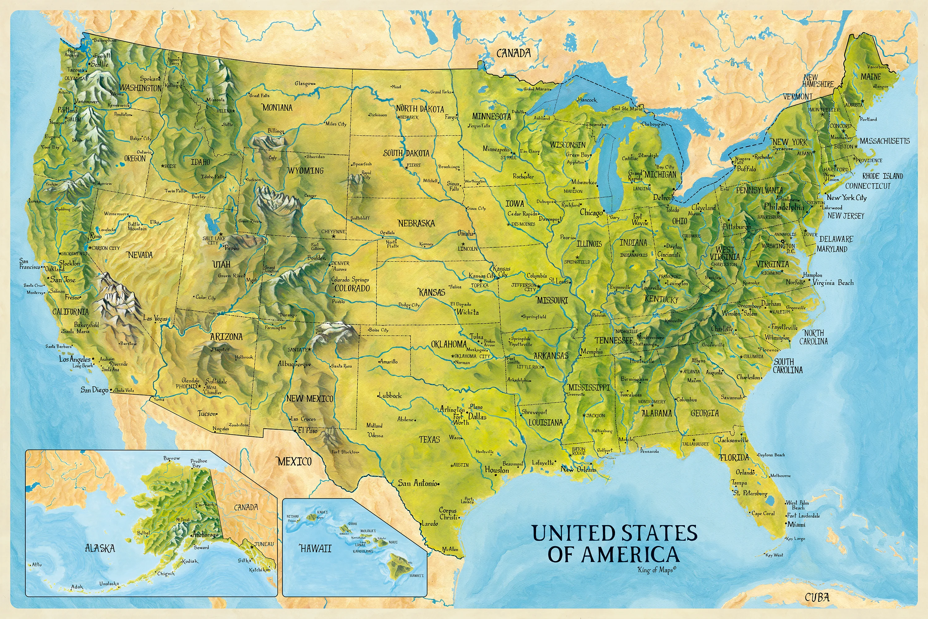
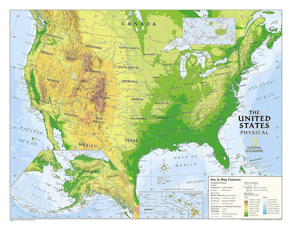
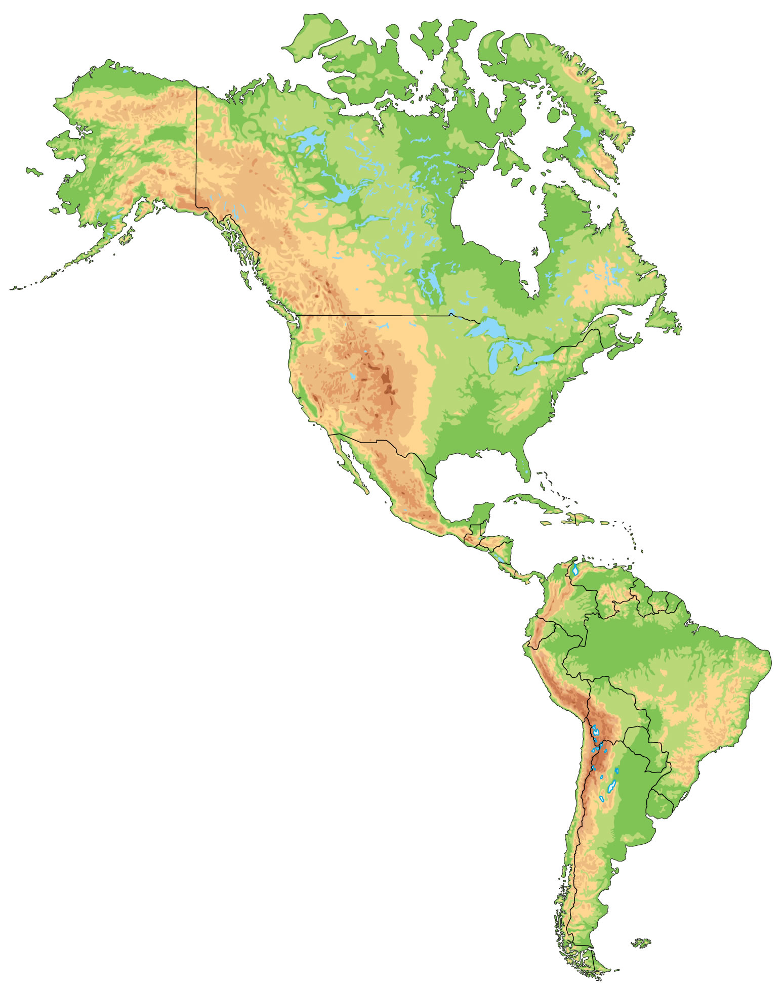
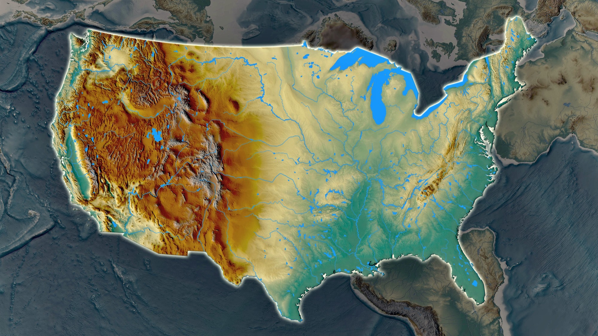
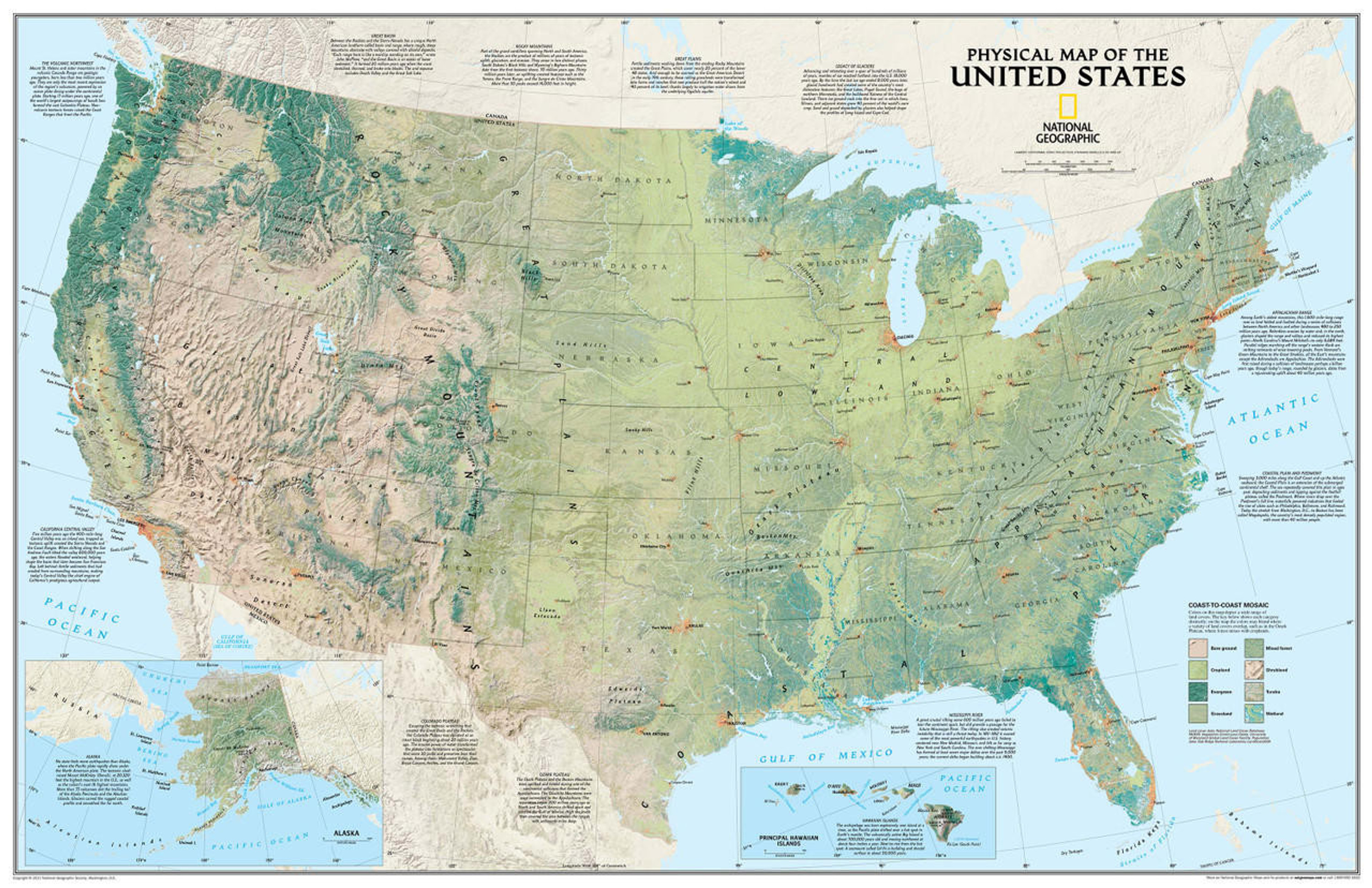
US shaded relief wall map
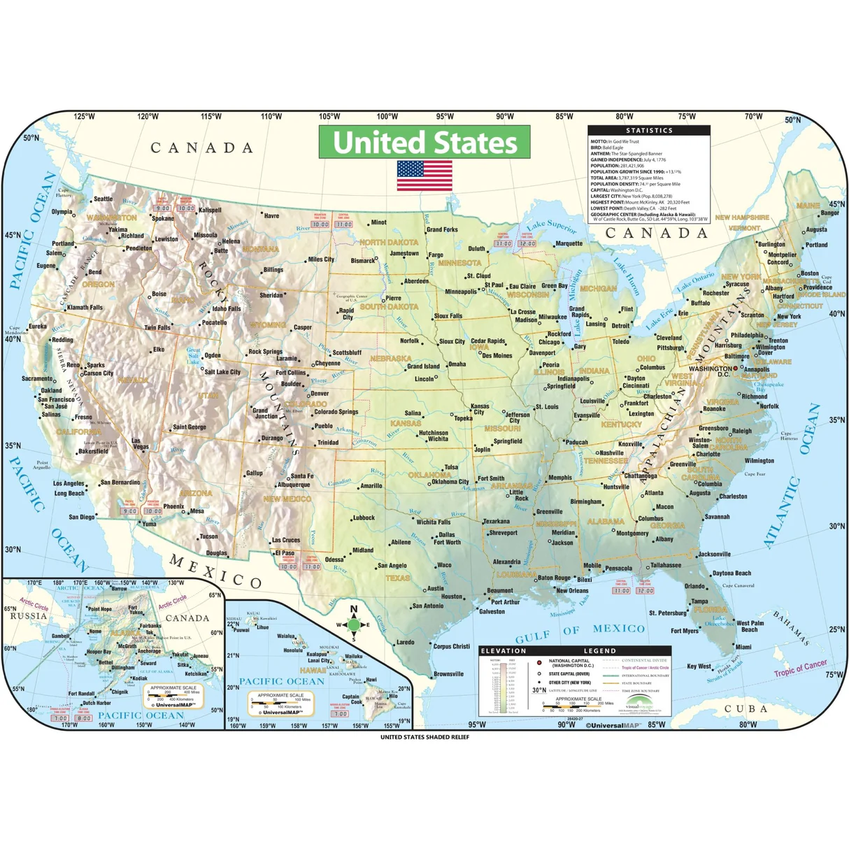 US shaded relief wall map showing topography, cities, and state borders.
Detailed shaded-relief wall map of the United States displaying mountains, plains, rivers, major highways, and cities. It marks state borders and capitals and includes insets for Alaska and Hawaii. Ideal for classrooms or offices — highlights elevation and terrain with clear geographic labels.
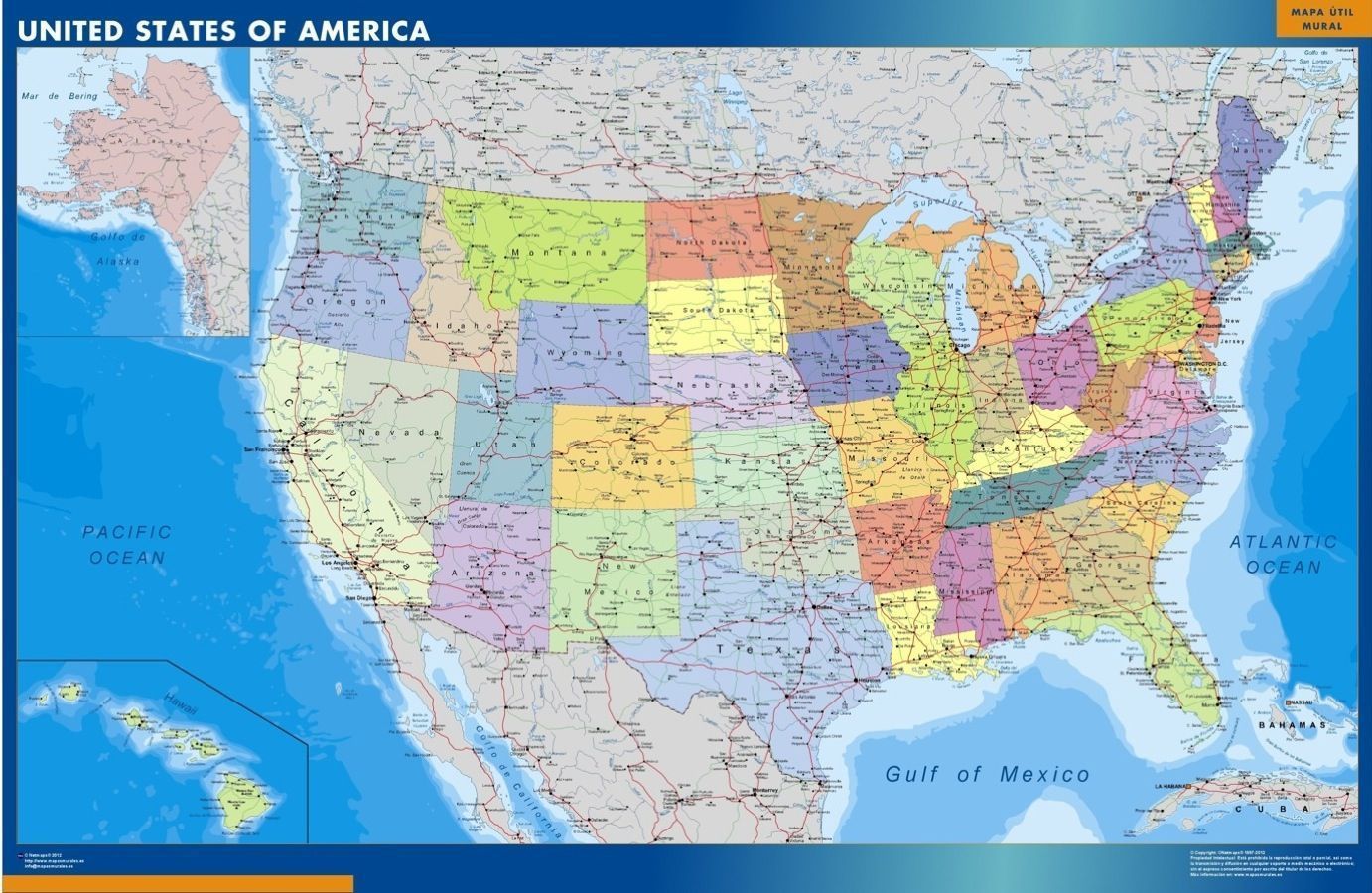
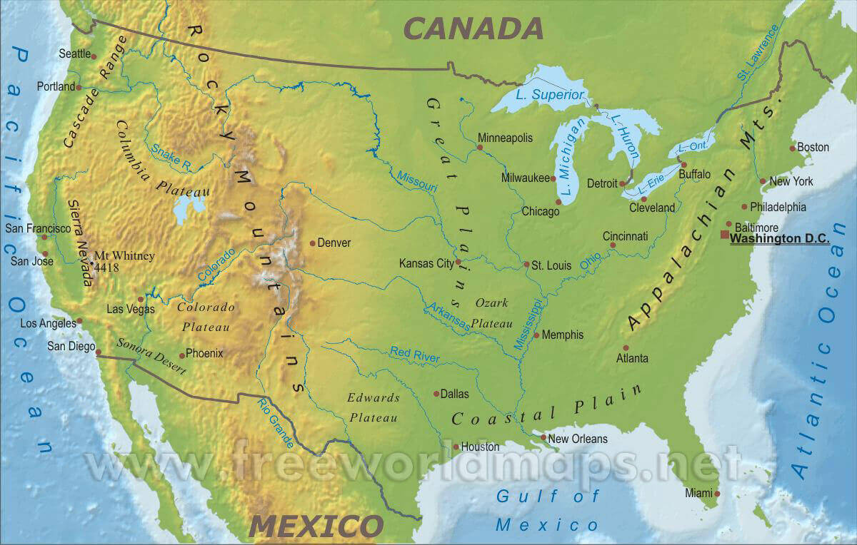
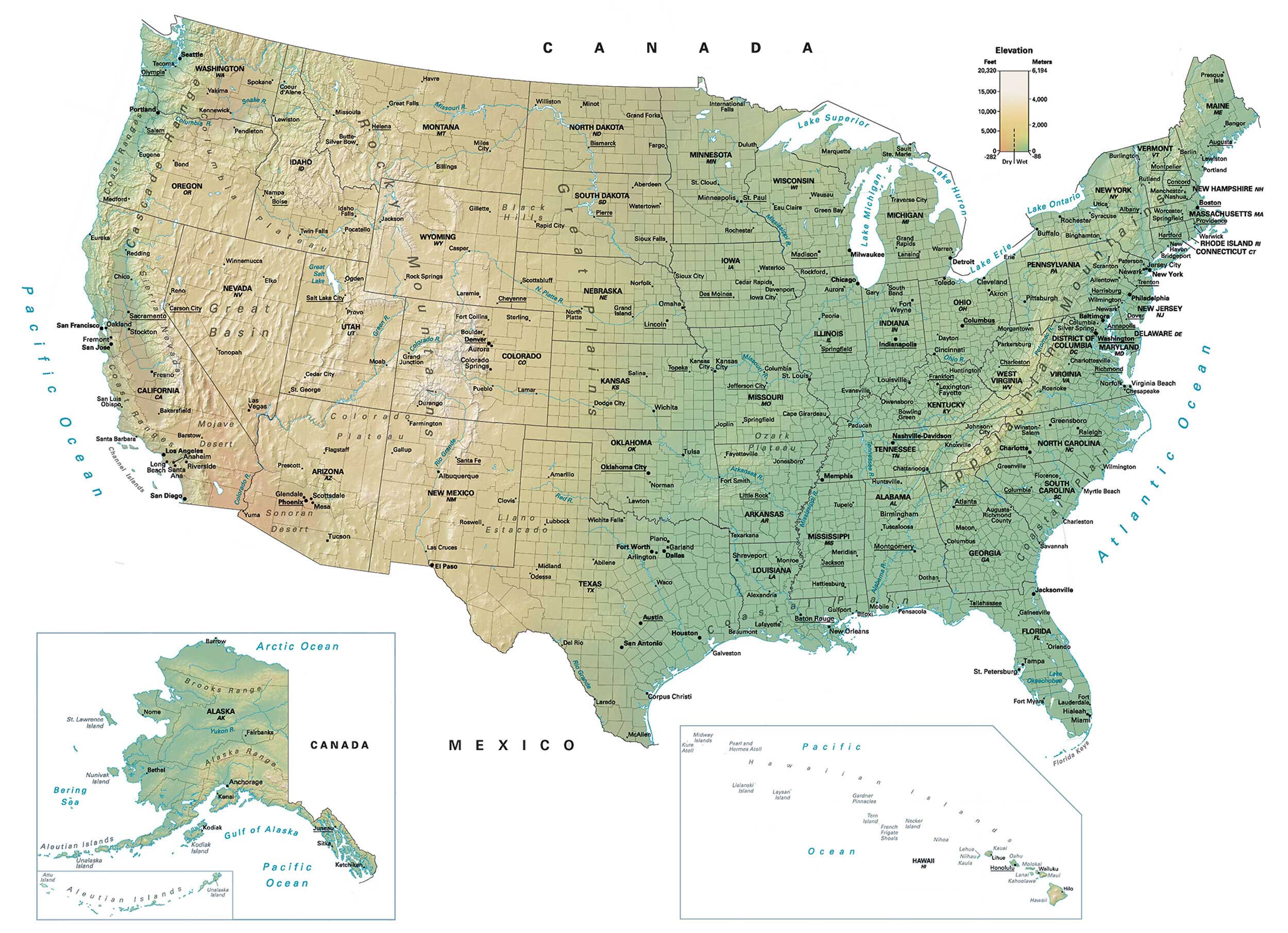
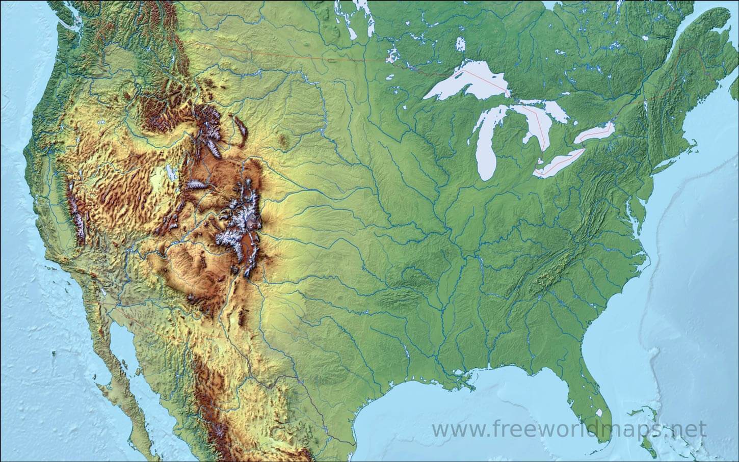
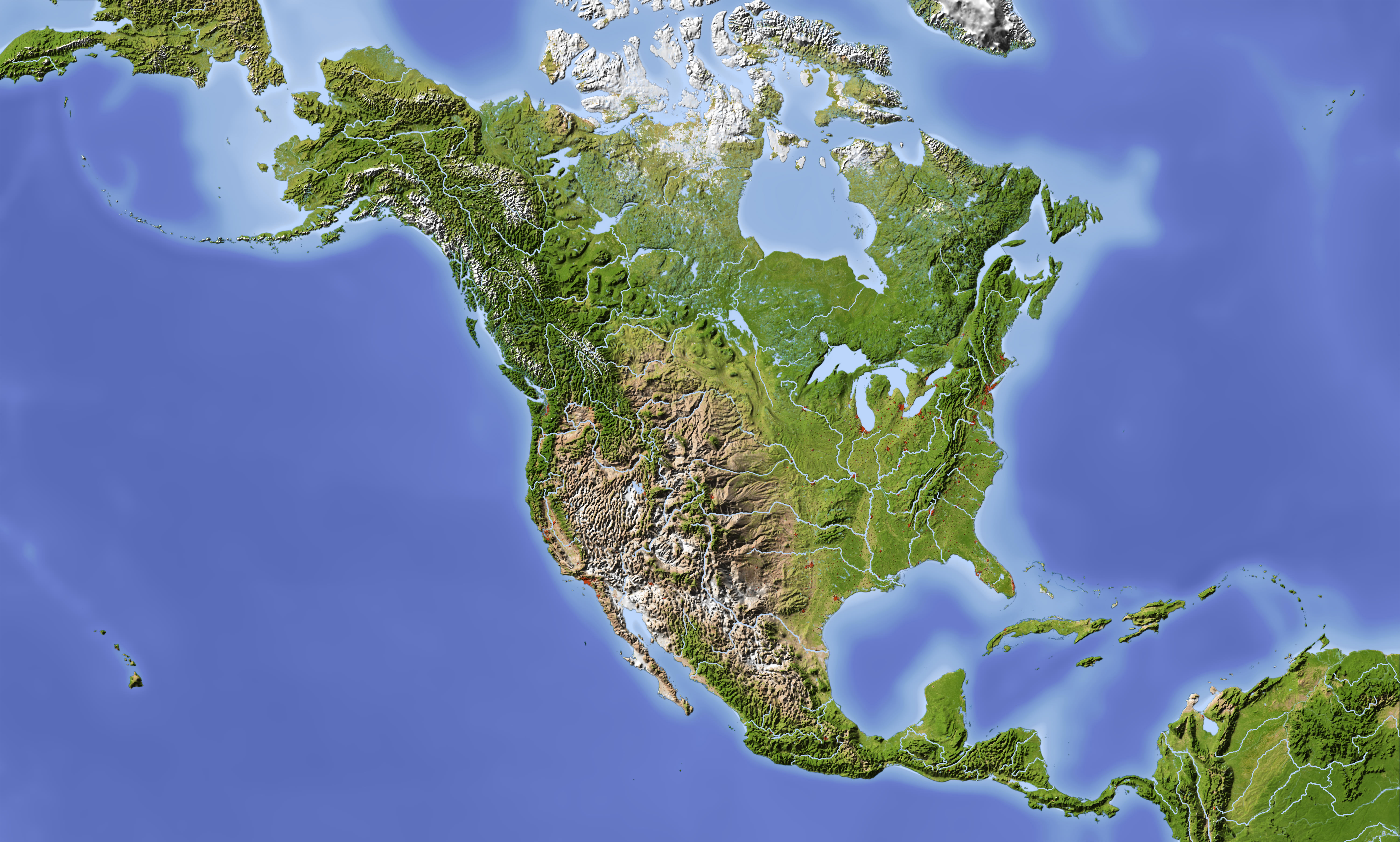
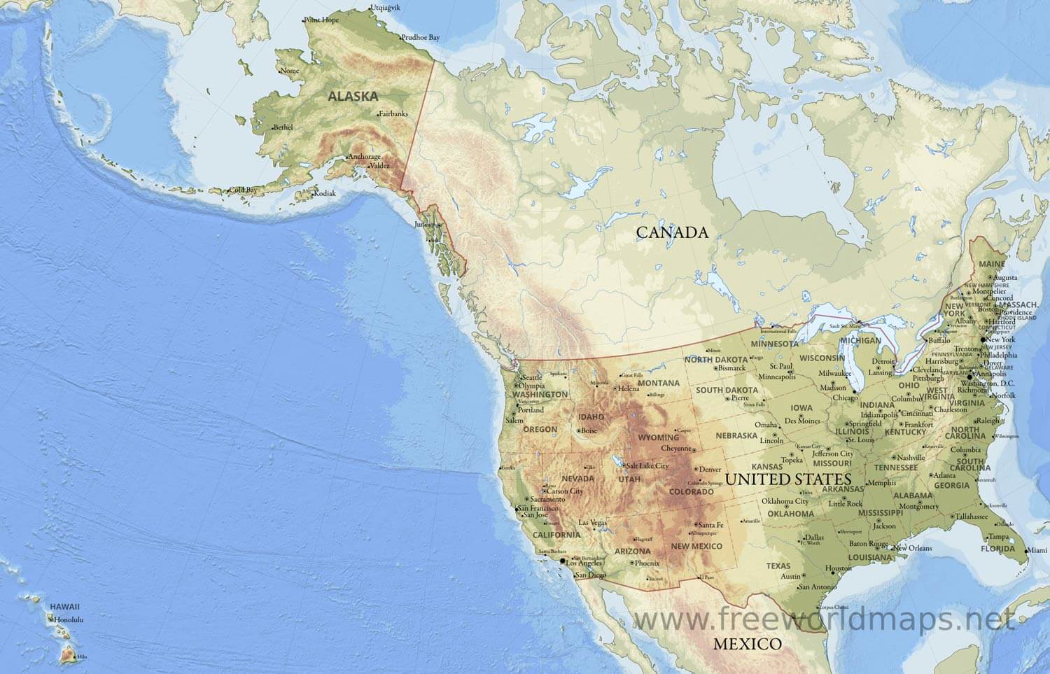
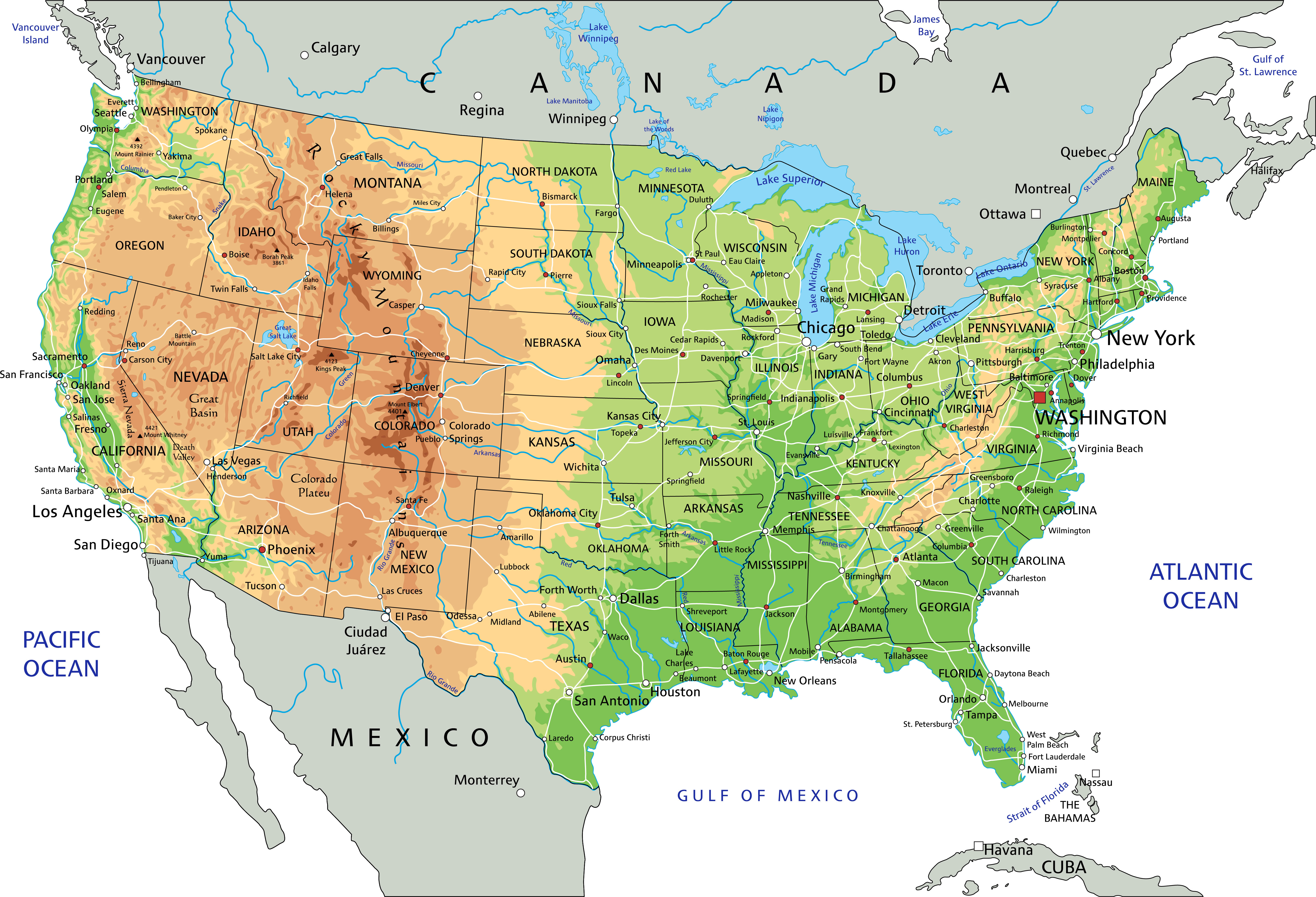
United States Physical Map with National Borders and Geography
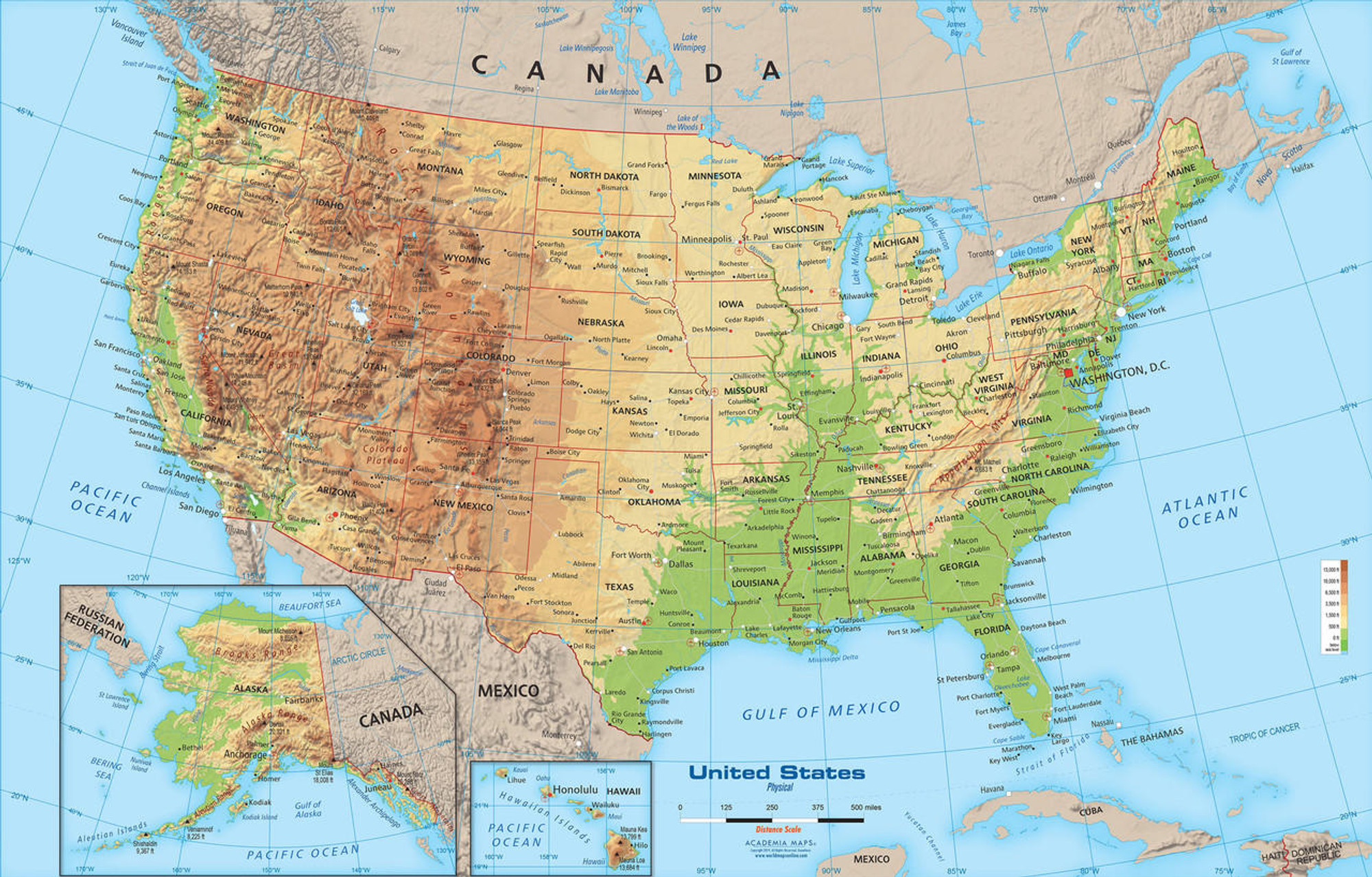 Detailed physical map of the United States showing borders, terrain, and cities.
This physical map of the United States shows detailed geography, including mountains, rivers, coastlines, and national borders. It highlights major cities, capitals, and neighboring countries like Canada and Mexico, providing an accurate overview of U.S. terrain and topography.
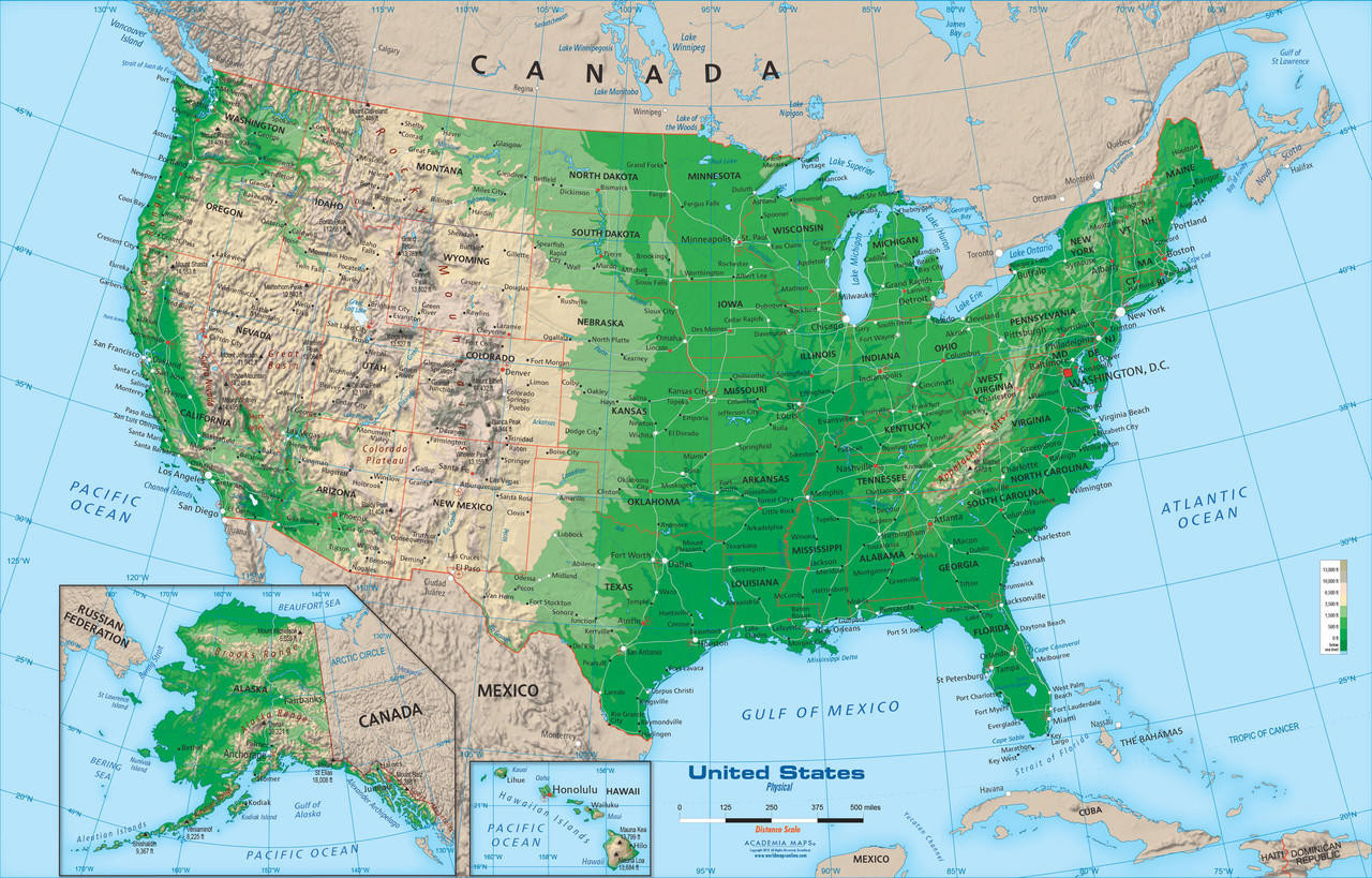
Large detailed map of the US
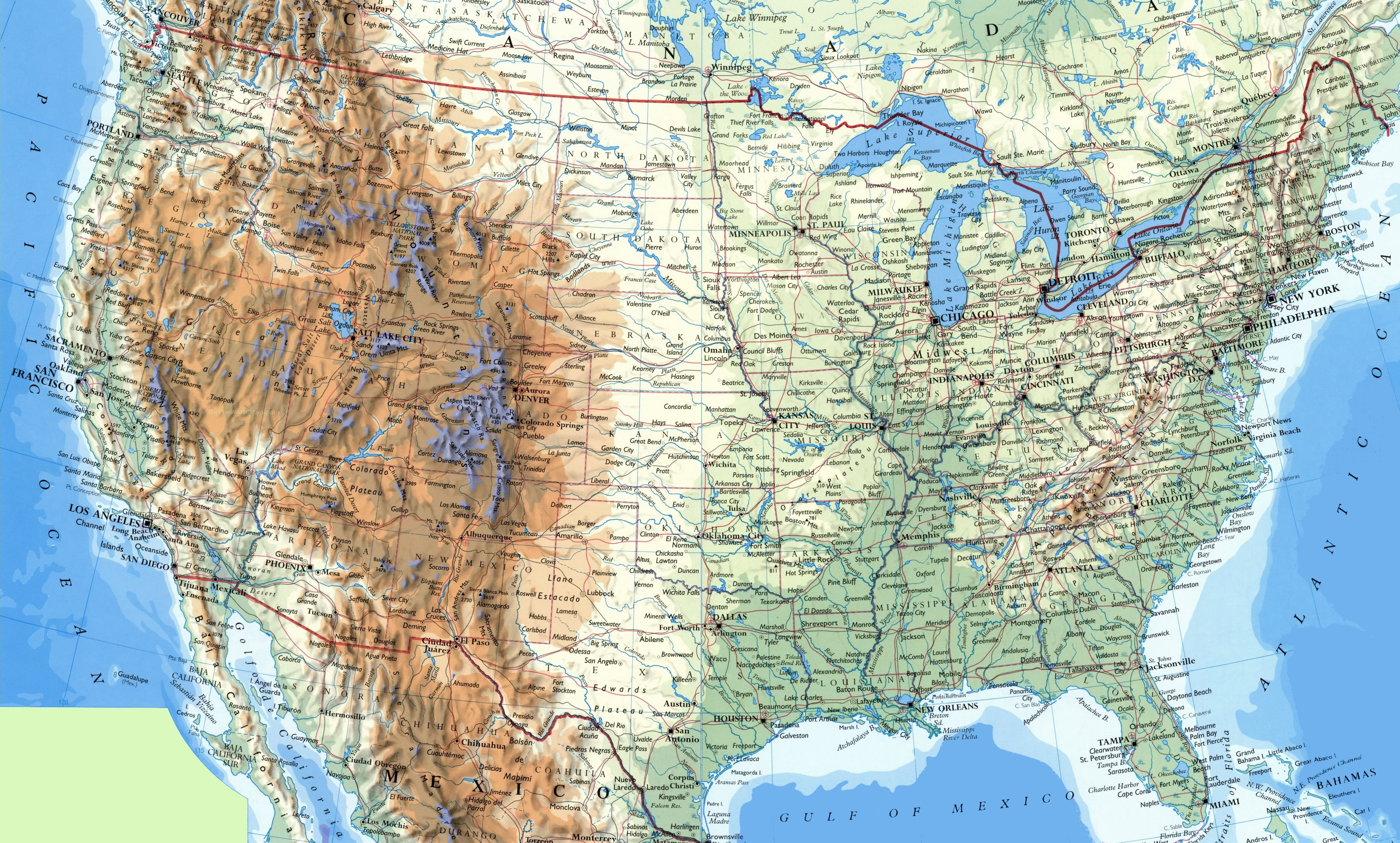
Large physical map of the USA
USA physical wall map
USA topo map
Map of the US geography map

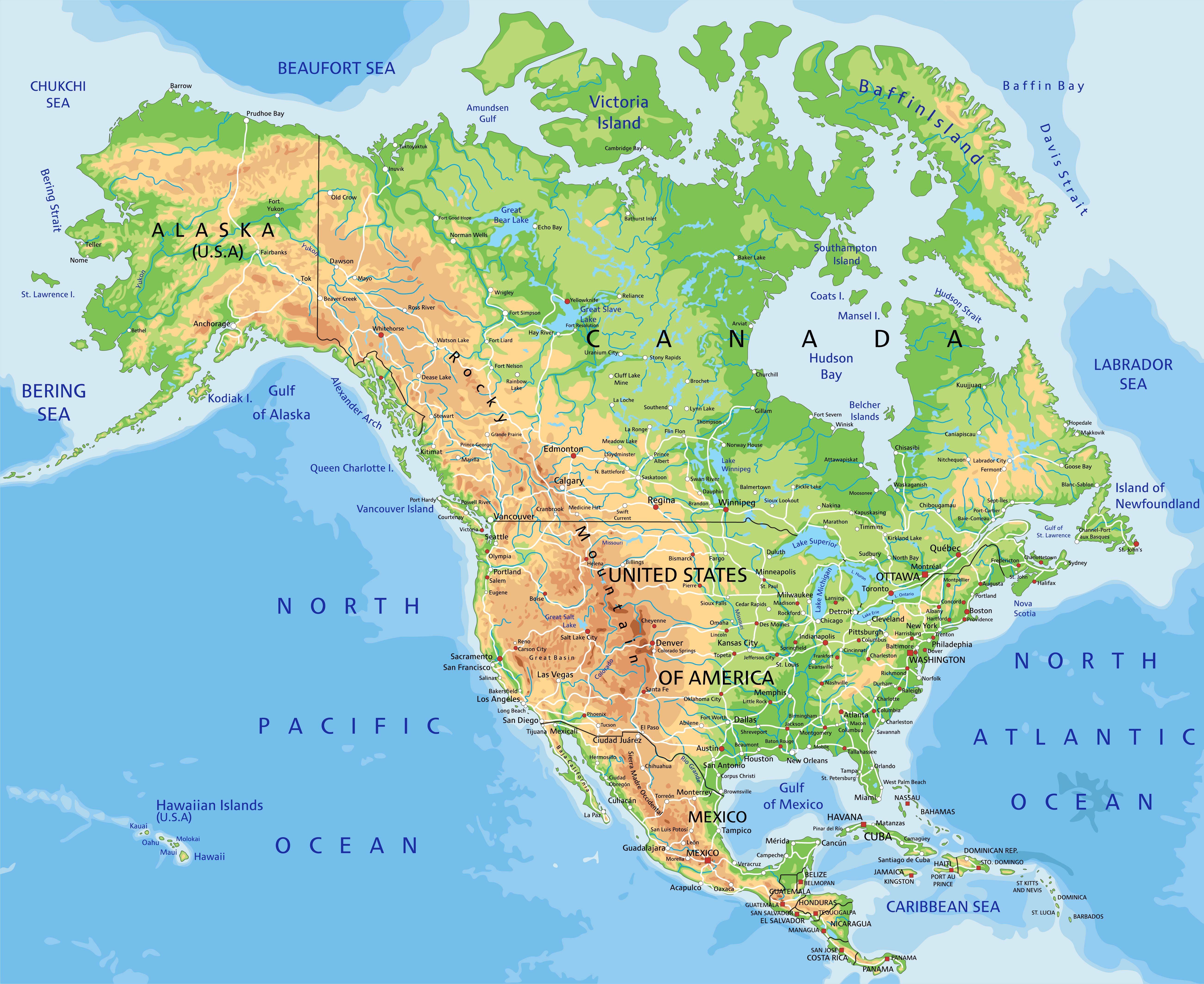
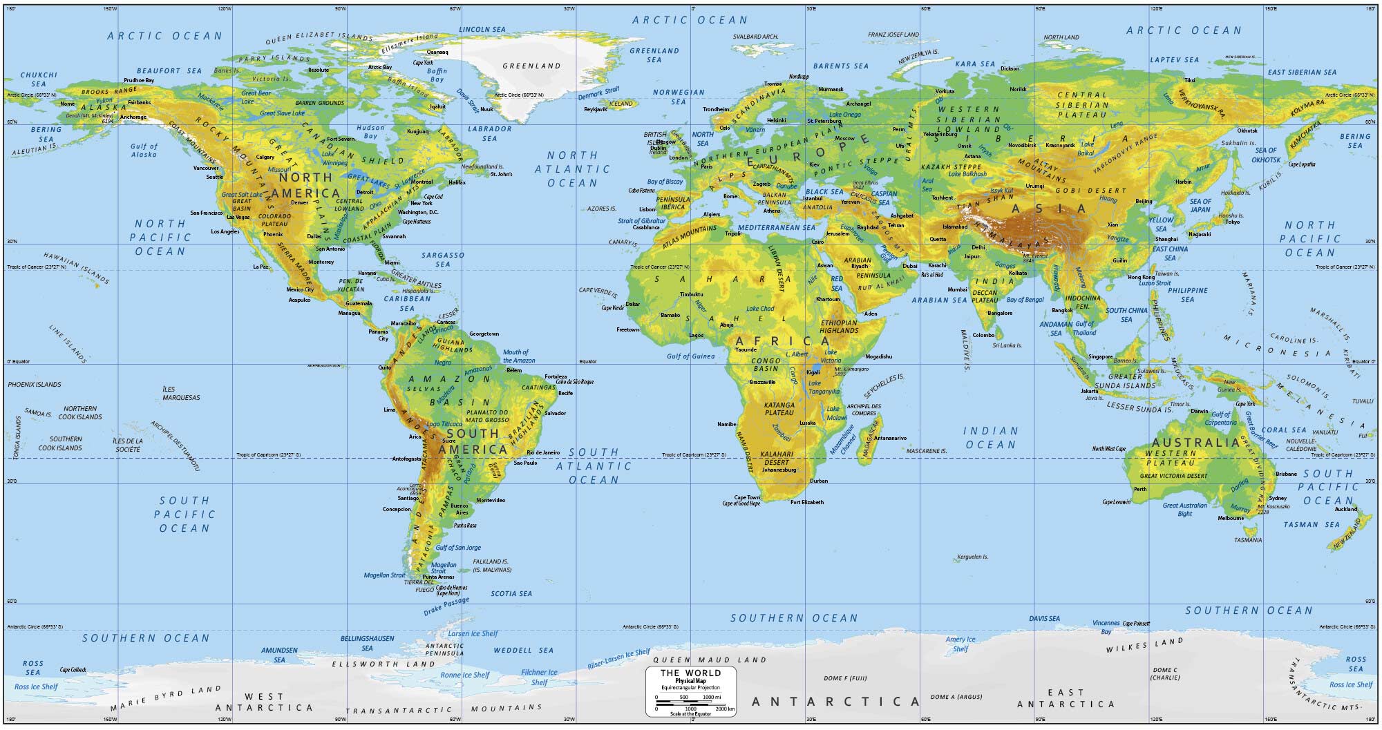
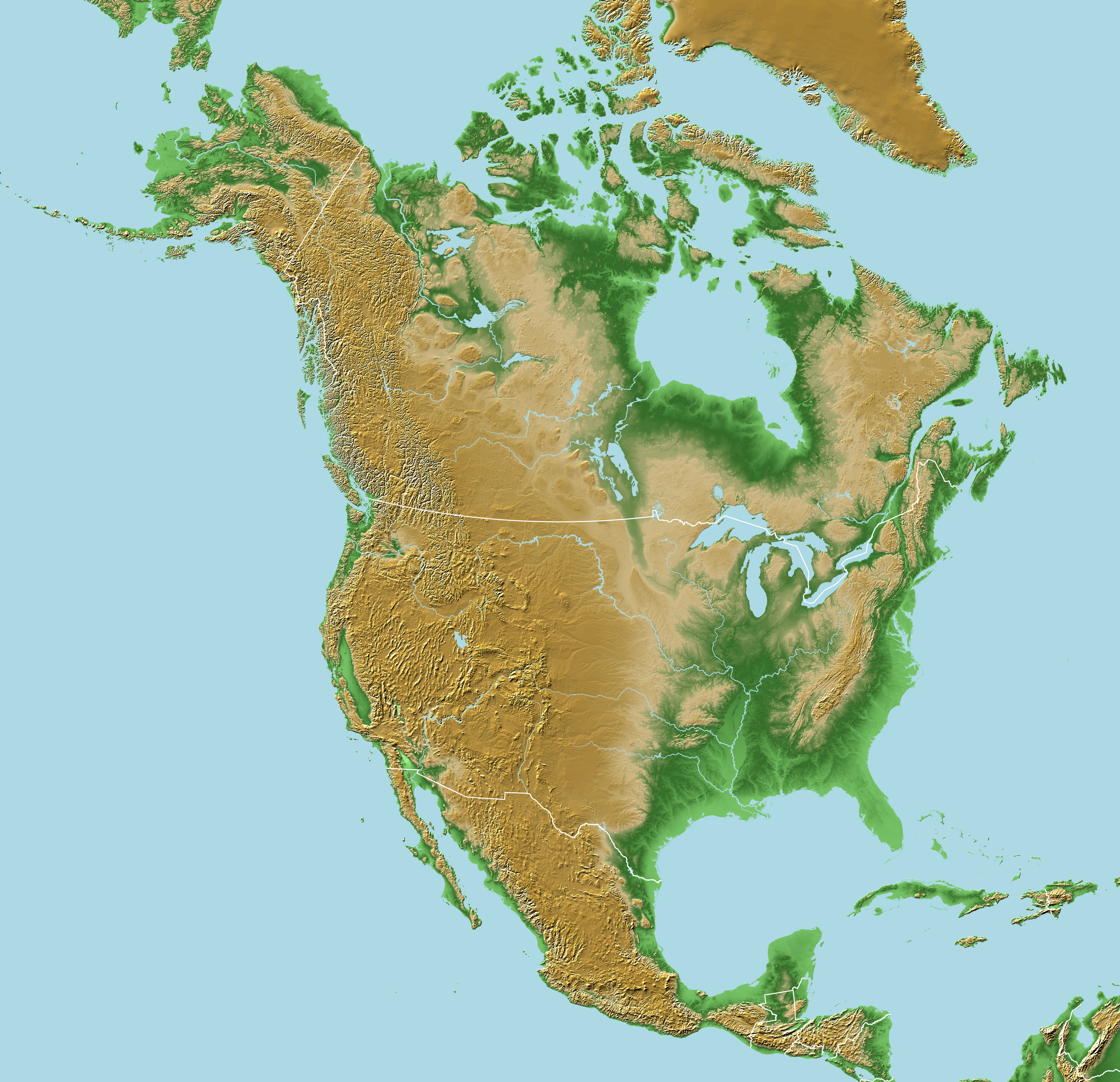
North America and US geological map
Physical map of North America and US
Physical map of the United States of America geography
Physical map of the US
Physical map of United States
USA physical map
USA physical map
Physical map of USA
Physical maps of the USA
Physical US map
The US physical national geography map
The World and US physical map
US scaled physical map

US topography and physical map
United States of America physical map
US and Americas physical map
US and North America satellite map with physical feature
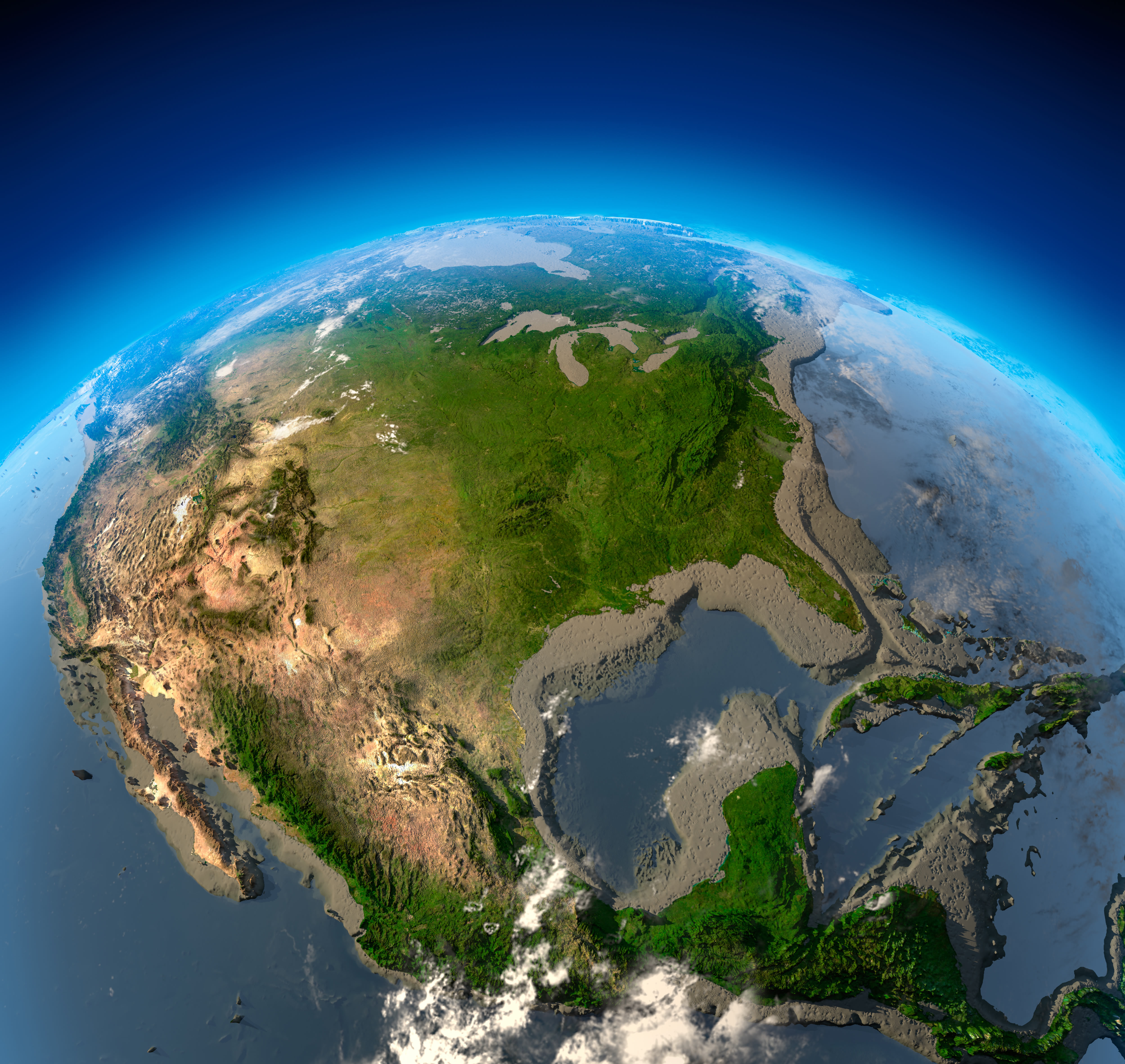
US and North America satellite physical map
US blank physical map by states
US geography map
US map physical topography map
US North America physical map
US physical feature map
US physical map with cities
US physical maps
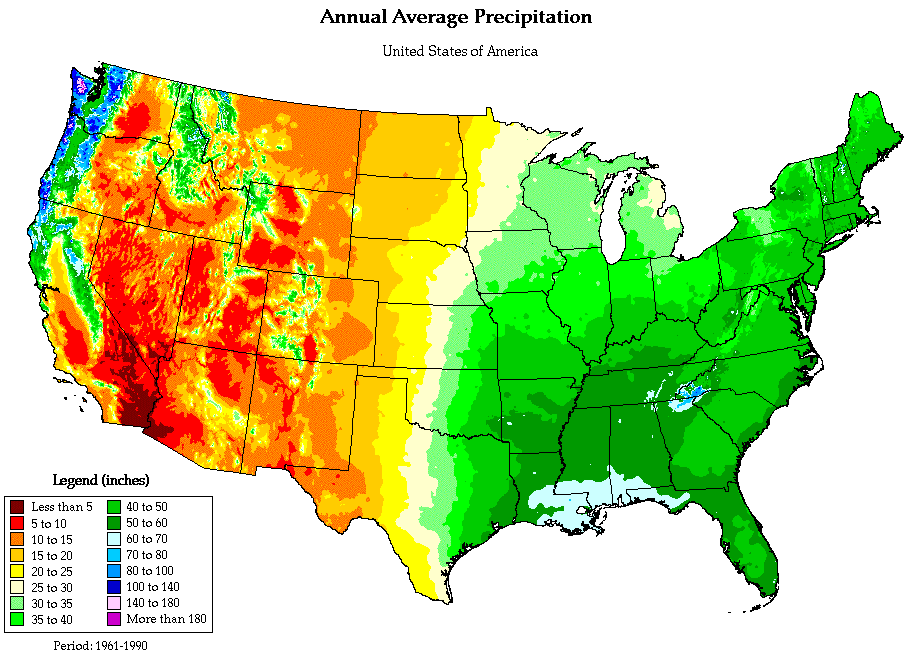
US precipitation and physical map
Feel free to explore these pages as well: