United Arab Emirates Location on the World Map: Geography, Borders and Regions
United Arab Emirates (UAE) is located in Western Asia on the southeastern coast of the Arabian Peninsula, in the heart of the Middle East. The country shares land borders with Saudi Arabia to the south and west and Oman to the east and southeast, while its northern coastline lies along the Persian Gulf. The UAE is composed of seven emirates, including Abu Dhabi, Dubai, and Sharjah, and occupies a strategic geographic position between Asia, Africa, and Europe. Because of this location, the United Arab Emirates has become an important center for global trade, transportation, tourism, and international business in the Gulf region.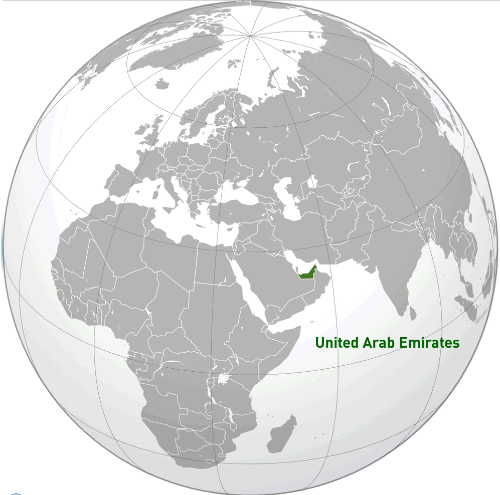
Where Is the United Arab Emirates Located? (Complete Geographic Guide)
Where Is the United Arab Emirates Located?
United Arab Emirates (UAE) lies in Western Asia, on the southeastern edge of the Arabian Peninsula. It shares land borders with Saudi Arabia to the south and west and Oman to the east and southeast. The country also has a long coastline along the Persian Gulf, as well as a smaller shoreline on the Gulf of Oman. Thanks to its strategic location between Asia, Africa, and Europe, the UAE has become a major center for international trade, transportation, and tourism.
Geographic Location of the United Arab Emirates
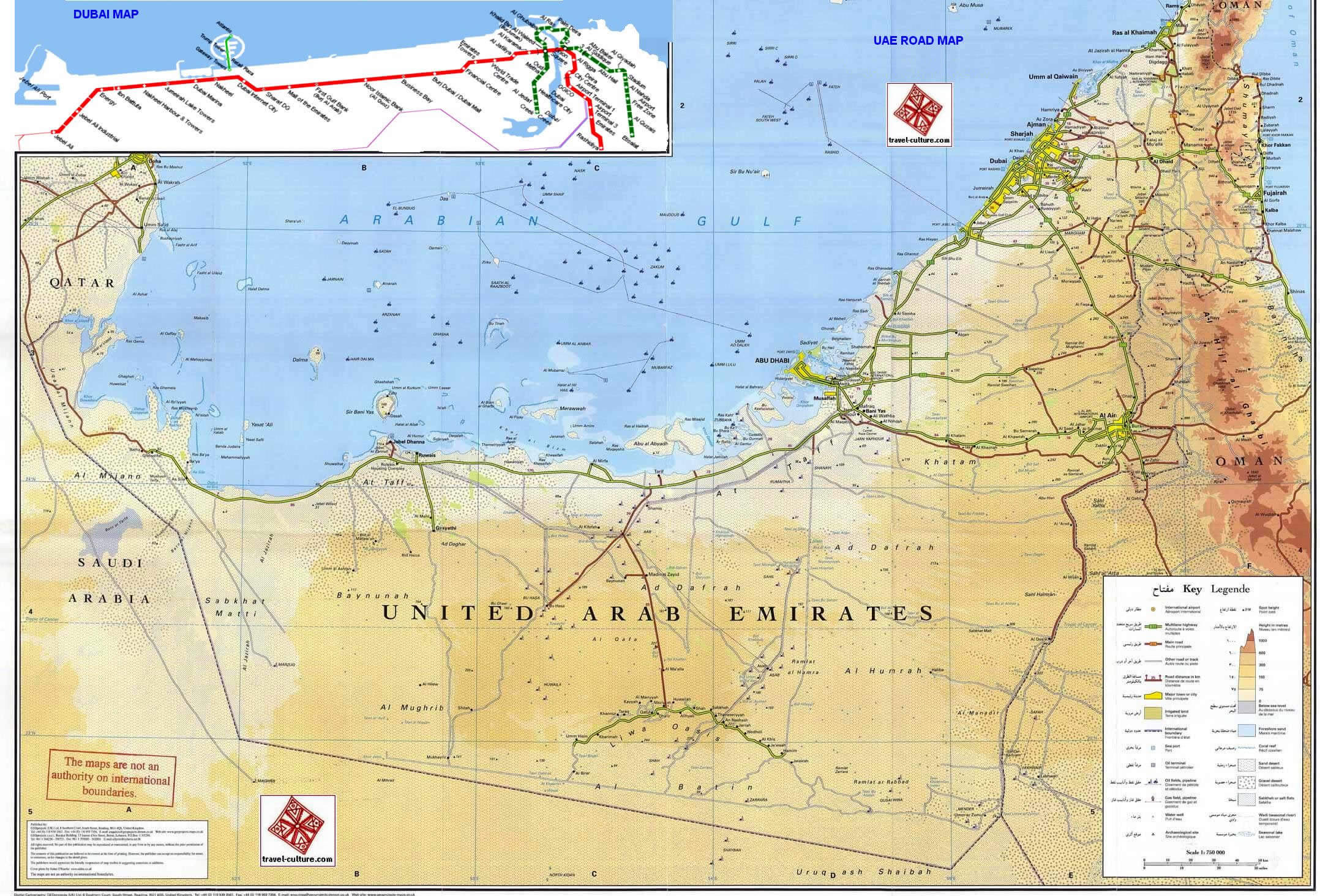
United Arab Emirates covers an area of about 83,600 square kilometers. A large part of the country is made up of desert terrain, including sections of the vast Rub’ al Khali (Empty Quarter). Its landscape features coastal plains along the Persian Gulf, extensive sandy deserts, and mountainous areas in the northeast near the Oman border. Key geographic features include the Hajar Mountains, numerous coastal islands, and natural oasis regions such as Al Ain.
What Are the Main Regions of the United Arab Emirates?
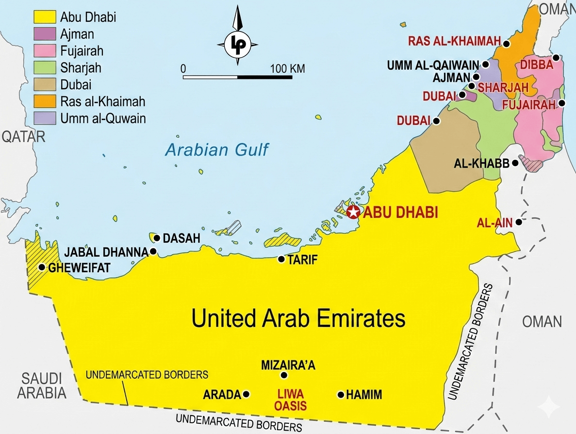
The United Arab Emirates is a federal state made up of seven emirates. Each emirate is governed by its own local authority while also participating in the country’s federal system. The seven emirates are:
- Abu Dhabi – The largest emirate and the capital of the UAE, serving as the political and administrative center of the country.
- Dubai – A global city known for finance, tourism, trade, and iconic skyscrapers.
- Sharjah – A cultural and educational center located next to Dubai.
- Ajman – The smallest emirate, located along the Persian Gulf coast.
- Umm Al Quwain – Known for its coastal lagoons and natural habitats.
- Ras Al Khaimah – Located in the northern part of the UAE and known for mountains and tourism.
- Fujairah – The only emirate located entirely on the Gulf of Oman.
What Are the 5 Largest Cities in the United Arab Emirates?
The five largest cities in the United Arab Emirates by population are:
- Dubai – The largest city in the UAE and a global center for business, tourism, and innovation.
- Abu Dhabi – The capital city and an important political and economic hub.
- Sharjah – A major cultural city known for museums, universities, and historic districts.
- Al Ain – An oasis city in the Emirate of Abu Dhabi located near the Oman border.
- Ajman – A coastal city and the capital of the Emirate of Ajman.
Quick Facts About the United Arab Emirates
| Official Name: | United Arab Emirates |
|---|---|
| Area: | 83,600 km² |
| Capital: | Abu Dhabi |
| Population: | Approximately 10 million |
| Currency: | UAE dirham (AED) |
| GDP: | Approx. $500 billion (nominal) |
| Per capita: | Approx. $50,000 (nominal) |
| Time Zone: | Gulf Standard Time (GST, UTC+4) |
| Calling code: | +971 |
| Internet TLD: | .ae |
Why the UAE’s Location Is Important
United Arab Emirates occupies a strategically important position in the Middle East because of its location along the Persian Gulf and near major international maritime routes. Through its modern ports and airports, the country serves as a key link connecting Europe, Asia, and Africa, making it a global center for trade, logistics, finance, and tourism. Its closeness to vital energy routes and regional markets also strengthens its influence in international trade and geopolitics.
Frequently Asked Questions
Is the United Arab Emirates in the Middle East?
Yes. The United Arab Emirates is located in Western Asia on the southeastern part of the Arabian Peninsula and is considered one of the key countries of the Middle East.
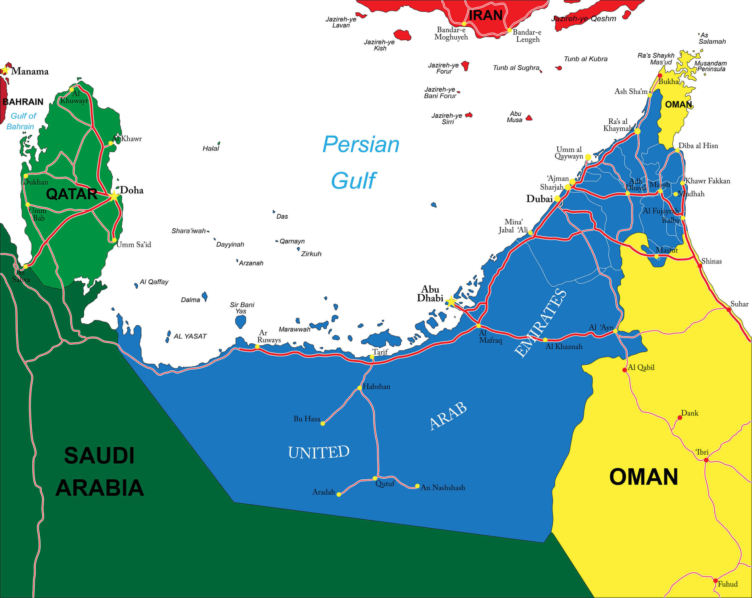
Which countries border the United Arab Emirates?
The United Arab Emirates shares land borders with Saudi Arabia to the south and west and Oman to the east and southeast.
What is the capital of the United Arab Emirates?
The capital of the United Arab Emirates is Abu Dhabi, which is also the largest emirate and the political center of the country.
Does the United Arab Emirates have access to the sea?
Yes. The UAE has a long coastline along the Persian Gulf and also borders the Gulf of Oman in the eastern part of the country.
What is the United Arab Emirates known for geographically?
The UAE is known for its vast desert landscapes, coastal plains along the Persian Gulf, the Hajar Mountains in the northeast, and oasis regions such as Al Ain.
Feel free to explore these pages as well:
- Head of Performance Marketing
- Head of SEO
- Linkedin Profile: linkedin.com/in/arifcagrici