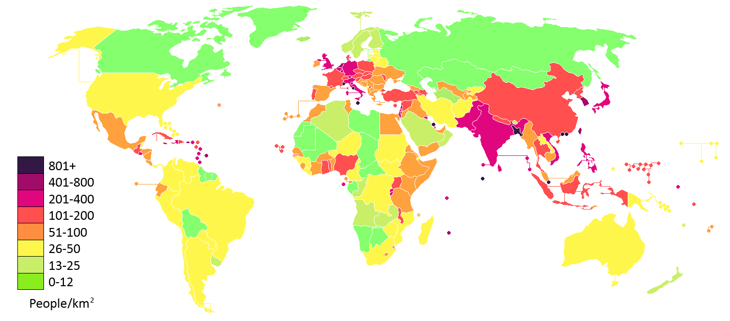
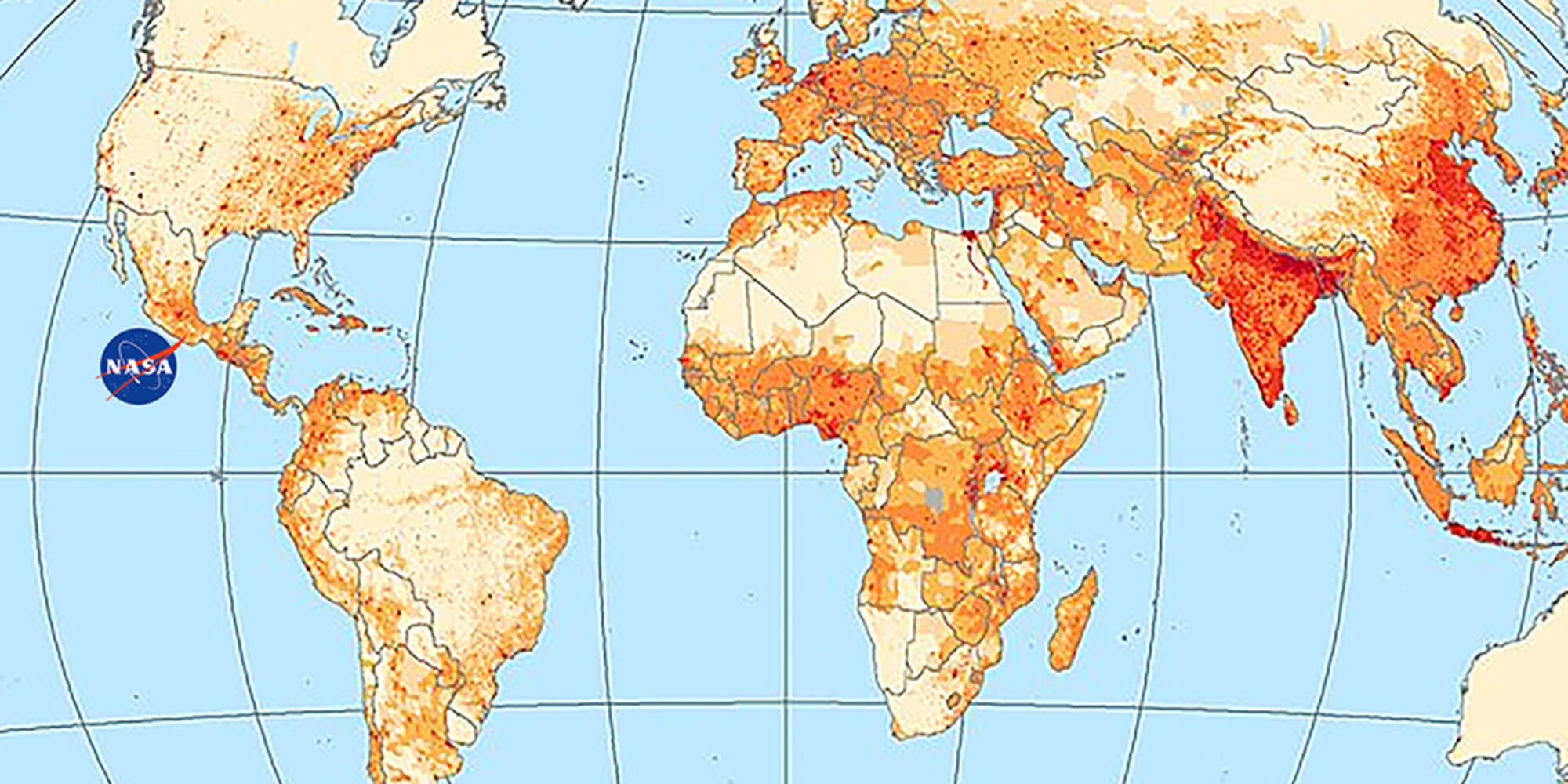
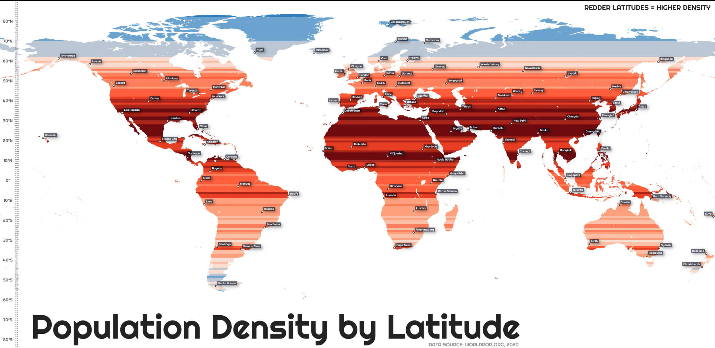
World Population Map: Global Density Hotspots
 World population density map showing global hotspots and sparse regions.
See how humanity is spread across the globe. Darker reds pinpoint the most crowded zones—South Asia, eastern China, Java, and Western Europe—while lighter tones mark thinly populated areas like the Sahara, Siberia, Australia, and the Amazon. It offers a clean, at-a-glance picture of global population patterns.
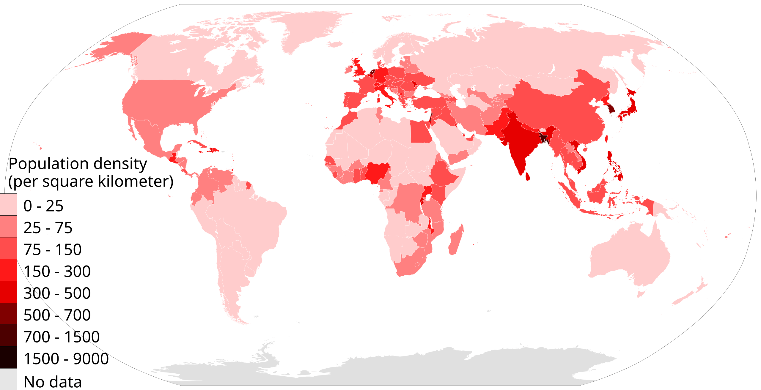
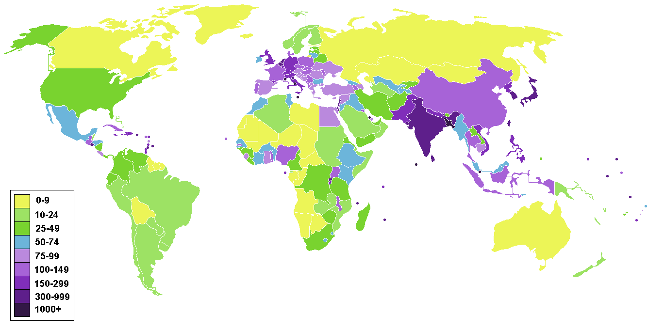
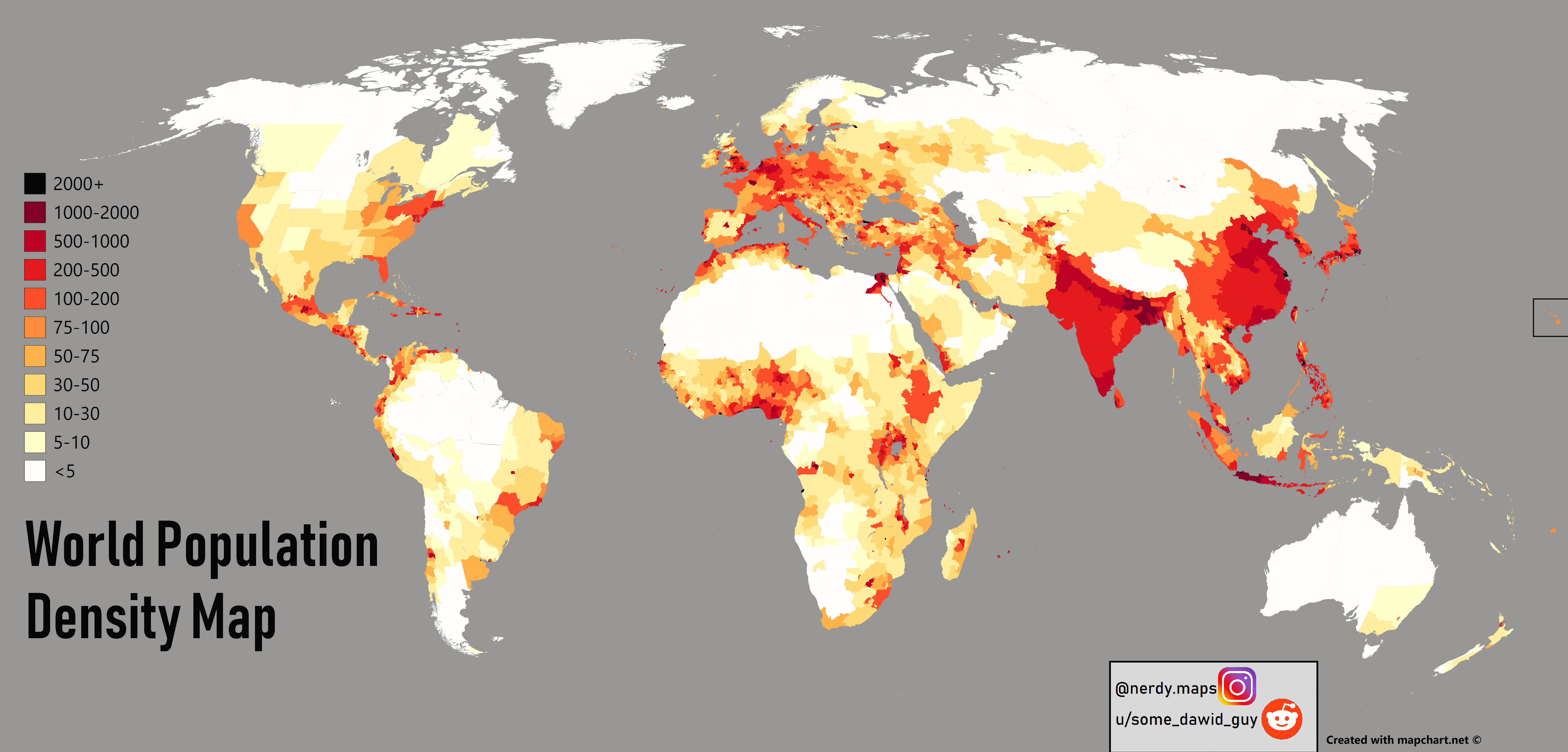
World Countries Population Density Map – Global Distribution
 World map by country showing population density patterns worldwide.
This world map compares population density by country, spotlighting very dense regions in South and East Asia, Western Europe, and parts of Africa and the Americas, while clearly showing sparse regions such as the Sahara, Siberia, Australia, and the Amazon. It's ideal for demographics and geography learning.
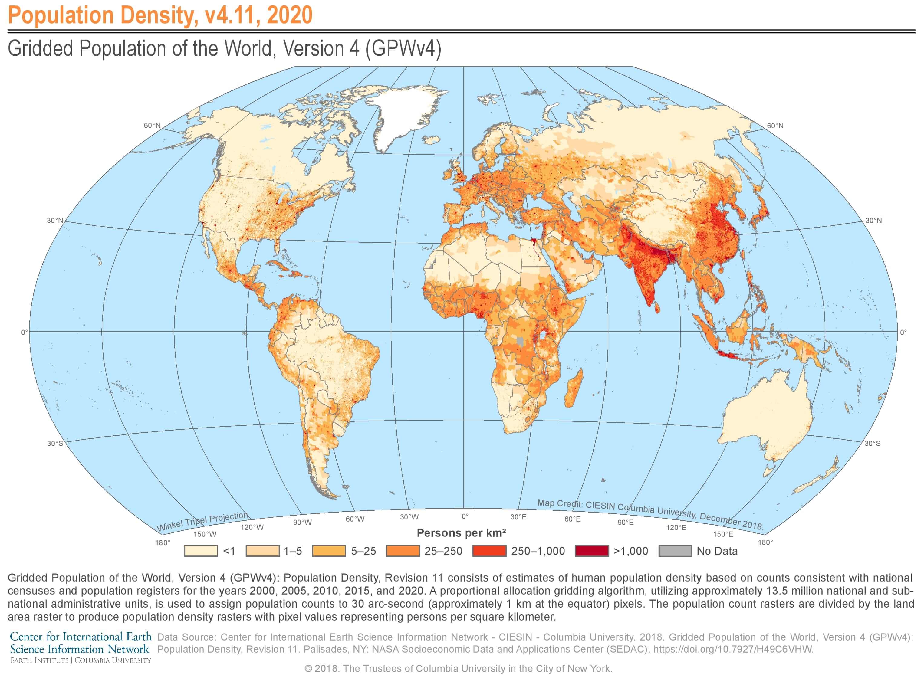
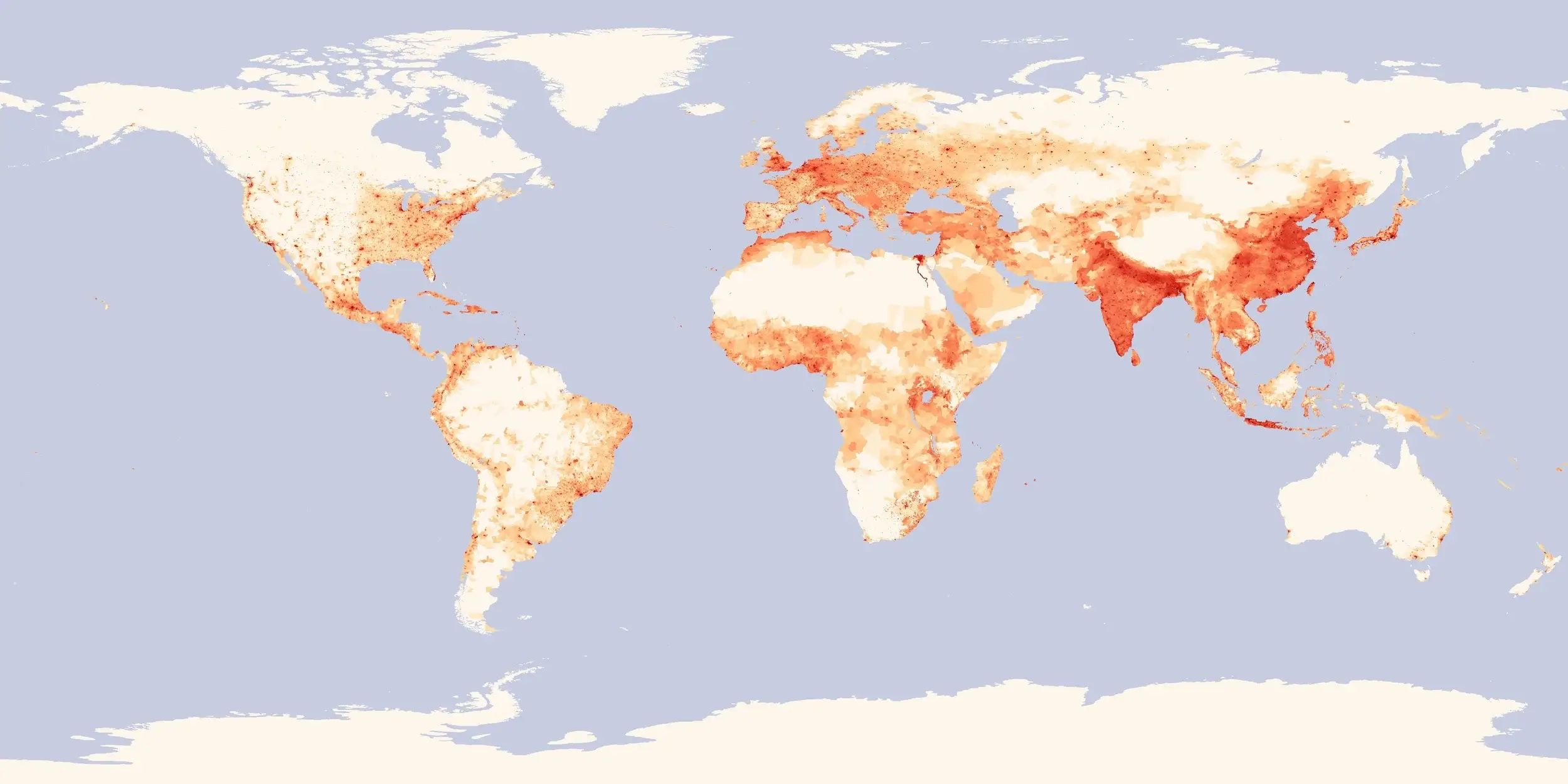
World Population density map per square kilometre