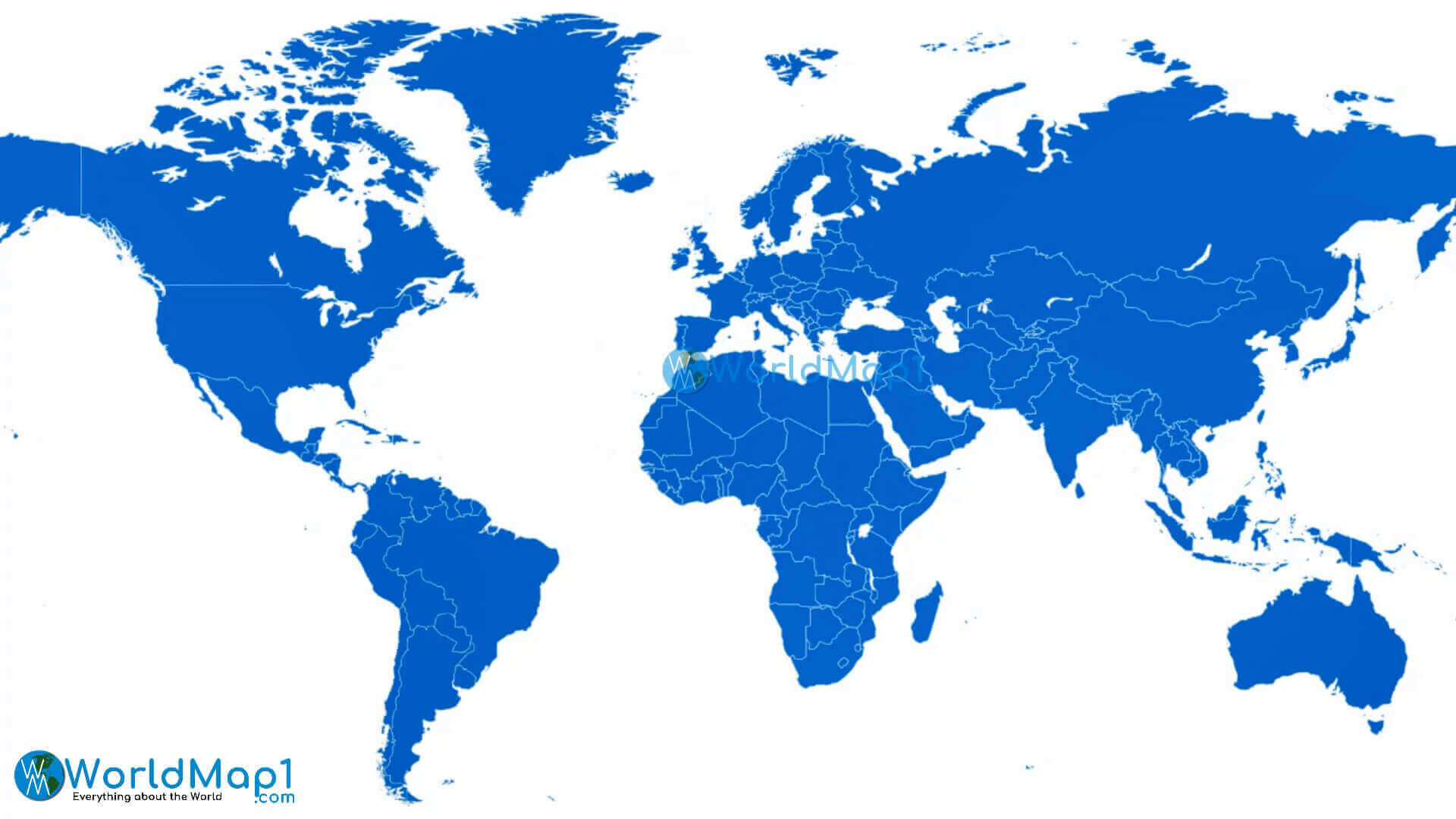
High resolution printable World atlas
High resolution printable World map with national fags
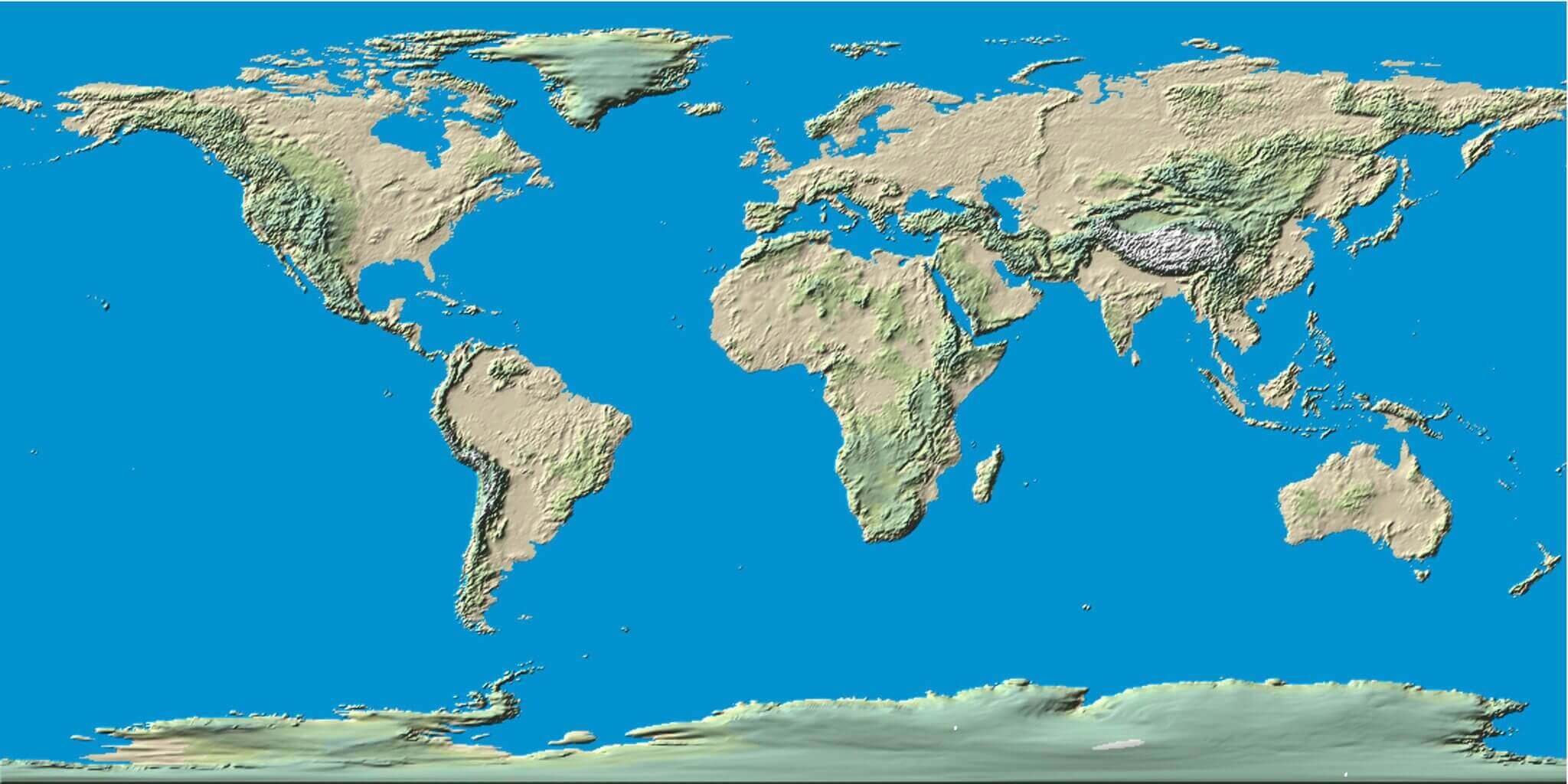
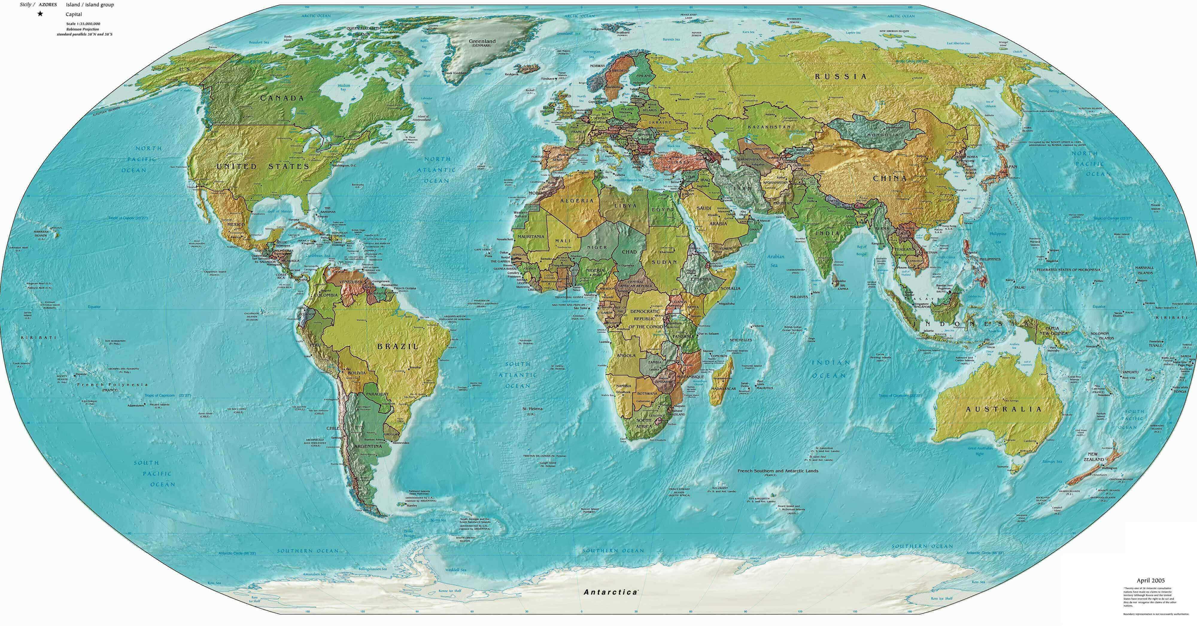
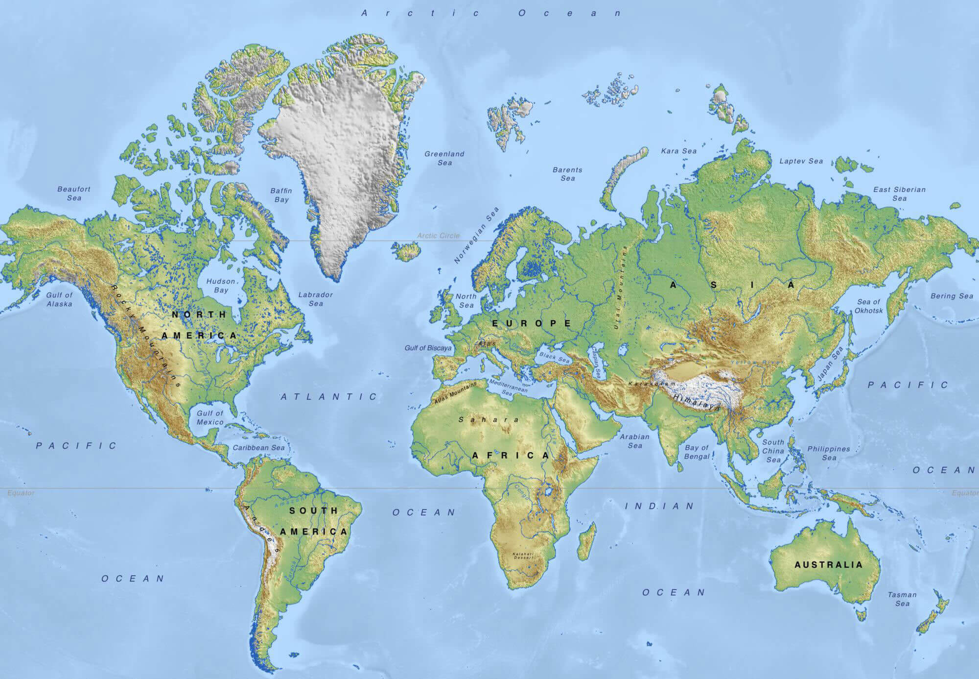
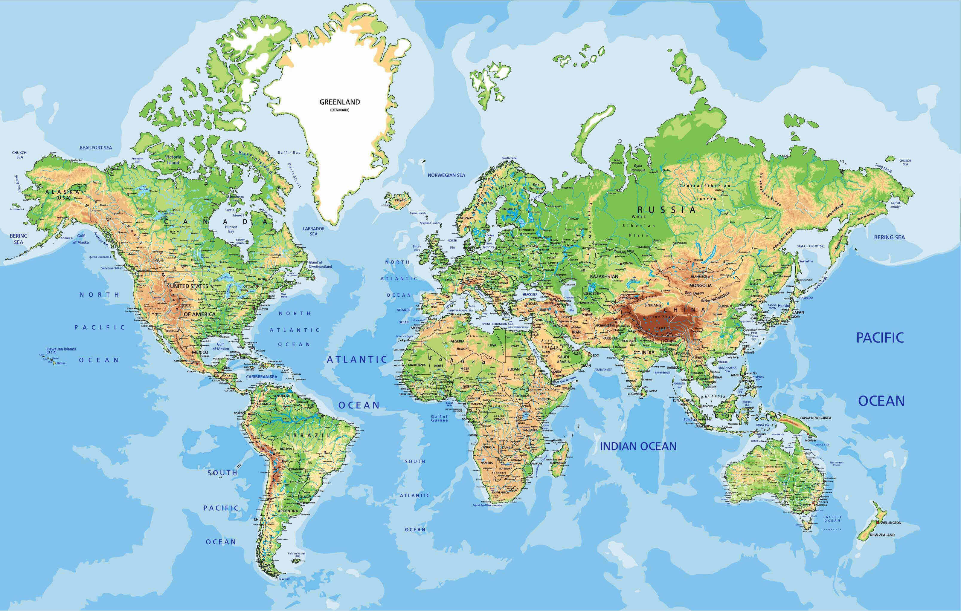
Physical High Resolution Printable World Map
 High resolution physical world map showing terrain, mountains, and oceans.
This physical high-resolution printable world map illustrates mountains, rivers, and terrain features across all continents. Perfect for classrooms, research, and travel planning, it highlights natural landscapes and geographic details, offering a clear global view of Earth’s physical features.
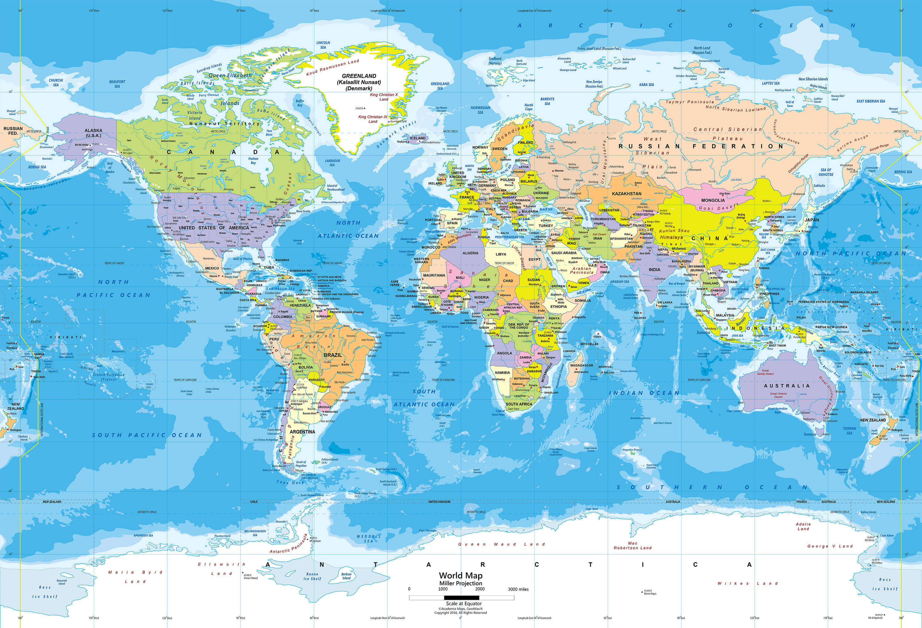
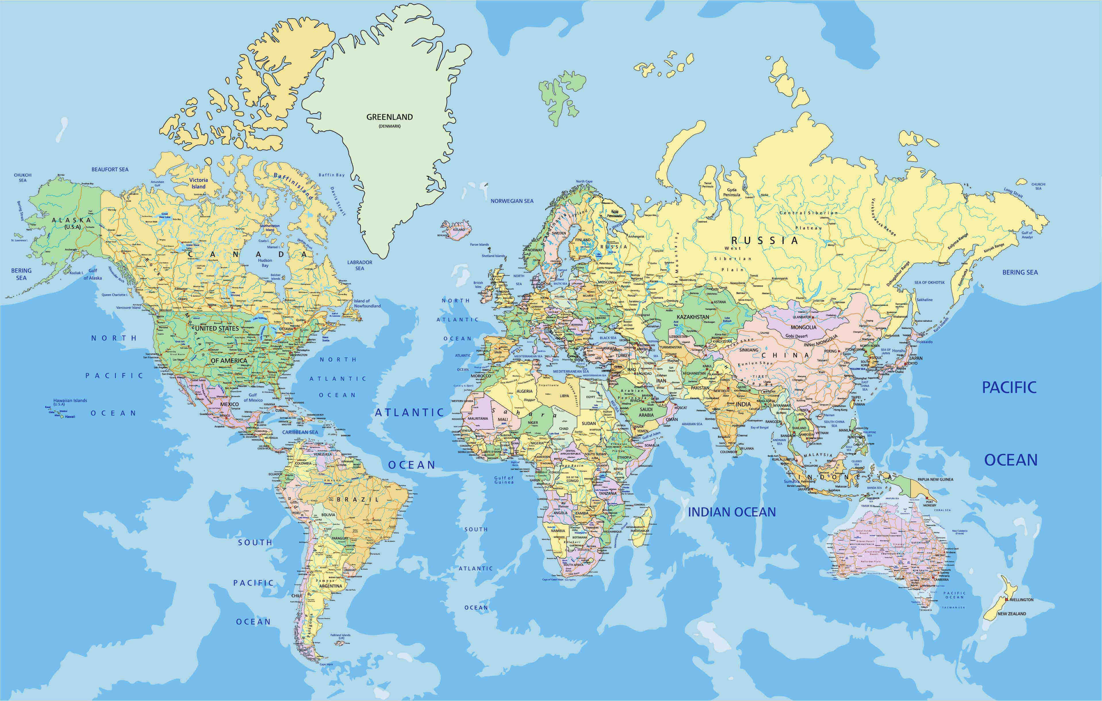
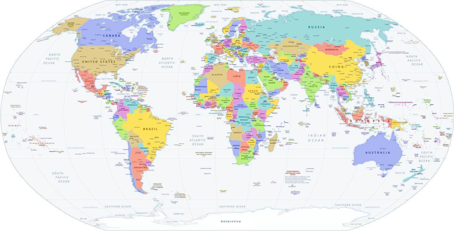
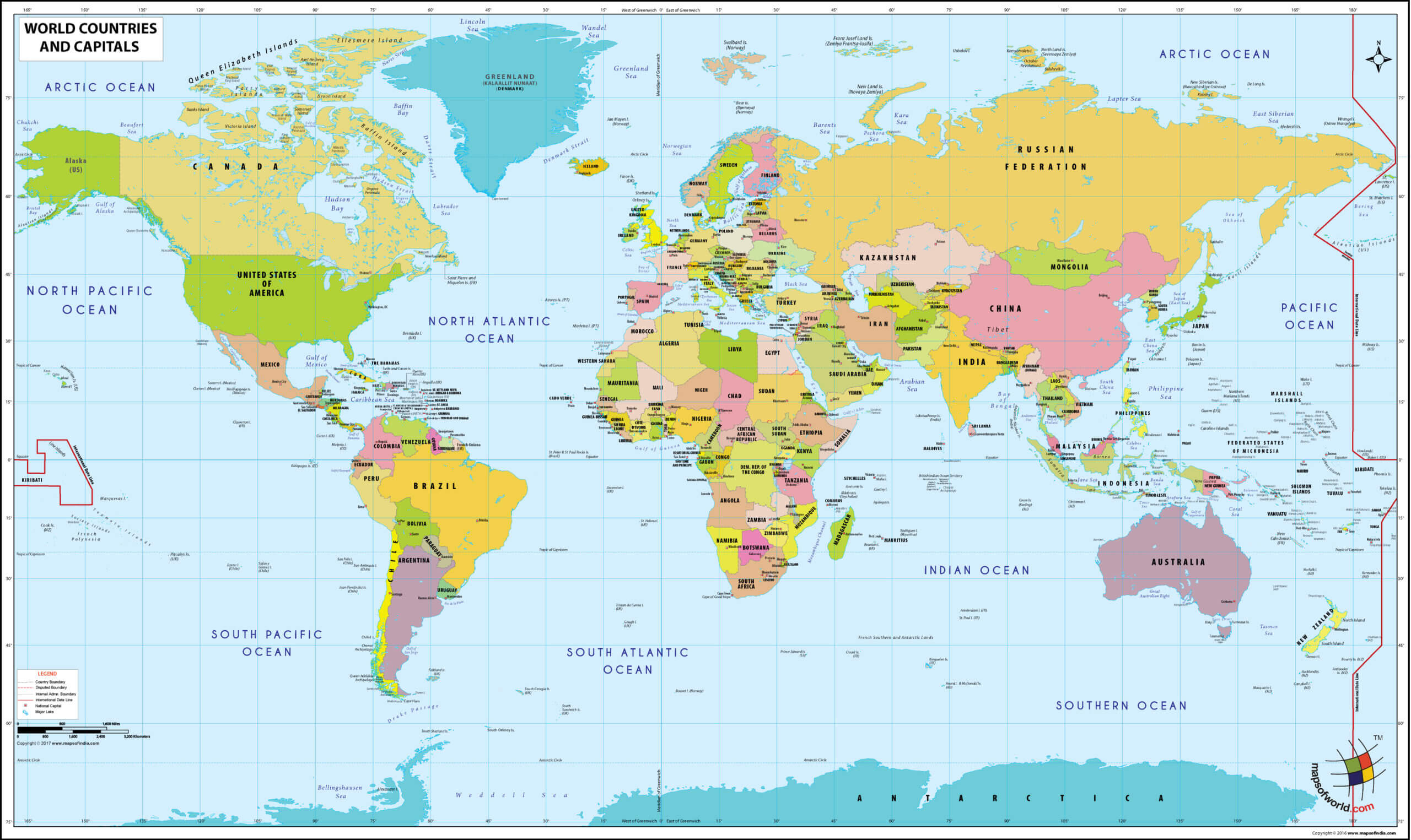
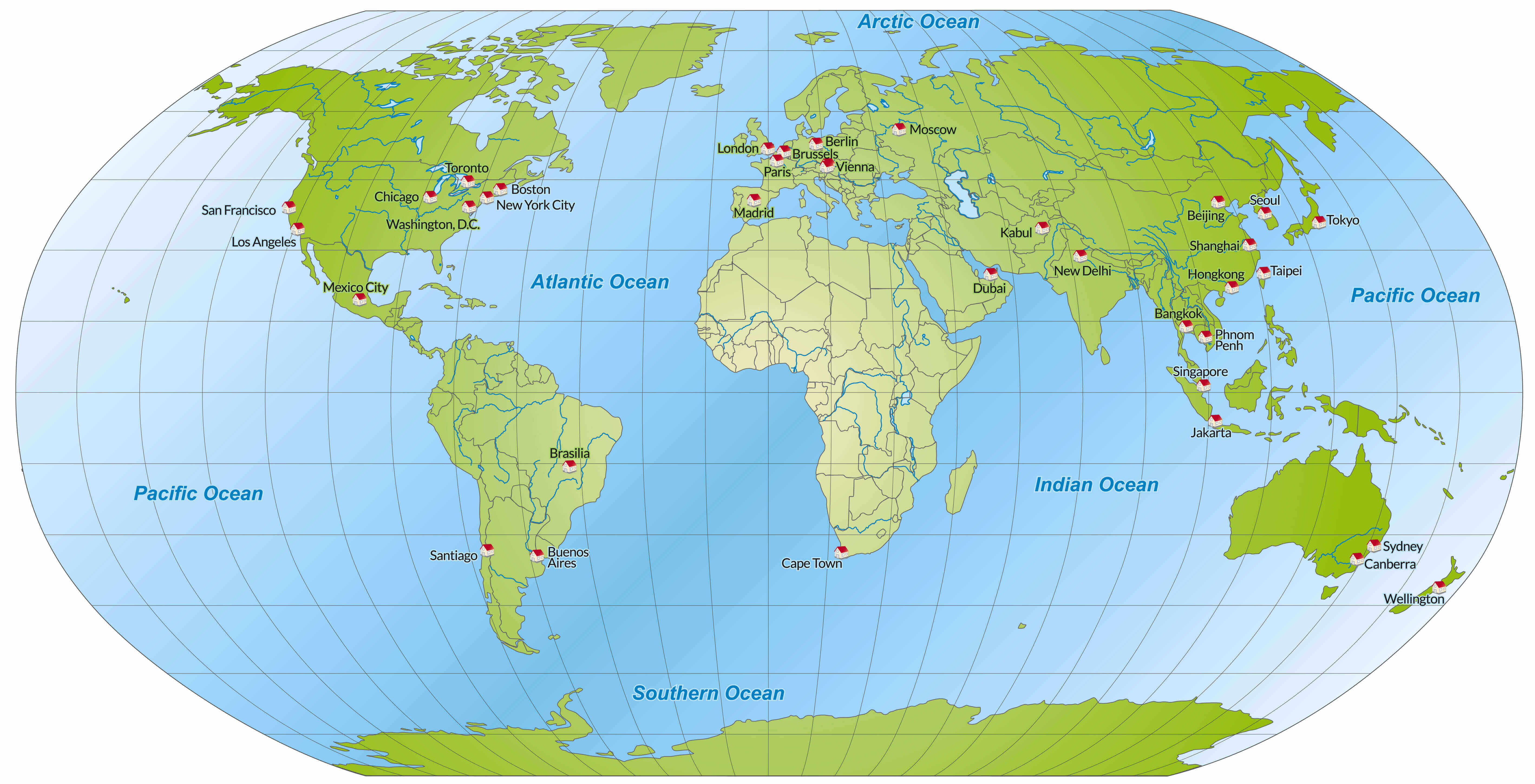
Printable High Resolution World Political Map
 High resolution printable world political map with countries and capitals.
This printable high-resolution world political map displays all countries, capitals, and major cities with clear borders. Perfect for classrooms, offices, and research, it provides an accurate view of global political divisions, helping users study geography, plan travel, or use it as a decorative wall map.
World printable terrain map
Large printable World political map
Printable countries map of the World
Printable Earth satellite map

Printable free relief map of the World
World printable political map
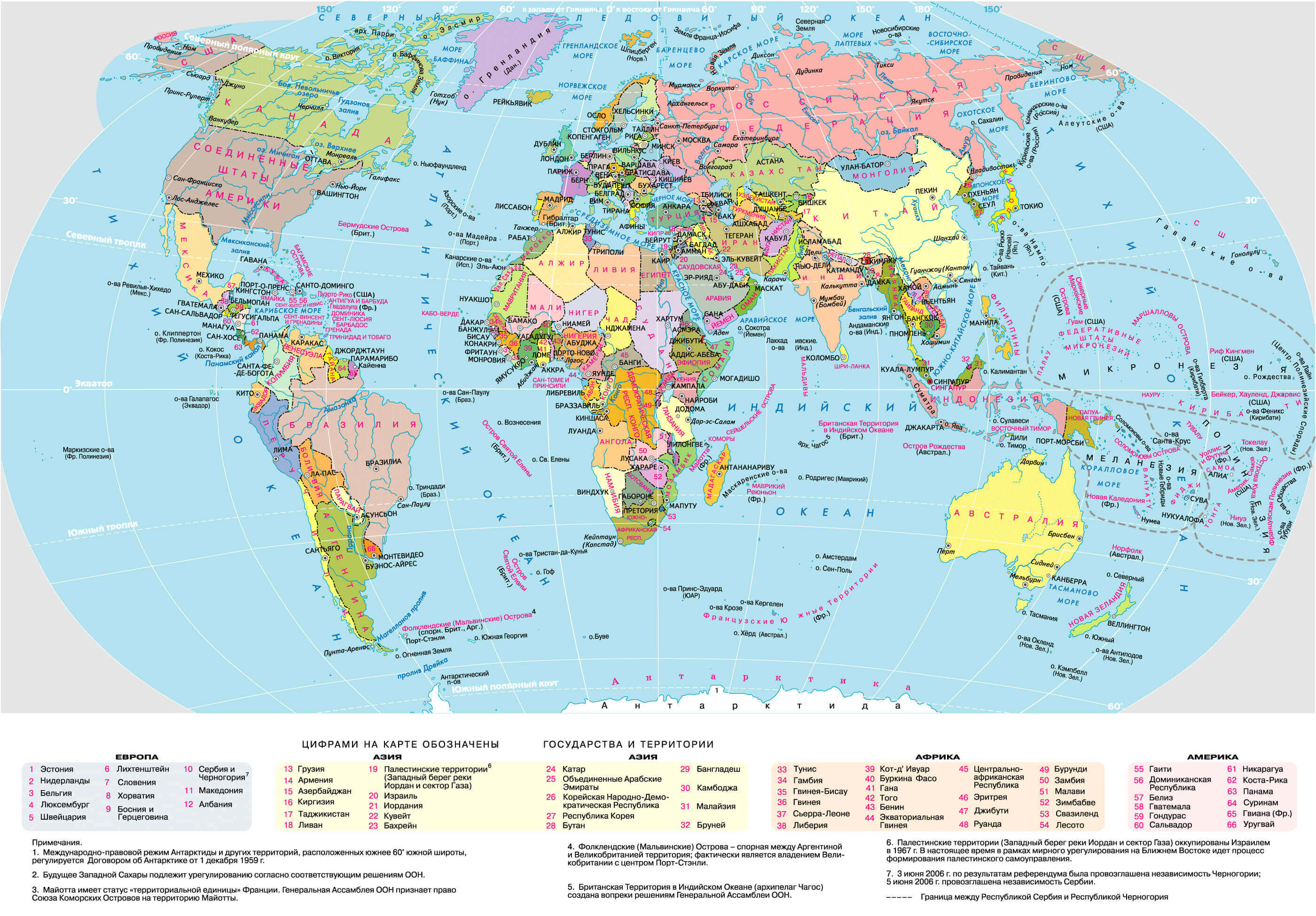
Printable large political map of the World in Russian
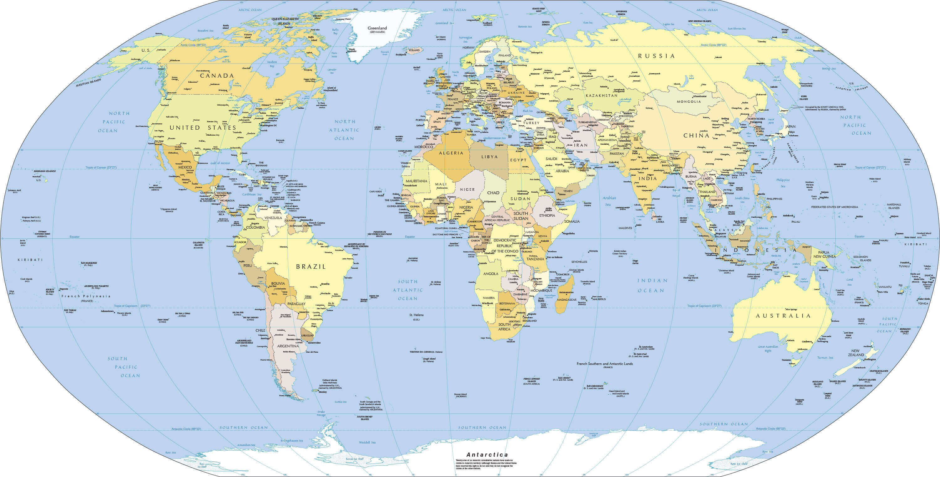
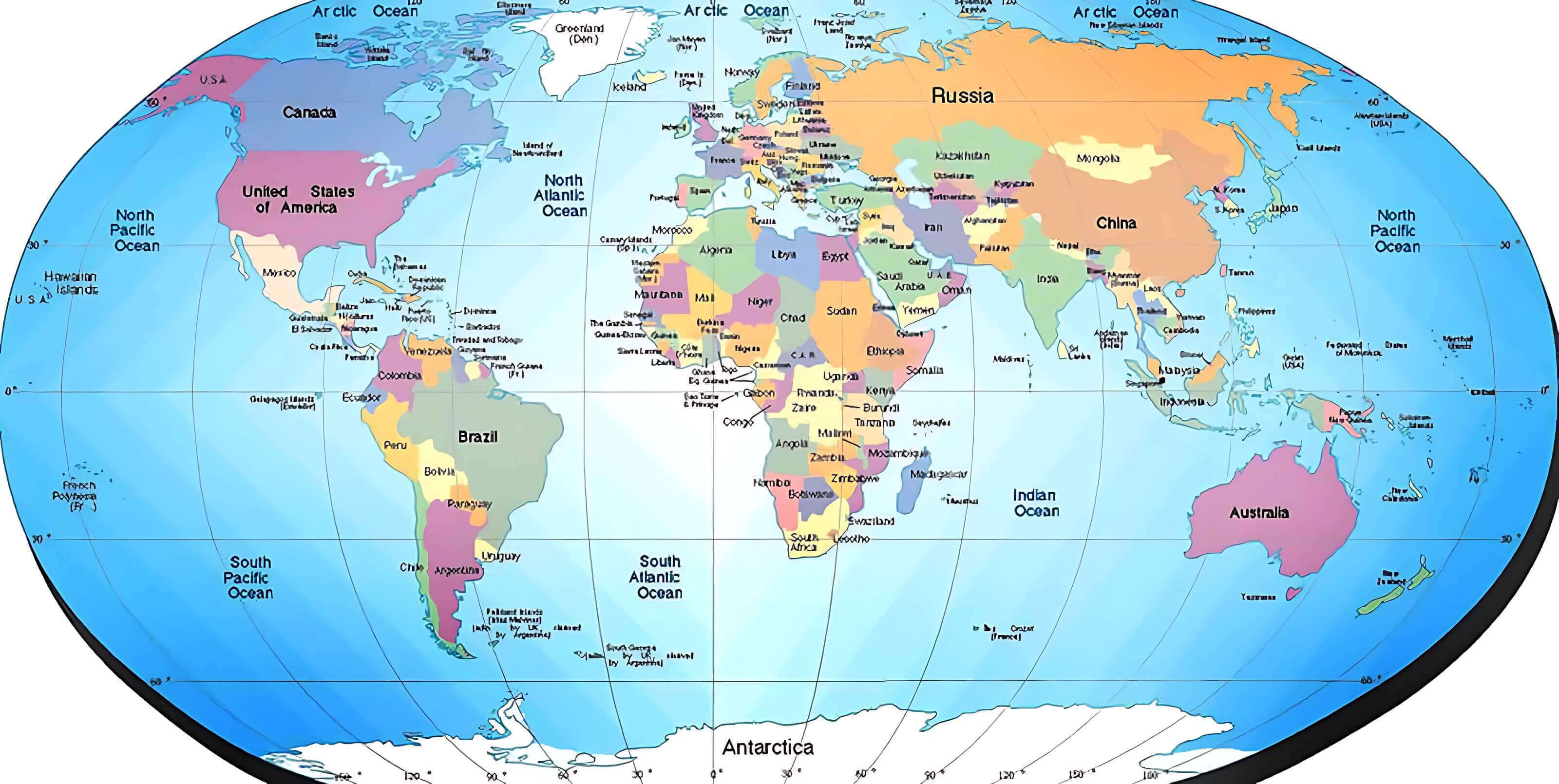
Printable map of the World with countries and major cities
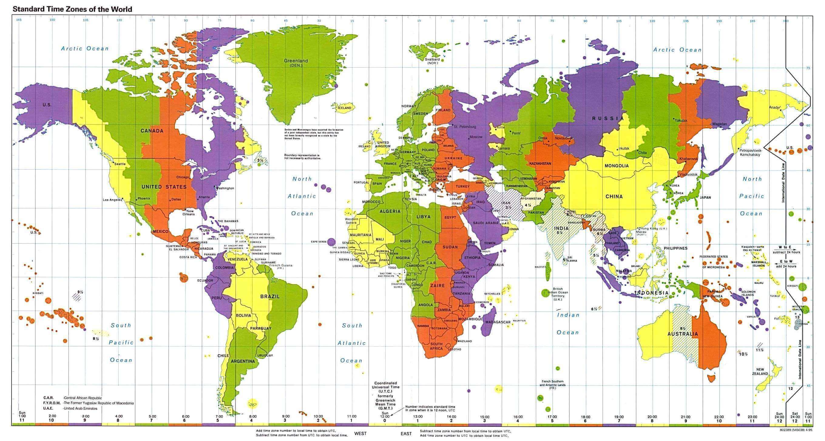
Printable standard time zones map of the World
Printable World map with countries and capitals
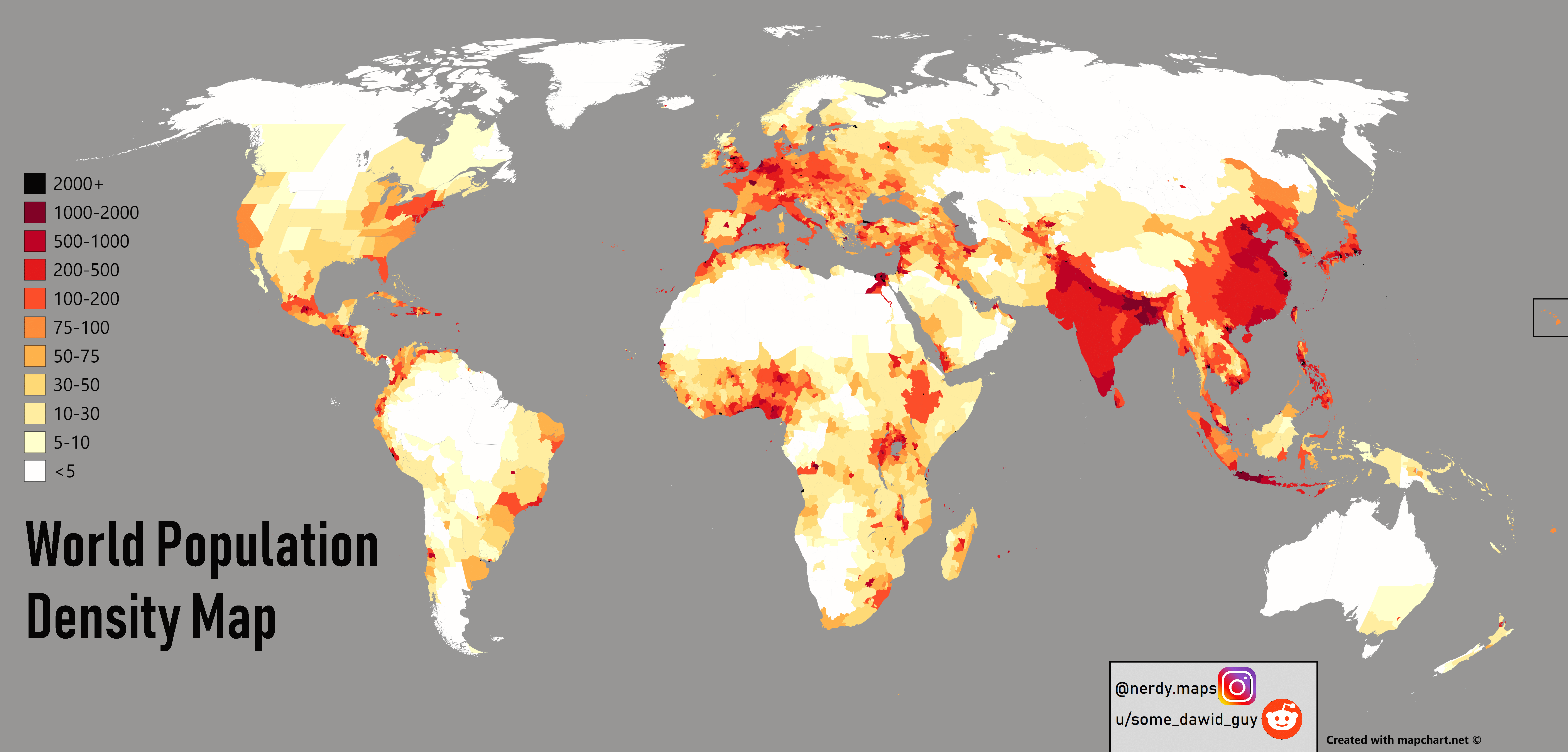
Printable World population density map
World countries printable map
World printable physical map
World printable blank map
World printable cities physical map
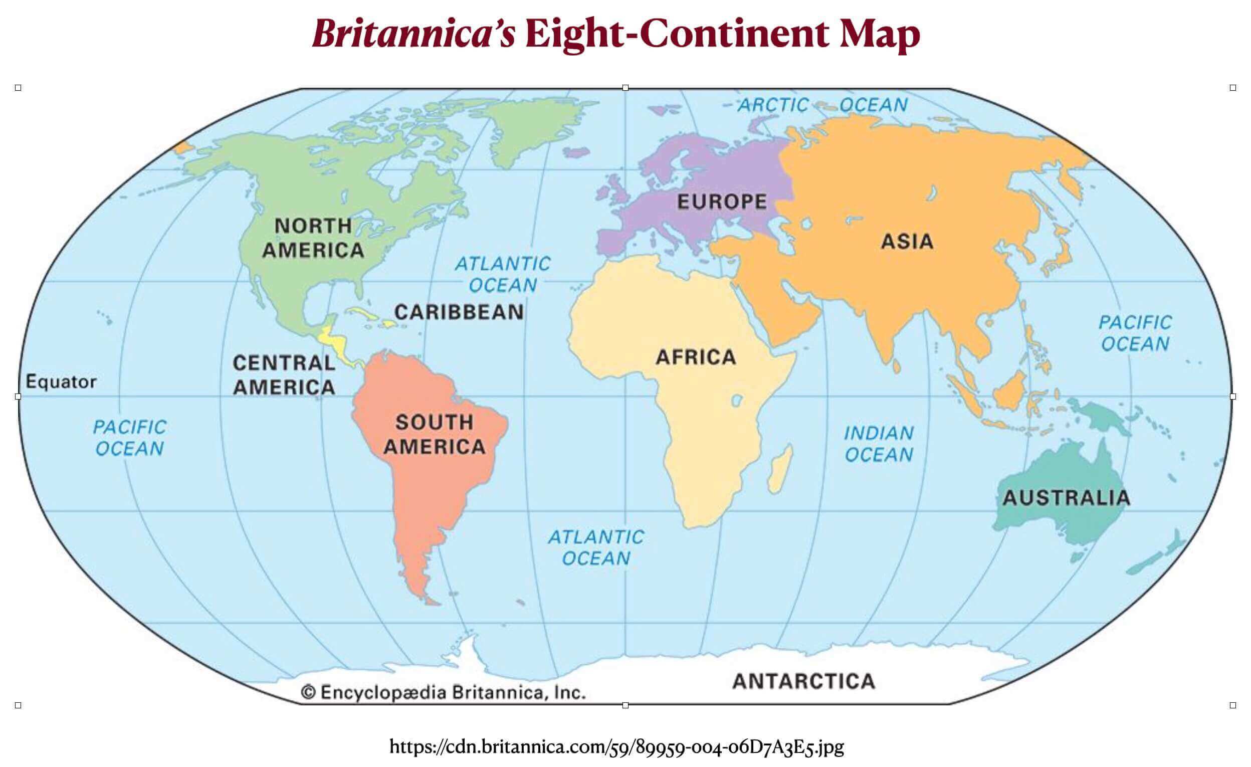
World printable continents map
World printable map with longitude and latitude
World printable maps with countries

World printable outlined country borders map
Feel free to explore these pages as well: