
Eastern Europe Map

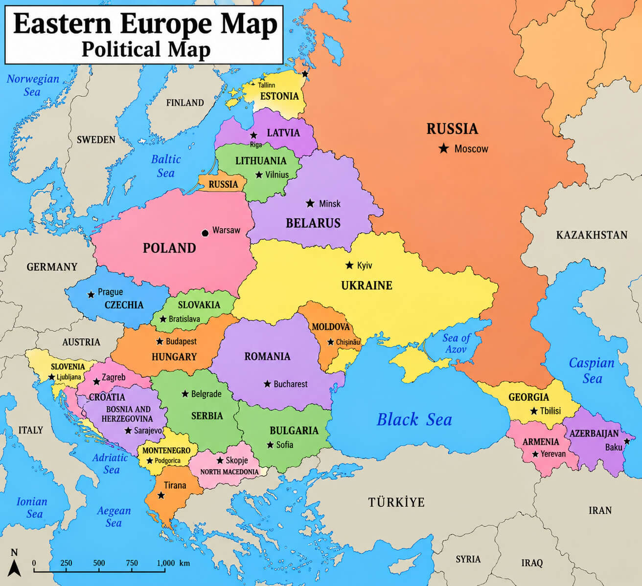
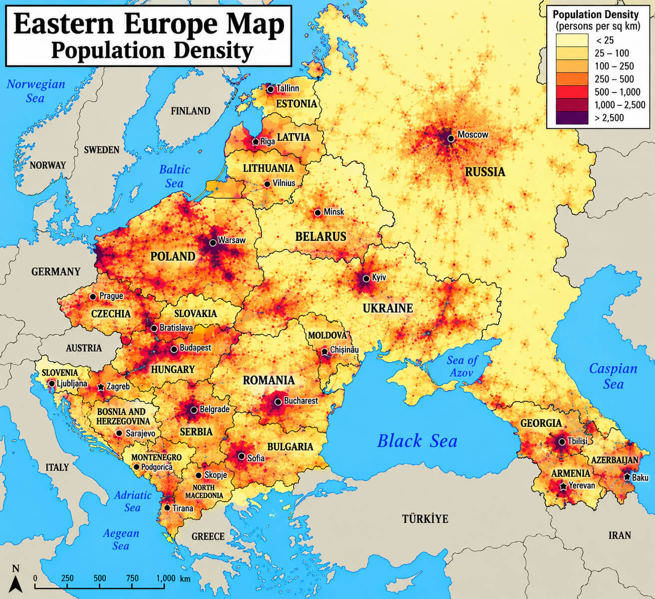
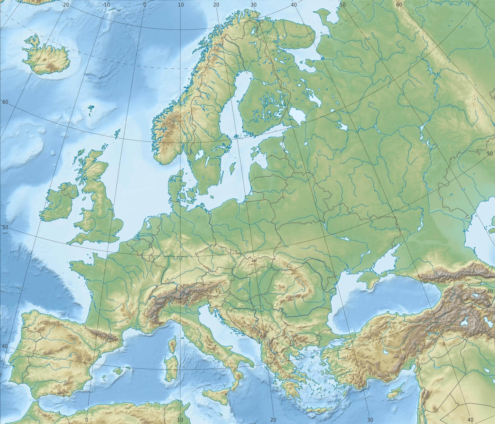
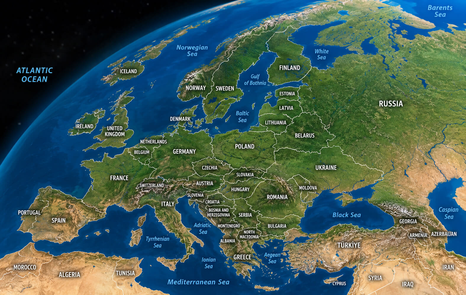
Explore Eastern Europe with a collection of detailed maps, including blank, political, physical, relief, satellite, population density and regional maps. Use the Eastern Europe blank map to study countries, borders and locations, or compare it with labeled maps showing major cities, landscapes and geographic features across the region.
Central and Eastern Europe map
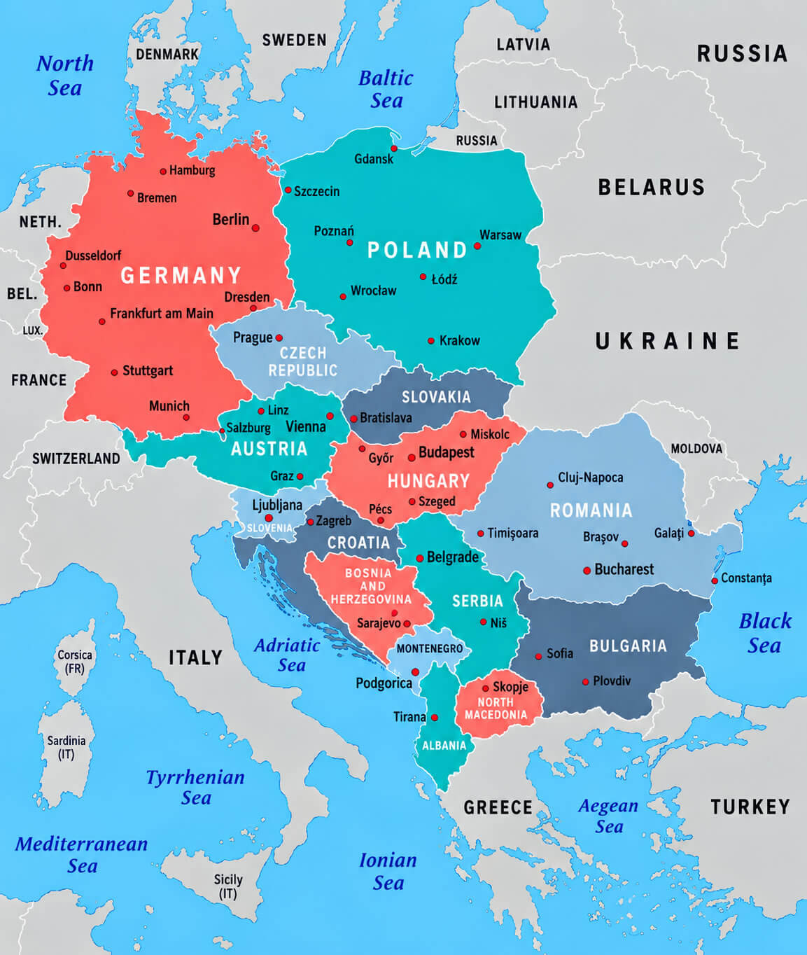
This detailed map of Central and Eastern Europe, featuring Germany, Poland, Austria, Hungary, Romania, Bulgaria, Serbia, Croatia, Slovakia, the Czech Republic and neighboring countries. The map highlights national borders, major cities, capitals and surrounding seas, making it a useful reference for understanding the geography of Central and Eastern Europe.
Christianity expansion in Europe map
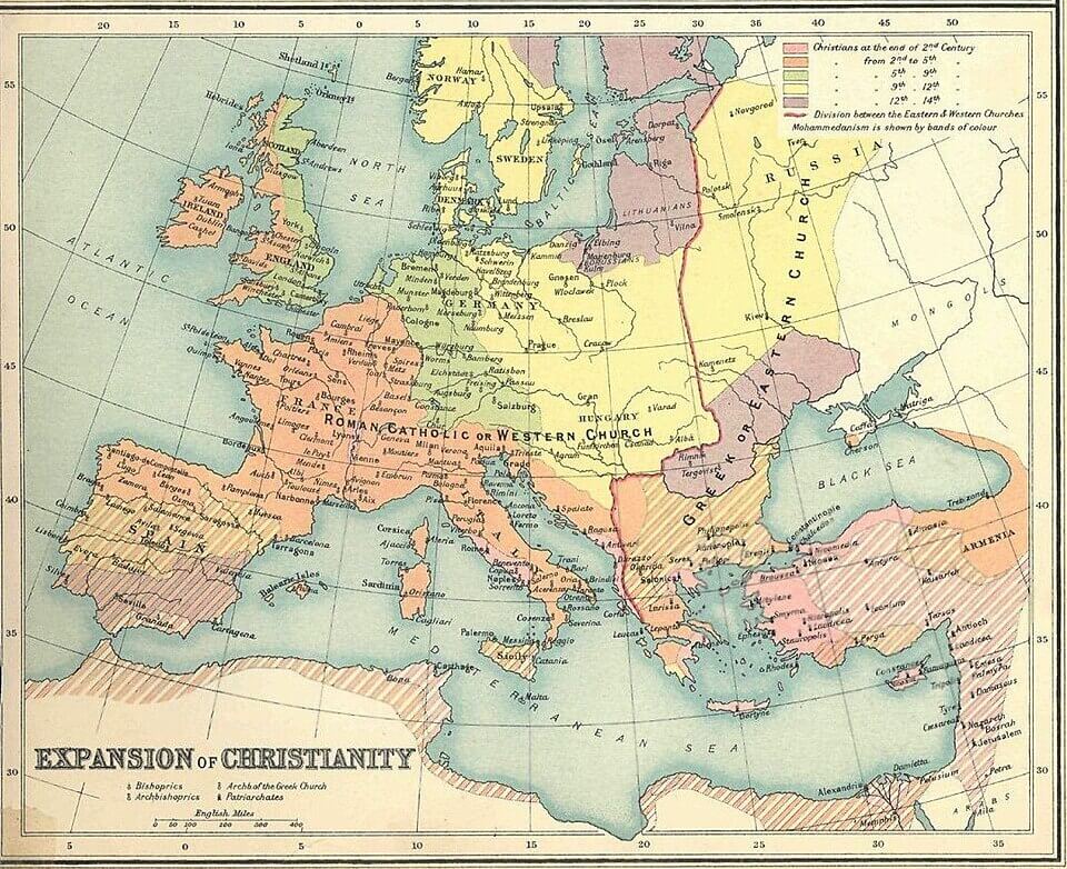
Eastern Europe countries map
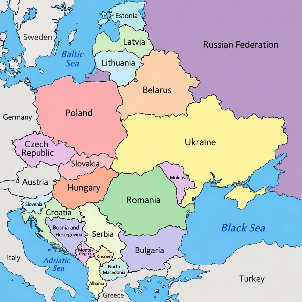
Eastern Europe physical map
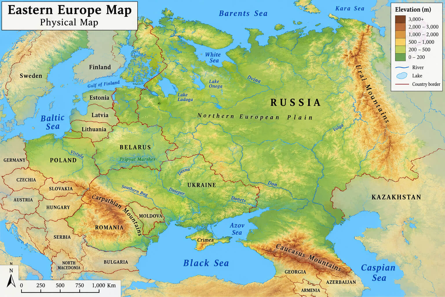
Eastern Europe political map
Eastern Europe population density map
Eastern Europe relief map
Eastern Europe satellite map
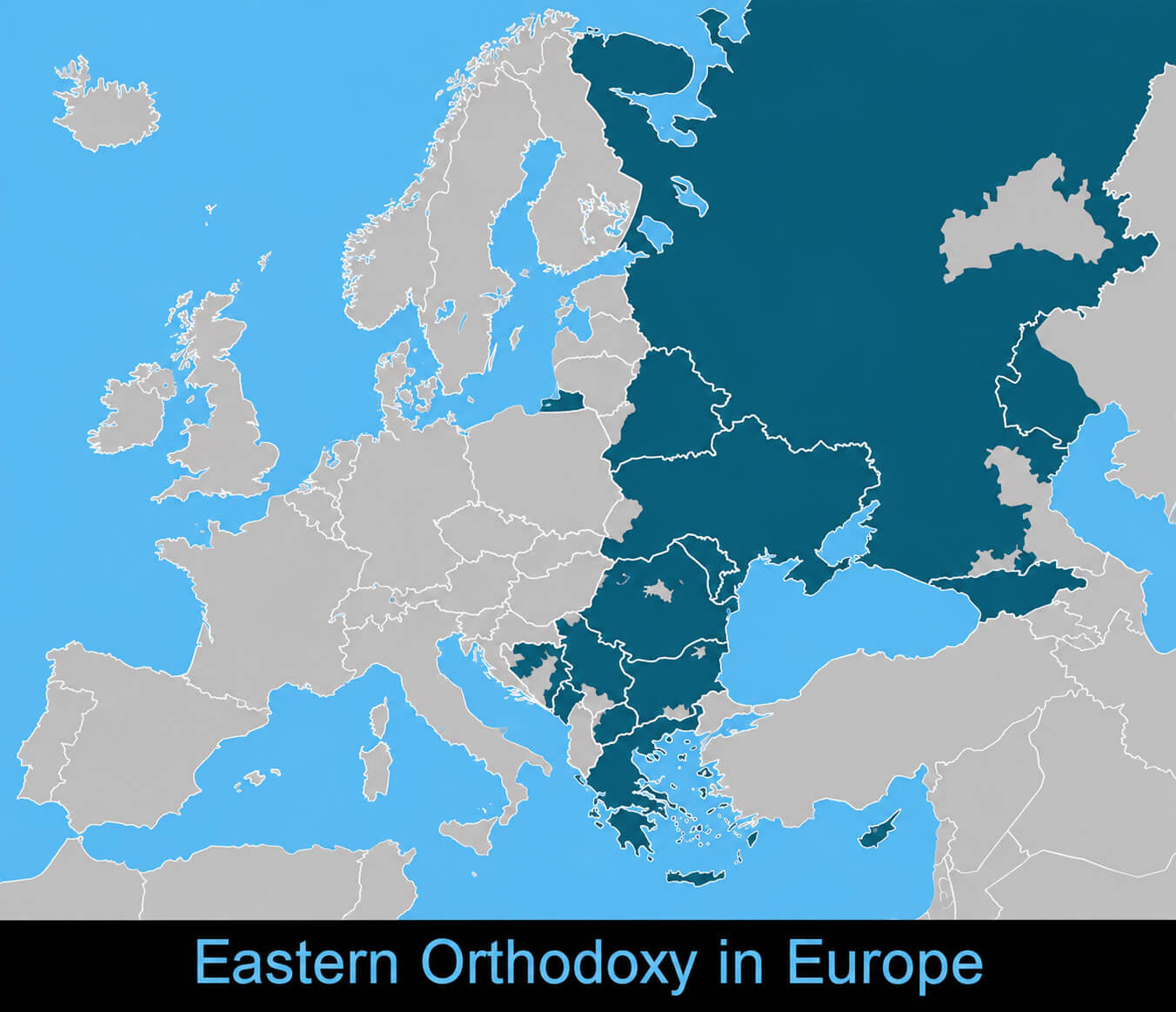
Eastern Orthodox Christianity Europe map
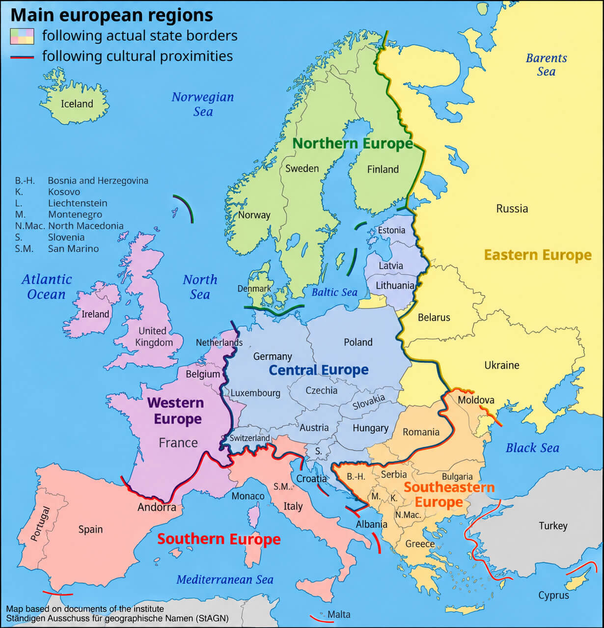
Europe regions map
Feel free to explore these pages as well:
- Europe Map
- Europe Political Map
- Europe Physical Map
- Europe High Resolution Map
- Europe Countries Map
- Europe Satellite Map
- Europe Cities Map
- Europe Religion Map
- Europe Topography Map
- Europe Historical Map
- Europe Economy Map
- Europe Population Map
- Europe Road Map
- Europe Time Zone Map
- Europe Blank Map
- Western Europe Map
- Northern Europe Map
- Southern Europe Map
- Eastern Europe Map
- European Union Map