
Europe Population Map

Explore our Europe population maps, showing population density, distribution, growth and demographic patterns across European countries. Compare densely populated urban regions with sparsely populated areas through detailed maps covering population by country, settlement patterns, life expectancy and demographic change. These maps provide a clear visual guide to Europe’s population geography.
Population density map of Europe

This Europe population density map, showing how population is distributed across the continent. Color-coded areas represent different density levels, highlighting densely populated regions around major urban centers and less populated areas across Northern and Eastern Europe. The map provides a clear visual comparison of population concentration and settlement patterns throughout Europe.
Europe population map in 2016

Population growth map of Europe in 2021

Muslim population density map in Europe

Europe Muslim population map 2010

Europe Muslim population map 2016
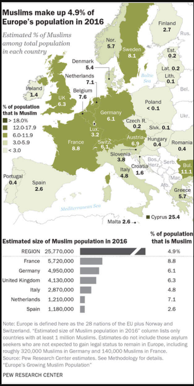
Europe Muslim population map in the World

Europe Muslim population map

Europe population density map 2006
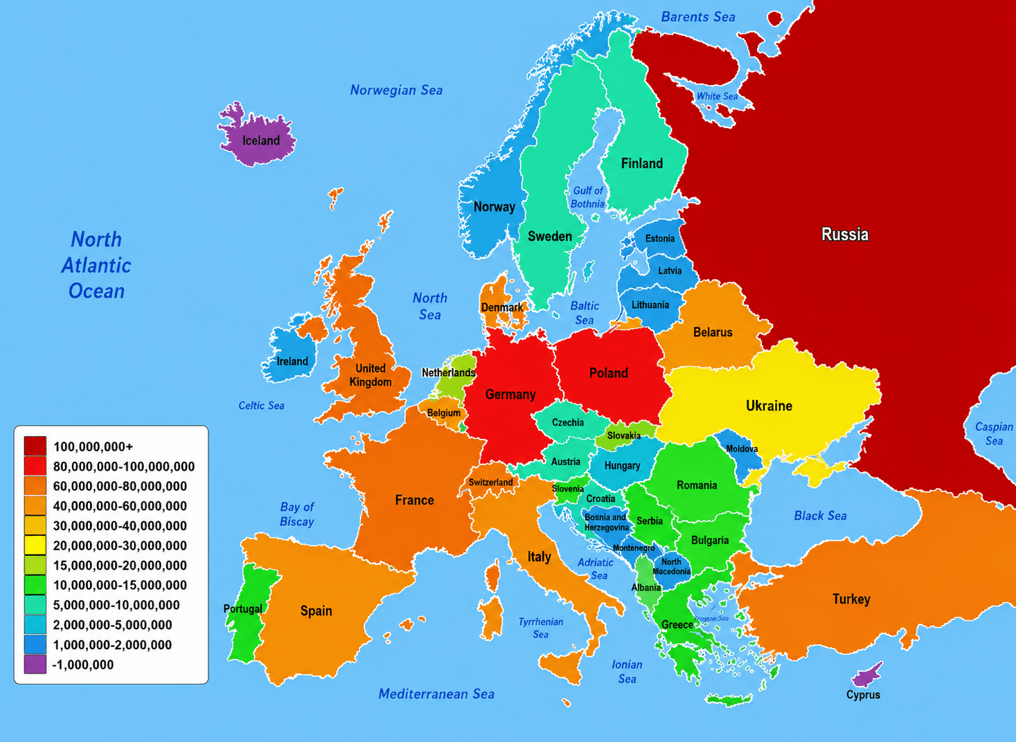
Europe population density map
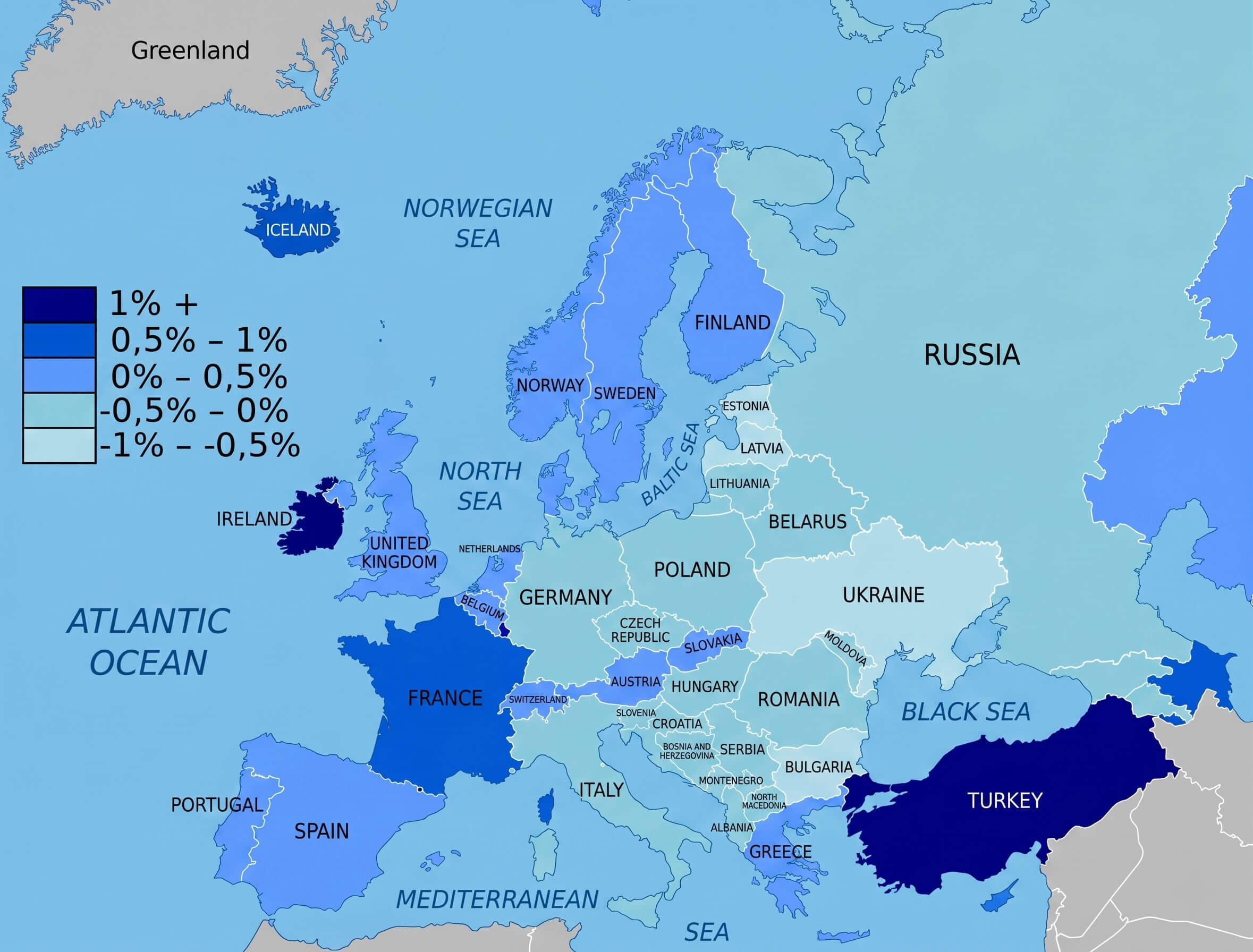
Europe population desnity map in 2017

Europe population map with inhabitants

Europe population map

Europe racial map
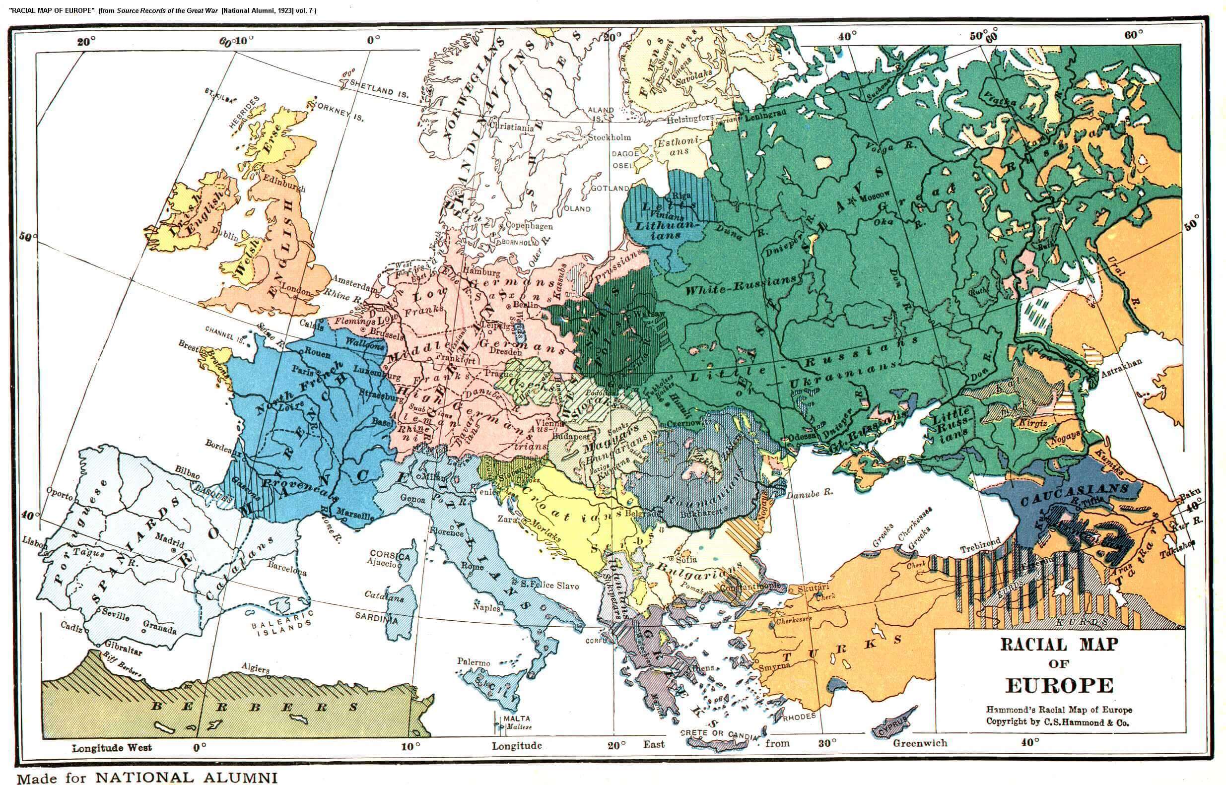
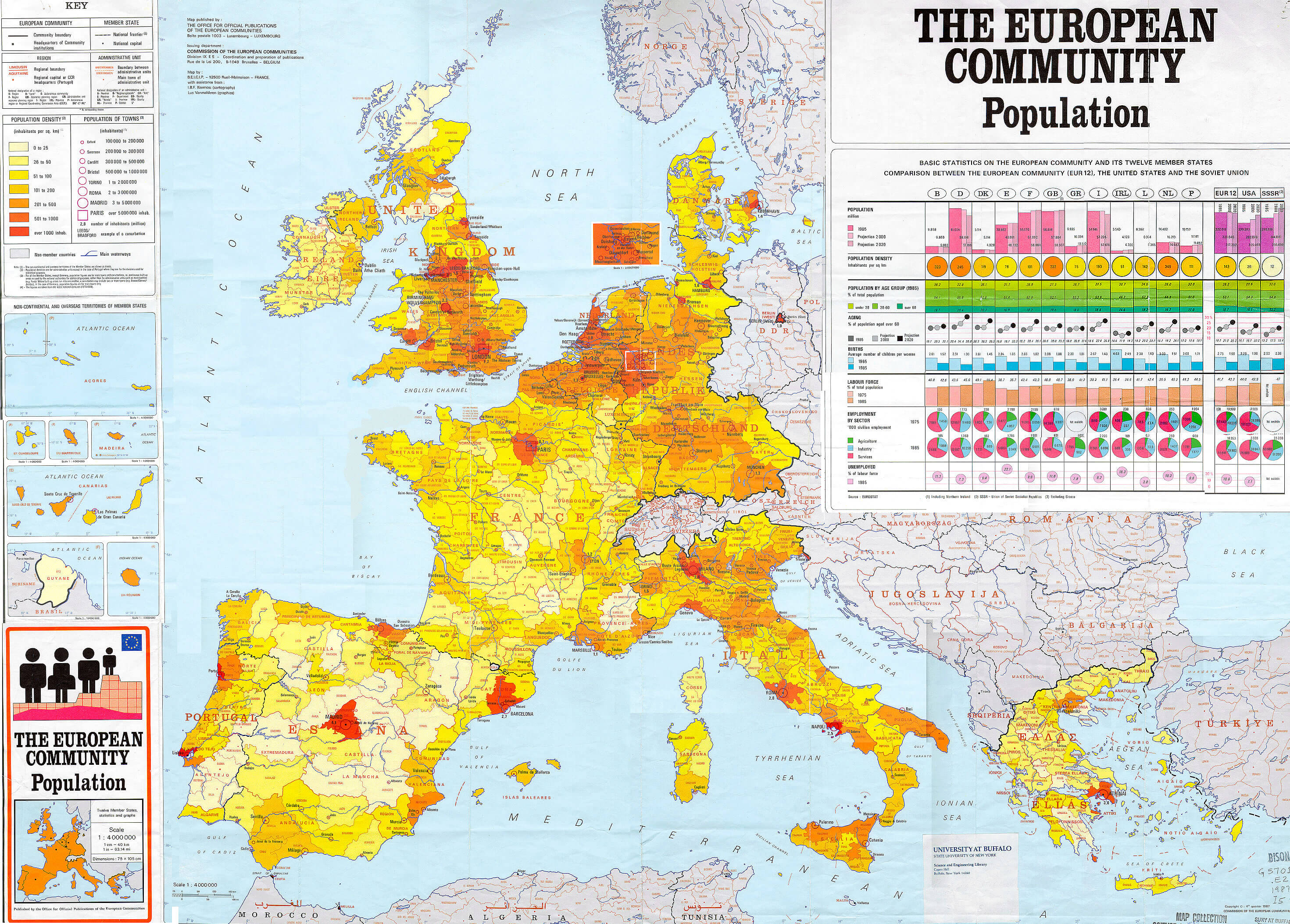
European comnunity population map
European countries by population map in 2023

European countries Muslim population map in 2020

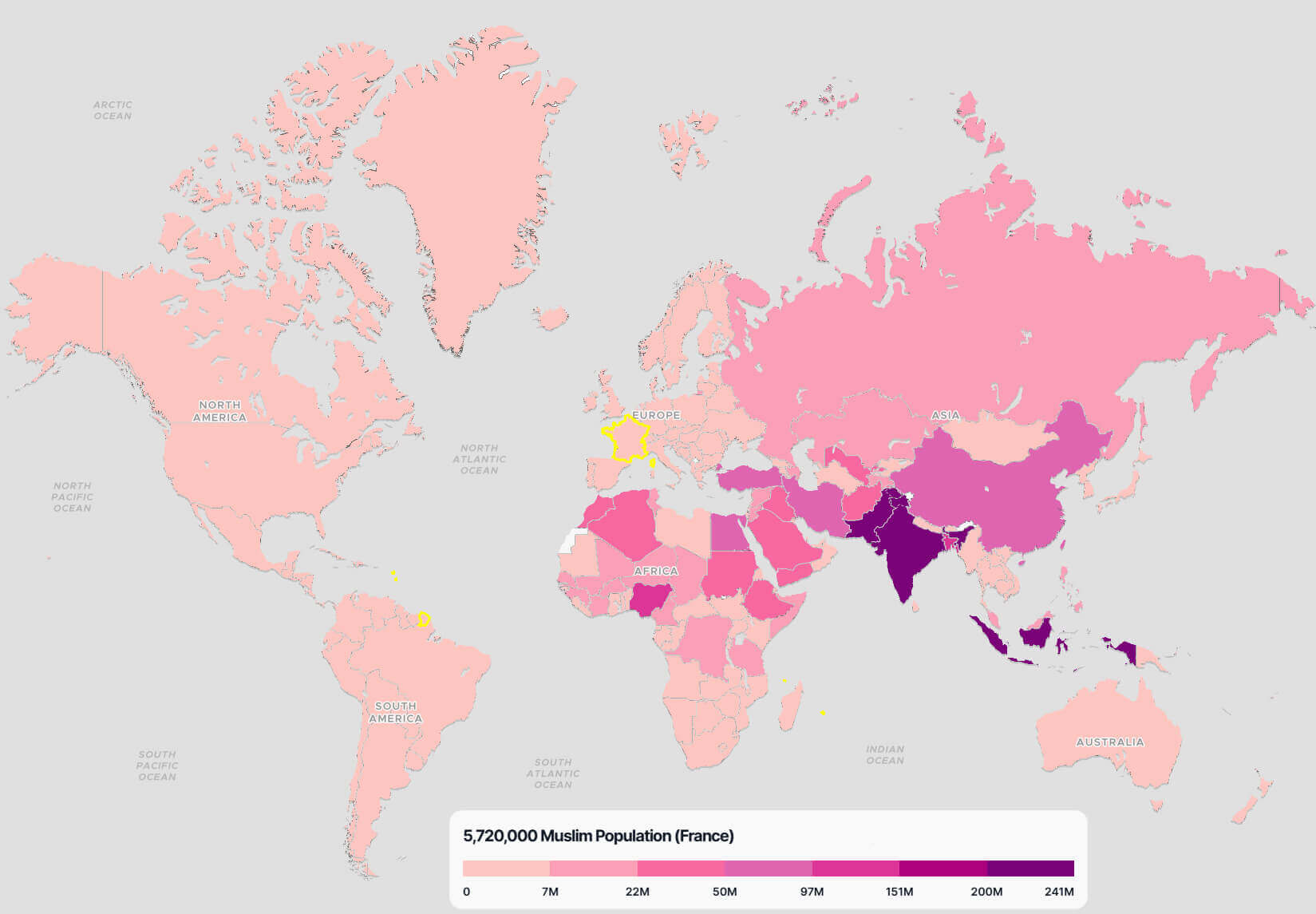
France Muslim population map in the World
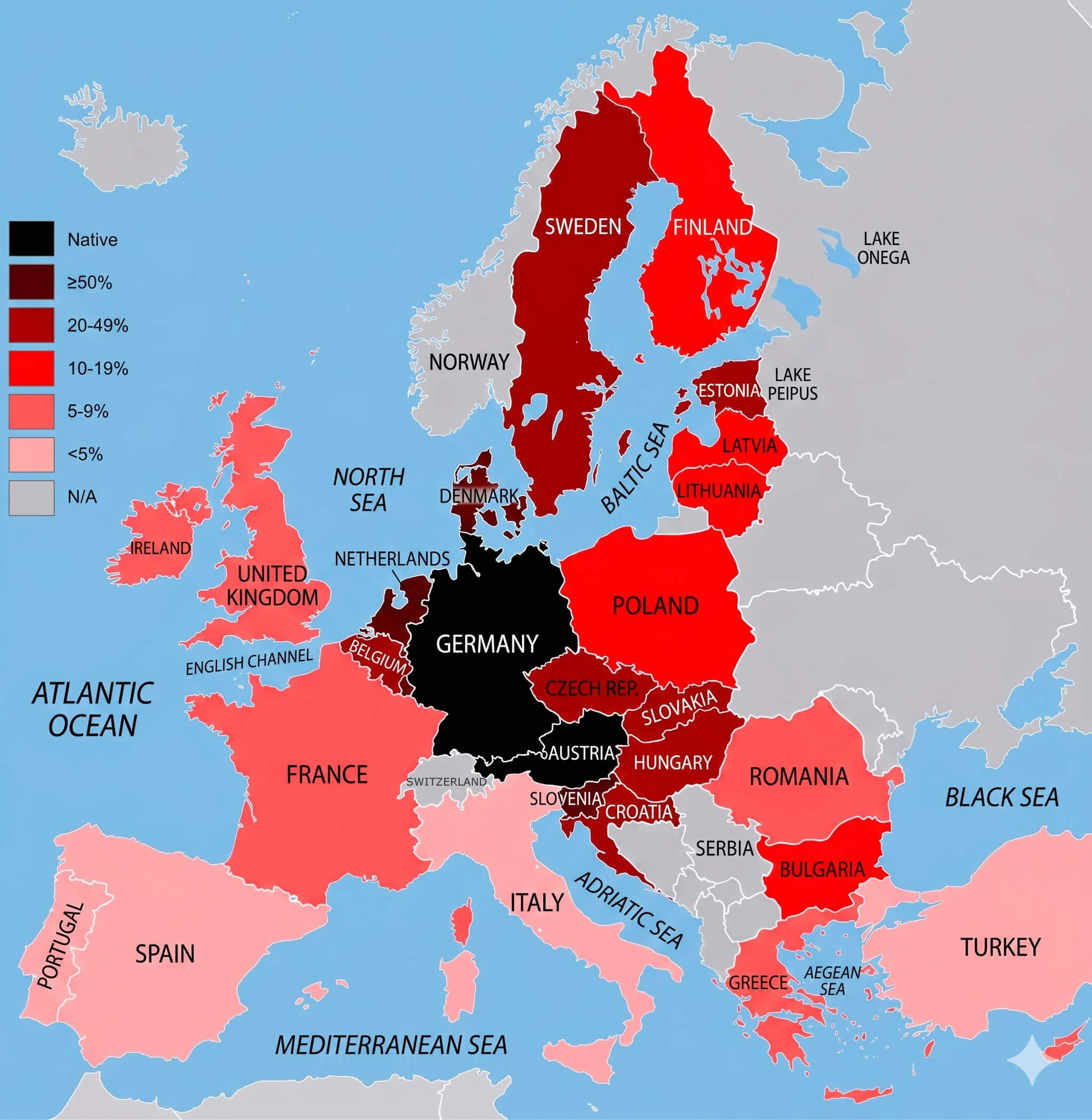
German language knowledge map Europe
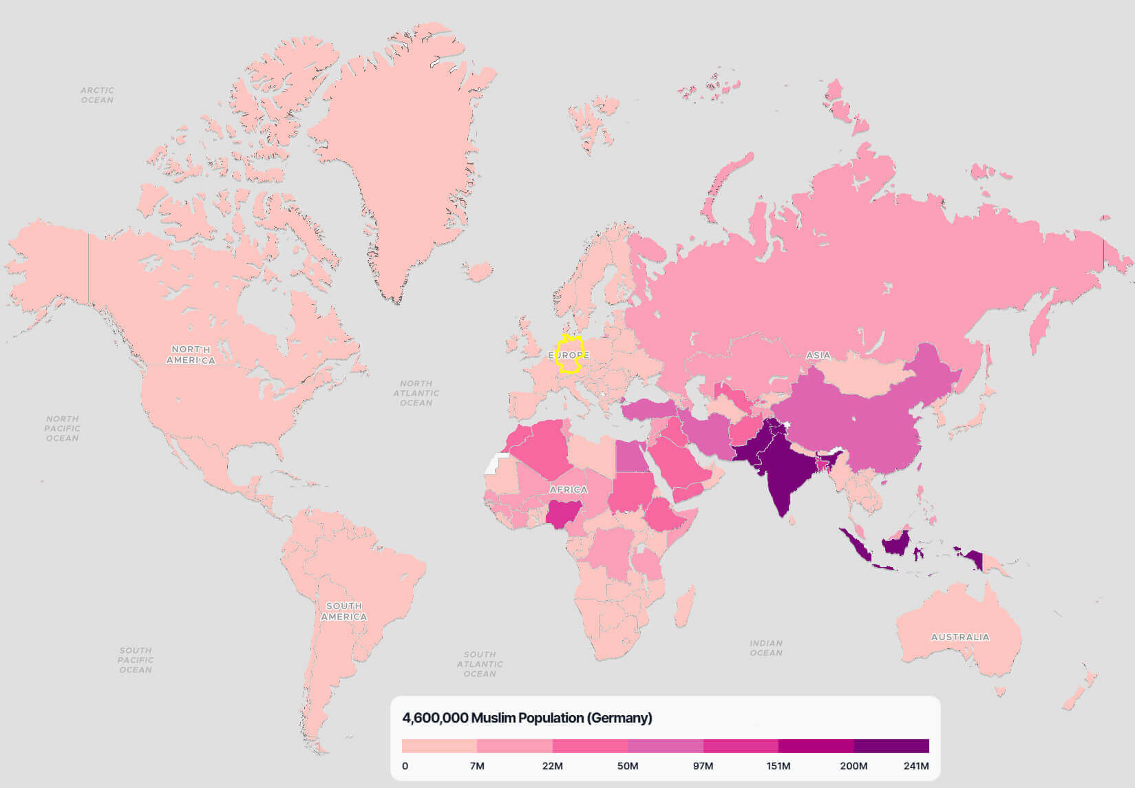
Germany Muslim population map in the World
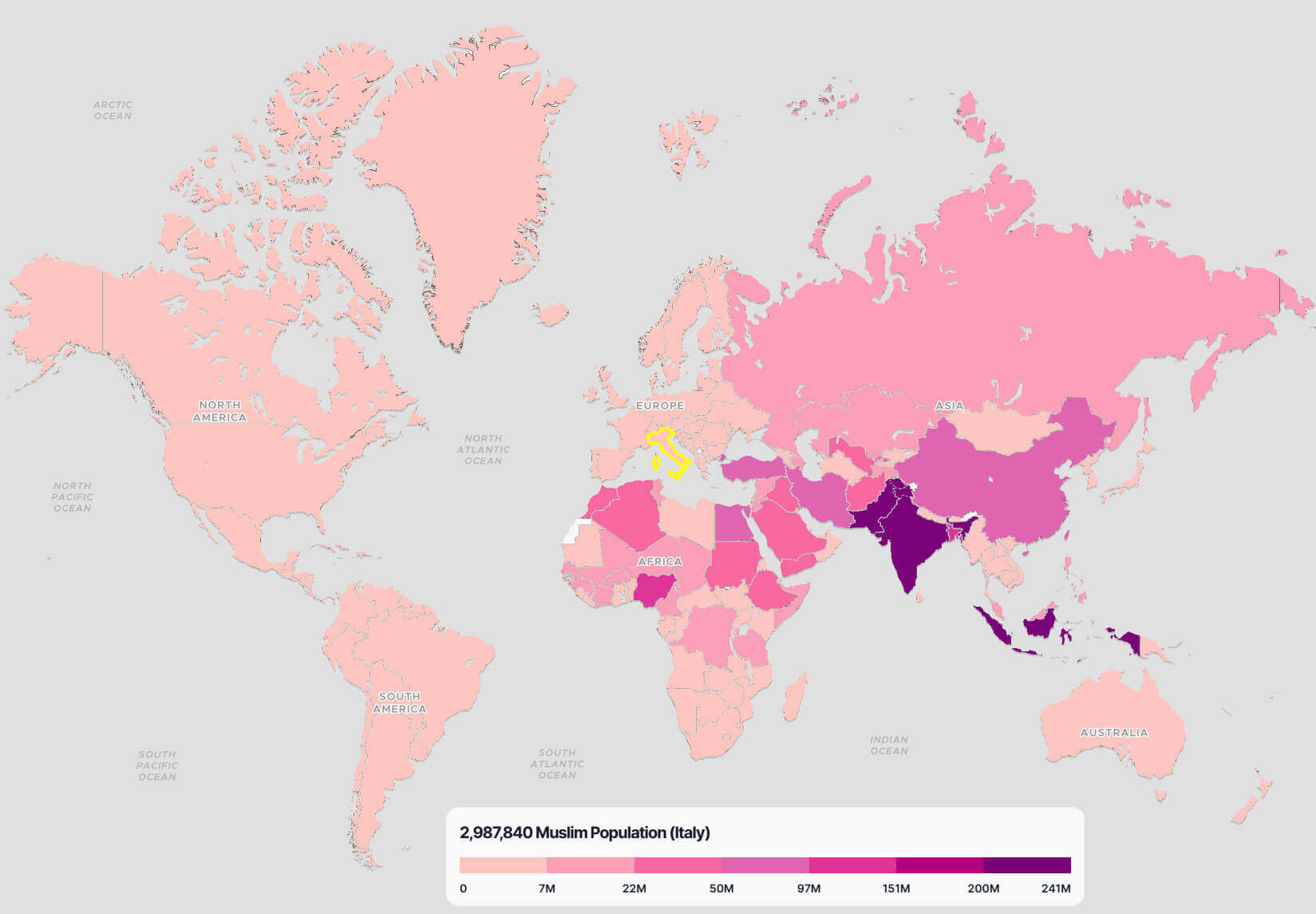
Italy Muslim population map in the World
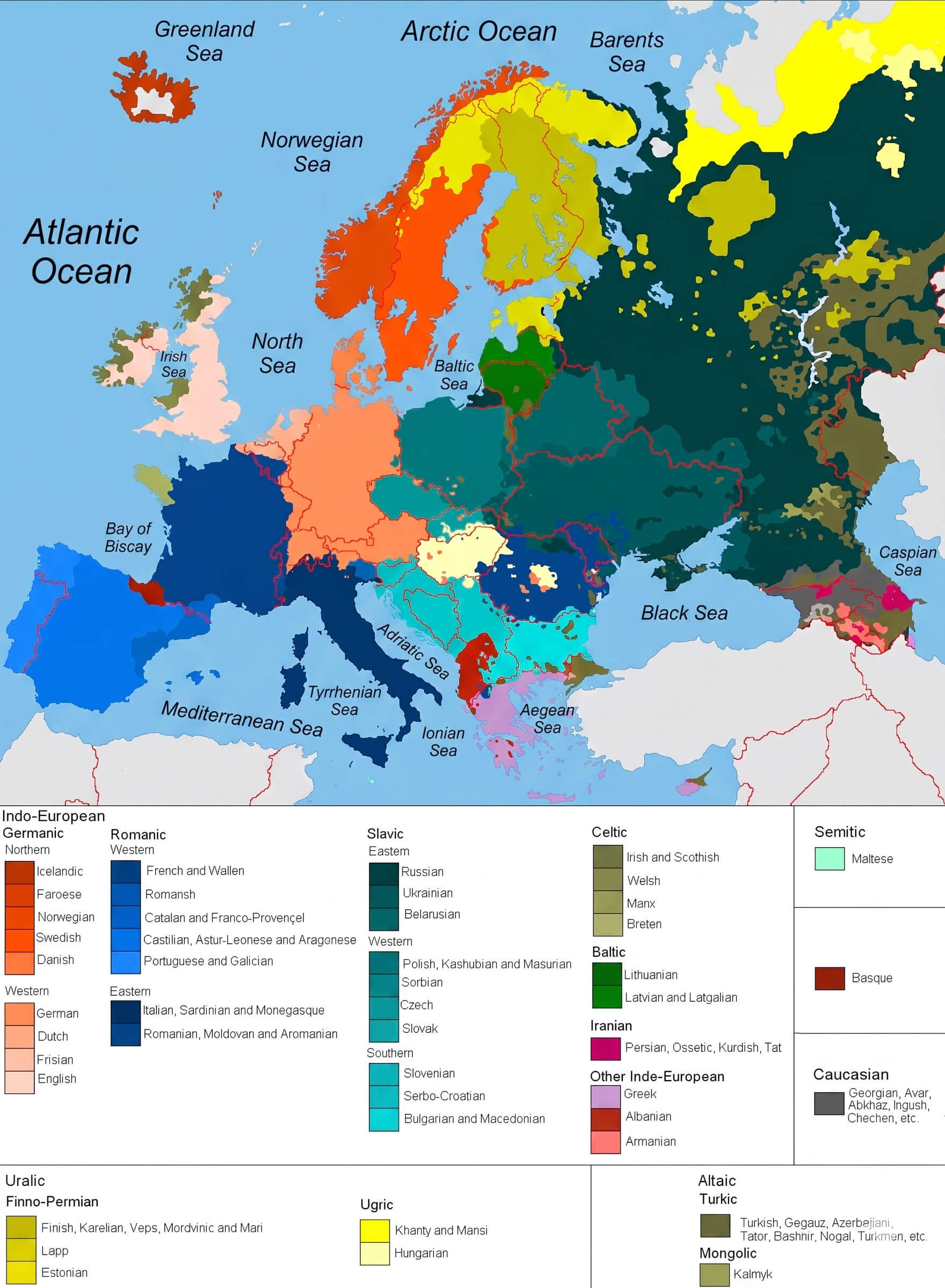
Languages spoken in Europe map
Life expectancy map in EU 2019

Life expectancy map in EU 2020

Life expectancy map in EU 2021

Linguistic map of Europe
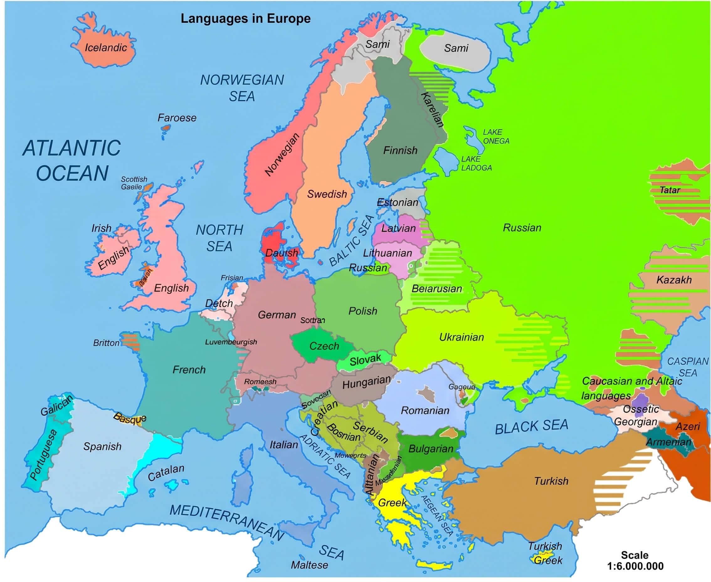
Major languages of map Europe

Muslim population growth map in Europe by 2050

Population density map of the EU in the night

UK Muslim population map in the World

Western Europe population map

Feel free to explore these pages as well:
- Europe Map
- Europe Political Map
- Europe Physical Map
- Europe High Resolution Map
- Europe Countries Map
- Europe Satellite Map
- Europe Cities Map
- Europe Religion Map
- Europe Topography Map
- Europe Historical Map
- Europe Economy Map
- Europe Population Map
- Europe Road Map
- Europe Time Zone Map
- Europe Blank Map
- Western Europe Map
- Northern Europe Map
- Southern Europe Map
- Eastern Europe Map
- European Union Map