Historical Maps of Asia: Empires, Kingdoms, and Ancient Civilizations
Step back in time with this fascinating collection of historical and political maps of Asia. From ancient Ptolemaic depictions to the rise of the Mongol Empire, World War II campaigns, and 19th-century geopolitical shifts, these maps offer a visual journey through Asia's complex past. Covering key events and transformations between 1300 and 2003, each map helps bring history to life.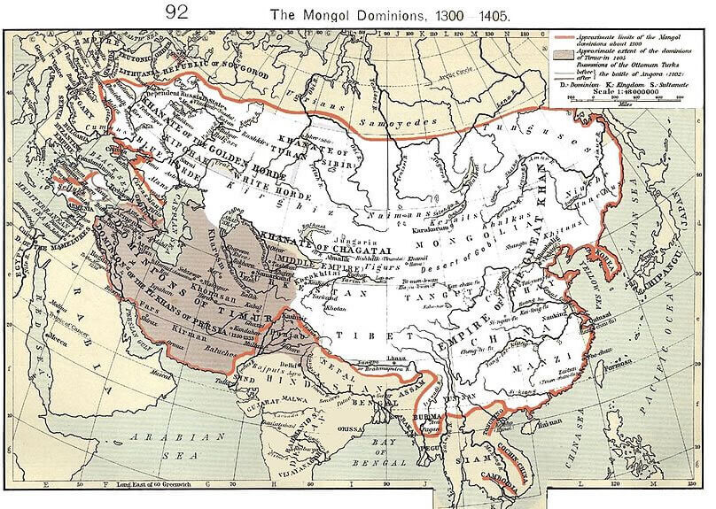
East Asia Historical Map: A Glimpse into Political Geography of the Region
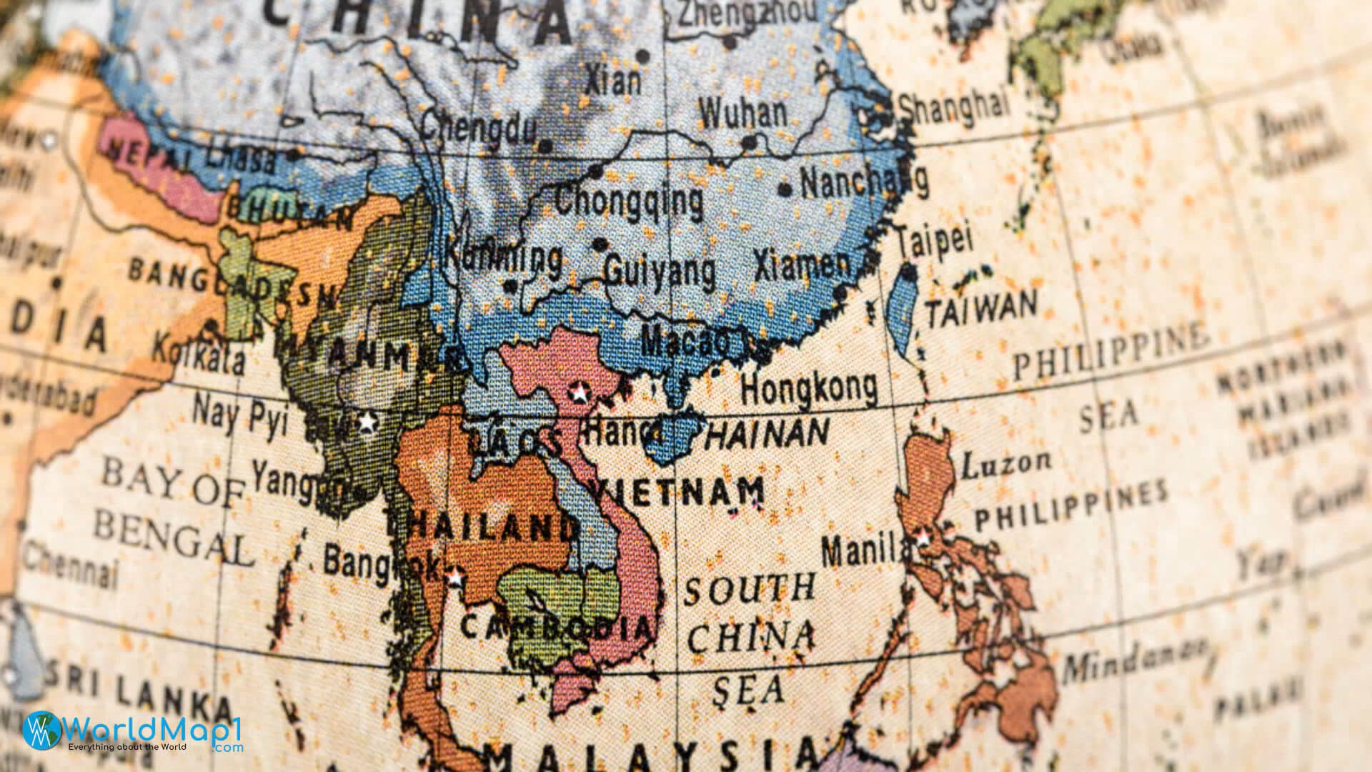 Close-up historical map of East Asia with old borders and major cities labeled
This vintage-style historical map highlights East Asia’s political geography, featuring countries like China, Vietnam, Thailand, Taiwan, and the Philippines with classic typography and aged textures. It showcases historical boundaries, city names, and trade routes, offering insight into past regional divisions and connections.
Close-up historical map of East Asia with old borders and major cities labeled
This vintage-style historical map highlights East Asia’s political geography, featuring countries like China, Vietnam, Thailand, Taiwan, and the Philippines with classic typography and aged textures. It showcases historical boundaries, city names, and trade routes, offering insight into past regional divisions and connections.
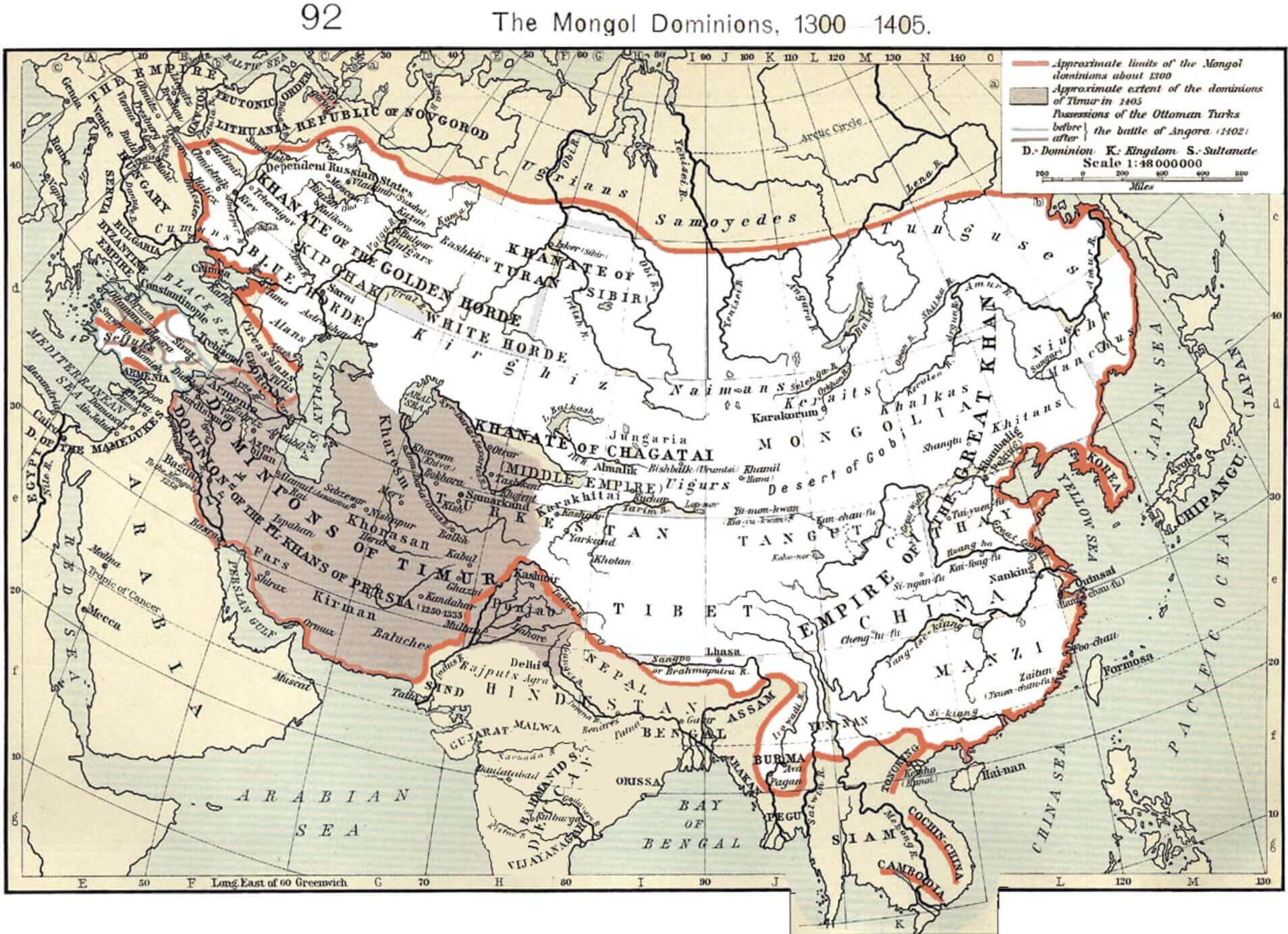
Mongol Empire in Asia (1300–1405): Historical Map of a Vast Dominion
Map of the Mongol Empire in Asia showing divisions and expansion from 1300 to 1405
This historical map illustrates the extent of the Mongol Empire's territory across Asia from 1300 to 1405. It highlights major khanates such as the Golden Horde, the Chagatai Khanate, the Ilkhanate and the Yuan dynasty, providing an insight into the vast influence of the empire stretching from Eastern Europe to the Pacific Ocean.
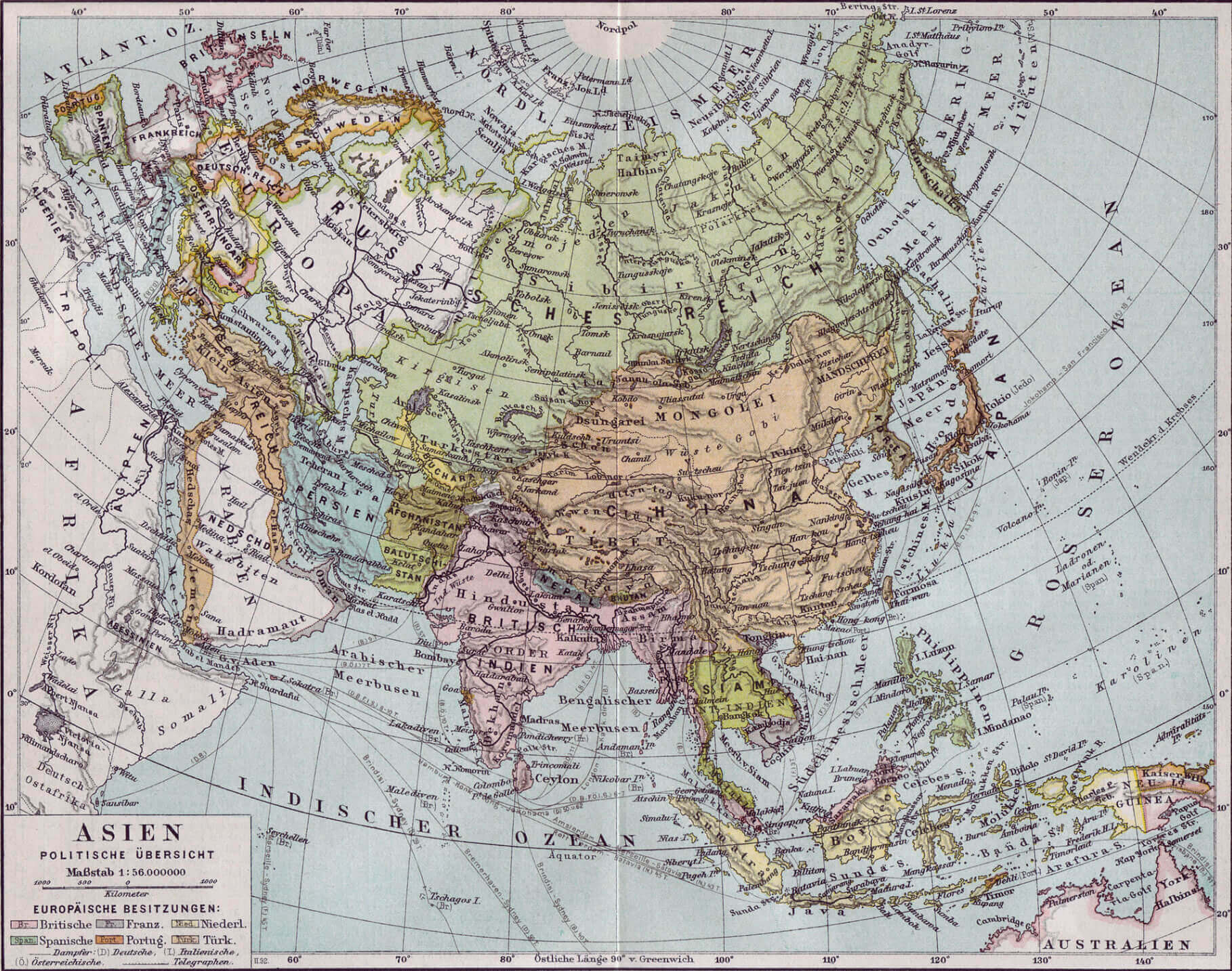
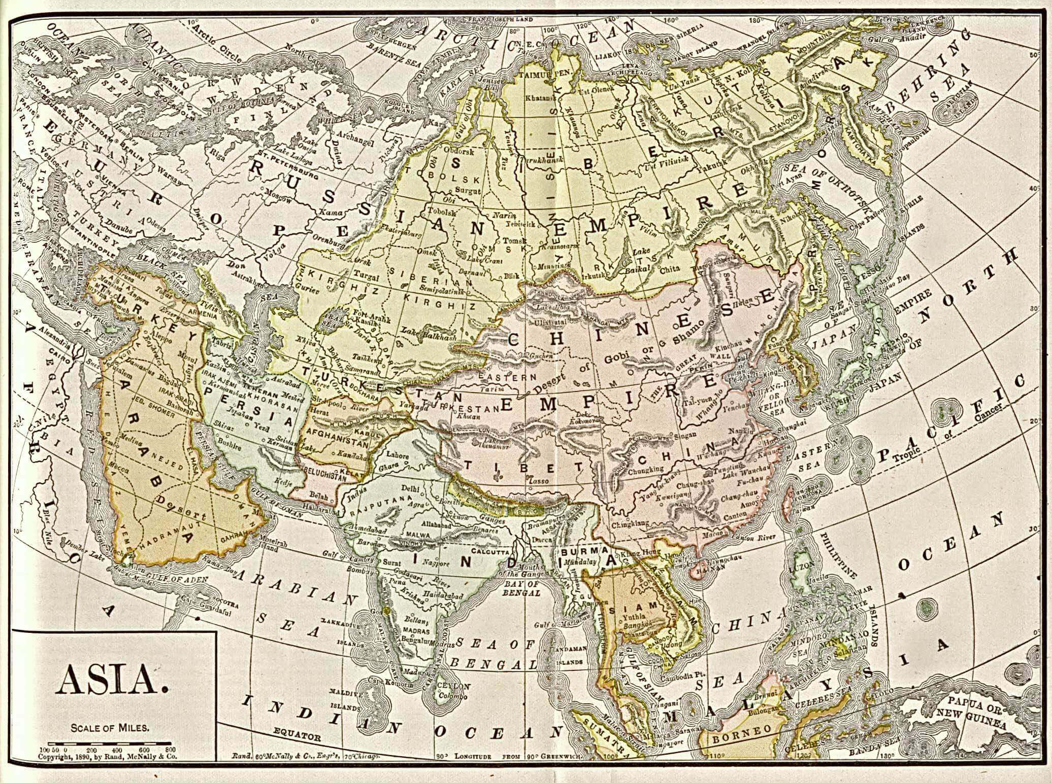
1890 Map of Asia
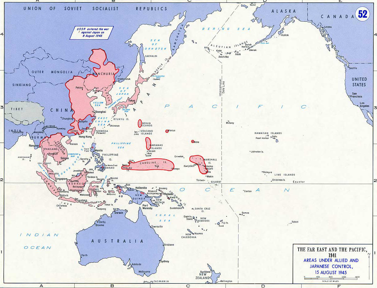
Asia Pacific War Map 1945
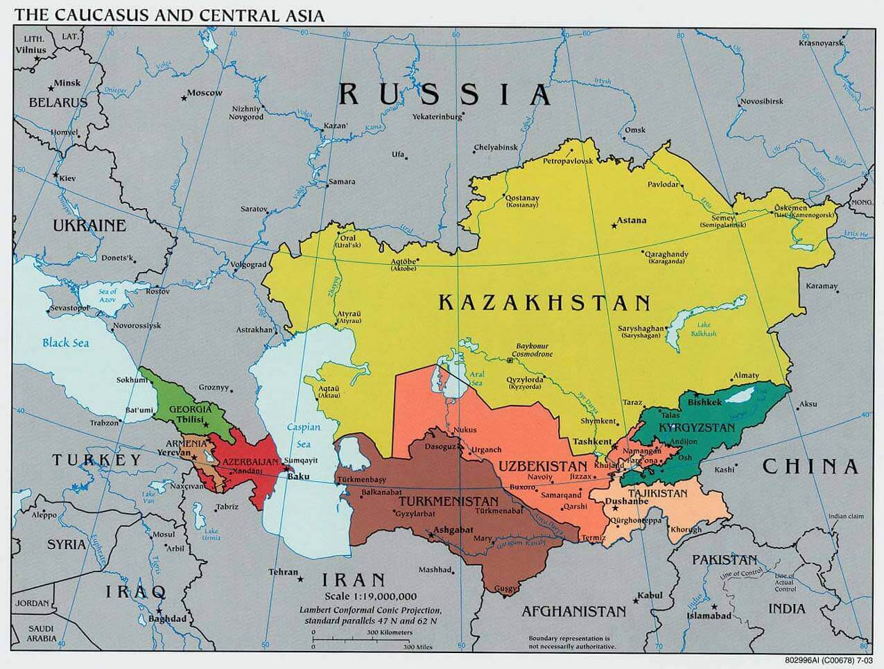
Caucasus Central Asia political Map 2003
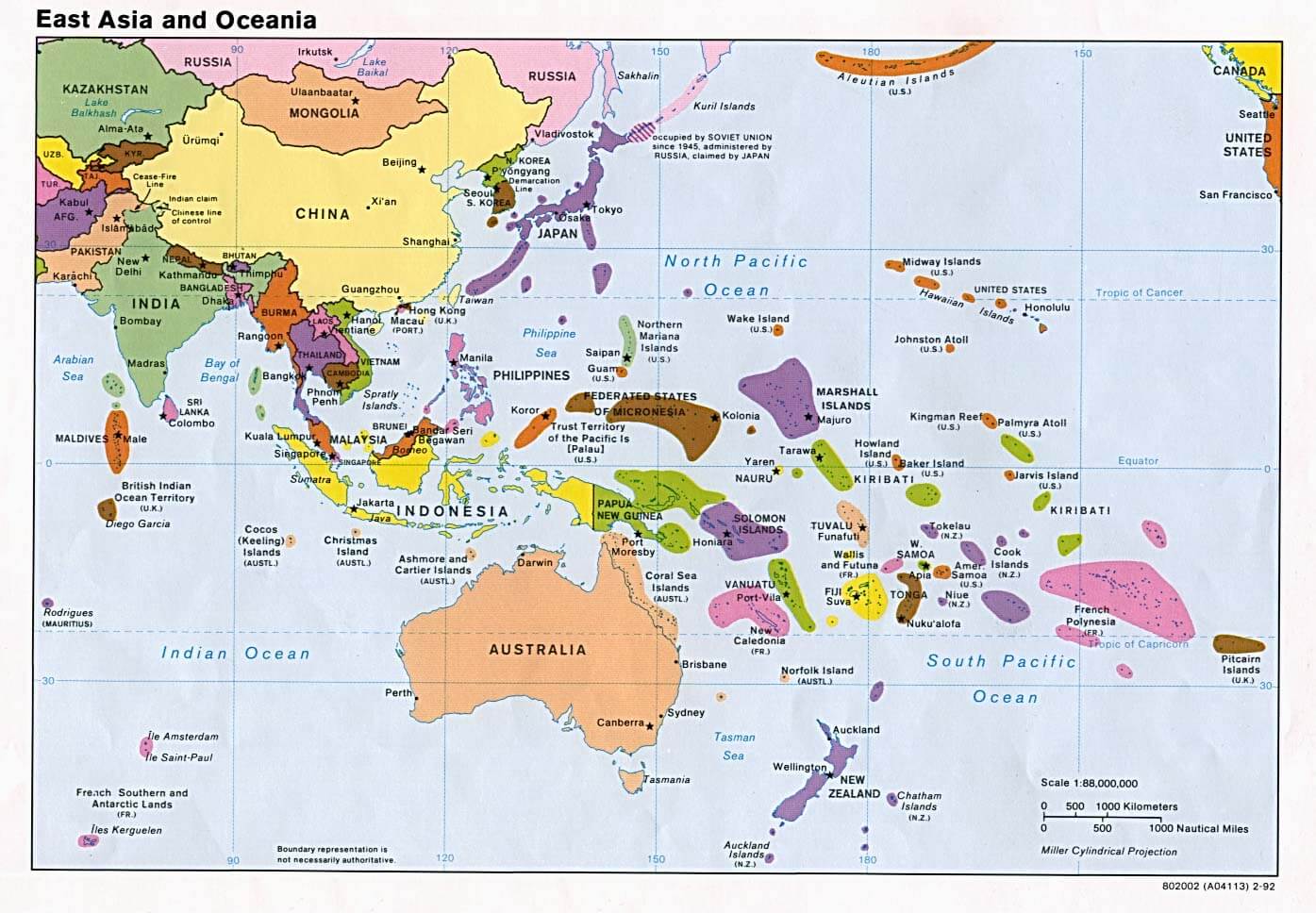
East Asia Oceania political 1992
Map of Asia 1892
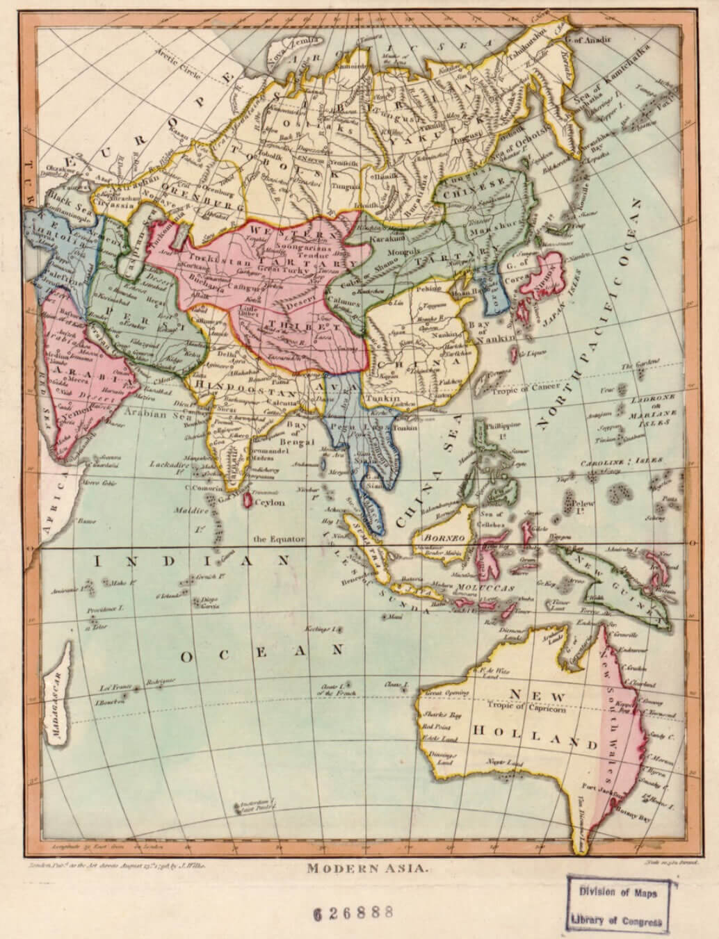
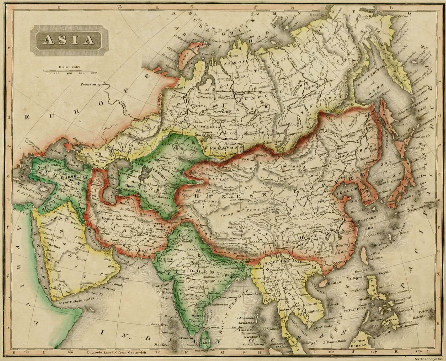
Map of Asia in 1796
Map of Asia in 1825
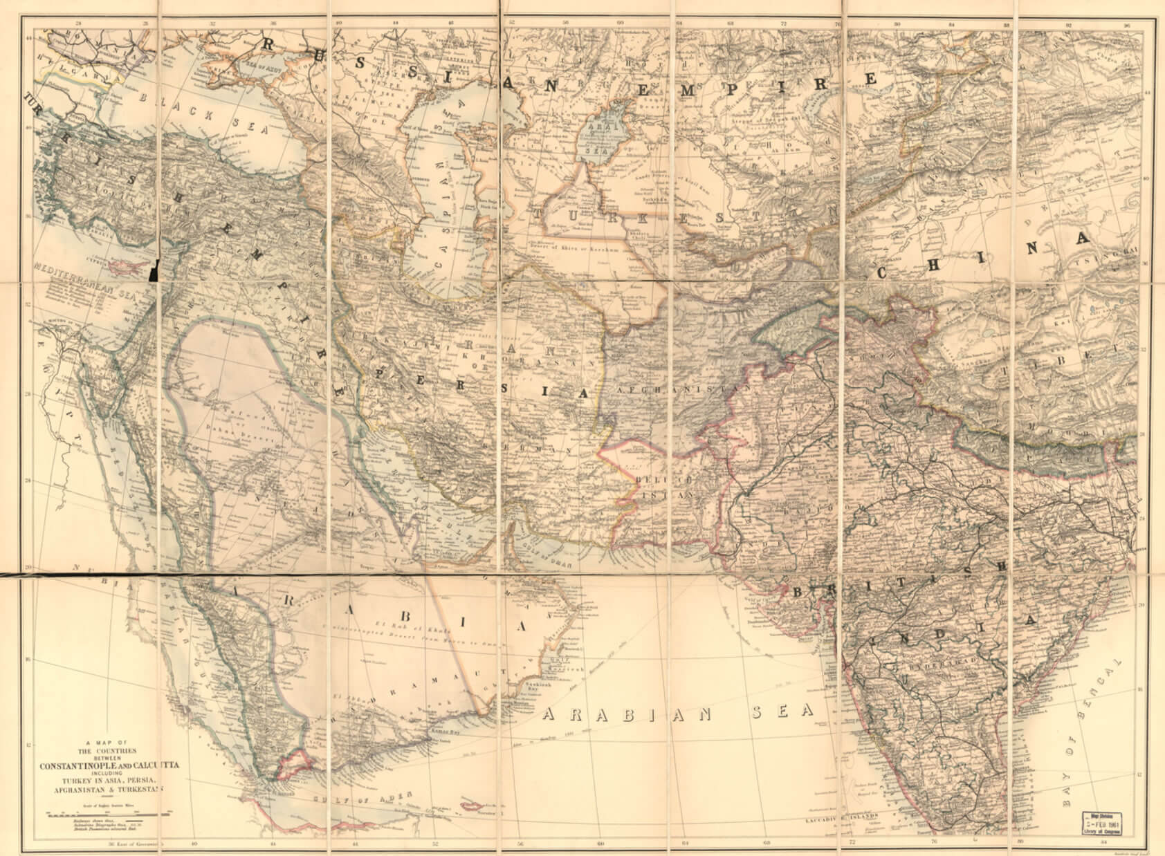
Map of Western Southern and Central Asia in 1885
Mongol Empire and Asia map
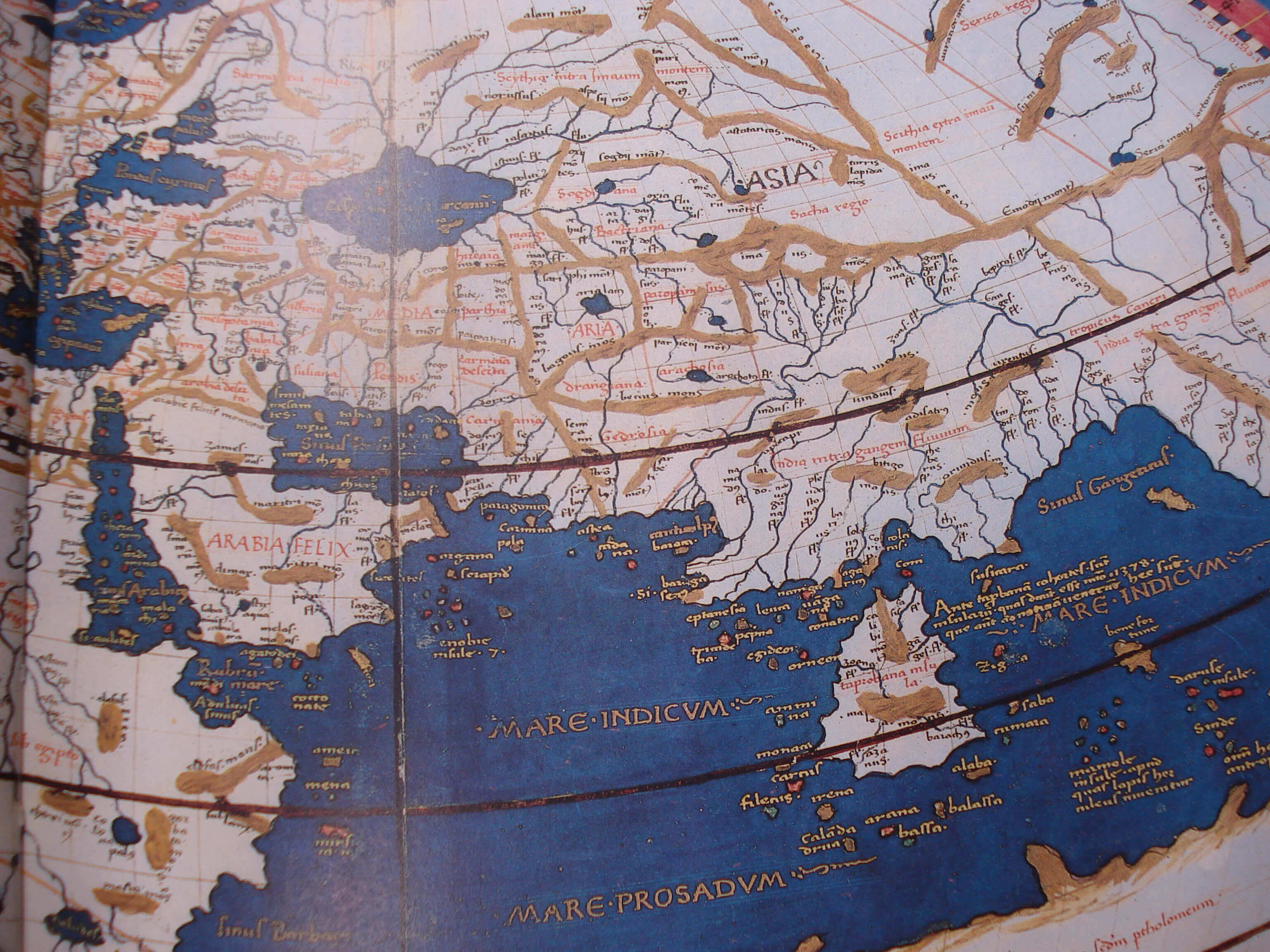
Ptolemy Asia map
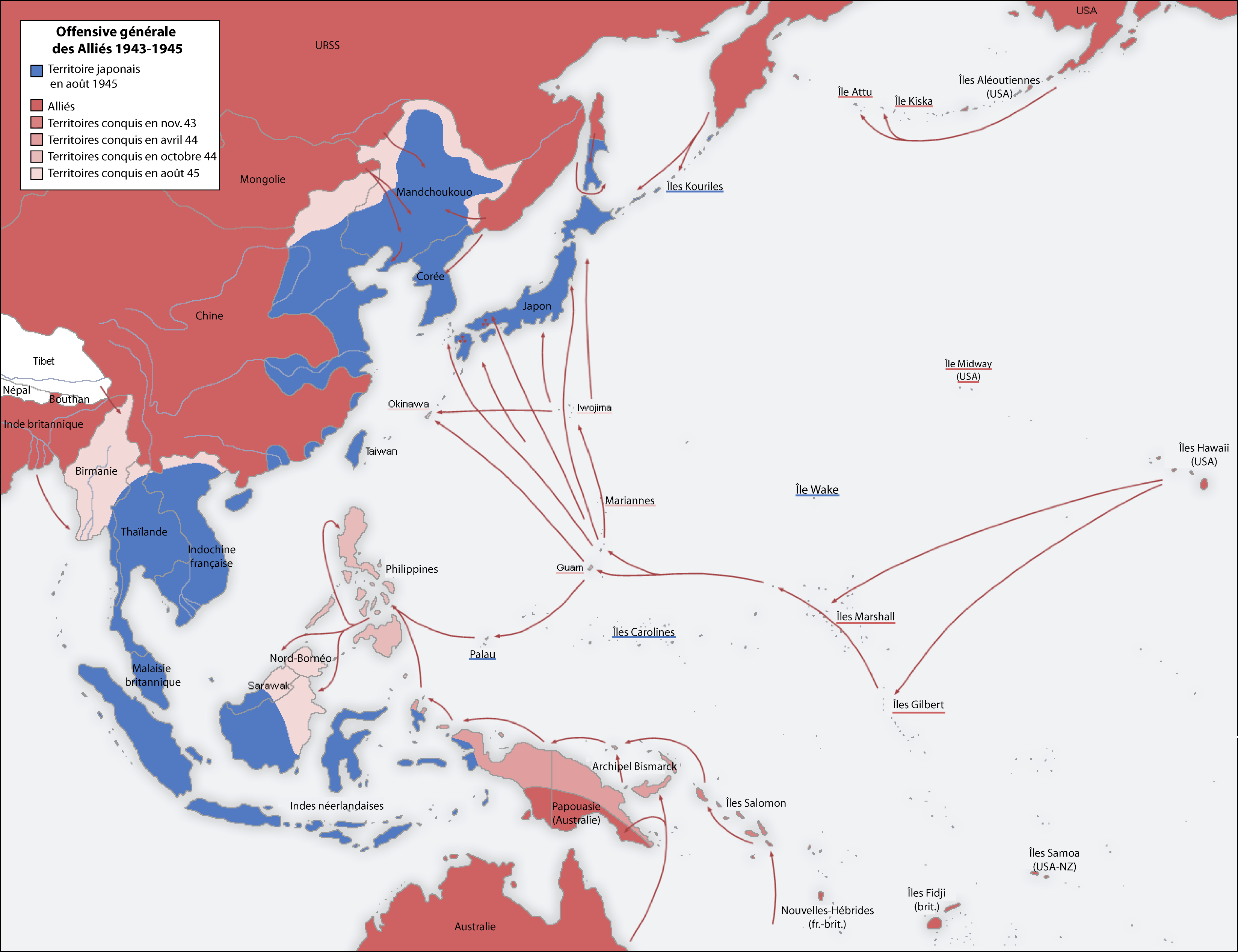
Second World War Asia 1943 1945 map
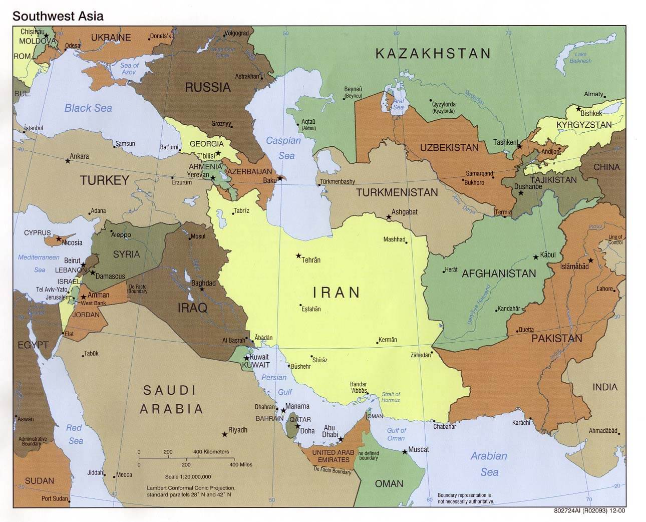
Western Asia political Map 2000
World war ii Map 1942
For more Asia Maps and About Africa;
- Head of Performance Marketing
- Head of SEO
- Linkedin Profile: linkedin.com/in/arifcagrici