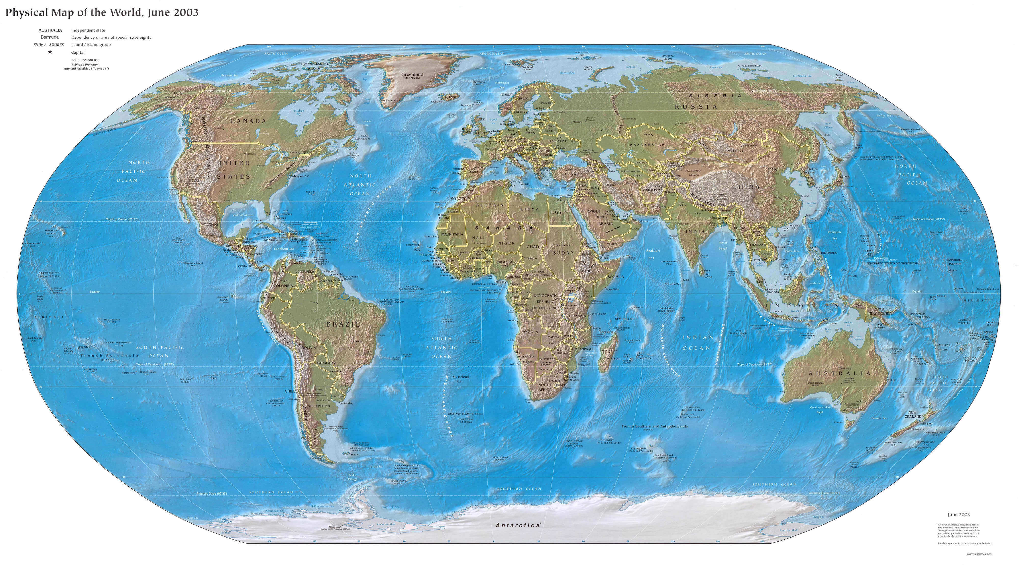
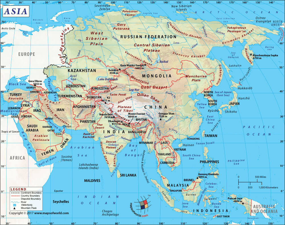
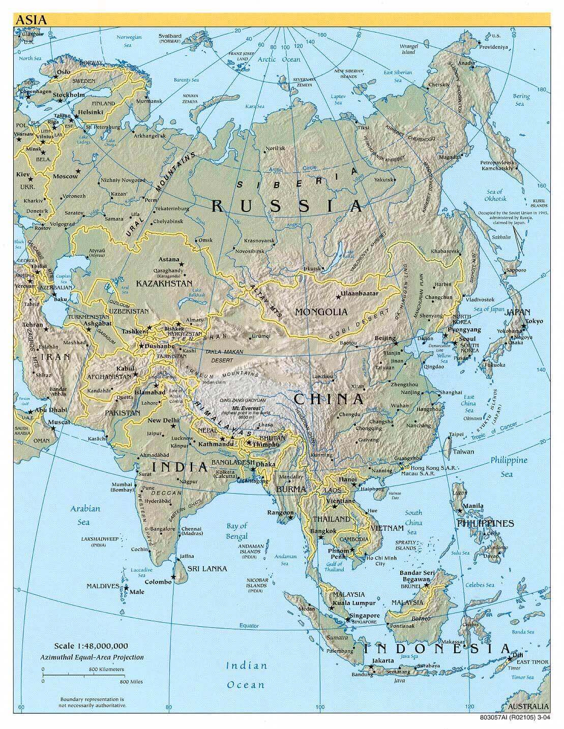
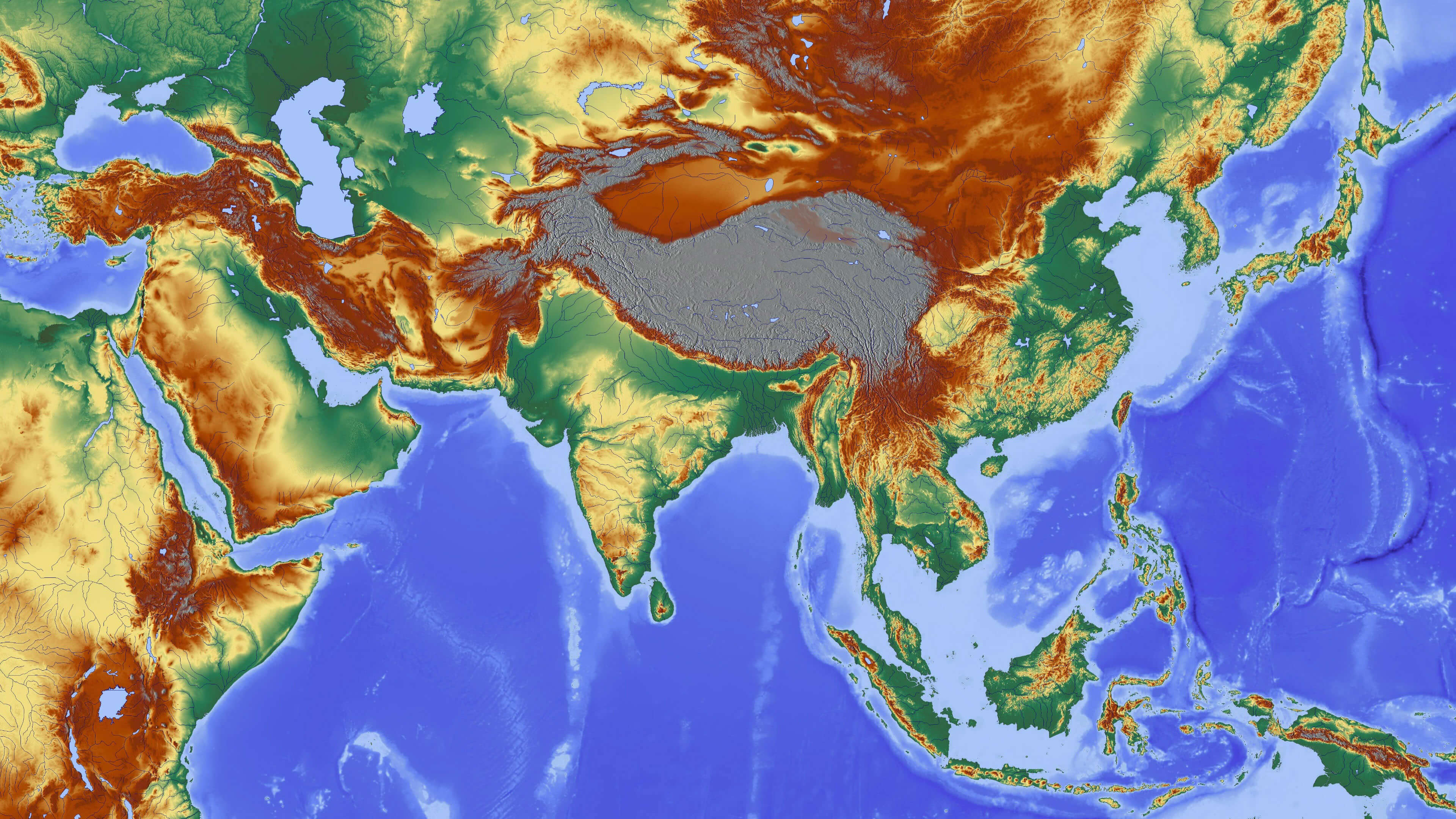
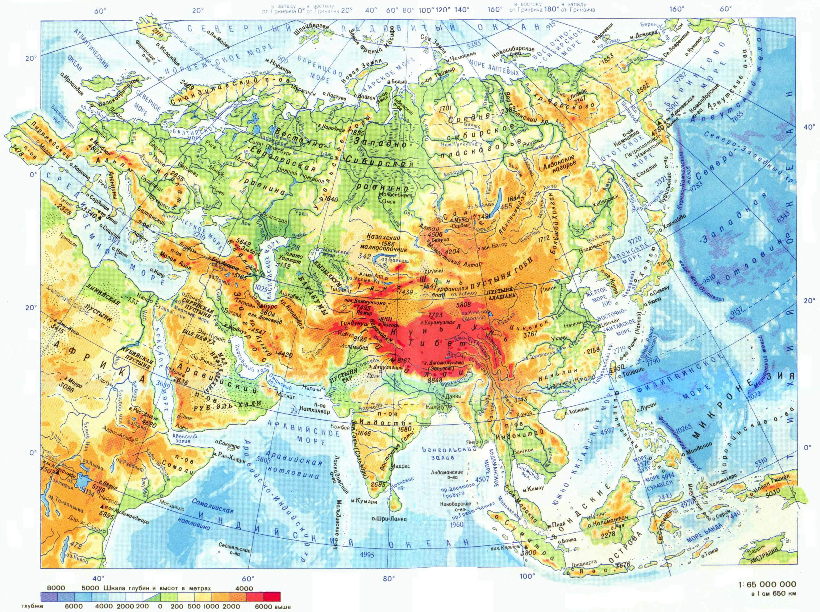
Physical Map of Asia: Mountains, Rivers, Deserts, and Landforms
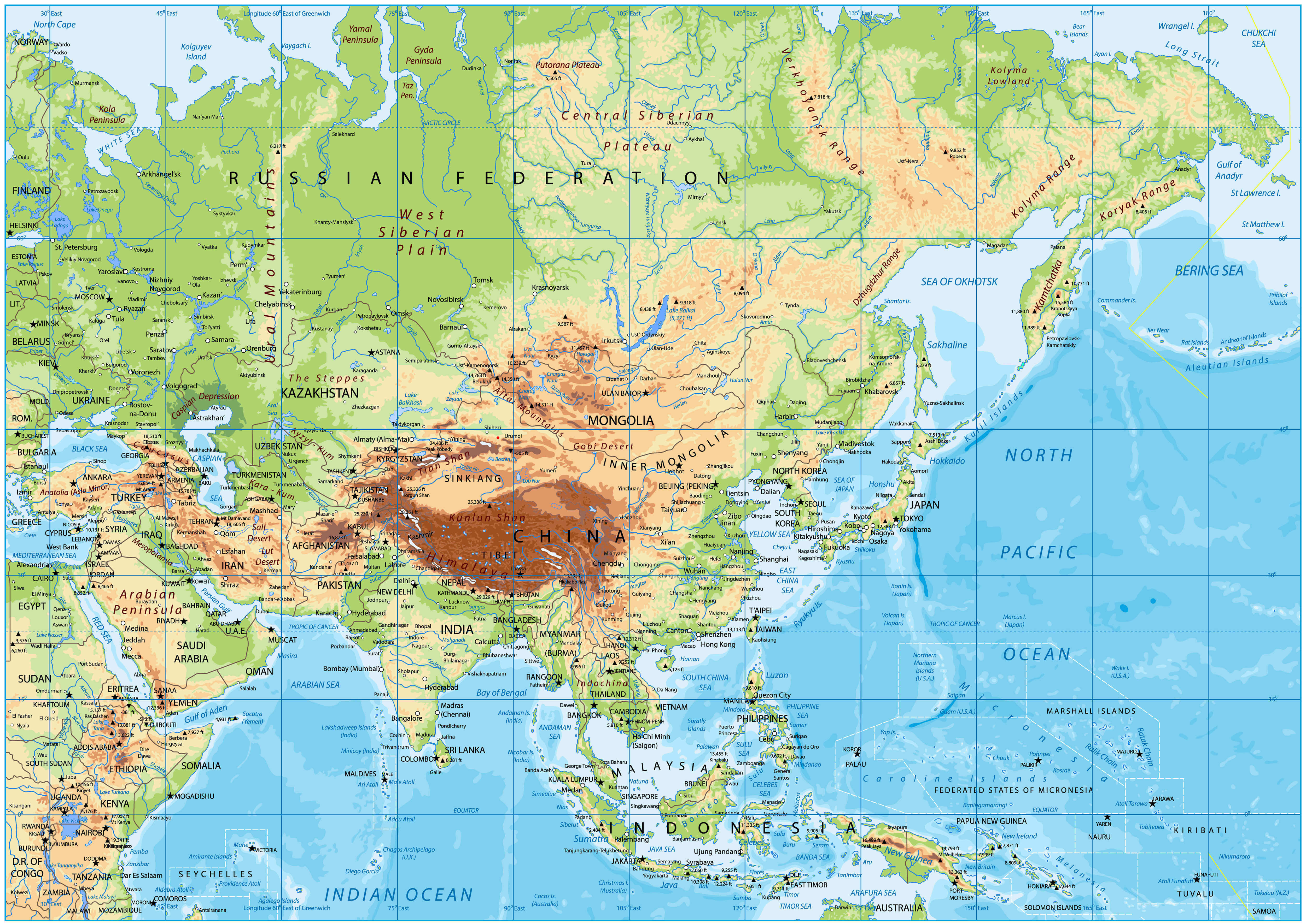 Asia physical map showing mountains, rivers, plateaus, deserts, and oceans.
This physical map of Asia highlights the continent’s diverse geography, including major mountain ranges such as the Himalayas, vast plateaus and deserts including the Gobi and Arabian, and important rivers including the Yangtze and Ganges. It also illustrates lowlands, islands and surrounding seas, providing a complete picture of Asia’s landforms.
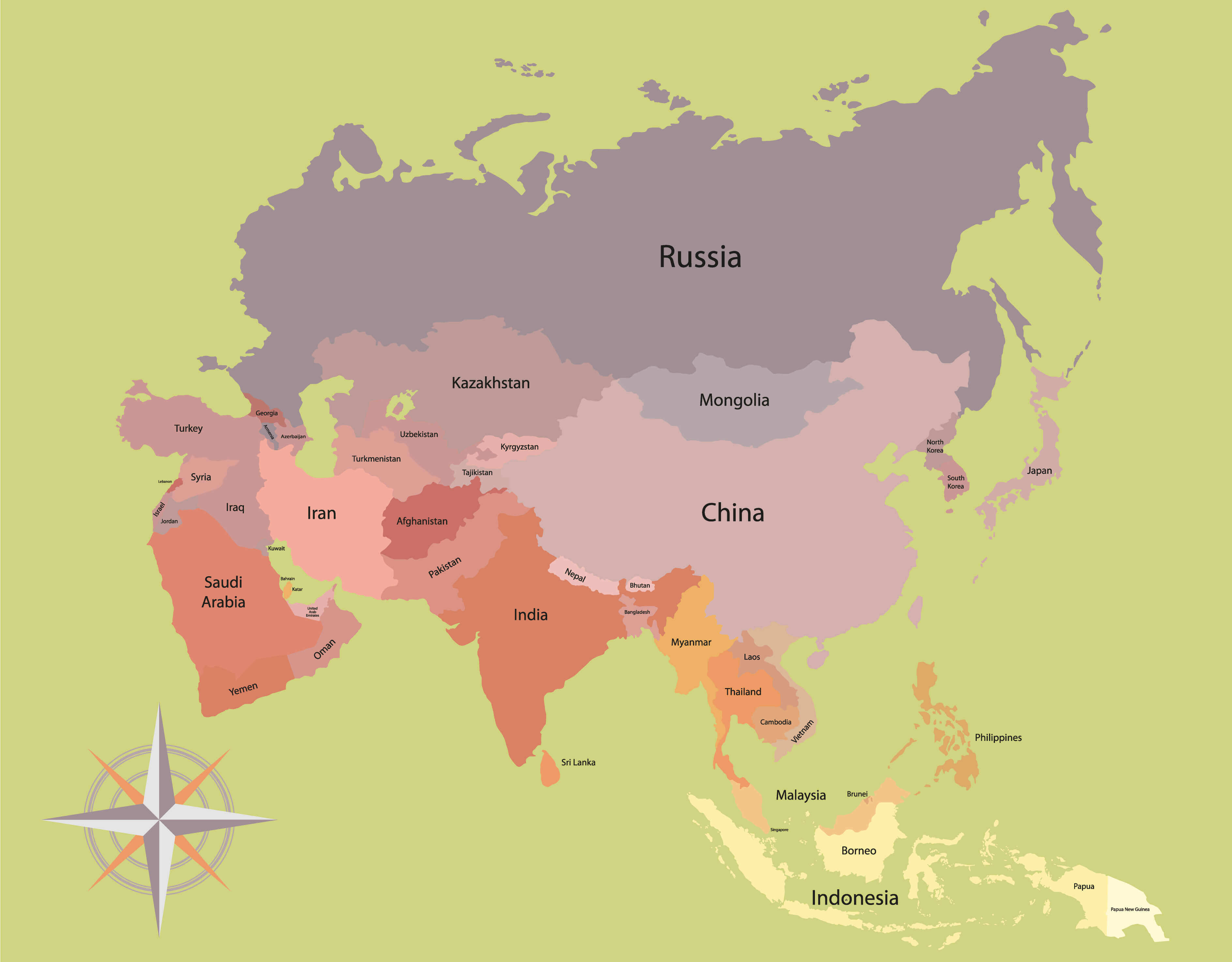
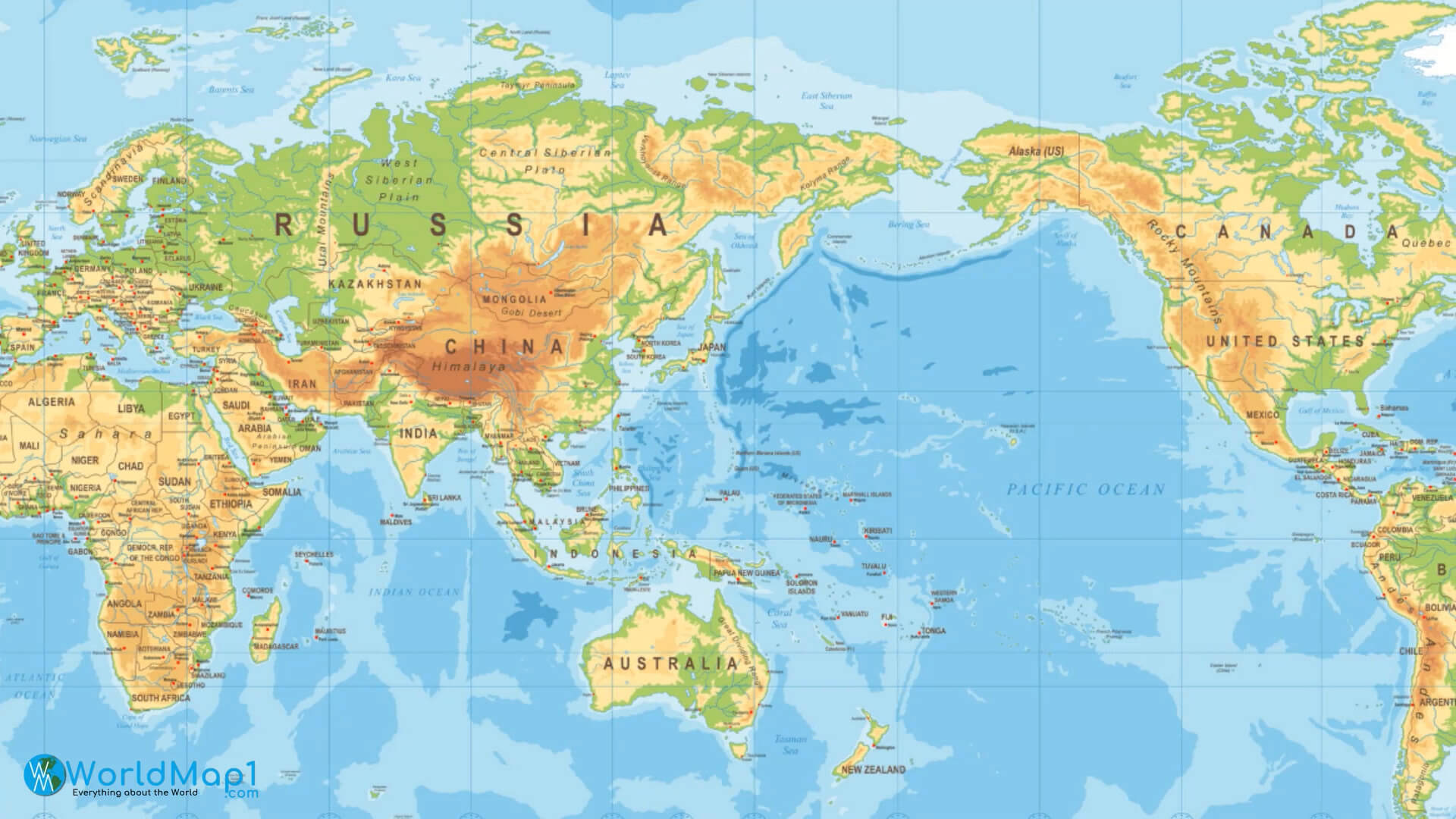
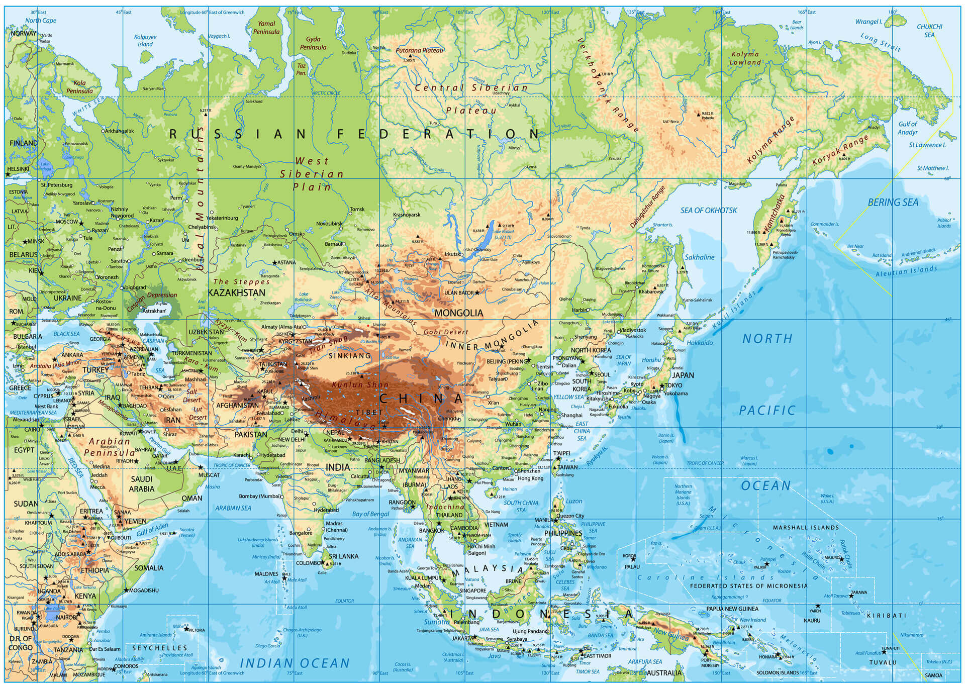
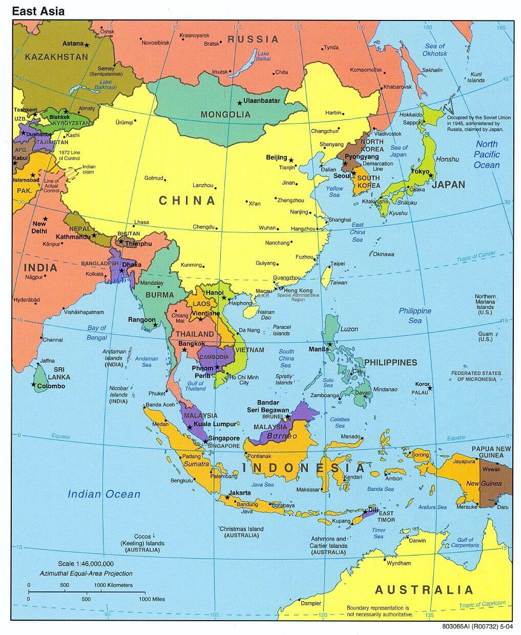
Far East Asia Map: Countries, Landforms, and Surrounding Seas
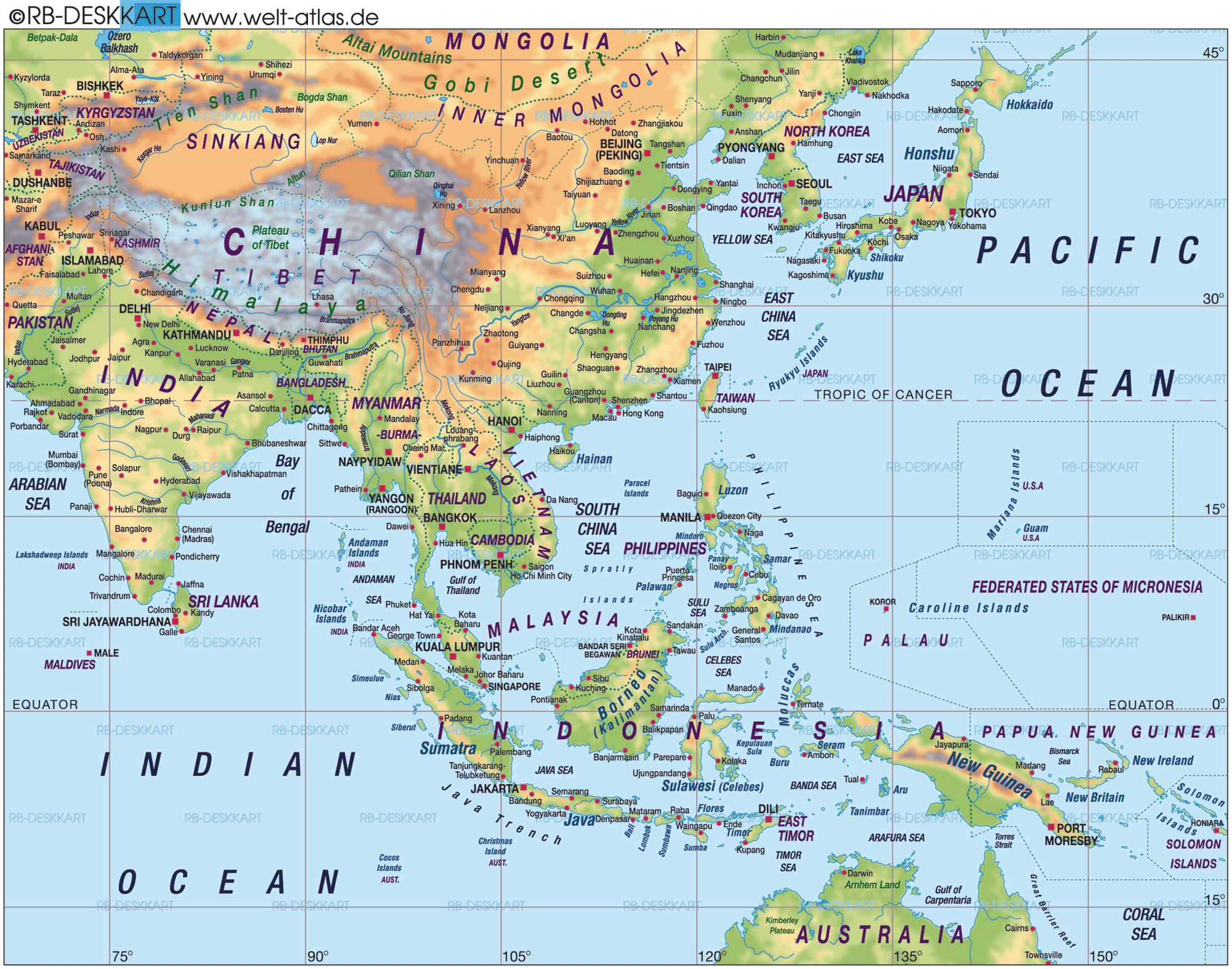 Far East Asia map showing countries, cities, terrain, and surrounding oceans.
This map of East Asia shows the geography and politics of countries such as China, Japan, South Korea, North Korea, Taiwan and the Philippines, as well as other nations in the surrounding region. Major cities, mountain ranges, rivers and seas, such as the East China Sea and the Pacific Ocean, are highlighted to provide a clear regional overview.