Asia Maps
Navigate Asia Maps, countries map, satellite images of the Asia, largest cities maps, political map, capitals, physical map and more maps.
World Continents Map
North America Map Asia Map South America Map Africa Map Oceania Map Antarctica MapEuroasia Map
A Collection of Asia Maps
Asia Physical Map with Rivers and Lakes
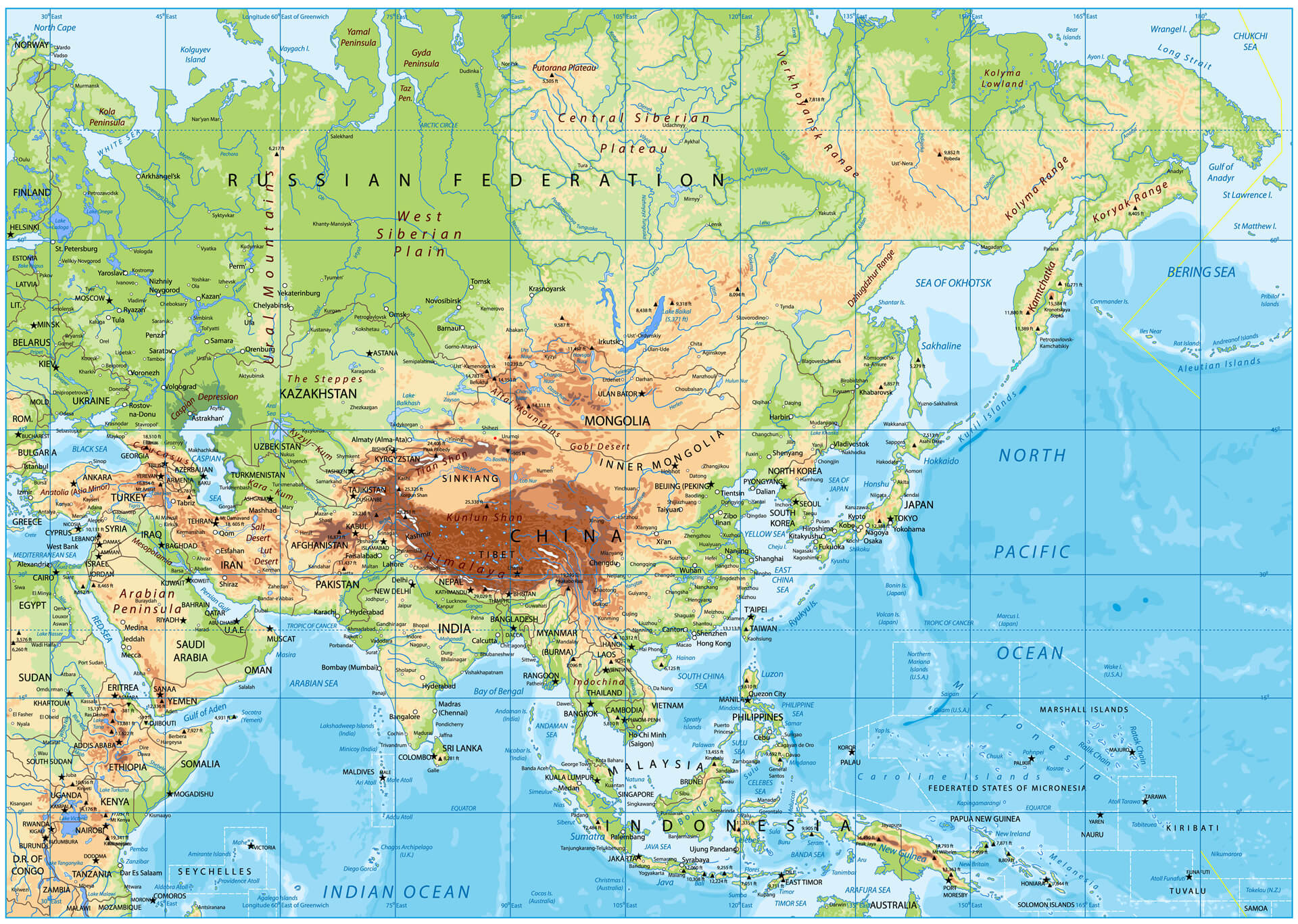 Asia Physical Map with Rivers, Lakes, Altitudes and China, Russia, Iran.
Asia Detailed Vector Map
 Asia Highly Detailed Vector Illustration Map
Asia Map with India Geography View
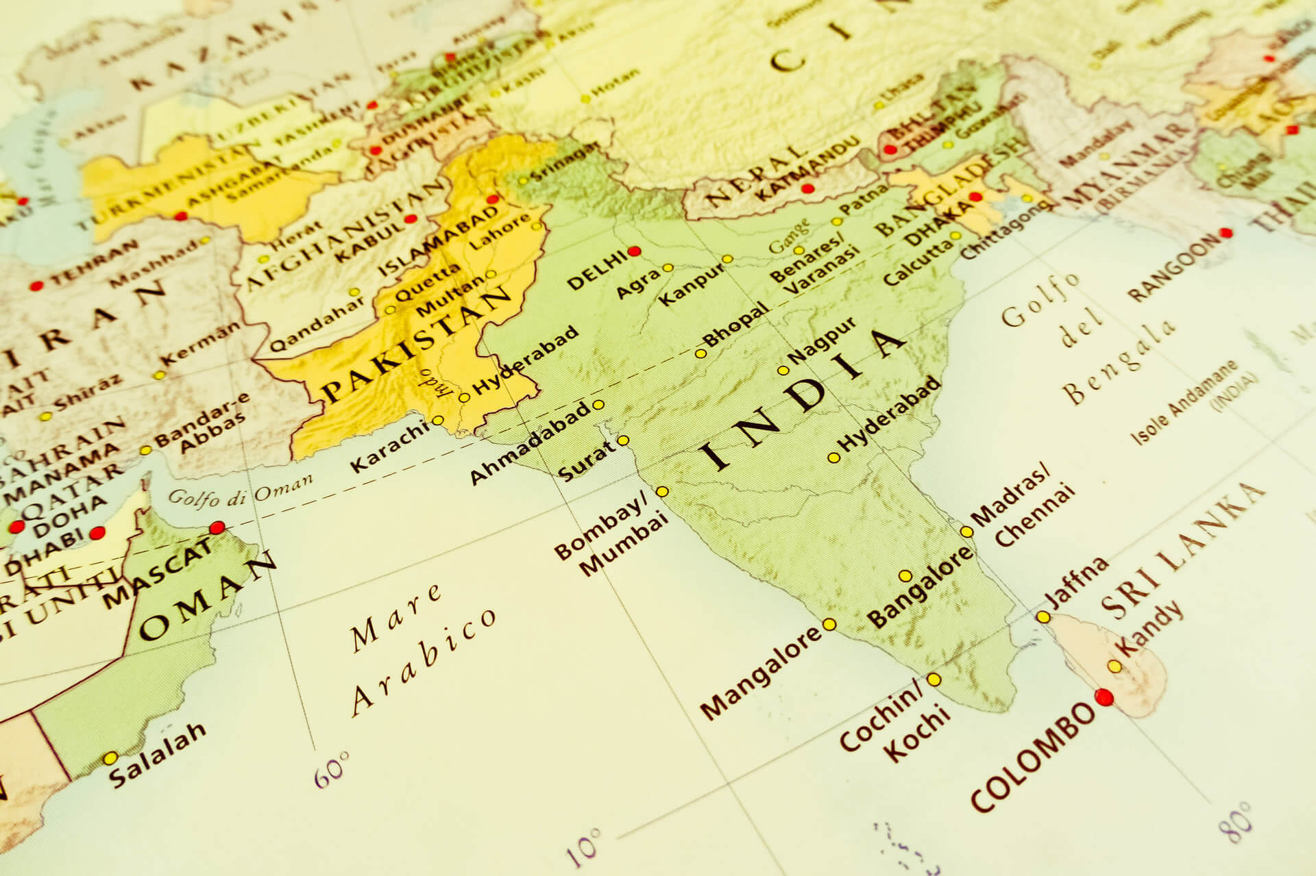 Asia Map with India Geography View, Pakistan, Oman, Nepal
China Provinces Map in Asia
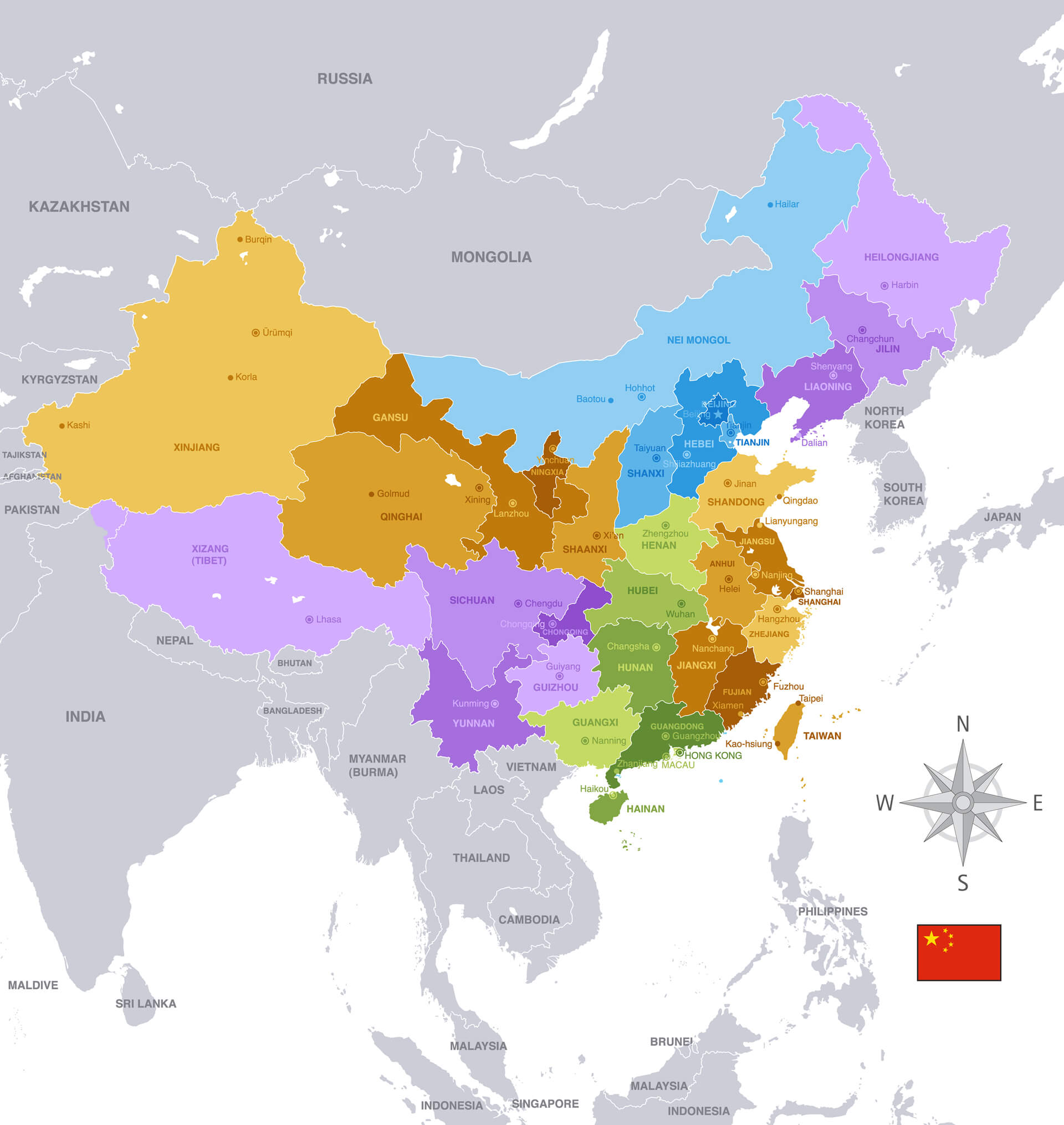 Republic of China Provinces Vector Map with Asia Map.
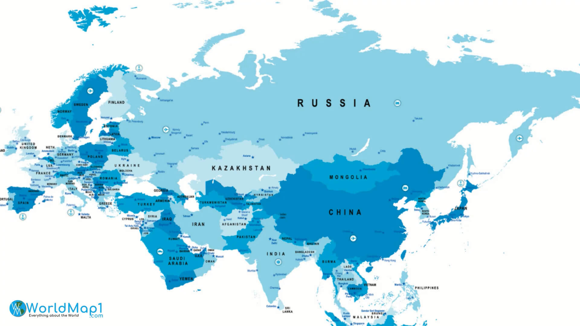
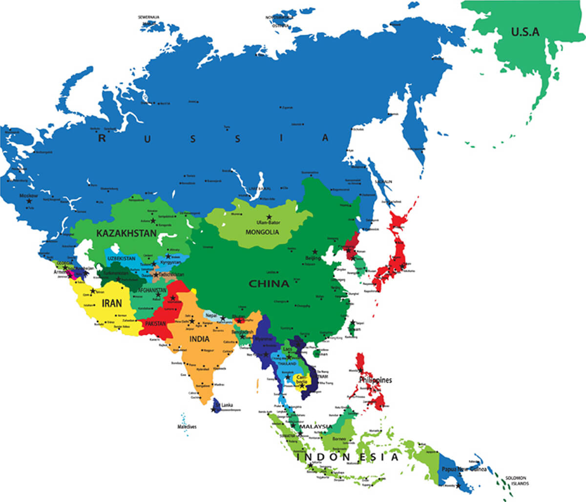
Asia Map with India, China and Russia
 Asian Countries Map with India, China, Russia, Saudi Arabia and Turkey.
Russia Map with Asia Continent Map
 Russia Map with Asia Continent Map and Asian Countries National Borders.
Colorful Southeast Asia Map
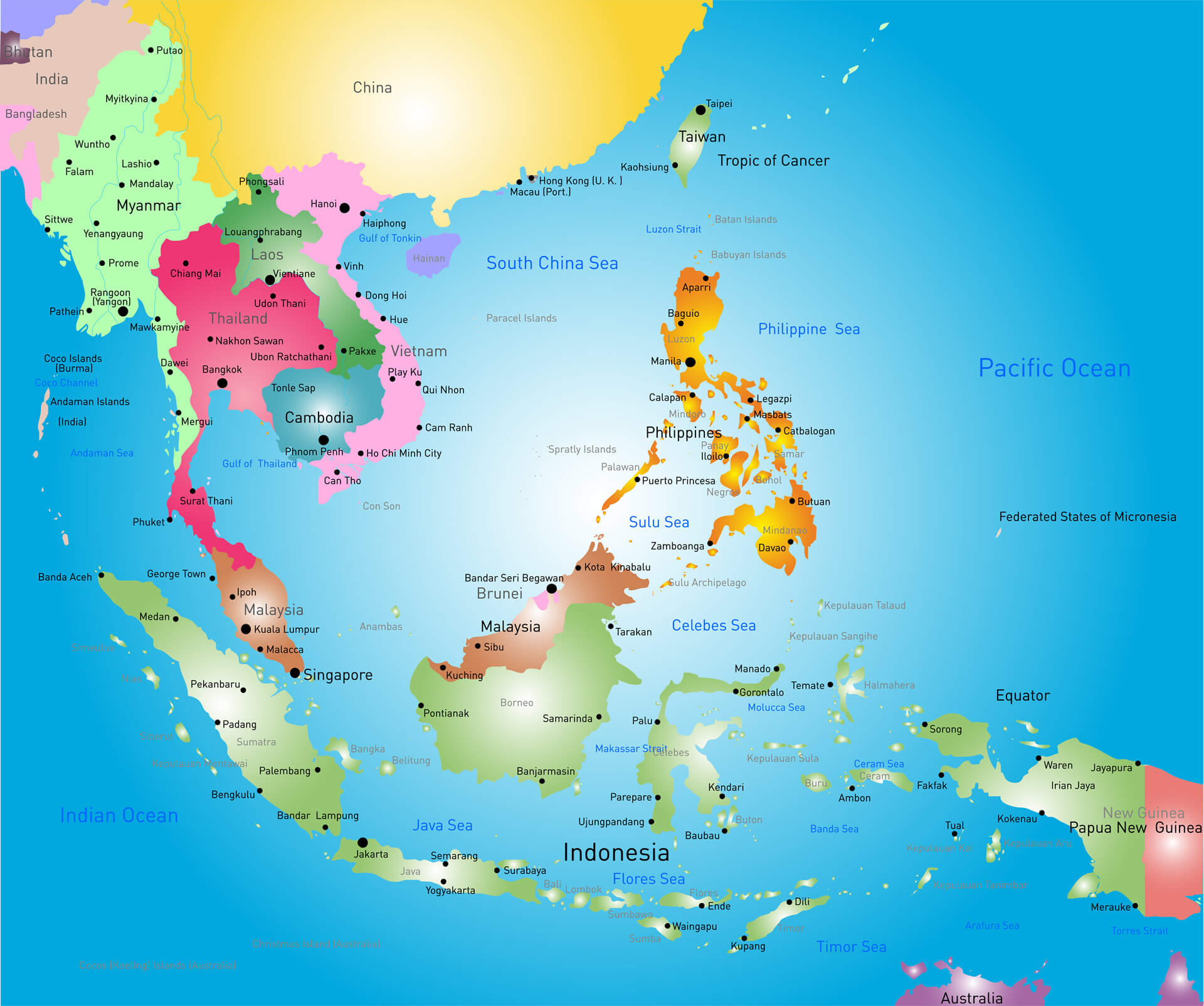 Colorful Southeast Asia Map with Political Map.
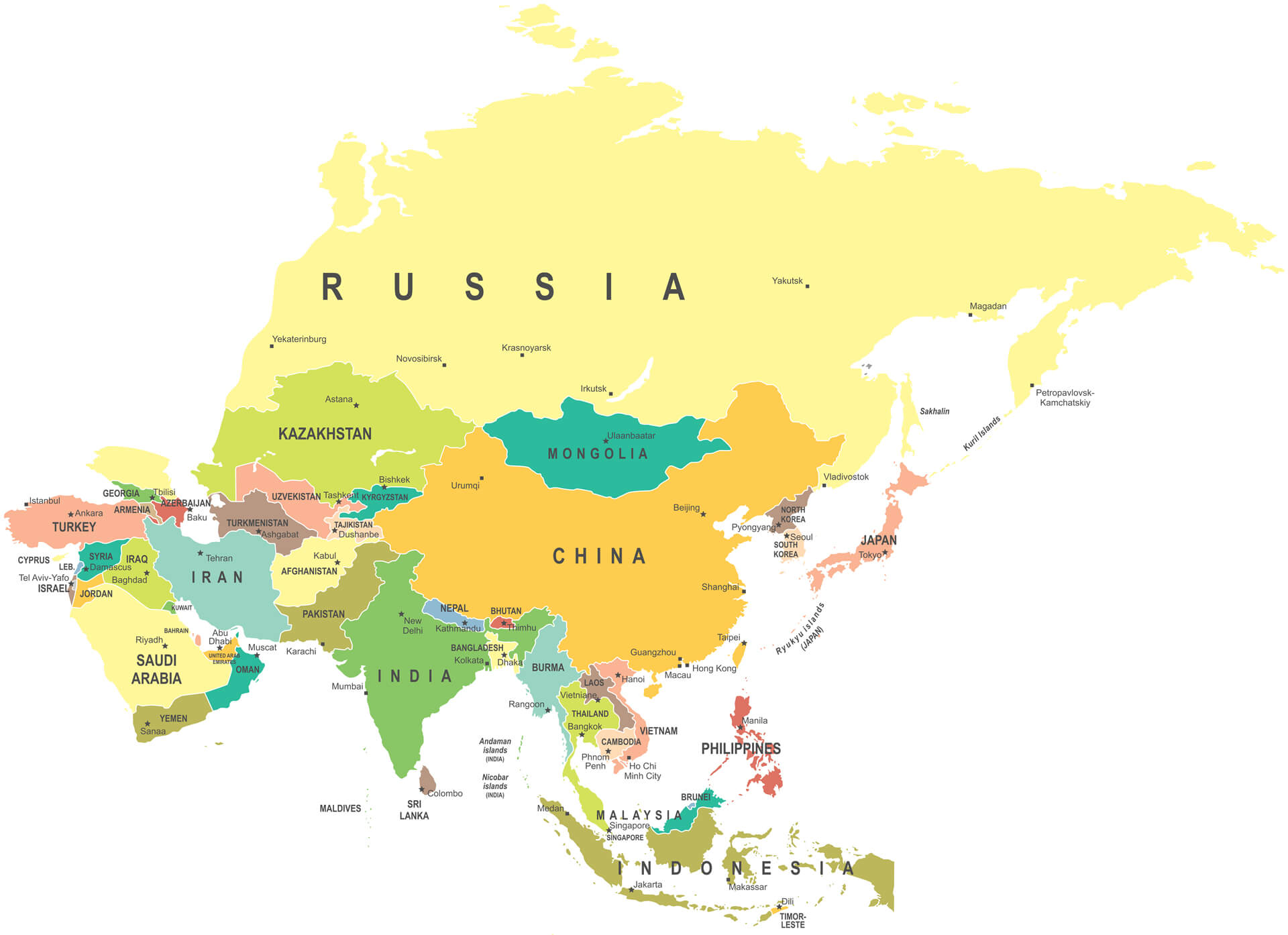
Asia Map Highly Detailed Vector Illustration
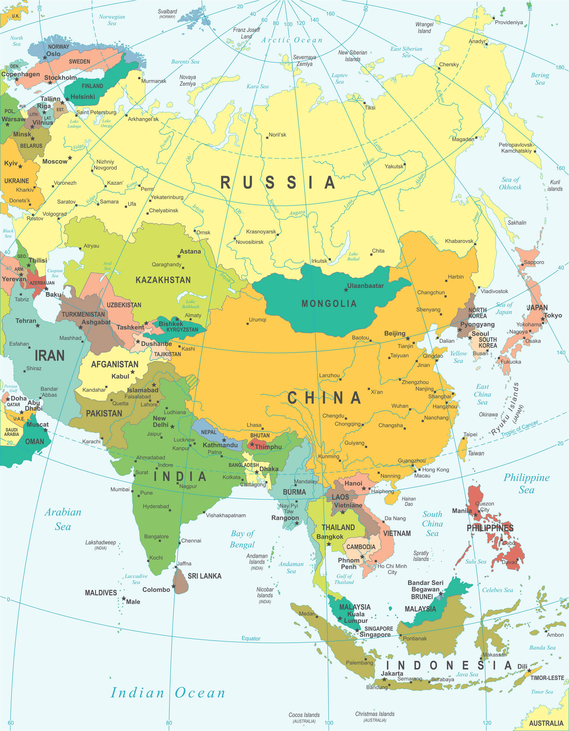 Asia Map Highly Detailed Vector Illustration with Russia, Mongolia, Kazakhstan, China, India, Pakistan.
Asia Countries Map
Taiwan Map
Tajikistan Map
Thailand Map
Turkmenistan Map
United Arab Emirates Map
Uzbekistan Map
Vietnam Map
Yemen Map
Japan Map
Jordan Map
Kazakhstan Map
Kuwait Map
Kyrgyzstan Map
Laos Map
Lebanon Map
Macau Map
Malaysia Map
Maldives Map
Mongolia Map
Myanmar Map
Nepal Map
Afghanistan Map
Bahrain Map
Bangladesh Map
Bhutan Map
Brunei Map
Cambodia Map
China Map
Asia Map
North Korea Map
Oman Map
Pakistan Map
Palestine Map
Philippines Map
Qatar Map
Russia Map
Saudi Arabia Map
Singapore Map
South Korea Map
Sri Lanka Map
Syria Map
East Timor Map
Hong Kong Map
India Map
Indonesia Map
Iran Map
Iraq Map
Israel Map
Please view more Asia Countries Maps
World Top 20 Largest Countries by Population Map
- 1. China Map - 1,439,323,776
- 2. India Map - 1,399,828,108
- 3. United States Map - 333,839,503
- 4. Indonesia Map - 277,749,346
- 5. Pakistan Map - 227,153,261
- 6. Brazil Map - 214,767,569
- 7. Nigeria Map - 213,593,168
- 8. Bangladesh Map - 167,086,674
- 9. Russia Map - 146,025,949
- 10. Mexico Map - 130,911,878
- 11. Japan Map - 125,910,309
- 12. Ethiopia Map - 119,117,925
- 13. Philippines Map - 111,711,419
- 14. Egypt Map - 105,152,003
- 15. Vietnam Map - 98,618,321
- 16. Democratic Republic Congo (DRC) Map - 93,531,207
- 17. Turkey Map - 85,664,955
- 18. Iran Map - 85,563,317
- 19. Germany Map - 84,175,561
- 20. Thailand Map - 68,407,231