Israel Cities Map with Major Towns and Regions
Explore a detailed Political Map of Israel that clearly presents the country's administrative boundaries, major cities, and international borders. The map highlights key urban centers such as Jerusalem, Tel Aviv-Yafo, and Haifa, while also showing neighboring countries and surrounding regions including the West Bank and Gaza Strip. Ideal for educational, research, and reference purposes, it provides a clear understanding of Israel's political structure and geographic position within the Middle East. 
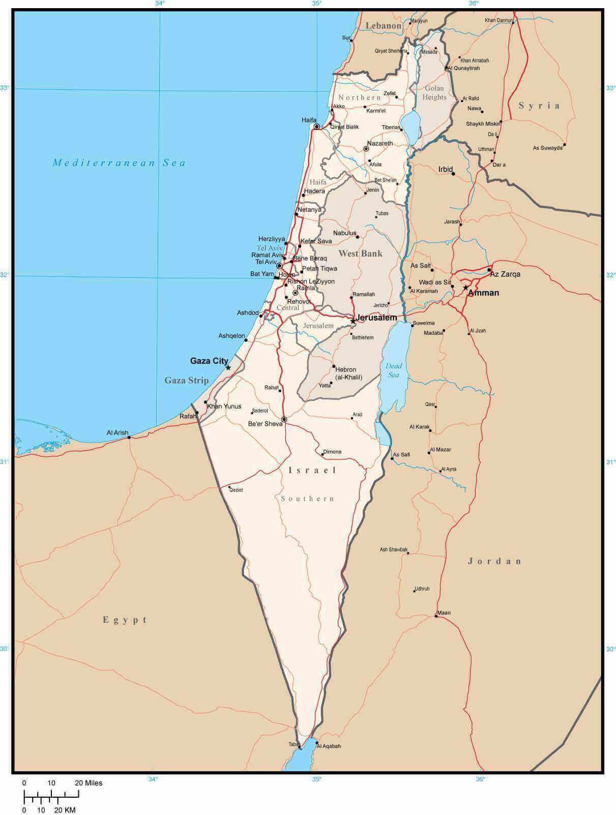
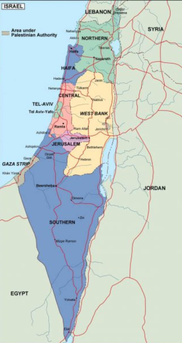
Israel West Bank and Gaza Strip Map with Major Cities
Detailed cities map of Israel
High-resolution Israel cities map
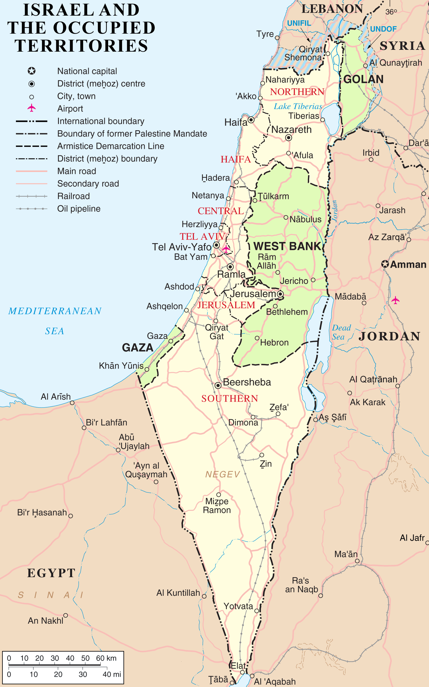
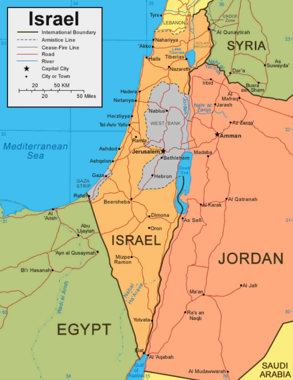
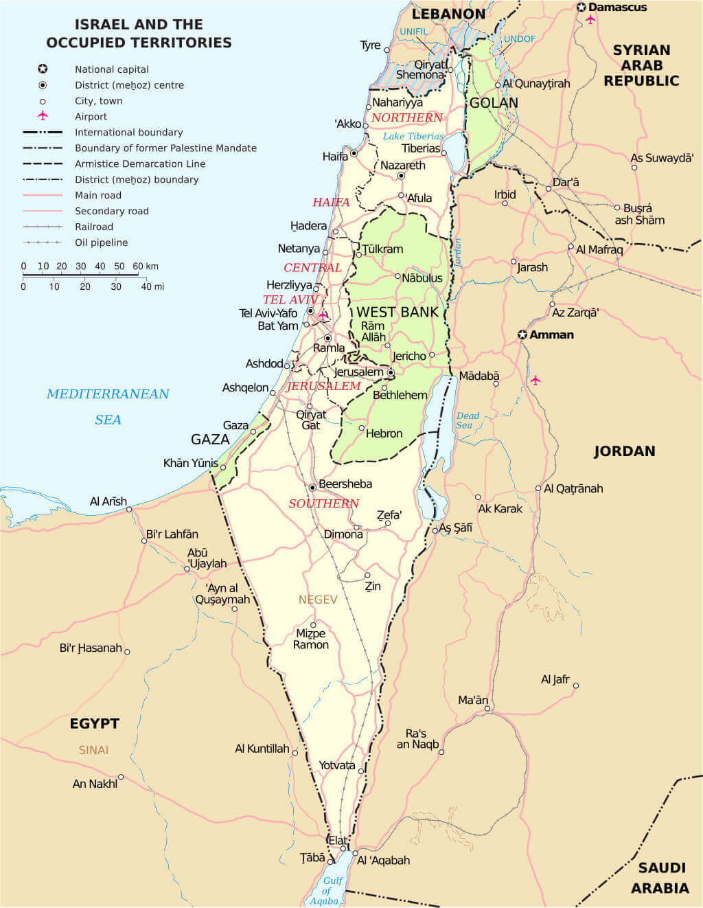
Israel and occupied territories road oil pipeline map
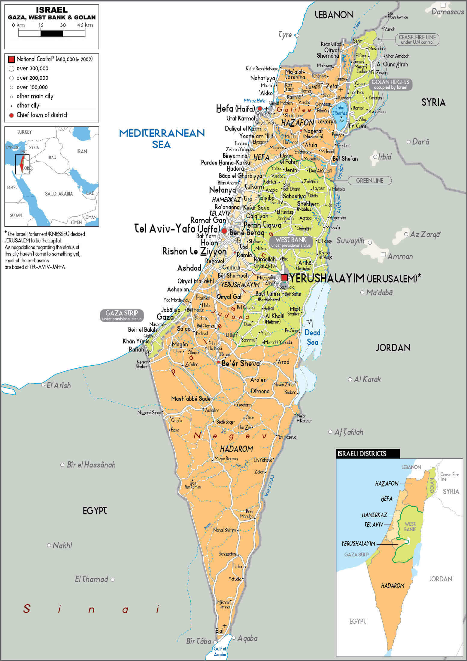
Israel cities and main roads map with Amman
Israel cities and main roads map
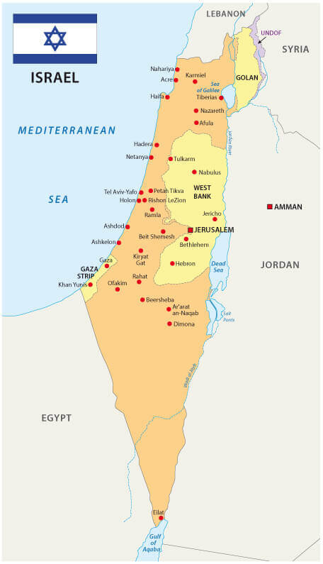
Israel cities map with flag
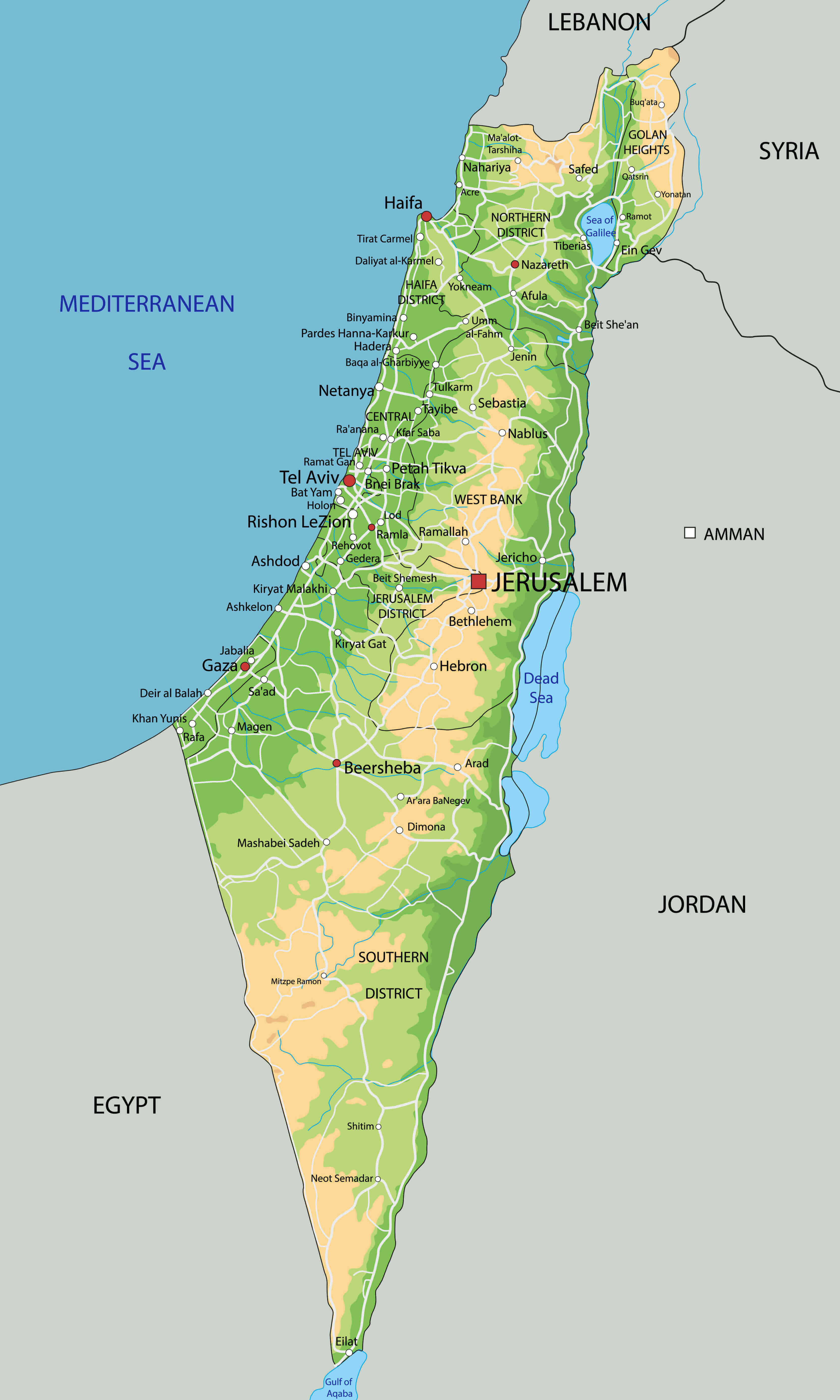
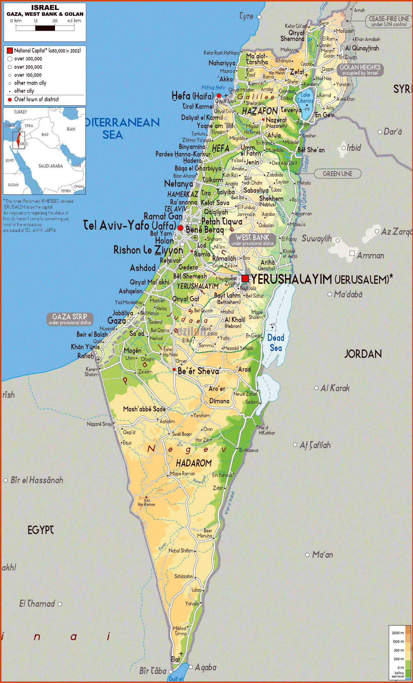
Israel cities physical map
Israel country map with national flag
Israel national border map with cities
Israel political map with cities
Israel railroad and highways map
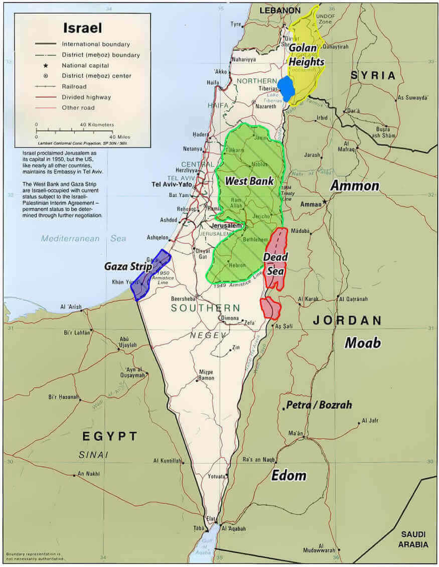
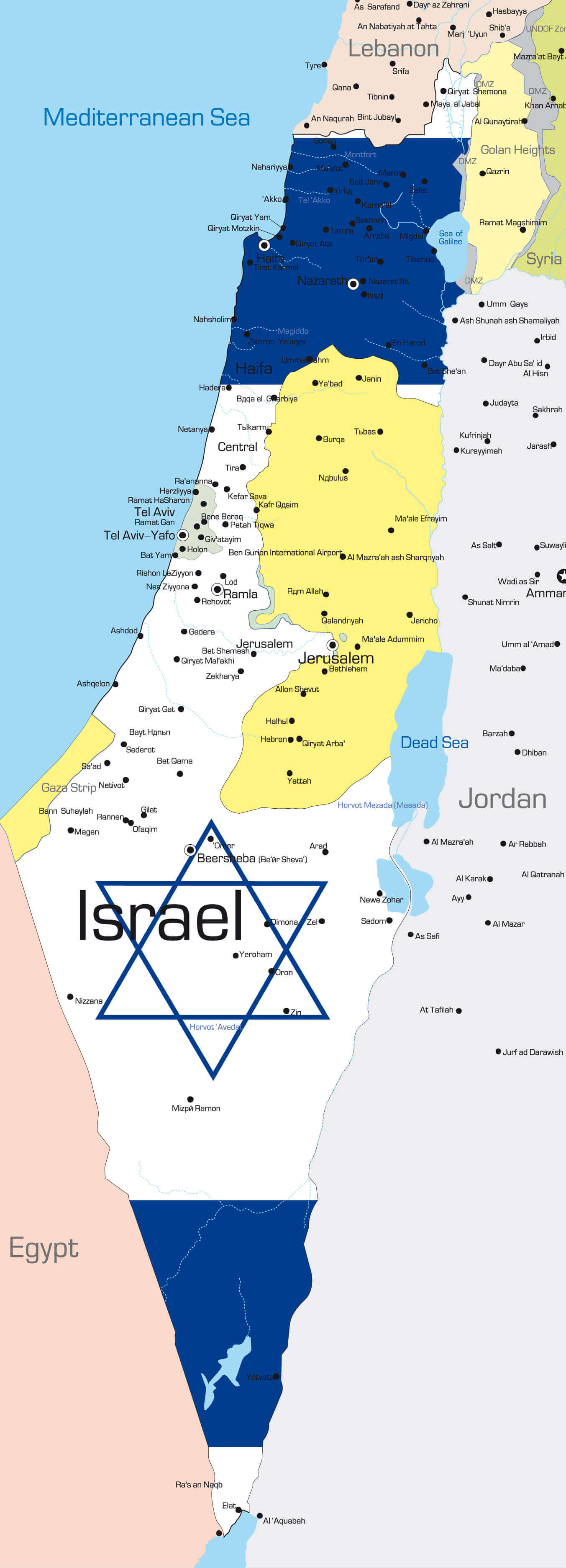
Israel regions map with West Bank Gaza strip
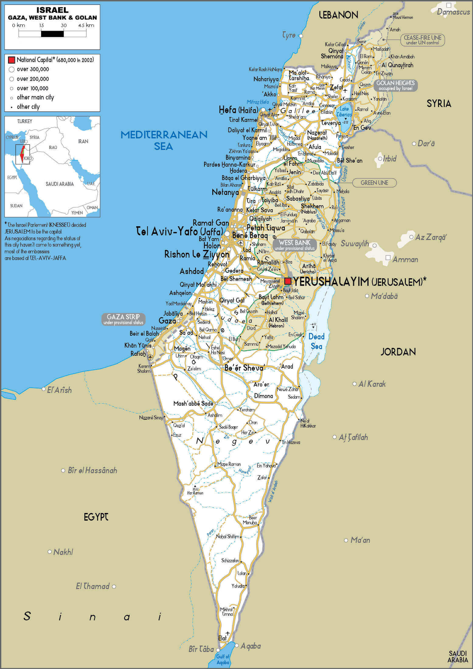
Israel West Bank Gaza strip golan heights map
Physical map of Israel with cities
Feel free to explore these pages as well:
Feel free to explore these pages as well:
Author: Arif Cagrici