Discover Satellite World Maps: Political Boundaries, Religions, Satellite and Weather Maps
Explore our extensive collection of World Maps, featuring a wide range of political, physical, environmental, and thematic maps designed for students, travelers, researchers, and geography enthusiasts. This collection includes World Per Capita Income Maps, World Physical Maps, World Political Maps, World Population Density Maps, and World Precipitation Maps, helping users better understand global geography, economic conditions, political boundaries, and climate patterns. Whether you are looking for a World Physical Map for educational use or a World Political Map for travel planning and research, our collection provides reliable and detailed resources.
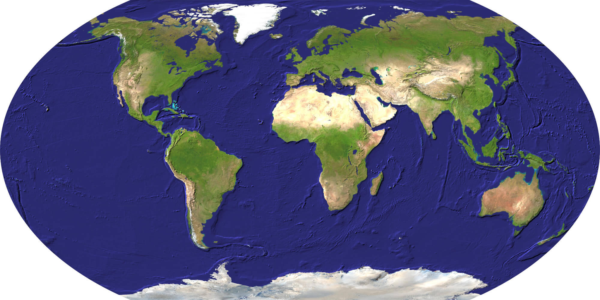
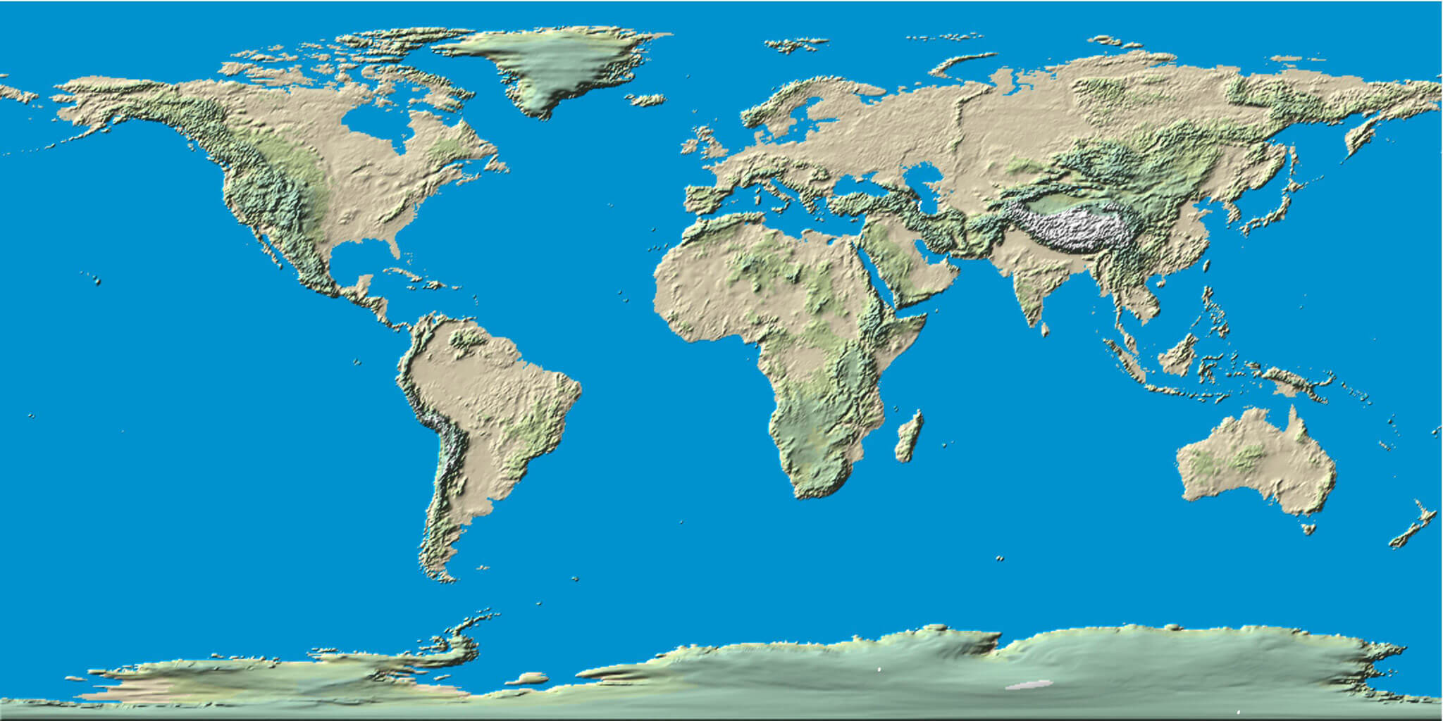
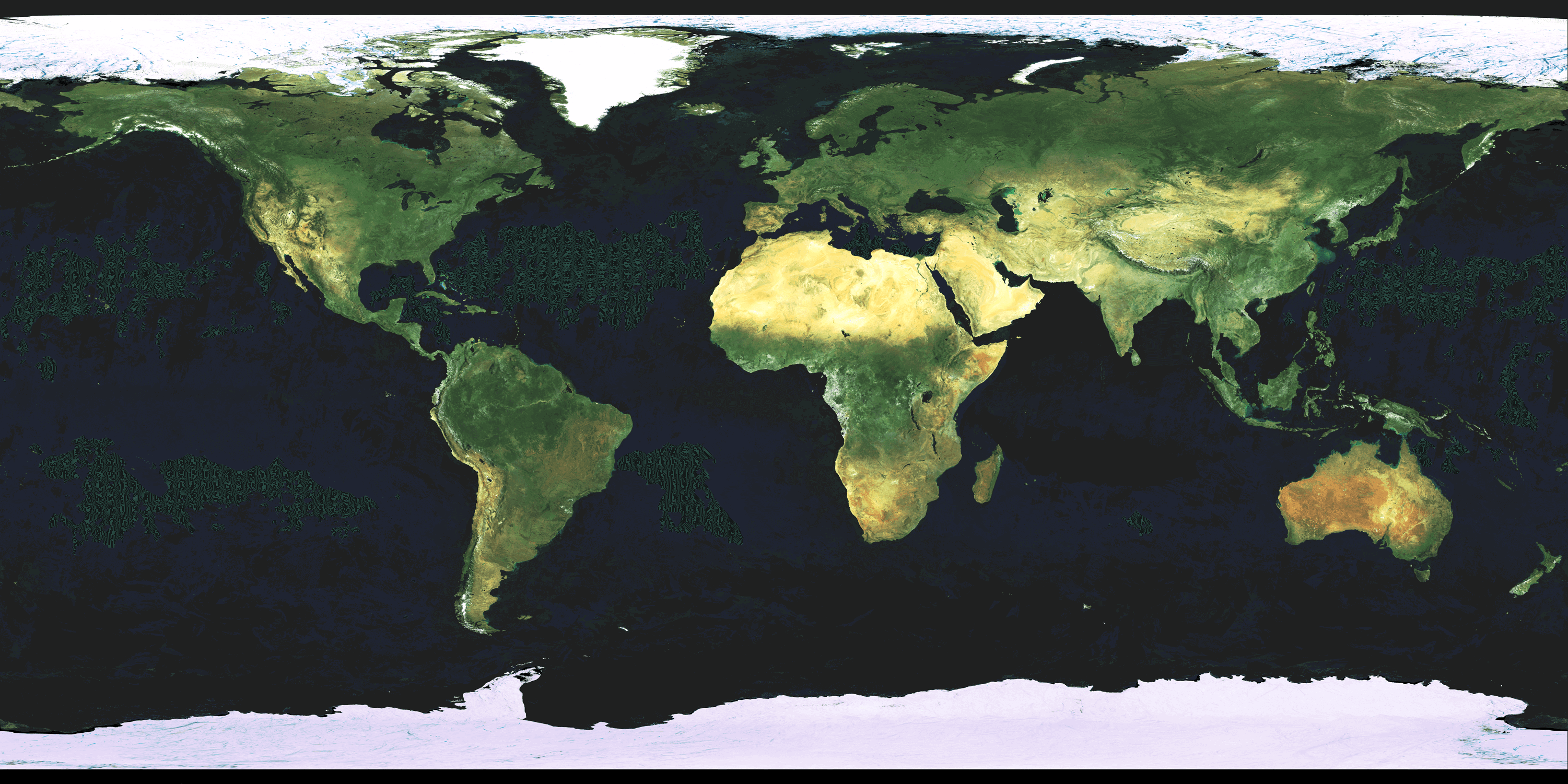
World Satellite Map Detailed
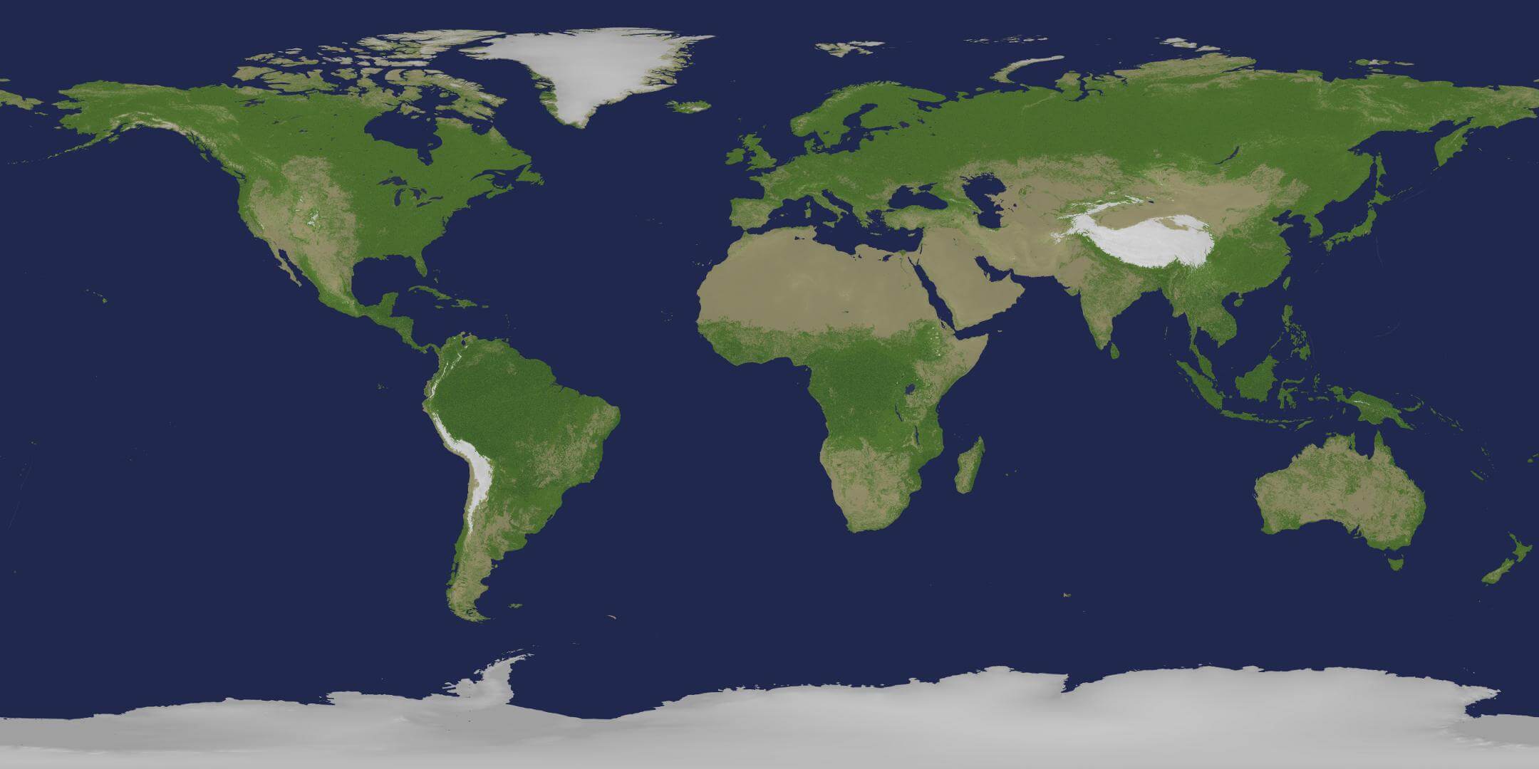
World Satellite Image 2014
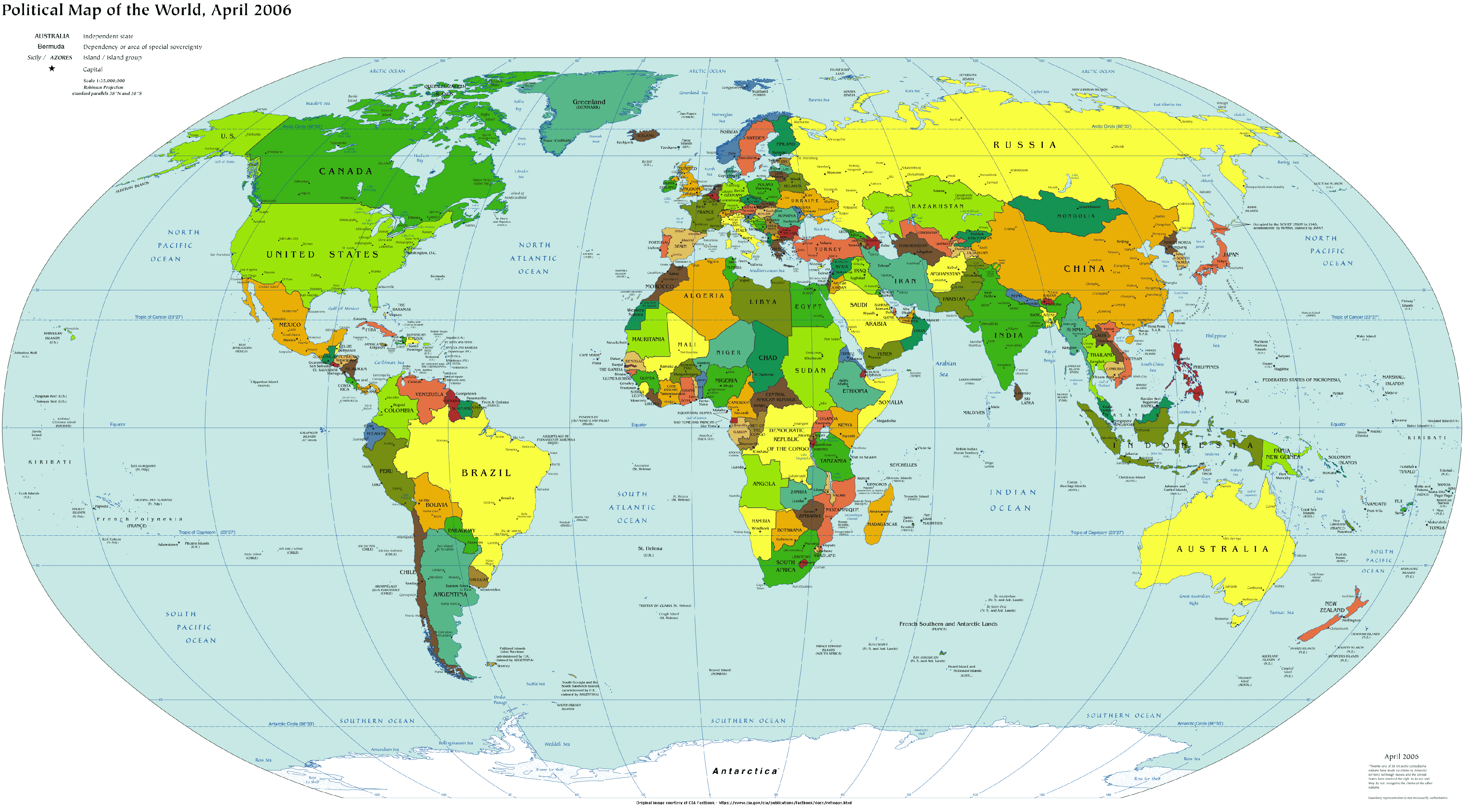
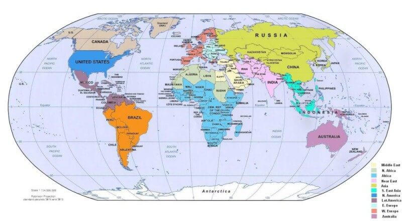
World Political Map English
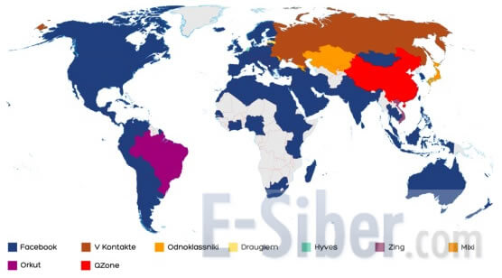
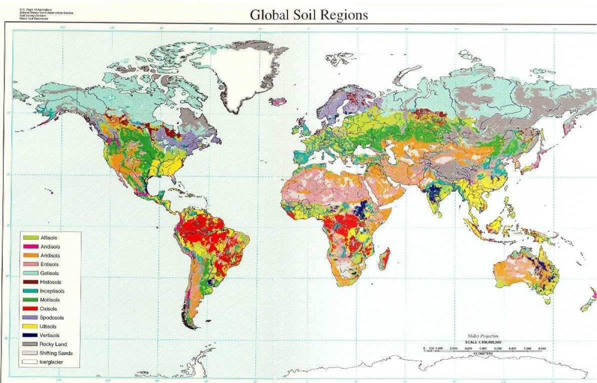
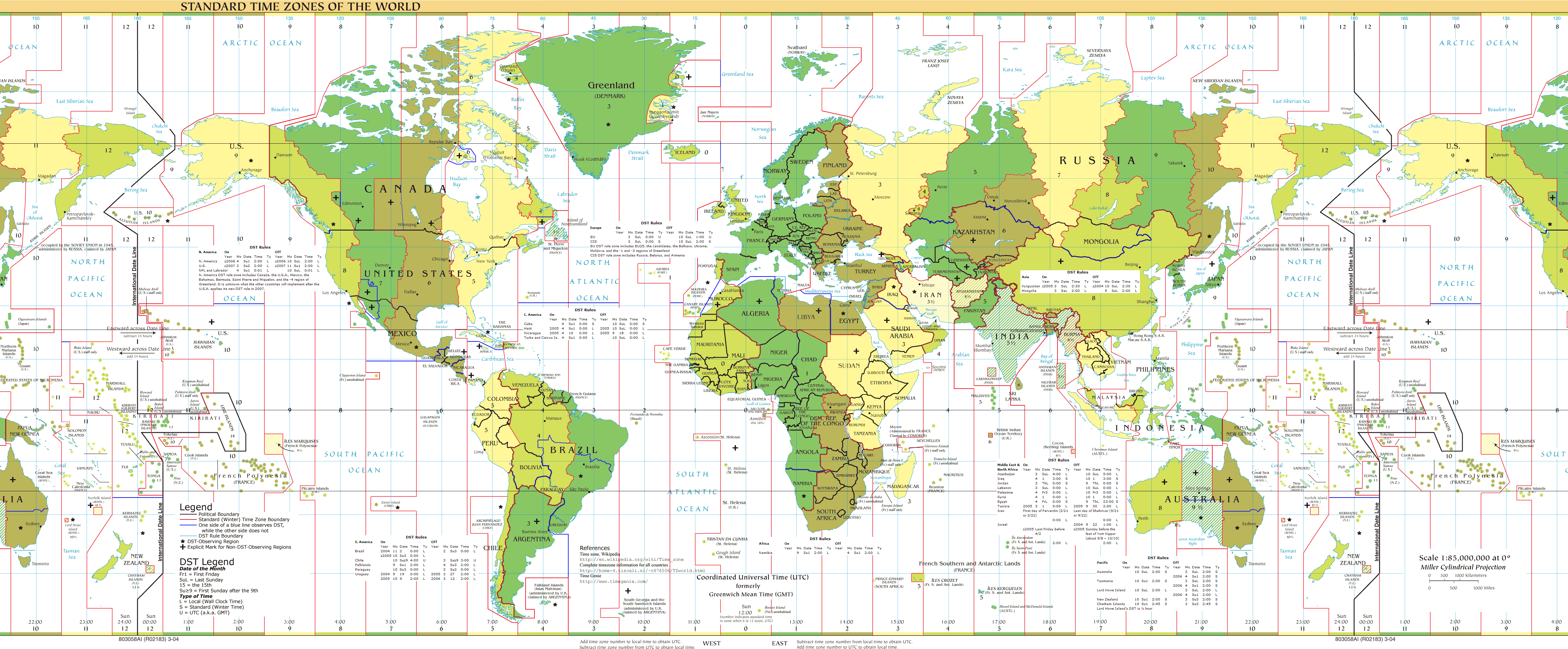
Discover specialized world maps such as the World Rainfall Map 2009, World Religions Maps, World Satellite Maps, World Soil Maps, and World Standard Time Zones Maps, offering valuable insights into weather systems, religion distribution, satellite imagery, land resources, and global time differences. Our collection also includes thematic resources like World Social Network Maps and historical satellite imagery such as the World Satellite Image 2014, making it a comprehensive source for exploring the world’s physical, political, and social structures.
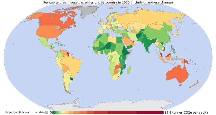
World Per Capita Income Map
World Physical Map
World Political Map
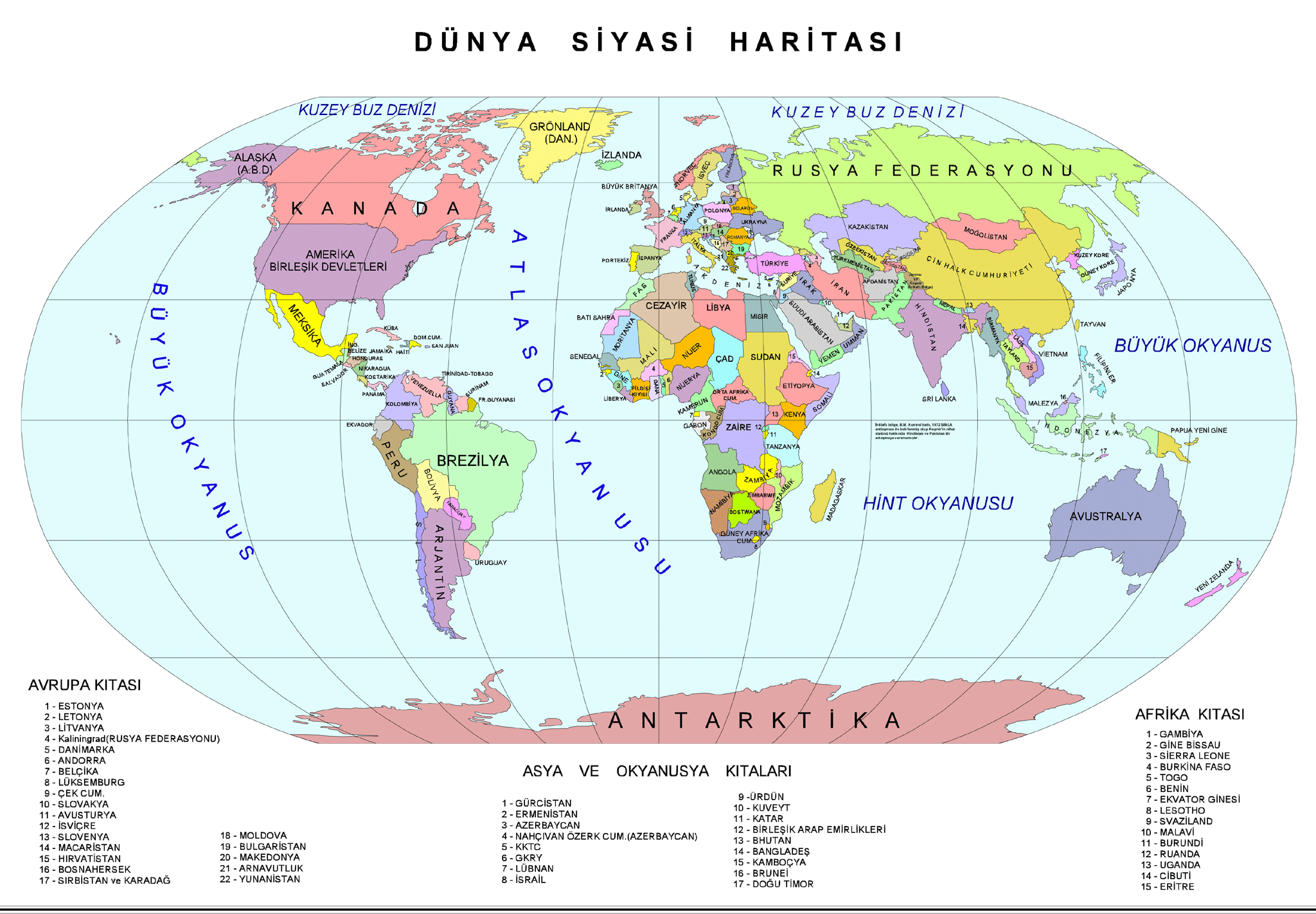
World Political Map Turkish
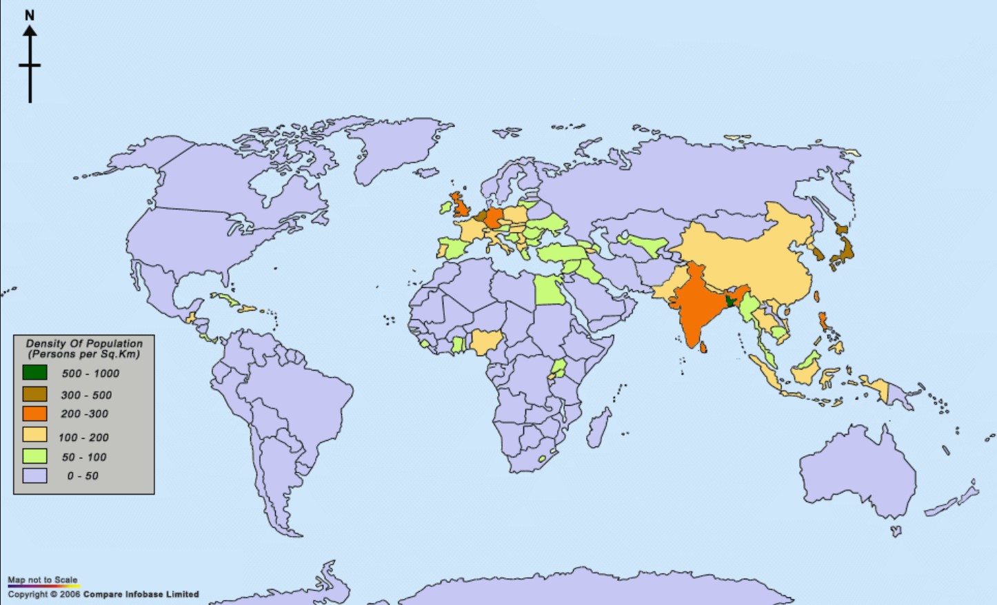
World Population Density Map
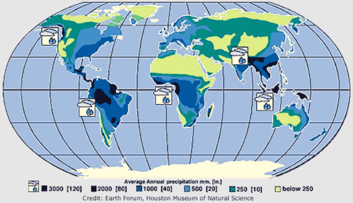
World Precipitation Map
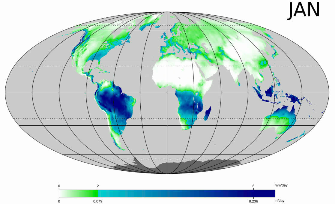
World Rainfall Map 2009
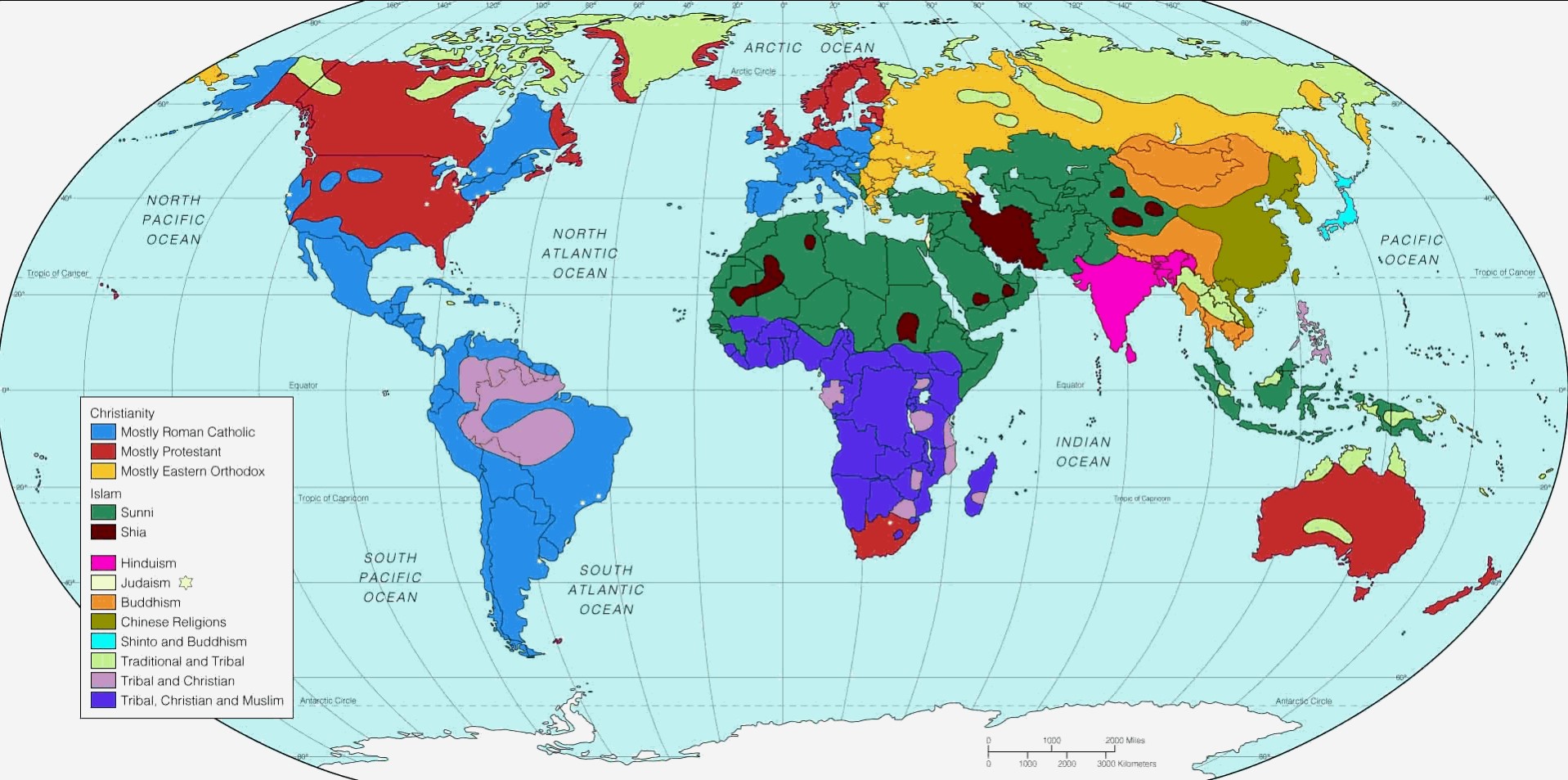
World Religions Map
World Satellite Map
World Social Network Map
World Soil Map
World Standard Time Zones Map
 ilgililinkerleriekle
- Head of Performance Marketing
- Head of SEO
- Linkedin Profile: linkedin.com/in/arifcagrici