Discover Oceania Maps: Political, Physical, and Regional Views
Discover Oceania Maps featuring countries, islands, political boundaries, satellite views, and regional maps of Melanesia, Micronesia, and Polynesia. Perfect for education, research, and travel planning. Find detailed Oceania Maps with Australia, New Zealand, Pacific Islands, political regions, geographic features, and satellite imagery for learning, research, and reference.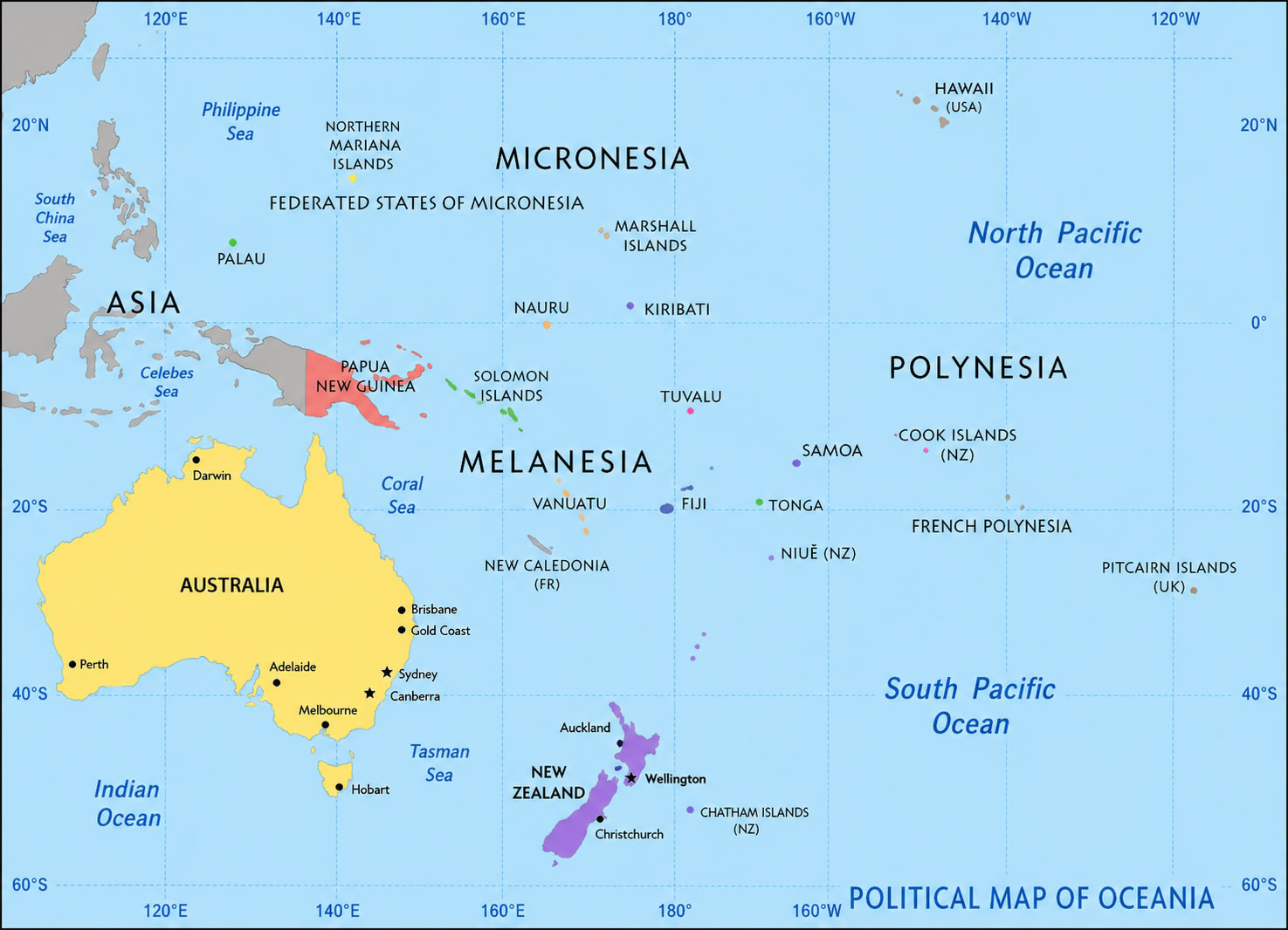
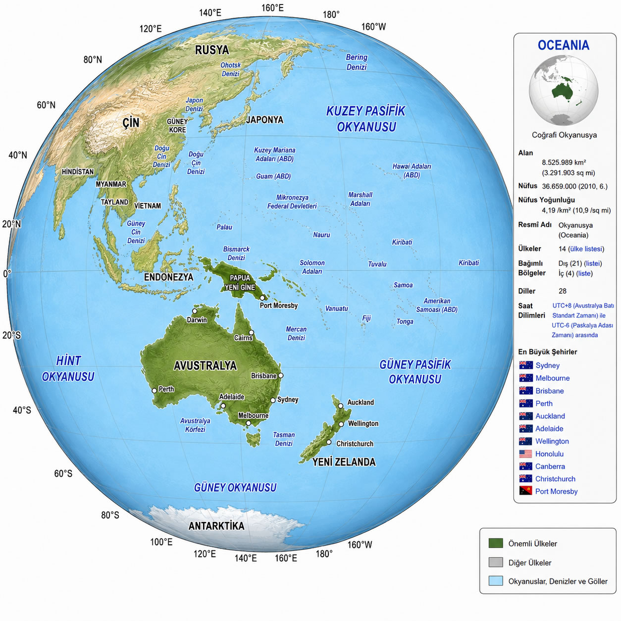
Oceania world globe map
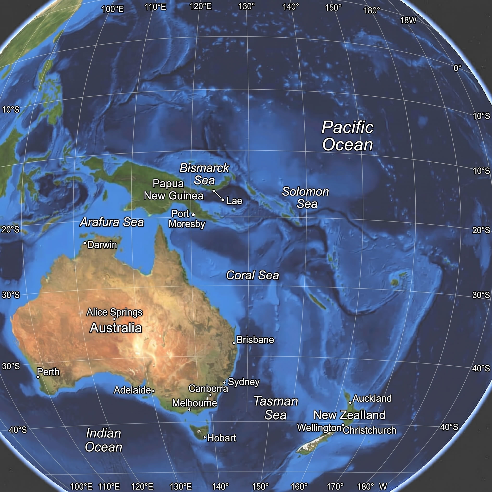
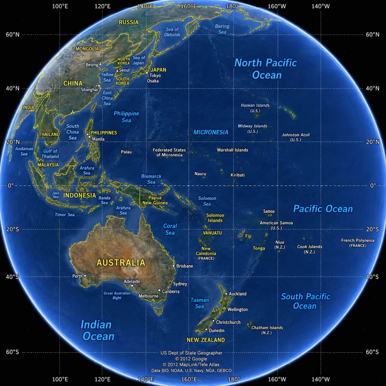
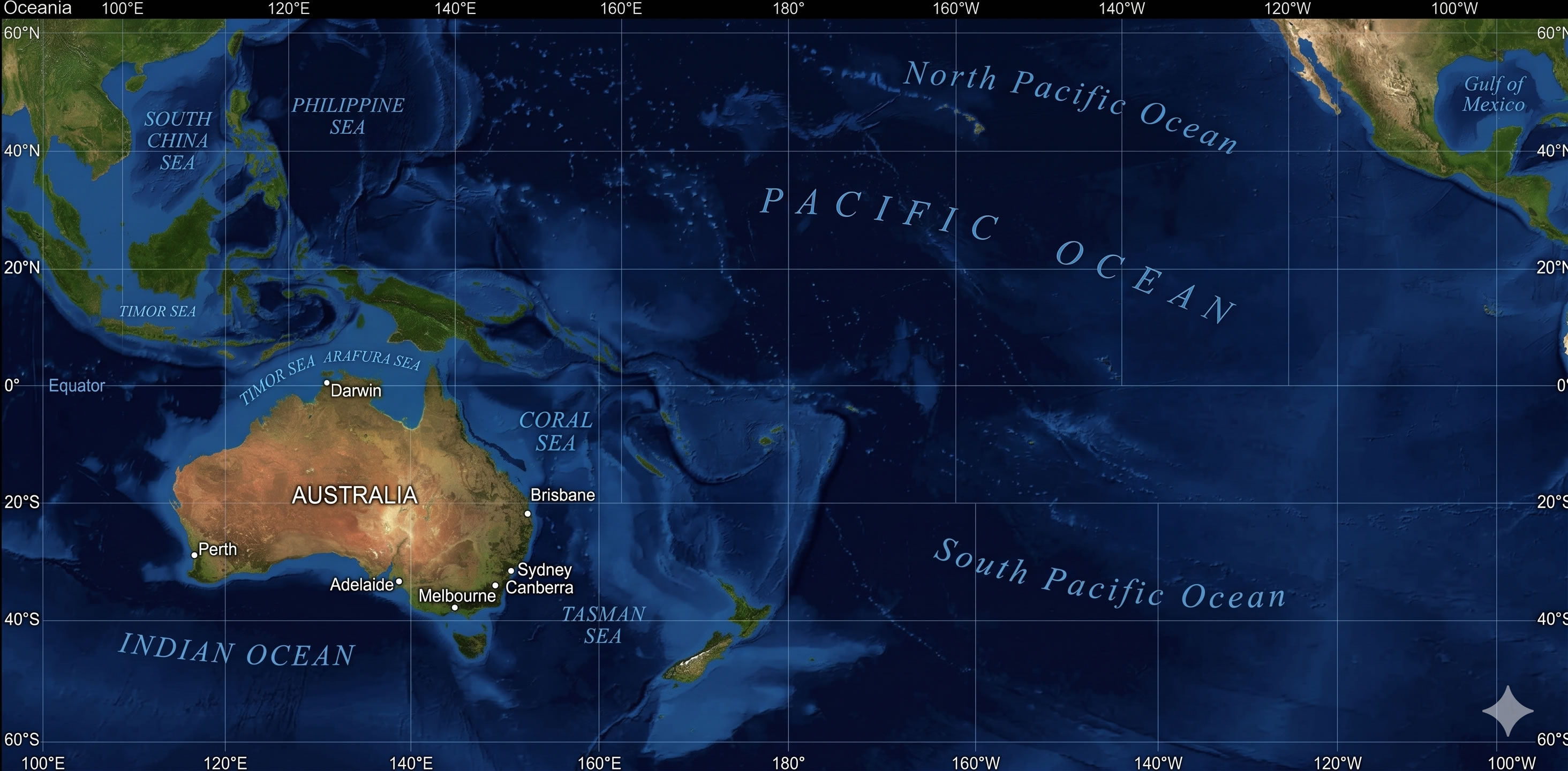
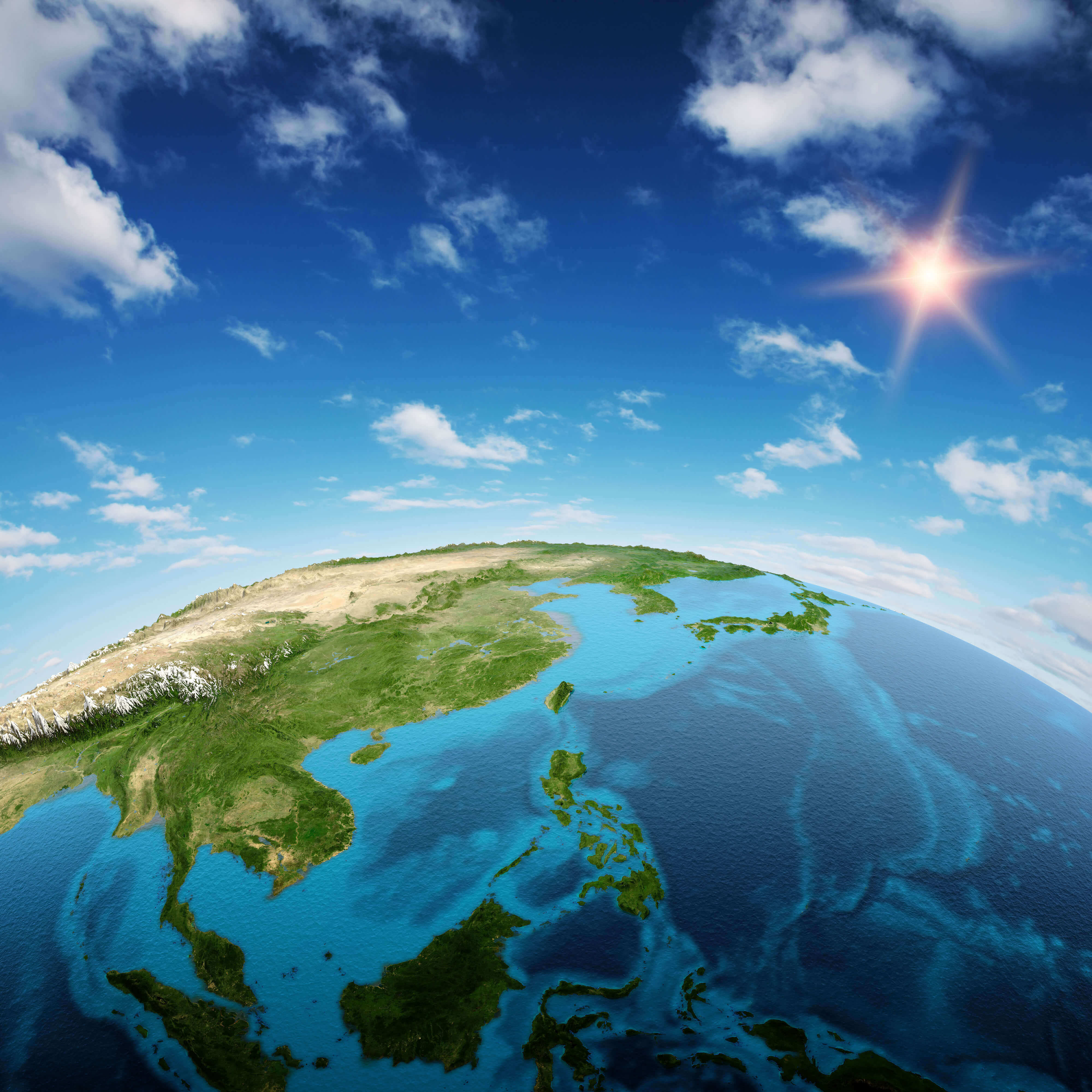
Oceania satellite globe map
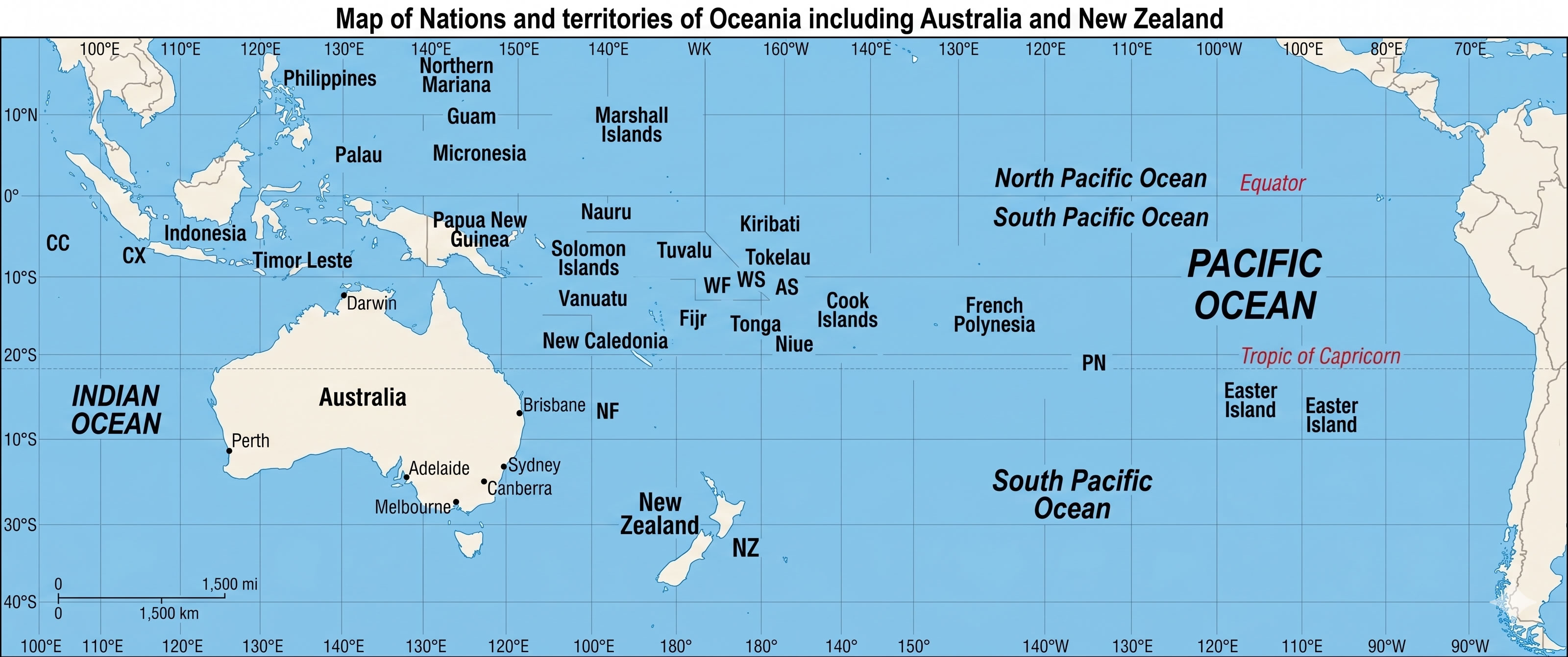
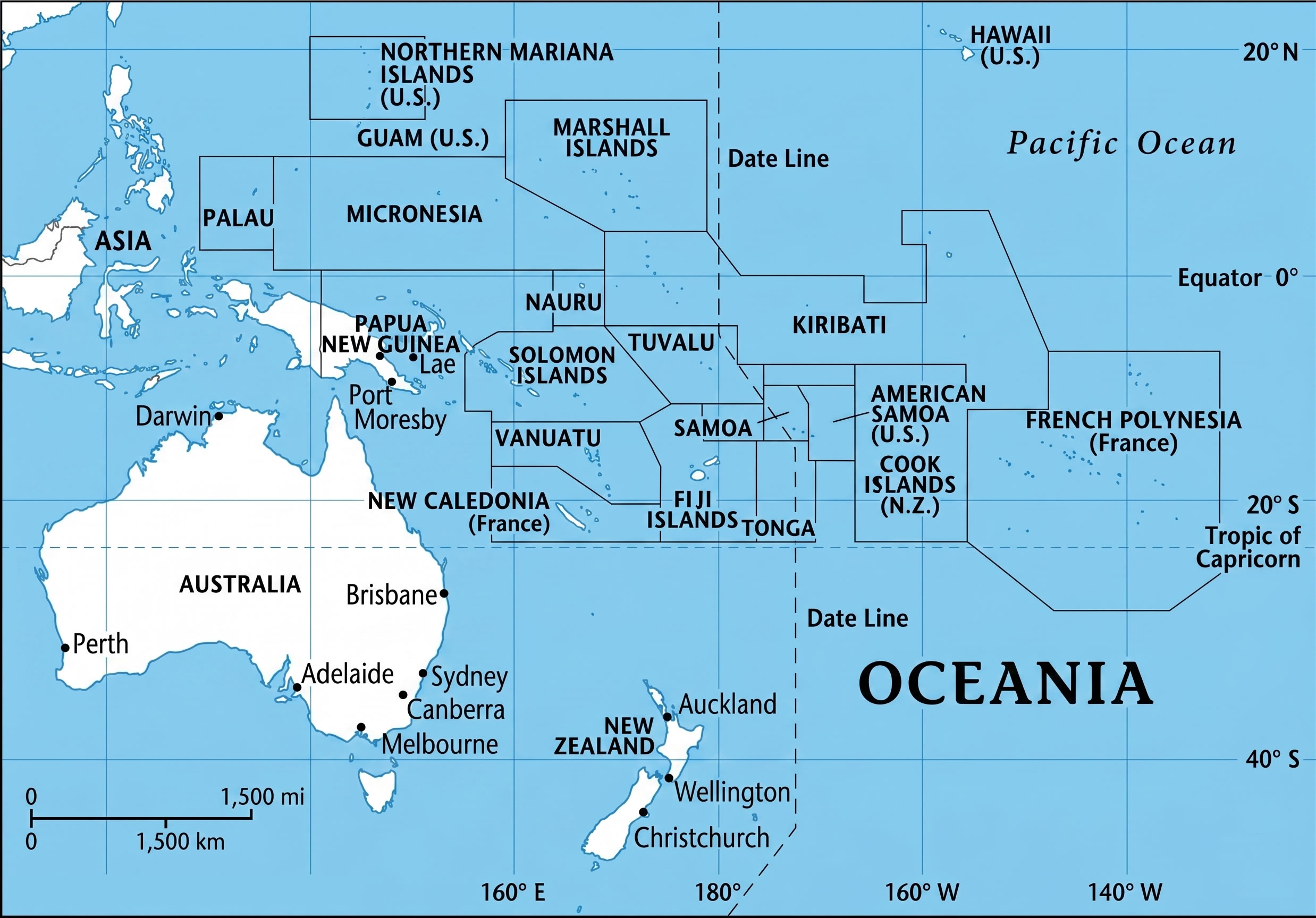
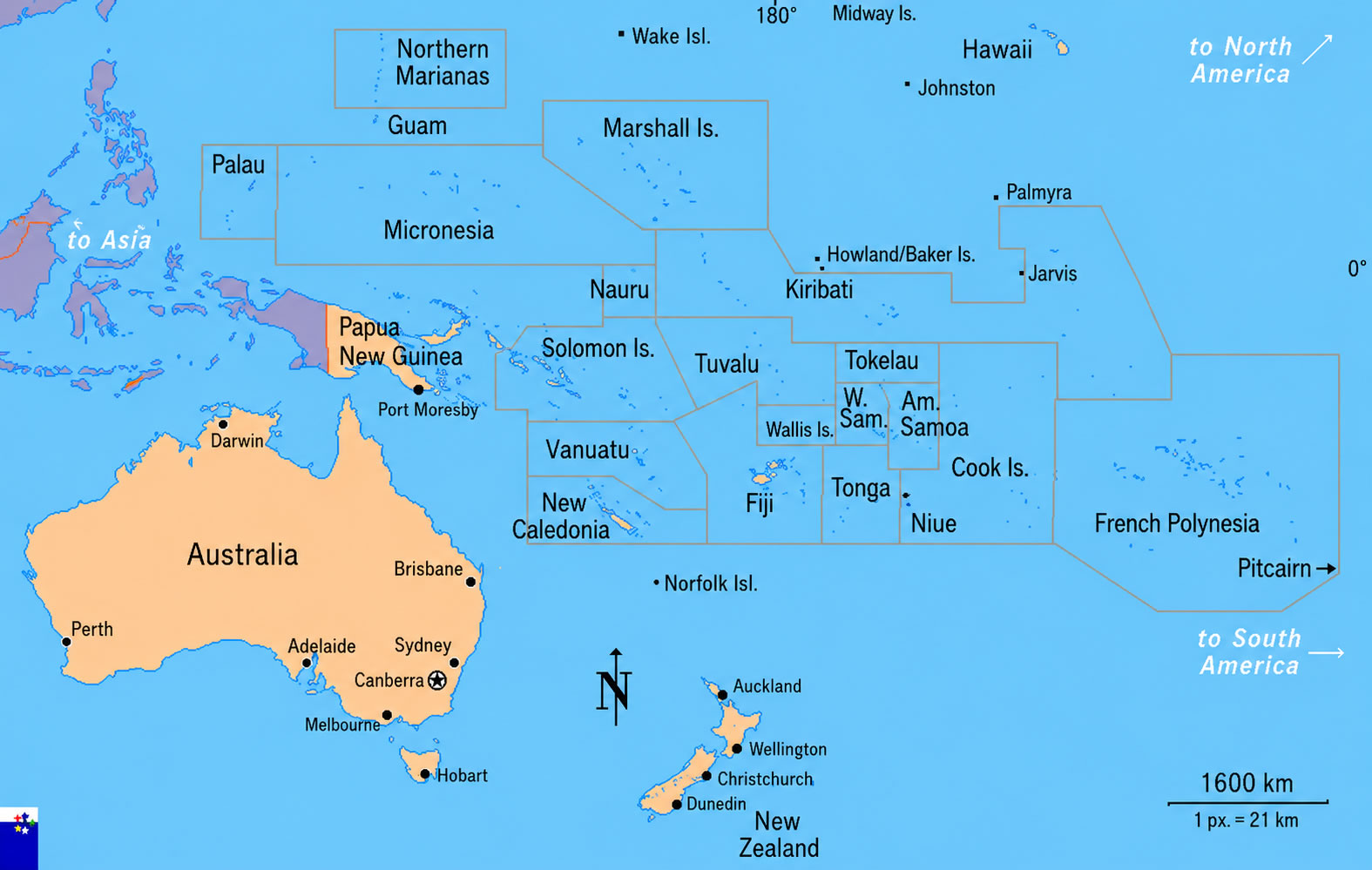
Political map of Oceania Countries and Islands
In addition to political maps, the collection offers specialized resources such as an Oceania satellite globe map, Oceania satellite relief map, Oceania topographic globe map, Oceania world globe map, and a Pacific Ocean Oceania globe map. These maps provide valuable insights into the region’s physical geography, island formations, and location within the wider Pacific. Whether you are researching Oceania subregions with Australia and New Zealand, studying the relationship between Southeast Asia and Oceania, or simply asking where Oceania is in the world, this collection serves as a valuable reference for education, research, travel planning, and geographic exploration.
Oceania political map overview with Pacific Islands
Oceania political map with countries
Australia Oceania map
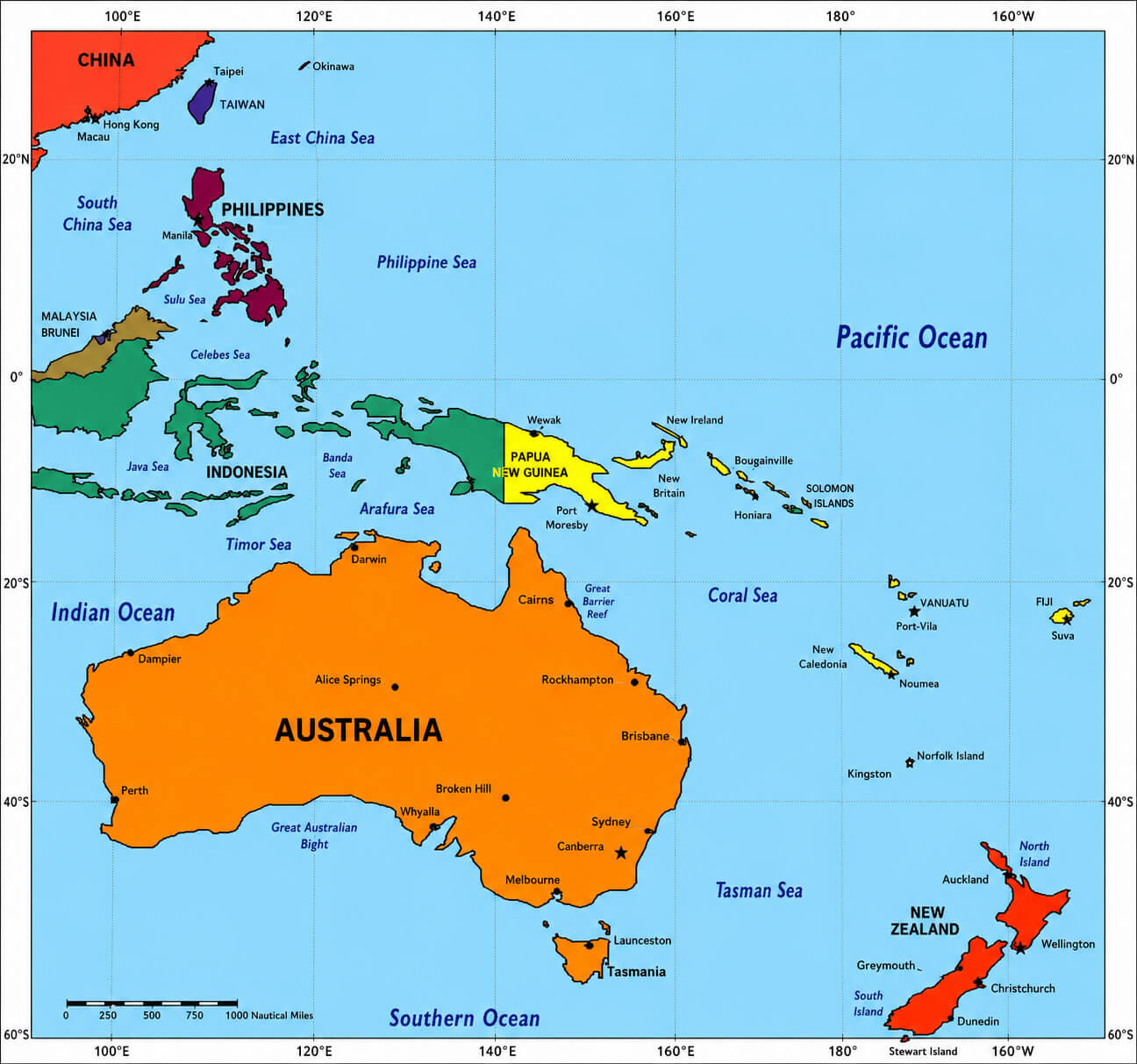
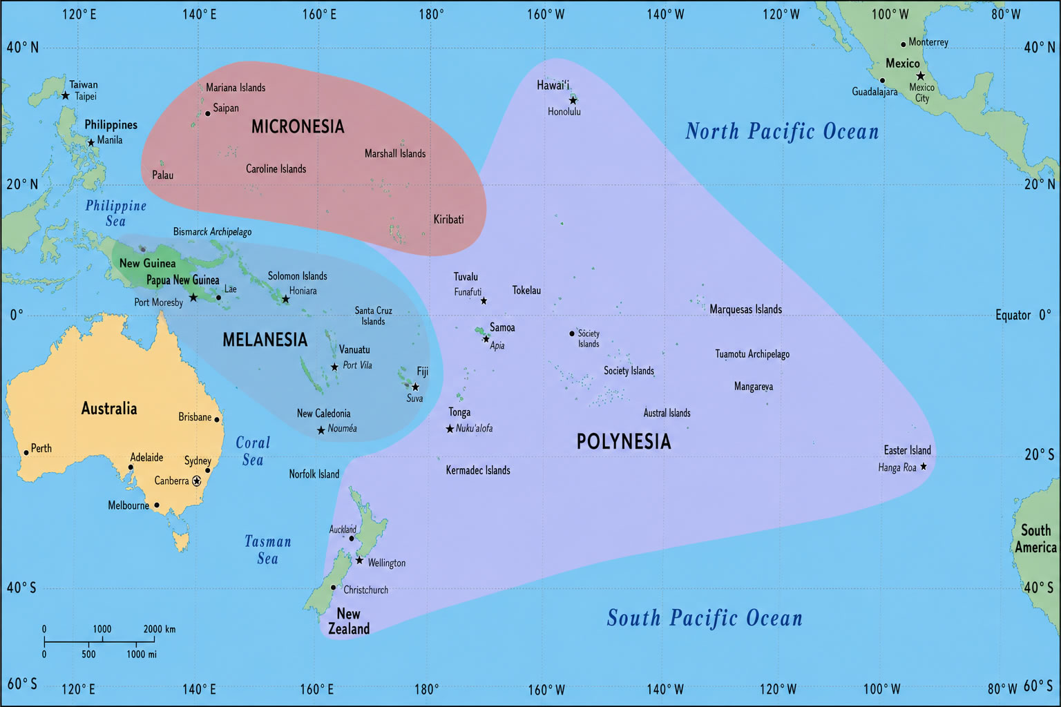
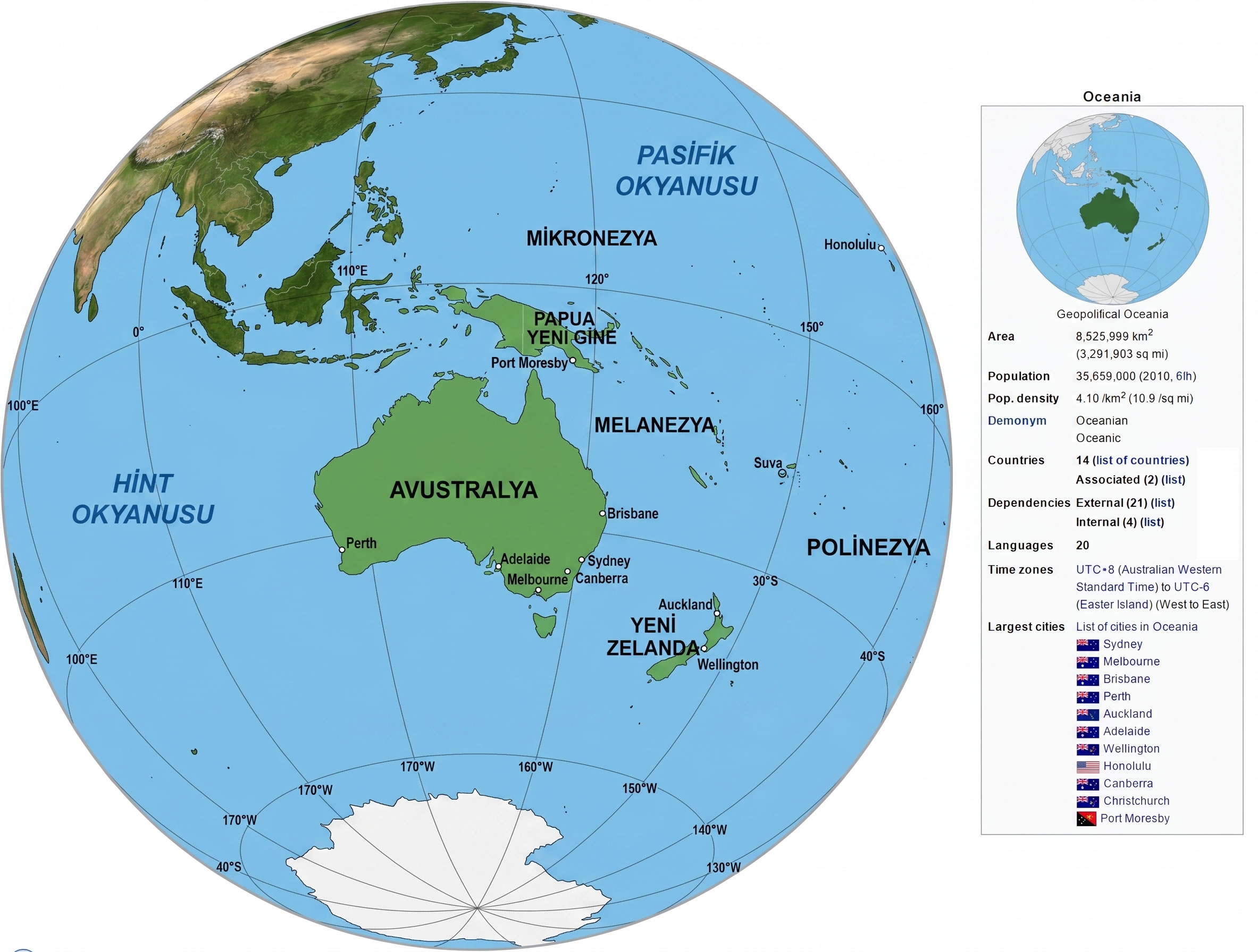
In addition to country and political maps, the collection includes detailed regional maps of Melanesia, Micronesia, and Polynesia, showcasing the unique cultural and geographic characteristics of Oceania’s major subregions. Users can also explore satellite and reference maps that highlight the region’s diverse islands, oceanic landscapes, and strategic location within the Pacific. Whether for education, research, travel planning, or geographic analysis, these Oceania maps serve as reliable and informative visual resources.
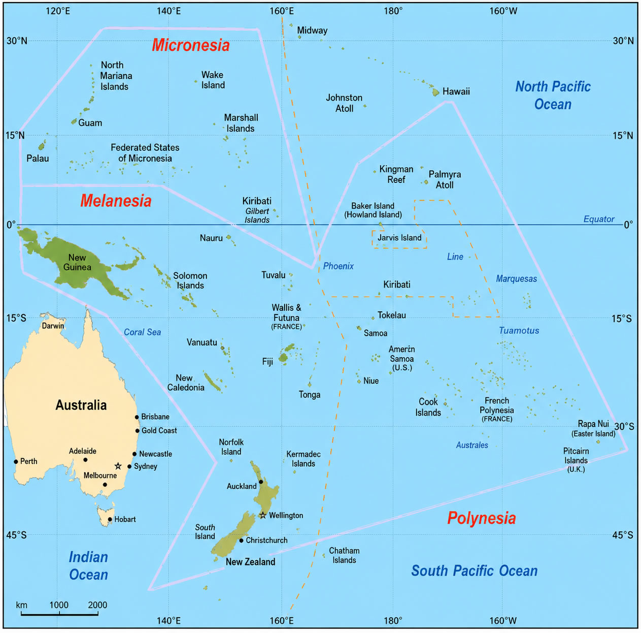
Polynesia Melanesia Micronesia regions map
Oceania topographic globe map
Oceania regions map Melanesia Micronesia Polynesia
Oceania satellite relief map
Oceania subregions map with Australia and New Zealand
Pacific Ocean Oceania globe map
Political map of Oceania
South east asia map and Oceania satellite image
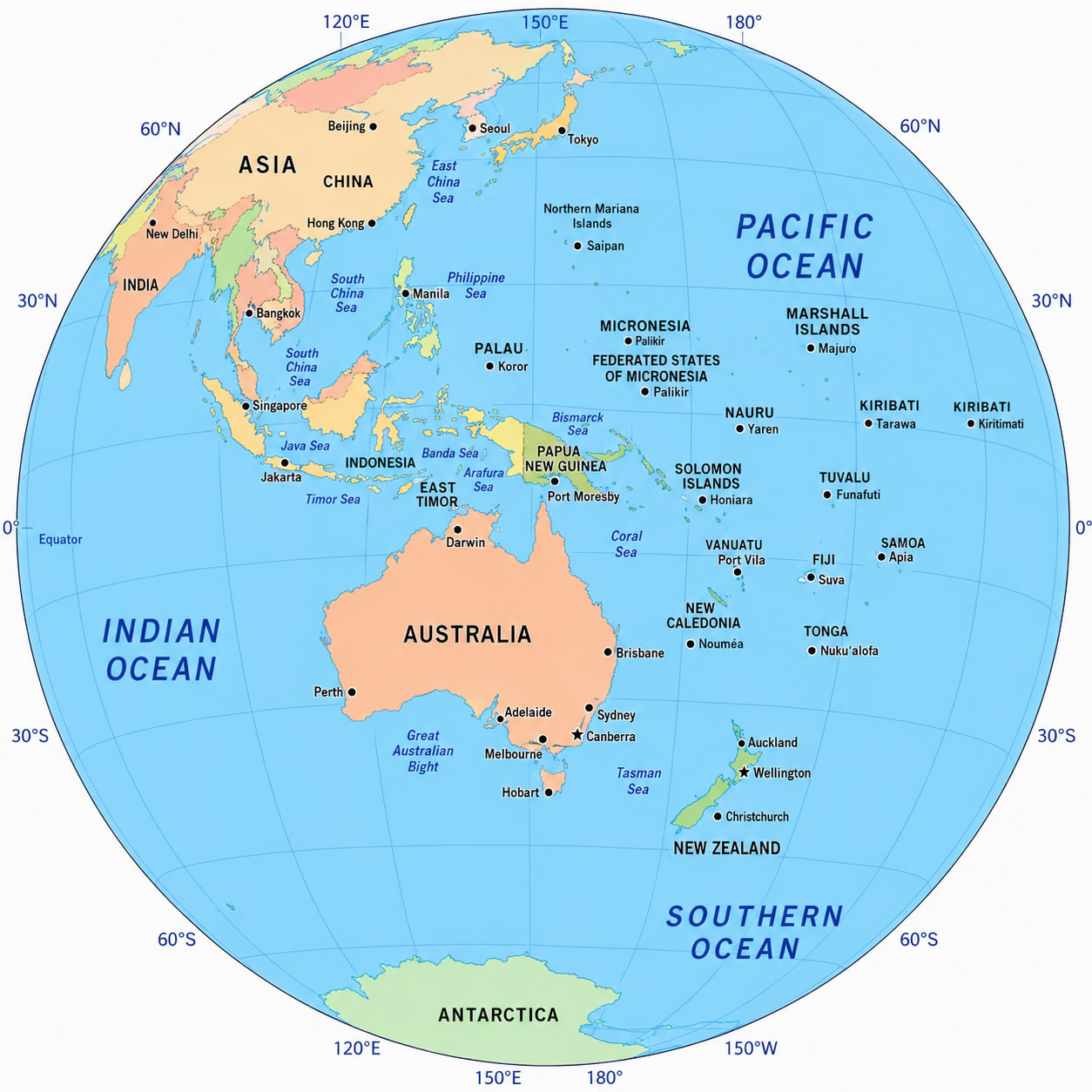
Where is Oceania in the world
Feel free to explore these pages as well:
- Head of Performance Marketing
- Head of SEO
- Linkedin Profile: linkedin.com/in/arifcagrici