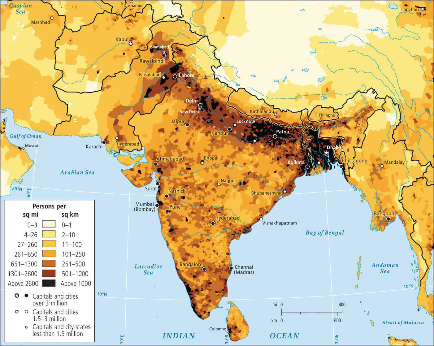
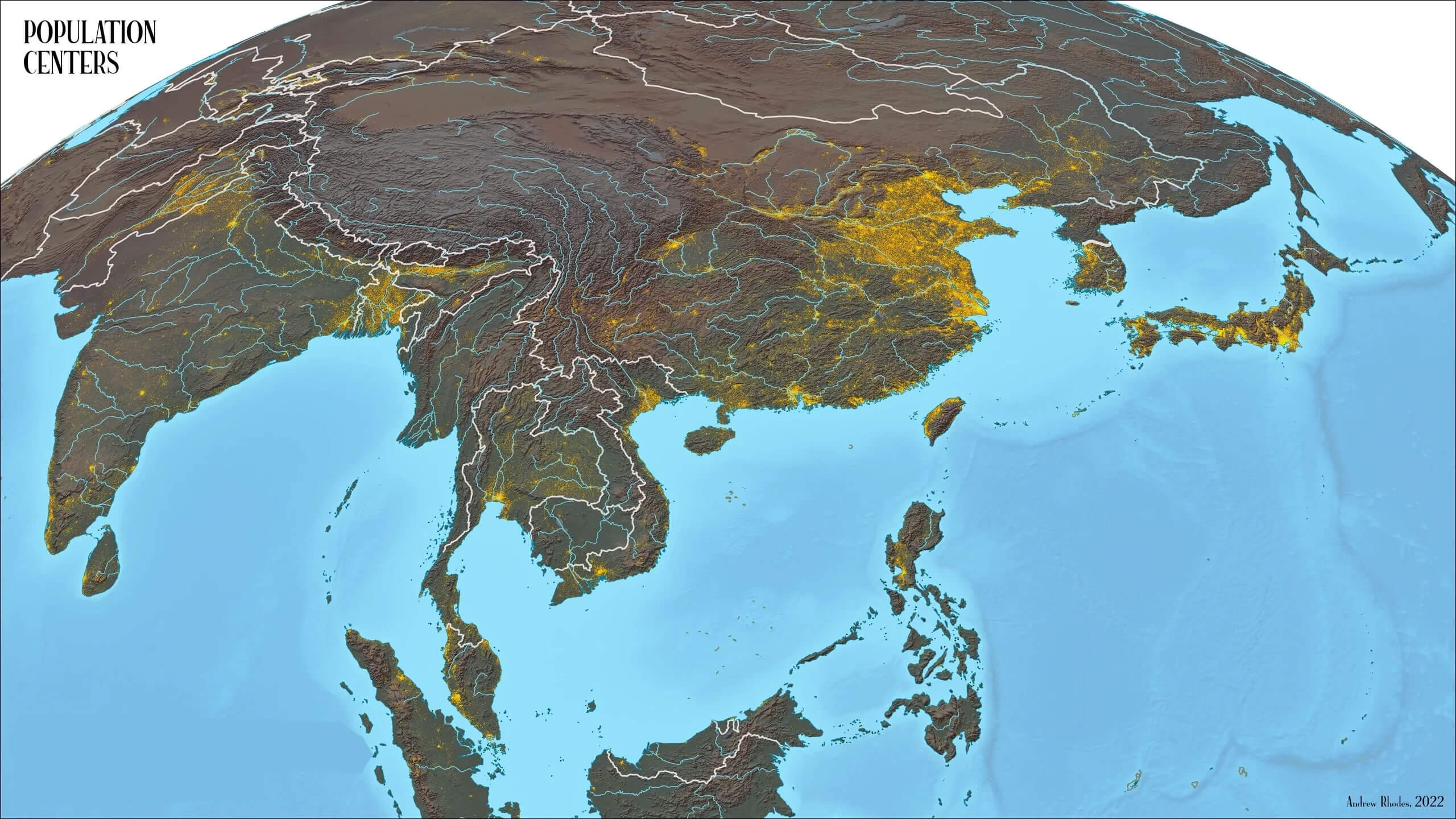
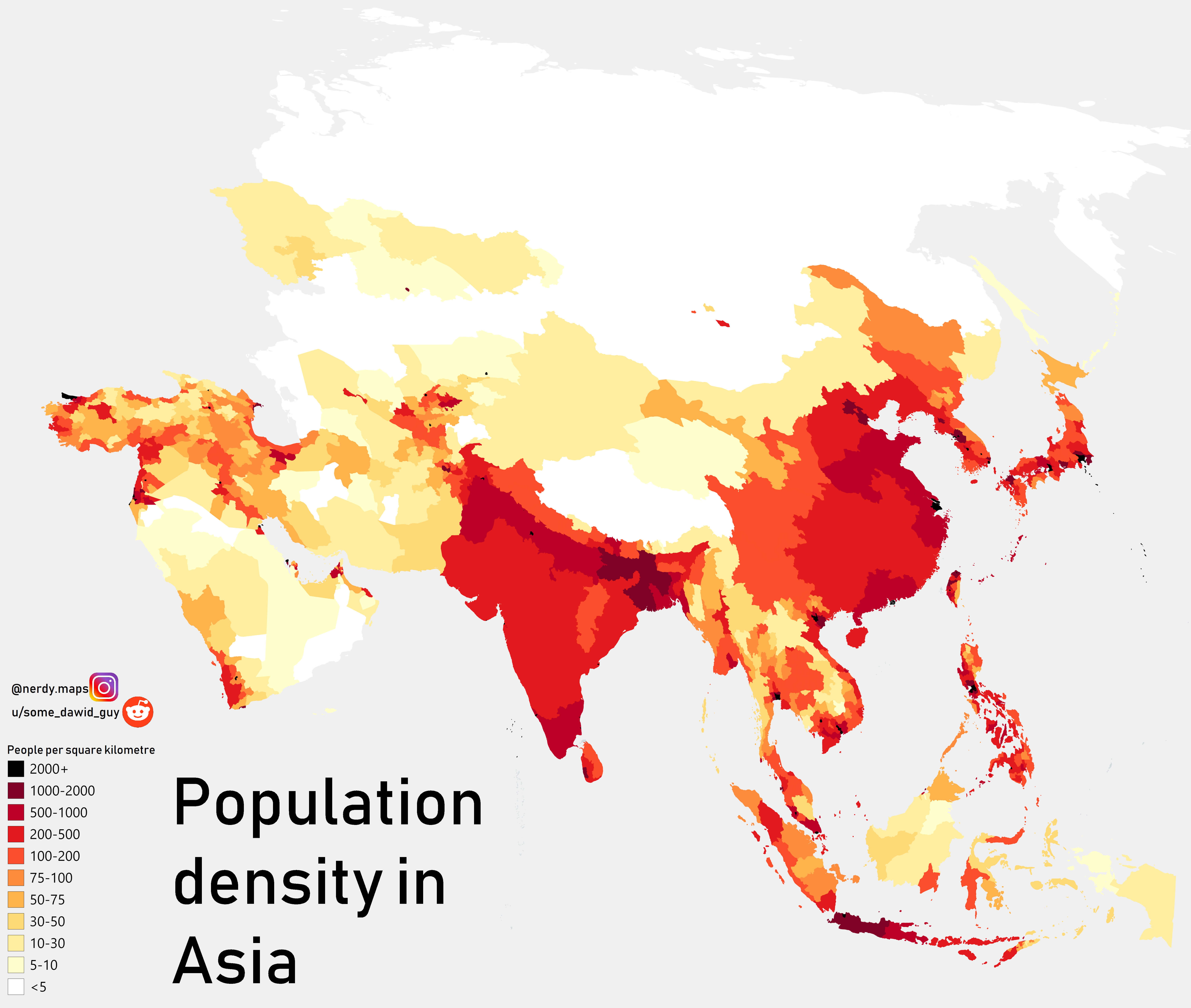
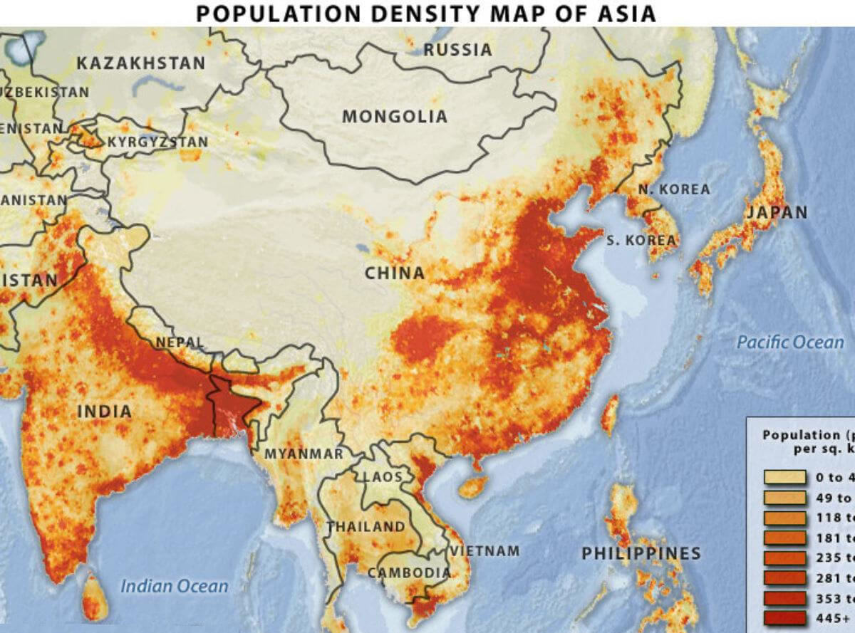
Asia Population Density Map: Understanding Regional Population Concentrations
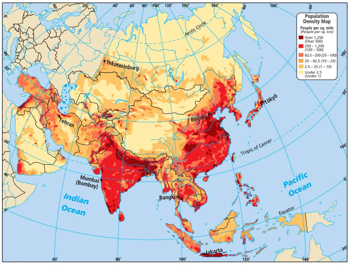 Population density map of Asia showing high and low-density regions in color gradients.
This population density map of Asia gives you a clear view of where people live across the continent. Areas like eastern China, India, and Southeast Asia stand out in deep red for their high population, while lighter shades highlight the vast, less populated regions of Central Asia and Siberia. It’s a helpful resource for understanding Asia’s demographics at a glance.
Muslim Population Distribution in Asia circa 1930
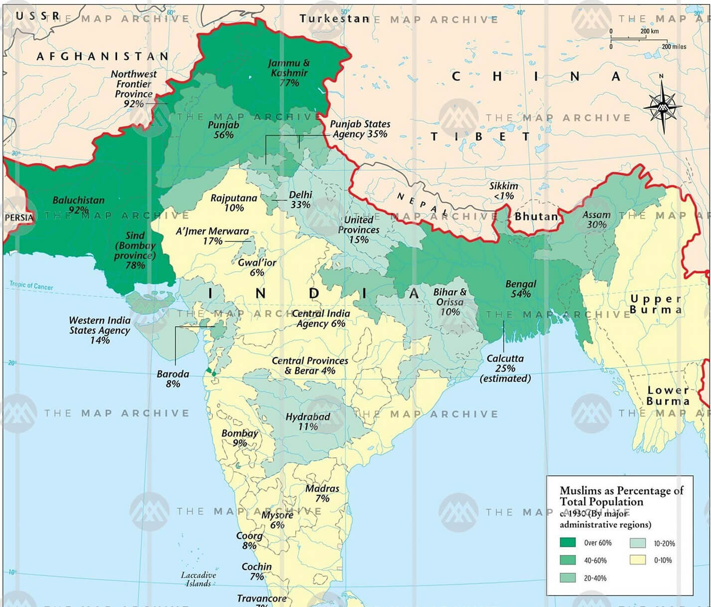 Map showing Muslim population percentage across South Asia around the year 1930.
This historical population map offers a glimpse into the religious landscape of South Asia around 1930. It shows Muslim population percentages across the region, with areas like Punjab, Bengal, Sindh, and the North-West Frontier Province showing high concentrations—often above 60%. In contrast, central and southern India reflect much lower percentages. The map captures a key moment in time, just before the partition.