High-Resolution Israel Map with Cities, Borders and Terrain
Explore Israel high-resolution map pages featuring detailed physical and political maps, city and road maps, and international boundary maps with highways. This collection includes the 12 Tribes of Israel map (1200–1050 BC) and the 1947 UN Palestine partition map, offering historical and modern cartographic references. 
High-Resolution Israel Political Map
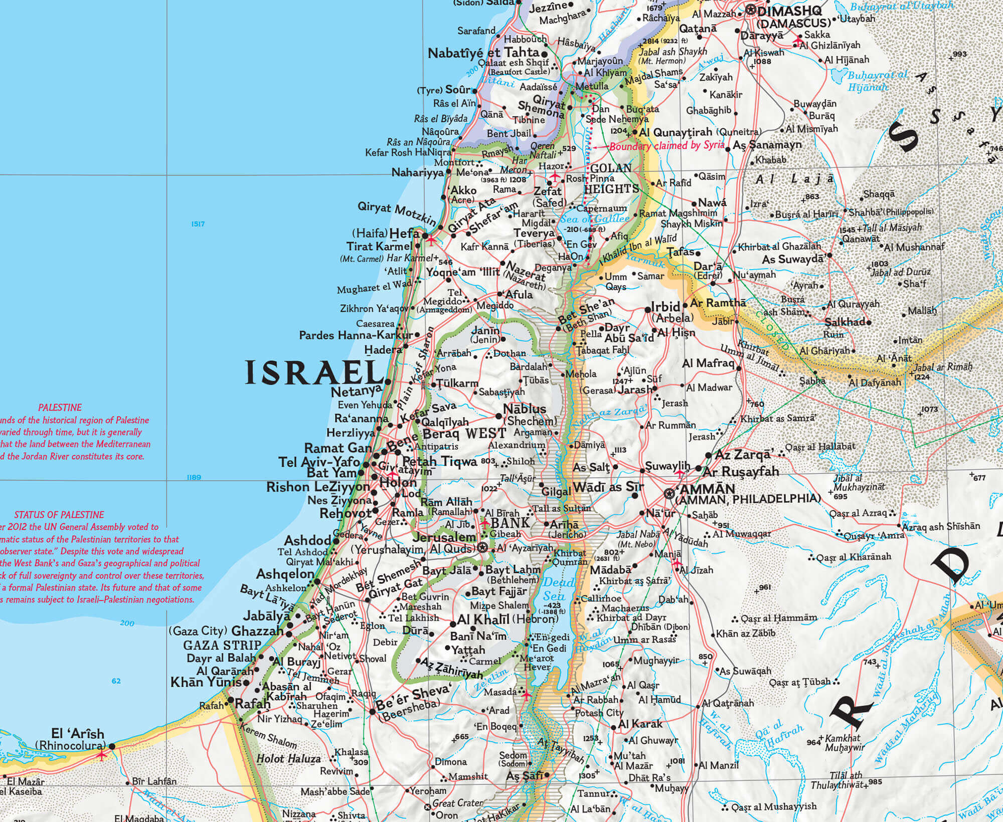
Detailed Israel road map with cities
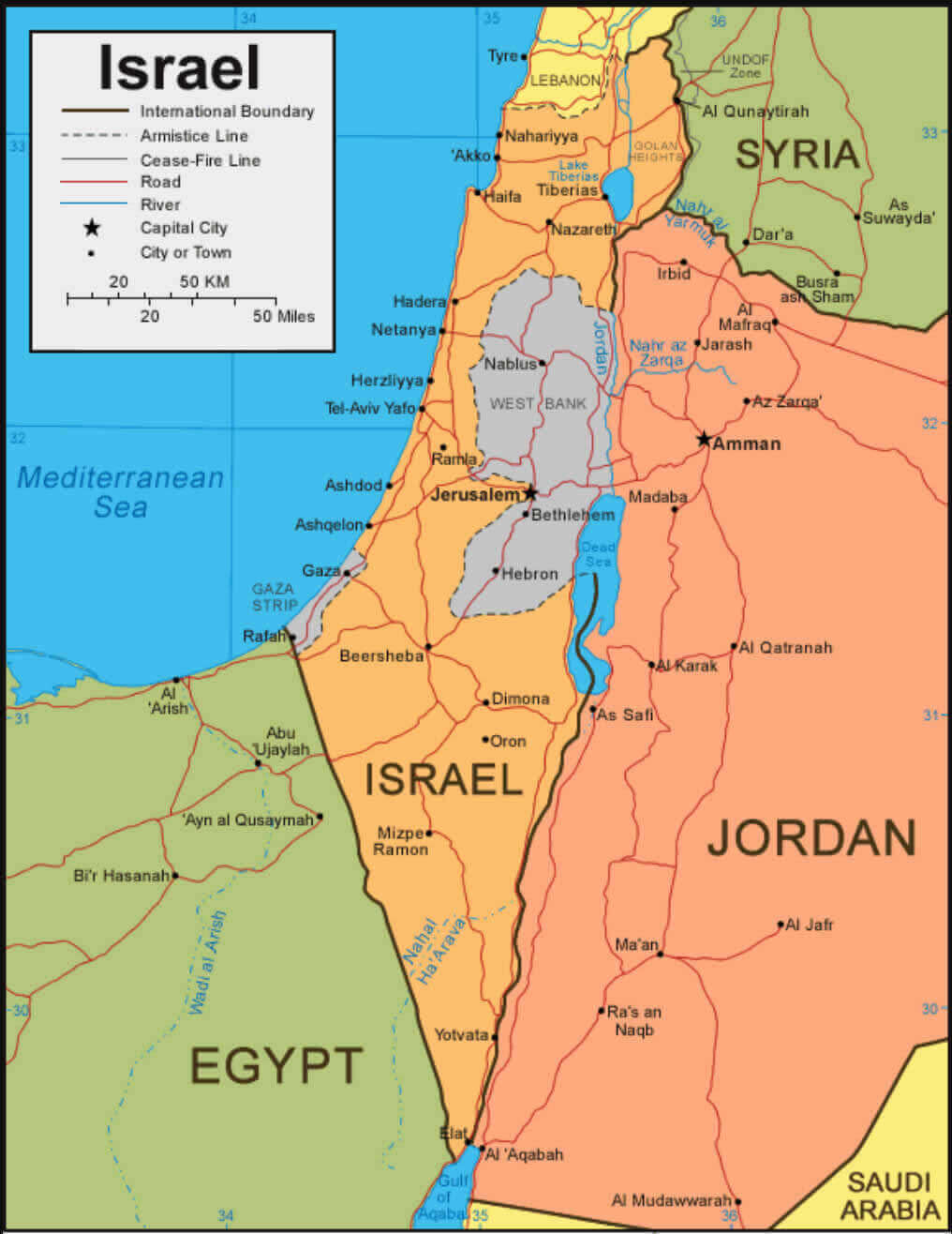
Israel international boundary map with highways
High resoultion Israel physical map with cities
High-resolution Map of Israel
12 tribes of Israel map between 1200 and 1050 BC

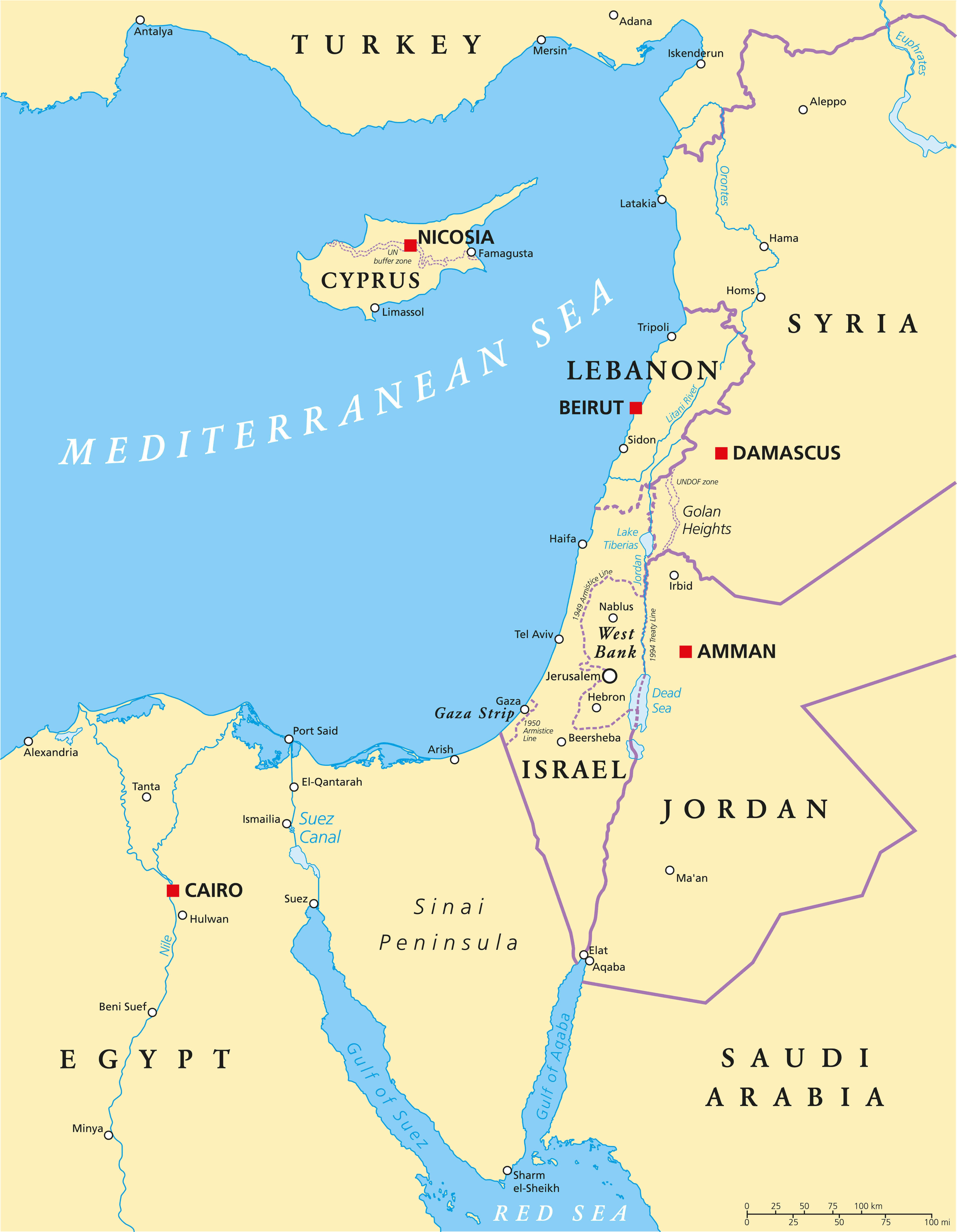
Detailed geographic eastern mediterranean Israel wall map
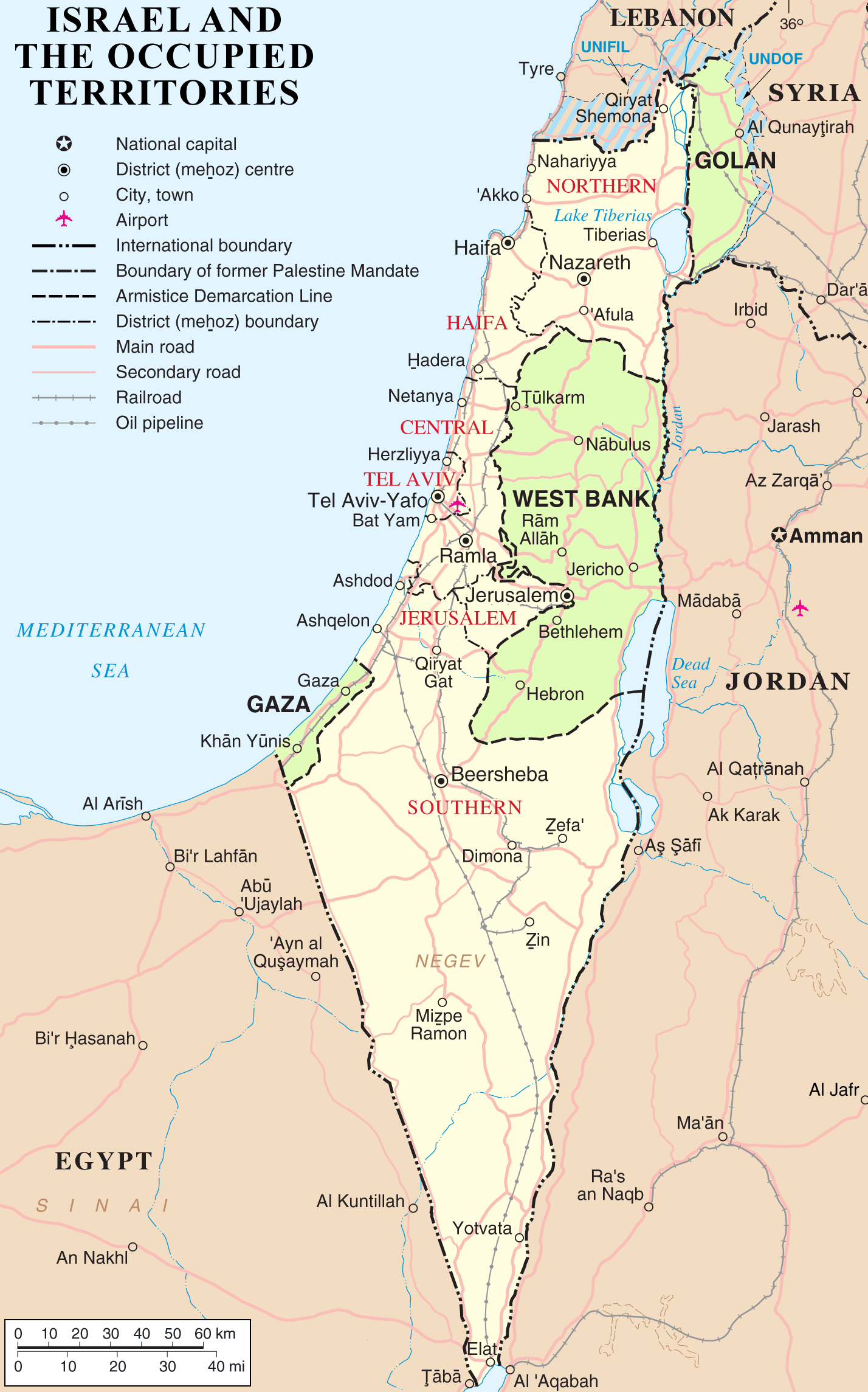
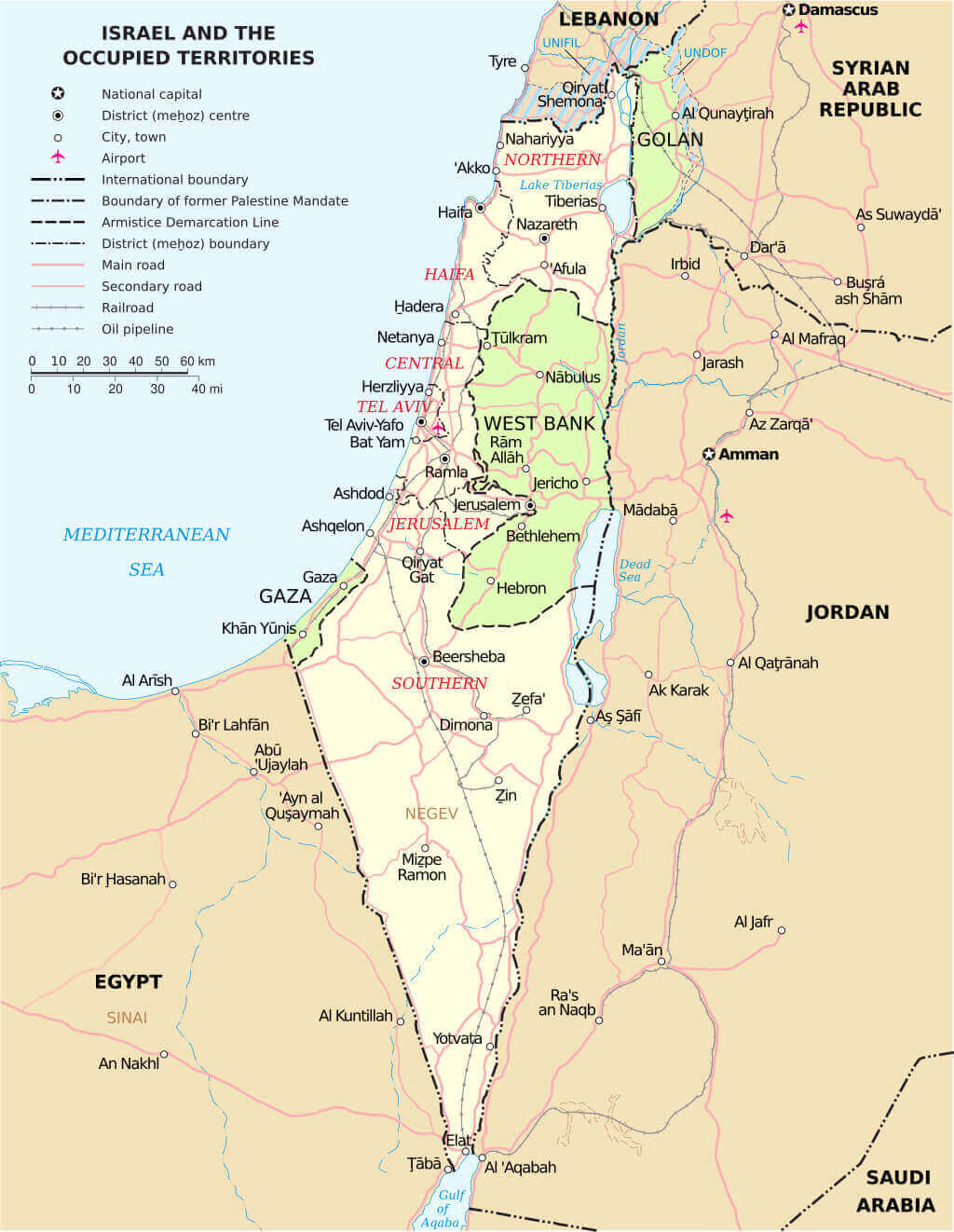
Israel and occupied territories road oil pipeline map
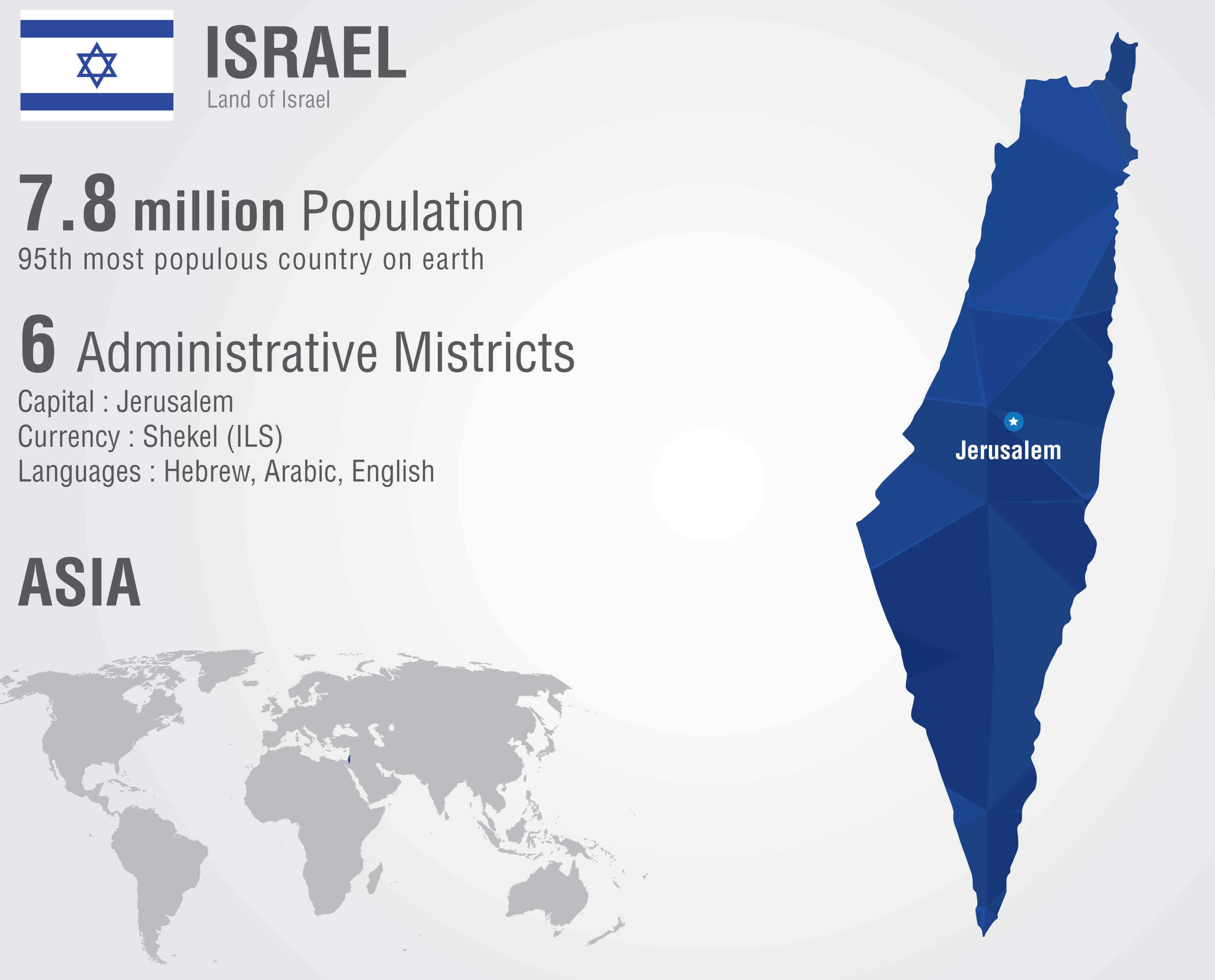
Israel country map with national flag
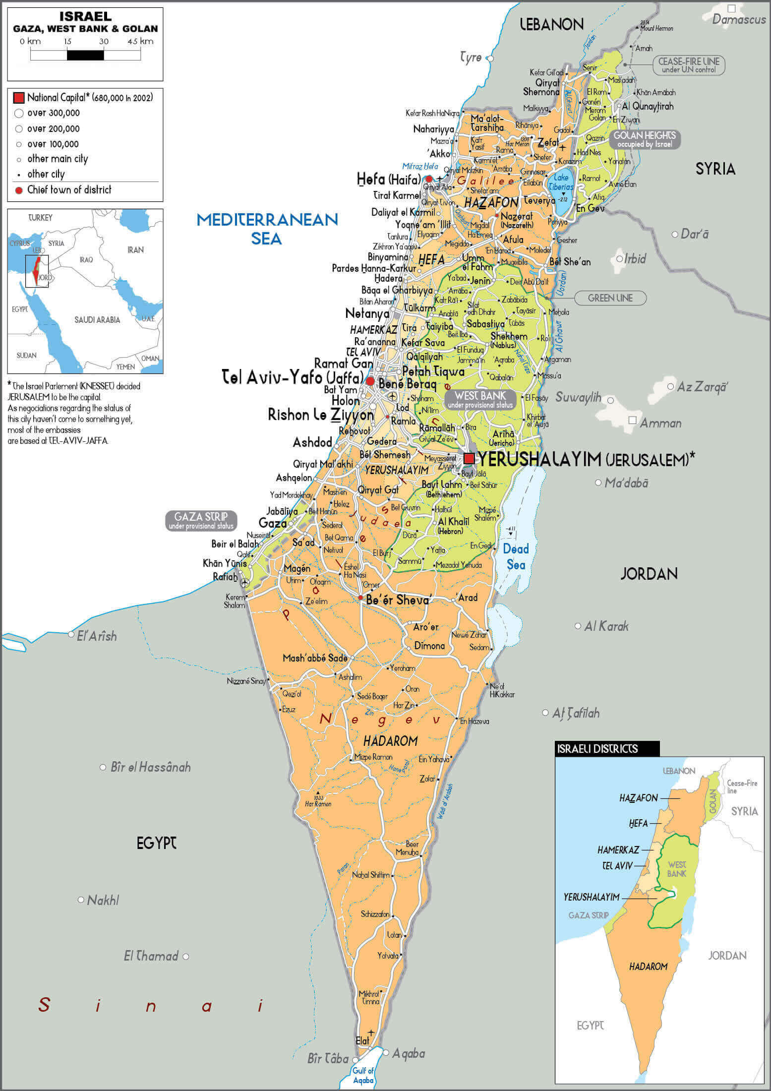
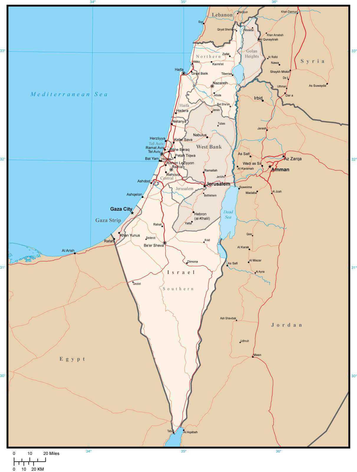
Israel Gaza West Bank physical map
Israel high resolution major cities map
Israel high resolution road map
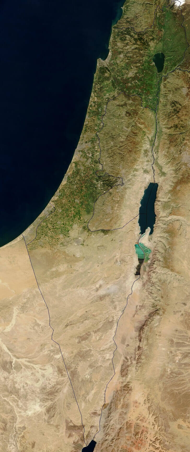
Israel high resolution satellite map
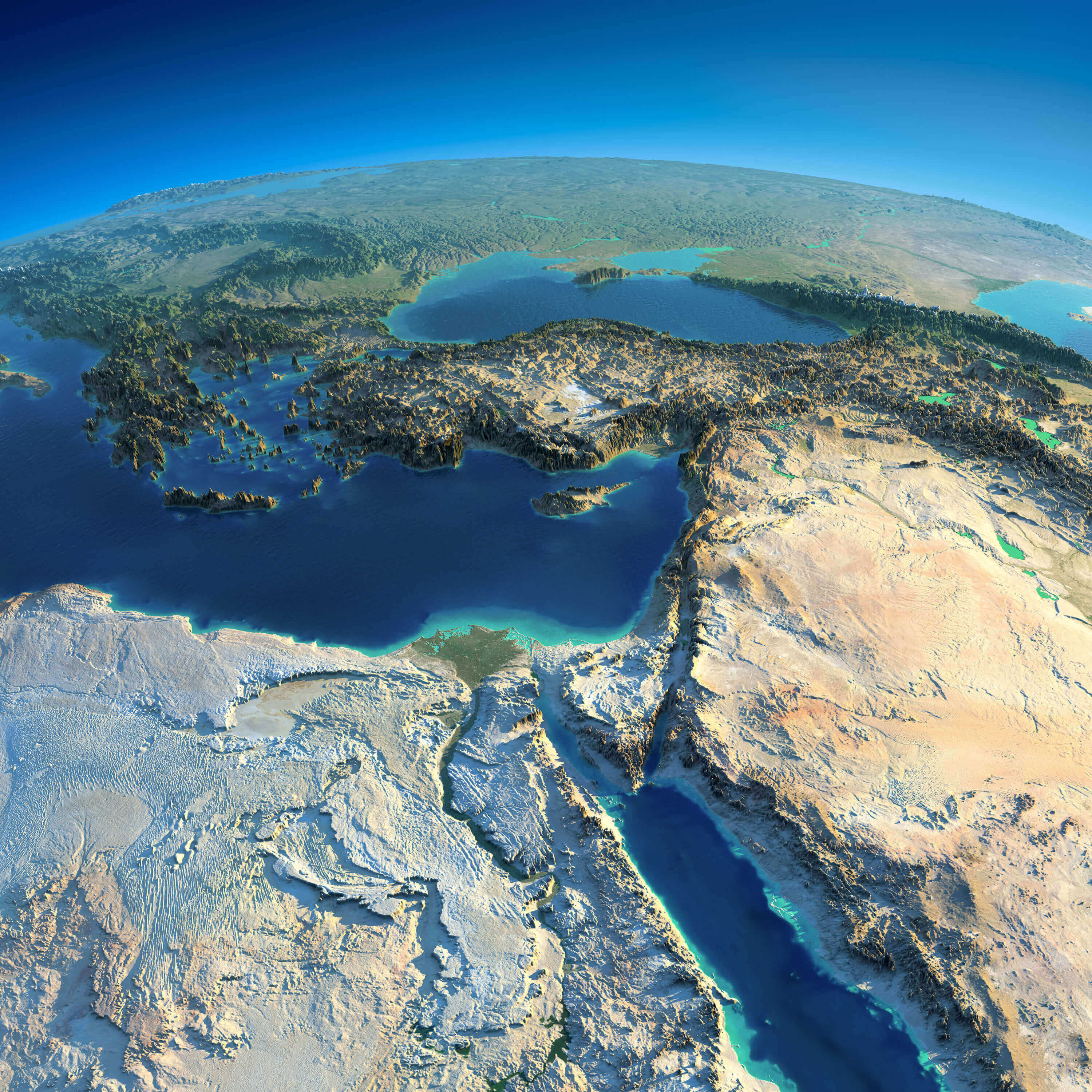
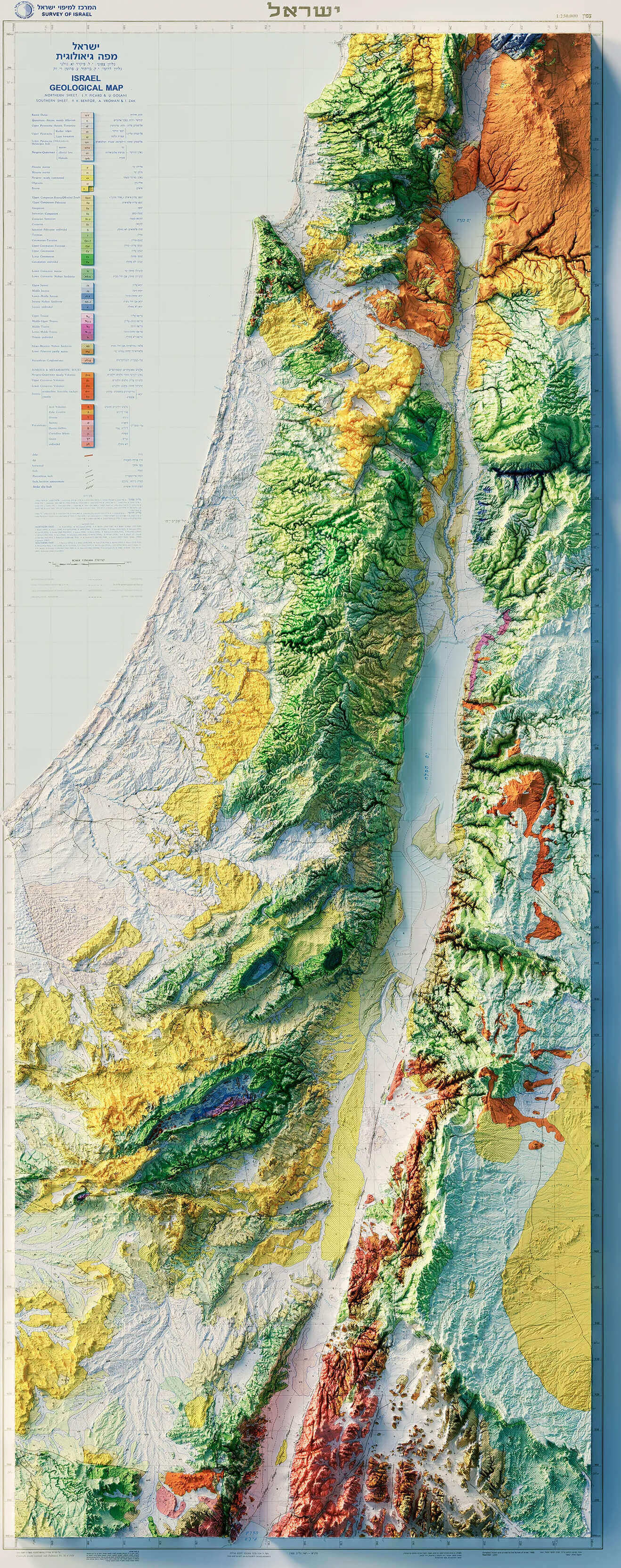
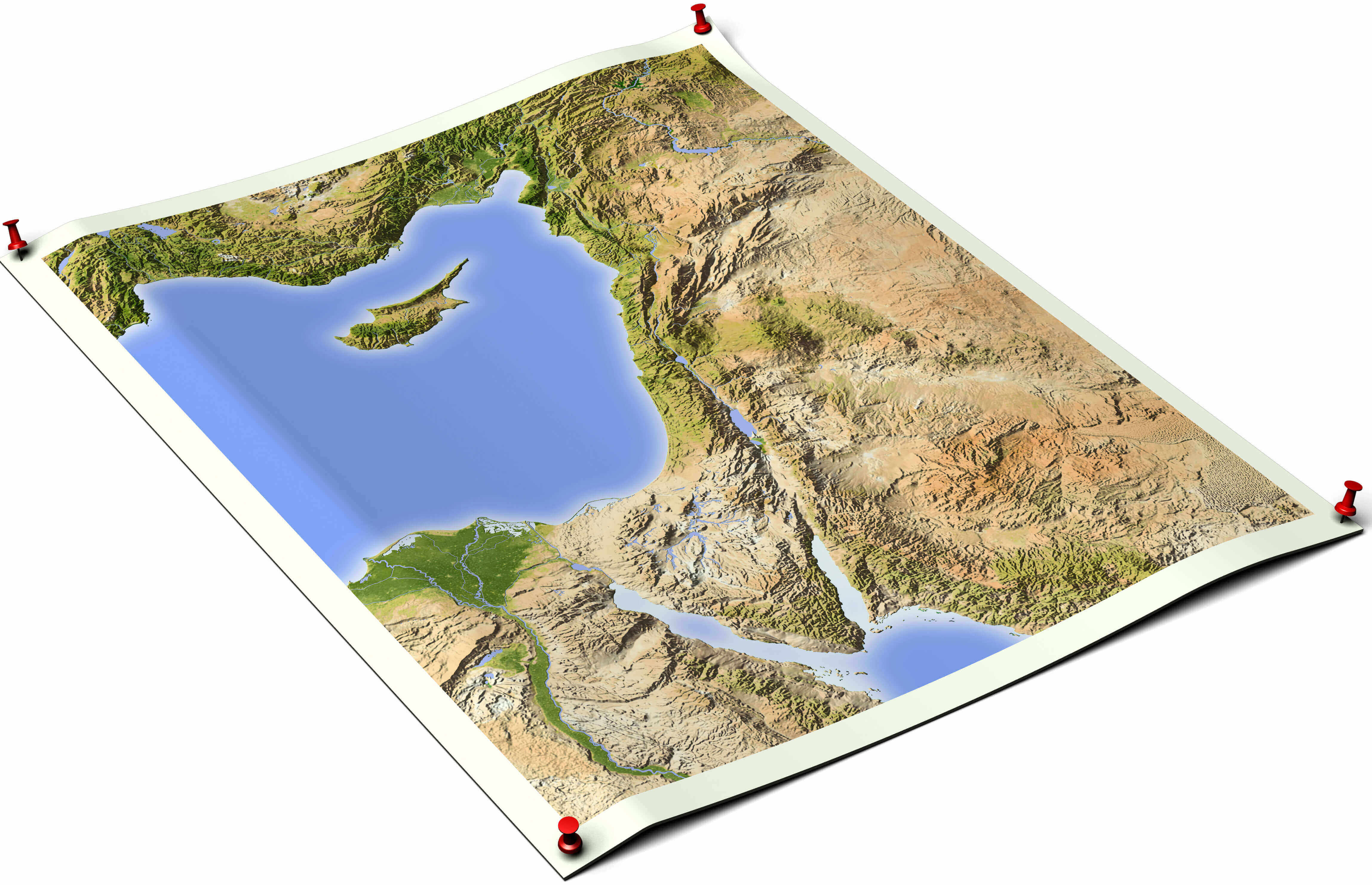
Israel large topography map
Israel political map with main cities
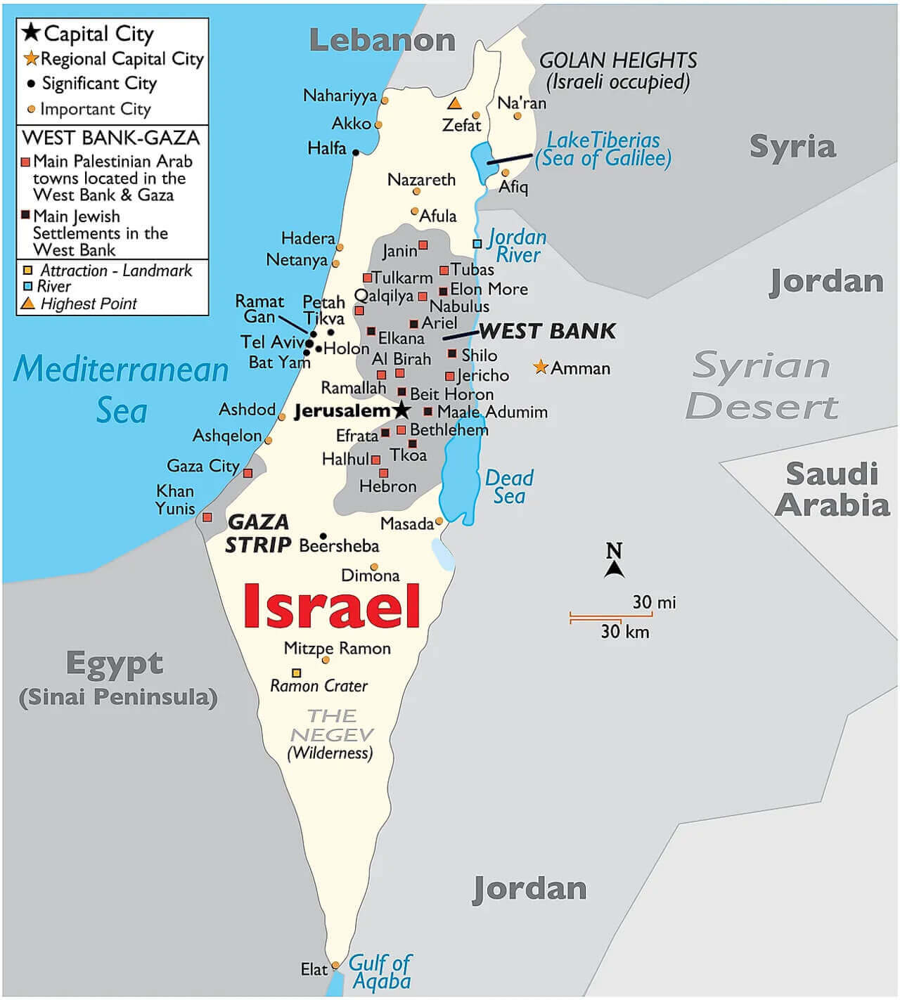
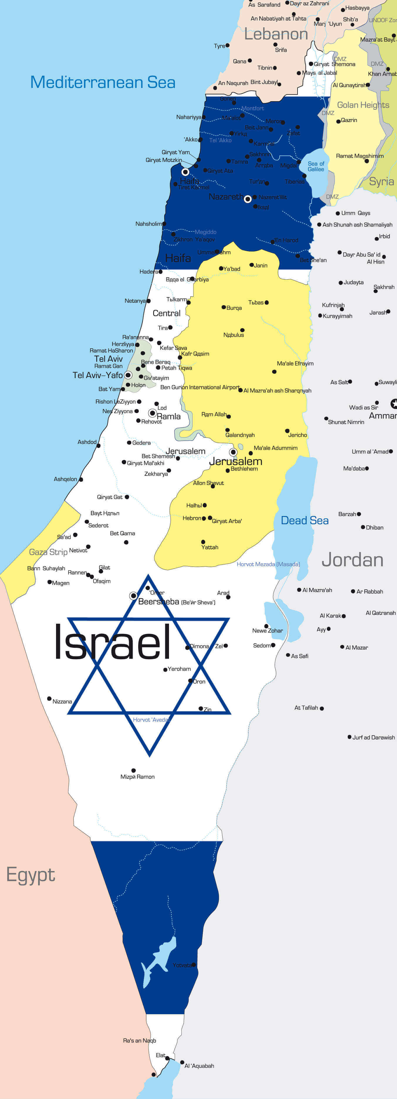
Israel west bank gaza strip golan heights map
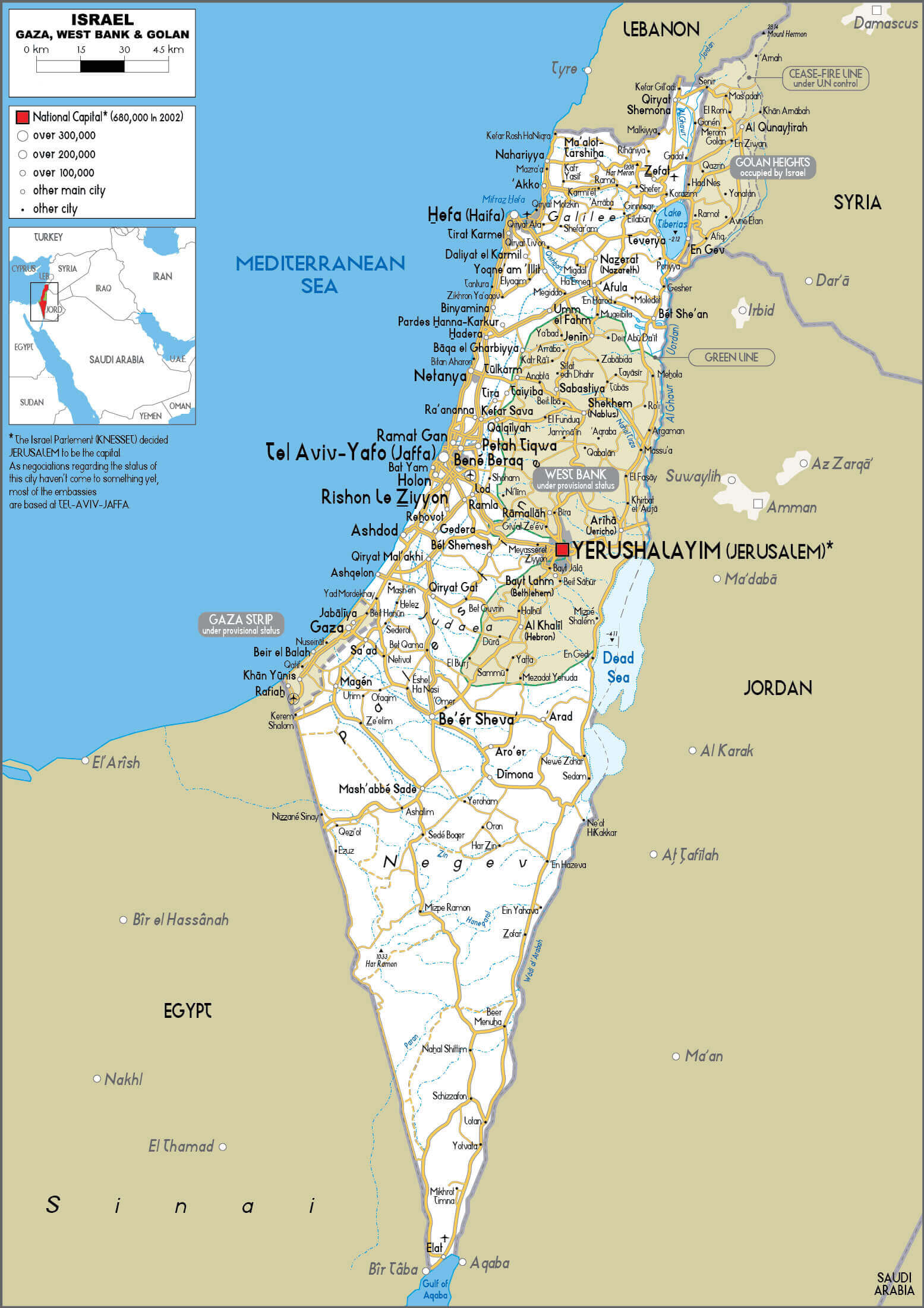
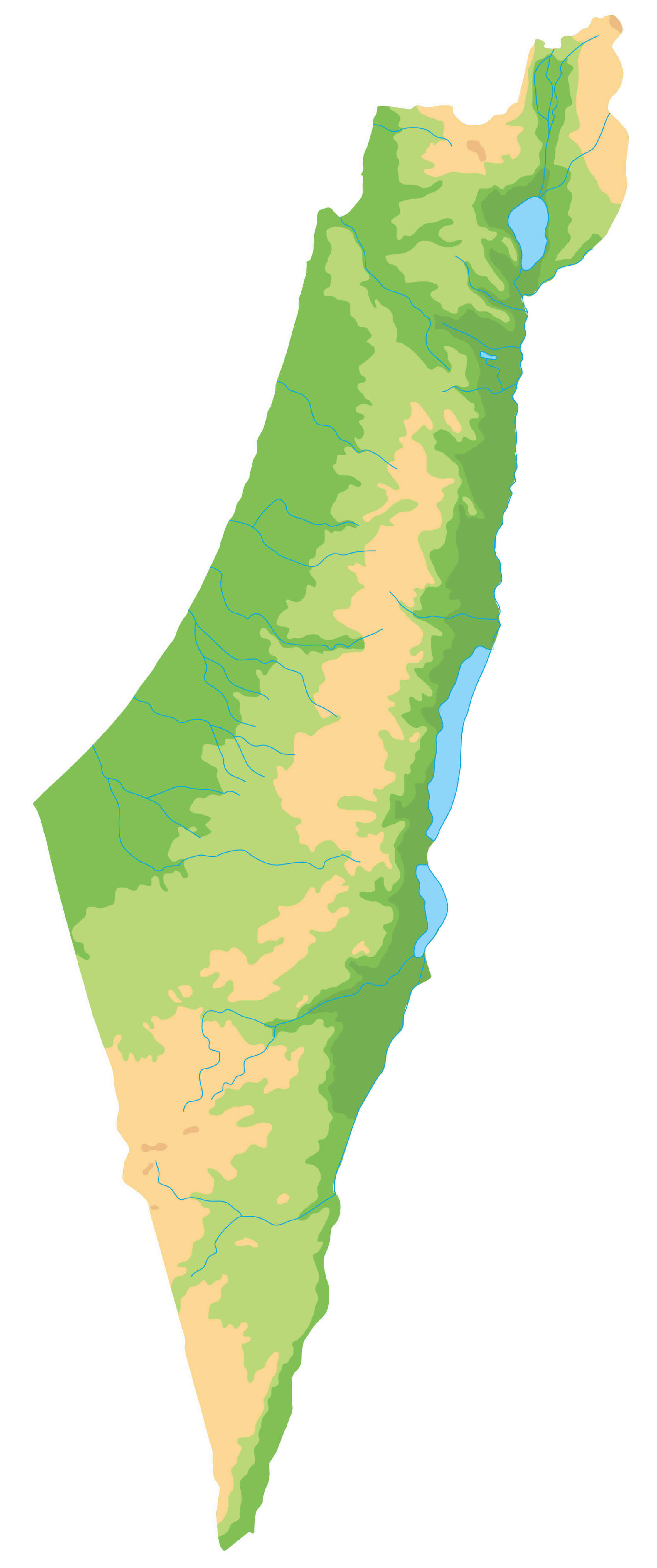
Large blank Israel physical map
Large Israel Eastern Mediterranean political map
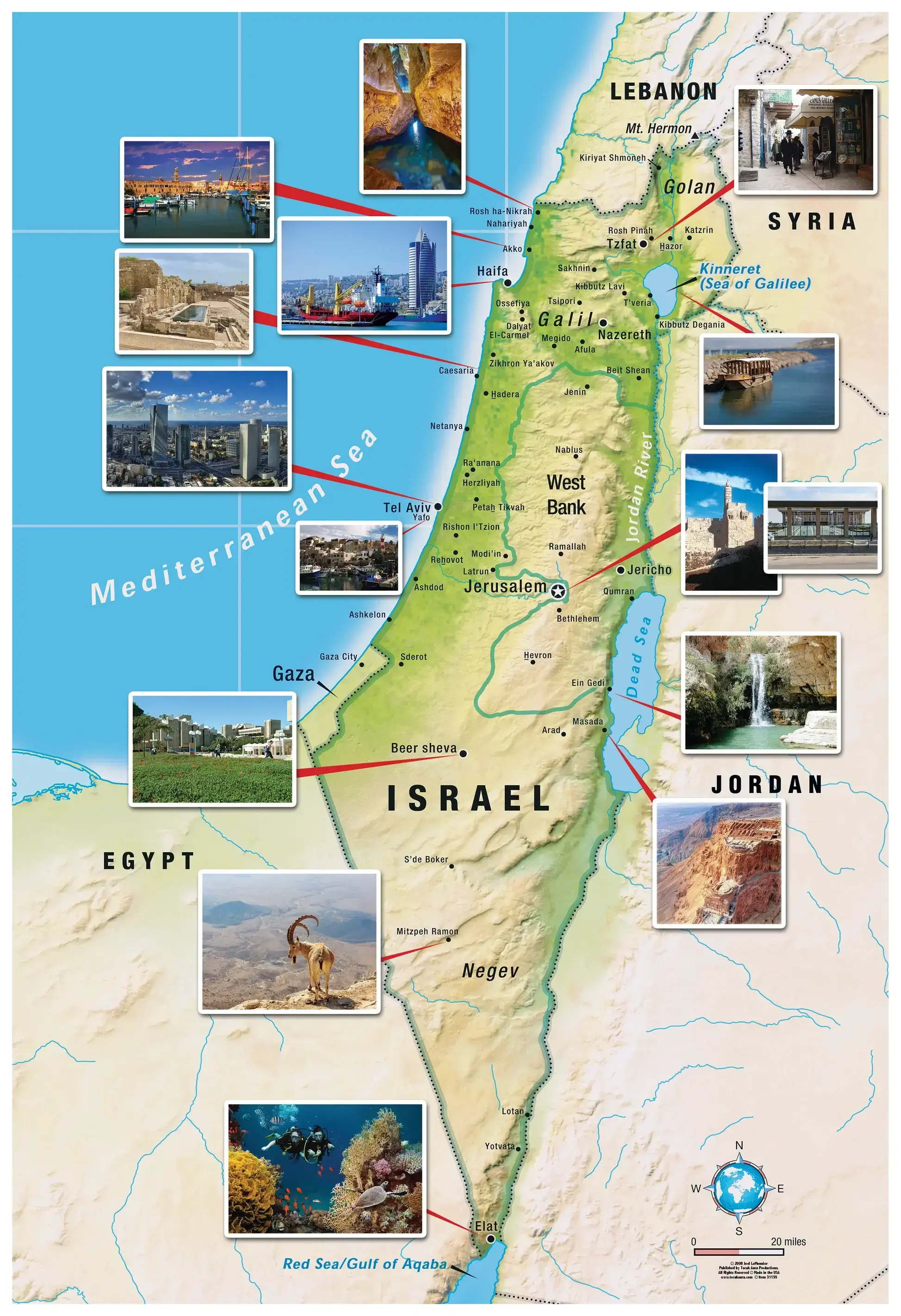
Large Israel info map
Large Israel major cities and main roads map
Large Israel Palestine unfolded map
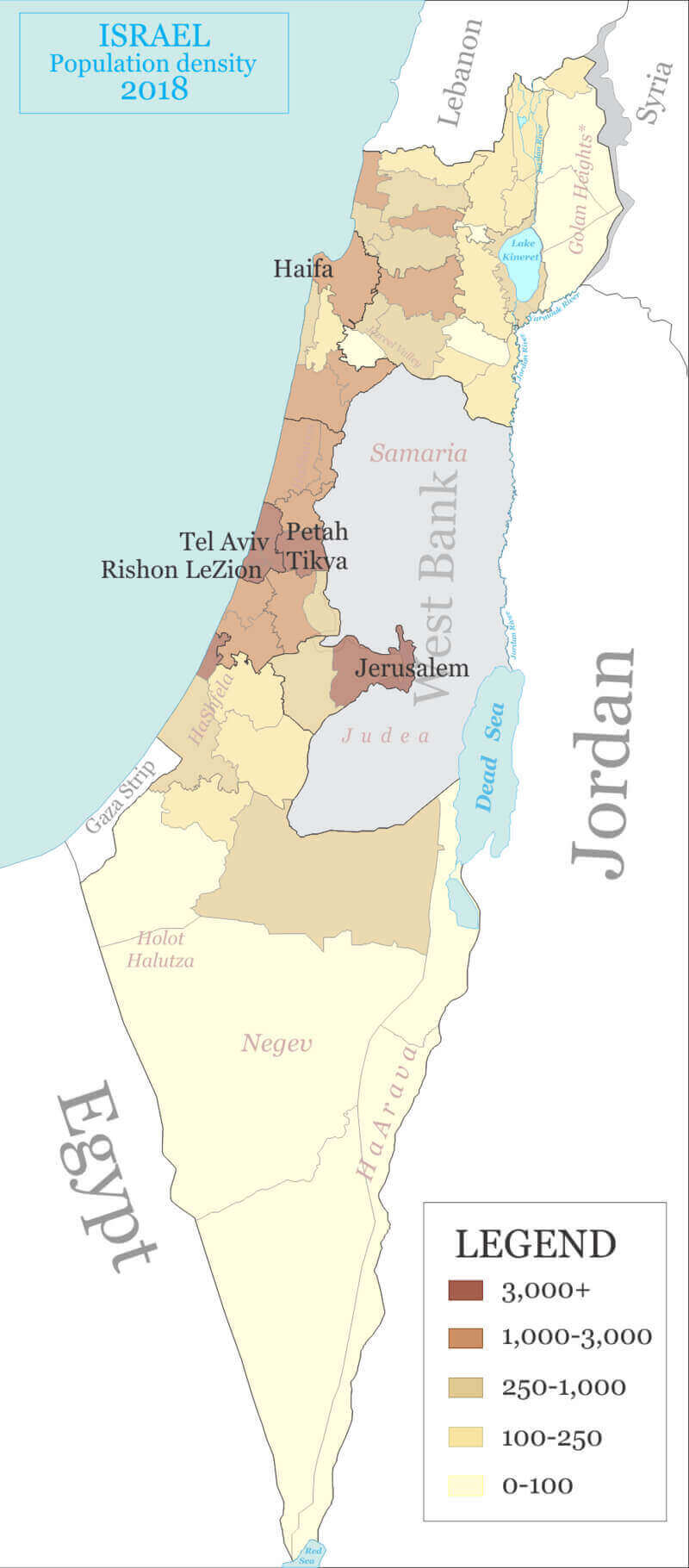
Large Israel population density map
Large Israel satellite map
Large political map of Israel
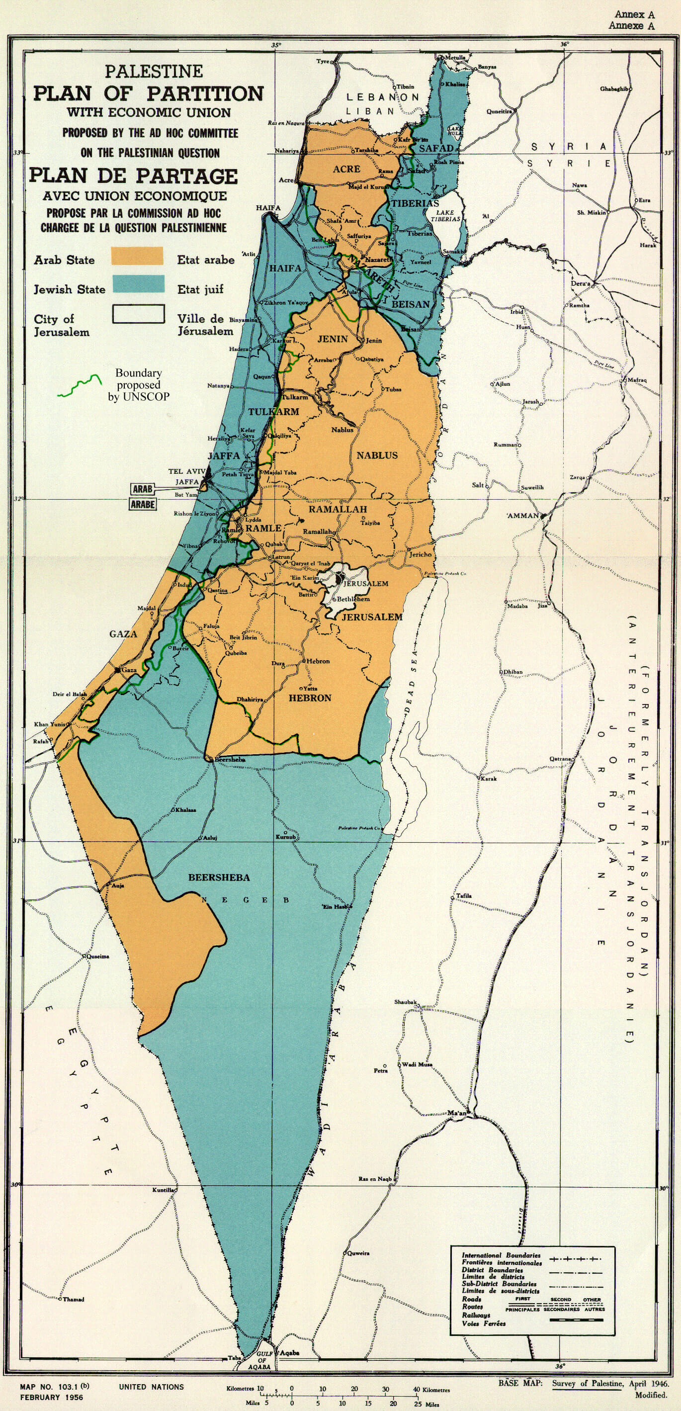
UN Palestine partition map in 1947
Feel free to explore these pages as well:
Author: Arif Cagrici