Detailed Maps of Morocco: Political, Physical, Administrative, Cities, Regions, Roads & Geography
Explore detailed maps of Morocco, featuring its physical and political boundaries, road networks, terrain, major cities, population density, national parks, highways, administrative regions, and satellite imagery. Understand Morocco's geography and its place on the African continent.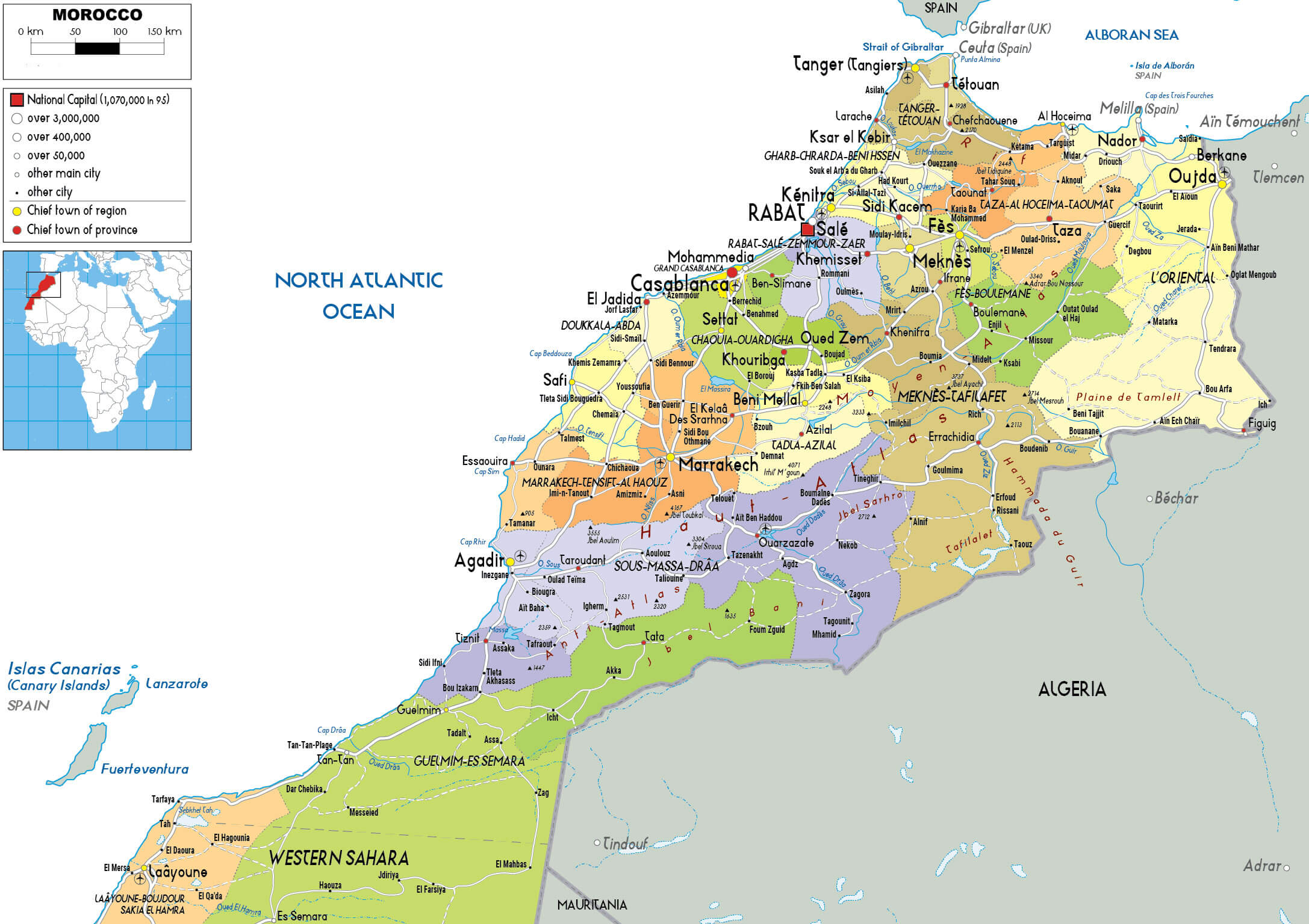
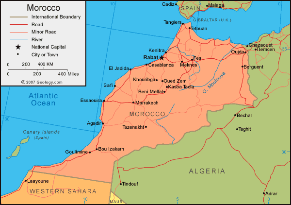
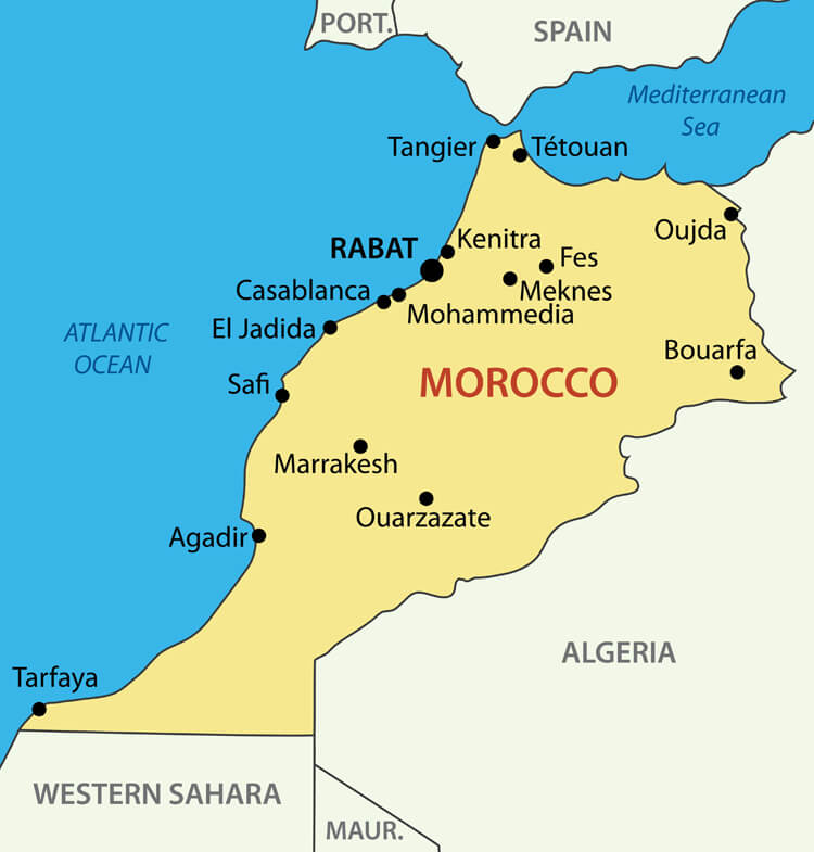
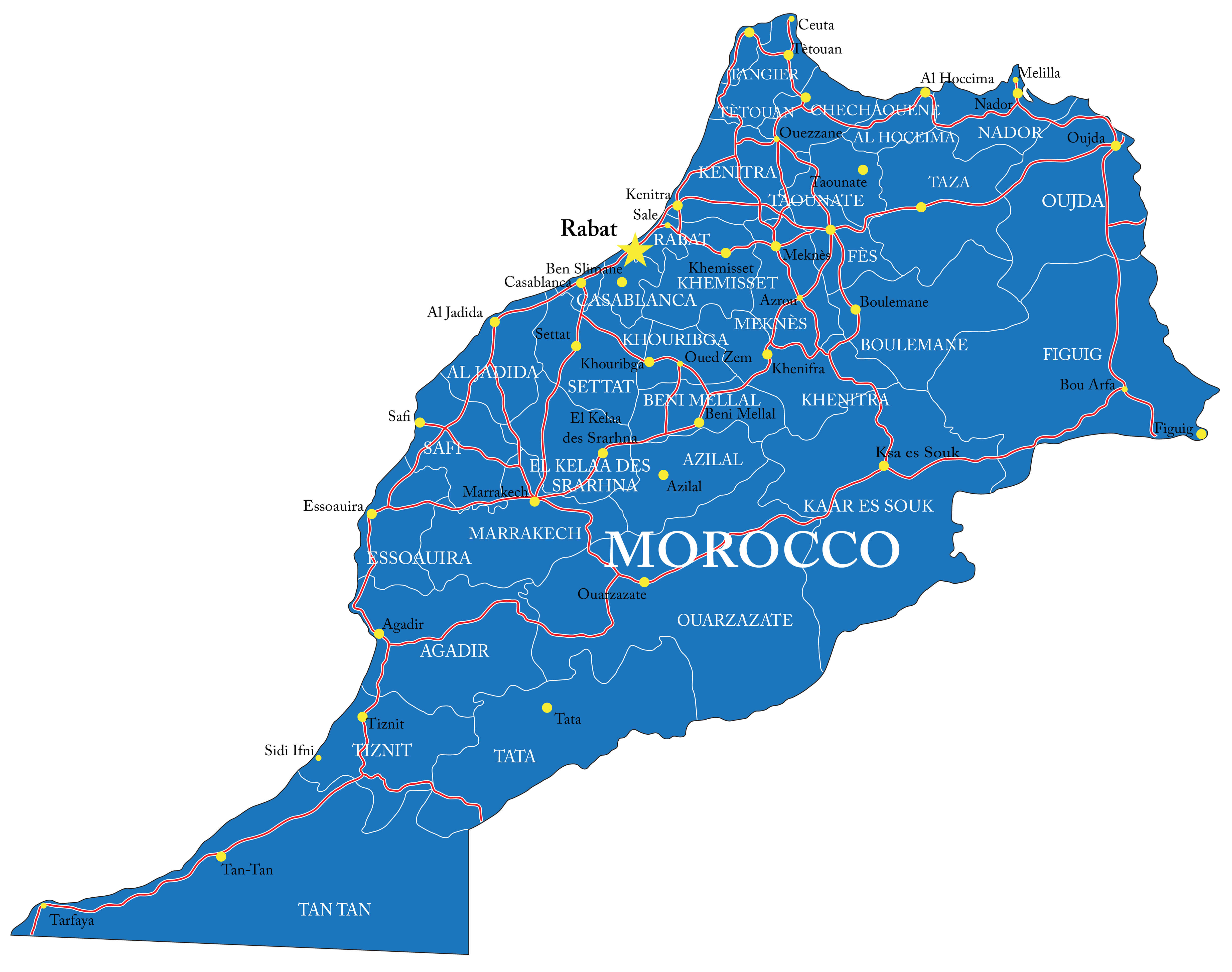
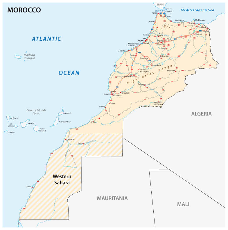
Morocco Road Map with Cities and Highways
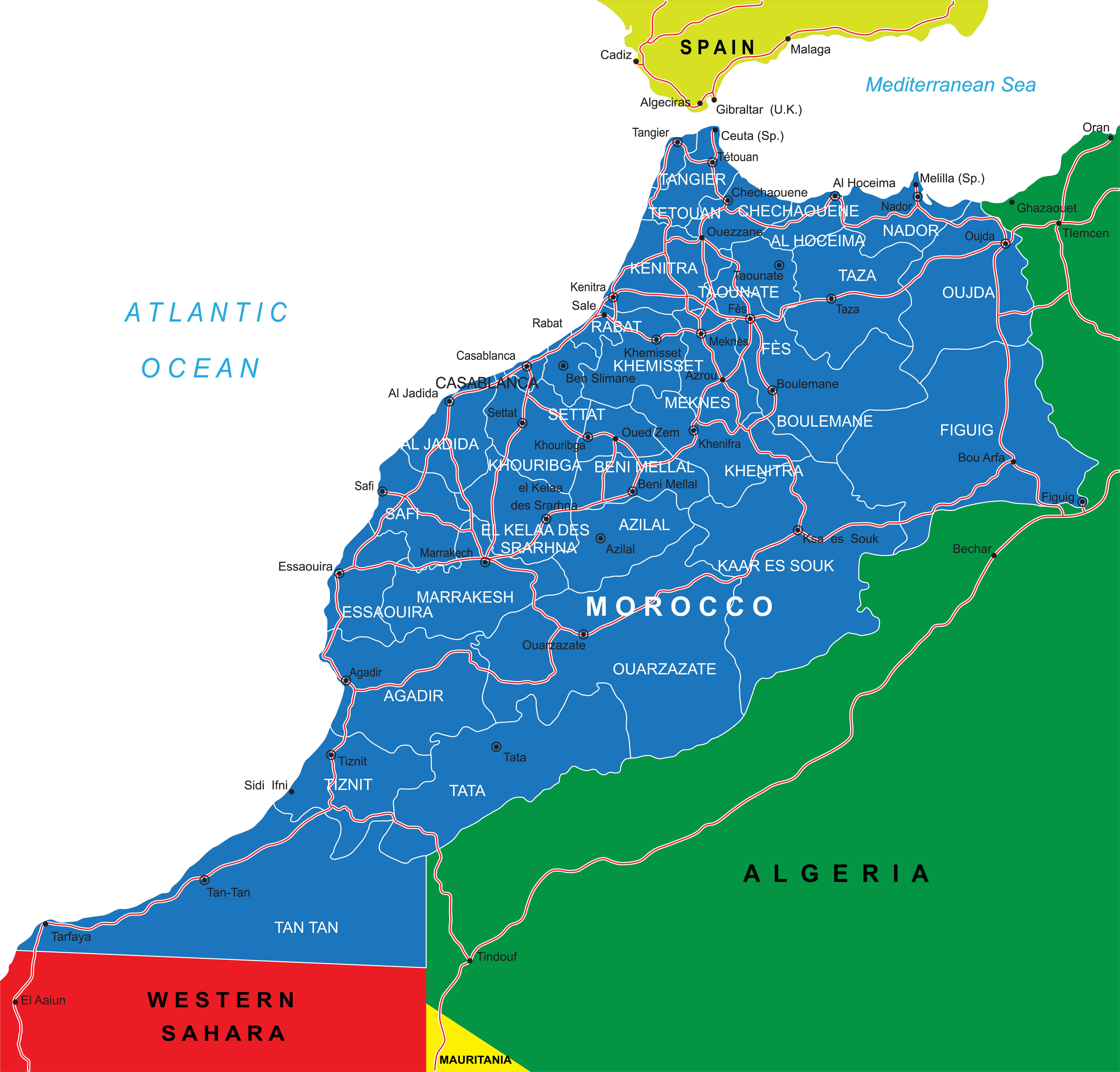 Detailed road map of Morocco showing major highways, cities, and country borders.
This detailed road map of Morocco showcases the country’s major highways, key cities, and provincial regions. It also outlines Morocco’s borders with Algeria, Western Sahara, and the nearby Spanish coastal territories, offering a clear and easy-to-follow view of its road network and geography.
Brief information about Morocco
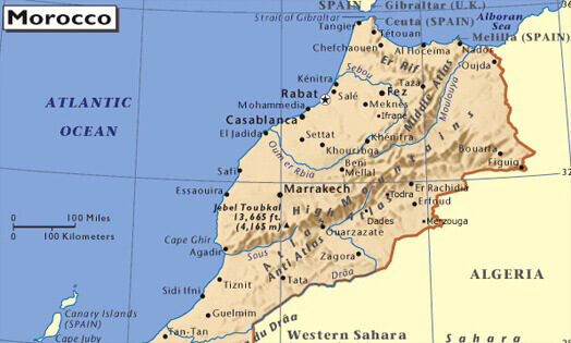
Located in North Africa, Morocco is a country renowned for its diverse landscapes, rich culture and historical significance. Bordered by the Atlantic Ocean and the Mediterranean Sea, it offers a mix of coastal cities, rugged mountains and vast deserts. The Atlas Mountains and the Sahara Desert are two iconic features that attract adventurers and nature lovers. Morocco's strategic location near Europe has also shaped its vibrant cultural mix of Arab, Berber and European influences.
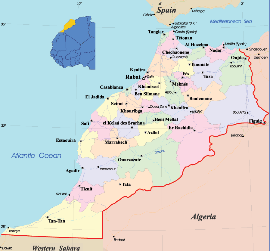
Administrative Map of Morocco with Regions and Capitals
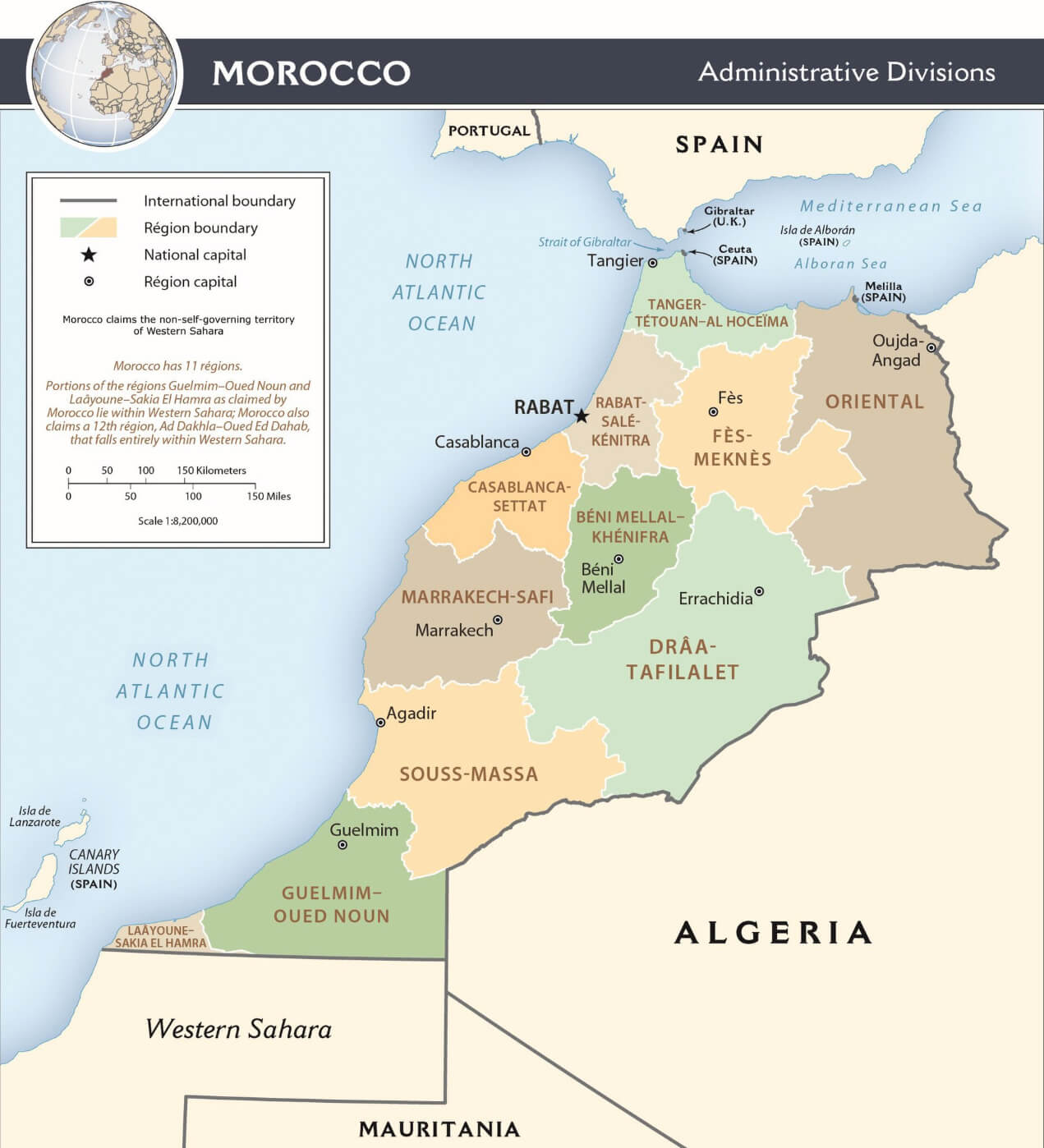 Map of Morocco showing administrative regions, capitals, and international borders.
This administrative map of Morocco displays all 11 regions, along with their capitals, the national capital Rabat, and the country’s international borders. It also illustrates Morocco’s territorial claims in Western Sahara, providing a clear look at its political divisions and overall governance structure.
The capital, Rabat, serves as the political centre, while Casablanca is the economic hub. Marrakech and Fes are renowned for their historic medinas, bustling souks and architectural wonders. Moroccan culture is deeply rooted in tradition, with a rich heritage of music, art and cuisine. Famous for its tagines, mint tea and intricate handicrafts, Morocco remains a unique destination that bridges Africa, Europe and the Middle East.
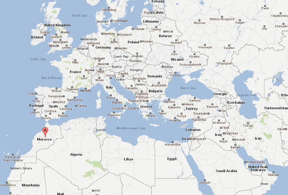
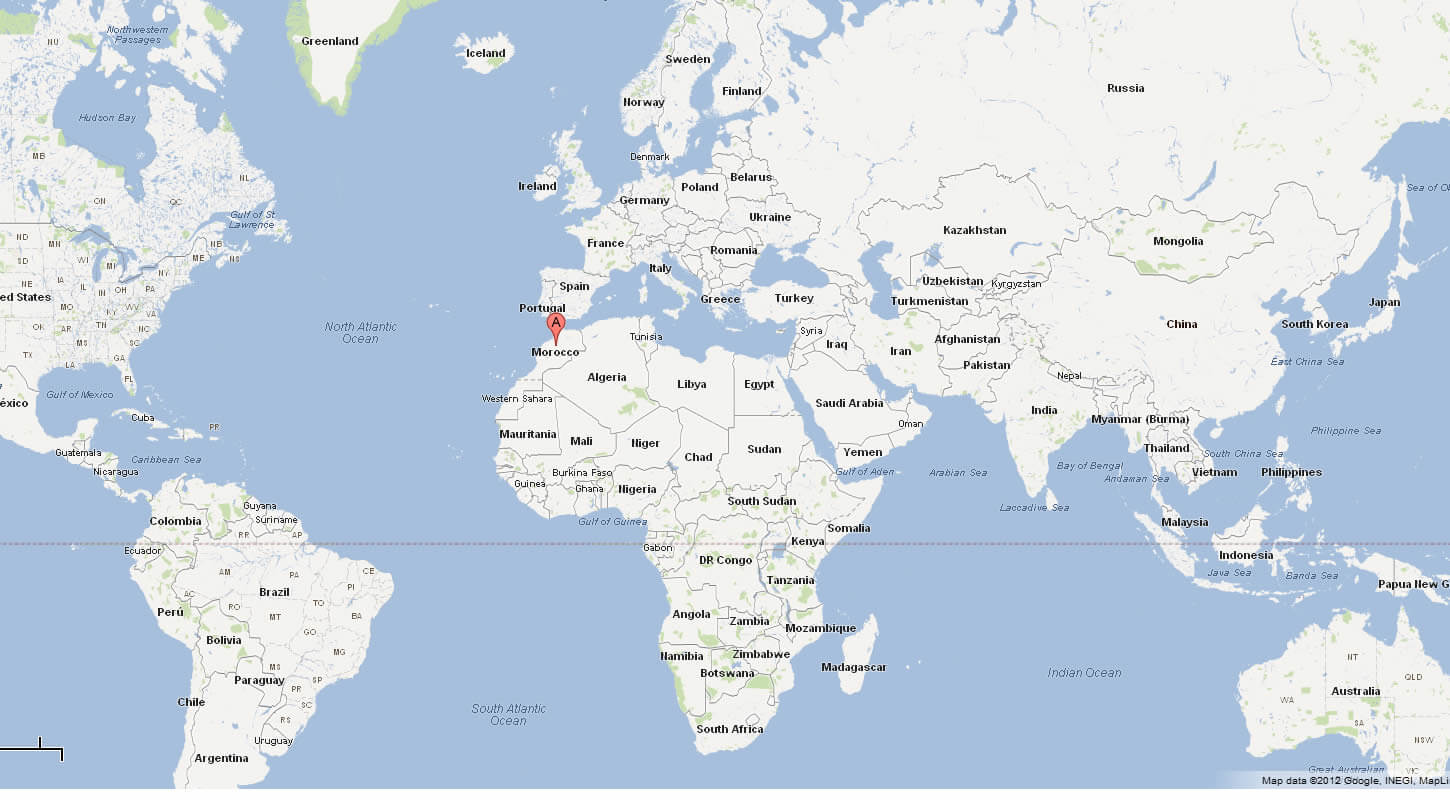
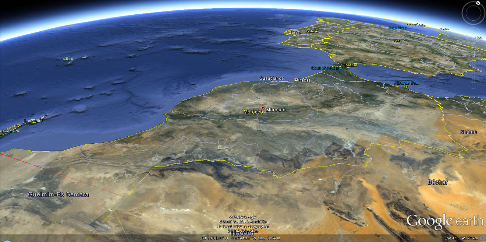
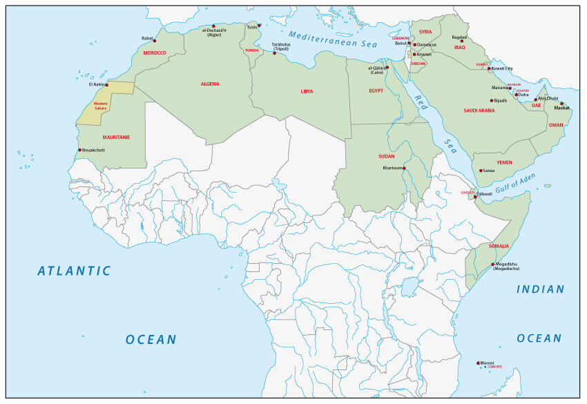
Where is located Morocco on the World Map
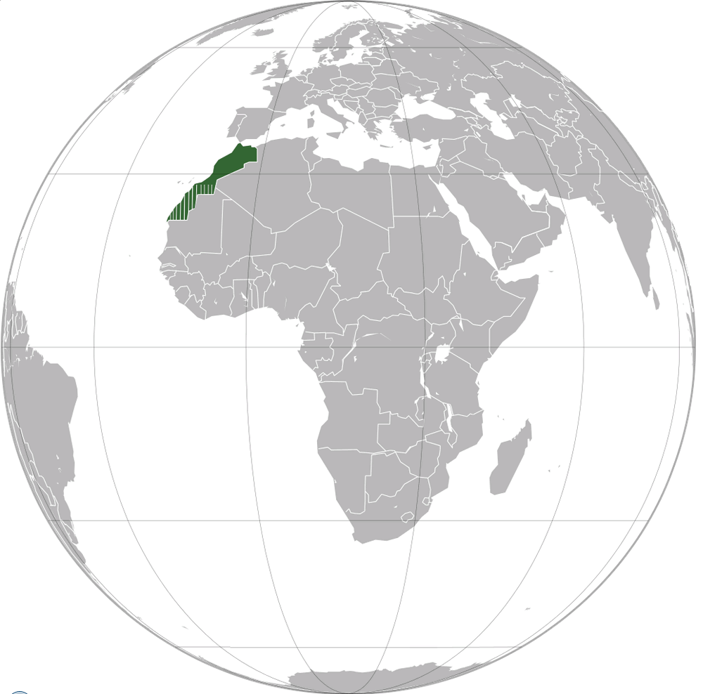 Where is located Morocco on the World Map
Morocco is located in the northwest corner of Africa, making it the closest African country to Europe. Bordered by the Atlantic Ocean to the west and the Mediterranean Sea to the north, Morocco has a long and strategic coastline. It borders Algeria to the east and south-east, while its southern border borders the disputed territory of Western Sahara. The Strait of Gibraltar separates Morocco from Spain by only 13 kilometres, underlining its geographical importance as a crossroads between continents.
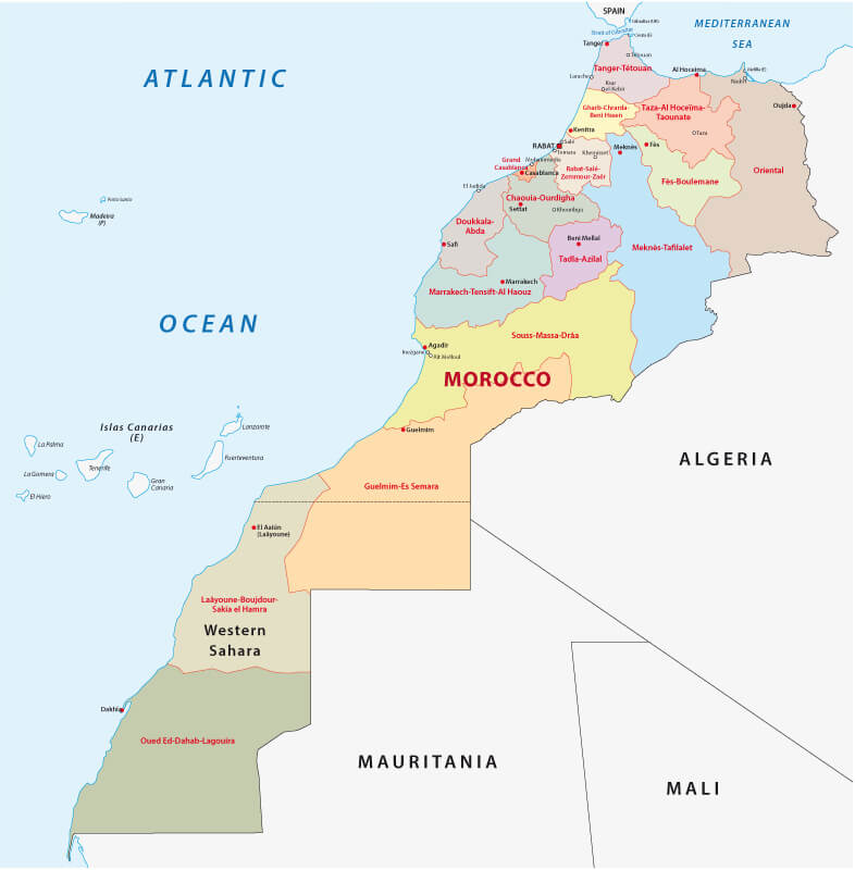
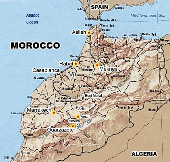
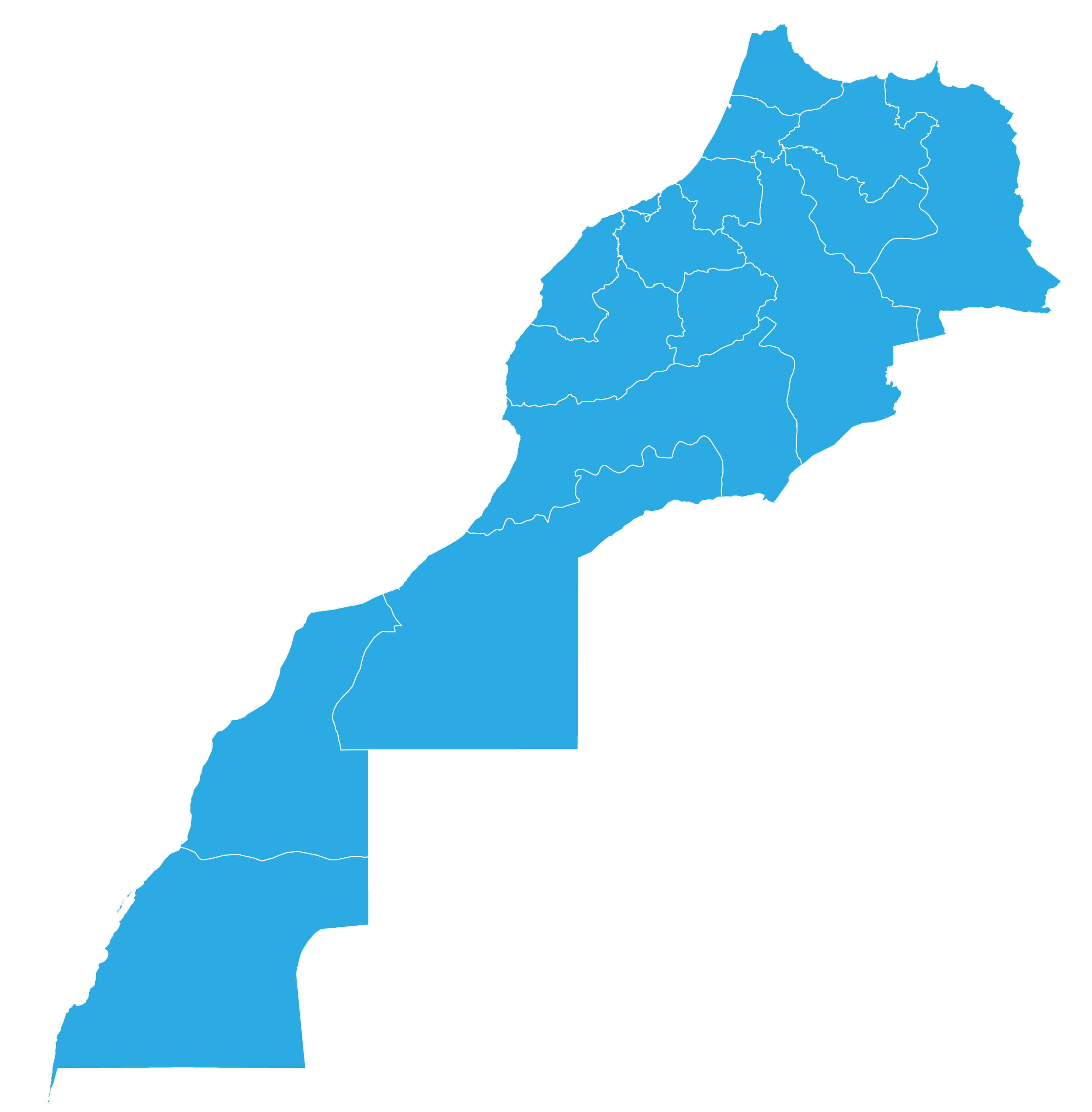
Morocco Provinces Map with Cities and Key Locations
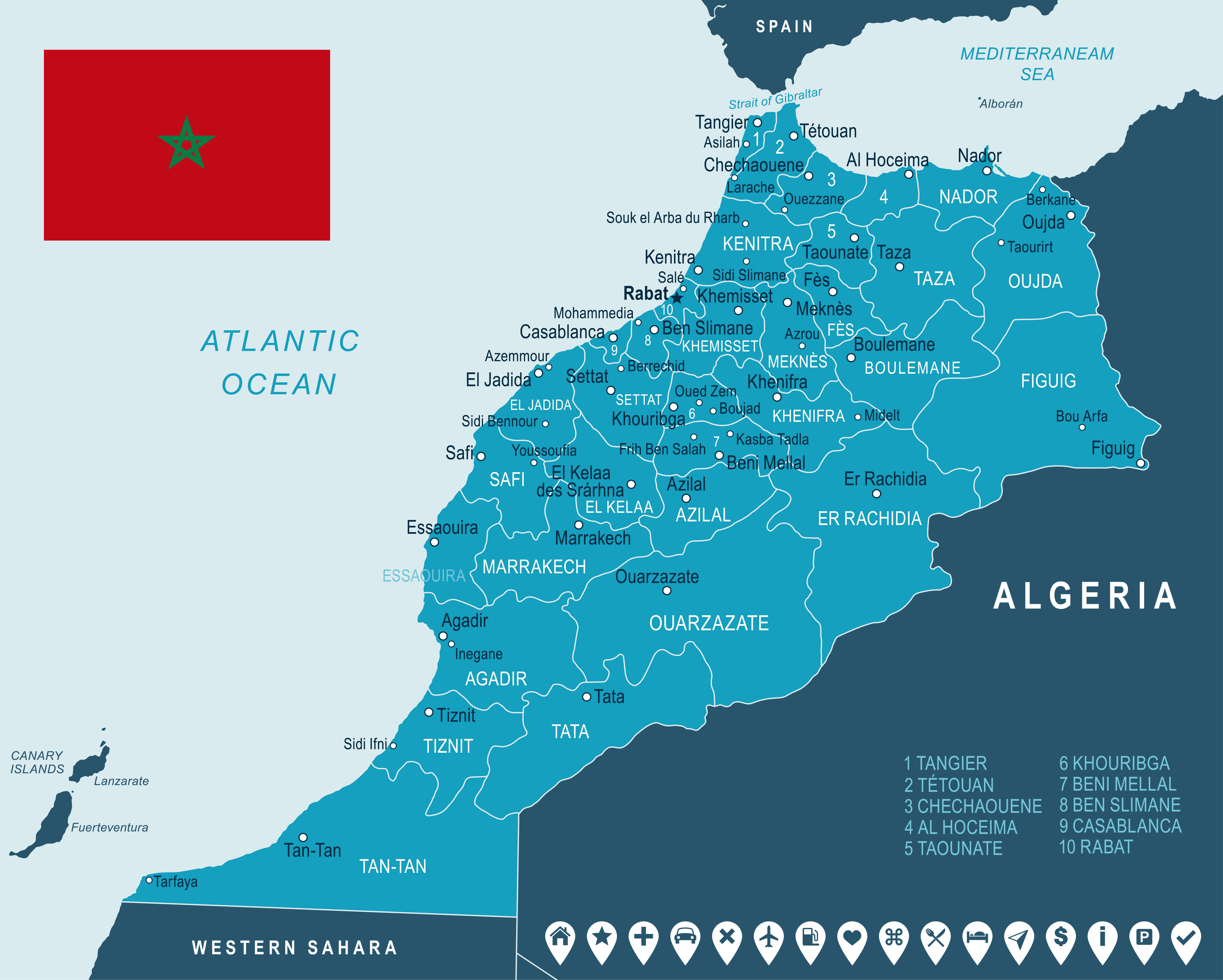 Map of Morocco showing provinces, major cities, landmarks, and national flag.
This map of Morocco shows all provinces as well as major cities, towns and points of interest. It also shows neighbouring countries, coastal boundaries and includes the national flag, giving a clear overview of the provincial layout of Morocco.
On the world map, Morocco is easily recognisable as the gateway to Africa, with its position on the edge of the Sahara and its proximity to the Iberian Peninsula. This location has historically made it a centre for trade, cultural exchange and migration. Its diverse geography includes fertile plains, mountain ranges such as the Atlas and Rif, and arid desert regions, contributing to its diverse climates and ecosystems.
Morocco's position also reflects its role as a bridge between cultures. Its location has allowed it to integrate Arab, Berber and European influences, which are reflected in its language, architecture and traditions. Its proximity to Europe has also facilitated strong economic and political ties, making Morocco an important player in both African and Mediterranean affairs.
Here are some statistical information about Morocco:
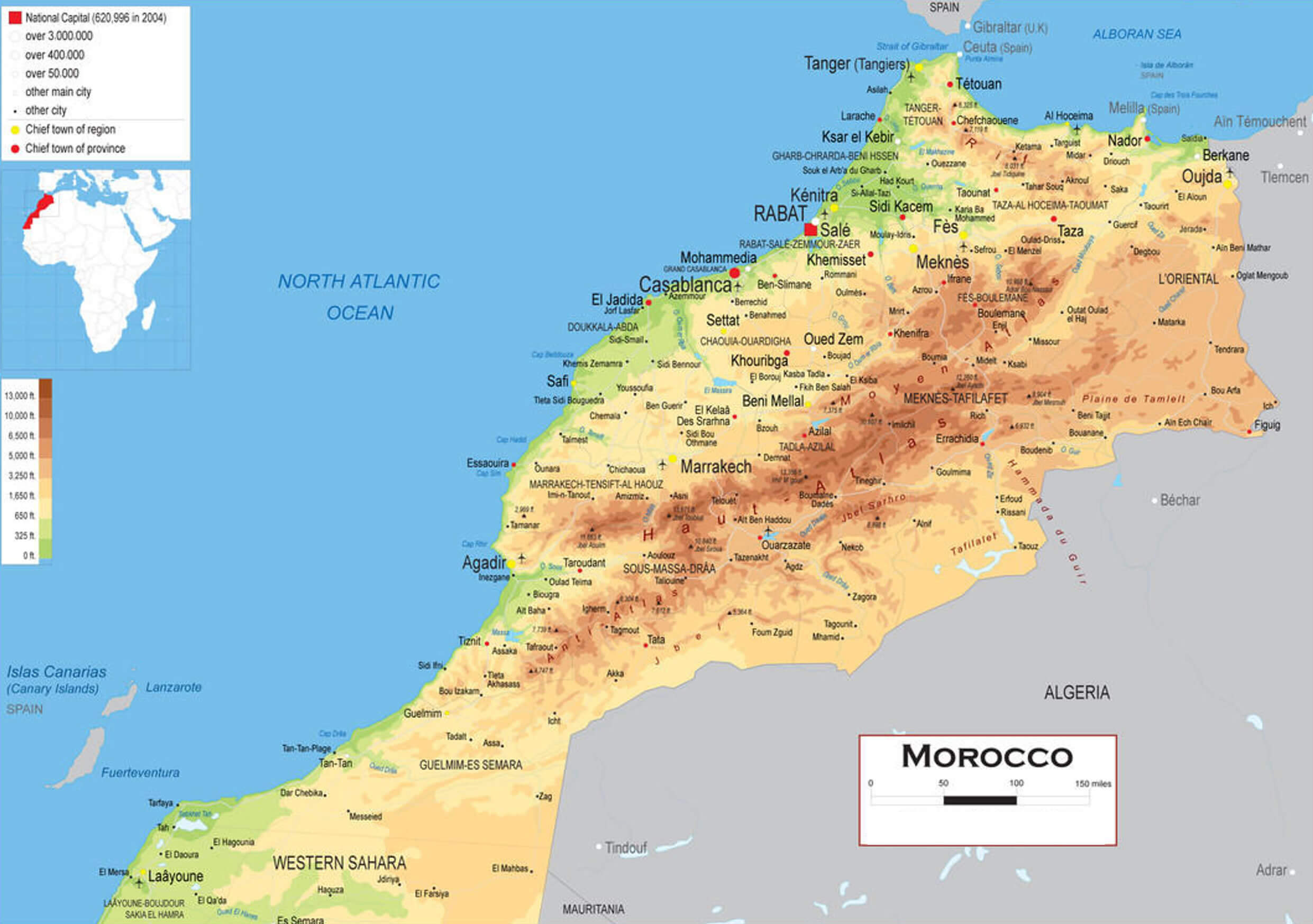
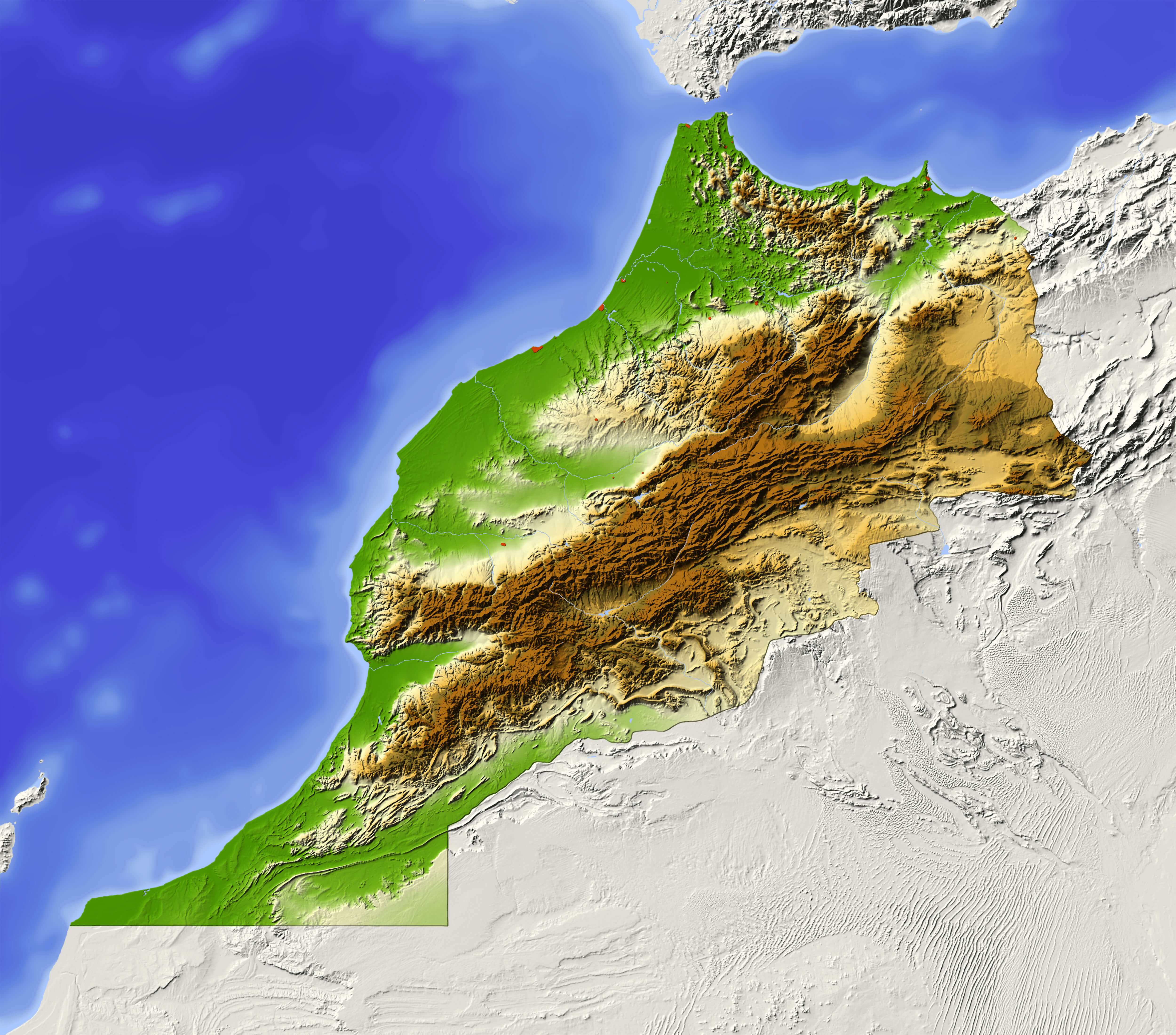
 Area: 446,550 km2 (172,410 sq mi)
 Morocco Physical Map with Cities
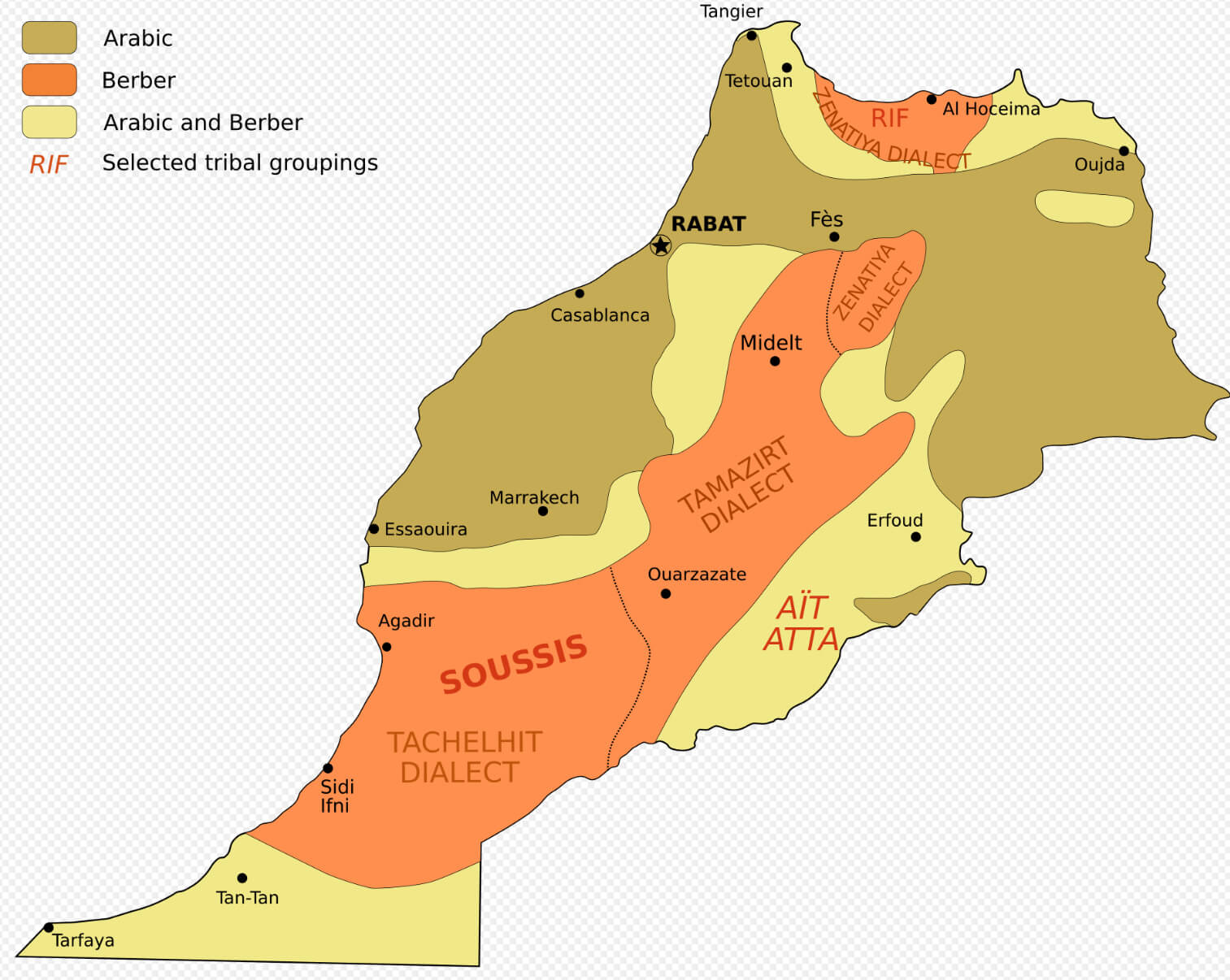
 Official languages: Arabic, Tamazight
 Ethnolinguistic map of Morocco
 GDP (nominal): $157.087 billion (2024 estimate)
 Map of Morocco
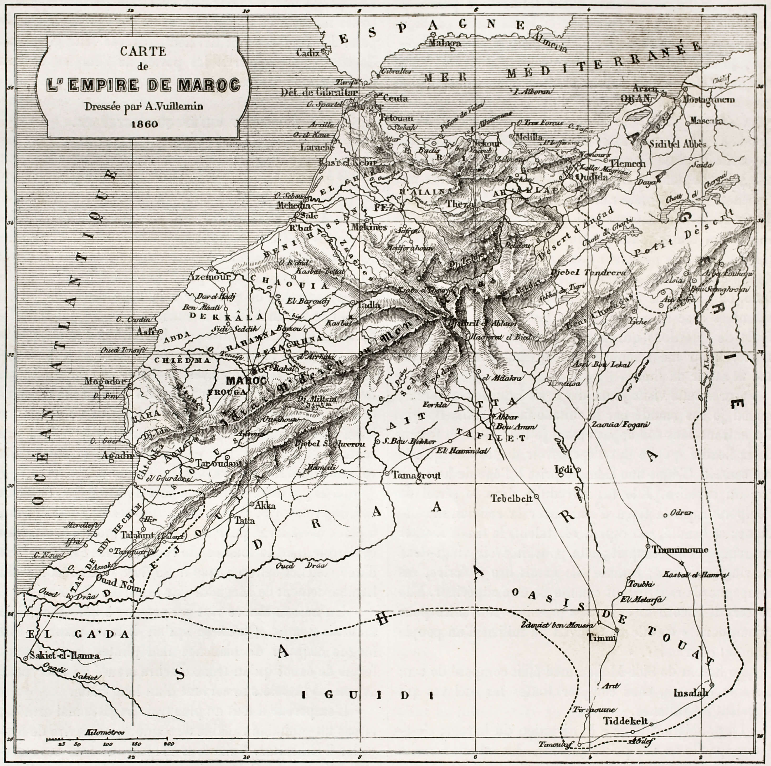
Morocco Empire Map 1120
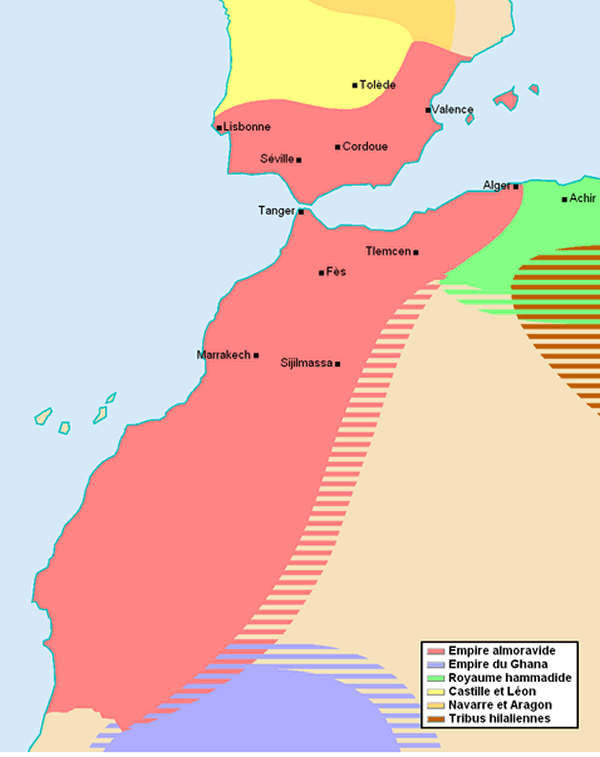 Historical map showing the Almoravid Empire and neighboring regions in 1120.
This historical map highlights the extent of the Almoravid Empire during the year 1120, covering parts of North Africa and the Iberian Peninsula. Neighboring territories such as the Ghana Empire, Castile and León, and Navarre are also shown, illustrating the region's complex political landscape.
Morocco Map Western Sahara
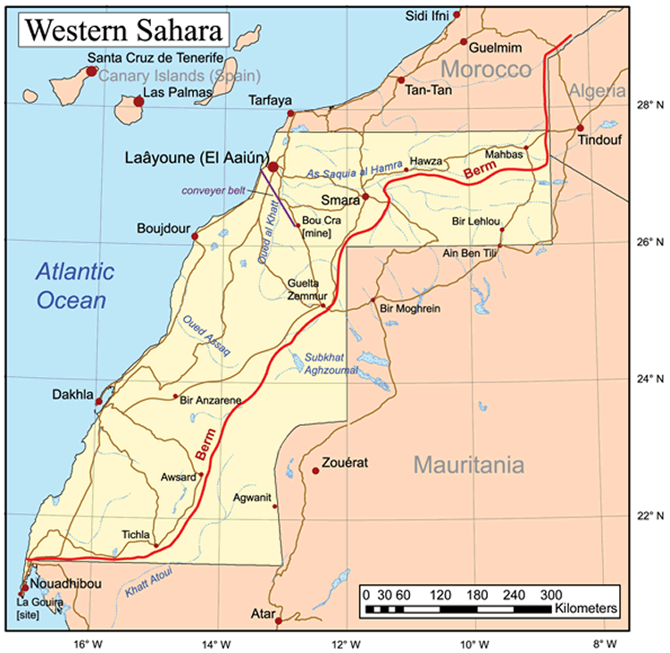 Map of Western Sahara showing major towns, Berm, and regional borders.
This map illustrates the geographical layout of Western Sahara, highlighting towns like Laayoune and Smara, the Berm security wall, and the surrounding borders with Morocco, Algeria, and Mauritania. The Atlantic Ocean lies to the west, and the map includes notable infrastructure like the Bou Craa phosphate mine.
Cities Map of Morocco
Map of Morocco showing major cities, provinces, and neighboring regions.This map provides a comprehensive view of Morocco, highlighting major cities like Casablanca, Rabat, and Marrakech, as well as provincial boundaries and neighboring countries. It showcases the strategic positioning of Morocco along the North Atlantic Ocean and Alboran Sea.
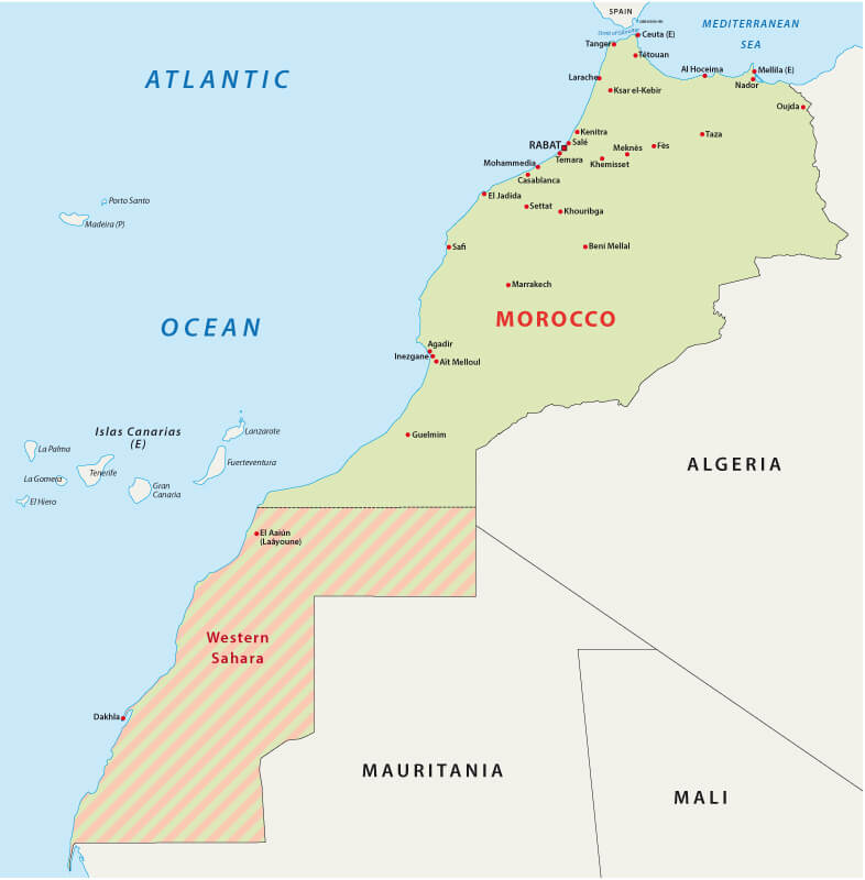
Morocco regions map with Western Sahara
Morocco map
Morocco physical map
Morocco satellite map
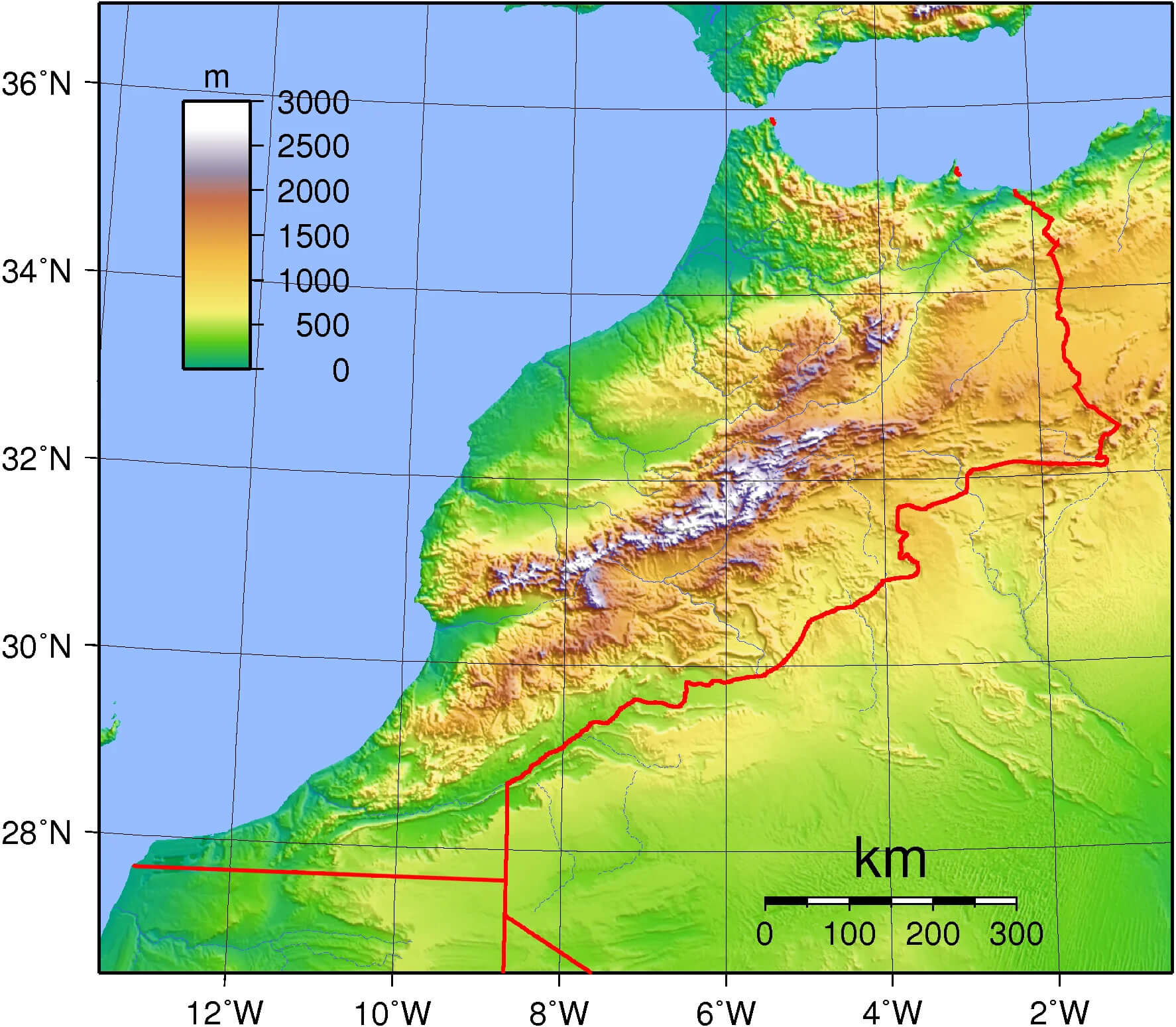
Morocco topographic map
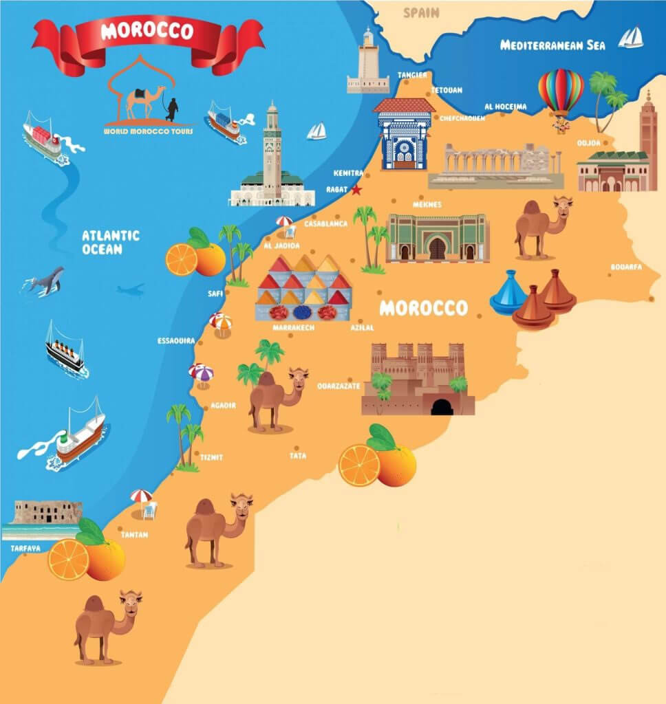
Morocco tourism map
Road map of Morocco with cities
Map of Morocco Africa
Map of Morocco World
Morocco Map Marrakech
Morocco Political Map
Morocco Earth Map
Morocco and Africa map
Morocco blank map
Morocco cities map with Western Sahara
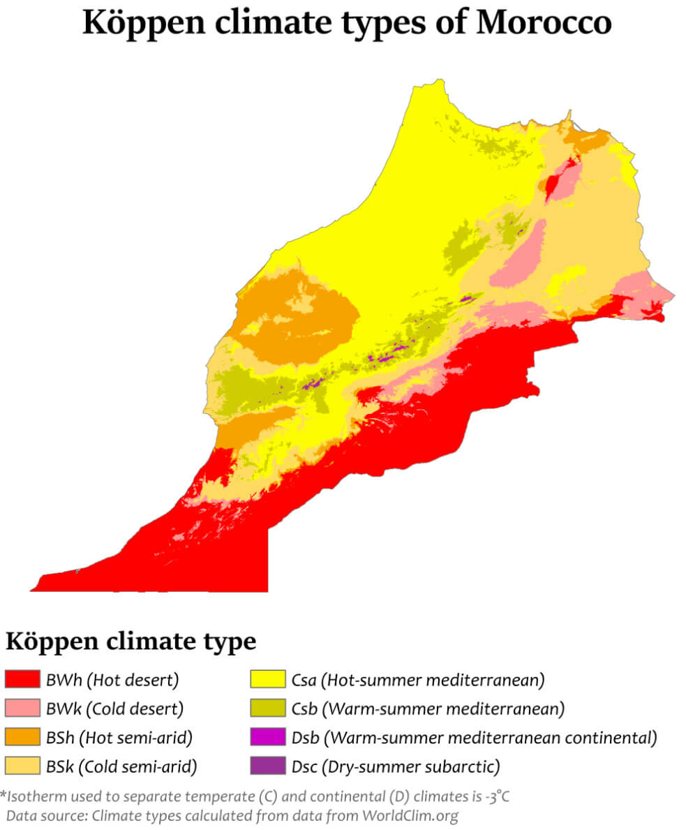
Morocco climate map
Morocco empire map 1860
Morocco map with north Africa and middle east
Morocco map with Western Sahara
For more Morocco Maps and About Morocco;
- Morocco Map
- Morocco
- Africa Map
- Africa
- Explore Africa Political Map
- Explore Africa Physical Map
- Explore European Countries Map
- Explore Africa Historical Map
- Explore Africa Satellite Map
- Explore Africa Religion Map
- Europe Africa Population Map
- Explore Africa Road Map
- Africa Maps
- Africa Language Map
- Africa Geographic Map
- Head of Performance Marketing
- Head of SEO
- Linkedin Profile: linkedin.com/in/arifcagrici