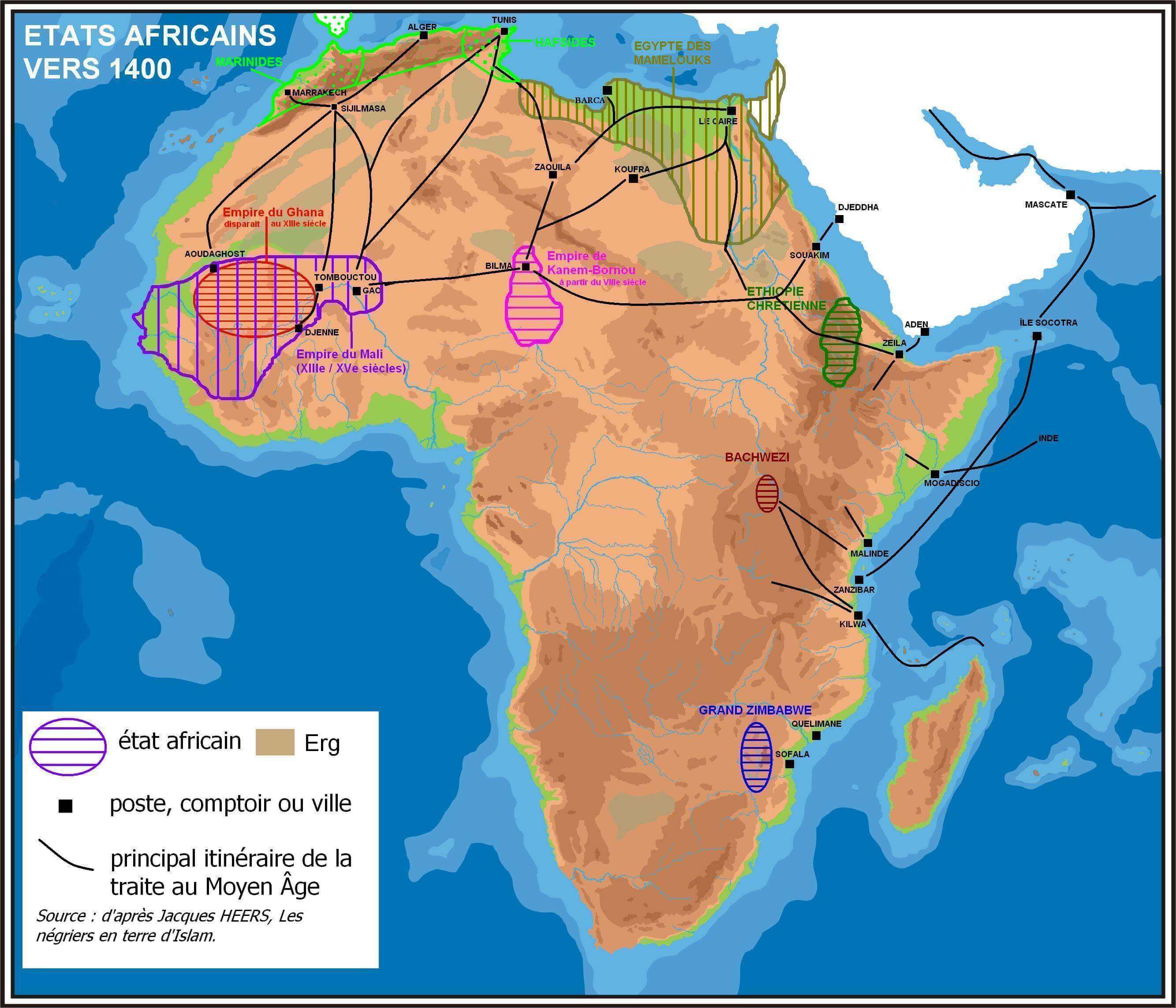
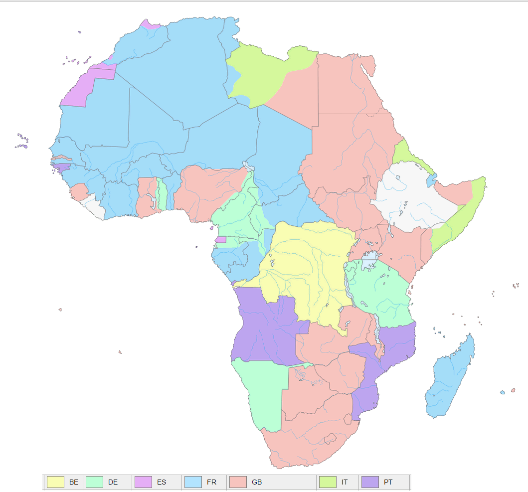
Antique Map of Africa: A Glimpse into the Continent’s Historical Geography
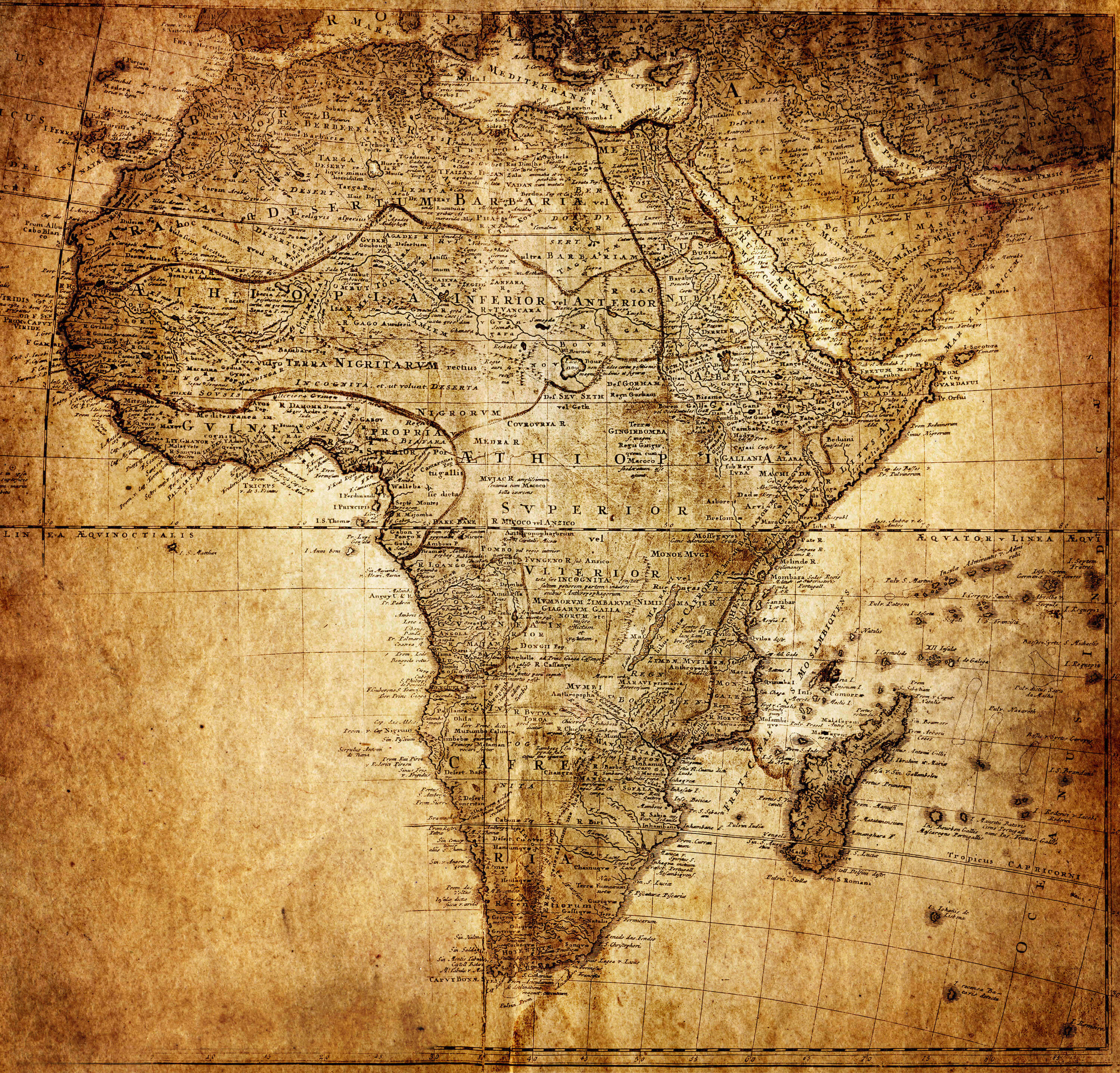 Old historical map of Africa showing ancient territories and trade routes.
This antique map of Africa offers a fascinating glimpse into the continent’s past, showcasing ancient kingdoms, colonial-era territories, and early European cartographic perspectives. It reveals historic trade routes, ethnographic boundaries, and pre-colonial political divisions, providing valuable insight into Africa’s rich heritage before the rise of modern nation-states.
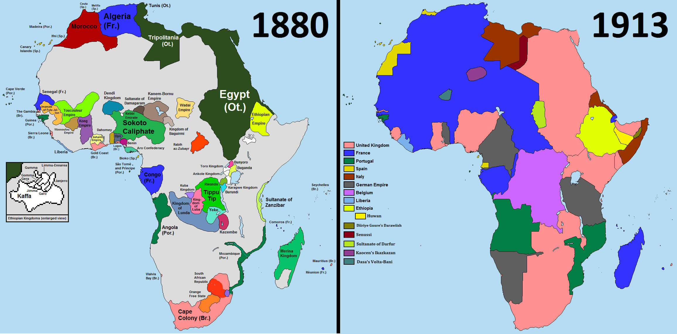
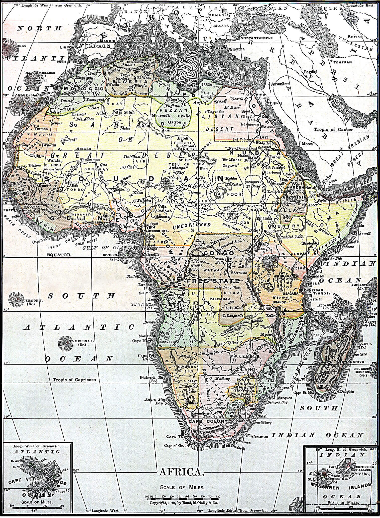
Historical Map of Africa in 1880: Pre-Colonial Boundaries and European Influence
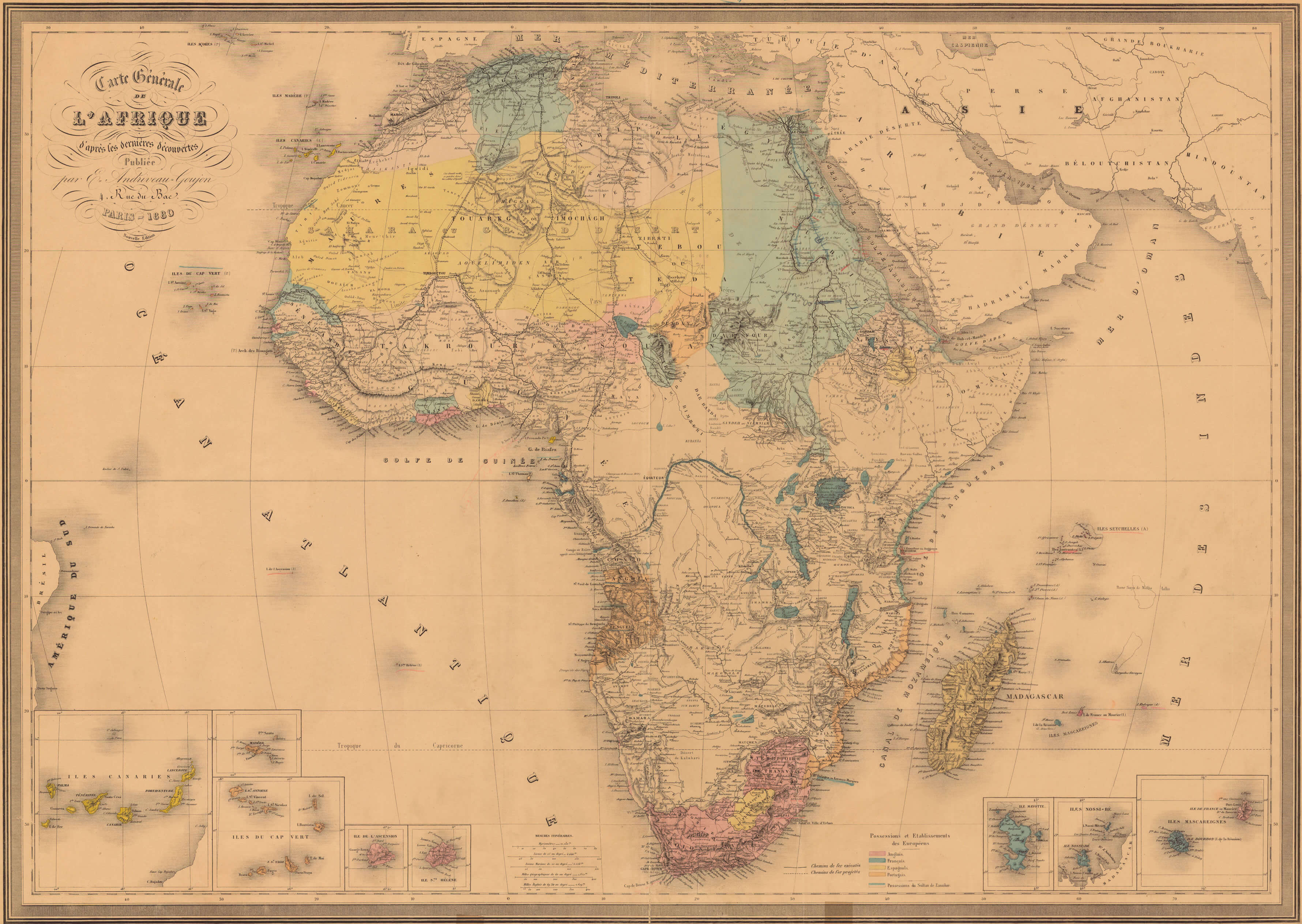 Africa 1880 historical map with pre-colonial regions and European territories.
This 1880 map of Africa captures the continent on the brink of Europe’s colonial scramble, preserving a pivotal moment in its history. It documents indigenous tribal territories, nascent colonial footholds, and the limited geographical understanding of the era. More than a territorial snapshot, it reveals the intricate political and cultural landscapes that existed before imperial powers imposed new borders—offering a rare window into pre-colonial Africa’s complex societal organization.