Nigeria Maps Collection: Political, Physical, Cities, Roads, Geographic, Satellite Views, Regions, and Population
Explore detailed maps of Nigeria featuring its physical landscape, political boundaries, major cities, highways, national parks, and ethnic regions. You'll also find administrative divisions, population density, and satellite imagery that together provide a complete picture of Nigeria's geography and its place within Africa.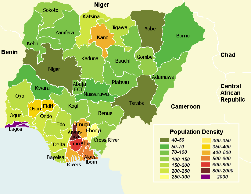
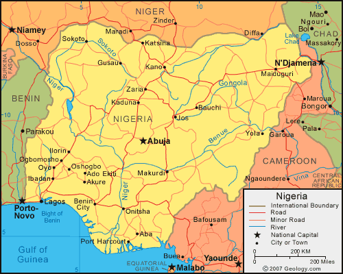
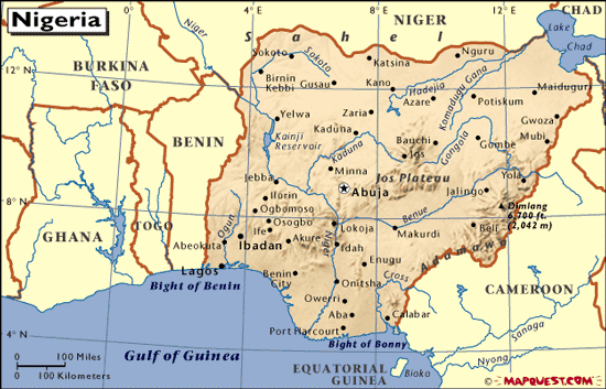
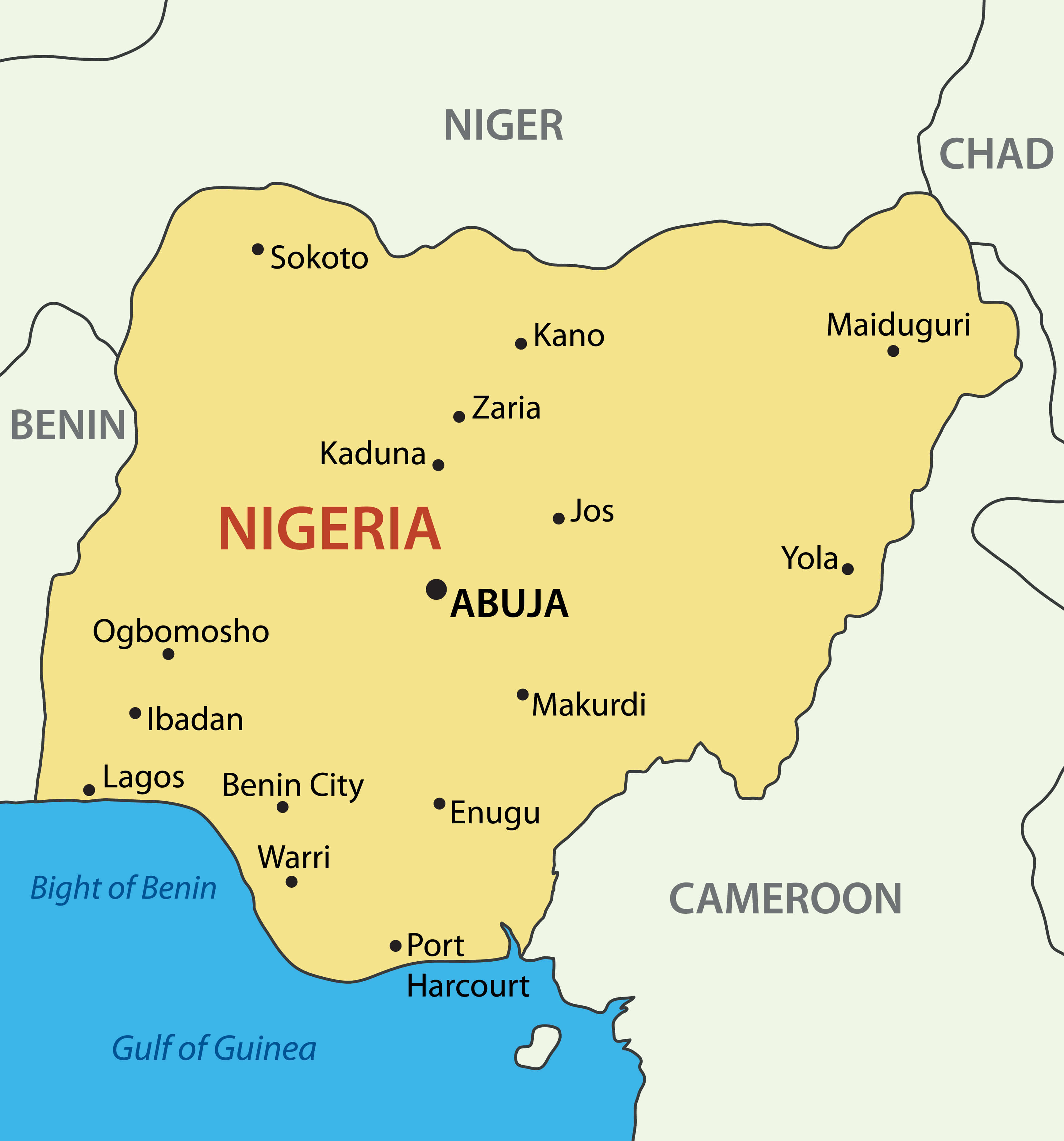
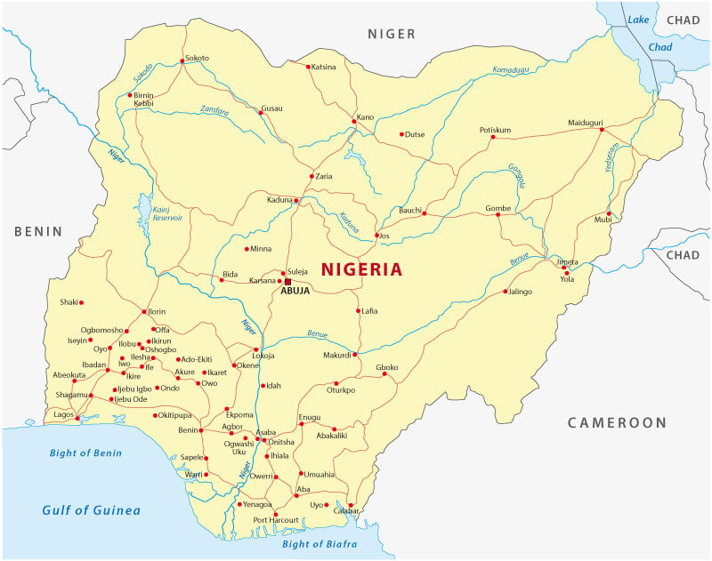
Nigeria Major Cities Map
 Map of Nigeria showing major cities and surrounding countries in West Africa.
This map of Nigeria shows major highways, roads and cities throughout the country. It includes state boundaries and major urban centres, providing a clear view of Nigeria's road network and regional layout.
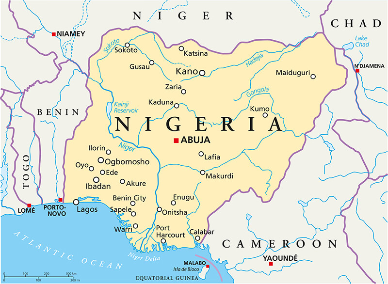
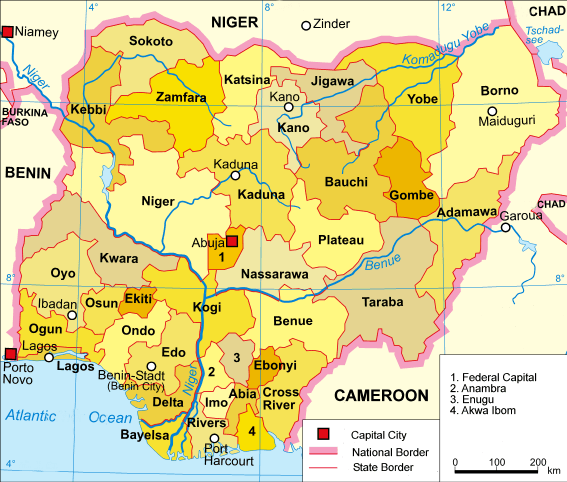
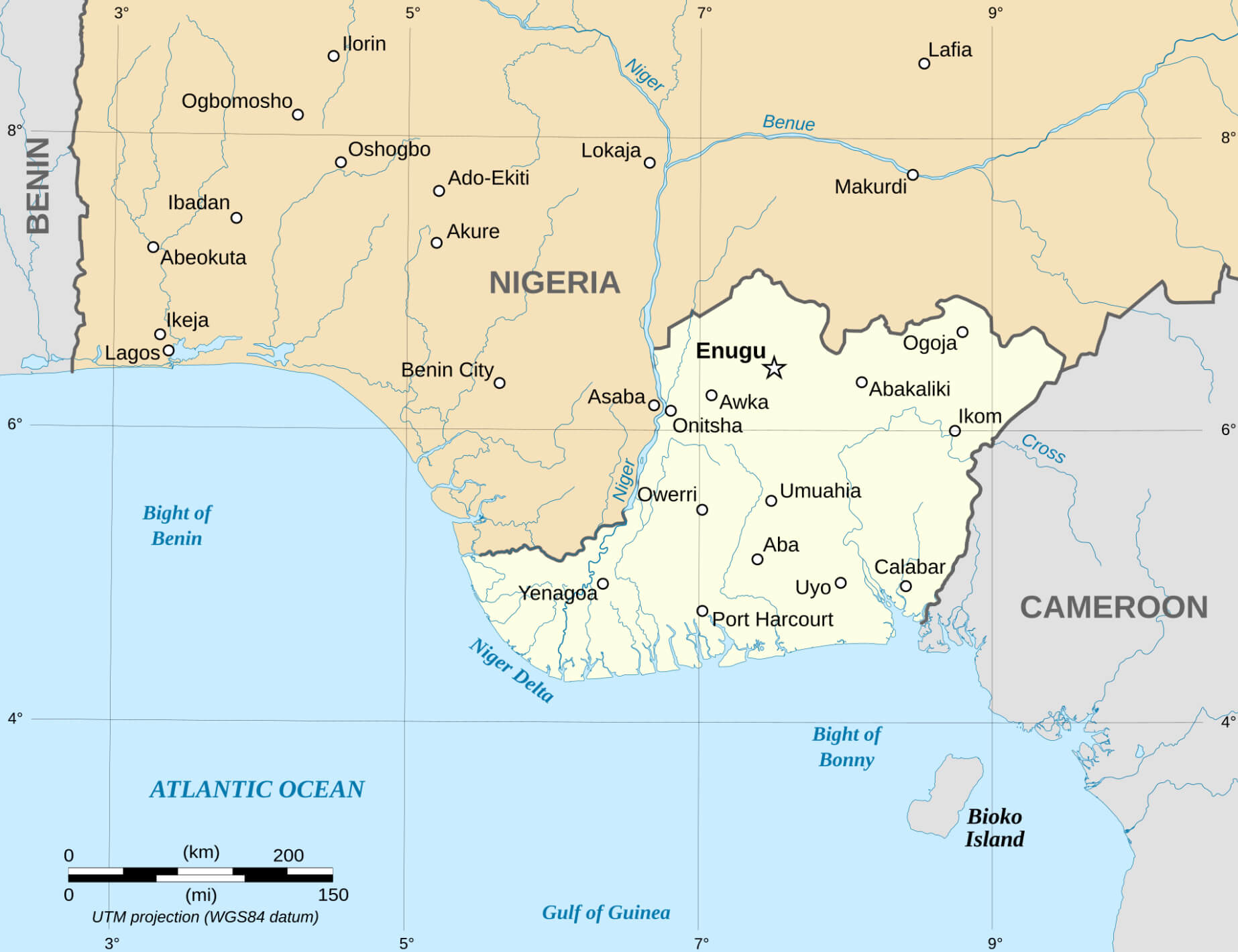
Nigeria Provinces Map with Rivers and Cities
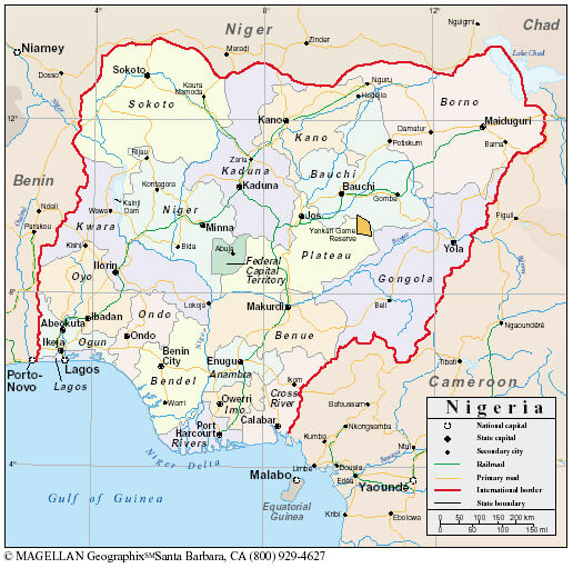
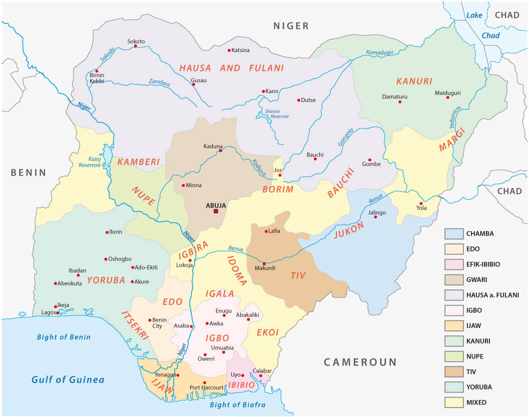 Map of Nigeria showing provinces, rivers, major cities, and ethnic regions.
This map of Nigeria displays the country's provinces, major rivers, cities, and ethnic regions. It provides a comprehensive view of Nigeria's diverse cultural landscape and geography, highlighting the connections between population groups and natural features.
Brief information about Nigeria
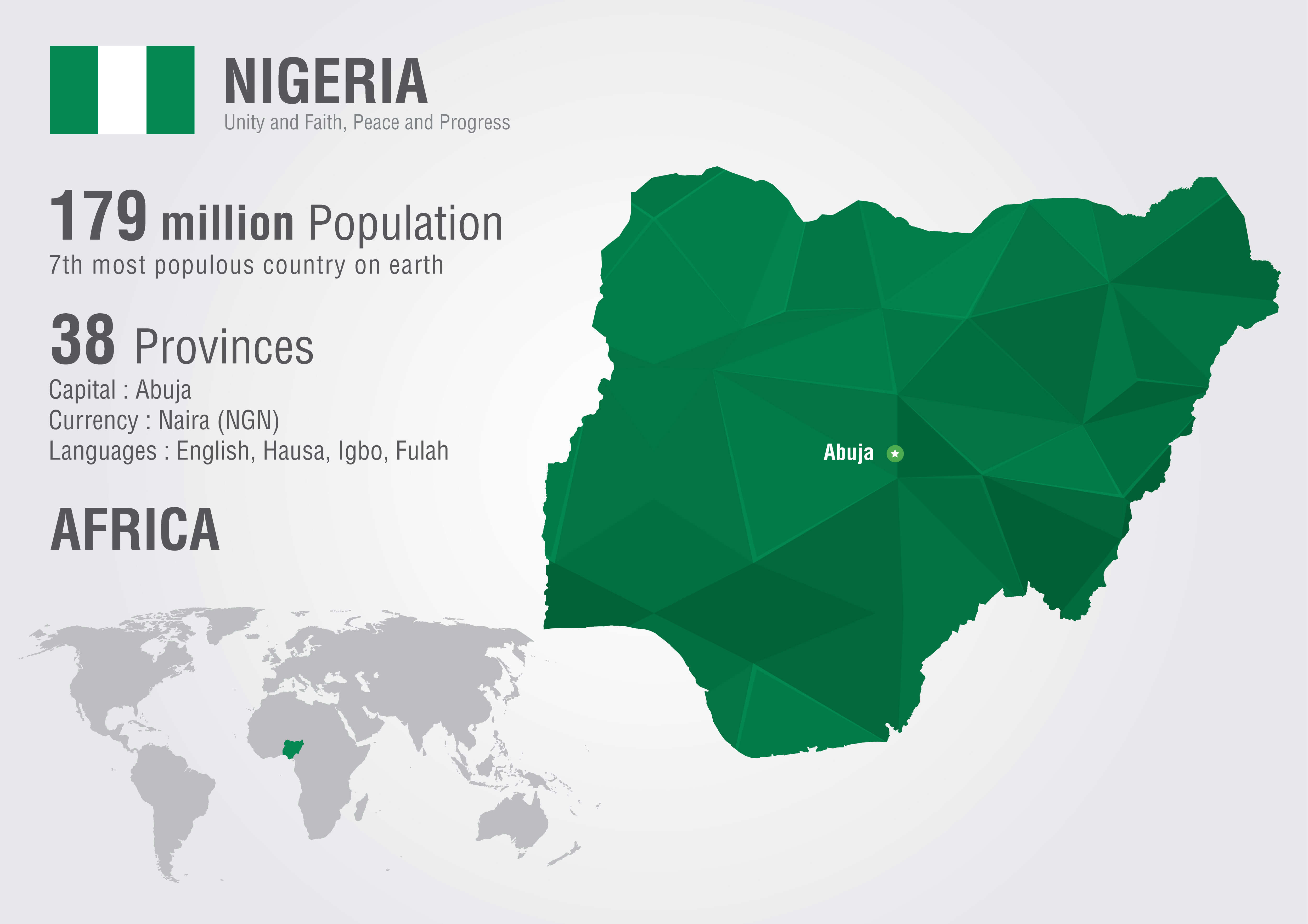
Nigeria, located in West Africa, is the most populous country in Africa with over 200 million people. It is known as the "Giant of Africa" due to its large population and economy. Nigeria is a federal republic with 36 states and the Federal Capital Territory, Abuja. The country is very diverse, with over 250 ethnic groups and multiple languages, with English as the official language. Major ethnic groups include the Hausa, Yoruba and Igbo.
Economically, Nigeria is a powerhouse in Africa, with an economy driven by agriculture, services and its vast oil and gas reserves. The Niger Delta region is one of the largest oil producing areas in the world. Despite its economic potential, the country faces challenges such as income inequality, corruption and security issues. Culturally, Nigeria is known for its vibrant music, Nollywood film industry and culinary traditions, making it a central hub for African arts and entertainment.
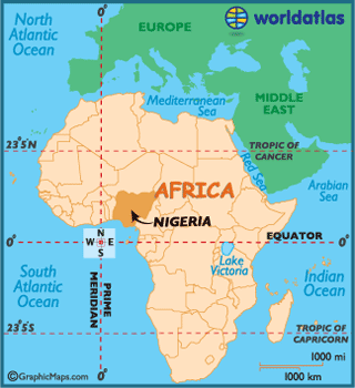
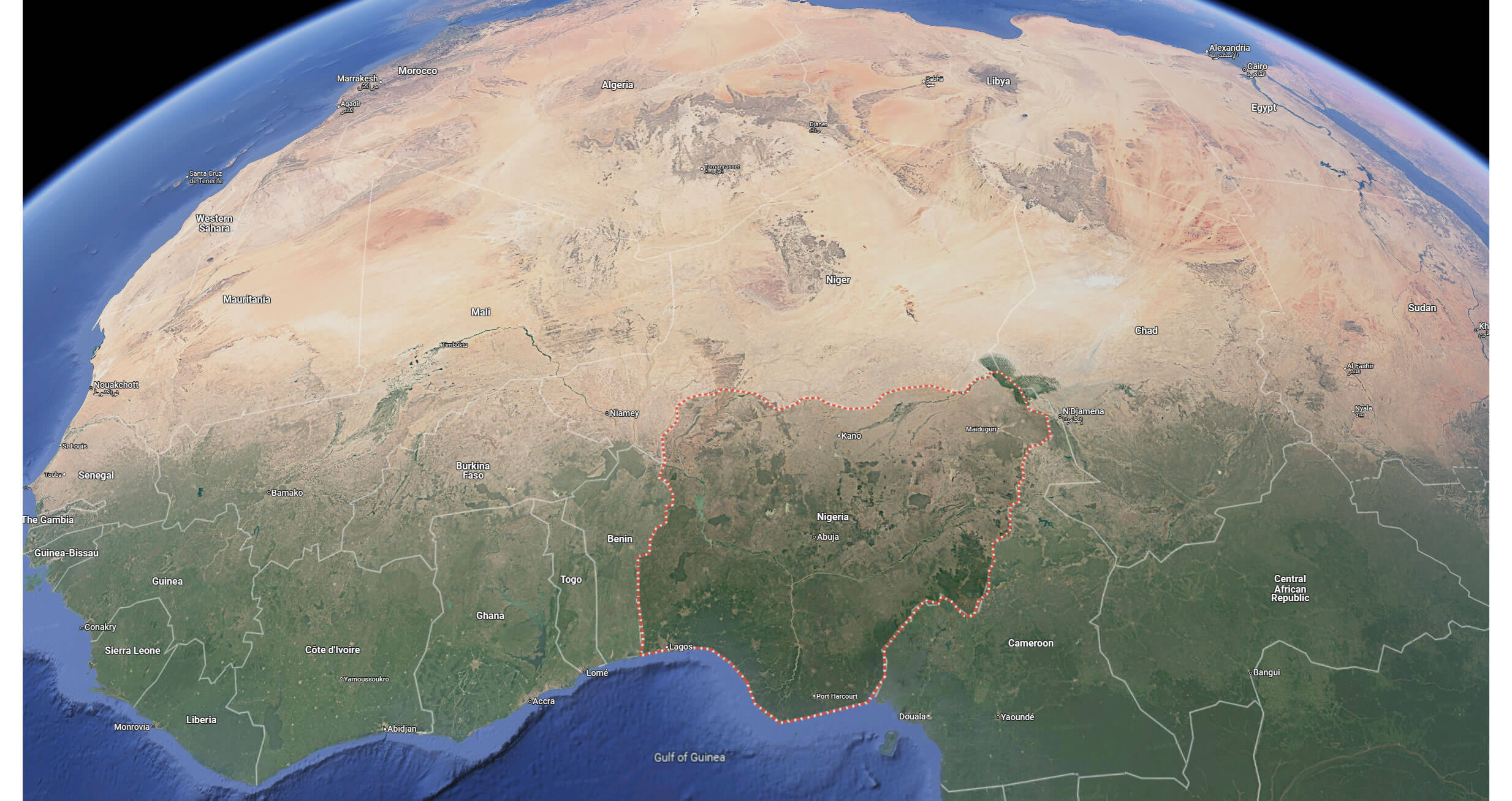
Where is located Nigeria on the World Map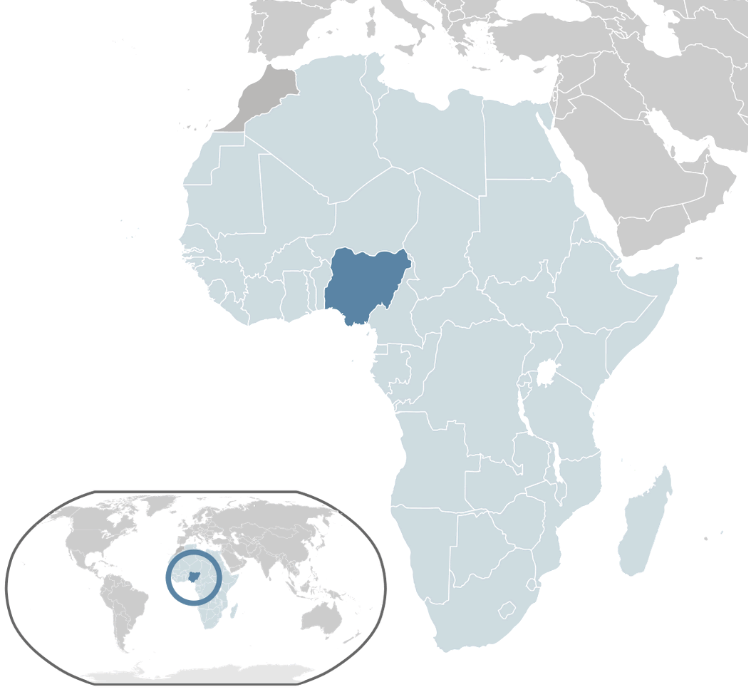 Where is located Nigeria on the World Map
Located on the west coast of Africa, Nigeria is bordered by four countries and the Atlantic Ocean. It borders Niger to the north and Chad and Cameroon to the east. Nigeria's western border is with Benin. To the south, the country's coastline stretches along the Gulf of Guinea, part of the Atlantic Ocean, making it a major maritime nation in West Africa.
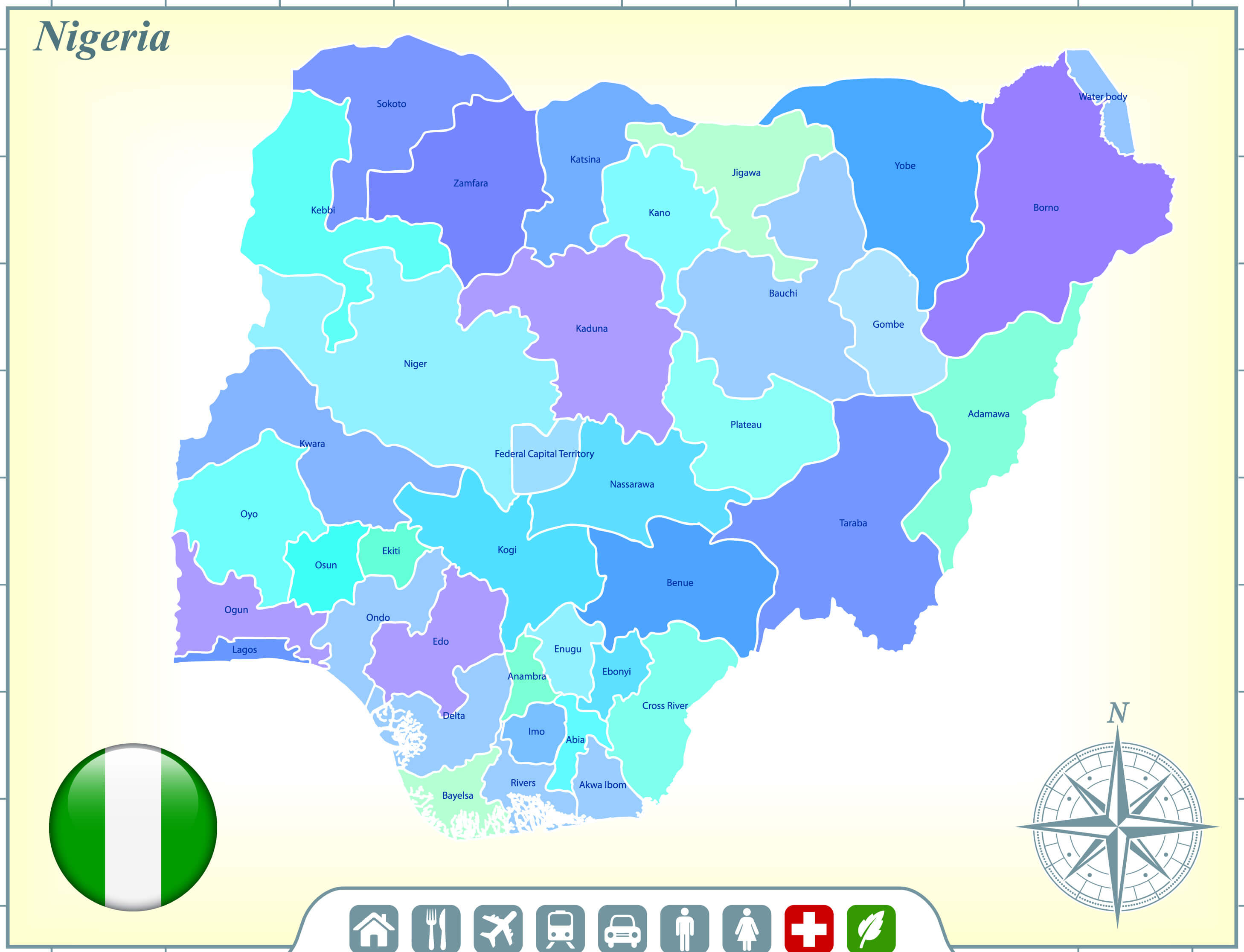
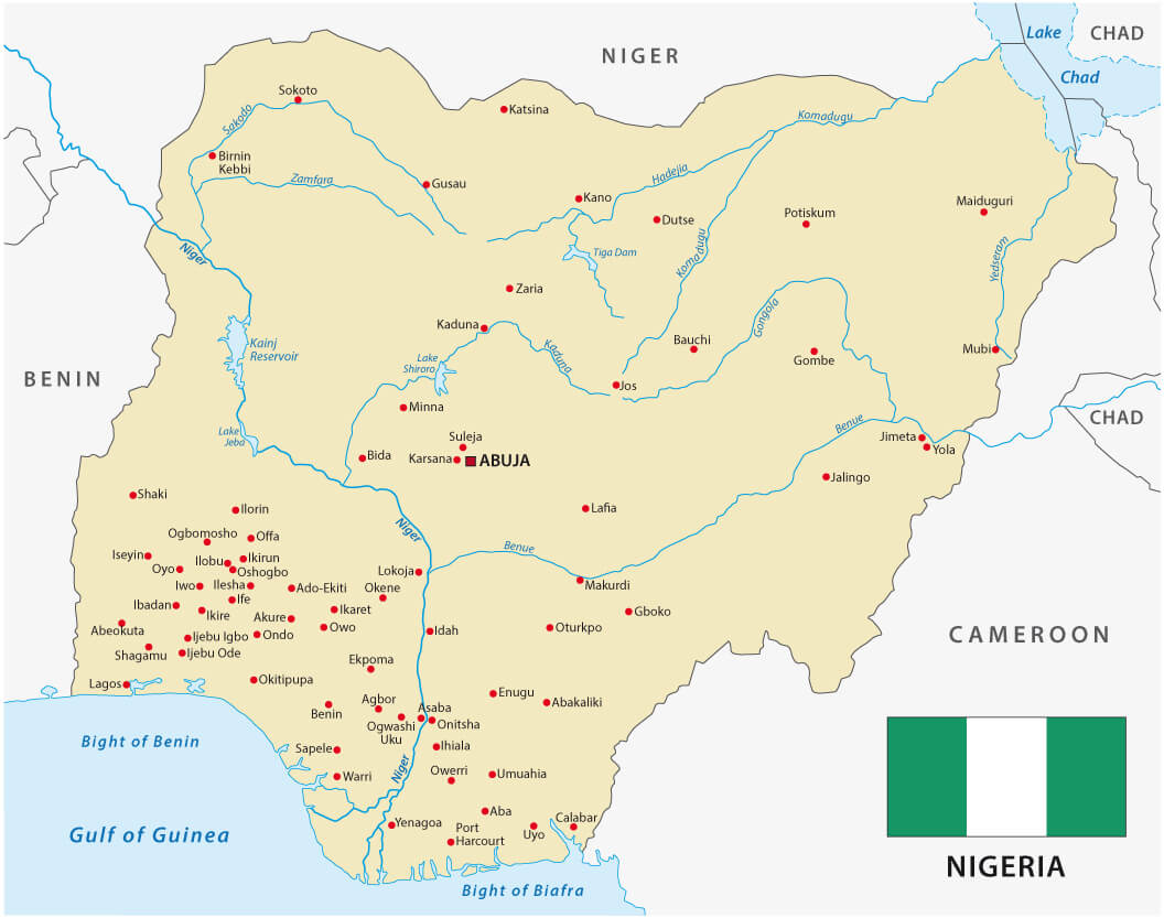
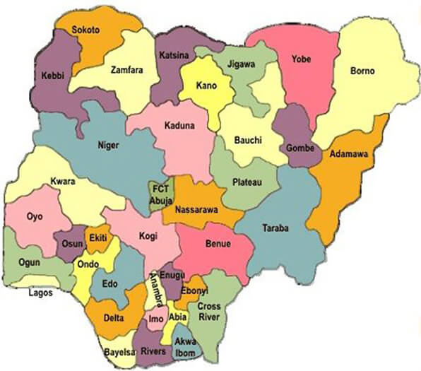
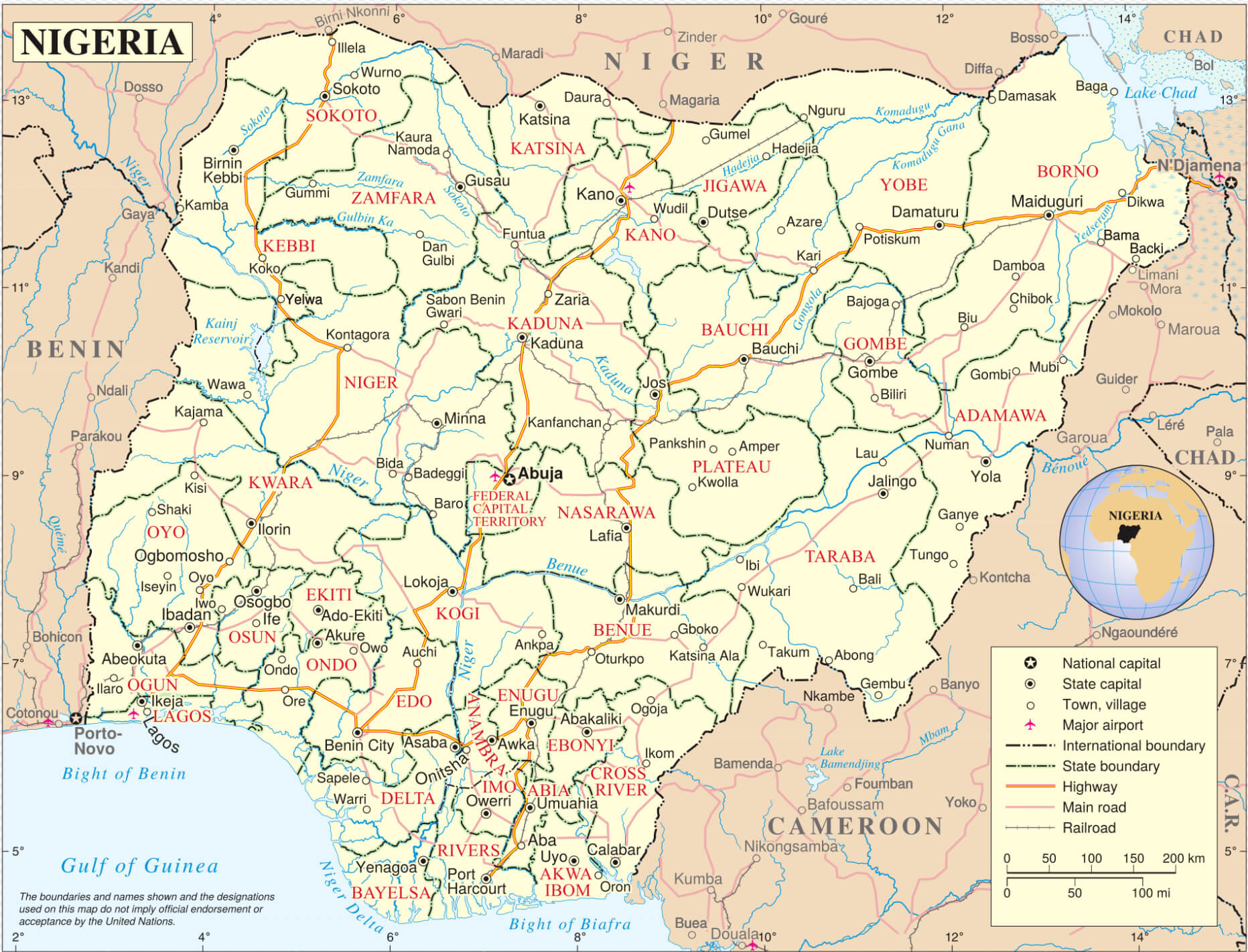
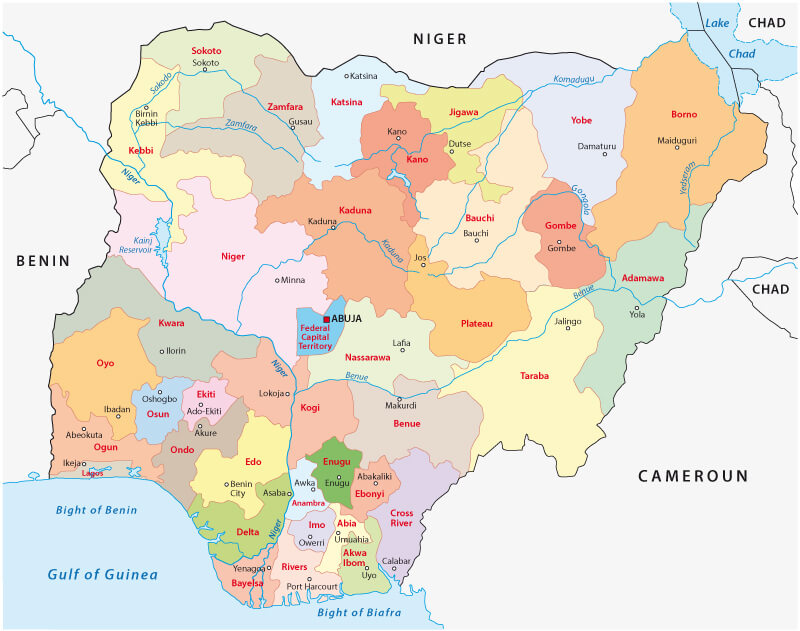
Administrative Map of Nigeria with States and Capitals
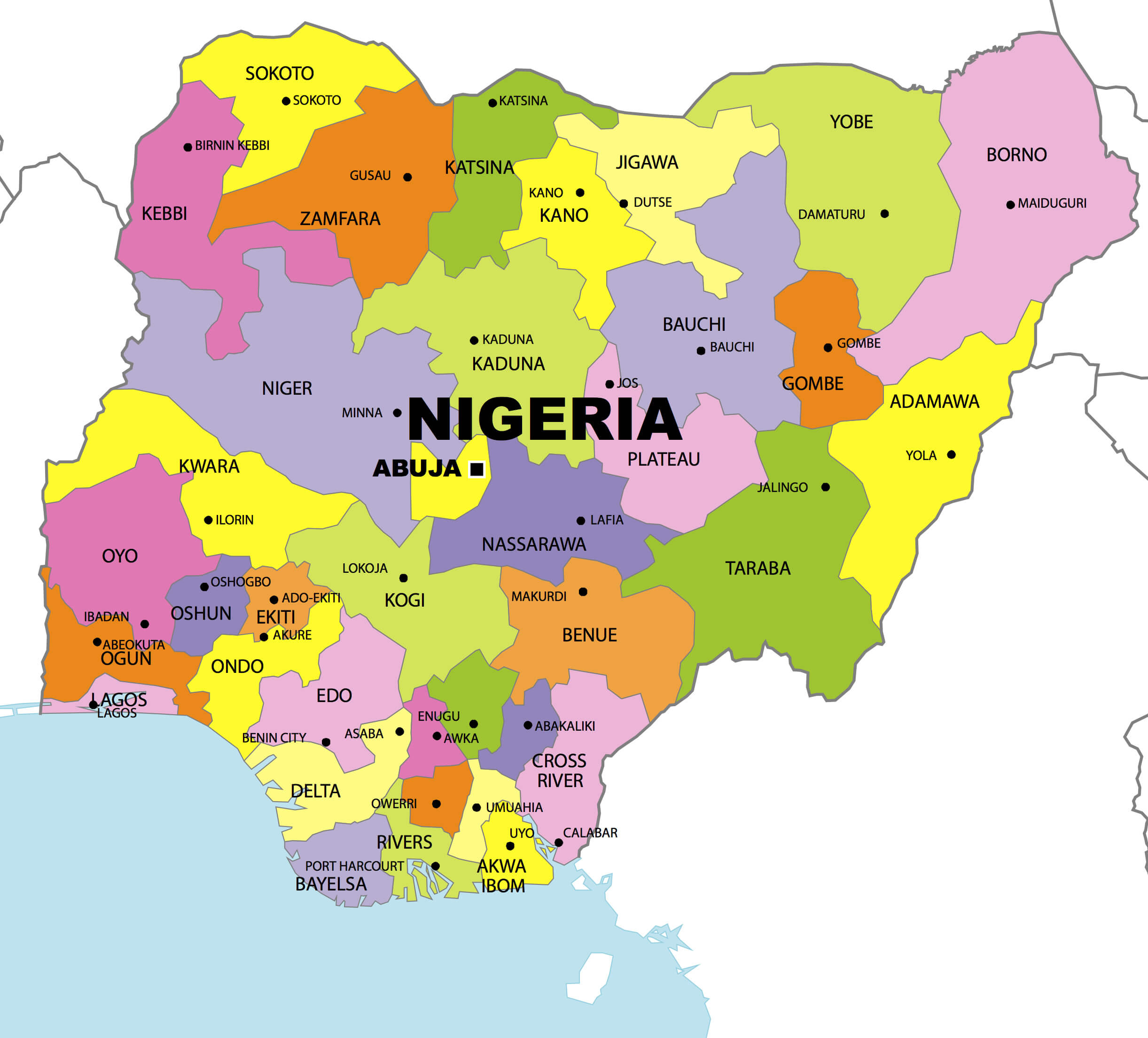 Colorful administrative map of Nigeria showing states and major cities.
This administrative map of Nigeria displays all 36 states with their borders, names, and capitals. Each state is color-coded for easy identification, and major cities like Lagos, Abuja, and Kano are clearly marked for reference.
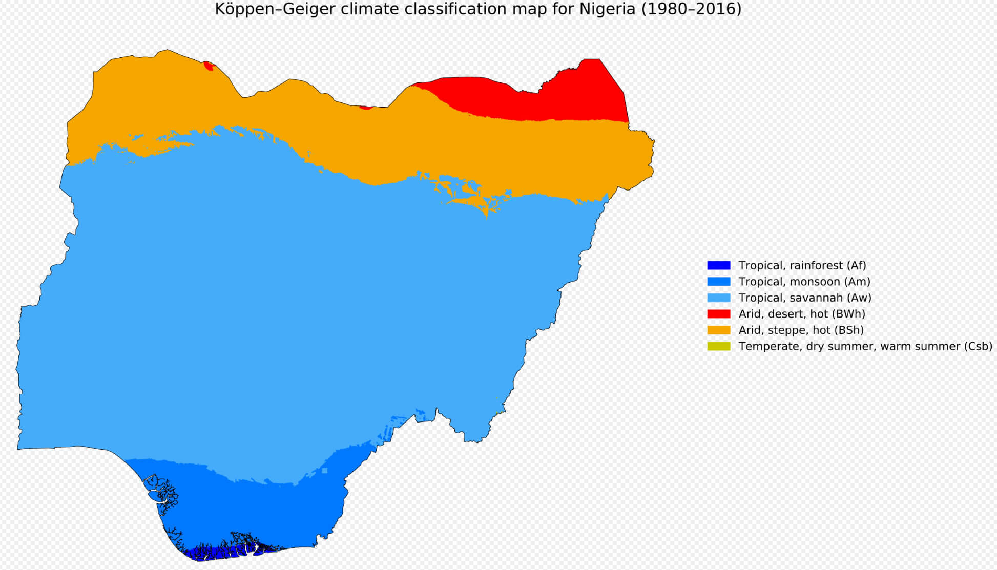
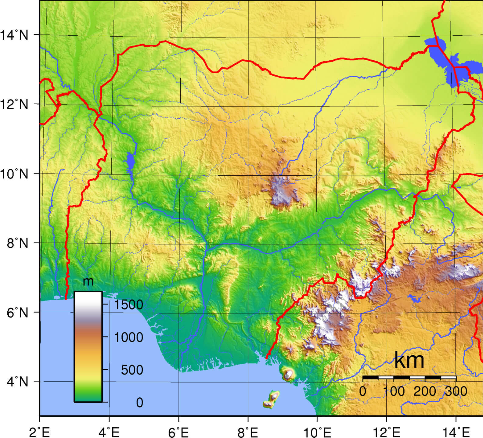
Geographically, Nigeria lies just above the equator, between latitudes 4° and 14° north and longitudes 3° and 15° east. This location gives the country a wide range of climates, from tropical rainforests in the south to arid Sahel conditions in the far north. The Niger and Benue rivers, the country's two largest rivers, meet at Lokoja to form a Y-shaped confluence that significantly influences the geography and economy of the region.
Satellite Map of Nigeria Showing Terrain and Vegetation
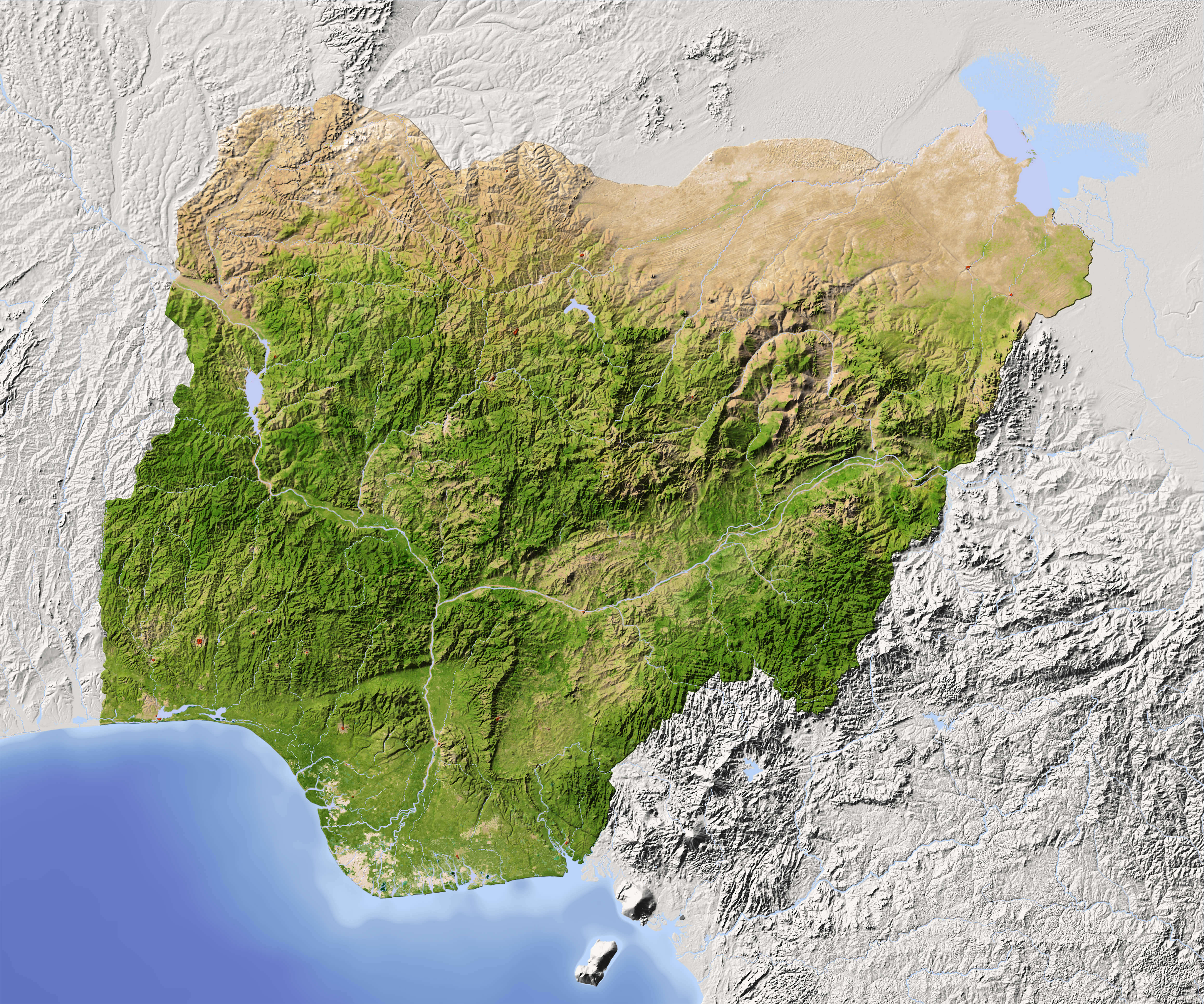 Satellite map of Nigeria with visible terrain, rivers, and vegetation zones.
This map of Nigeria shows major highways, roads and cities throughout the country. It includes state boundaries and major urban centres, providing a clear view of Nigeria's road network and regional layout.
Nigeria's strategic location makes it a major hub for trade and commerce in Africa. Its position on the Gulf of Guinea provides access to major shipping routes, while its land borders facilitate trade with neighbouring countries. In addition, Nigeria's vast land area of approximately 923,768 square kilometres makes it the largest country in West Africa and serves as an anchor for regional integration and economic development.
Here are some statistical information about Nigeria:
Busy urban street scene in Lagos Nigeria

Nigeria info map
 Area: 923,769 km2 (356,669 sq mi)
 Nigeria Road Map with Cities and Highways
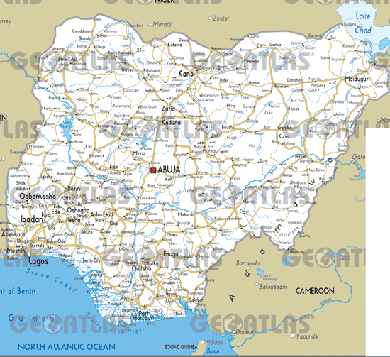
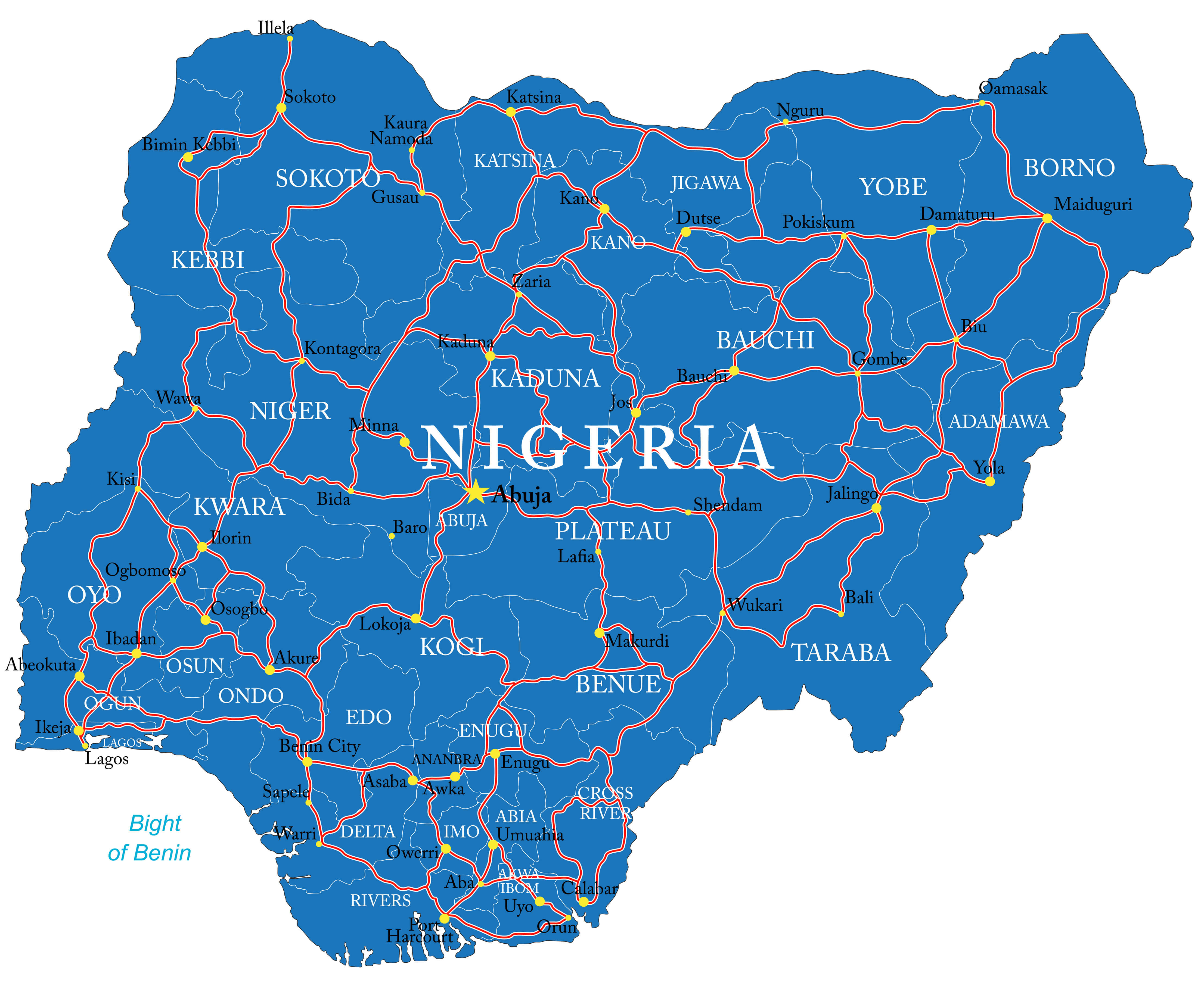 Detailed road map of Nigeria showing highways, cities, and state boundaries.
This map of Nigeria shows major highways, roads and cities throughout the country. It includes state boundaries and major urban centres, providing a clear view of Nigeria's road network and regional layout.
Official languages: EnglishNigeria linguistic groups map
 Religion: Islam 53.5%, Protestant 35.3%, Roman Catholic 10.6%, Other 0.6%.
 Nigeria provinces map with flag
 Currency: Naira (NGN)
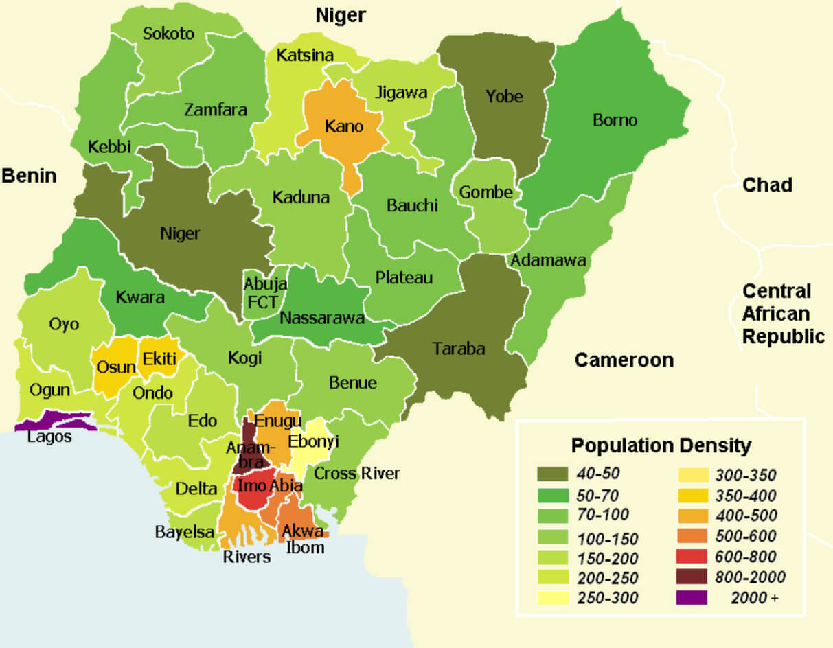
 Nigeria population density map
Physical map of Nigeria with cities
Political map of Nigeria
Nigeria cities and rivers map
Map of Nigeria
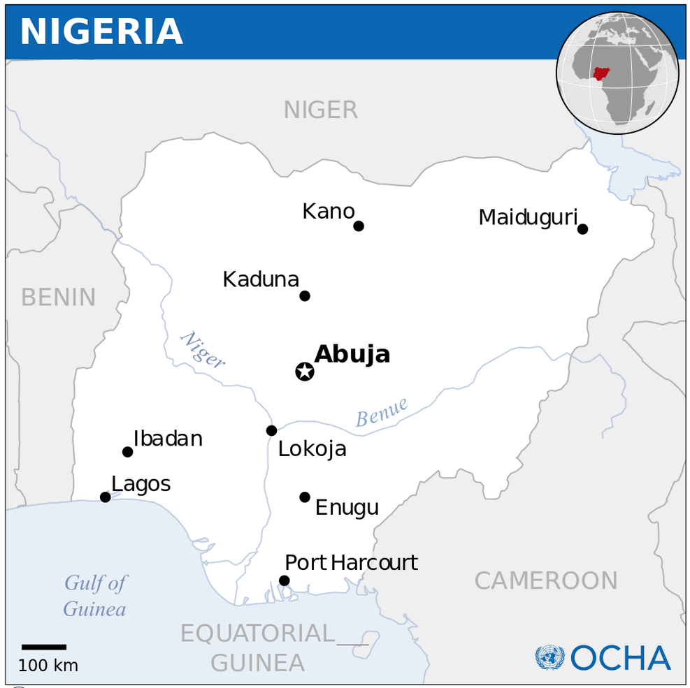
Nigeria Location Map
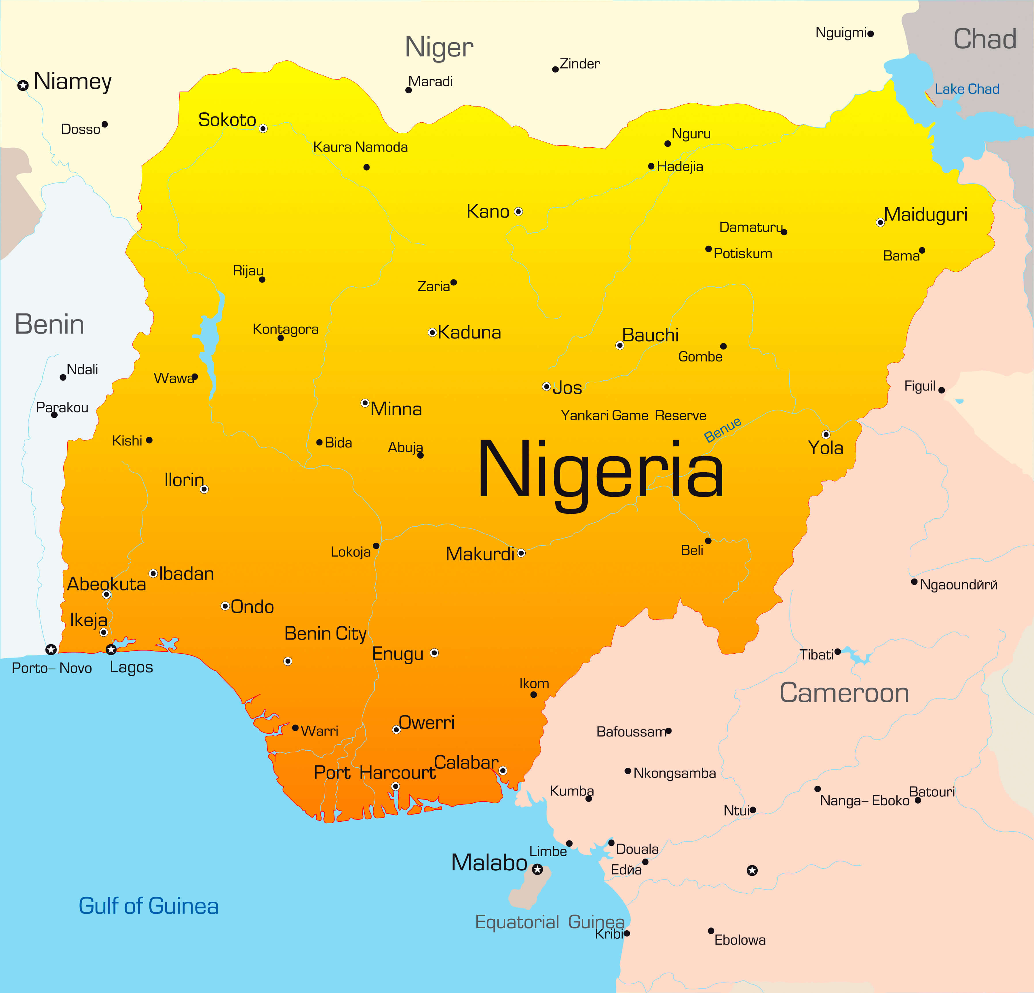
Nigeria Cities Map
 Map of Nigeria showing states, capitals, and major cities with boundaries.
This map of Nigeria highlights its states, capitals, and major cities, including Lagos, Abuja, Kano, and Maiduguri. It outlines international boundaries, state borders, and transportation networks, providing a detailed overview of Nigeria's geography.
Nigeria Economy Map
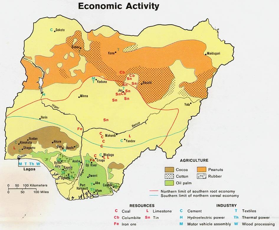 Nigeria economic activity map showing agriculture, resources, and industries.
This map illustrates Nigeria's economic activities, including major agricultural regions (cocoa, peanuts, oil palm, cotton, and rubber), key resources (coal, tin, limestone, iron ore), and industries (textiles, wood processing, motor vehicle assembly, and power generation).
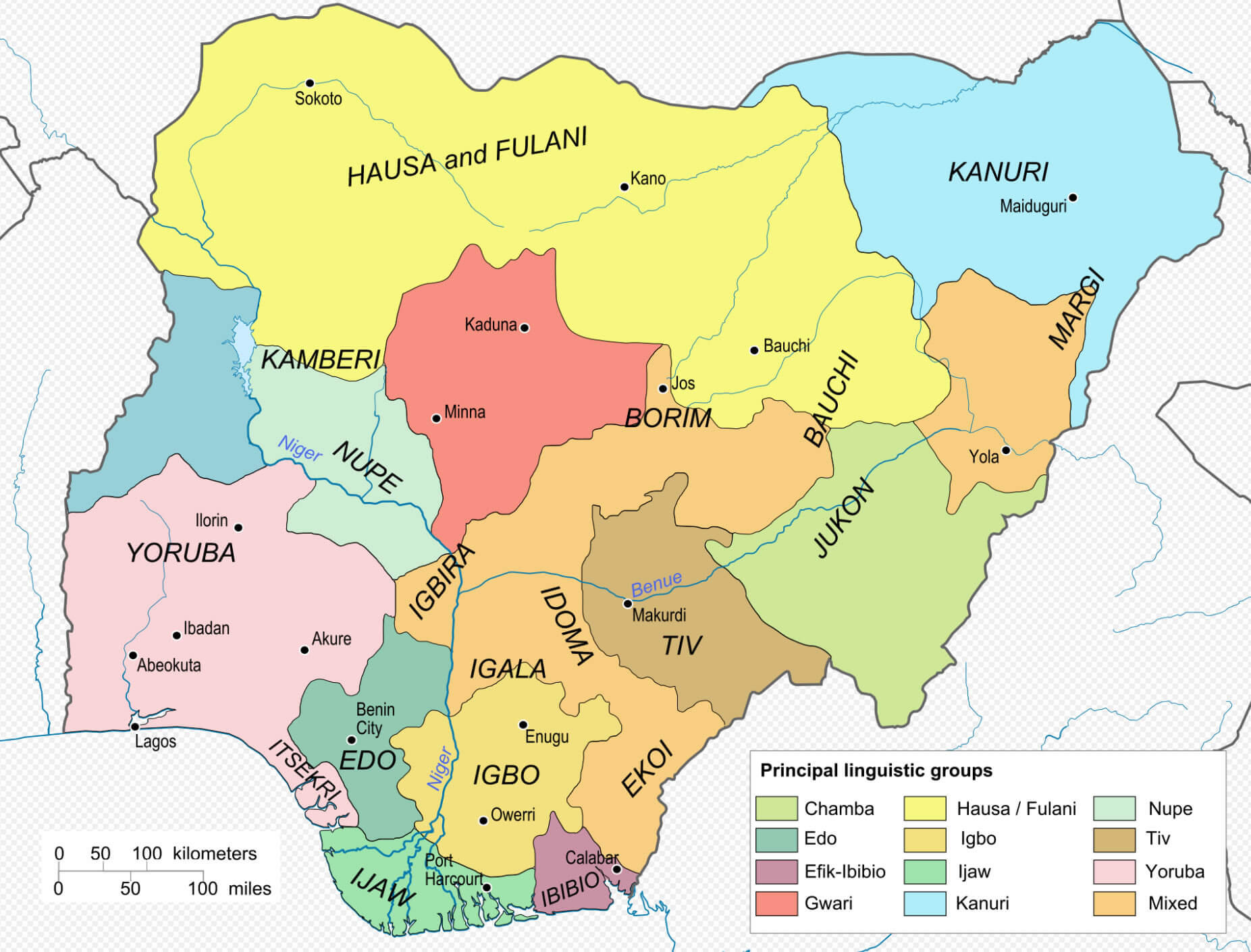
Nigeria Linguistic Map
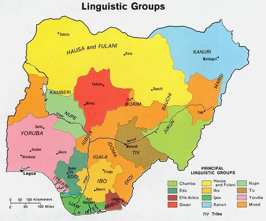 Linguistic map of Nigeria showing major languages and ethnic groups by region.
This map depicts Nigeria's linguistic diversity, highlighting major language groups, including Hausa and Fulani, Yoruba, Ibo, Tiv, Kanuri, and others. Each region's linguistic group reflects the cultural and ethnic composition of Nigeria.
Nigeria Map Abuja
 Map of Nigeria with roads, cities, and Abuja as the capital.
This detailed map of Nigeria showcases its road networks, major cities, and Abuja as the capital. It highlights connections between regions, coastal access, and neighboring countries, offering an insight into Nigeria's infrastructure and urban layout.
Nigeria Map Africa
Nigeria Physical Map
Nigeria Political Map
Nigeria Provinces Map
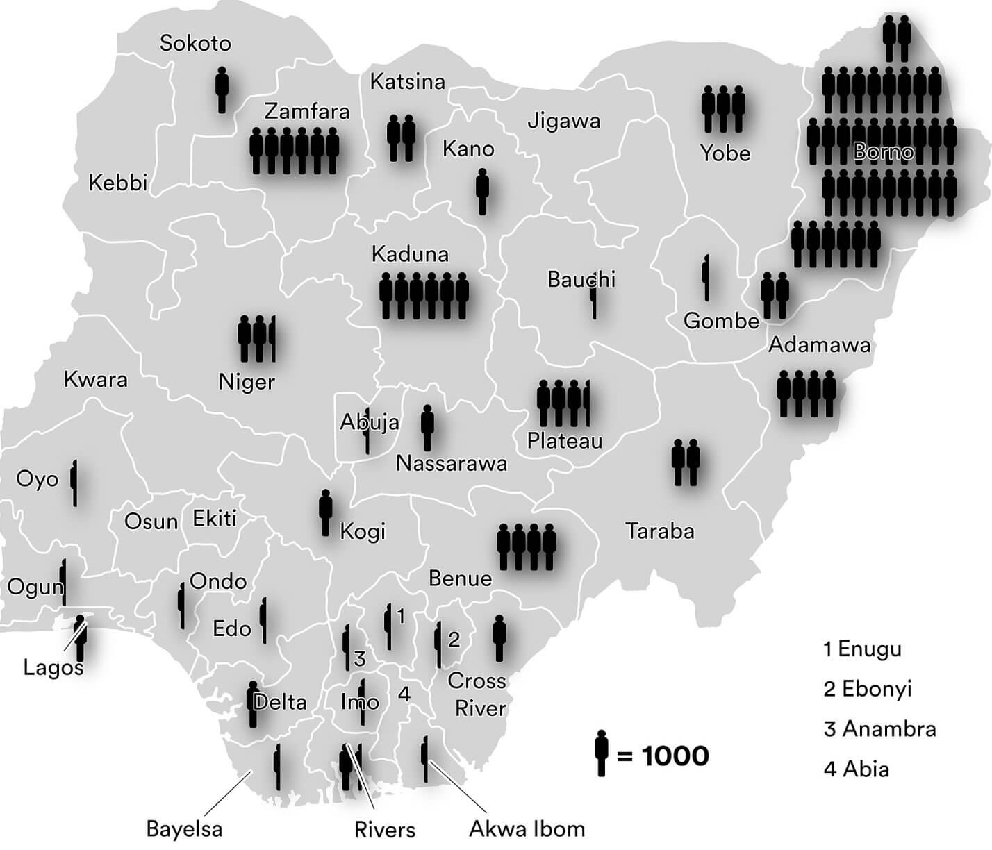
Boko Haram attacks map in Nigeria
Deforestation map in Nigeria 1981 2020

Nigeria administrative map
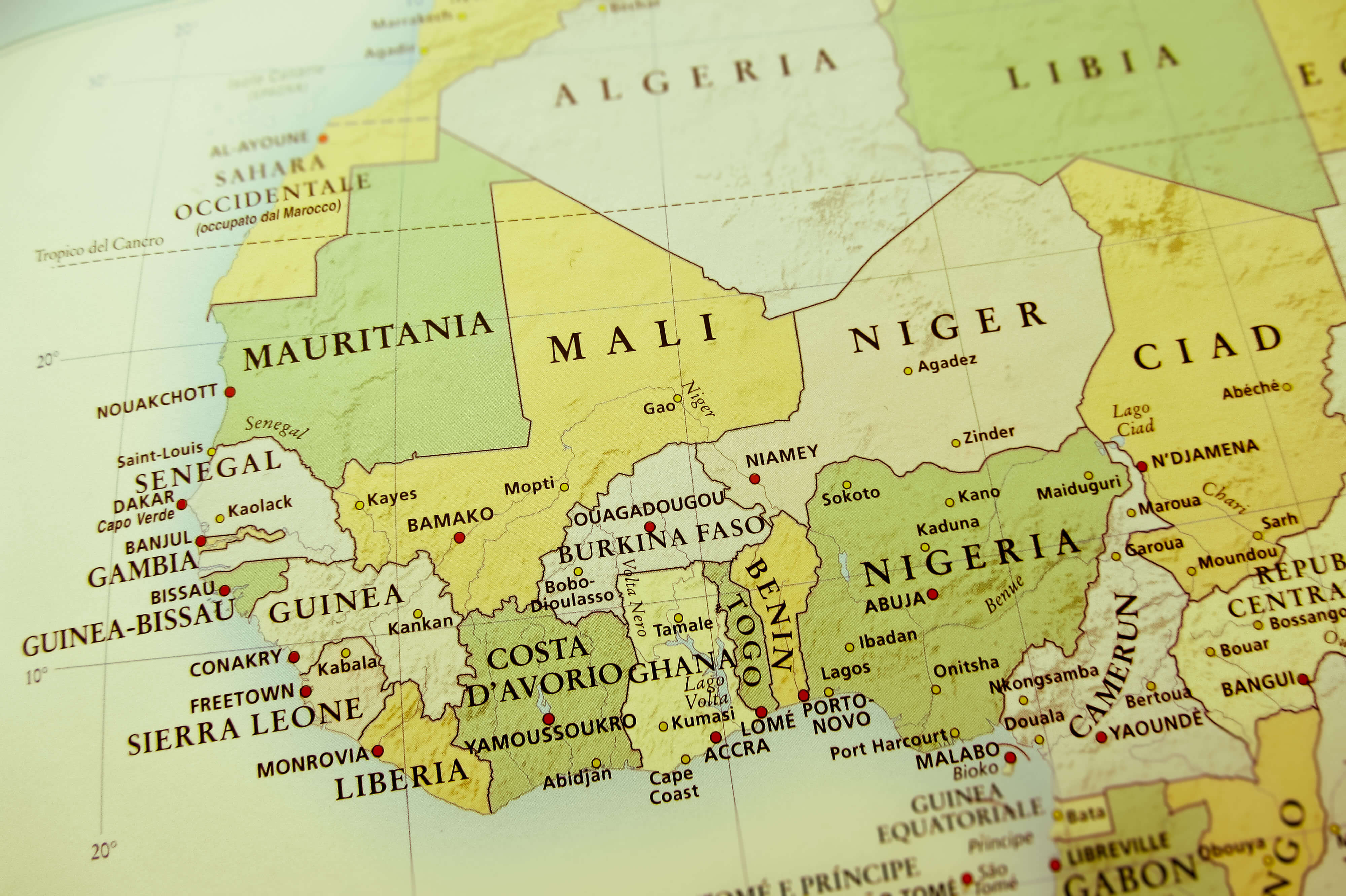
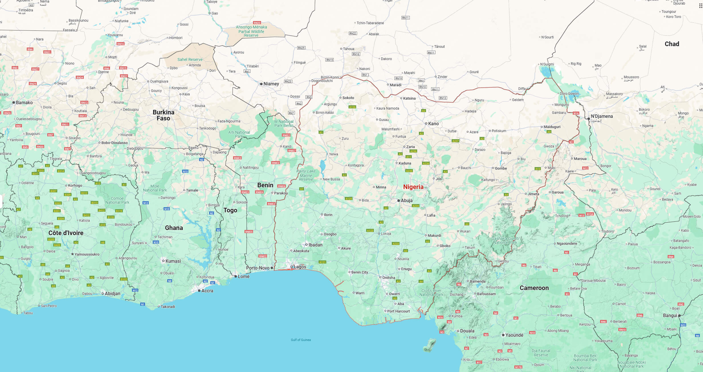
Nigeria and West African countries map
Nigeria climate map
Nigeria country physical map
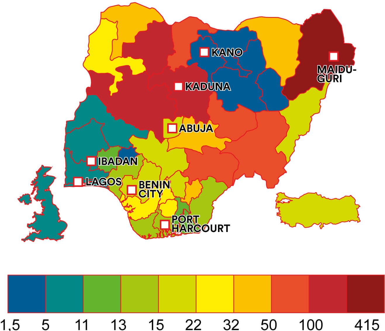
Nigeria homicide map comparing UK Turkey
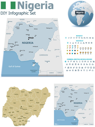
Nigeria infograhic map
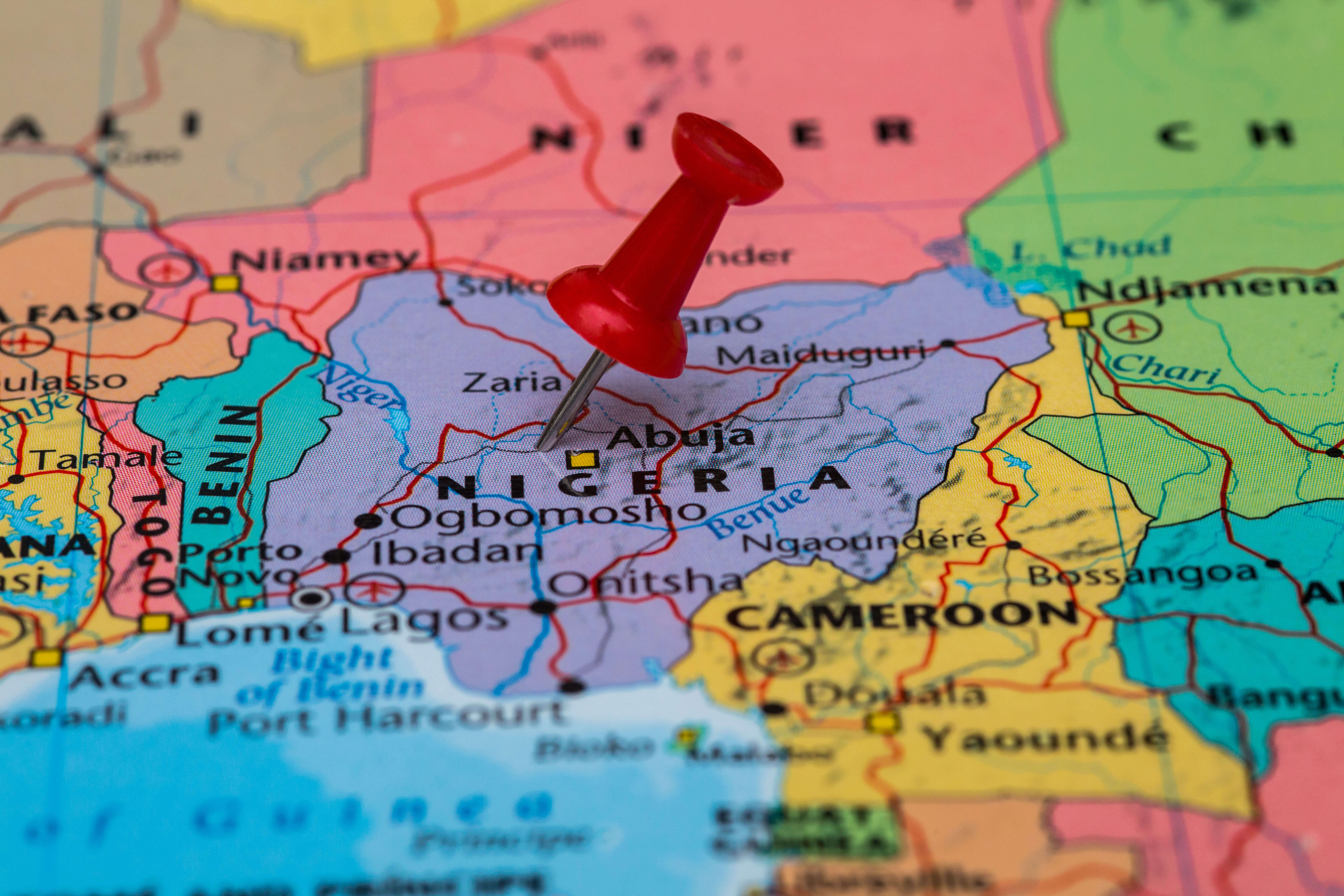
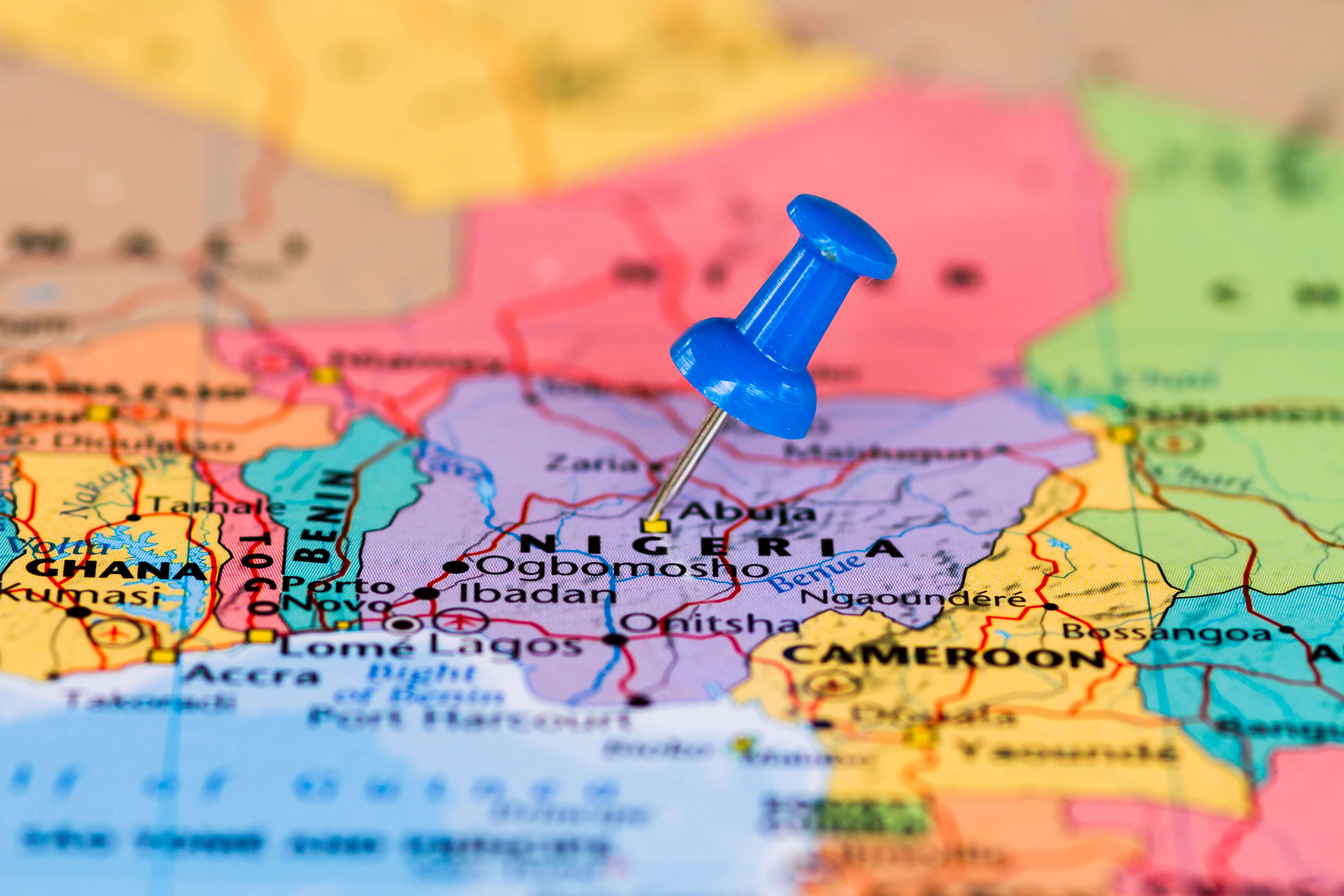
Nigeria location map
Nigeria map from space
Nigeria map in 1967
Nigeria map
Nigeria neighbour countries map
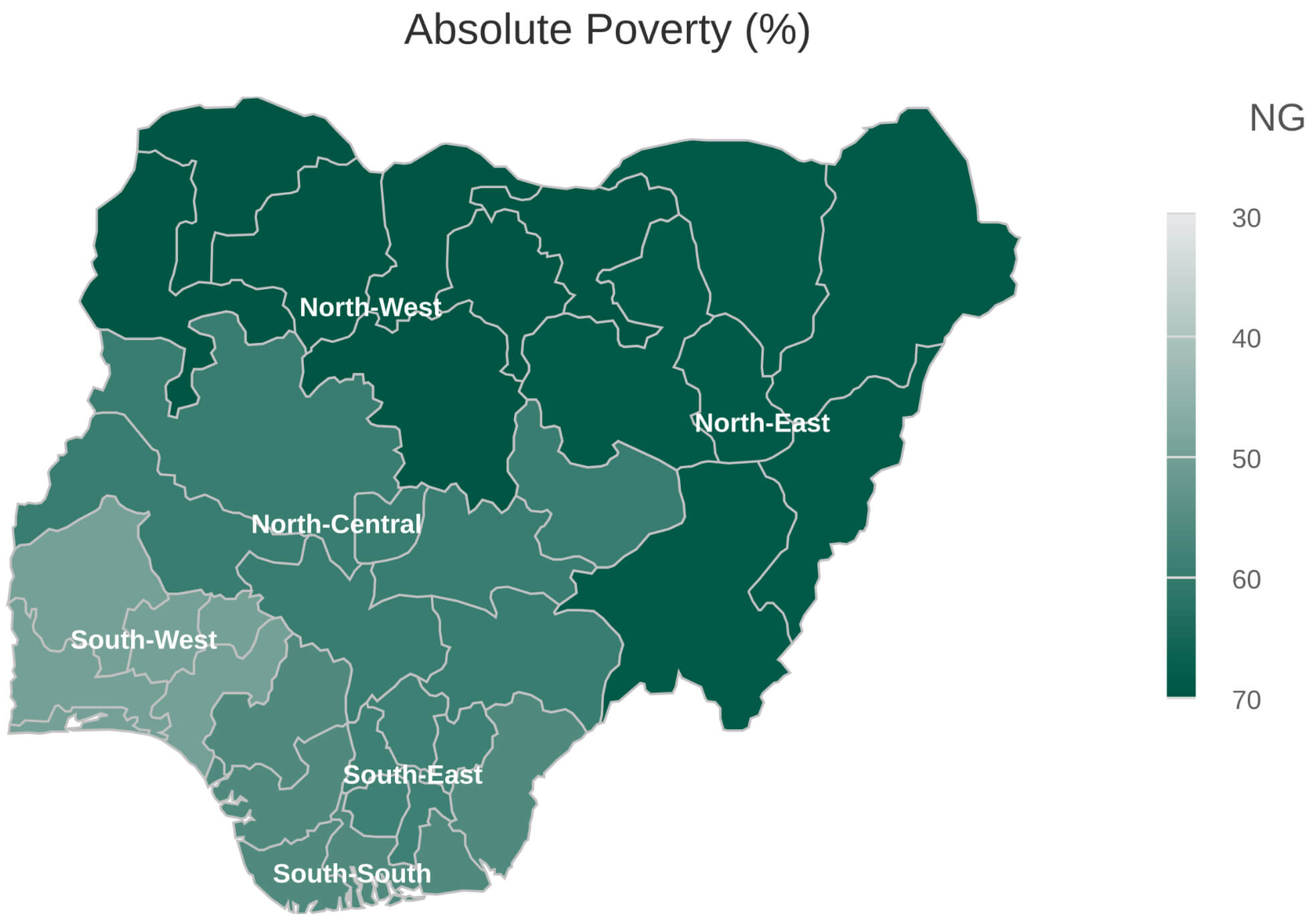
Nigeria poverty map
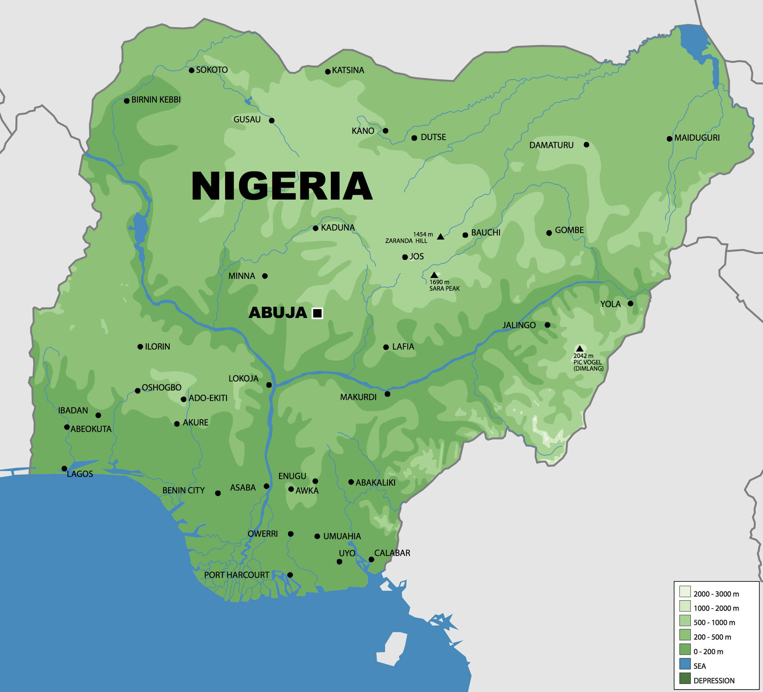
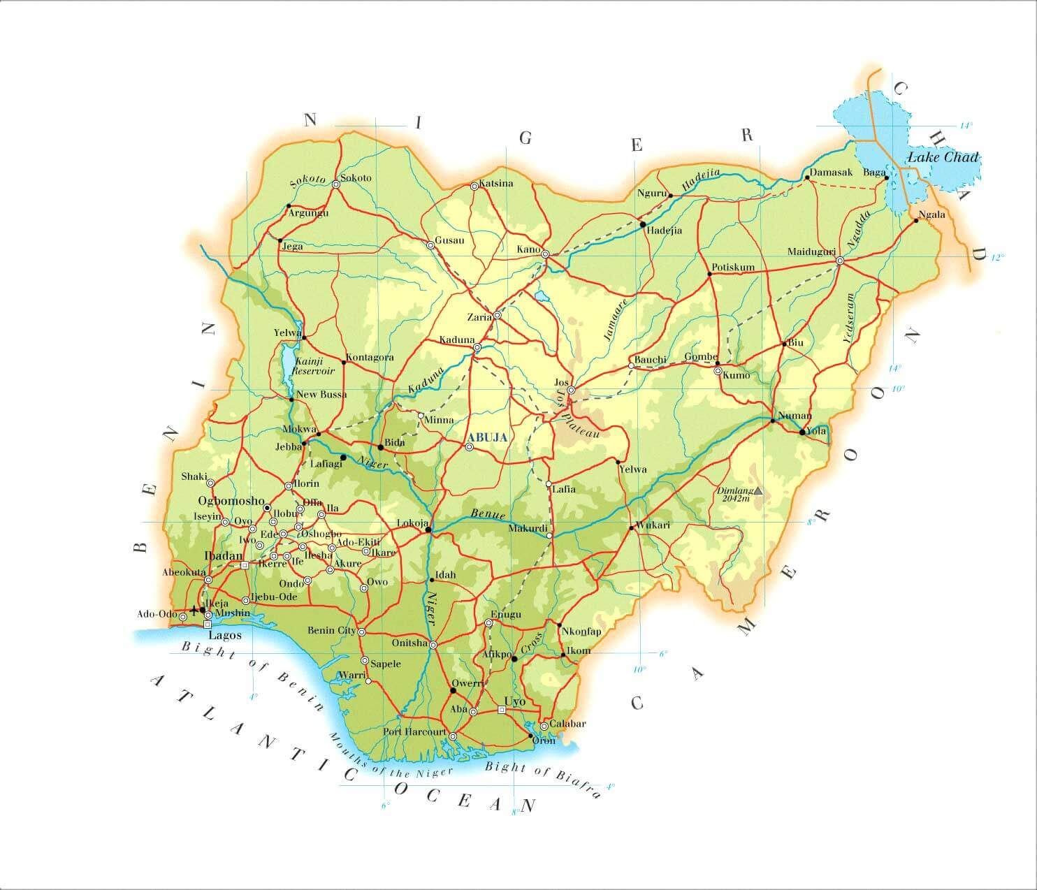
Nigeria terrain map
Physical map of Nigeria
Population density map of Nigerian
Regions map of Nigeria
Rivers map of Nigeria
Topography map of Nigeria
For more Morocco Maps and About Morocco;
- Nigeria Map
- Nigeria
- Africa Map
- Africa
- Explore Africa Political Map
- Explore Africa Physical Map
- Explore European Countries Map
- Explore Africa Historical Map
- Explore Africa Satellite Map
- Explore Africa Religion Map
- Europe Africa Population Map
- Explore Africa Road Map
- Africa Maps
- Africa Language Map
- Africa Geographic Map
- Head of Performance Marketing
- Head of SEO
- Linkedin Profile: linkedin.com/in/arifcagrici