United States of America time zones map with states
 USA map showing time zones and state borders in different colors.
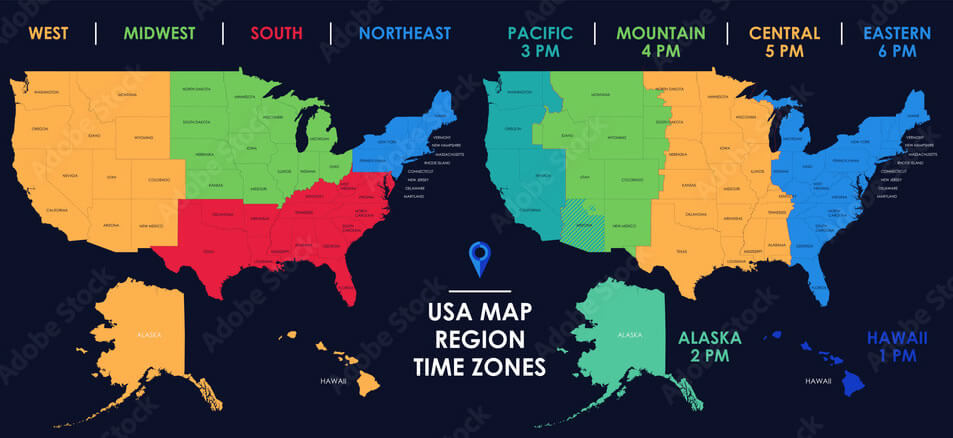
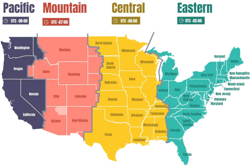
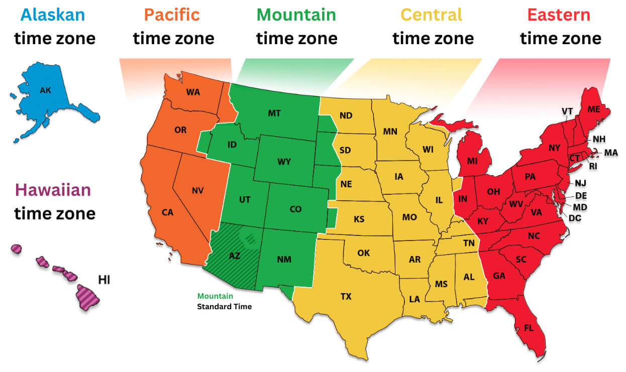
A color-coded map of the United States displaying all five main time zones: Eastern, Central, Mountain, Pacific, and Alaskan, along with Hawaiian time zone. Each state is labeled, and the zones are clearly separated to show which states fall into which time zone.
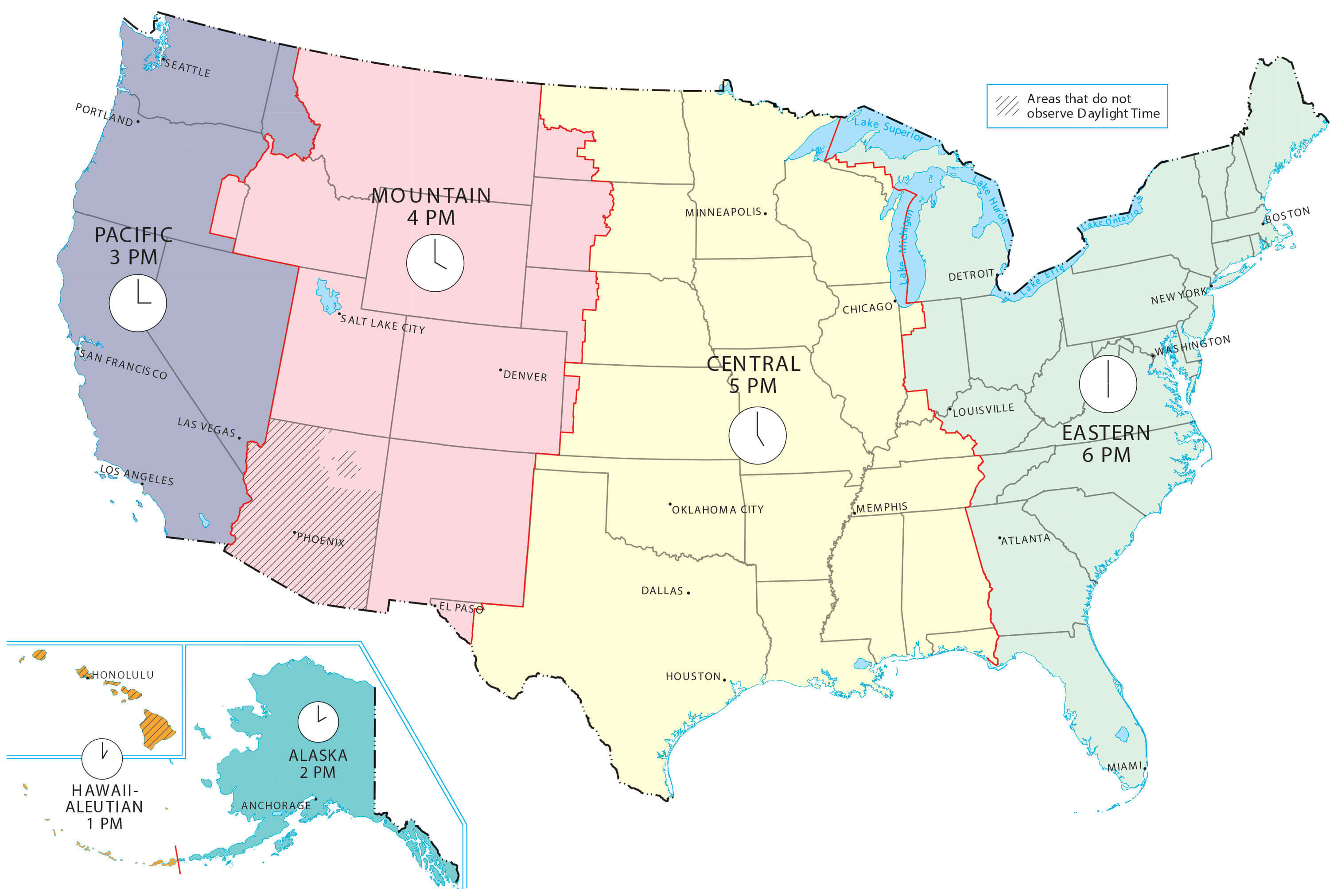
Pacific mountain central eastern time zones map in the US
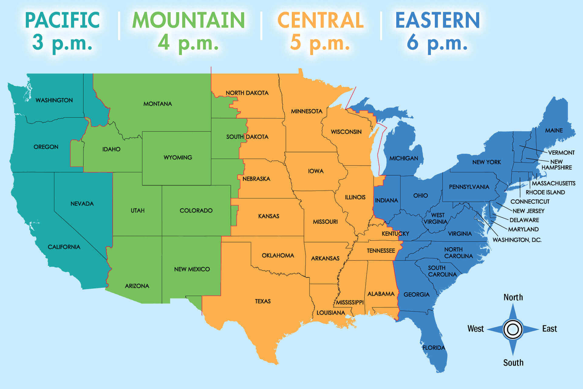
 Color-coded USA map with Pacific, Mountain, Central, and Eastern time zones.
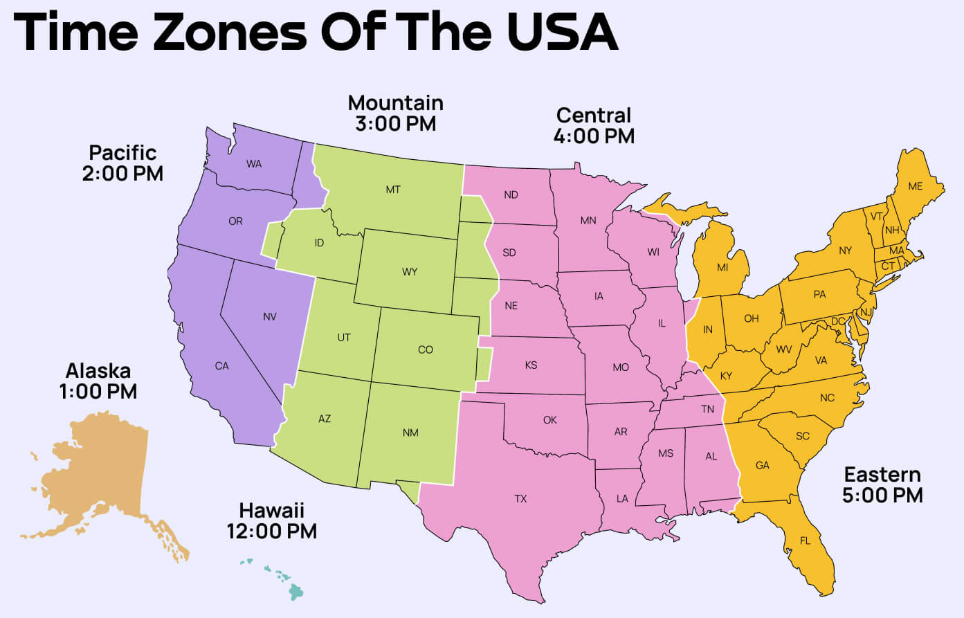
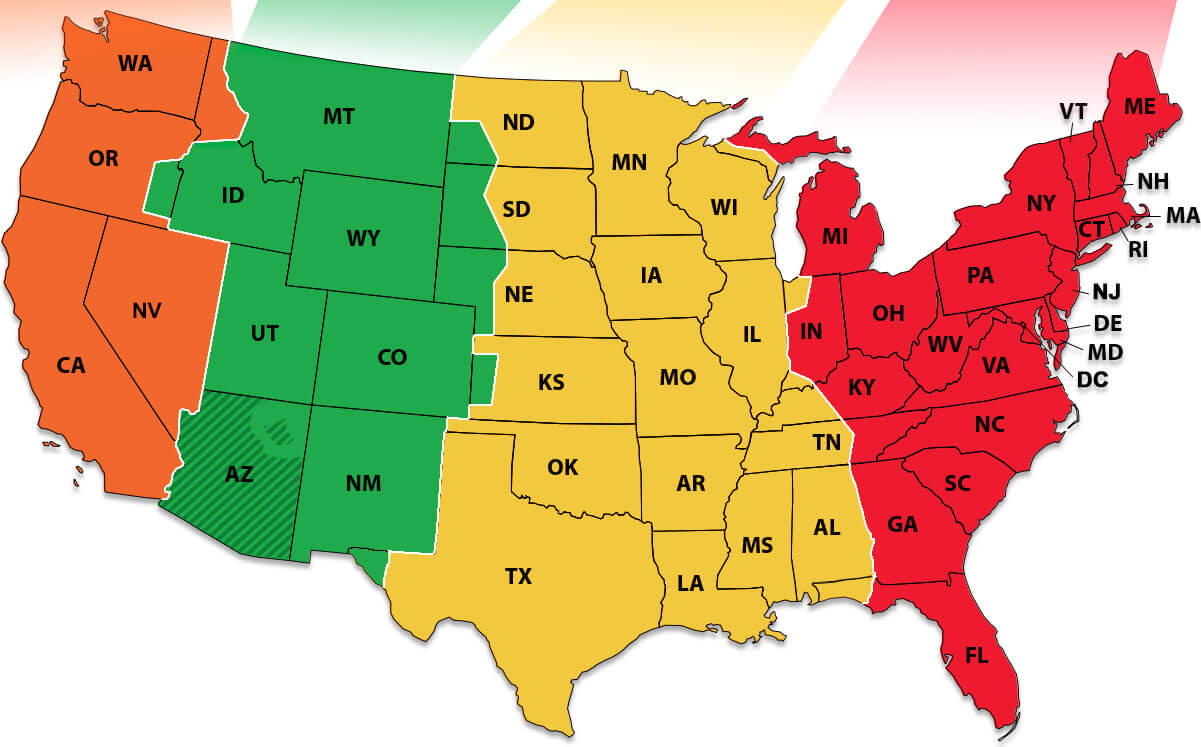
A brightly colored map of the United States showing the Pacific, Mountain, Central, and Eastern time zones, along with Alaska and Hawaii. Each region is labeled with its time (e.g., Pacific 3 PM, Eastern 6 PM), and the states are grouped by major U.S. regions: West, Midwest, South, and Northeast.
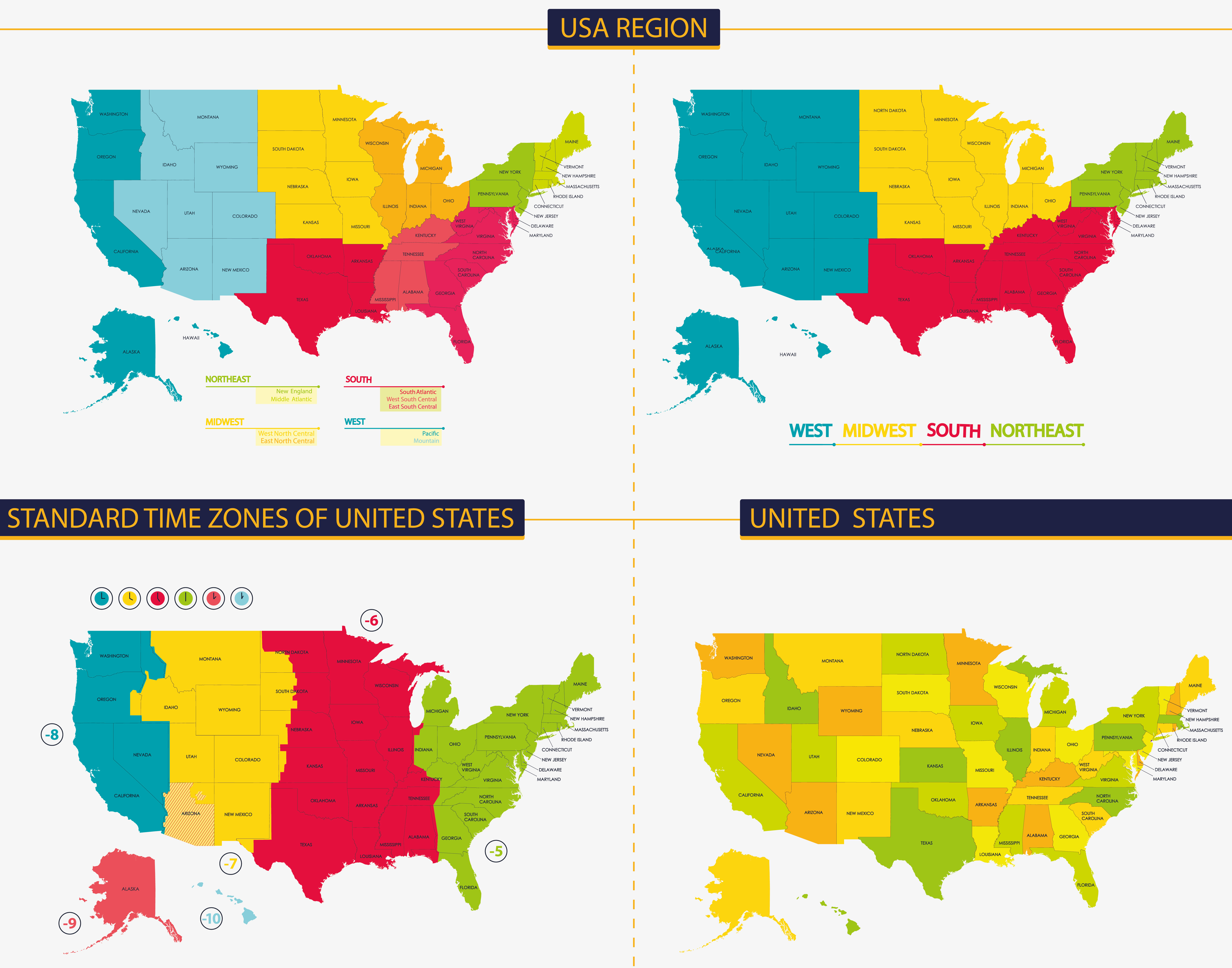
Time Zone Boundary Map of the United States
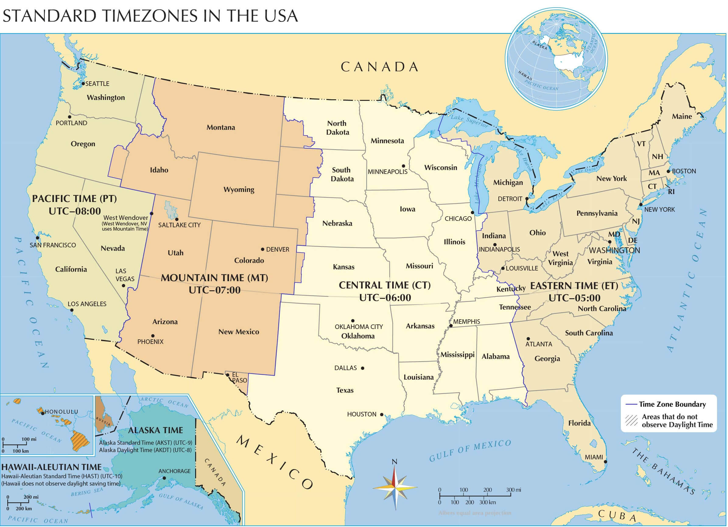 Map showing time zone boundaries across the United States with UTC offsets.
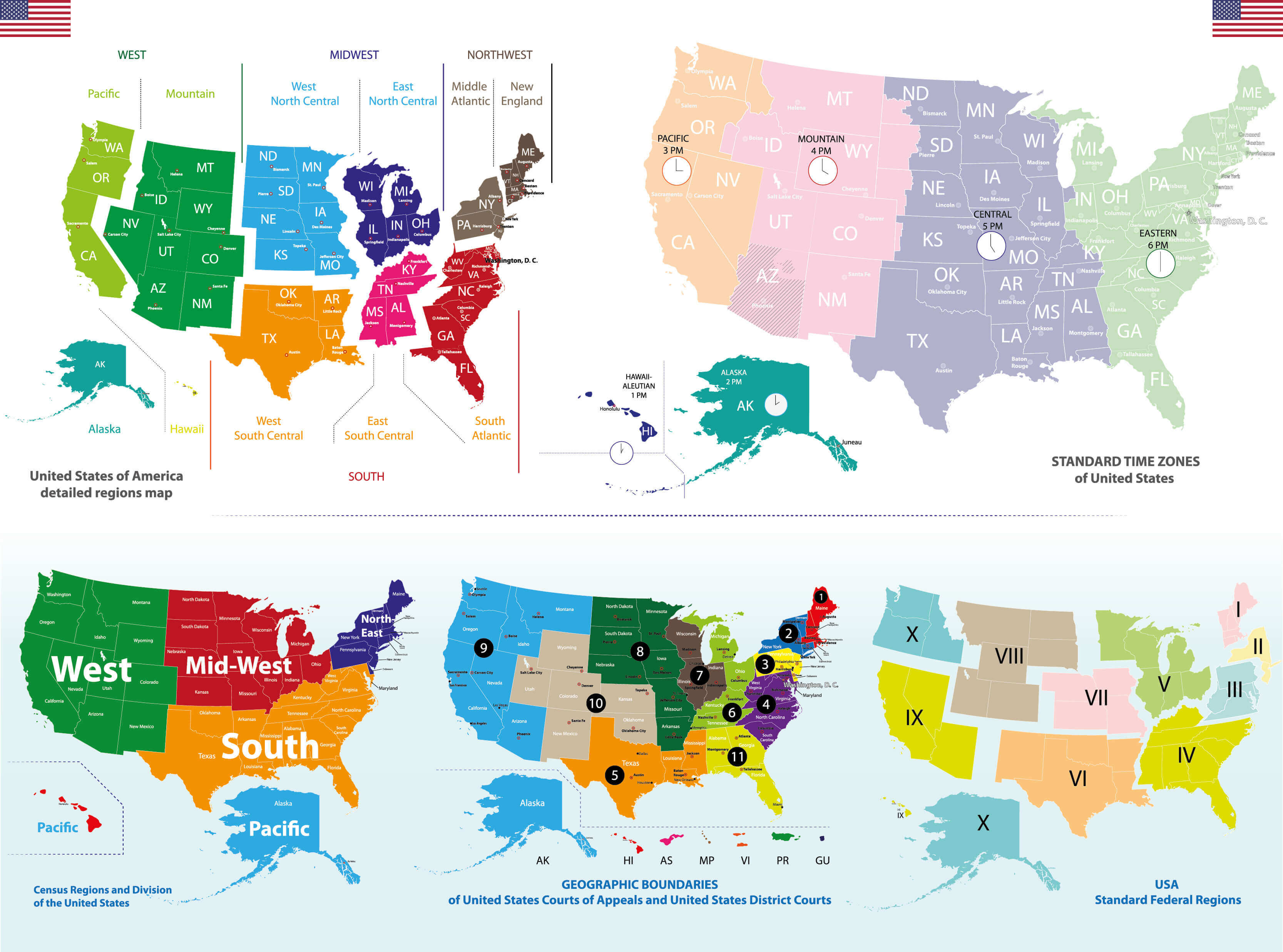
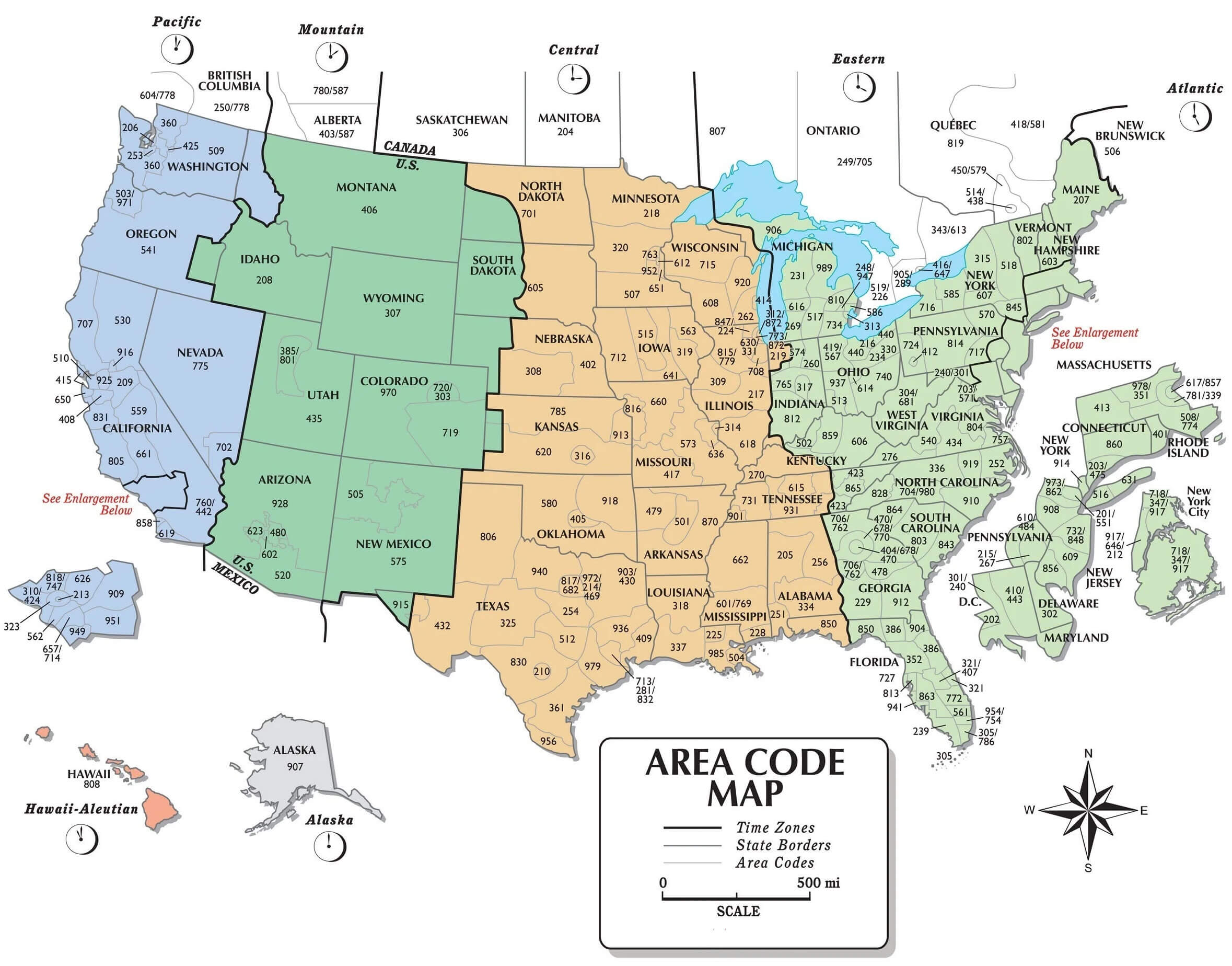
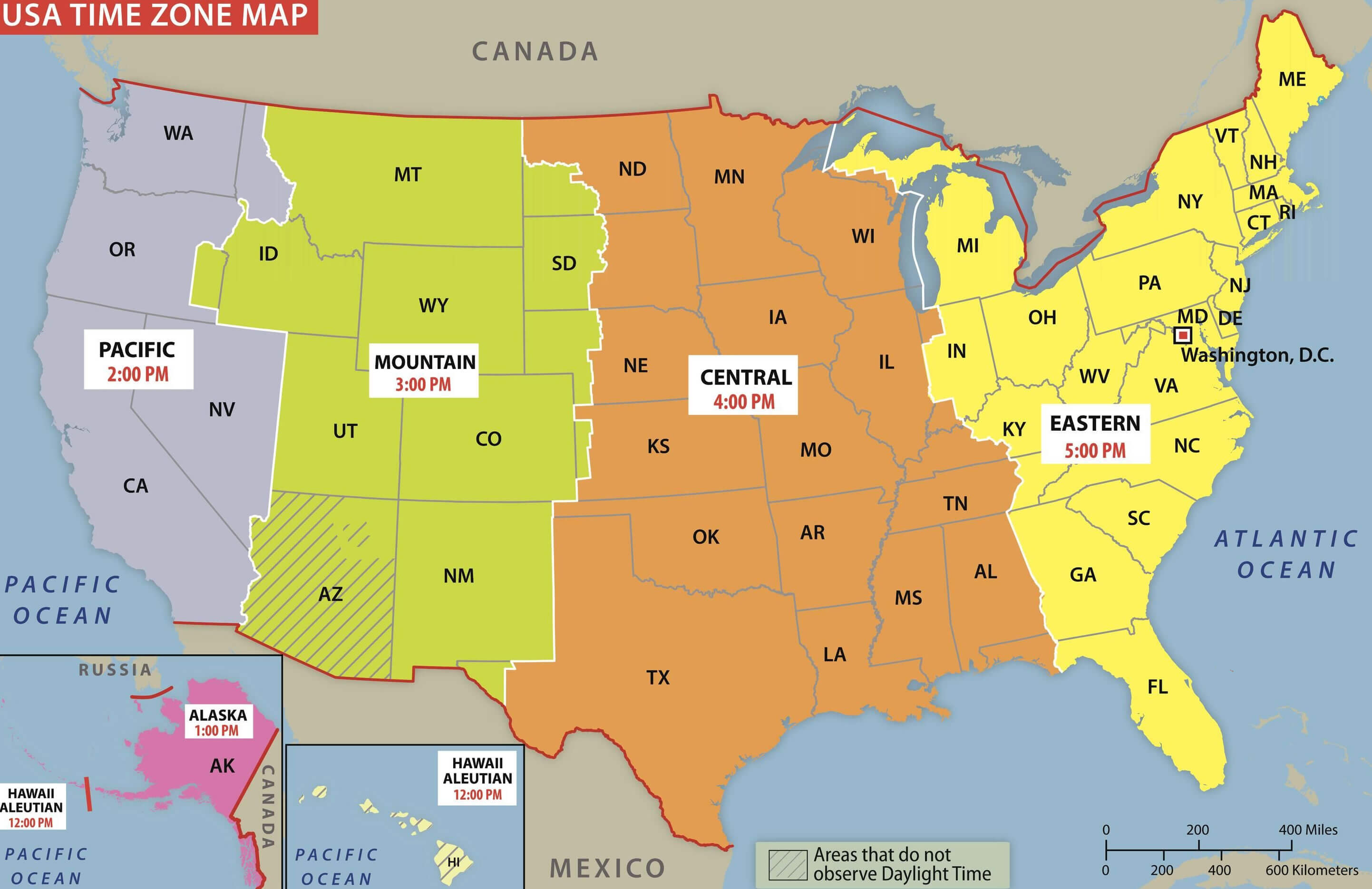
This time zone boundary map of the United States illustrates the division between Eastern, Central, Mountain, Pacific, Alaska, and Hawaii-Aleutian time zones. It includes UTC offsets and highlights regions that do not observe Daylight Saving Time, offering a clear guide to U.S. time differences
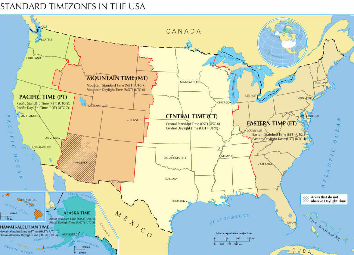
Standard time zones in the USA
US time zone map with universal time
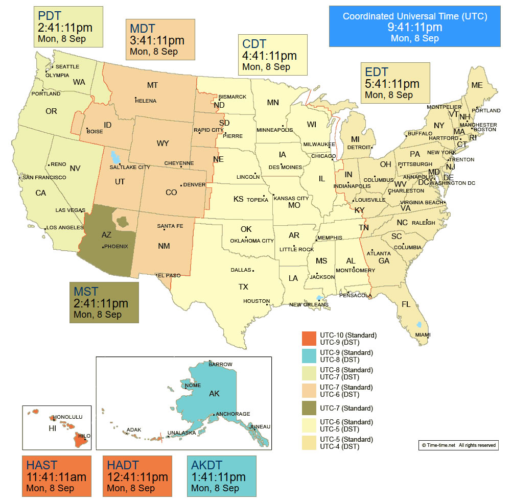
Standard time zones map of the United States
US Time Zone Map: Tracking Time Across America
The
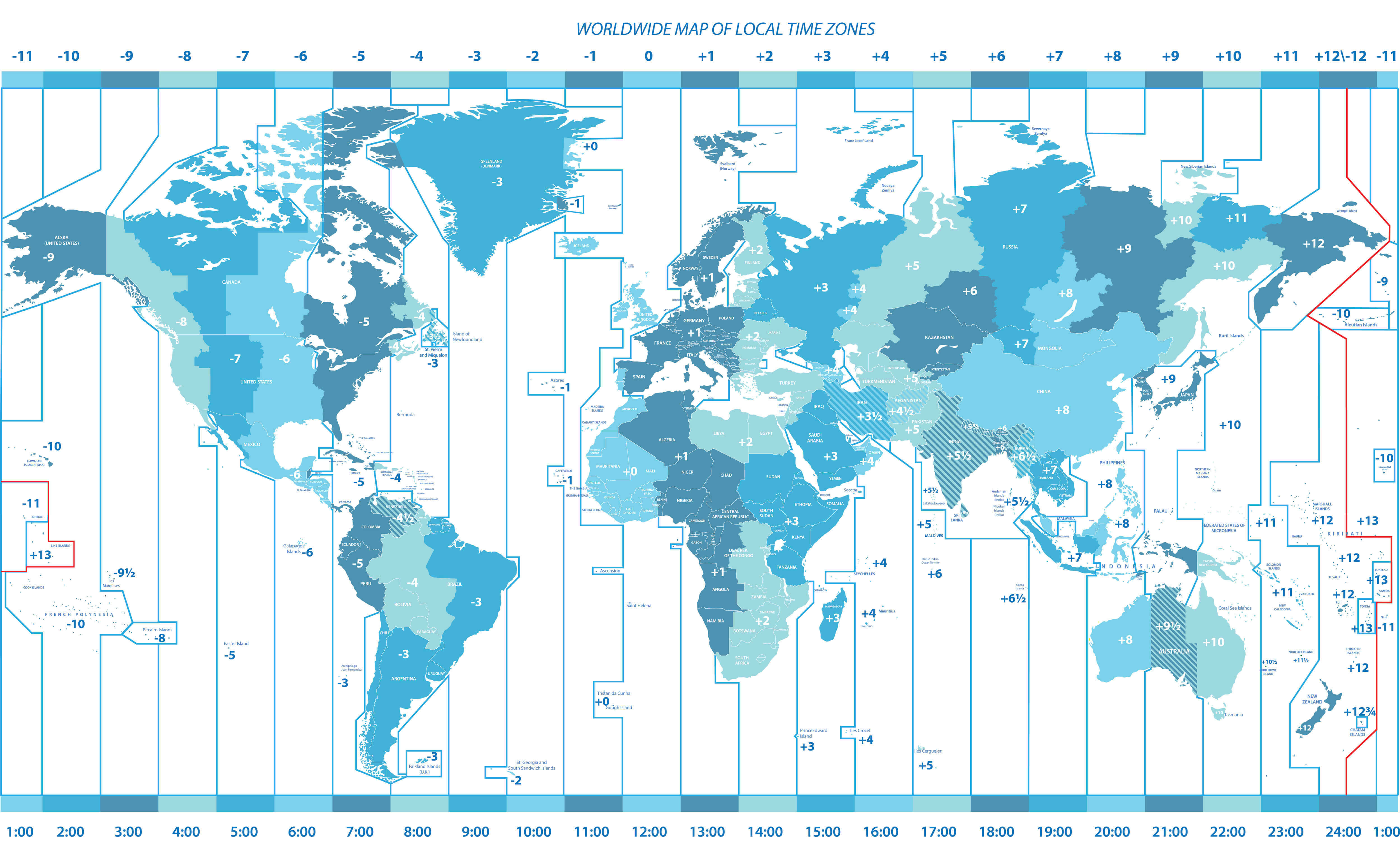
United States Time Zone Map reflects the country's vast geographic spread, encompassing six main time zones across the 50 states:
Eastern Time (ET, UTC-5), Central Time (CT, UTC-6), Mountain Time (MT, UTC-7), Pacific Time (PT, UTC-8), Alaska Time (AKT, UTC-9), and Hawaii-Aleutian Time (HAT, UTC-10). Most states observe Daylight Saving Time (DST), advancing clocks by one hour from March to November, although states like Hawaii and most of Arizona do not.
The 10 most populous U.S. states are
California, Texas, Florida, New York, Pennsylvania, Illinois, Ohio, Georgia, North Carolina, and Michigan. Among them, California operates on Pacific Time, while Texas spans both Central and Mountain Time Zones, though most of the state uses Central Time. Florida, New York, Pennsylvania, Georgia, North Carolina, Ohio, and Michigan follow Eastern Time. Illinois uses Central Time. This mix of time zones among the largest states affects everything from travel coordination to nationwide broadcasting and business schedules.
The
US Time Zone Map is essential for managing cross-country communication and planning. From setting up virtual meetings to booking coast-to-coast flights, knowing the correct local time is crucial. Whether it’s morning in New York or still the middle of the night in Los Angeles, the time zone differences reflect the diversity and scale of the United States. The map not only serves as a practical tool but also illustrates how time itself adapts to the country's sprawling geography.
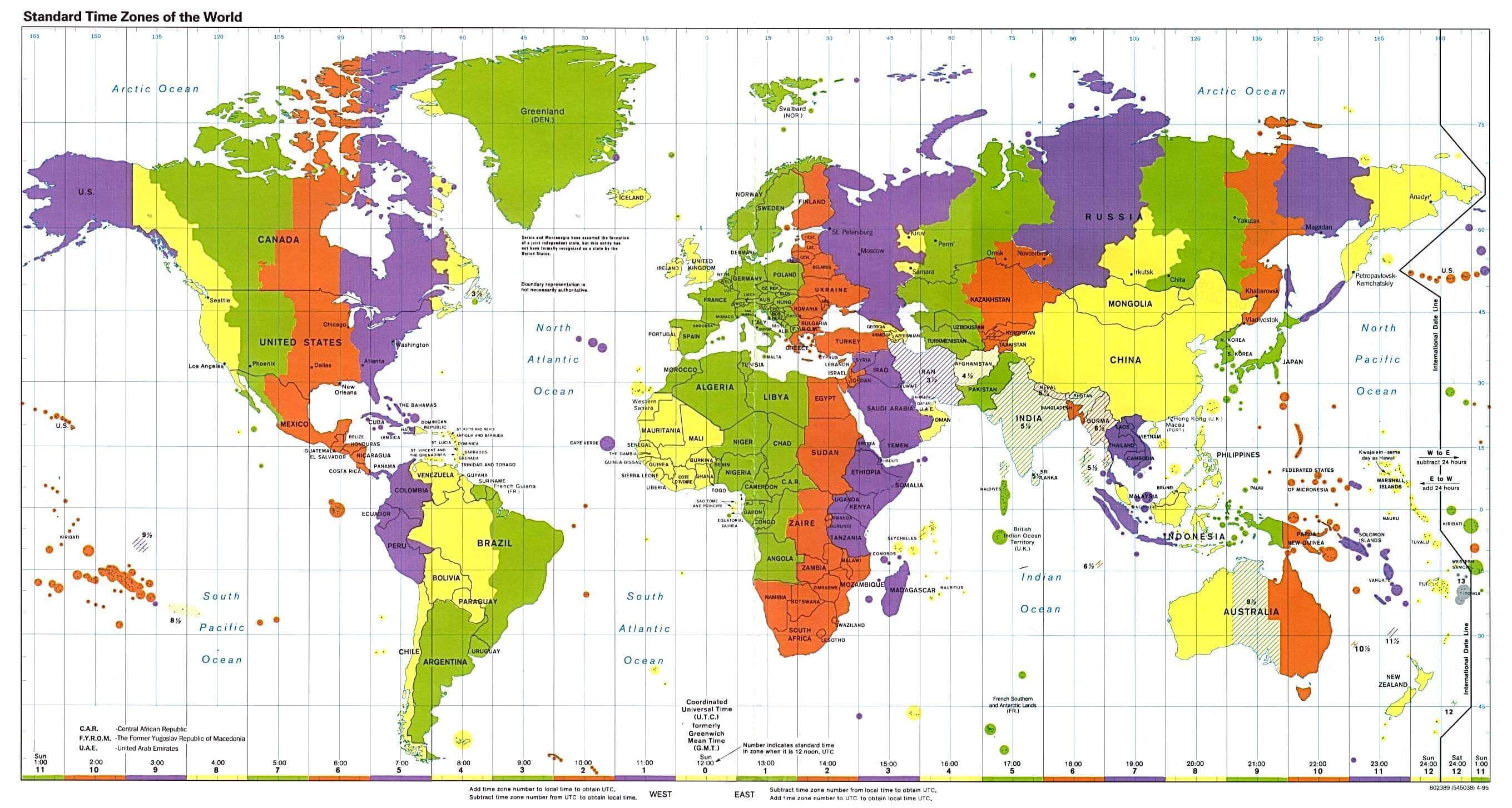
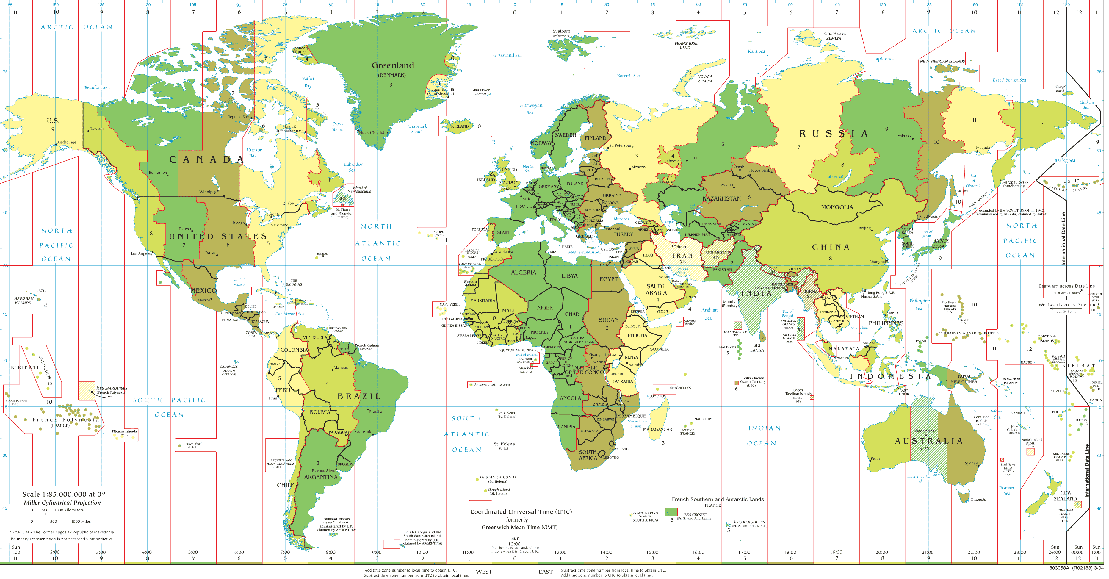
Standard time zones map of the World and the United States
The USA and states time zone map
Time zones map of the United States
Time zones map of the USA
United States and US states time zone map
United States time zone map
United States time zones map
US time zone map
USA time zone map
World time zone map with US
World US time zones map
Feel free to explore these pages as well: