Explore Kenya with Detailed Maps – Political, Physical, Satellite Views, Cities, Geography and Borders
Explore Kenya with detailed maps showcasing its geography, political boundaries, major cities, road networks, regions, population density, national parks, administrative divisions, and satellite imagery. Gain a clear understanding of Kenya's landscape and its place within Africa.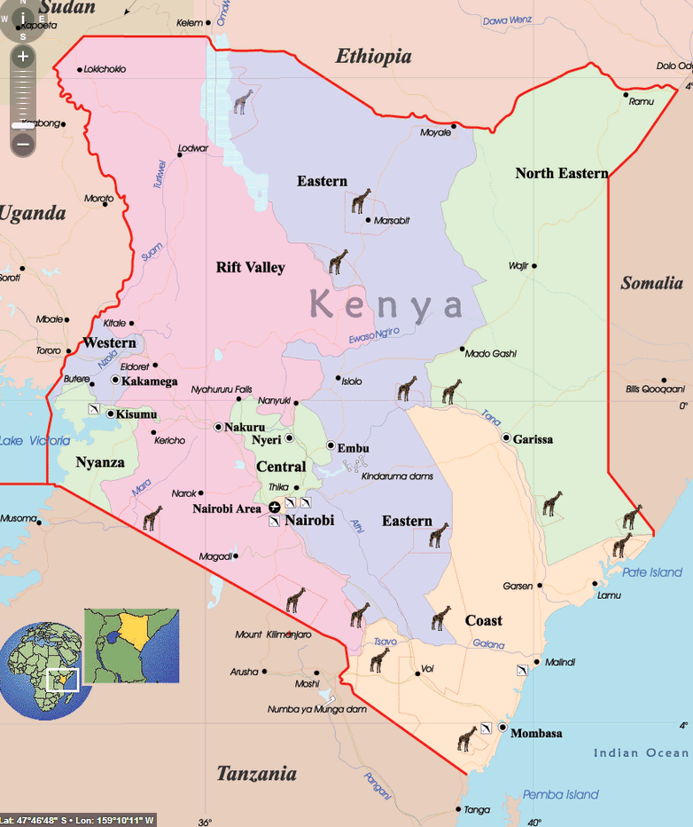
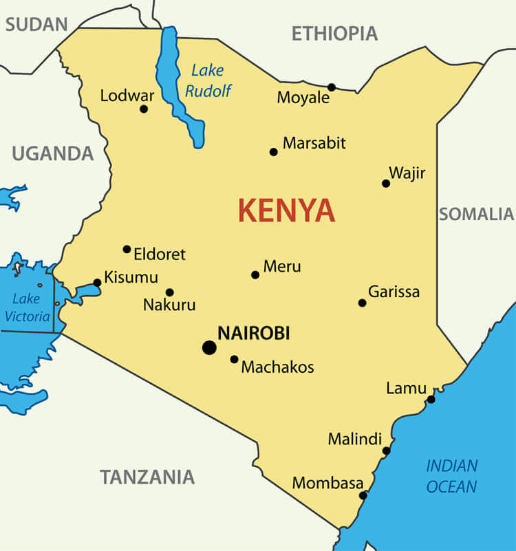
Kenya Cities Map with Regions and Major Towns
 Map of Kenya showing major cities, regions, borders, and neighboring countries.
This map of Kenya displays the country’s major cities and towns such as Nairobi, Mombasa, Kisumu, and Nakuru. It also shows key regional divisions, national borders, neighboring countries, and significant geographic features like Lake Victoria and Mount Kilimanjaro.
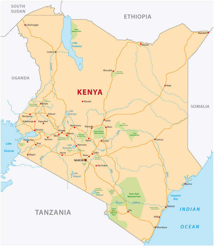
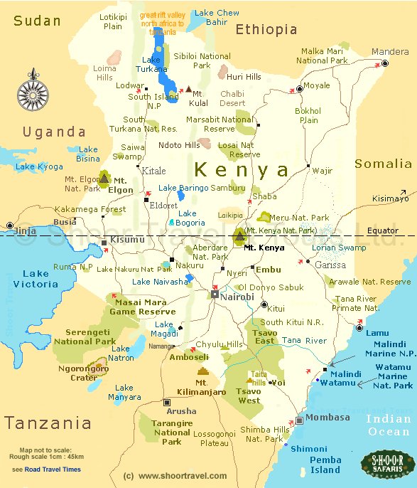
Kenya Main Roads Map with Cities and National Parks
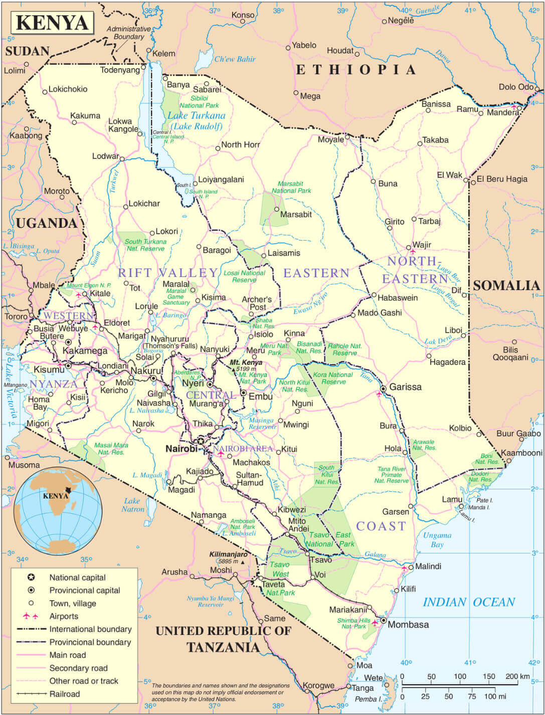 Map of Kenya showing major cities, regions, borders, and neighboring countries.
This detailed map of Kenya shows the main and secondary road networks connecting major cities, towns and border points. It also includes airports, national parks, provincial boundaries and Kenya's location in East Africa.
Brief information about Kenya
Located in East Africa, Kenya is a country renowned for its stunning landscapes, diverse wildlife and rich cultural heritage. It's home to world-famous national parks such as Maasai Mara and Amboseli, where you can see the Big Five and the annual wildebeest migration. Mount Kenya, Africa's second highest peak, offers breathtaking scenery and challenging hikes.
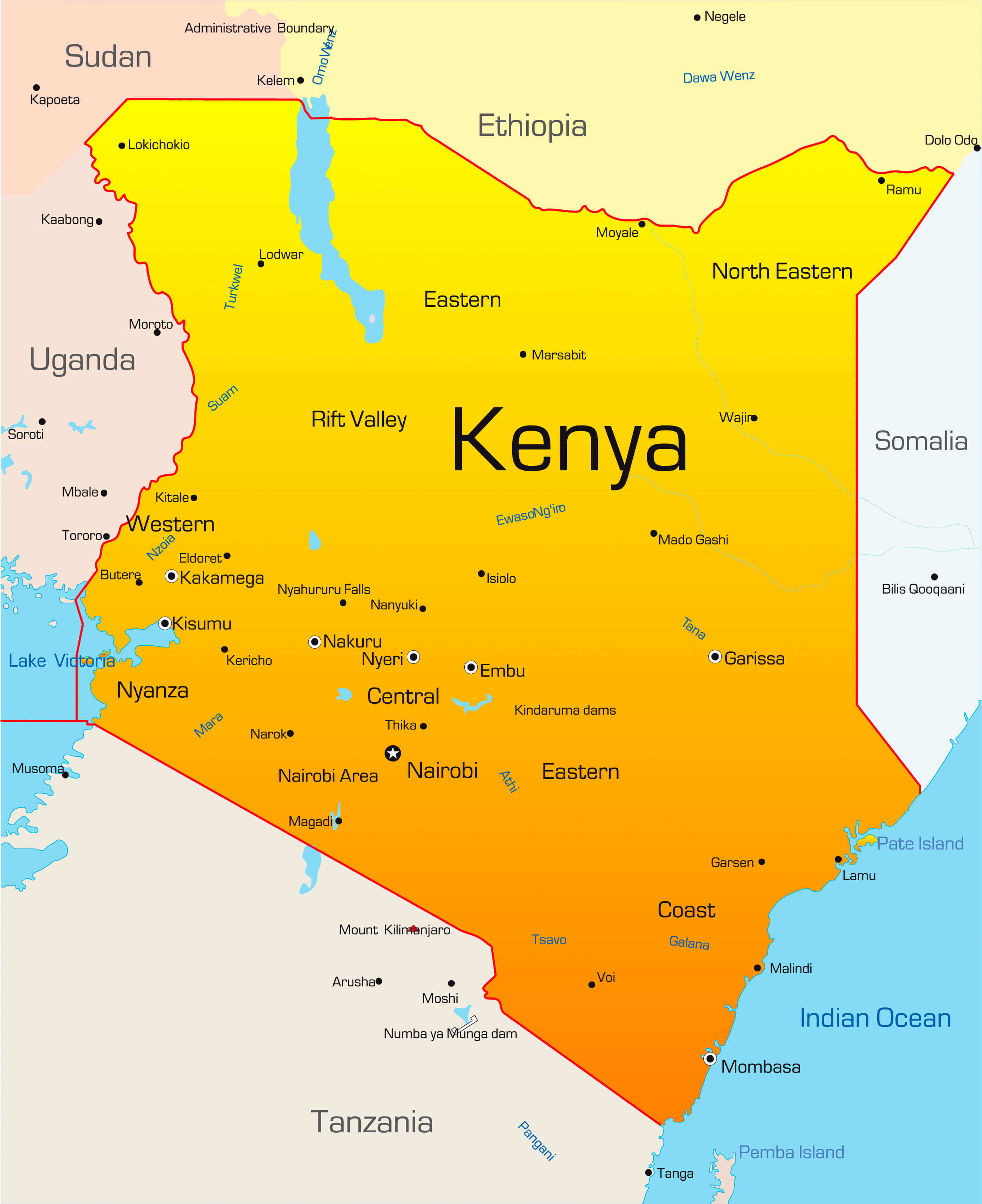
Kenya Cities and Rivers Map
 Map of Kenya showing major cities, rivers, lakes, and neighboring countries.
This map of Kenya highlights key cities such as Nairobi, Mombasa, Kisumu, and Eldoret, along with major rivers like the Tana, Athi, Tsavo, and Galana. It also shows major lakes, national borders, and Kenya’s location within East Africa.
The capital, Nairobi, is a bustling hub that combines modern urban life with natural attractions such as Nairobi National Park, where lions roam against the city skyline. Kenya's Indian Ocean coastline boasts beautiful beaches and historic towns such as Mombasa, rich in Swahili culture. It's a must-visit destination for adventure, relaxation and cultural exploration.
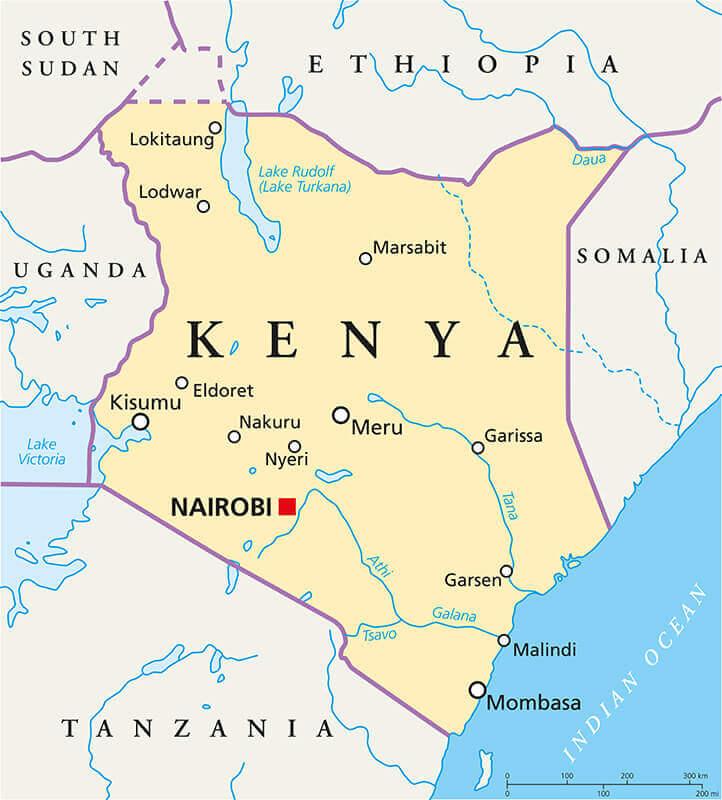
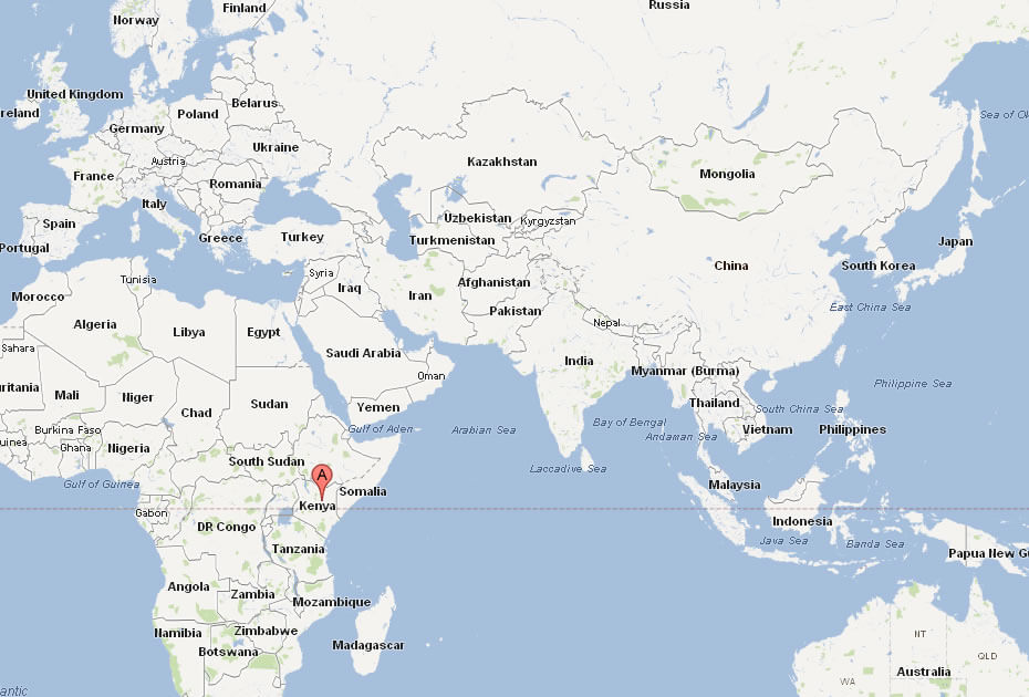
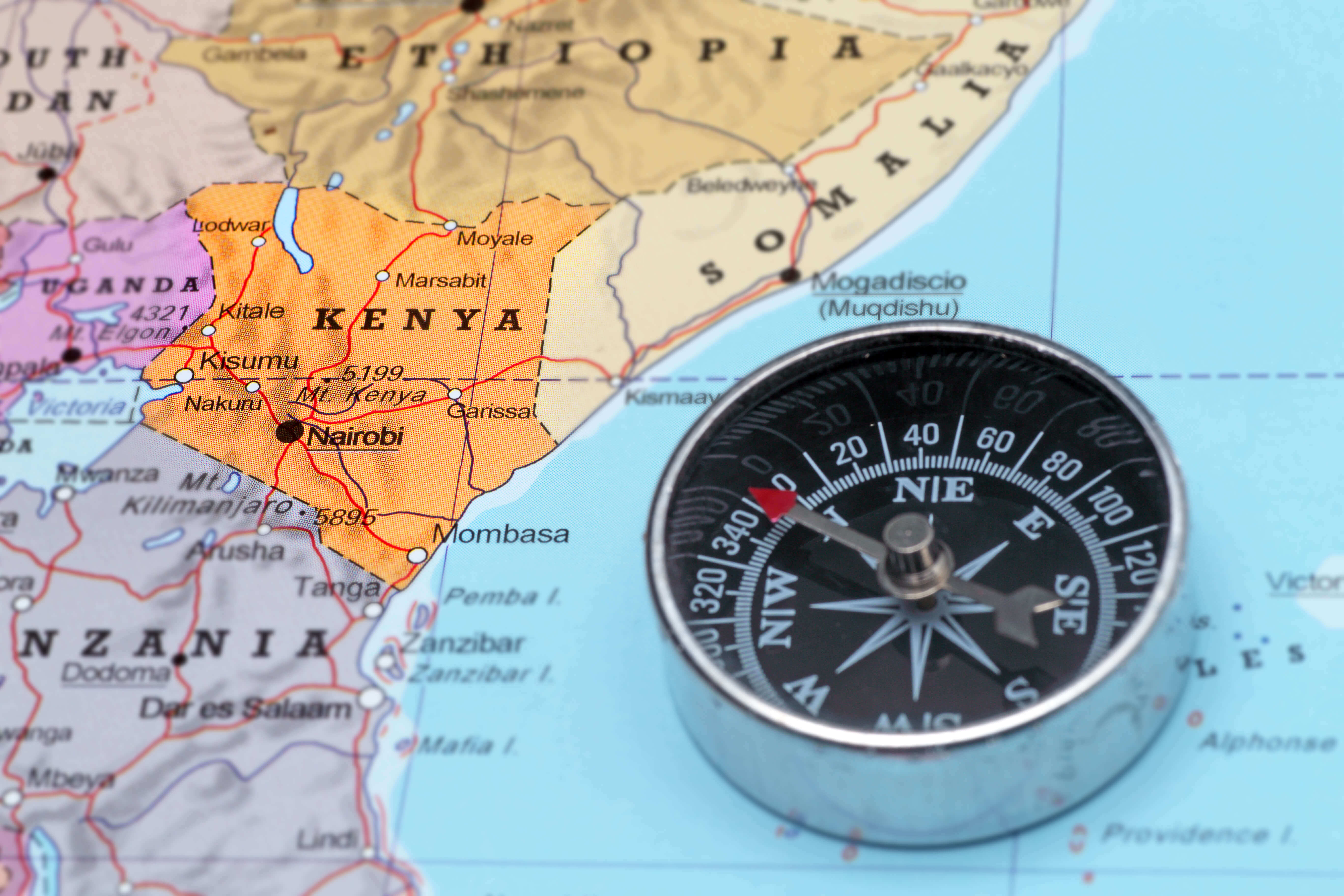
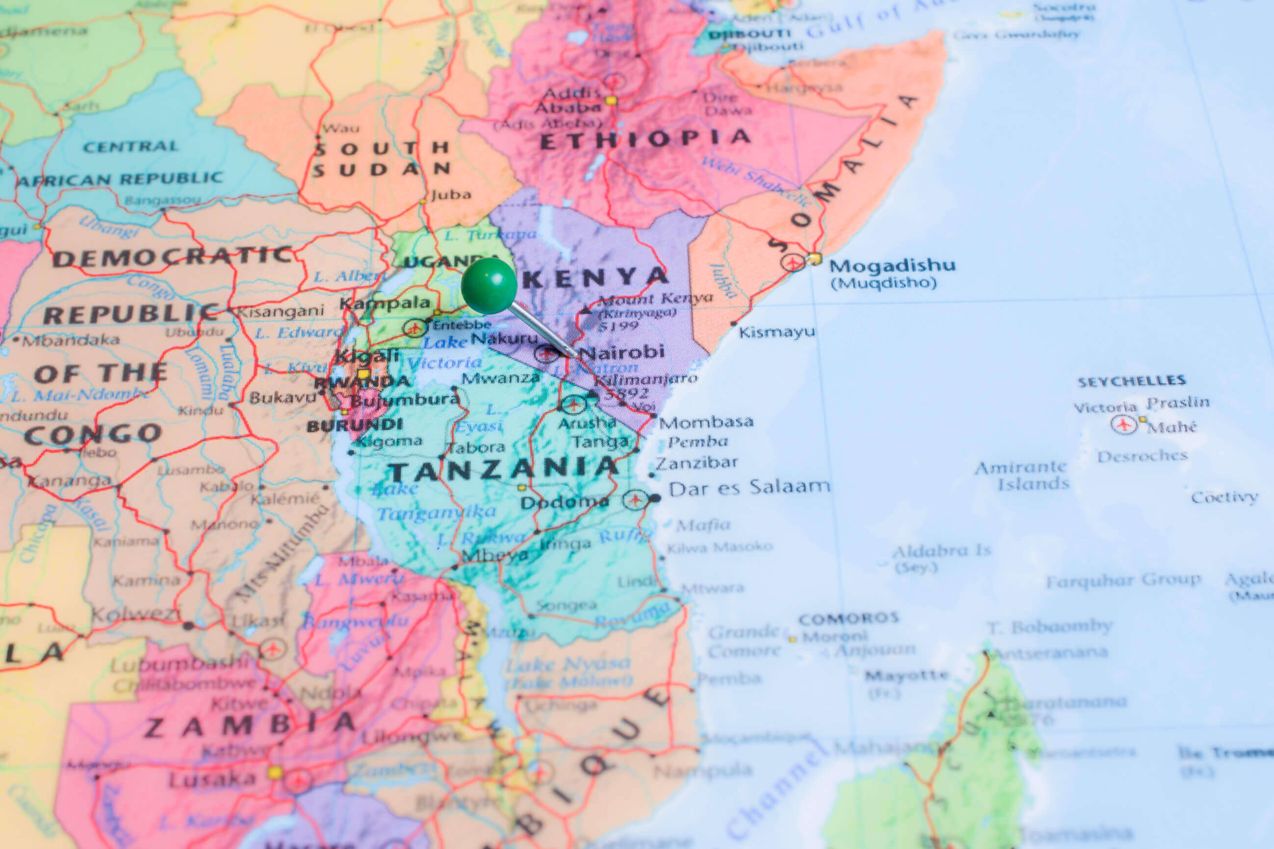
Where is located Kenya on the World Map
 Where is located Kenya on the World Map
Kenya is located in East Africa, straddling the equator and bordering the Indian Ocean to the southeast. It borders South Sudan and Ethiopia to the north, Somalia to the east, Uganda to the west and Tanzania to the south.
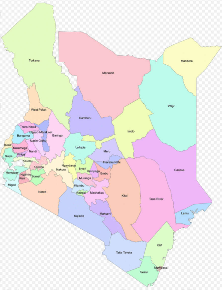
Kenya regions map
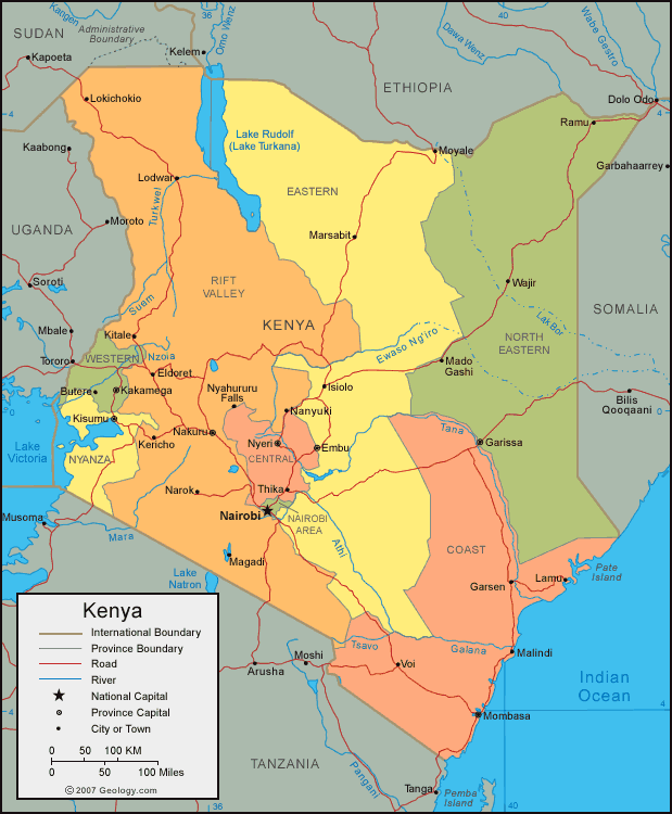
On the world map, Kenya lies on the eastern side of the African continent, with its coastline offering stunning views of the Indian Ocean. The Great Rift Valley runs through the country and its diverse geography includes savannah, mountains and beaches.
With Nairobi as its capital, Kenya is a central hub for trade, travel and wildlife tourism in Africa. Its iconic location makes it easily recognisable on the world map.
Here are some statistical information about Kenya:
 Area: 580,367 km2 (224,081 sq mi)
 Kenya national parks map
 Ethnic groups: 17.13% Kikuyu, 14.35% Luhya, 13.37% Kalenjin, 10.65% Luo, 9.81% Kamba, 5.85% Somali, 5.68% Kisii, 5.23% Mijikenda, 4.15% Meru, 13.78% others.
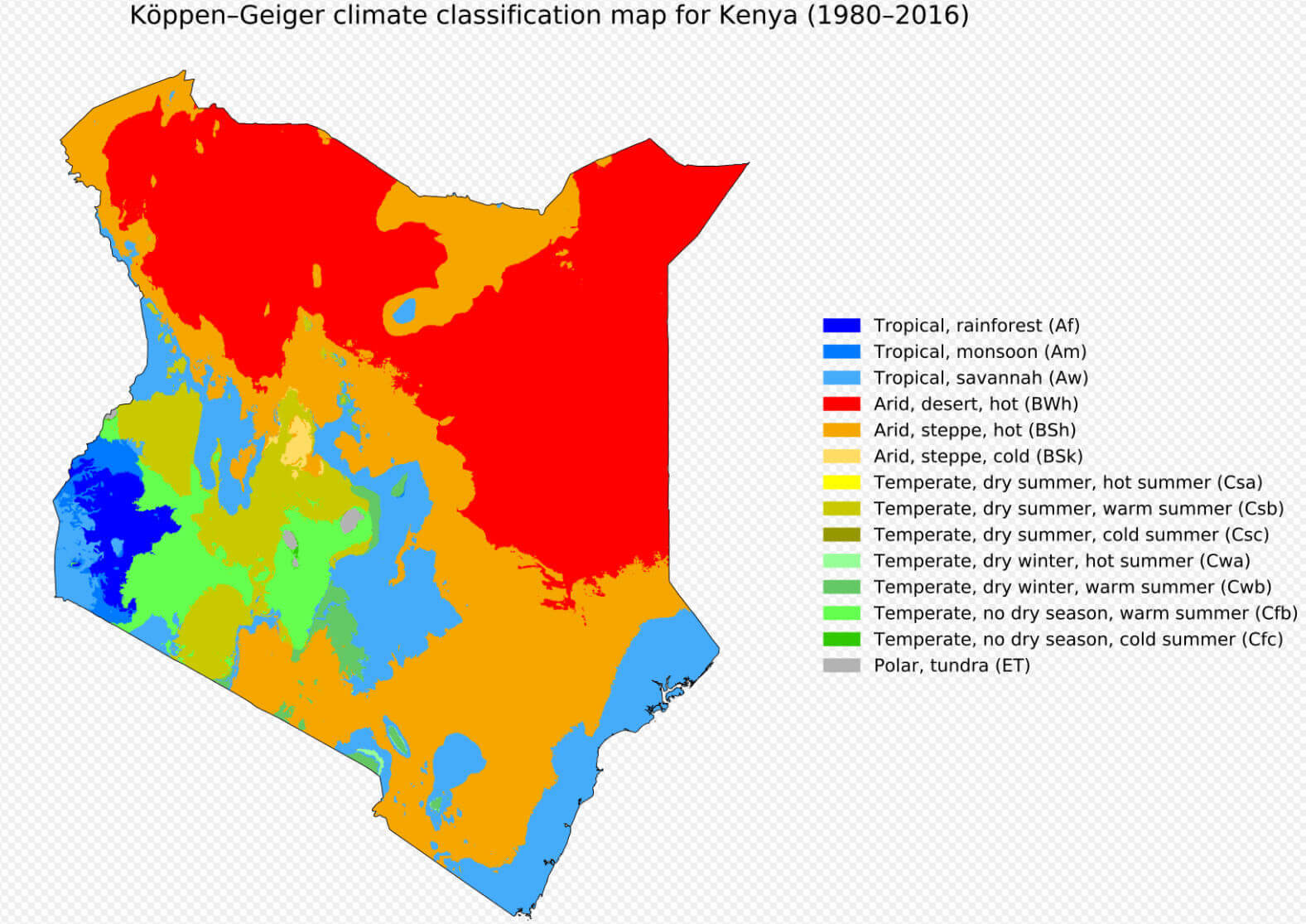
 Kenya climate map
Map of Kenya
 Kenya map showing provinces, cities, rivers, and international borders.
This map highlights Kenya's provincial boundaries, key cities like Nairobi and Mombasa, rivers, and major geographical features such as Lake Turkana and Lake Victoria. It also shows Kenya's borders with neighboring countries, emphasizing its strategic location.
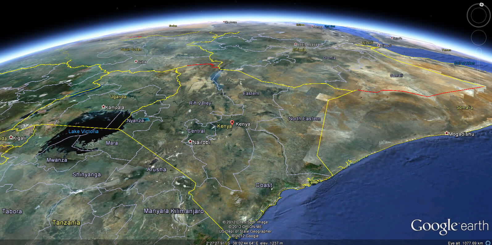
Kenya satellite map
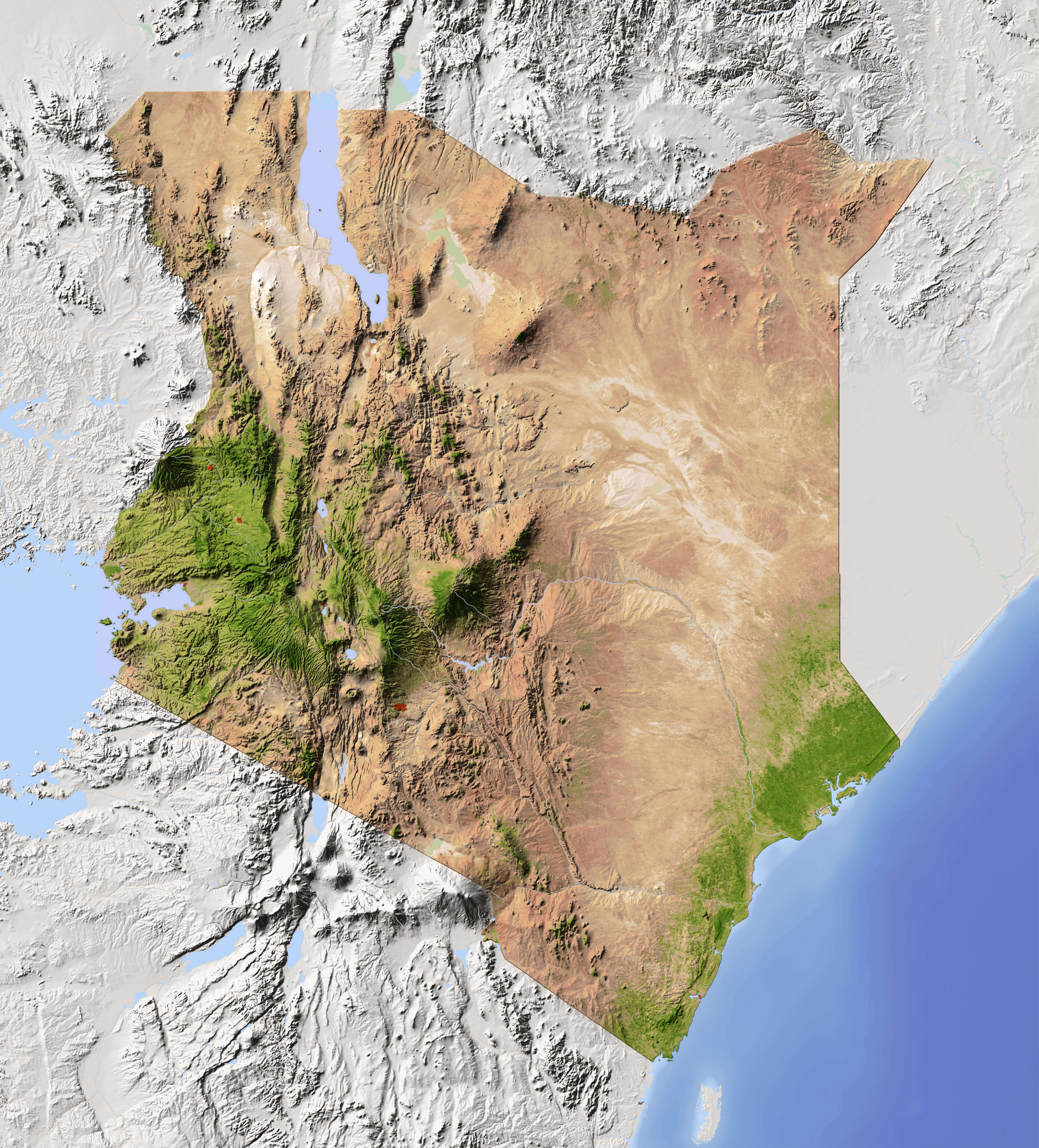
Kenya terrain map
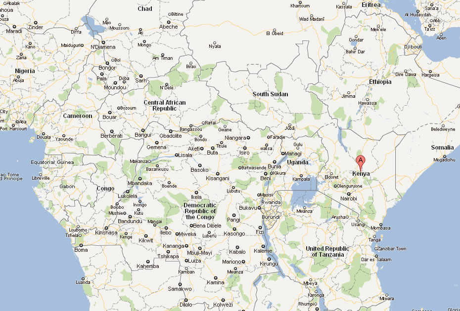
Kenya Location Map
Kenya Physical Map
Kenya Political Map
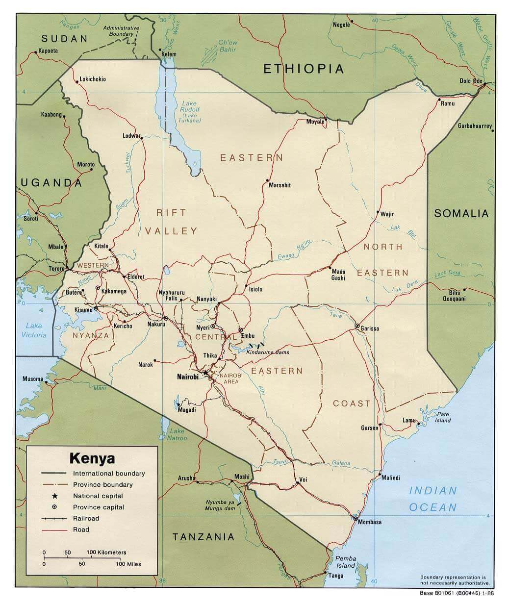
Kenya international borders map

Kenya Map Cities
 Map of Kenya showing cities, national parks, and geographic features.
This map showcases Kenya's major cities like Nairobi and Mombasa, iconic national parks such as Maasai Mara and Amboseli, and geographic landmarks like Mount Kenya, the Great Rift Valley, and Lake Victoria. It highlights Kenya's diverse landscape and tourist attractions.
Kenya Maps
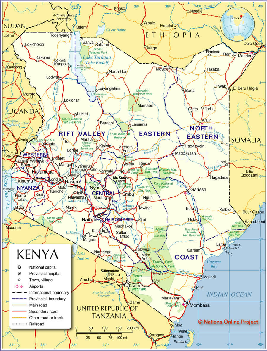 Detailed map of Kenya showing provinces, cities, roads, and borders.
This map outlines Kenya's provinces, including Rift Valley, Central, and Coast. It marks major cities like Nairobi and Mombasa, key roads, airports, and international borders with Ethiopia, Sudan, and Tanzania, showcasing Kenya’s connectivity and regional divisions.
Map of Kenya Africa
Map of Kenya World
Maps of Kenya
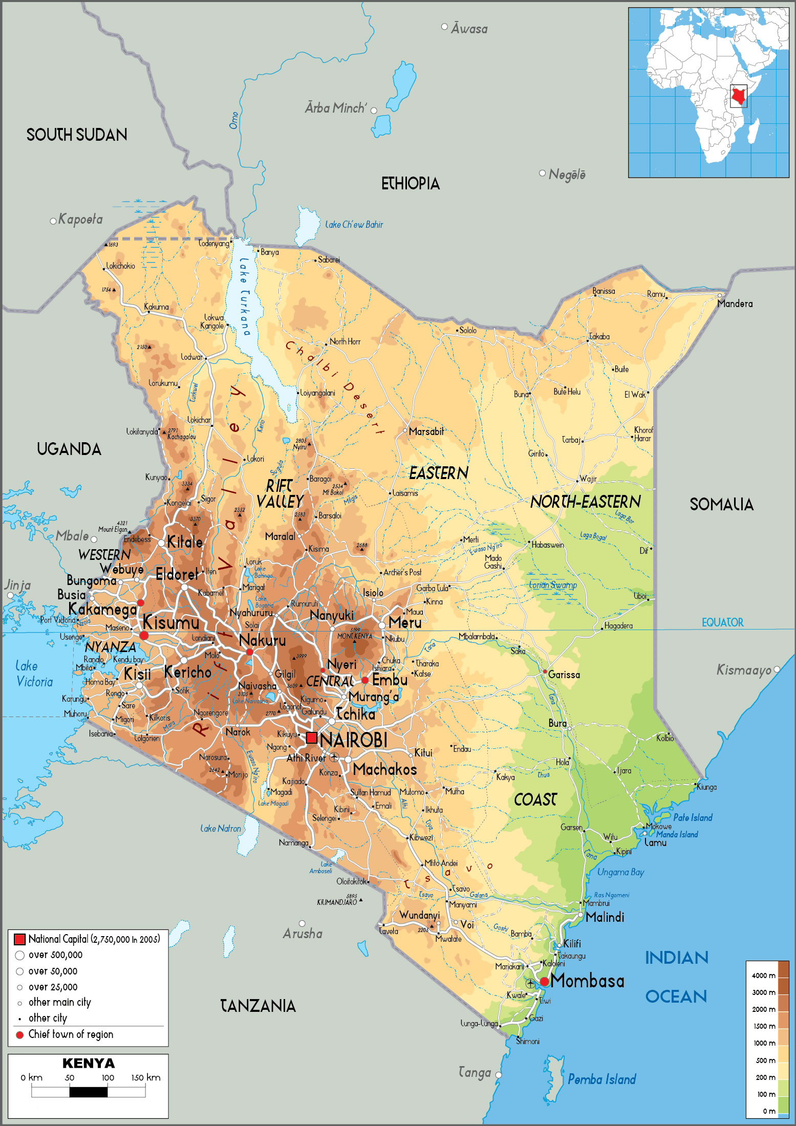
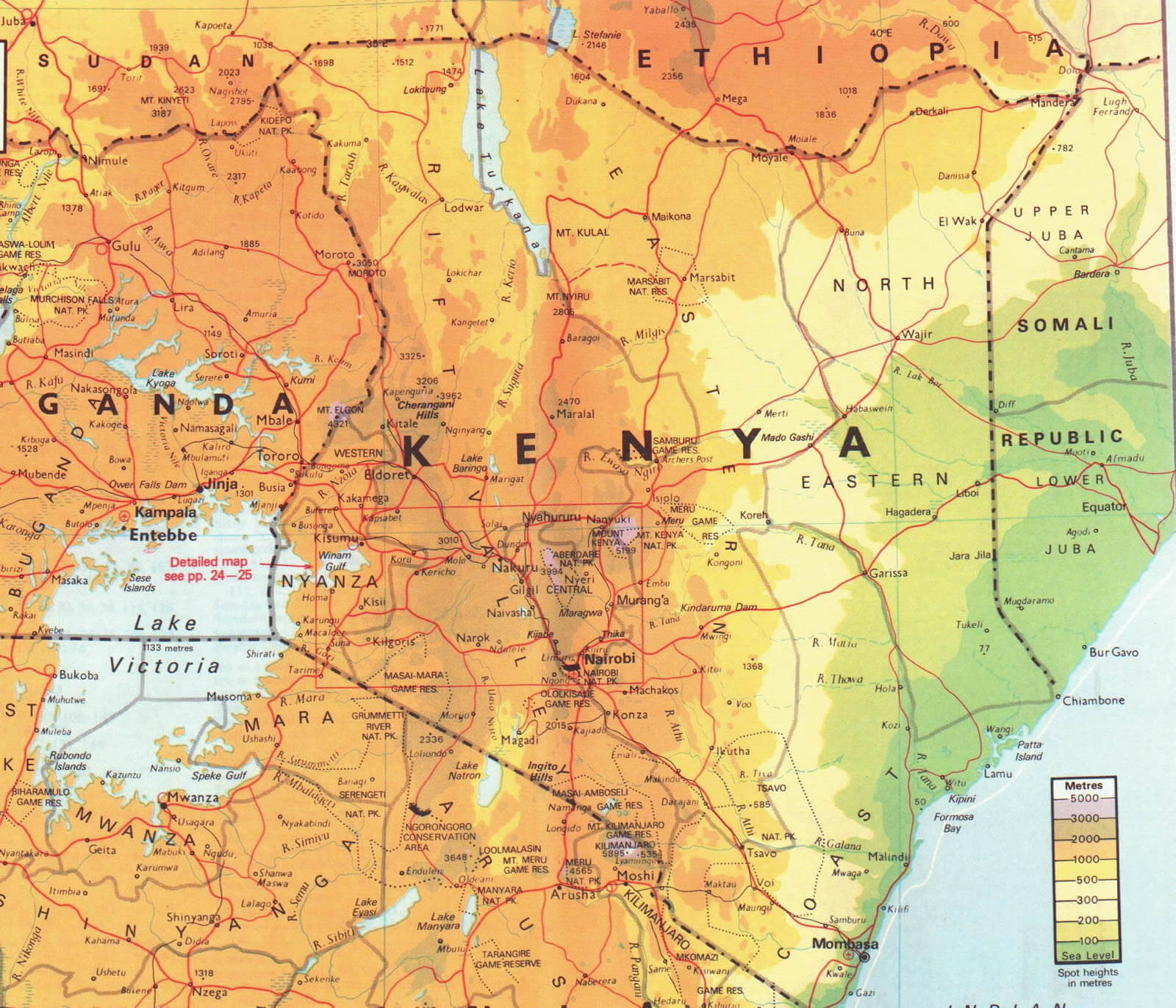 Kenya map showing elevation, regions, roads, and key cities.
This map illustrates Kenya’s topography with color-coded elevation levels, major cities like Nairobi and Mombasa, and significant roads. It also highlights Lake Victoria, the Great Rift Valley, and borders with Uganda, Ethiopia, and Somalia.
Kenya Earth Map
cities map of Kenya
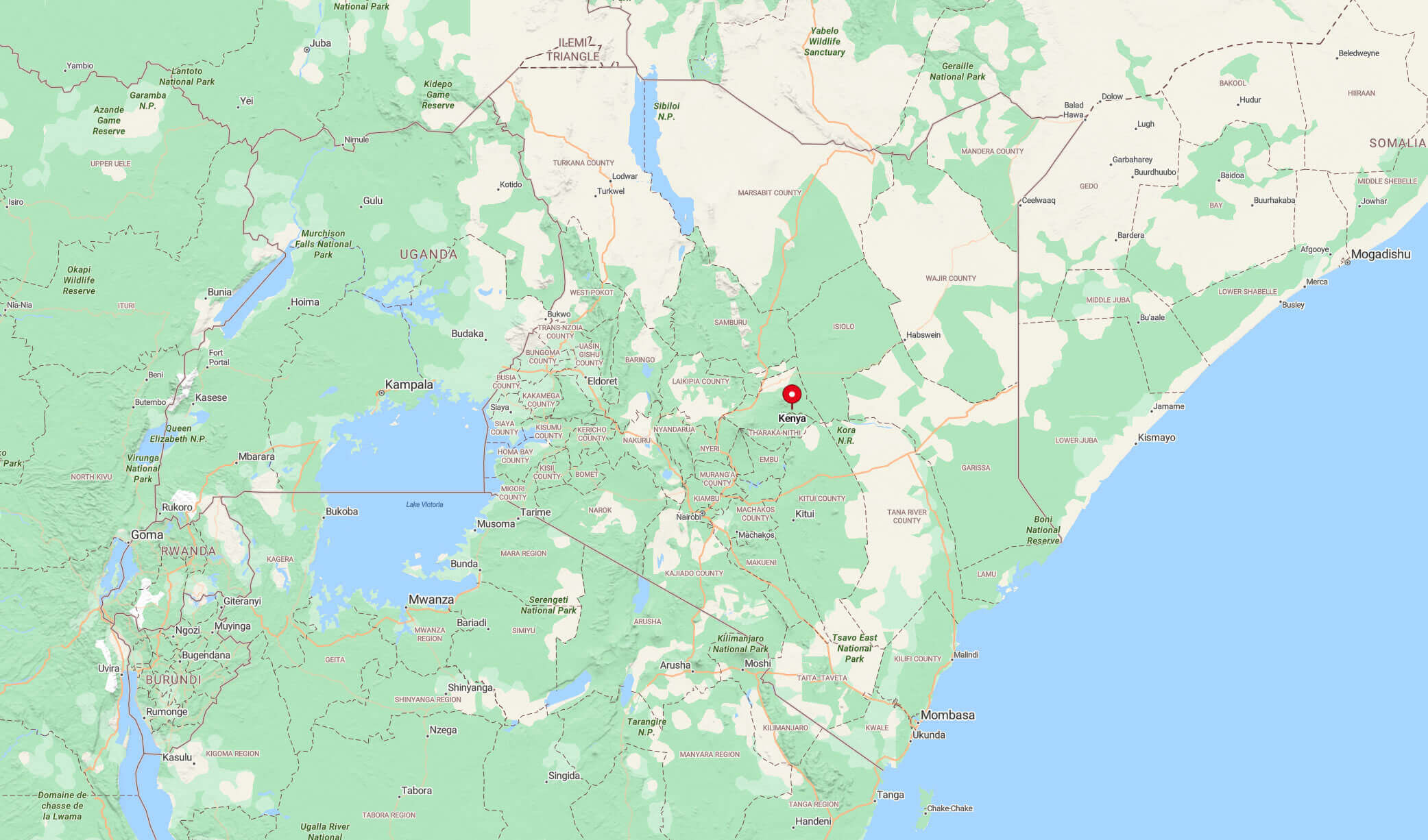
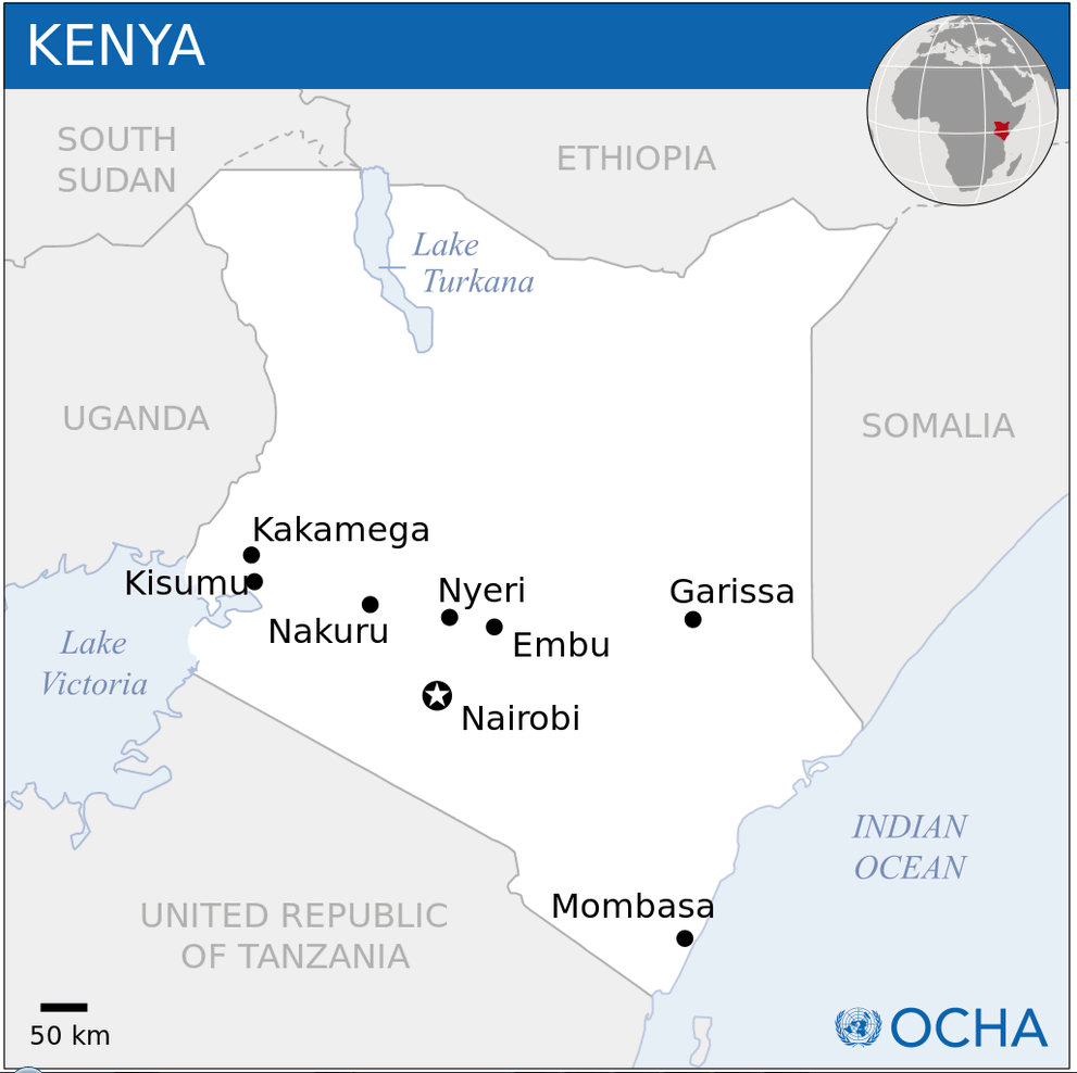
Kenya location map
Kenya major cities map
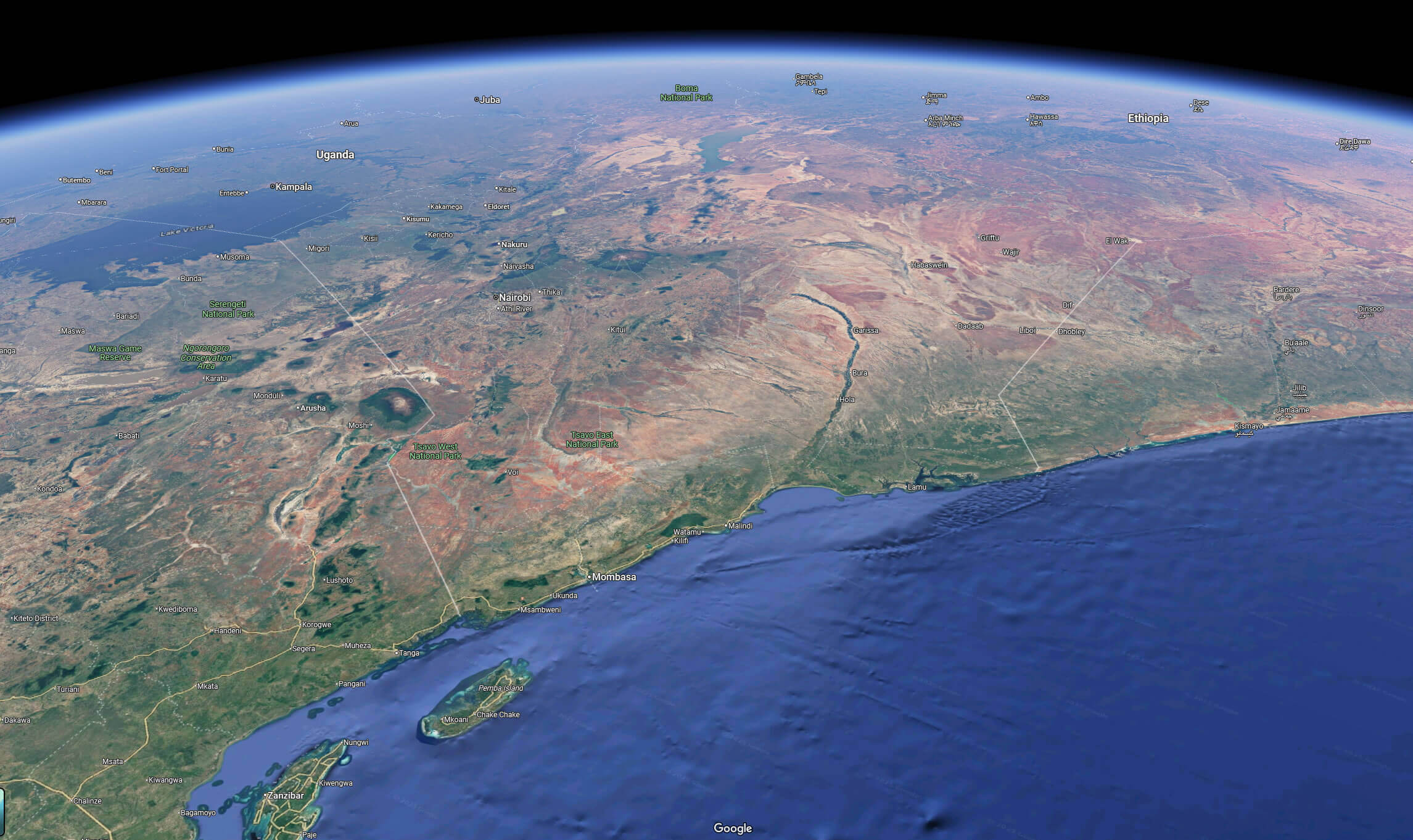
Kenya map from space
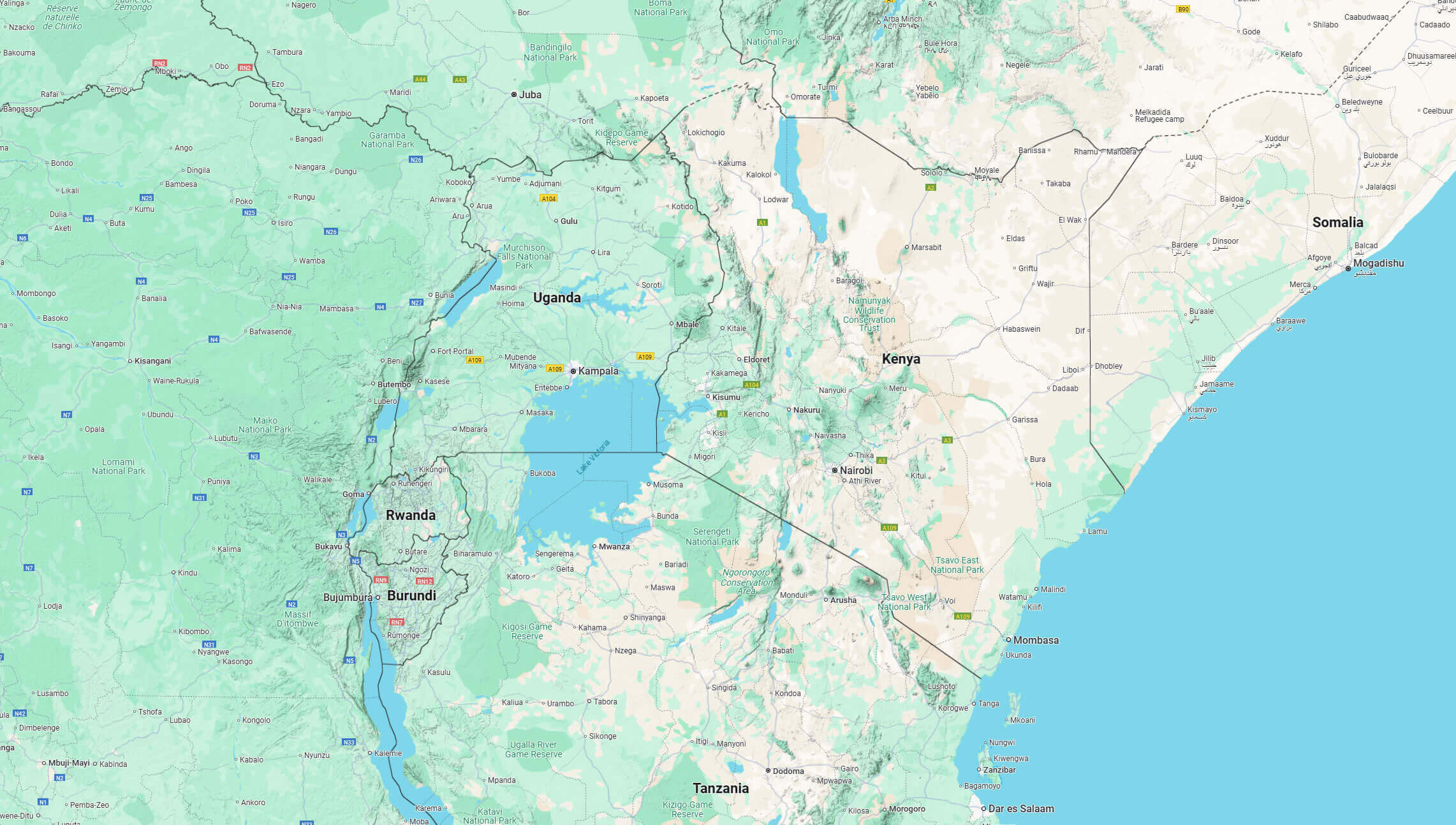
Kenya neighbour countries map
Kenya political map with main roads
For more Kenya Maps and About Kenya;
- Kenya Map
- Kenya
- Africa Map
- Africa
- Explore Africa Political Map
- Explore Africa Physical Map
- Explore European Countries Map
- Explore Africa Historical Map
- Explore Africa Satellite Map
- Explore Africa Religion Map
- Europe Africa Population Map
- Explore Africa Road Map
- Africa Maps
- Africa Language Map
- Africa Geographic Map
- Head of Performance Marketing
- Head of SEO
- Linkedin Profile: linkedin.com/in/arifcagrici