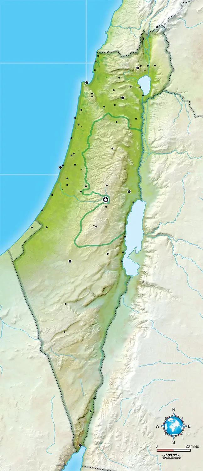
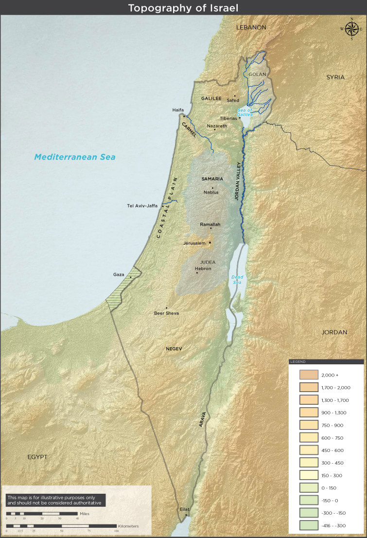
Physical Map of Israel: Terrain, Elevation and Natural Features
Explore a detailed Physical Map of Israel that highlights the country's diverse natural landscape, including the Mediterranean coastal plain, the central highlands, the Jordan Rift Valley, and the Negev Desert. The map shows elevation changes, mountain ranges, rivers, and key geographic features such as the Dead Sea and the Sea of Galilee. Ideal for geographic study and reference, it provides a clear overview of Israel's terrain and topography. 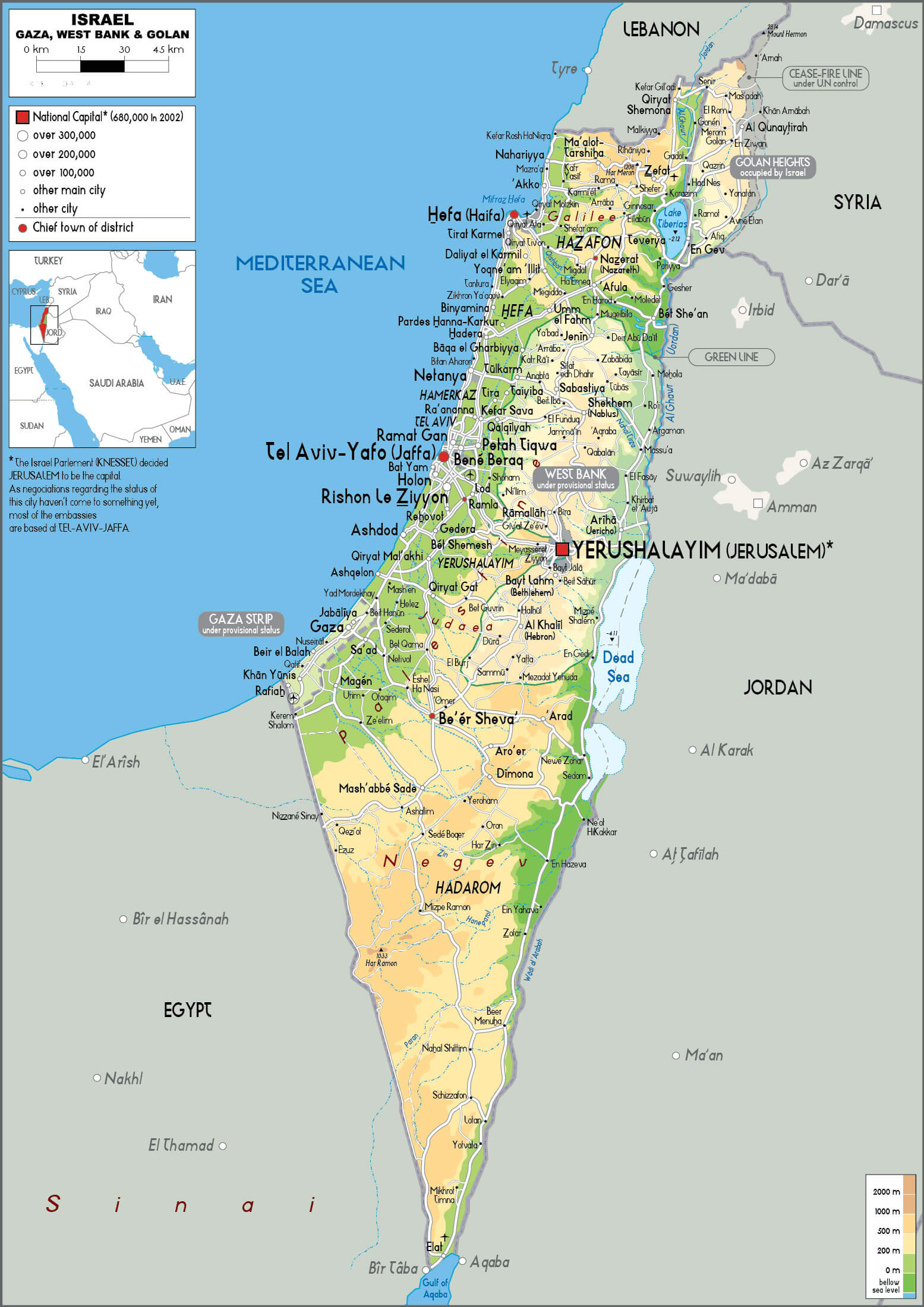
Detailed Israel physical map
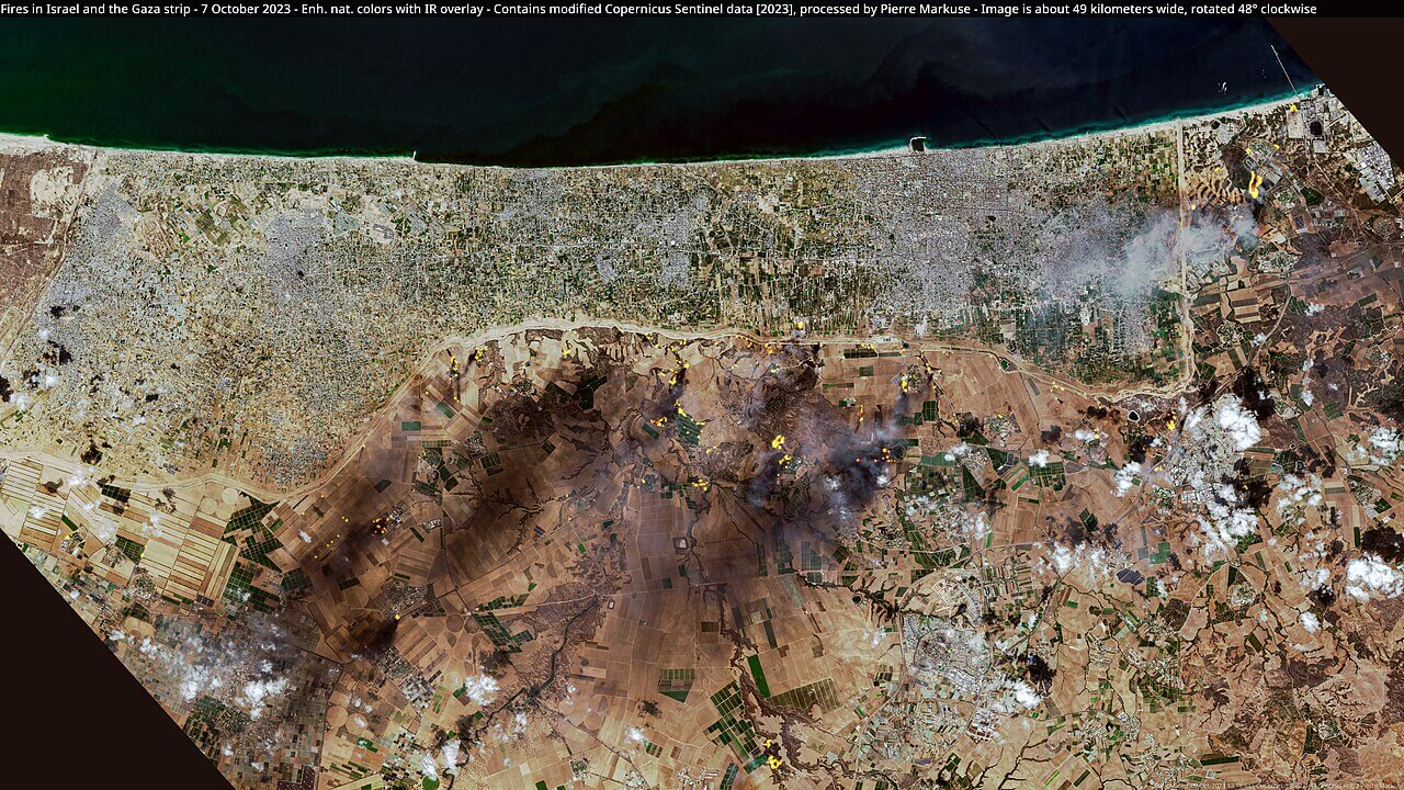
Israel and gaza strip map 7 October 2023 war
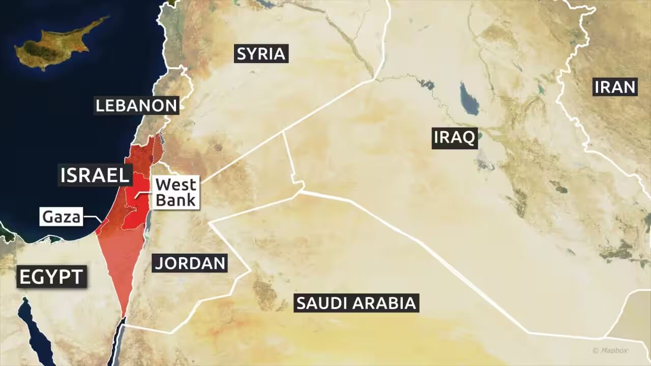
Israel and middle east countries map
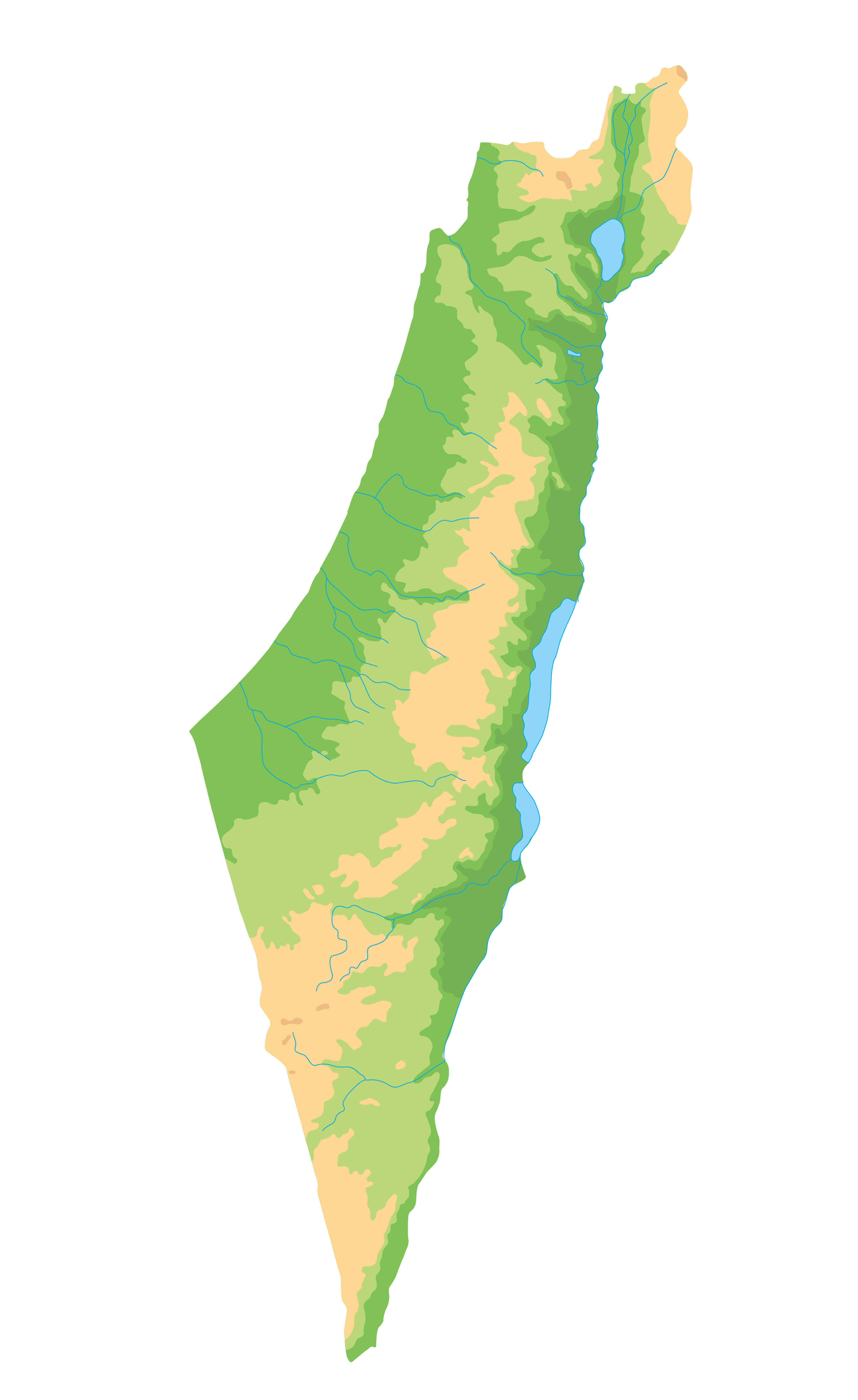
Israel blank physical map
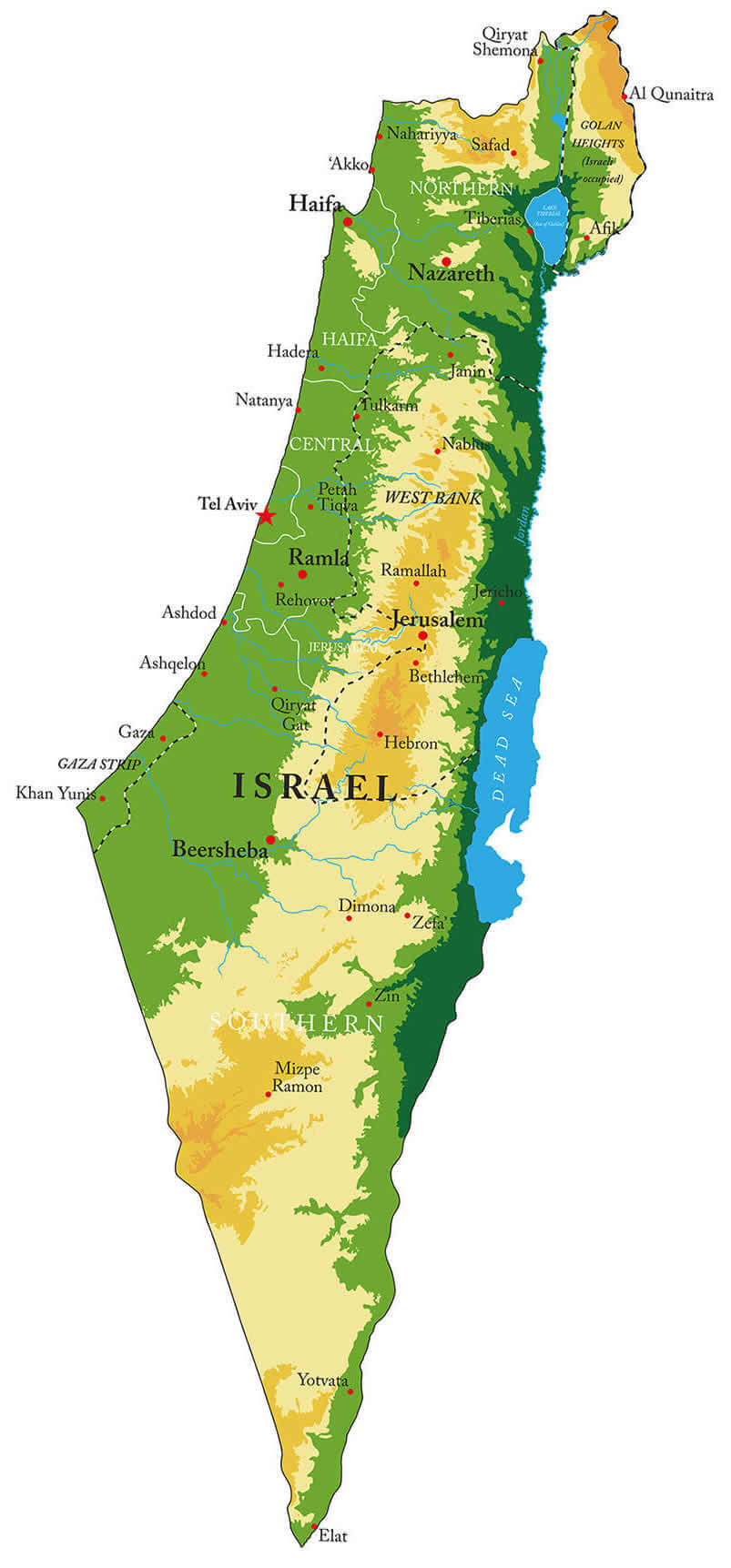
Israel Physical Map with Elevation and Major Cities
Israel physical map with major cities
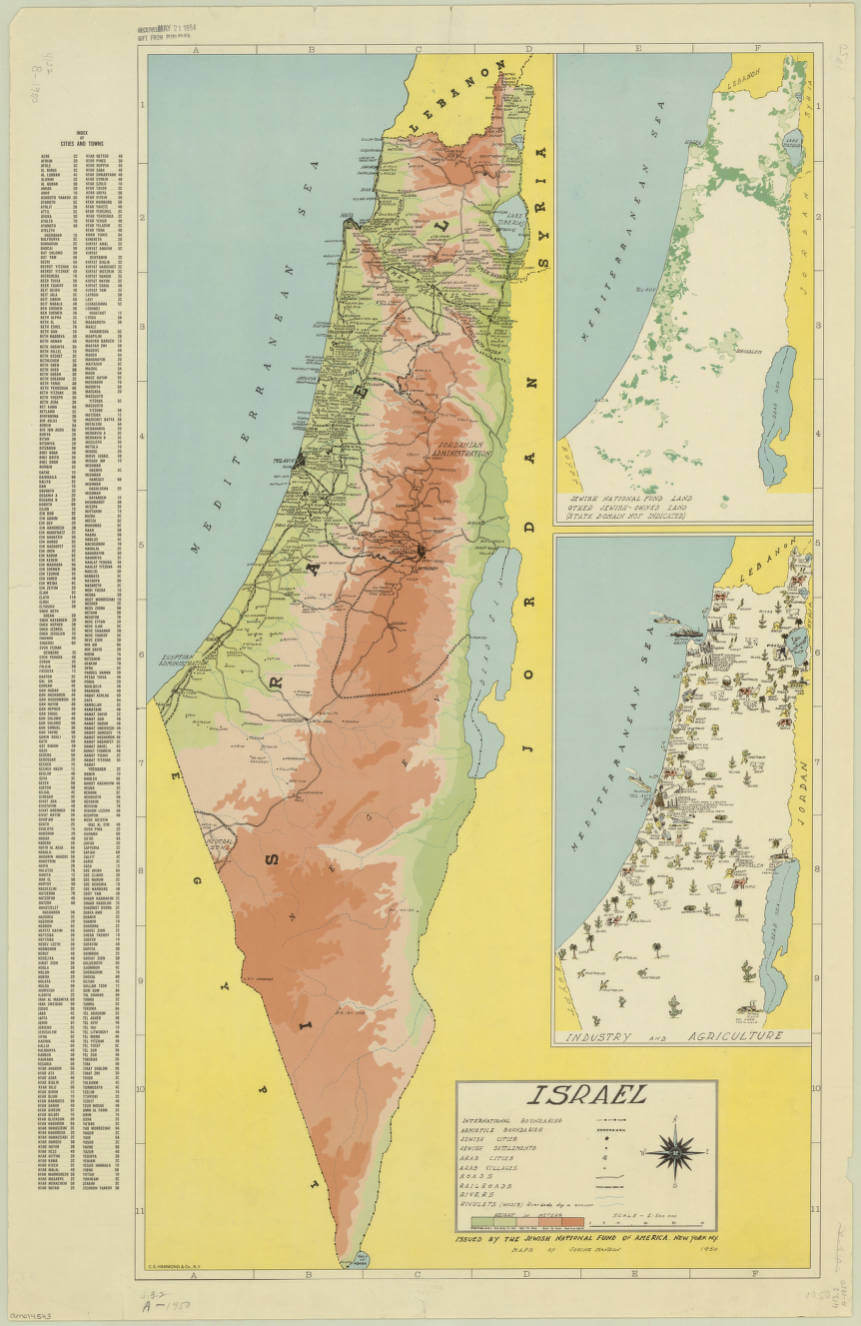
Israel physical historical map
Israel physical map with Arab countries
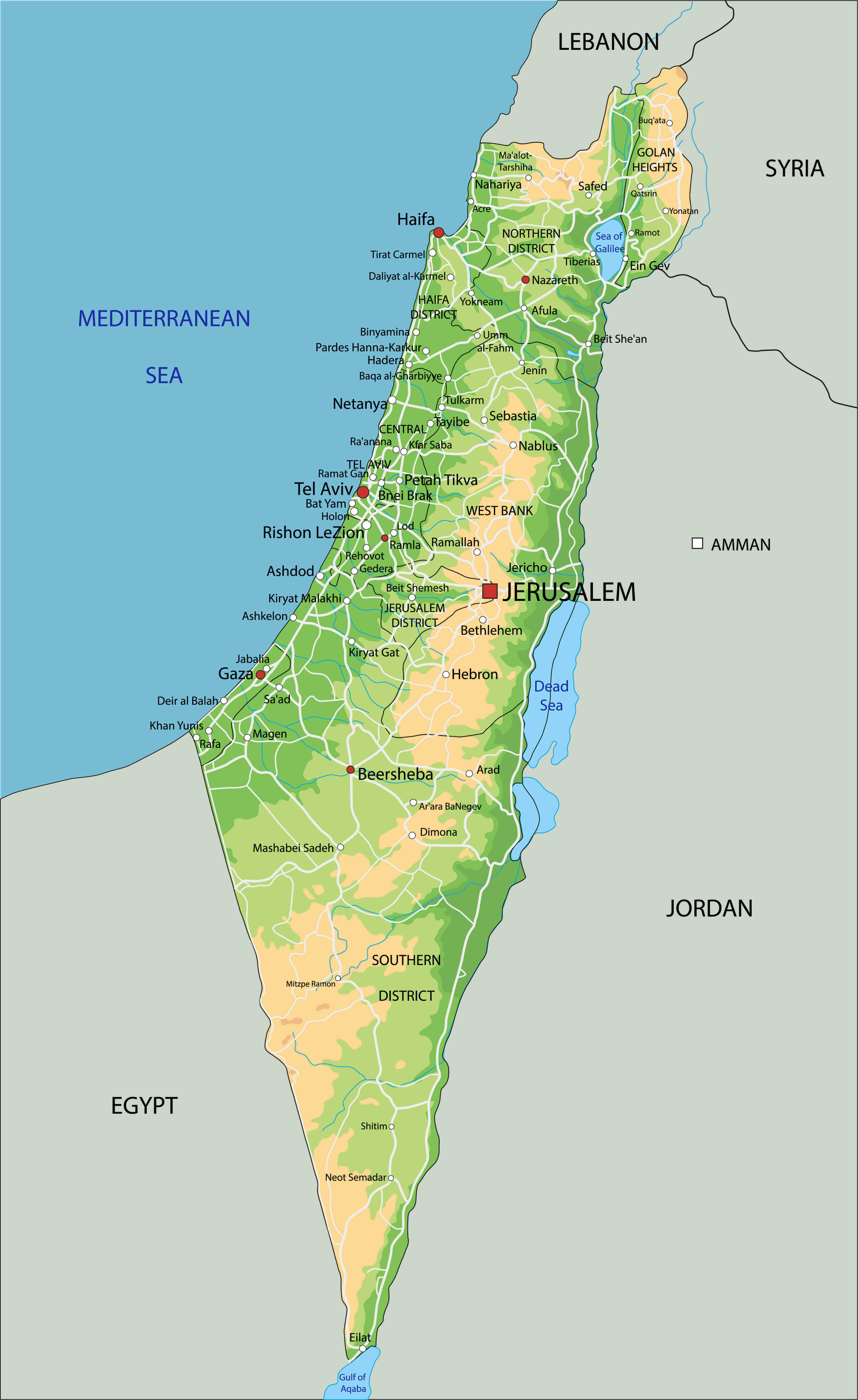
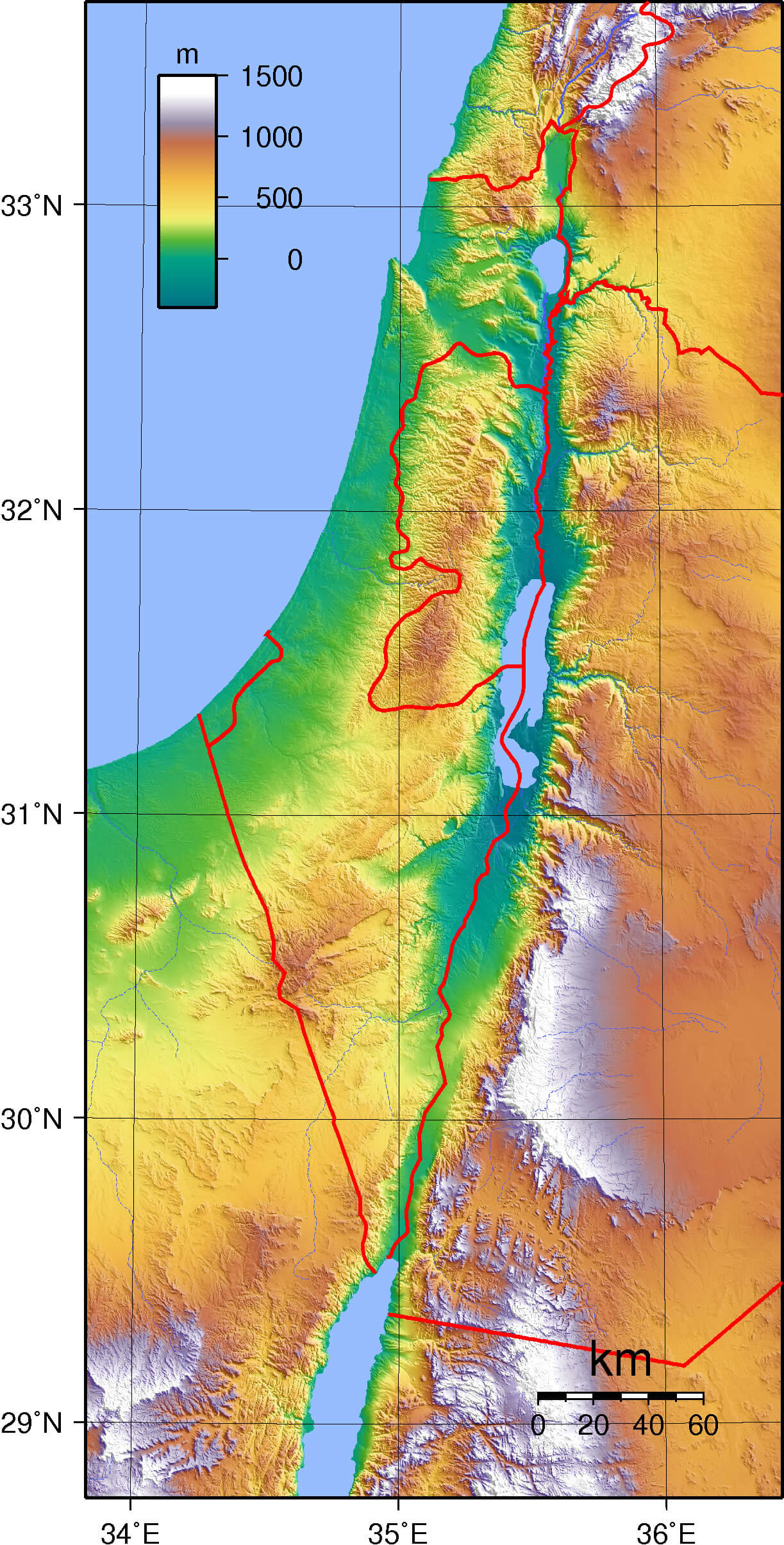
Israel topography map
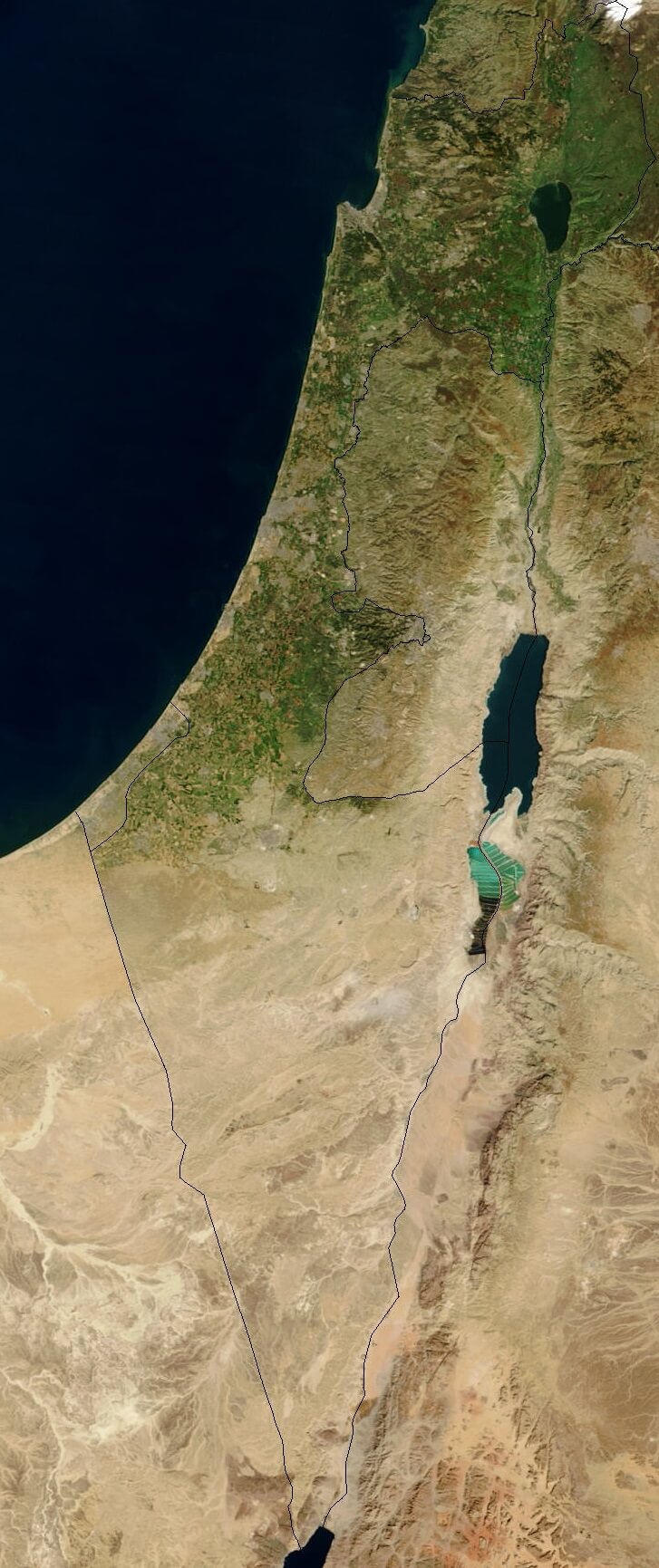
Satellite image of Israel in January 2003
Topography map of Israel
Feel free to explore these pages as well:
Feel free to explore these pages as well:
Author: Arif Cagrici