Where Is Israel Located on the Map? Location, Borders, and Geography Explained
Where is Israel located? Discover Israel's position in the Middle East, its neighboring countries, Mediterranean coastline, and key geographic features on the world map.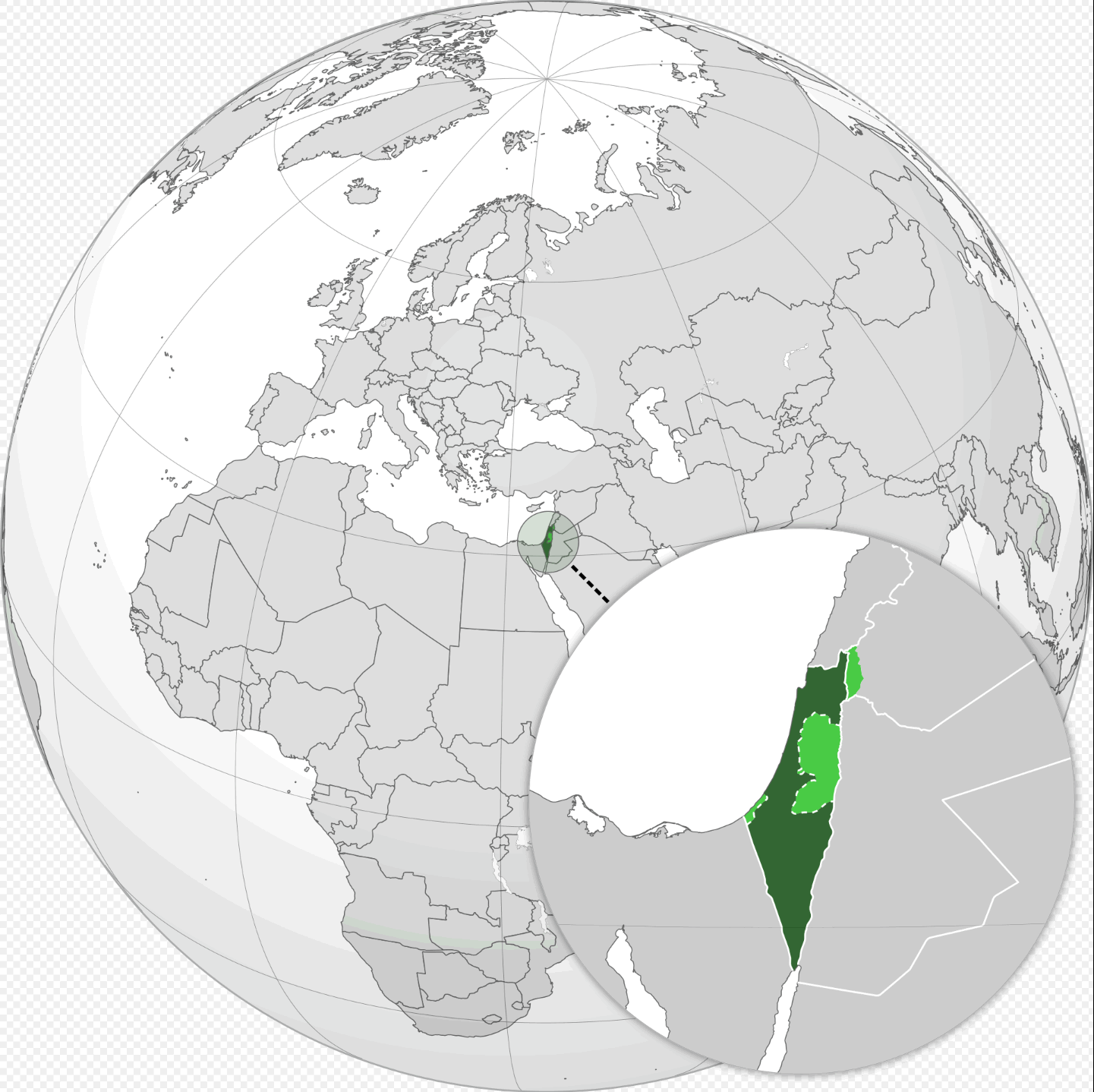
Where Is Israel Located? (Complete Geographic Guide)
Where Is Israel Located?
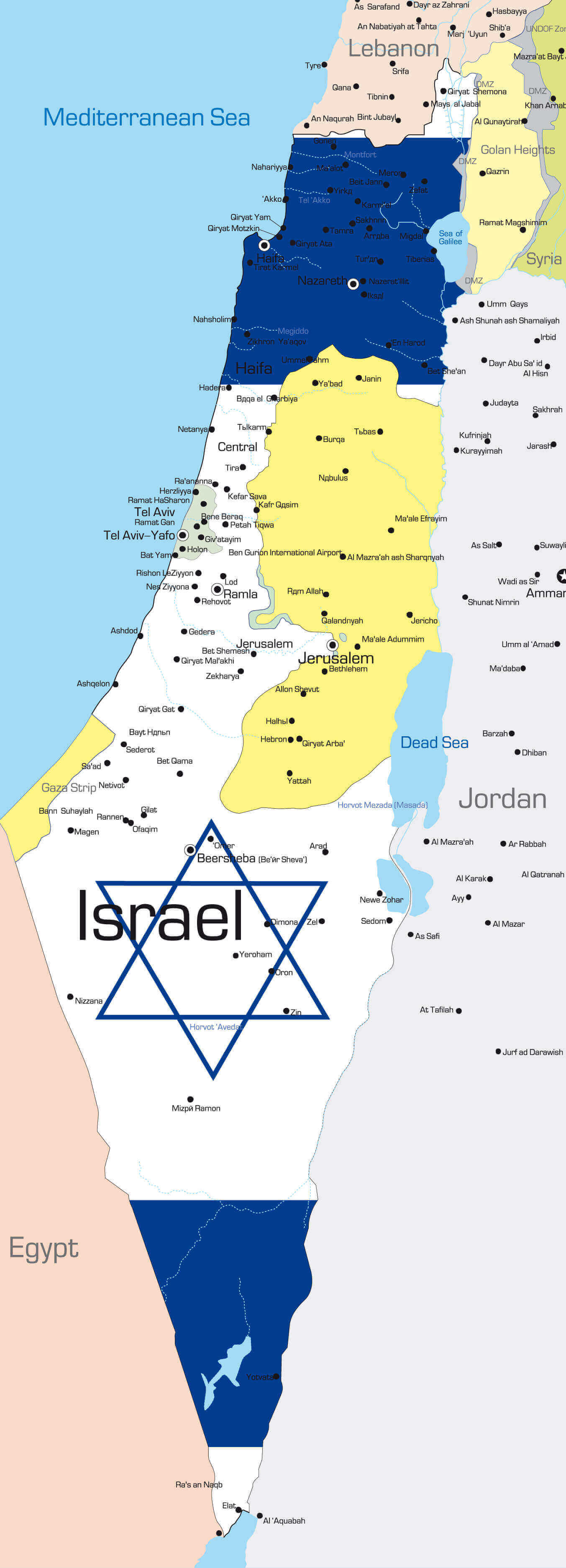
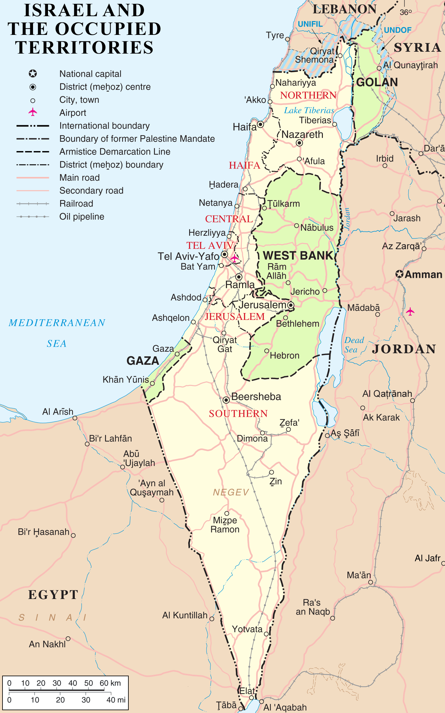
Israel is located in Western Asia, on the eastern shore of the Mediterranean Sea in the Middle East. The country shares borders with Lebanon to the north, Syria to the northeast, Jordan to the east, and Egypt to the southwest. Israel also borders the Palestinian territories of the West Bank and the Gaza Strip. Its Mediterranean coastline provides access to important maritime trade routes connecting Europe, Asia, and Africa.
Geographic Location of Israel
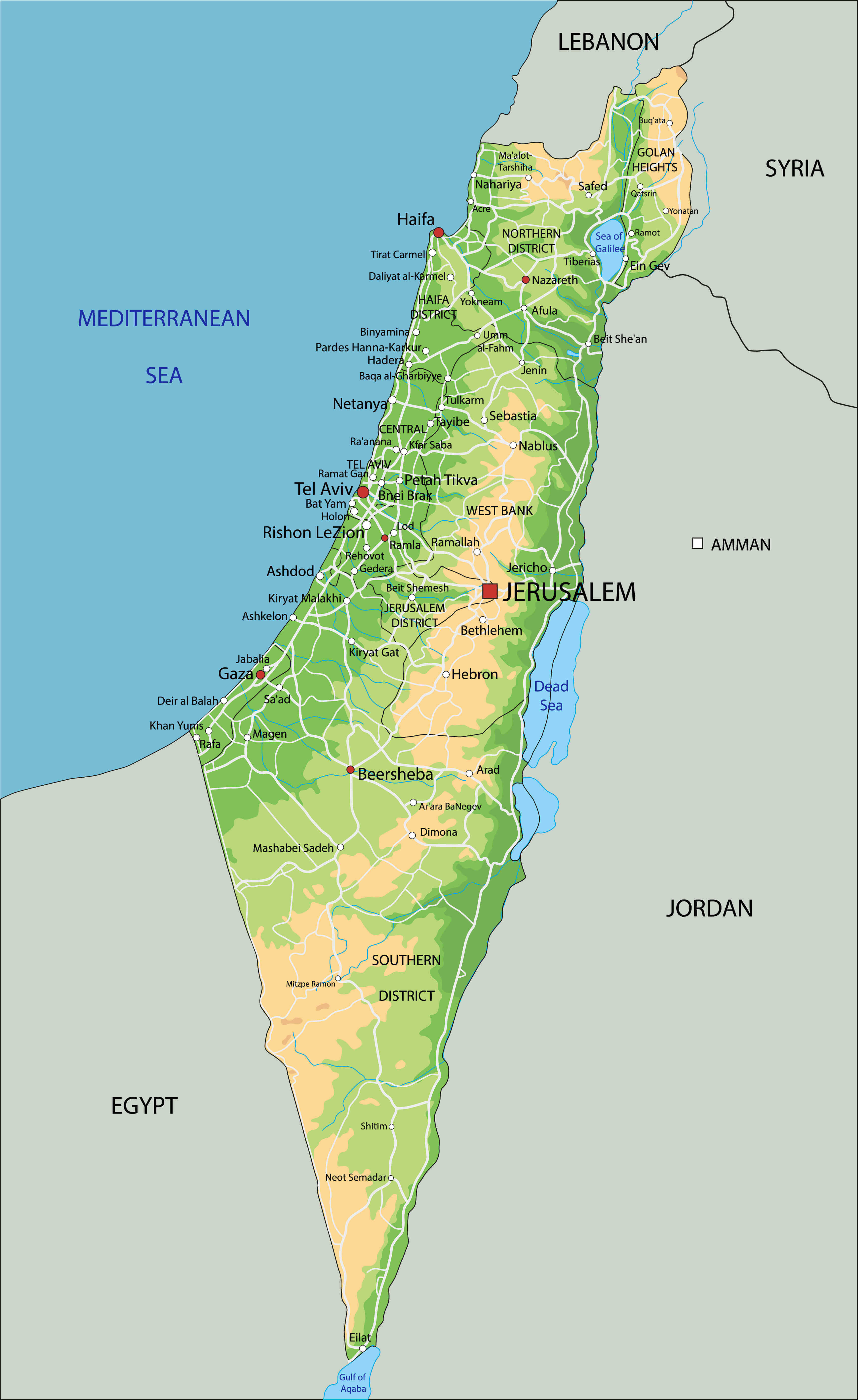
Israel covers an area of approximately 22,145 square kilometers, making it a relatively small country in the Middle East. Despite its size, the country has a highly diverse landscape that includes coastal plains along the Mediterranean Sea, fertile valleys such as the Jezreel Valley, mountainous regions like the Galilee and the Judean Hills, and desert areas including the Negev Desert in the south. Israel is also home to the Dead Sea, the lowest point on Earth's surface.
What Are the Main Regions of Israel?
Israel is administratively divided into several districts. Some of the most important geographic and cultural regions include:
- Jerusalem District – Home to Jerusalem, the historic and political center of the country.
- Tel Aviv District – The economic and technological hub of Israel, including the metropolitan area of Tel Aviv.
- Haifa District – A major port and industrial region along the Mediterranean coast.
- Northern District (Galilee) – Known for its mountainous terrain, historical sites, and natural landscapes.
- Southern District (Negev) – A vast desert region covering much of southern Israel.
What Are the 5 Largest Cities in Israel?
The five largest cities in Israel by population are:
- Jerusalem – The capital city and an important religious and historical center.
- Tel Aviv – The country's main economic and technological hub located on the Mediterranean coast.
- Haifa – A major port city known for its industries and cultural diversity.
- Rishon LeZion – One of the largest cities in central Israel, part of the Tel Aviv metropolitan area.
- Petah Tikva – A major city near Tel Aviv and an important center for high-tech industries.
Quick Facts About Israel
| Official Name: | State of Israel |
|---|---|
| Area: | 22,145 km² |
| Capital: | Jerusalem |
| Population: | Approximately 9.8 million |
| Currency: | Israeli new shekel (ILS) |
| GDP: | Approx. $500 billion (nominal) |
| Per Capita: | Approx. $50,000 (nominal) |
| Time Zone: | Israel Standard Time (IST, UTC+2) |
| Calling code: | +972 |
| Internet TLD: | .il |
Why Israel's Location Is Important
Israel holds a strategically significant position at the meeting point of Europe, Asia, and Africa. Located along the eastern coast of the Mediterranean Sea, the country has historically functioned as an important corridor for trade routes, population movement, and cultural interaction between different civilizations. Its location near key regional powers and major maritime pathways has given Israel lasting geopolitical relevance and continues to shape regional security, politics, and economic activity.
Frequently Asked Questions
Is Israel in the Middle East?
Yes. Israel is situated in Western Asia and is generally regarded as part of the Middle East region.
Which countries border Israel?
Israel borders Lebanon in the north, Syria in the northeast, Jordan to the east, and Egypt to the southwest. It also shares boundaries with the Palestinian territories of the West Bank and the Gaza Strip.
What is the capital of Israel?
Jerusalem is the capital of Israel and is widely recognized as one of the world's oldest and most historically important cities.
What seas border Israel?
Israel has a Mediterranean coastline to the west and also reaches the Red Sea through the Gulf of Aqaba in the country's southern region.
What is Israel known for geographically?
Israel is geographically diverse, featuring Mediterranean coastal plains, the mountainous landscapes of Galilee, the vast Negev Desert in the south, and the Dead Sea, which is the lowest point on Earth's surface.
Feel free to explore these pages as well:
- Head of Performance Marketing
- Head of SEO
- Linkedin Profile: linkedin.com/in/arifcagrici