A Collection of Australia Maps: Geography, Cities, Regions and Landscapes
Discover our extensive Australia Maps Collection, offering a diverse range of maps that highlight the country's geography, regions, cities, and natural landscapes. Whether you are a traveler planning your next adventure, a student studying geography, or a researcher seeking reliable map resources, this collection provides valuable visual references. Explore detailed maps including an Australia country reference map, Australia states and territories map, Australia major cities map, and Australia cities and regions map, each designed to help users better understand Australia's administrative structure and regional diversity.
Australia cities and regions map

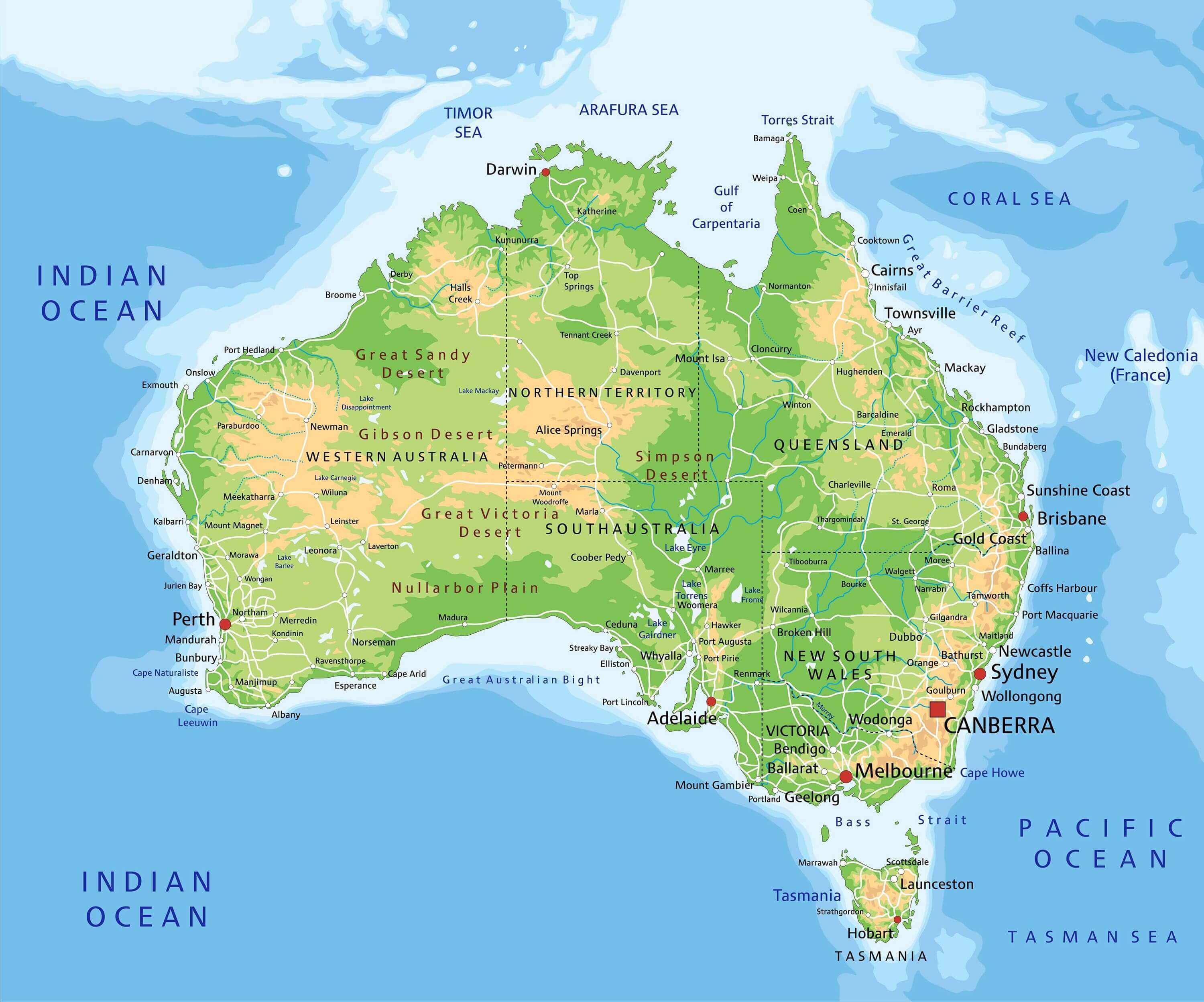
Australia detailed physical geography map
Australia administrative regions map
Our collection also offers specialized maps such as the Australia climate regions map, Australia historical map, Australia physical features map, Australia physical relief and terrain map, Australia detailed physical geography map, and Australia detailed topographic map. For those interested in modern cartography and satellite imagery, we provide an Australia satellite Earth view map that highlights the continent's unique landscapes and natural formations. Whether you are studying Australia's geography, planning a trip, teaching geography lessons, or simply exploring the world's sixth-largest country, these maps provide valuable visual insights into Australia's diverse environments, regions, and history.
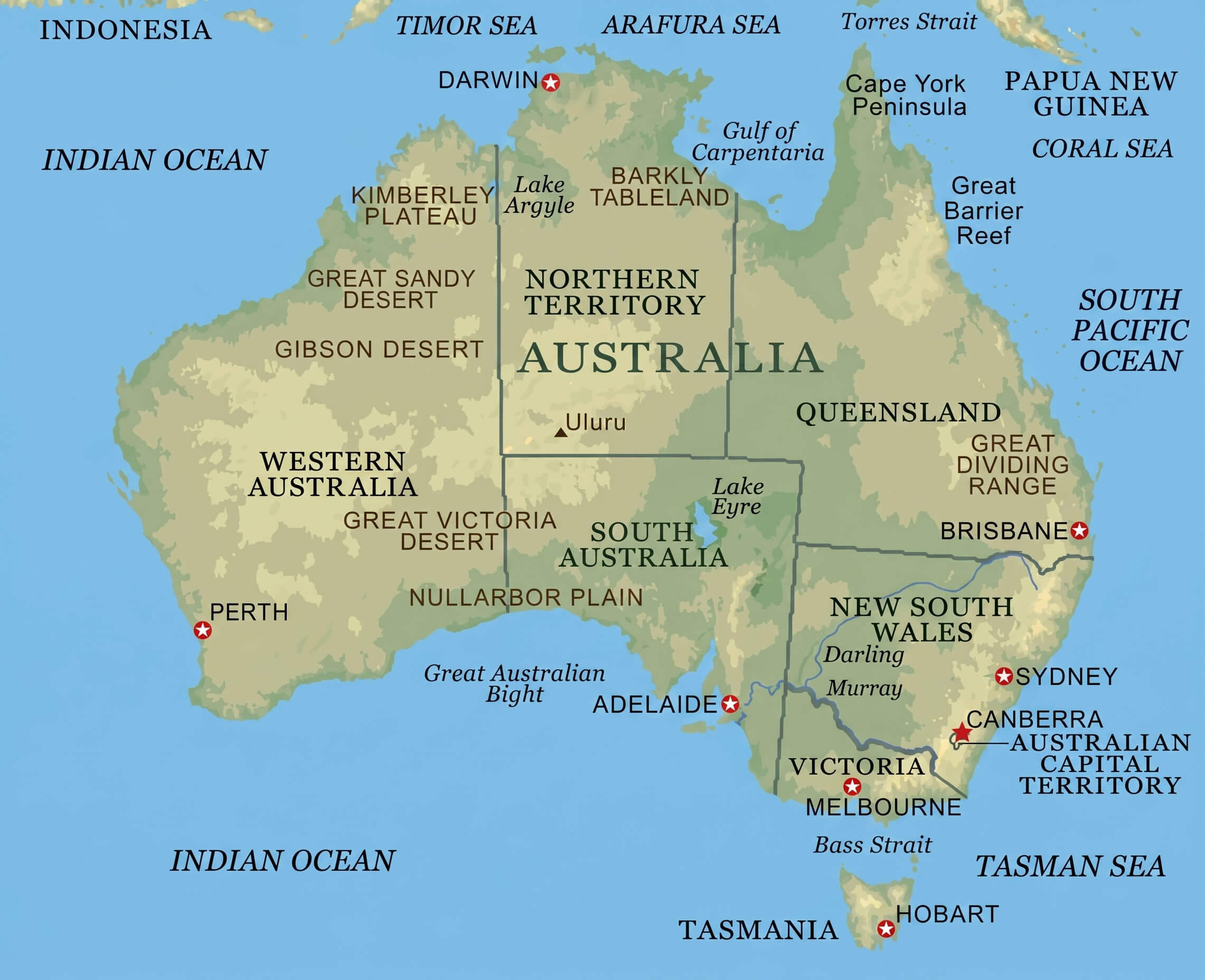
Australia country reference map
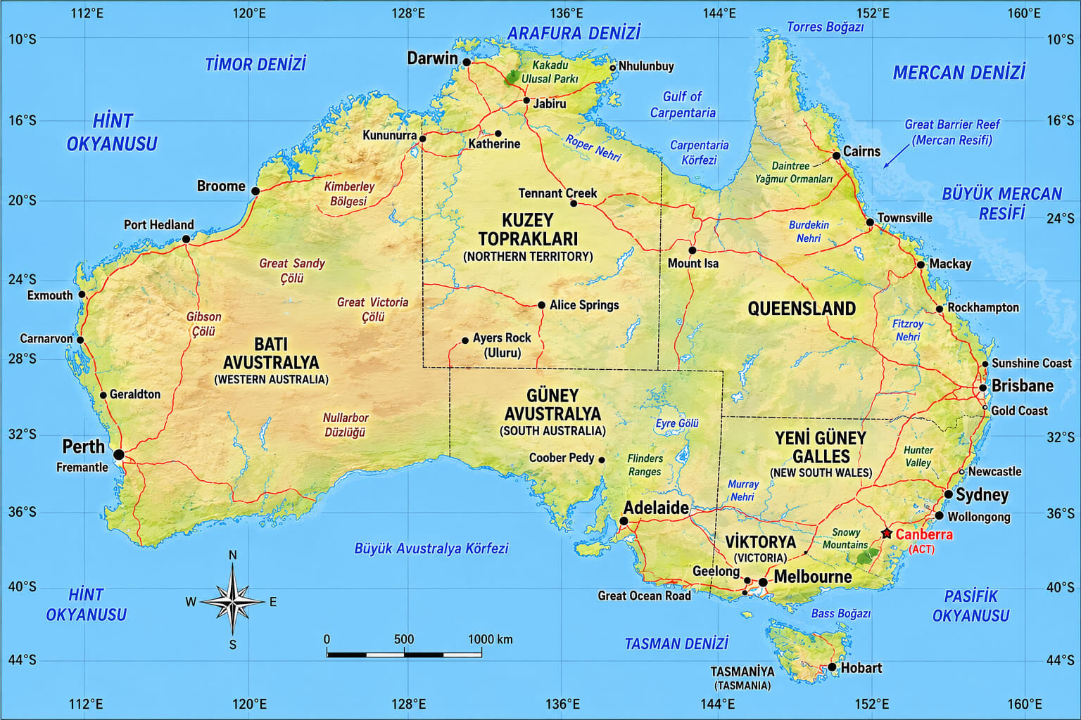
Australia detailed topographic map
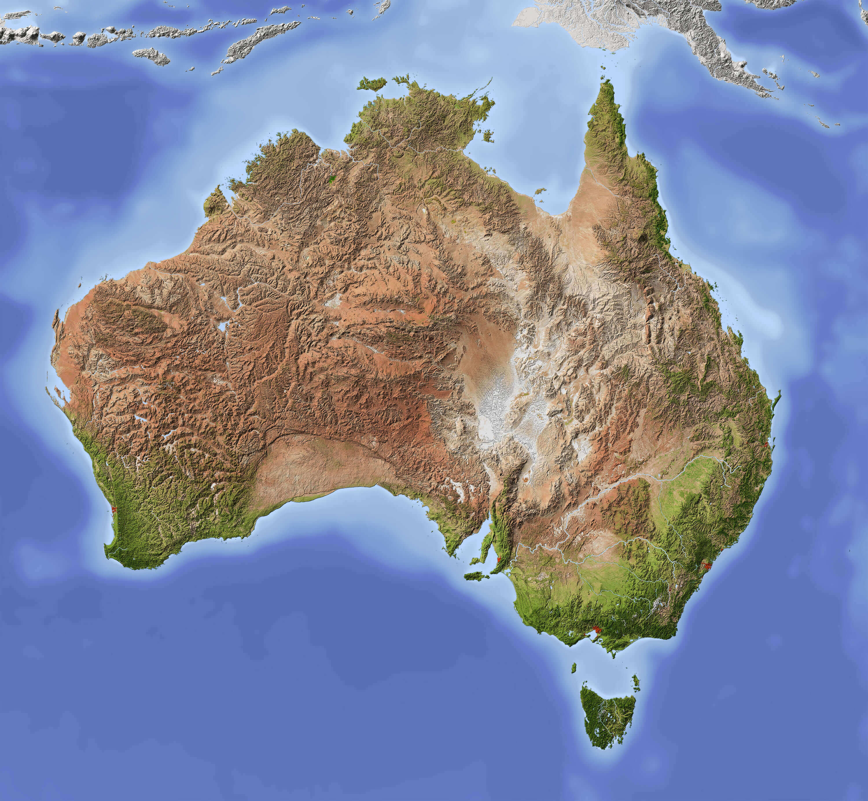
Australia shaded relief map with major cities
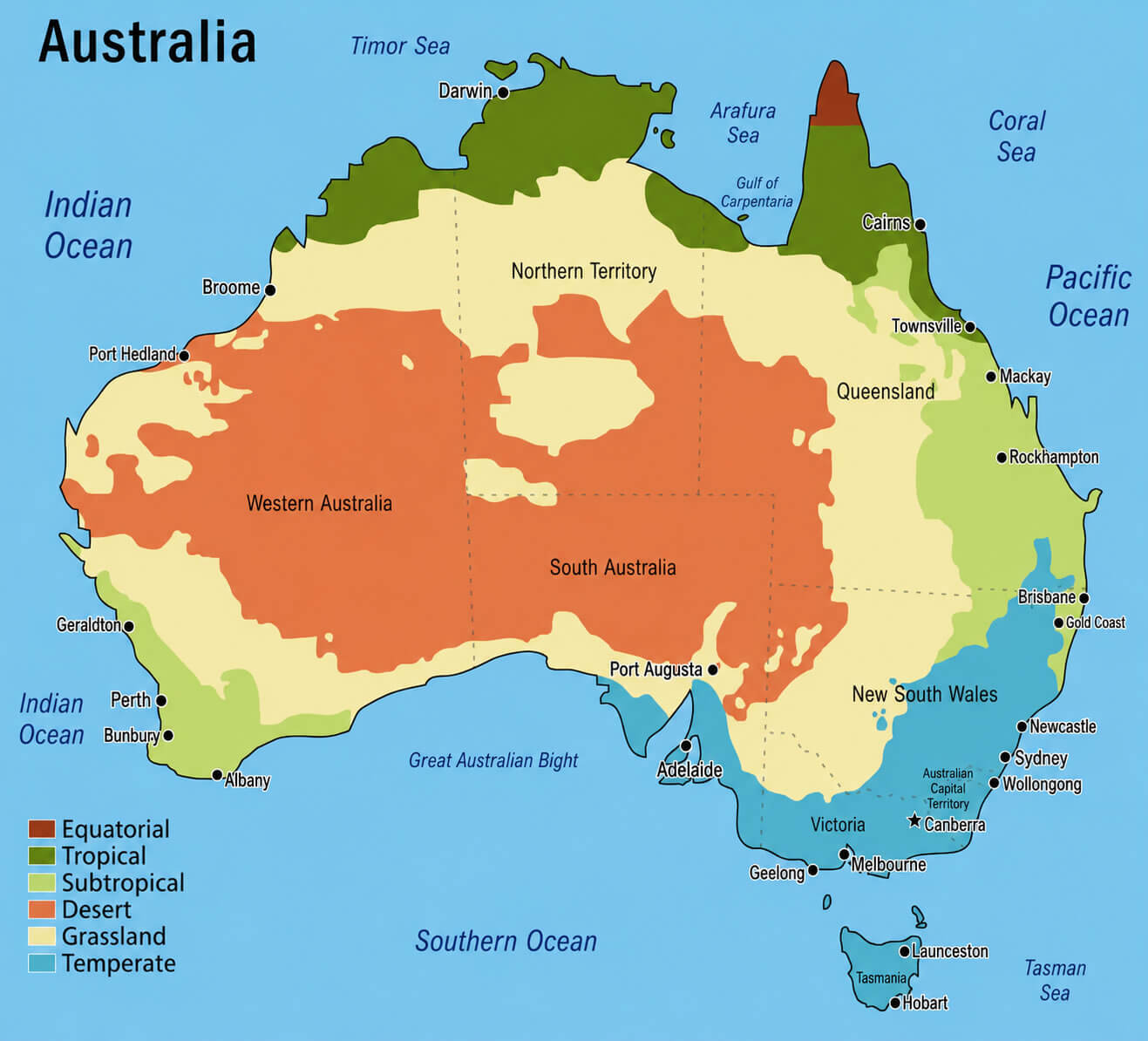
Australia climate regions map
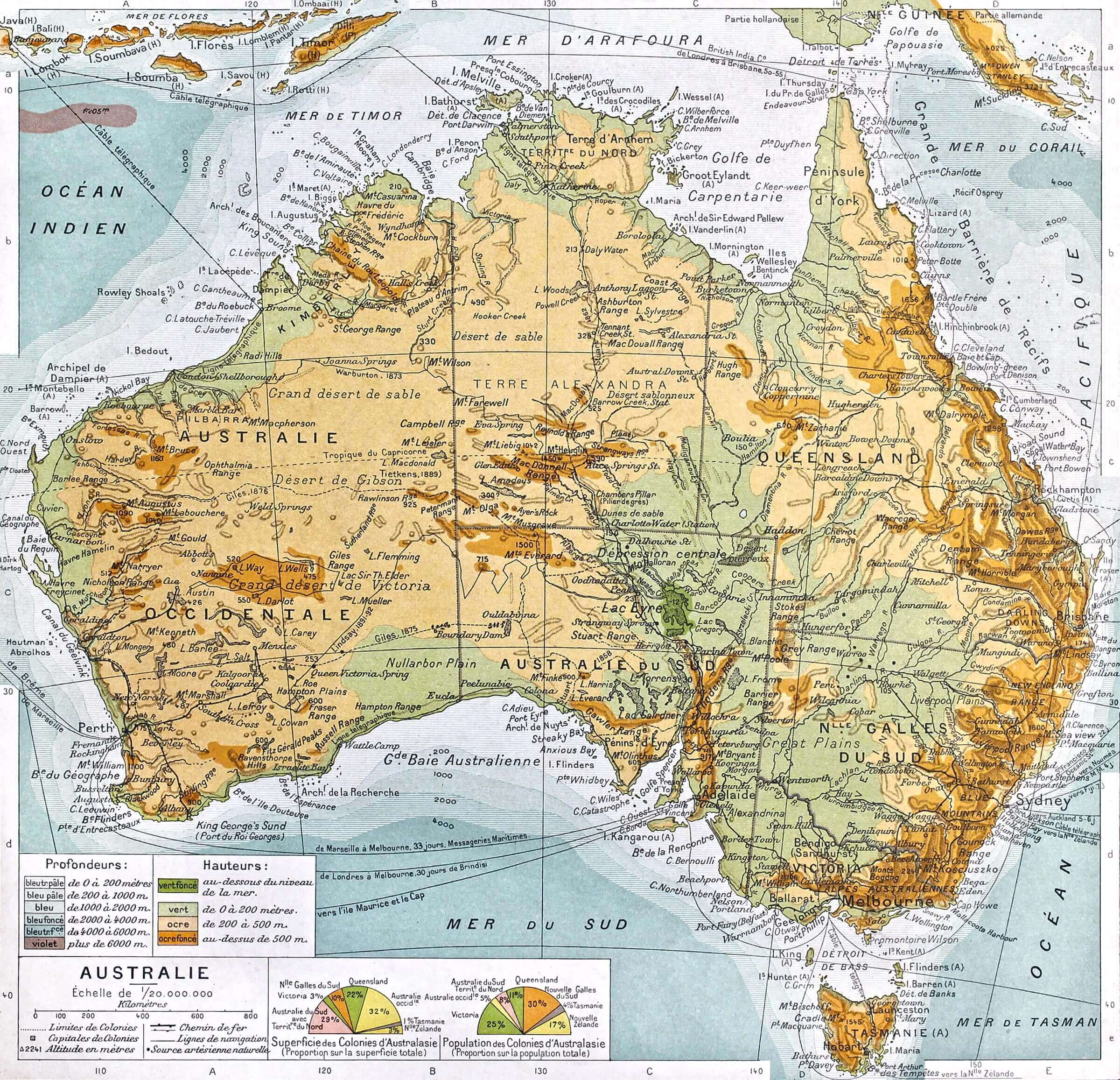
Australia historical map
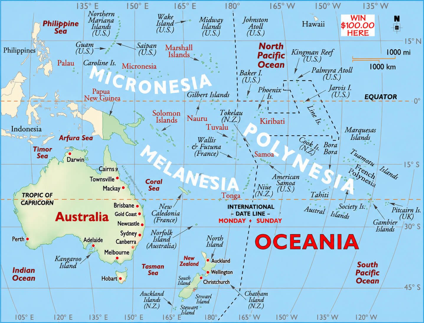
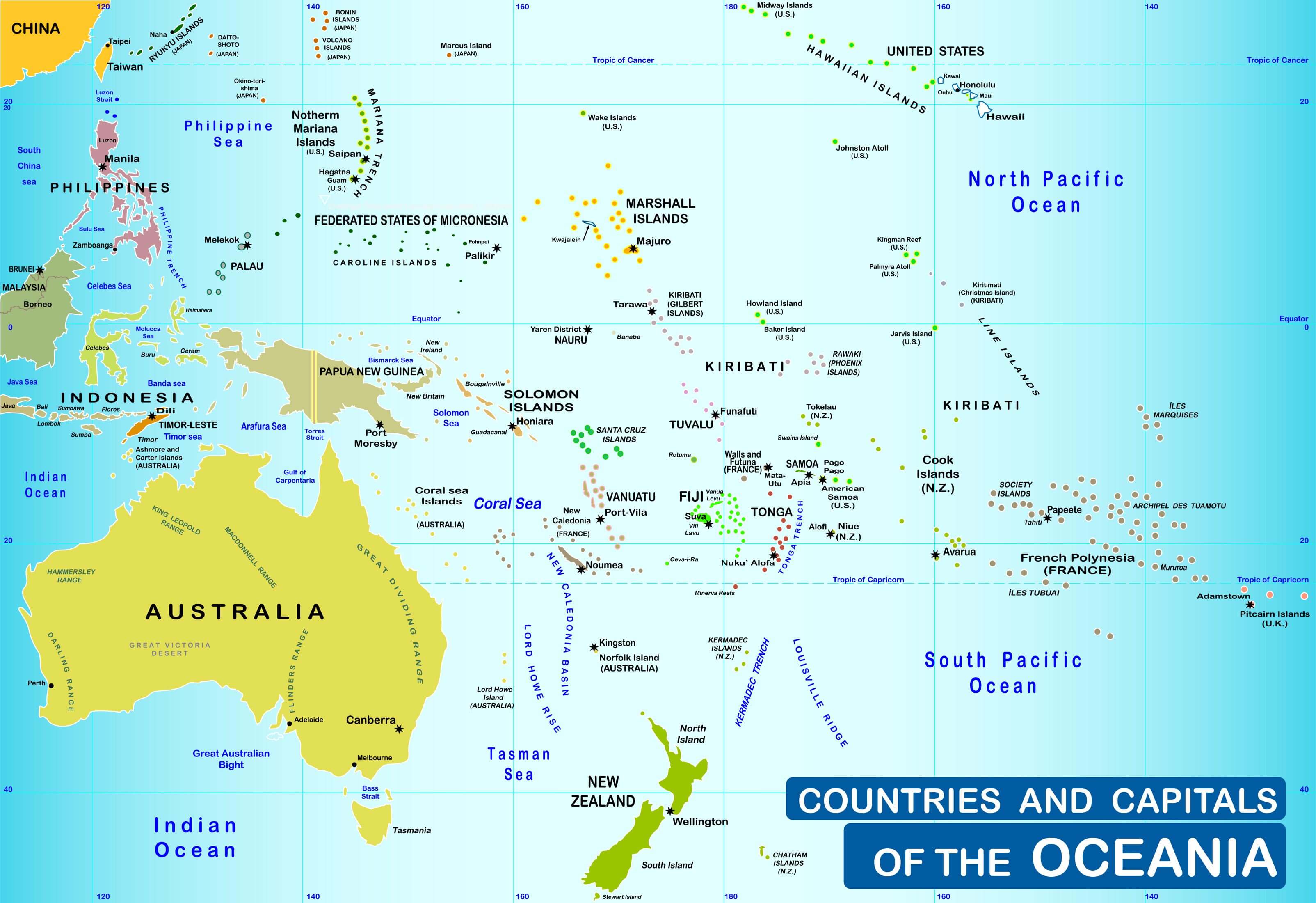
In addition to national maps, the collection also features broader regional perspectives such as an Oceania and Australia regional map and an Oceania countries and capitals map. These maps place Australia within its wider Pacific context, making it easier to explore neighboring countries, island nations, and regional connections across Oceania. Together, these resources provide a comprehensive overview of Australia's geographic position, political divisions, and regional importance.
Australia major cities map
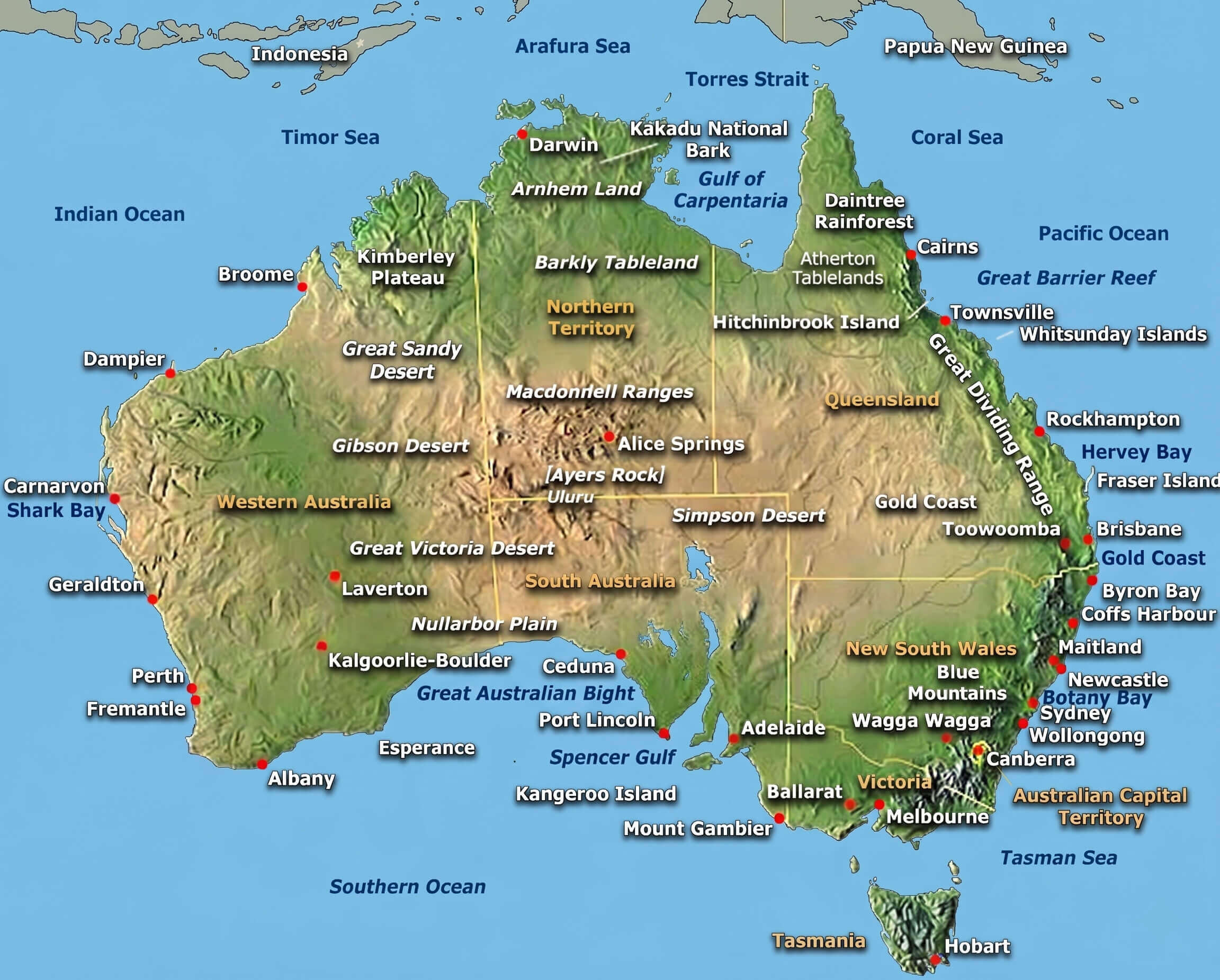
Australia physical features map
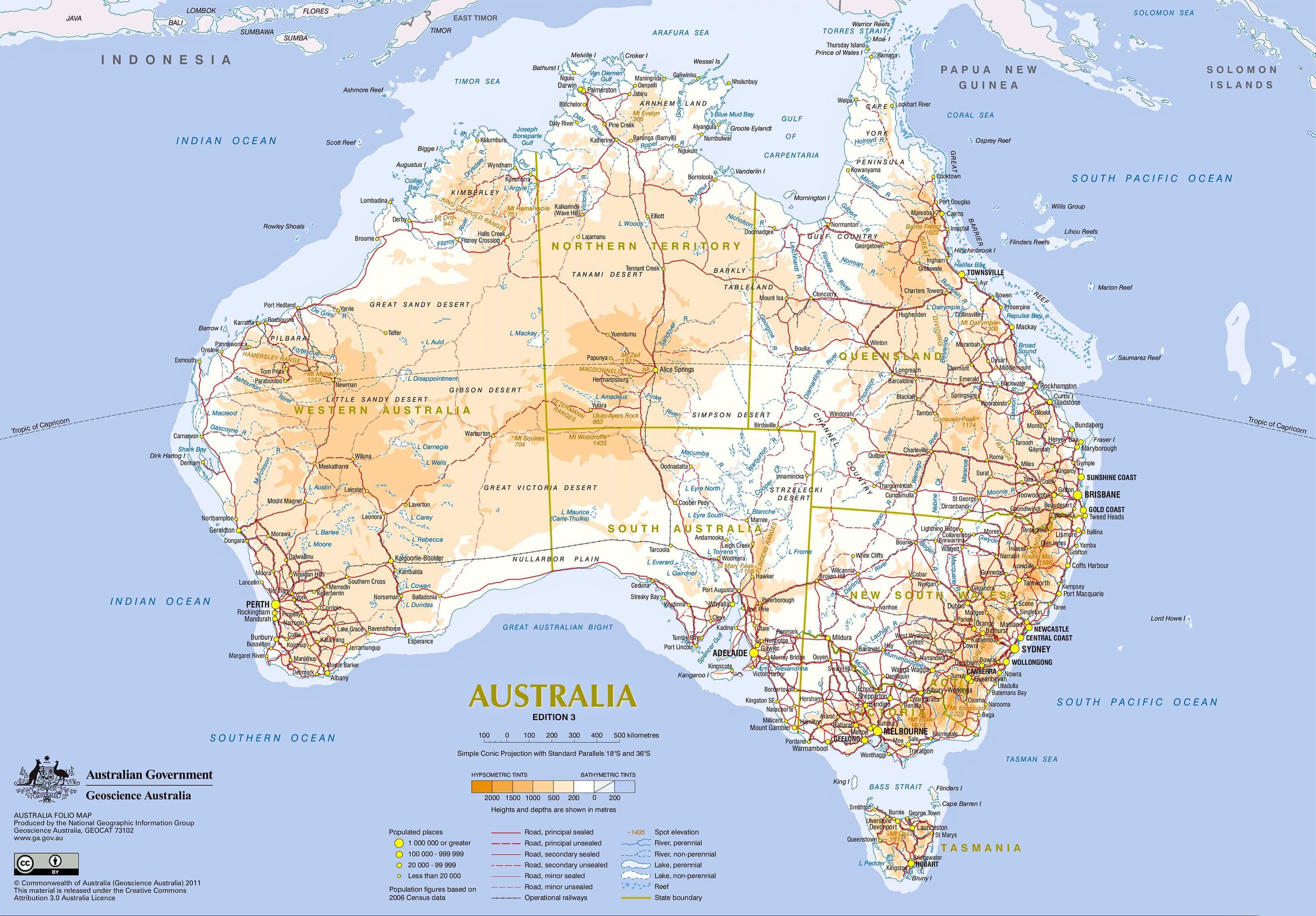
Australia physical relief and terrain map
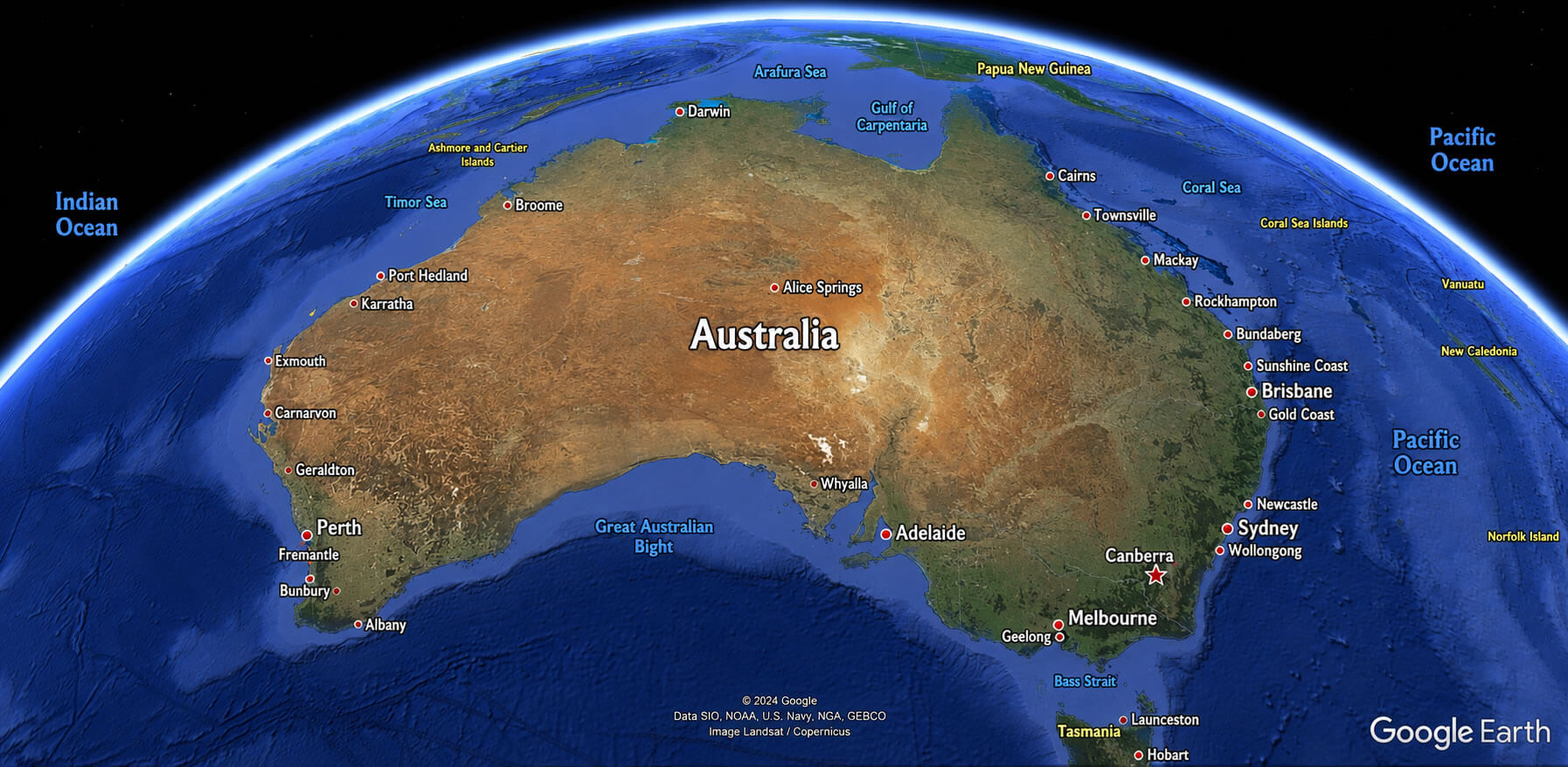
Australia satellite Earth view map
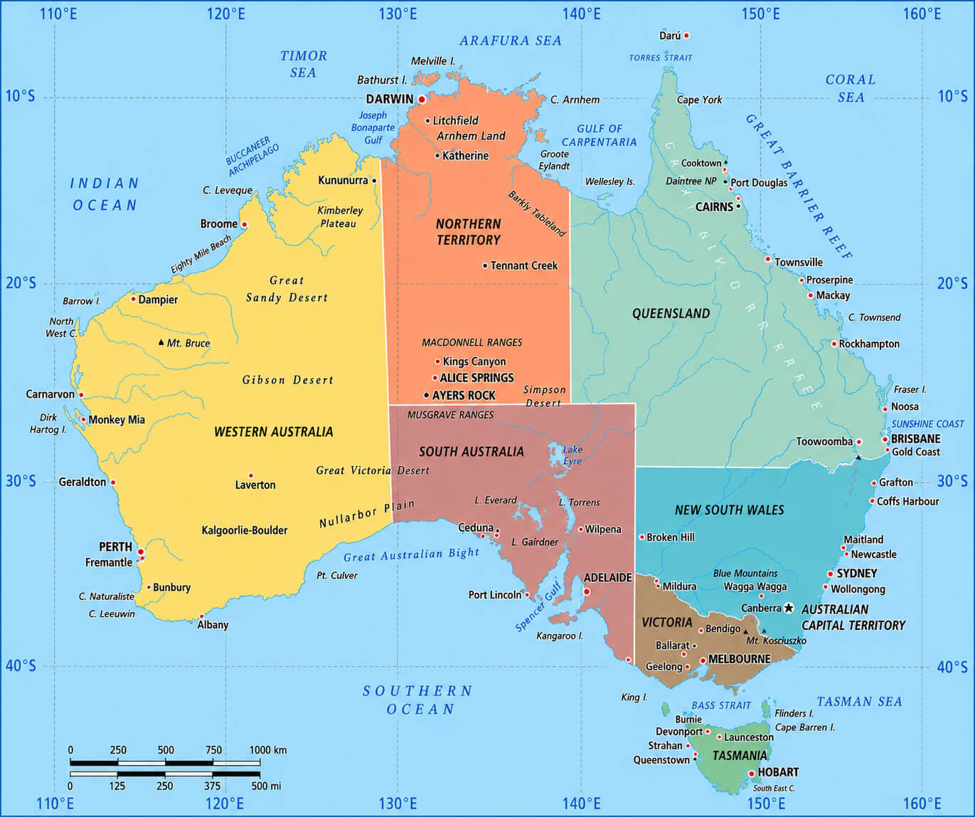
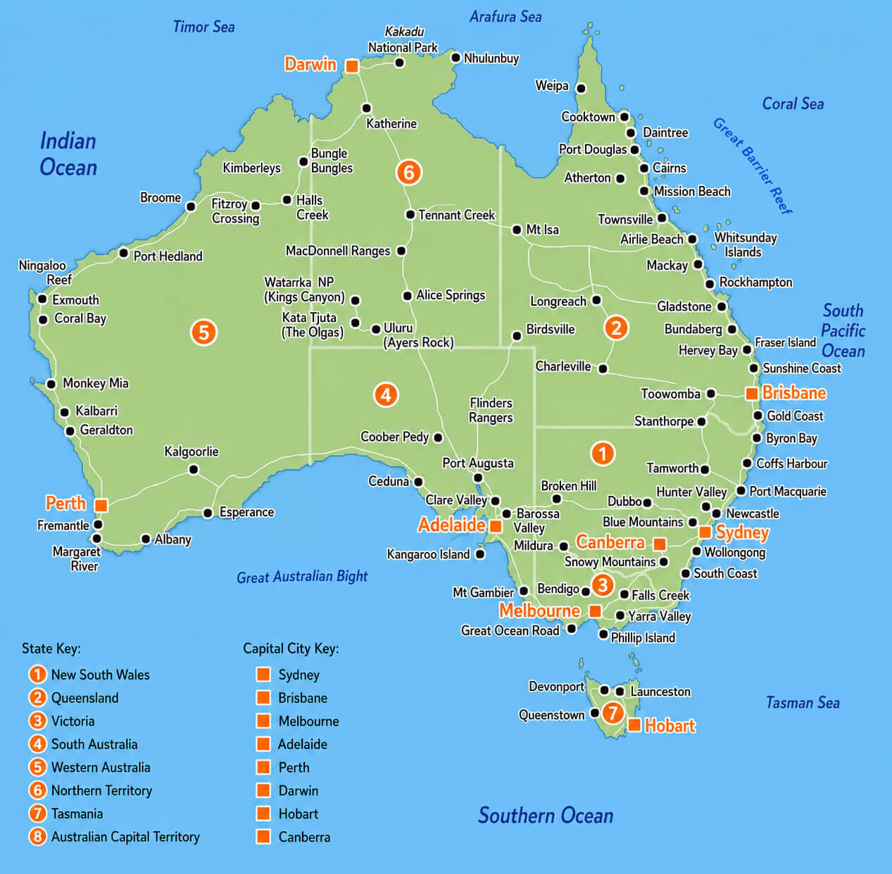
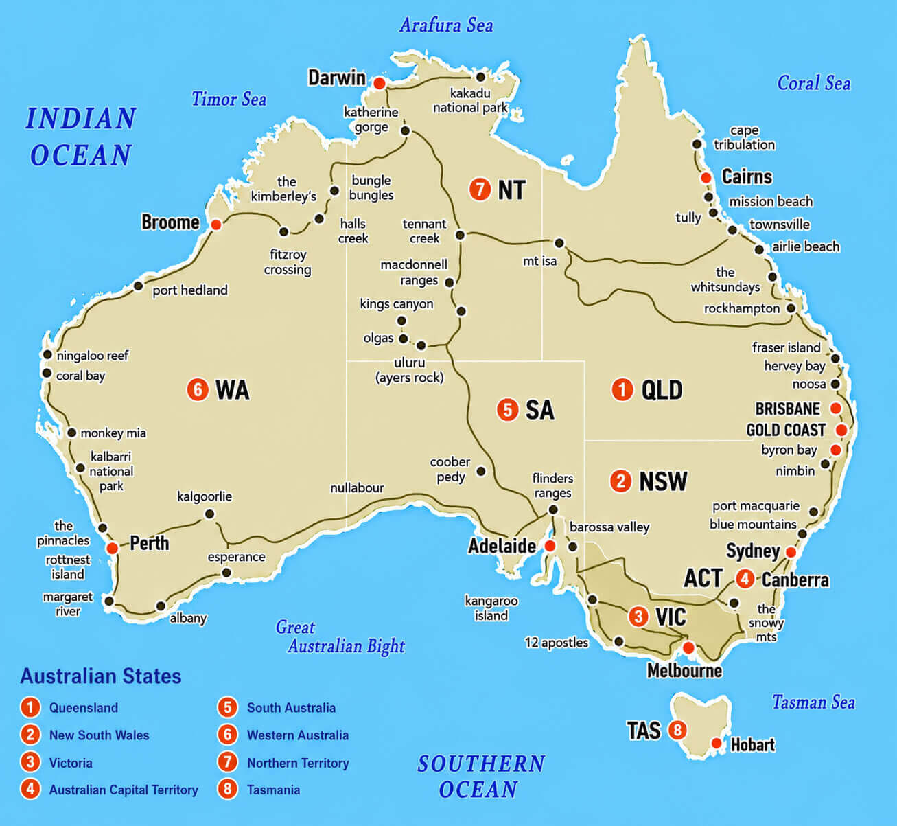
Australia states and territories map
Oceania and Australia regional map
Oceania countries and capitals map
Feel free to explore these pages as well:
- Head of Performance Marketing
- Head of SEO
- Linkedin Profile: linkedin.com/in/arifcagrici