High Resolution Map of California: Detailed Counties, Cities & Geographic Features
Discover the ultimate high-resolution map of California, designed for clarity, precision, and versatility—perfect for research, travel planning, or exploring the Golden State in detail. This page features a comprehensive range of maps, from a California administrative map of regions and boundaries to colorful county-level political maps and detailed California political maps with major cities and state boundaries, helping you fully understand the state's geographic and administrative structure.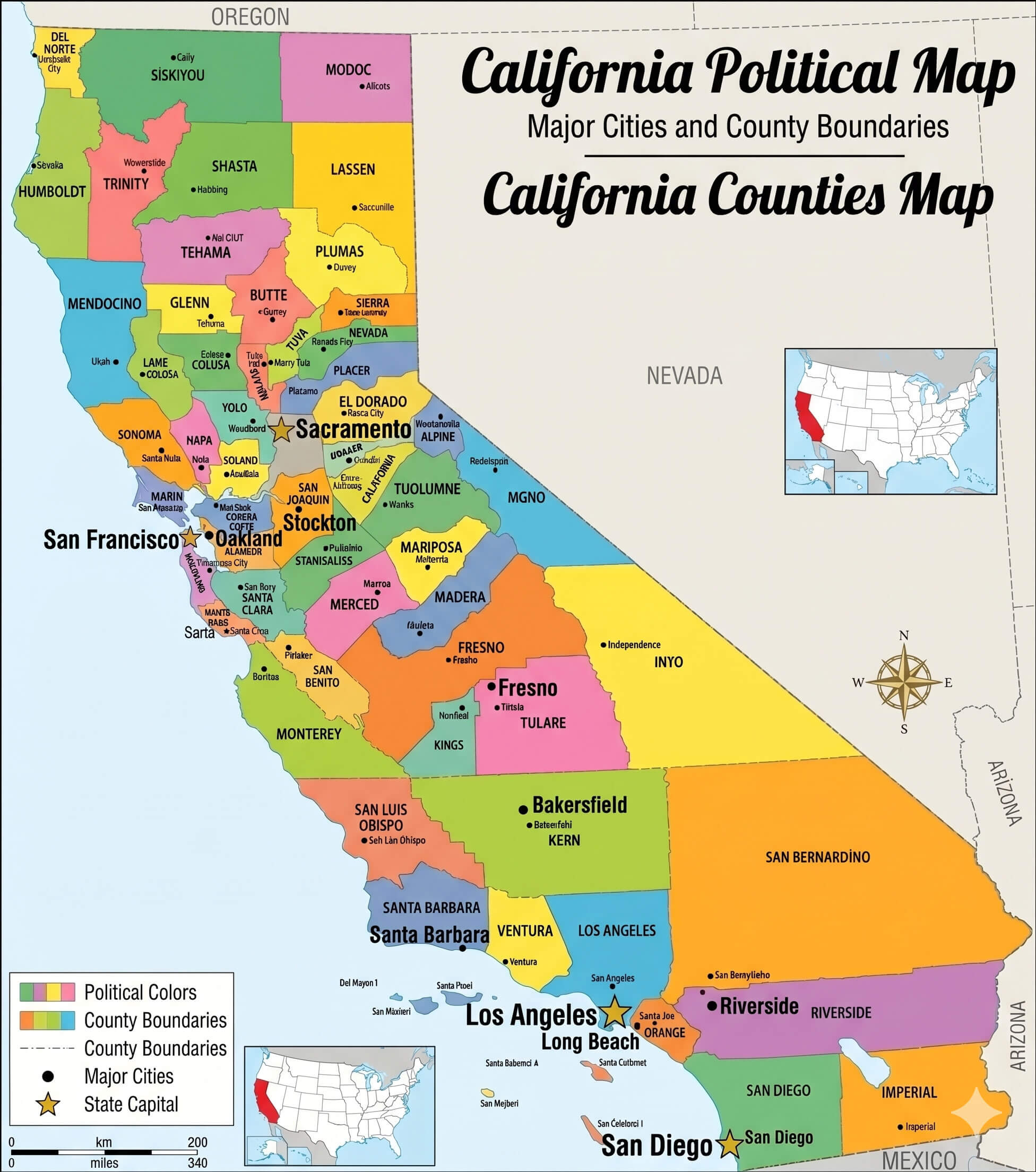
California main cities map major urban areas labeled
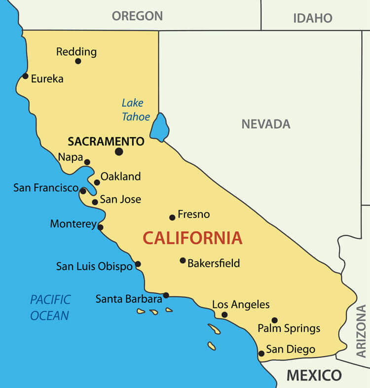
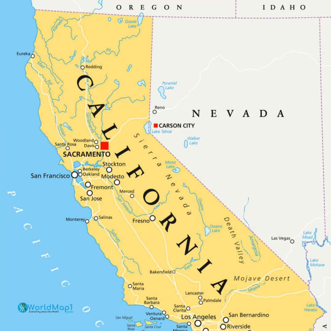
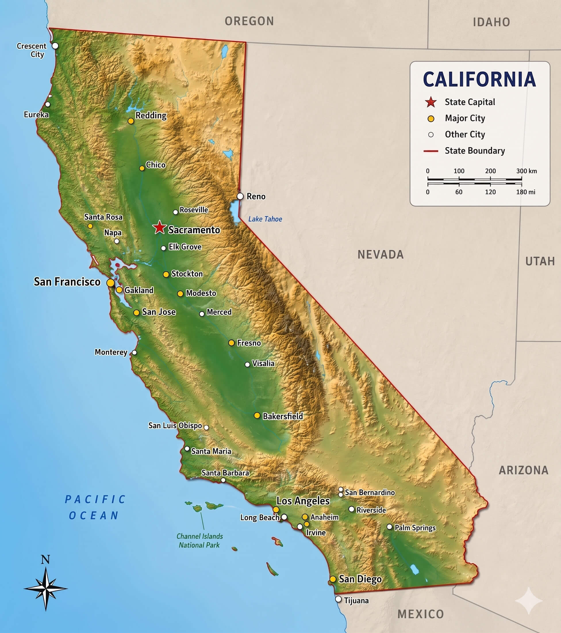
California map major cities and state boundaries detailed
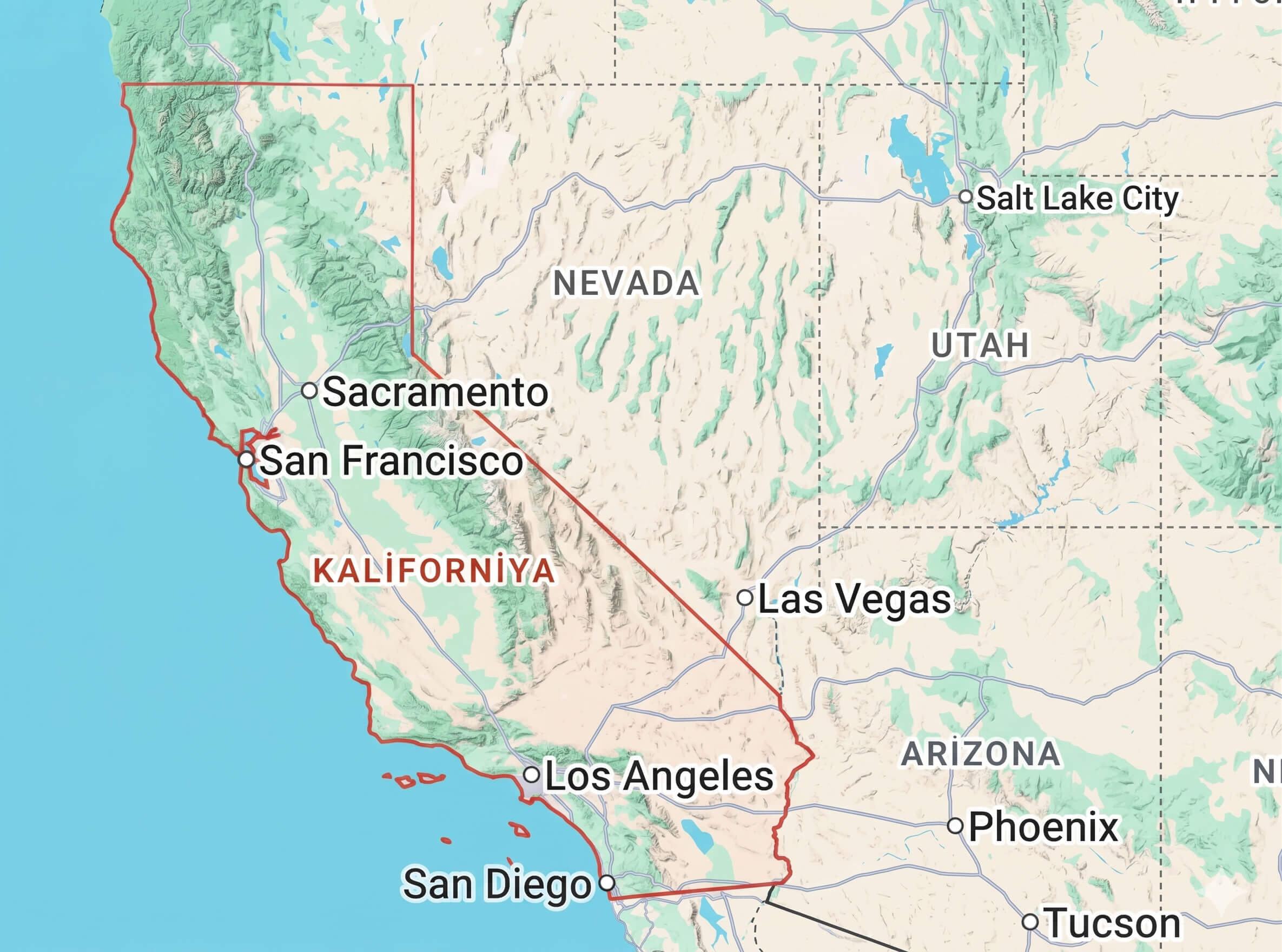
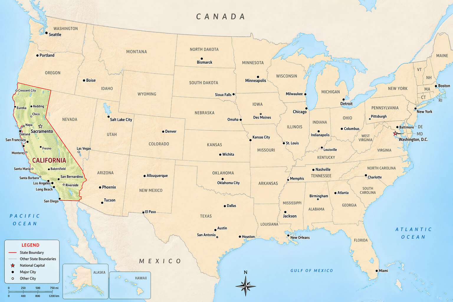
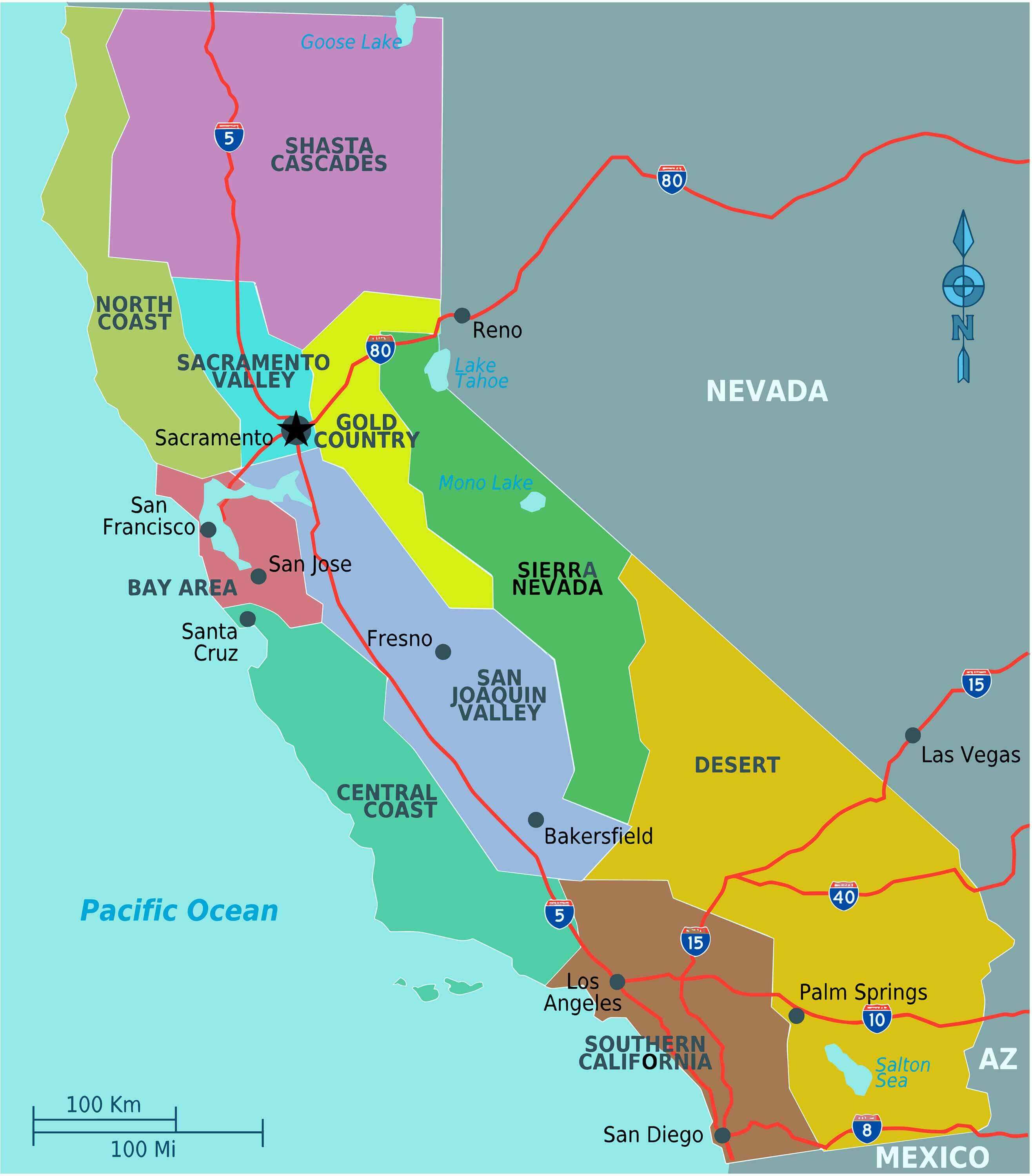
California map with major cities and neighboring states
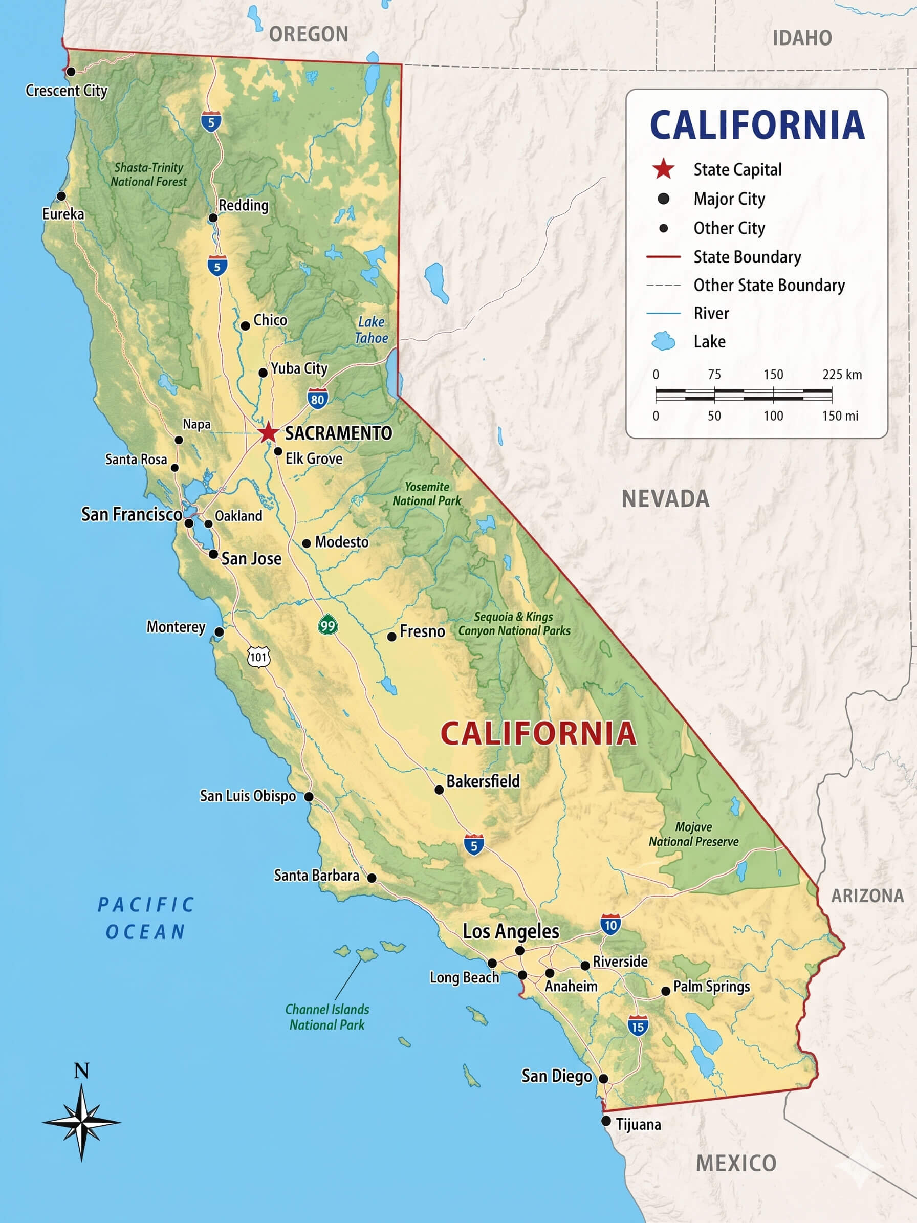
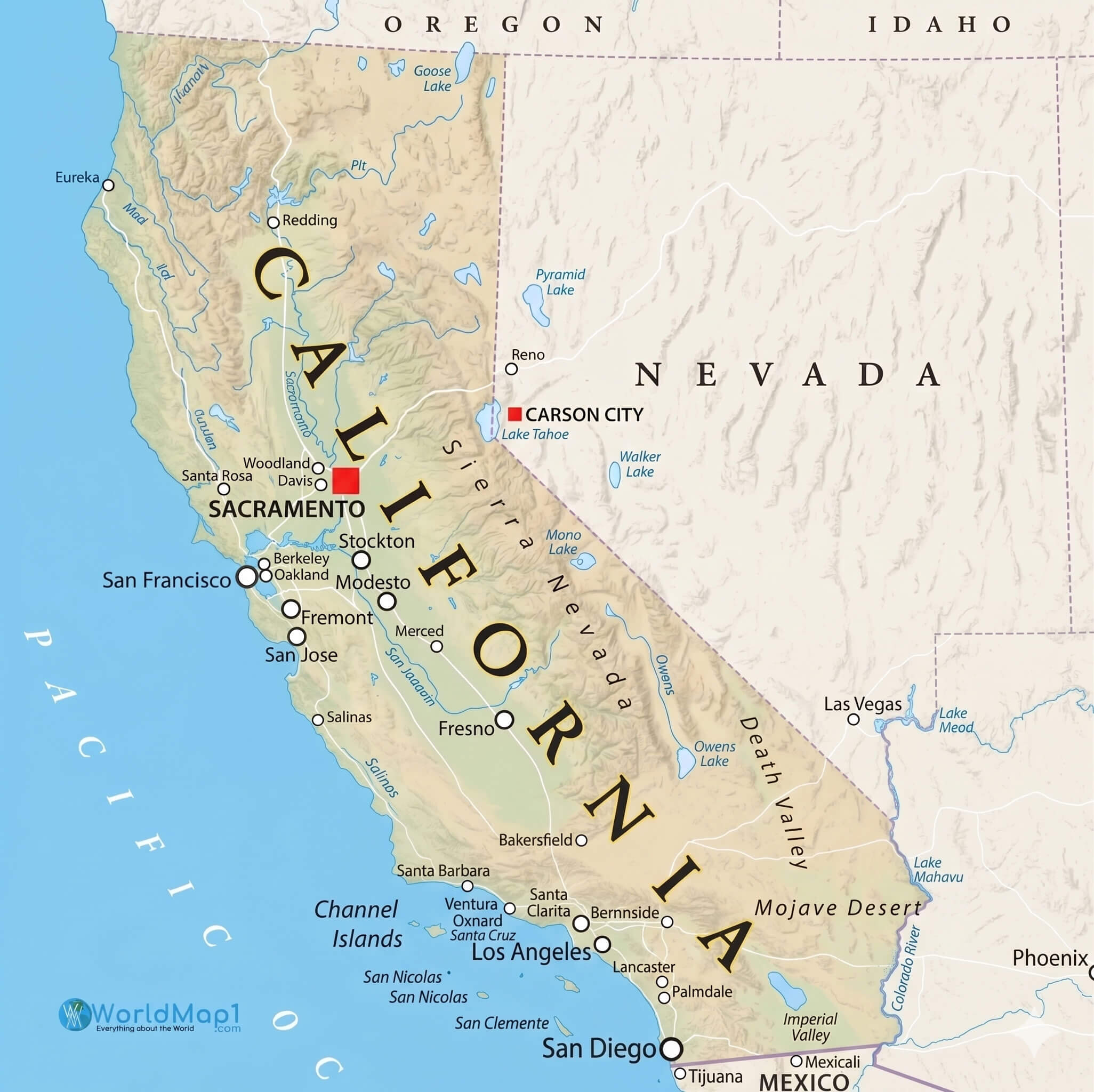
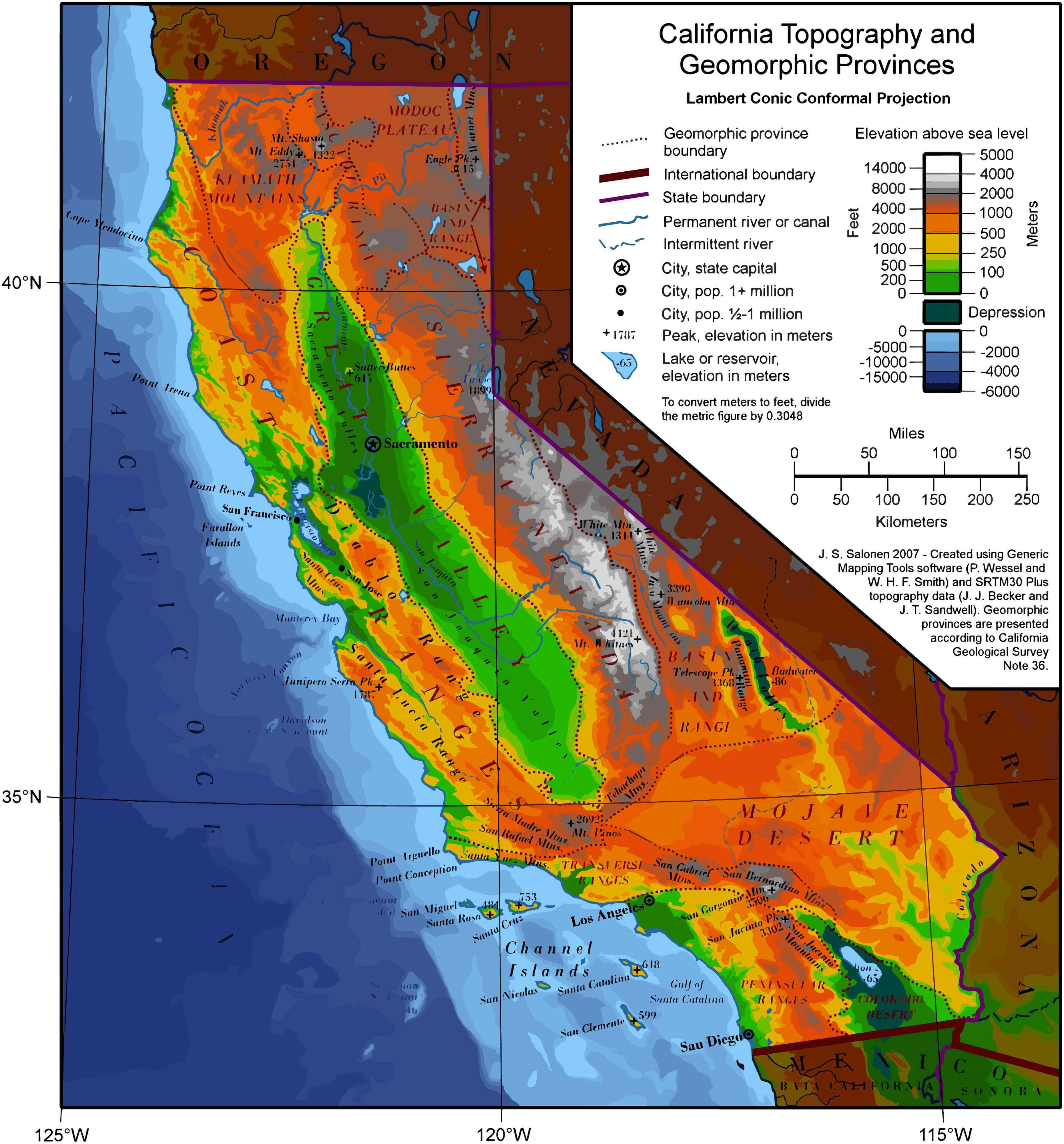
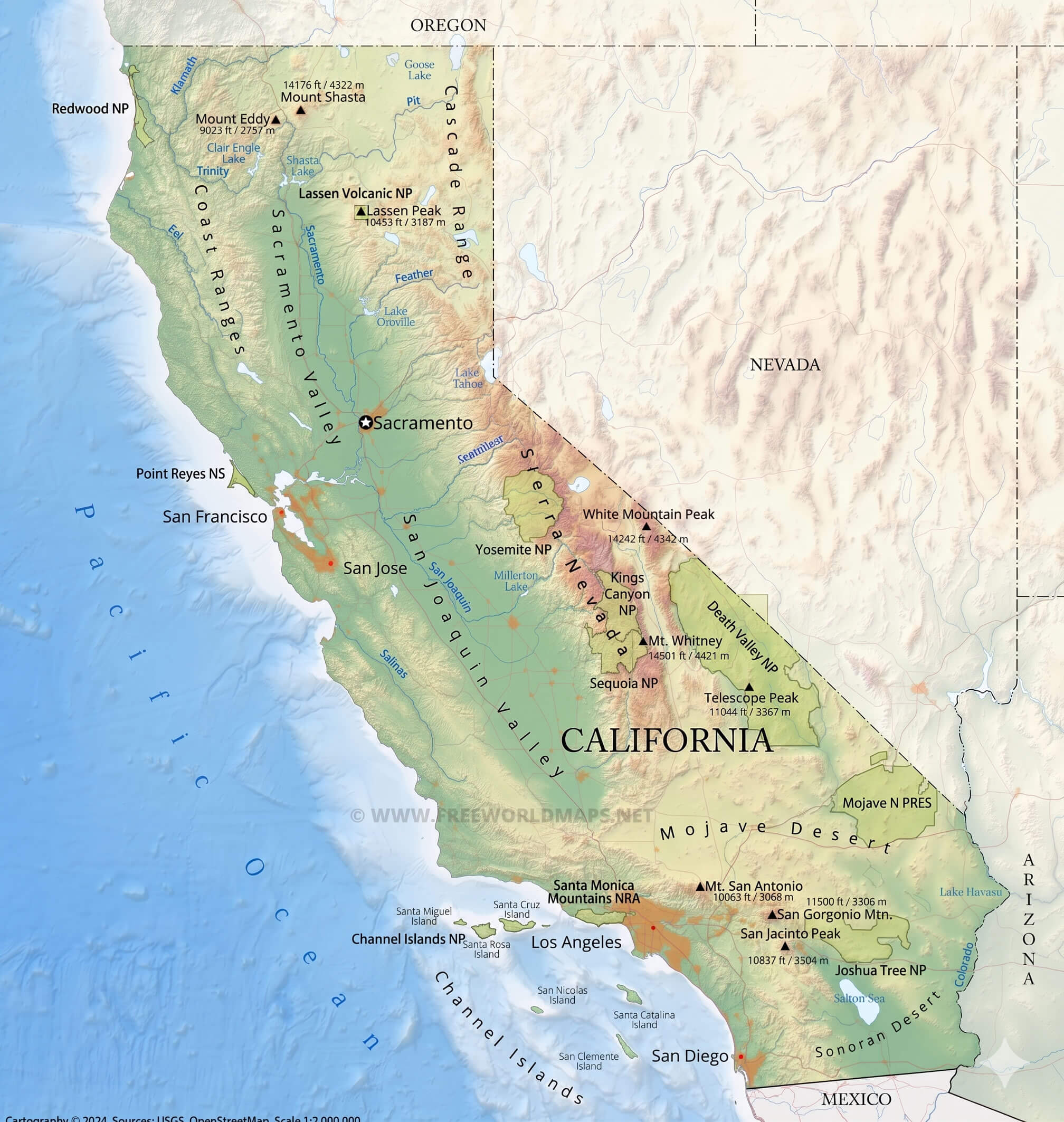
California physical relief map with terrain and elevation
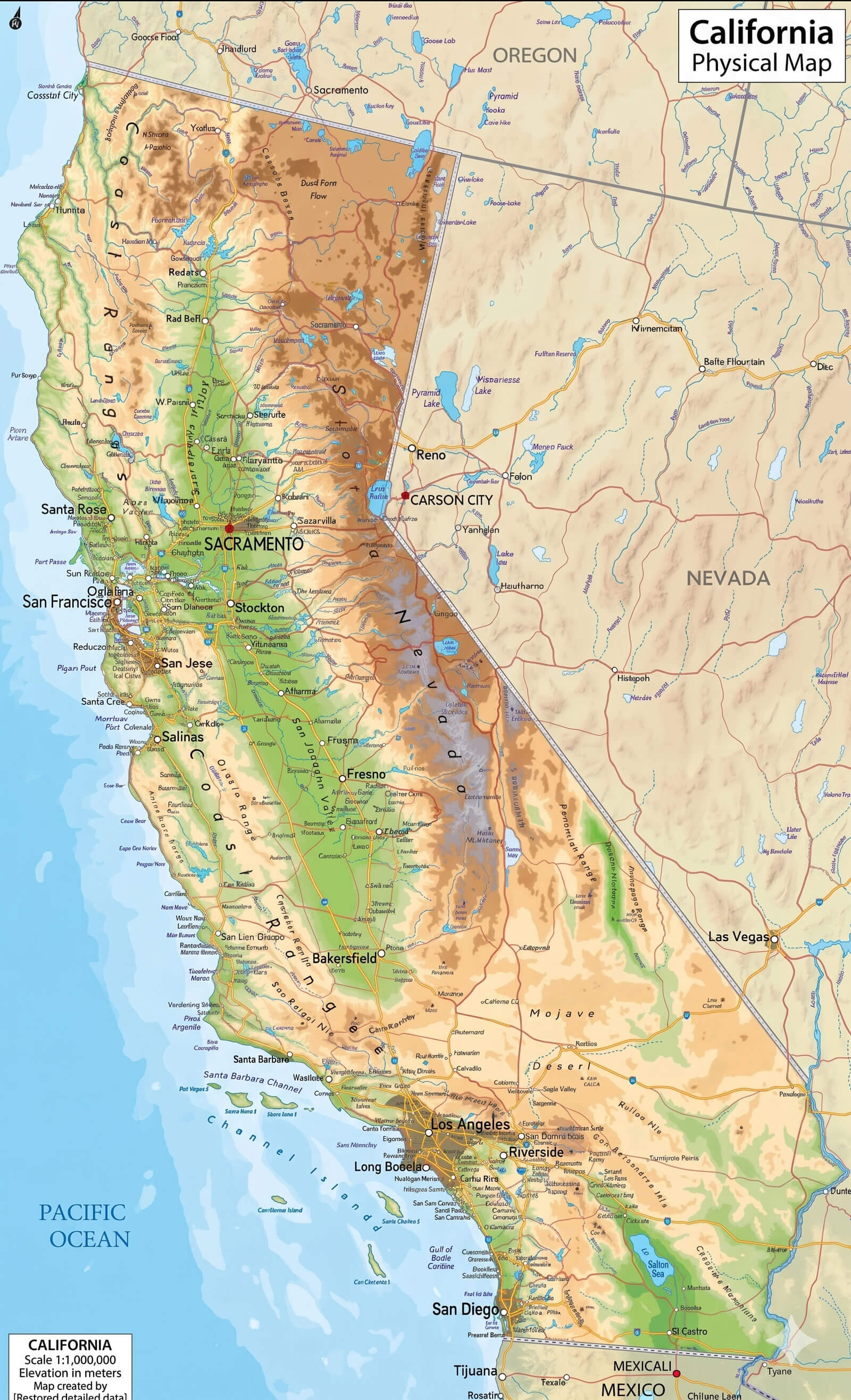
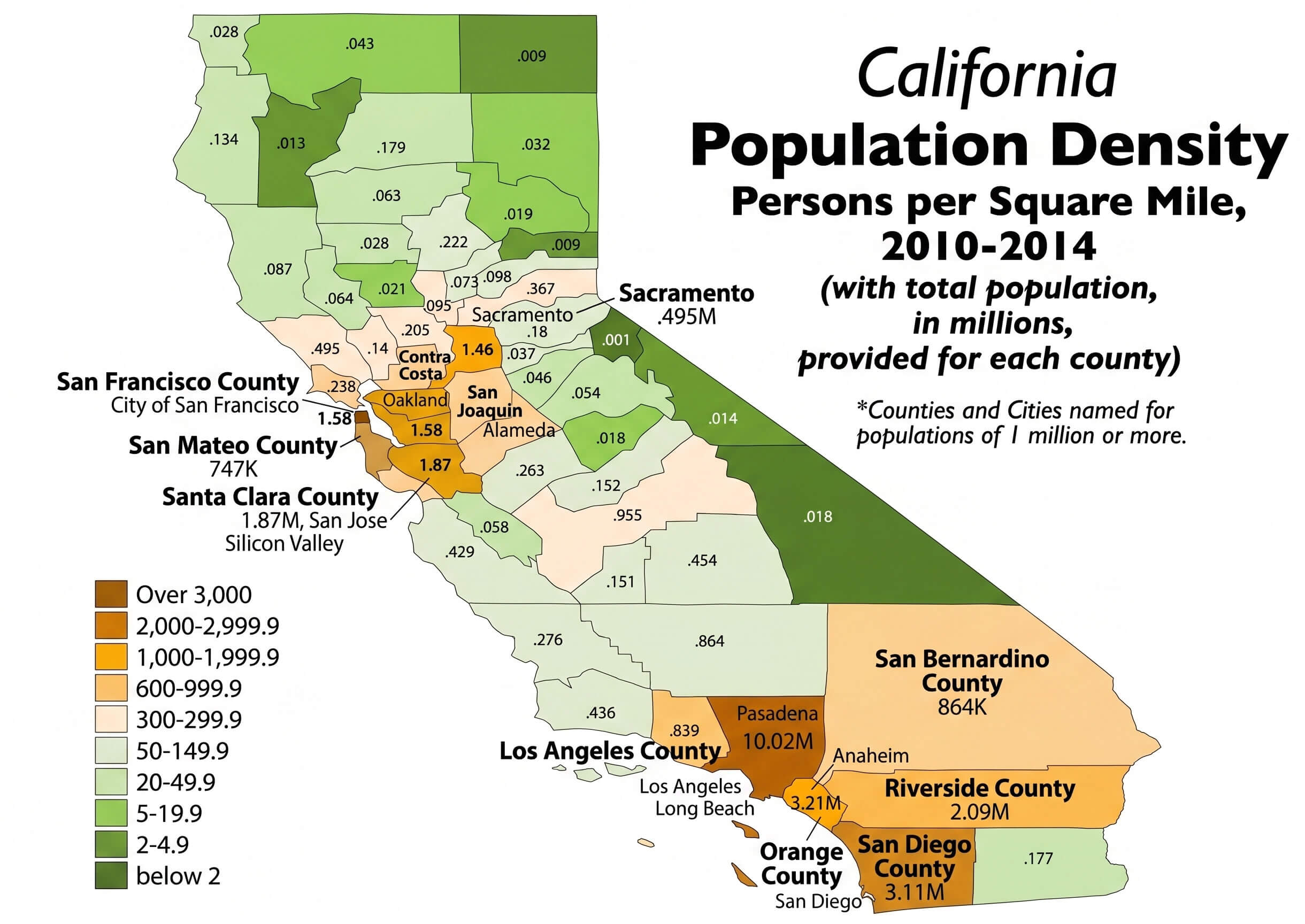
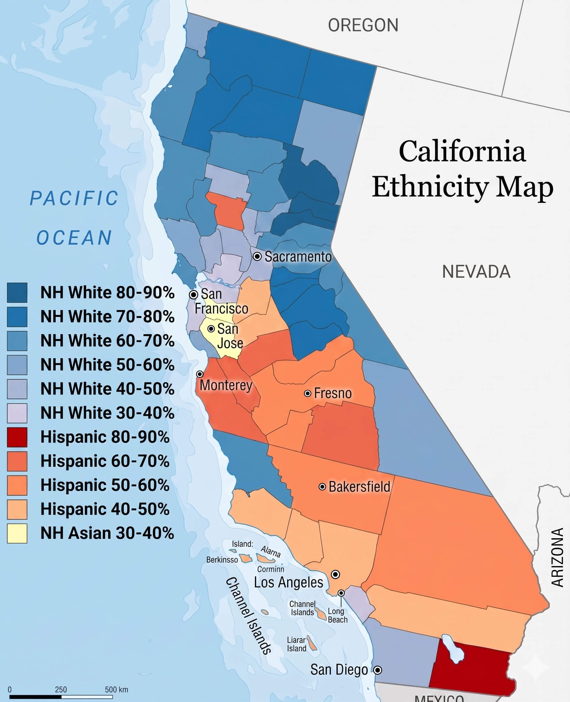
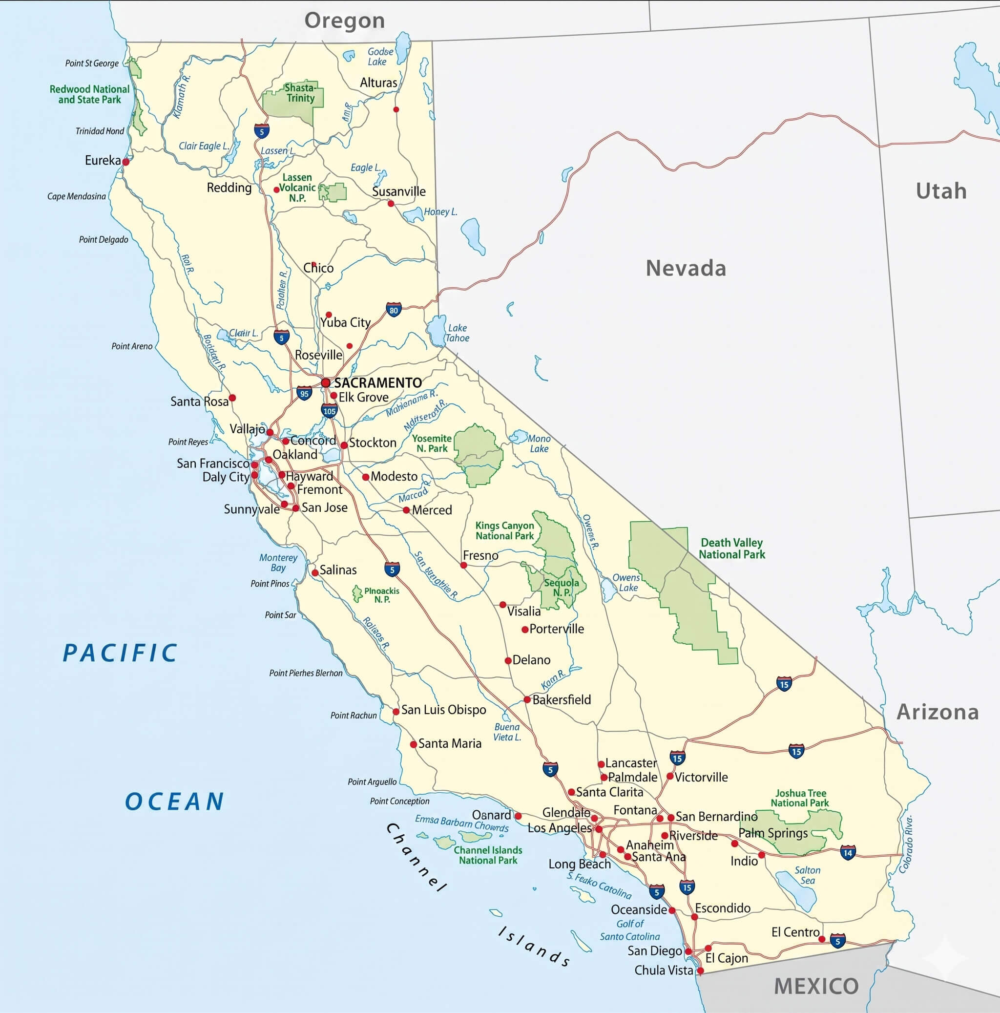
Explore a wide range of detailed visuals, including a California physical relief map highlighting terrain and elevation, a California topography and geomorphic physical map, and a California rivers and lakes map with clearly defined waterways for a deeper look at natural features. For urban and demographic insights, you can also examine a California population density heatmap showing urban distribution, as well as a California ethnicity map displaying demographic patterns by county. In addition, practical resources are available, such as a California road map with detailed highways and cities, a California main cities map with major urban areas labeled, and a California map featuring major cities alongside neighboring states.
California population density map by county high-resolution
California rivers and lakes map waterways detailed
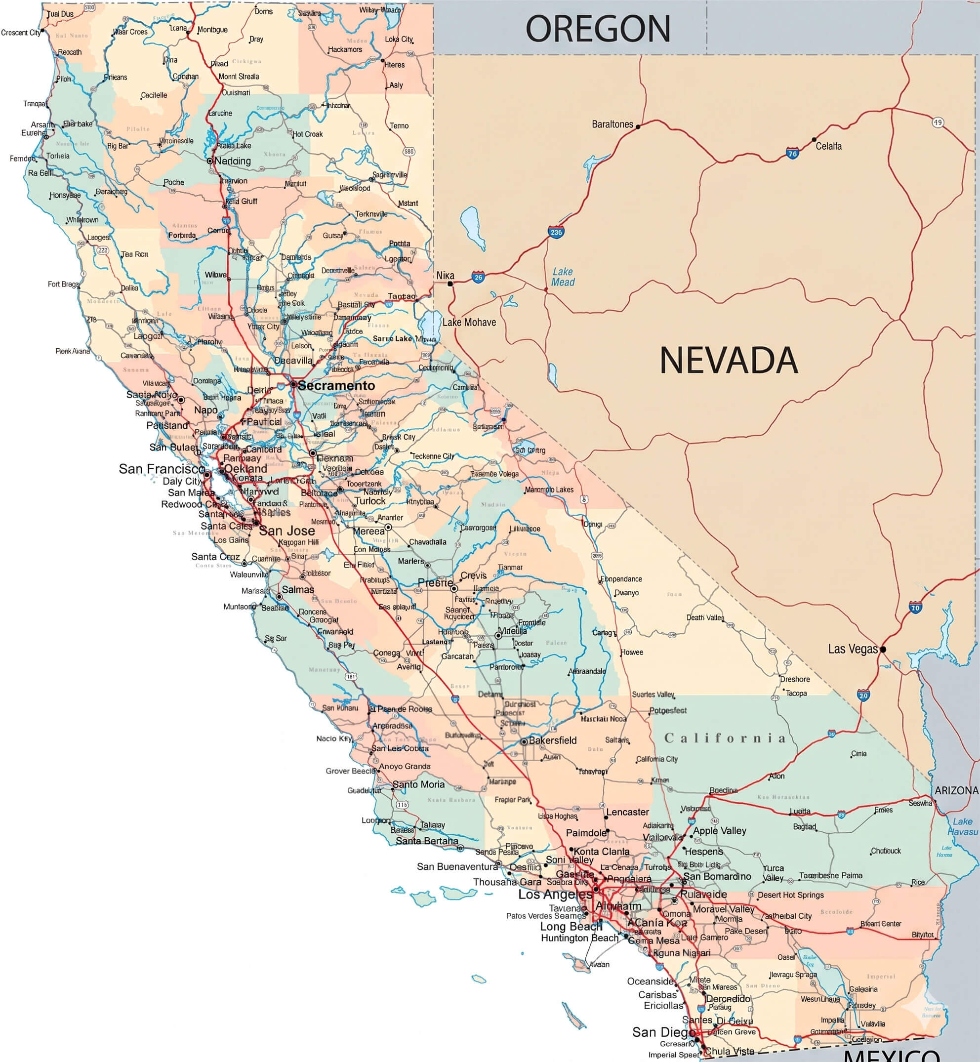
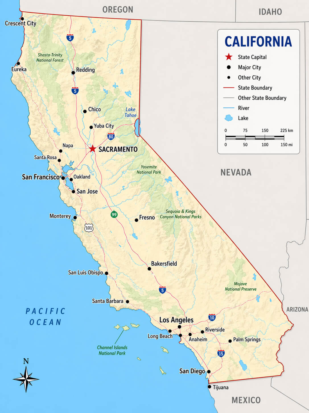
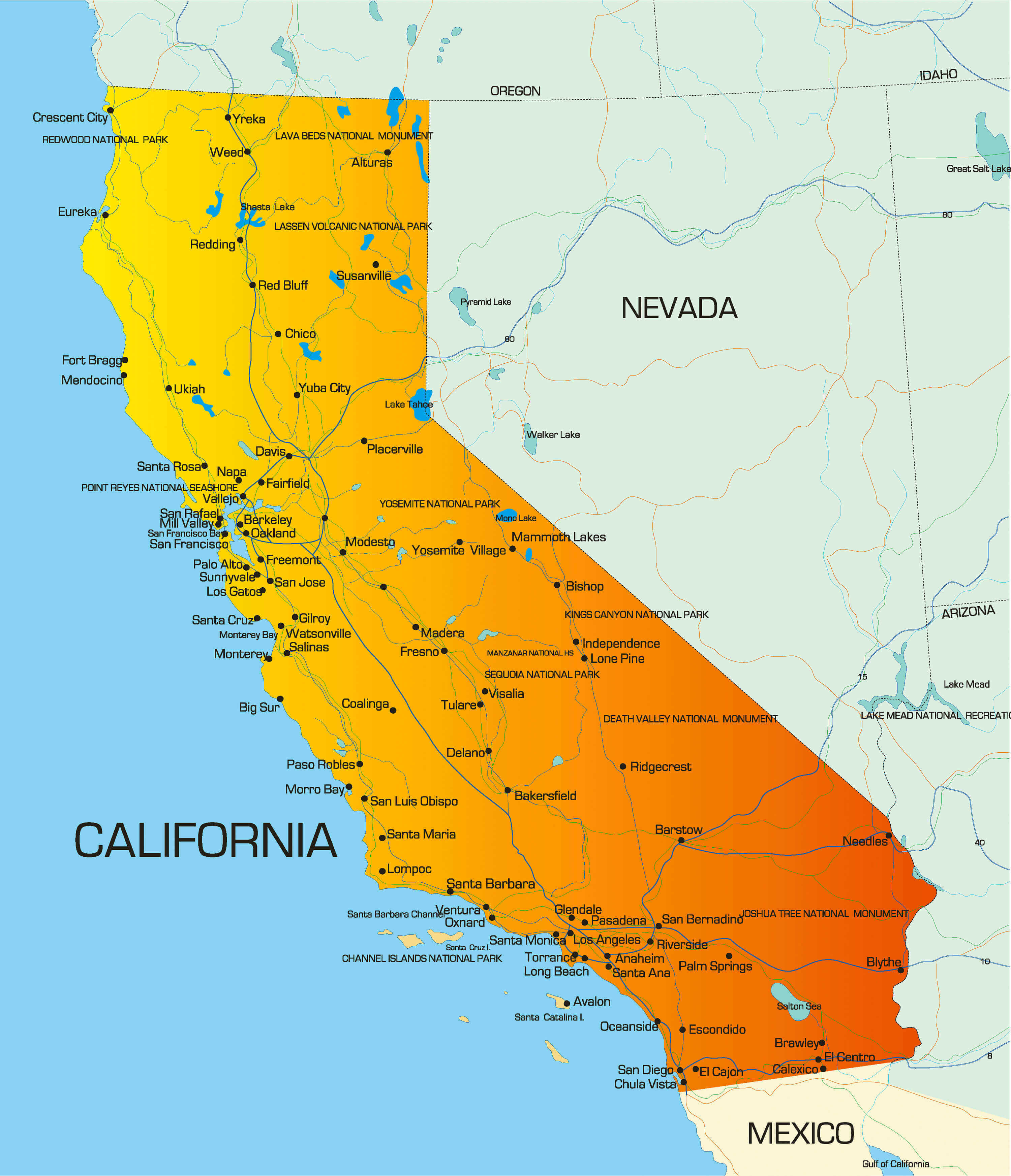
California road map detailed highways and cities
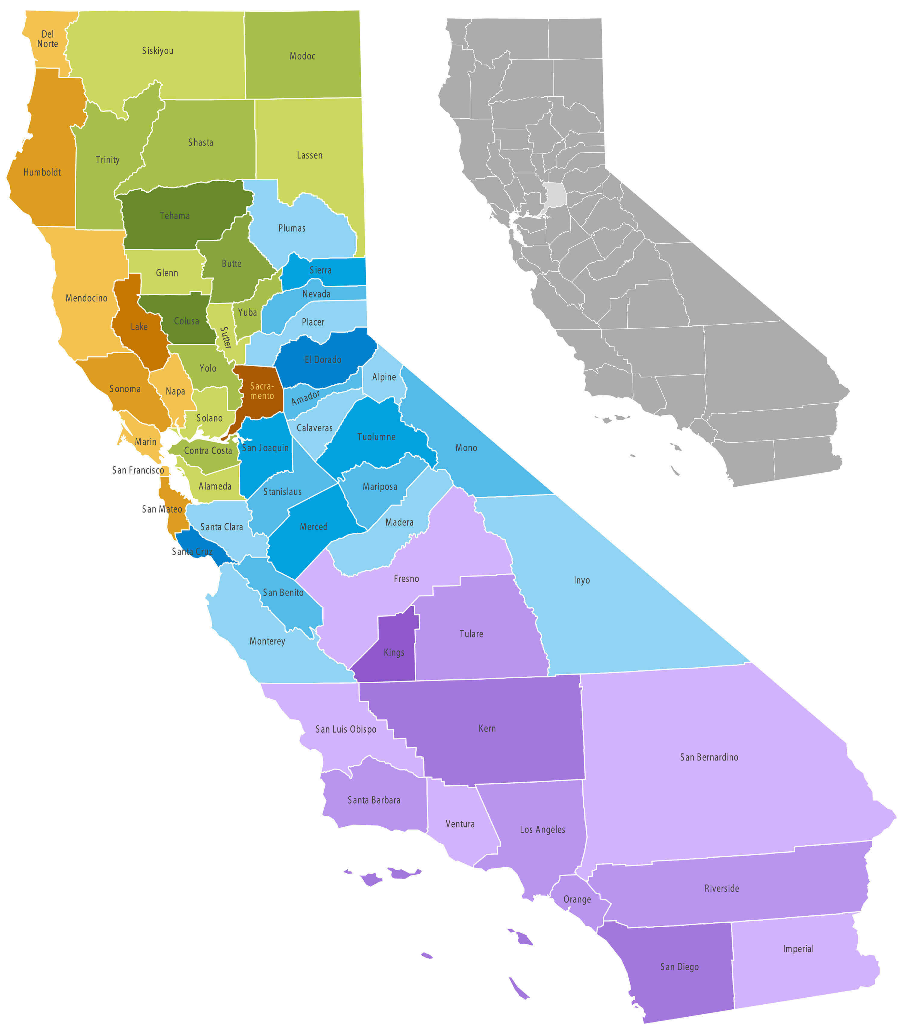
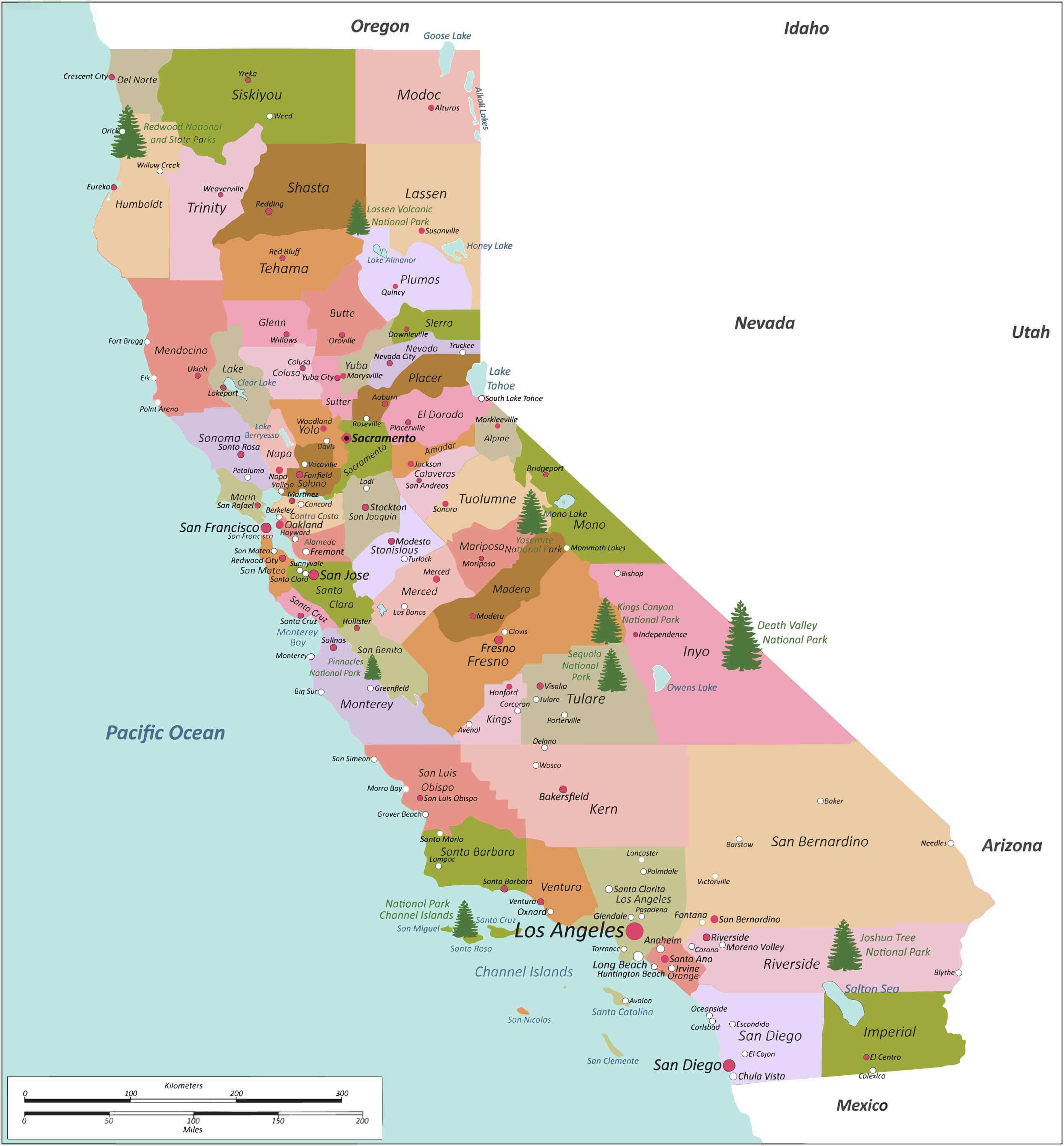
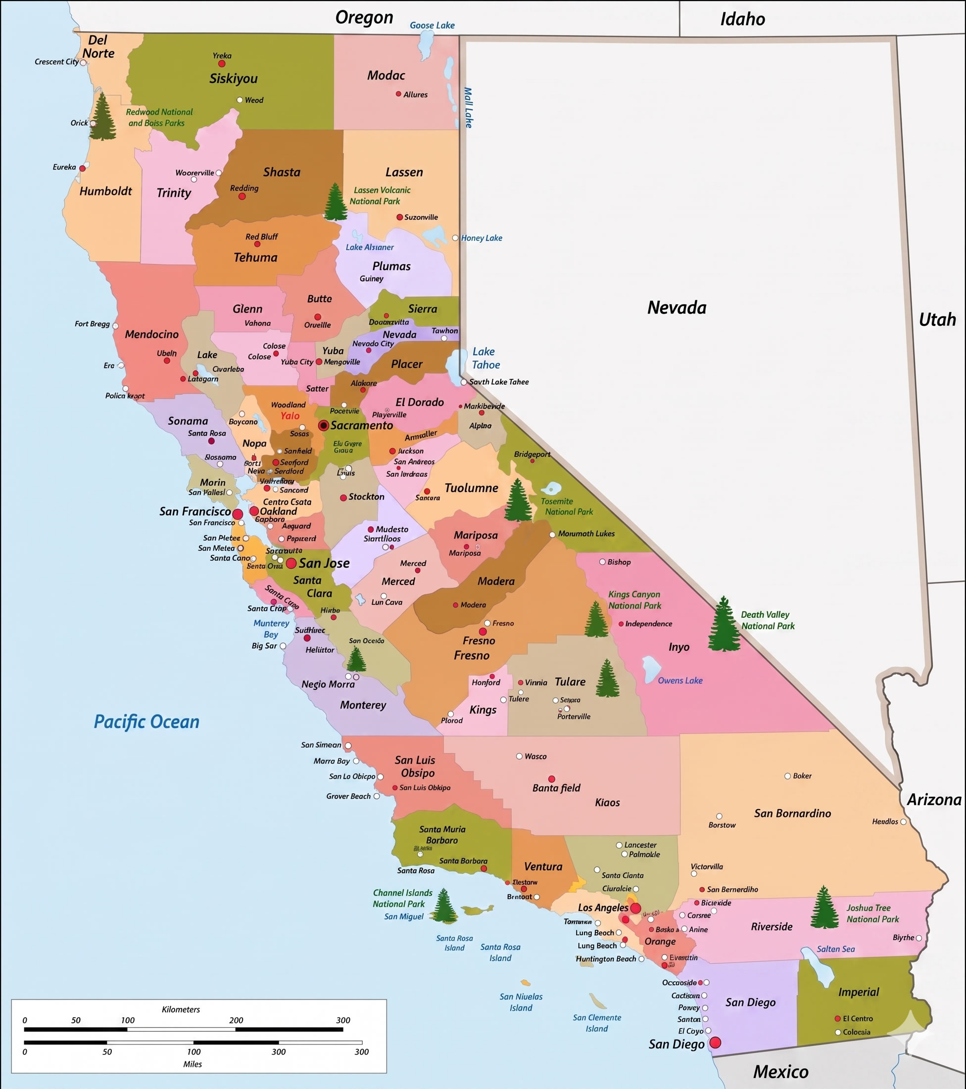
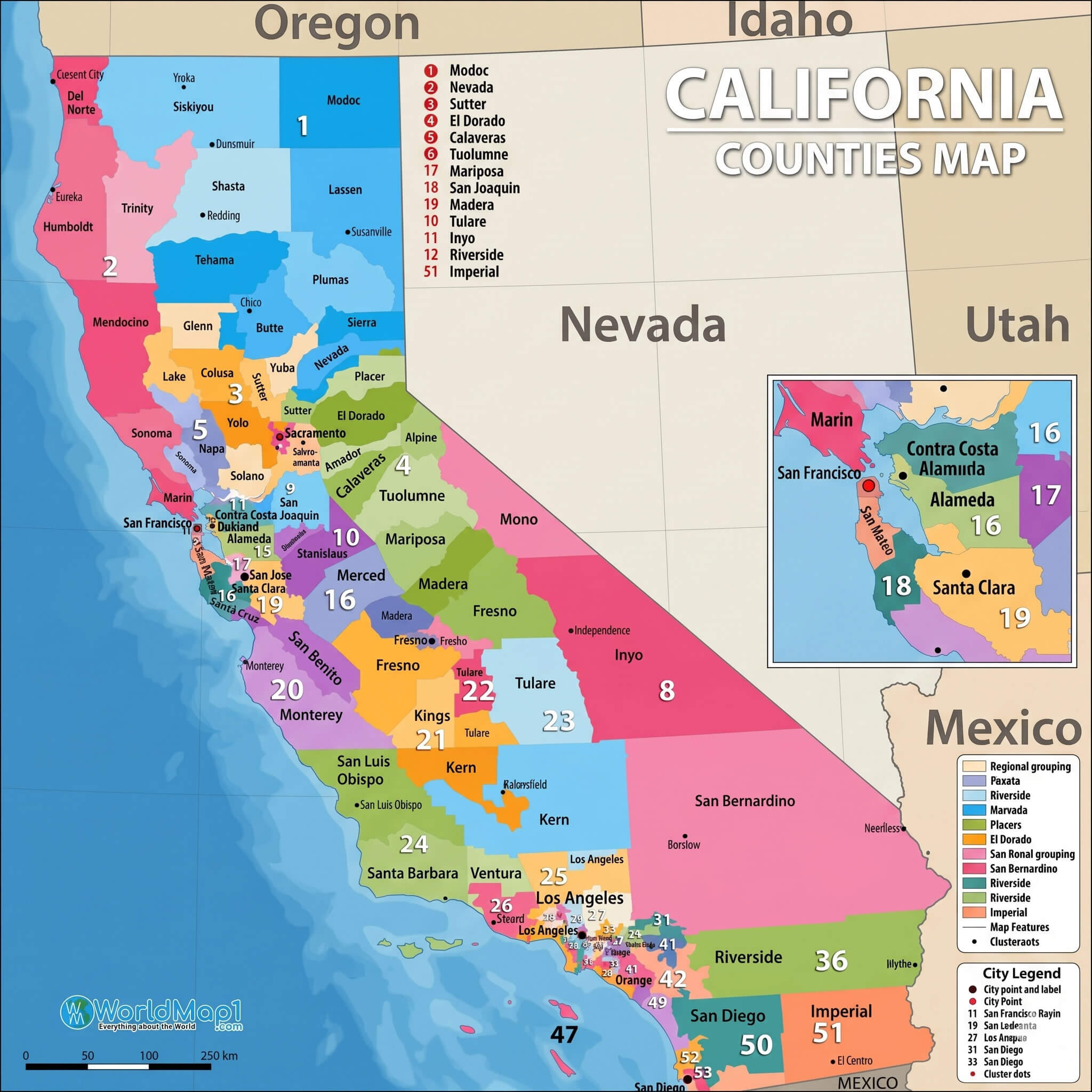
California counties with colored regions high-resolution map
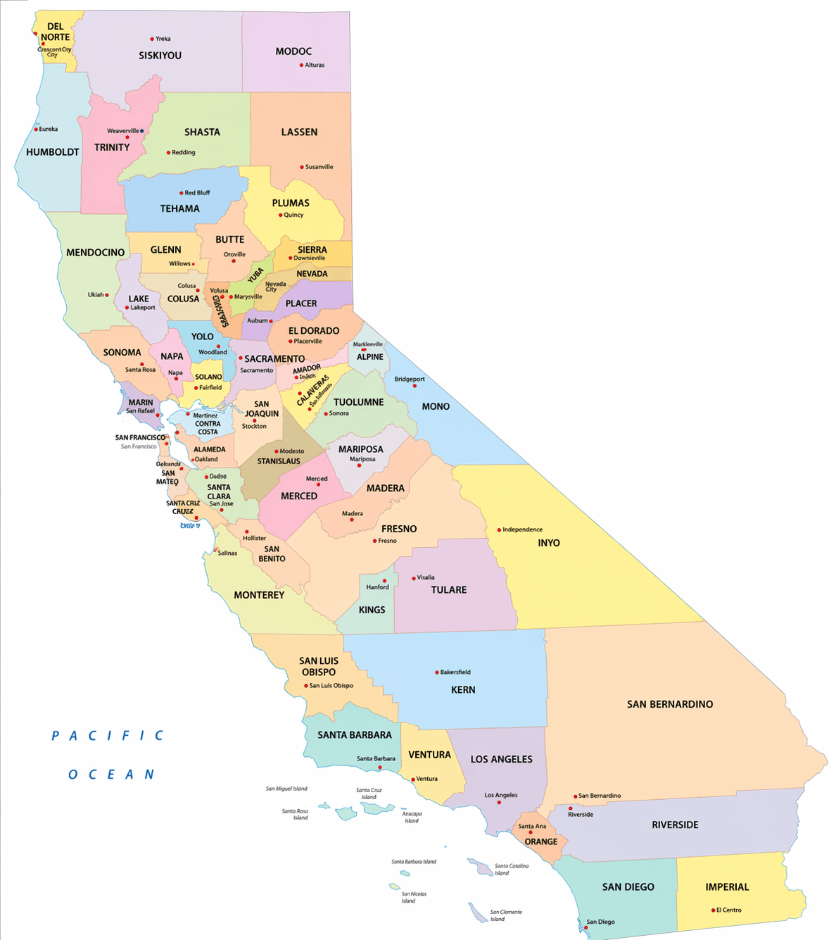
California county map colorful detailed with city labels
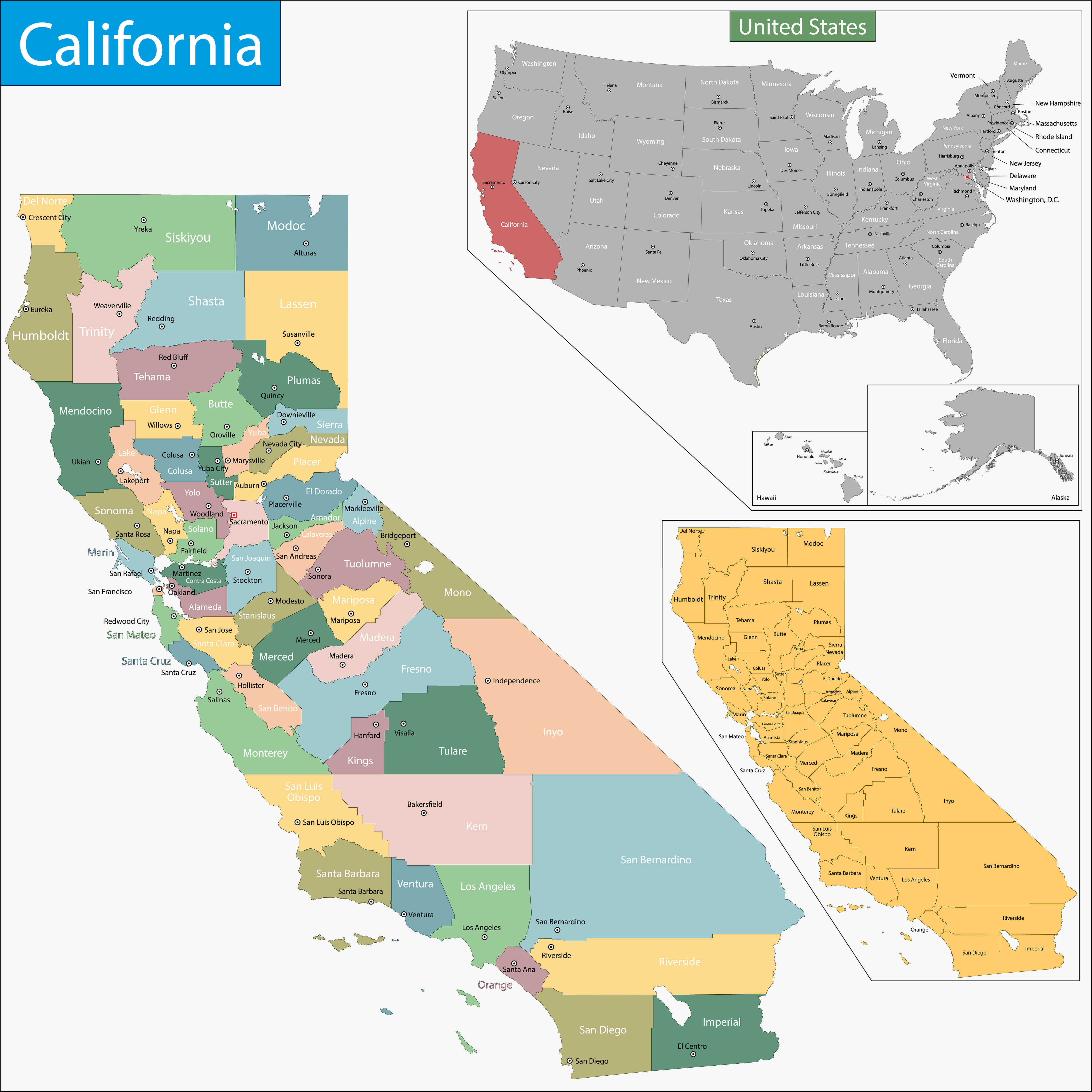
California county map with major cities and us location highlight
California ethnicity map demographic distribution by county
You"ll also find colorful high-resolution California counties maps and high-resolution physical map options. Whether you"re looking for a California county map with detailed city labels, a county map of California and its regions, or a high-resolution California road map with major cities and highways, this curated collection offers some of the most comprehensive and visually rich mapping resources available.
California high resolution physical map
California political map counties and city boundaries
California political map major cities state boundaries detailed
California administrative map regions and boundaries
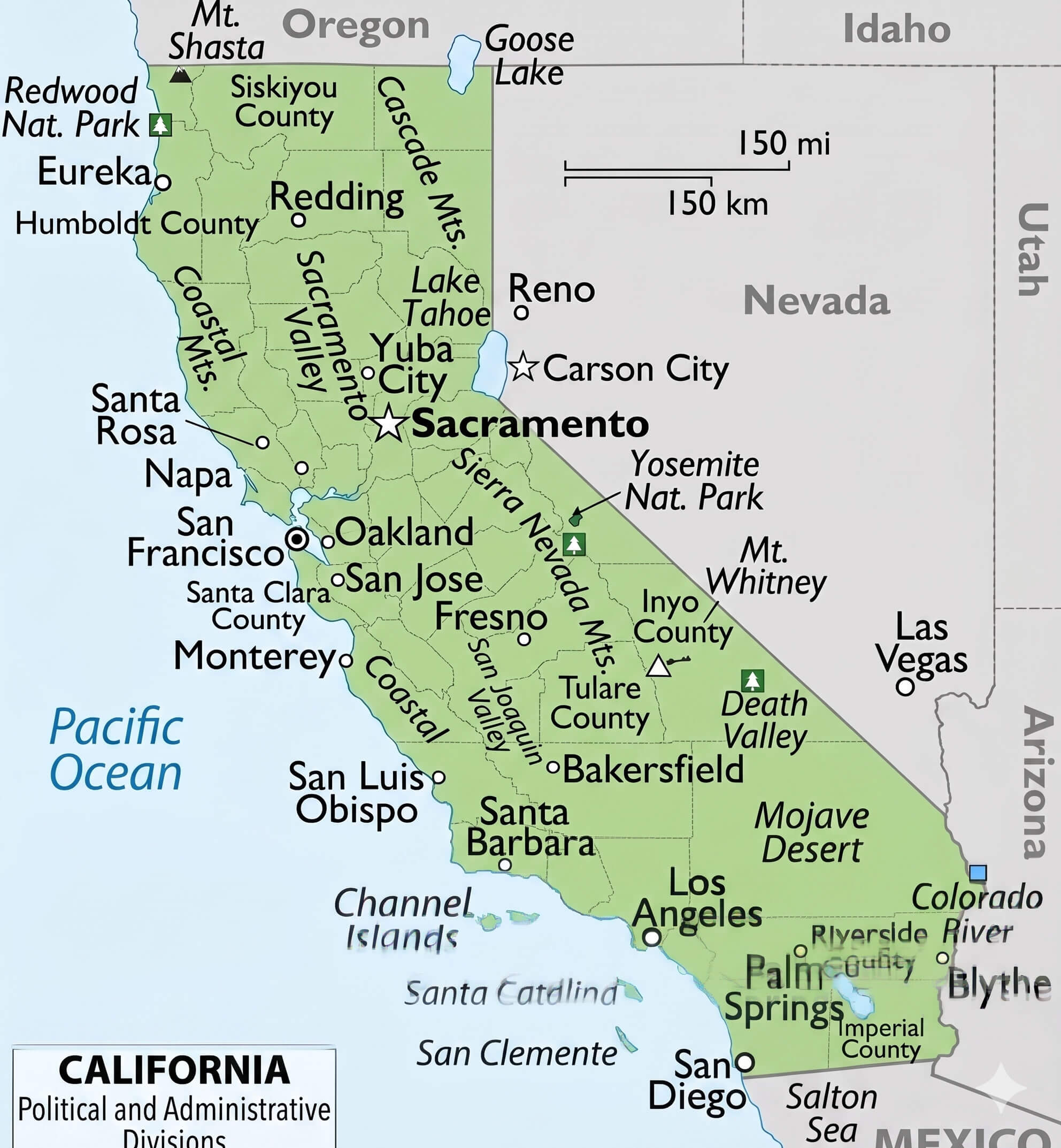
California counties and regions map with regions and city
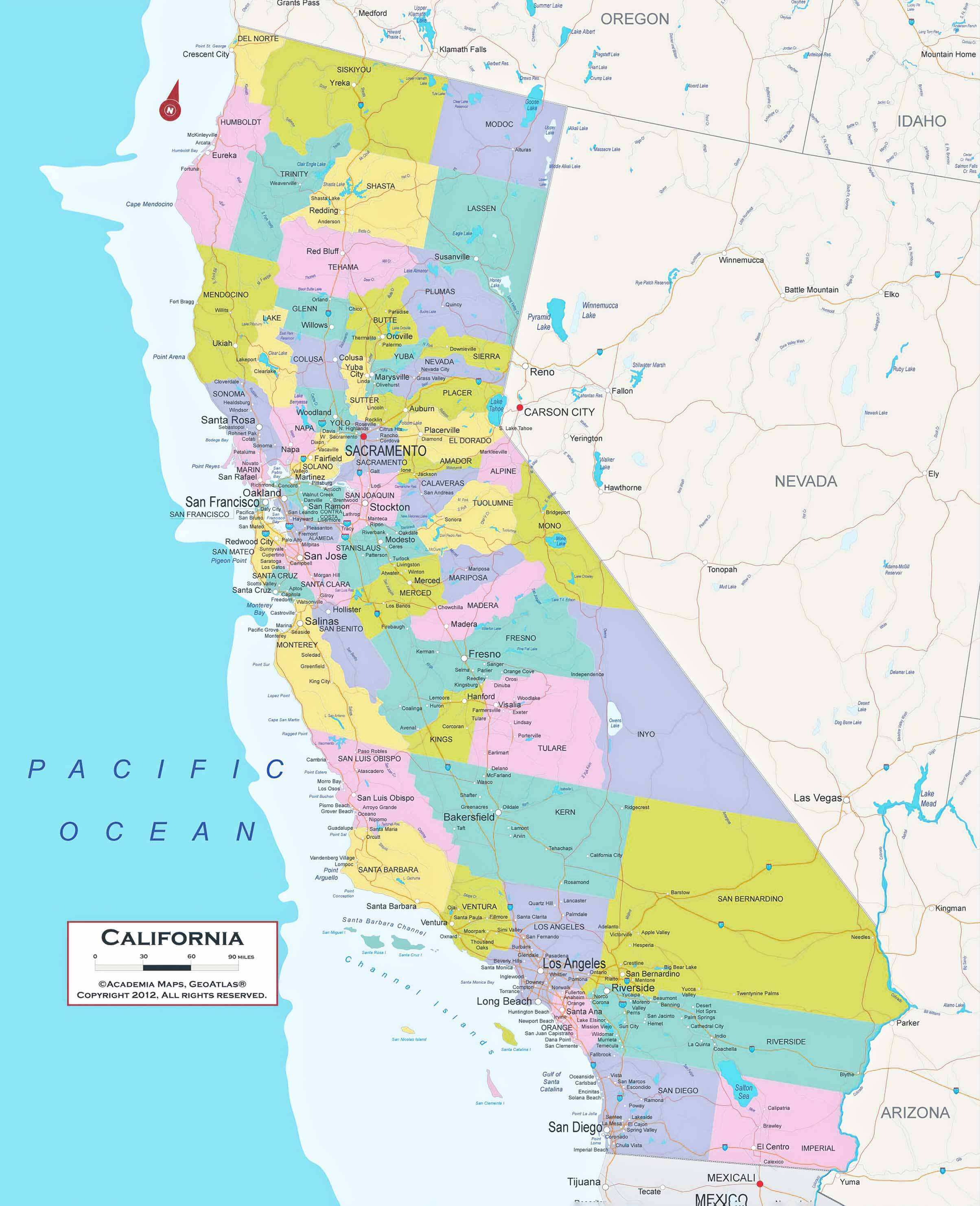
California counties map colorful political boundaries
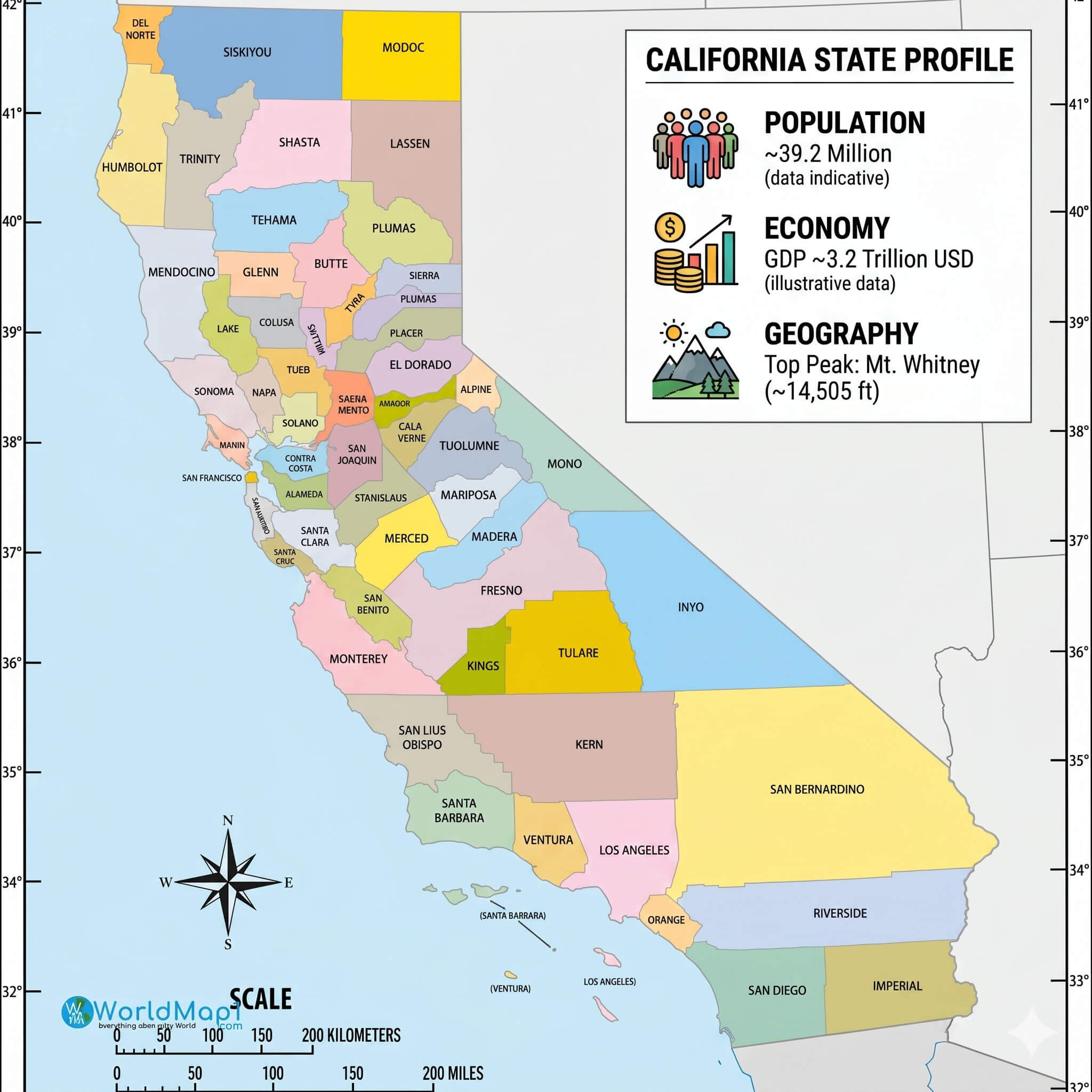
California counties map with natural features
California population density heatmap urban distribution
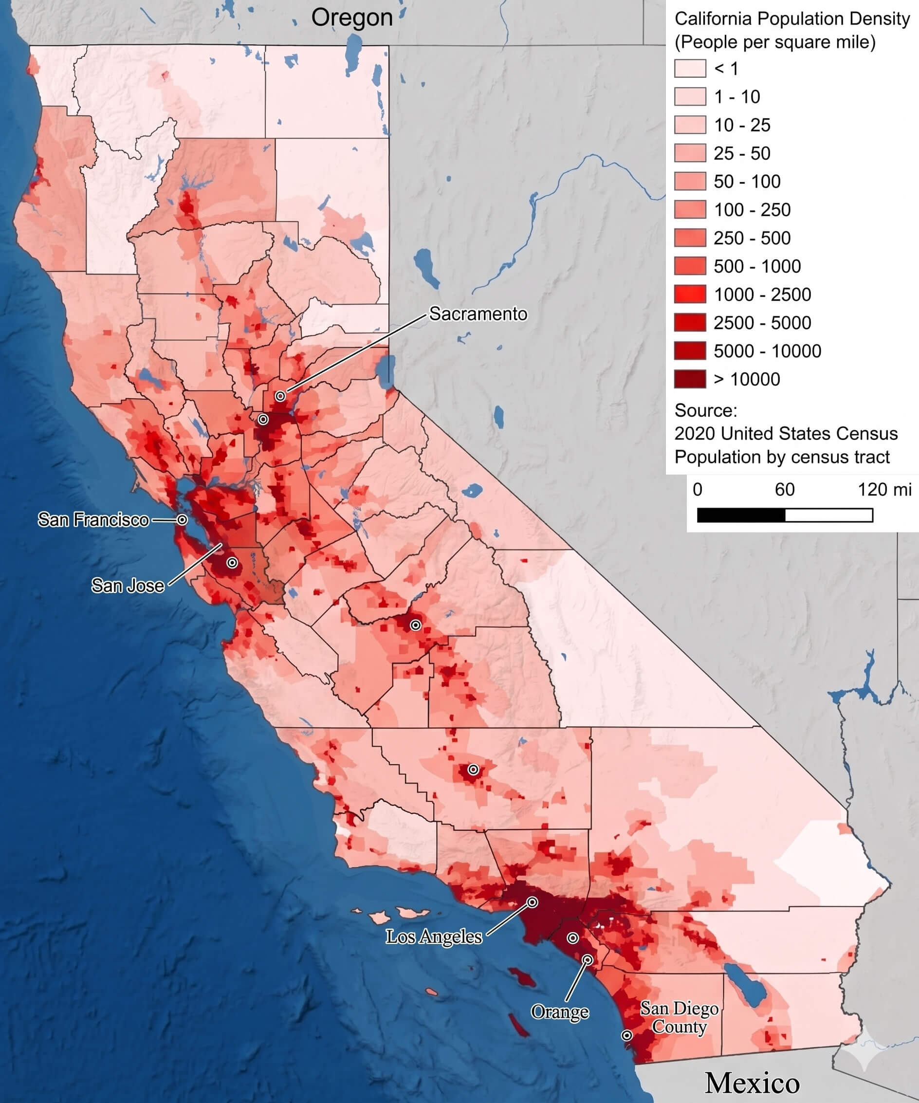
California population density map by county high-resolution
California rivers and lakes map waterways detailed
California road map detailed highways and cities
California state map major cities
California topographic relief map major cities
California topography and geomorphic physical map
California us political map major cities state boundaries high resolution
Colorful California county and national park map
Colorful high resolution California counties map
County map of California and regions
Detailed California major cities map

High resolution California physical relief map terrain elevation
High-resolution California road map major cities highways
Feel free to explore these pages as well:
- Head of Performance Marketing
- Head of SEO
- Linkedin Profile: linkedin.com/in/arifcagrici